 ">
">
Haute Route Pyrenees – Rugged and Rural (D5-9)
Having never done a blog before I’m beginning to understand that taking notes as the days go by is important, and that keeping up with posts is essential.
I’m moving into taller mountains and more rural hamlets so finding an internet connection is becoming more challenging. I was not able to get a SIM card for my phone due to the company’s contractual stipulations, so these updates will come fewer and farther between from here on.
For now though, I have a few days to cover for you lovely readers. It has been an adventure filled week without a doubt.
Day 5 – Roncevalles to Egurgui
13.1 miles; 3,123ft ascent; 3,608ft descent
We camped in an abandoned, slightly haunted plot near the cathedral with a curious herd of cows that threatened to randomly stampede and trample us in our tents at any random frightening sound.
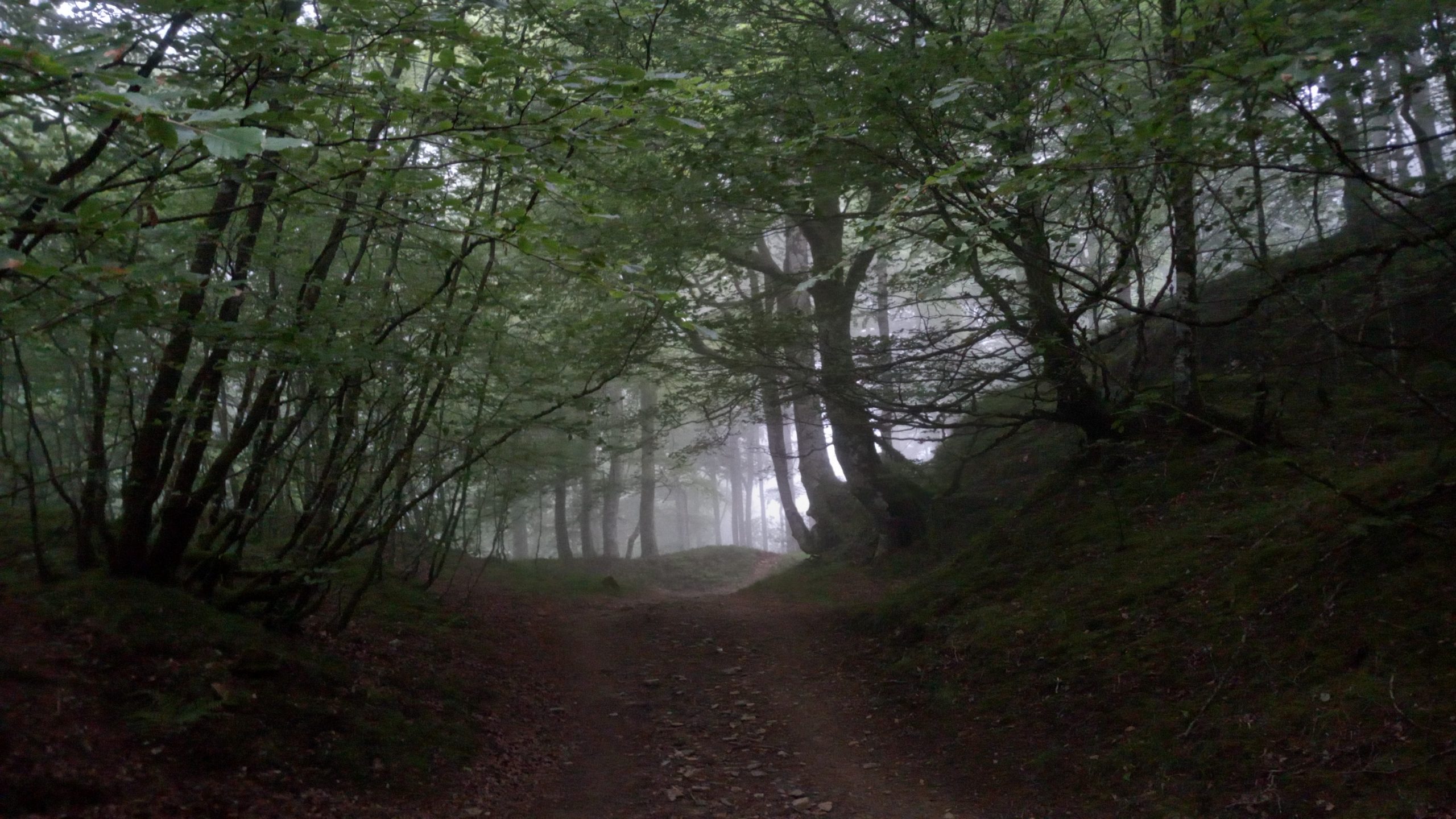
The wind was strong and the temperature dropped, making prime conditions for the mountain mist that is so frequent in this region.
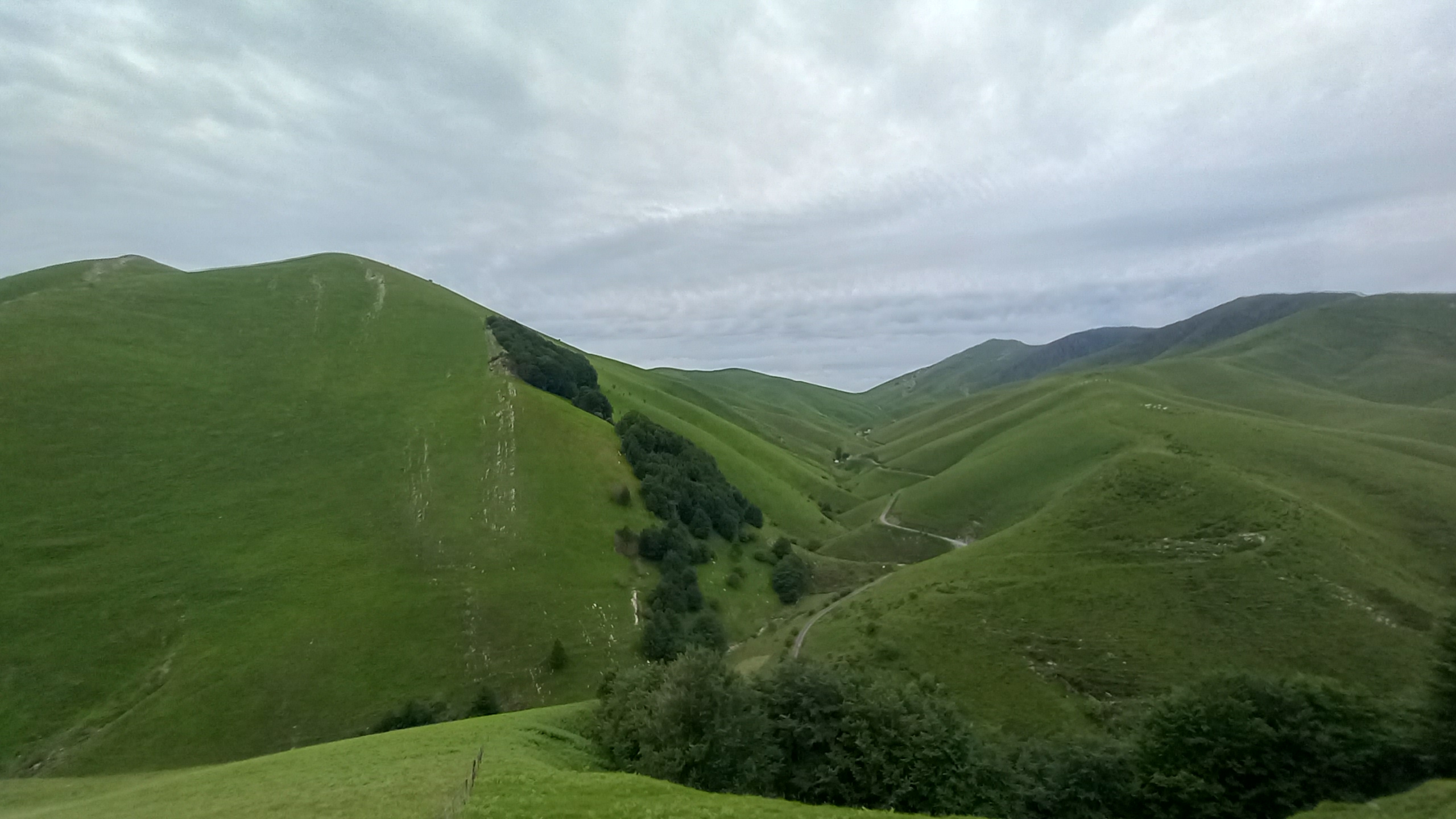
Much of the first half of the day would be “Bob Ross” hiking with happy little trees and paint your own views.
I got started first, retracing footsteps up to Roncevaux Pass but this time with no other people coming down from St. Jean Pied a Port (I would pass 3 after the top of the pass before splitting off the Camino Frances).
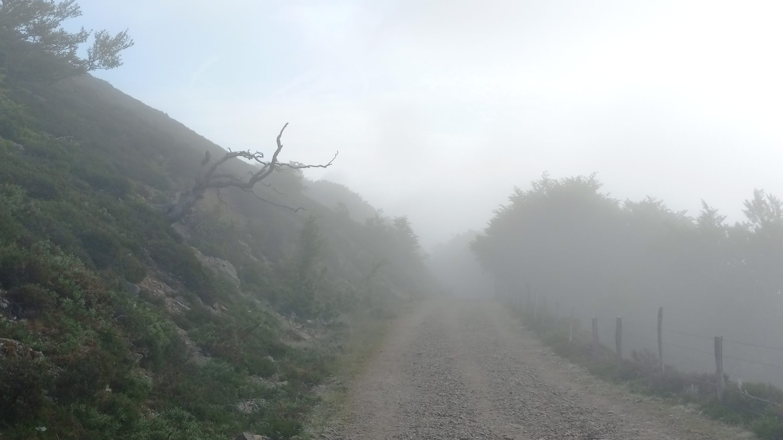
The long climb led through fog filled mystical patches of forest and open grassy hills. At times the wind and early morning sun would break up the mist and the elevation I felt as though I was on an island in an ocean of cloud below.

Much of the first half of the day would be “Bob Ross” hiking with happy little trees and paint your own views. Following dirt track the route undulated along the hills and ridges with little gain or descent.
At one point there was supposed to be a stone circle “easy to find near the road” but the fog was so thick I didn’t see it. Instead I found a green metalic shepherd’s refuge to eat lunch out of the elements.
A little later the trail dipped steeply into a valley and out of the mist came a chain of about 20 hikers climbing the other direction. I was having trouble finding the faded path, so the sight was most welcome. The fog was so thick that as I quietly filmed the eerie sight not one of them saw me standing nearby. After they had passed I had a laugh and went down to the creek where I had a nap on the bridge and waited for Johan.
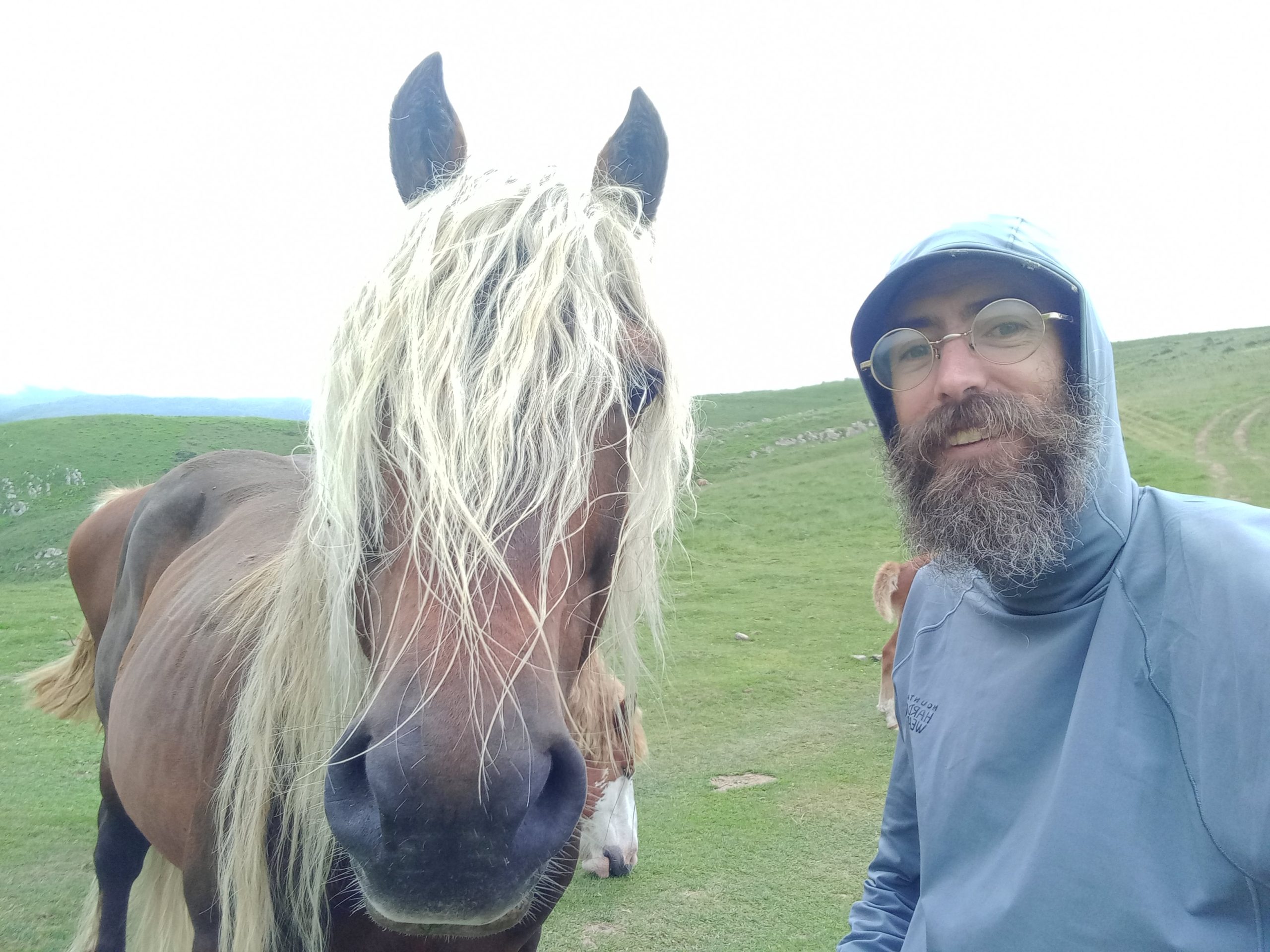
I waited for an hour or two and just as I started the steep ascent, after the first switchback, I saw my hiking buddy not far behind. At the top of the pass I made friends with some horses and waited for him to catch up.

The last half of the day turned into a beautiful clear afternoon. After a short and easy descent we found our site next to a creek and an abandoned locked up refuge deep in the valley.

Day 6 – Egurgui – Col Bagargui
9.5 miles; 3,442ft ascent; 1,969ft descent
The mist came back in overnight, but not nearly as thick. The day started with a very steep climb to regain elevation, with no trail or markers. At the top there were small GR marked posts that followed the contour, more or less, for a few miles.
At the top of the gain our trail met up with the GR10 again at the Cromlechs d’Okabe, a mysterious set of ancient stone circles. My guess is that a battle occurred on the pass, it seemed like an epic place to have one in times of old.

The trail then dropped through the Iraty Forest down to a small tourist campgroumd with a café and two closed restaurants.
We stopped for some coffee and a short connection to the outside world through the wonder of wifi, watching as a light rain began. Choosing our window of opportunity we headed out to regain elevation again, climbing through a peaceful beech forest. On our way out I found a bow to hunt with, but decided my chances and need we not be great so left I left it with the café.

Not long after leaving the café we arrived at the Col Bagargui where there was a small store, and we both badly needed a resupply. We stocked up gratefully and at that point the wind was getting stronger and the damp fog getting wetter.
The decision was made to pay the €15 for beds in the gîte rather than tent camp and we joined about 15 other hikers taking refuge from the bad weather. There was a chess board with most of the pieces so Johan and I played four games, only one of which I won. I need to up my game.
Day 7 – Col Bagargui to Refugio de Belagua
~18 miles; 6,186ft ascent; 6,380ft descent
We were really hoping the weather would clear in the morning because there was a peak coming up with sketchy ridge walks and promising great views. It did a little bit, it wasn’t quite as misty but it wasn’t clear either.
We set out and followed a dirt track for a while, then attempted to follow the track and begin the ascent of Orhi Peak. I forgot to keep an eye on my GPS and we did end up making a wrong turn following a set of markers for a different GR. This was easily remedied by going up and over a small shoulder but resulted in very wet feet from the dewy grass.
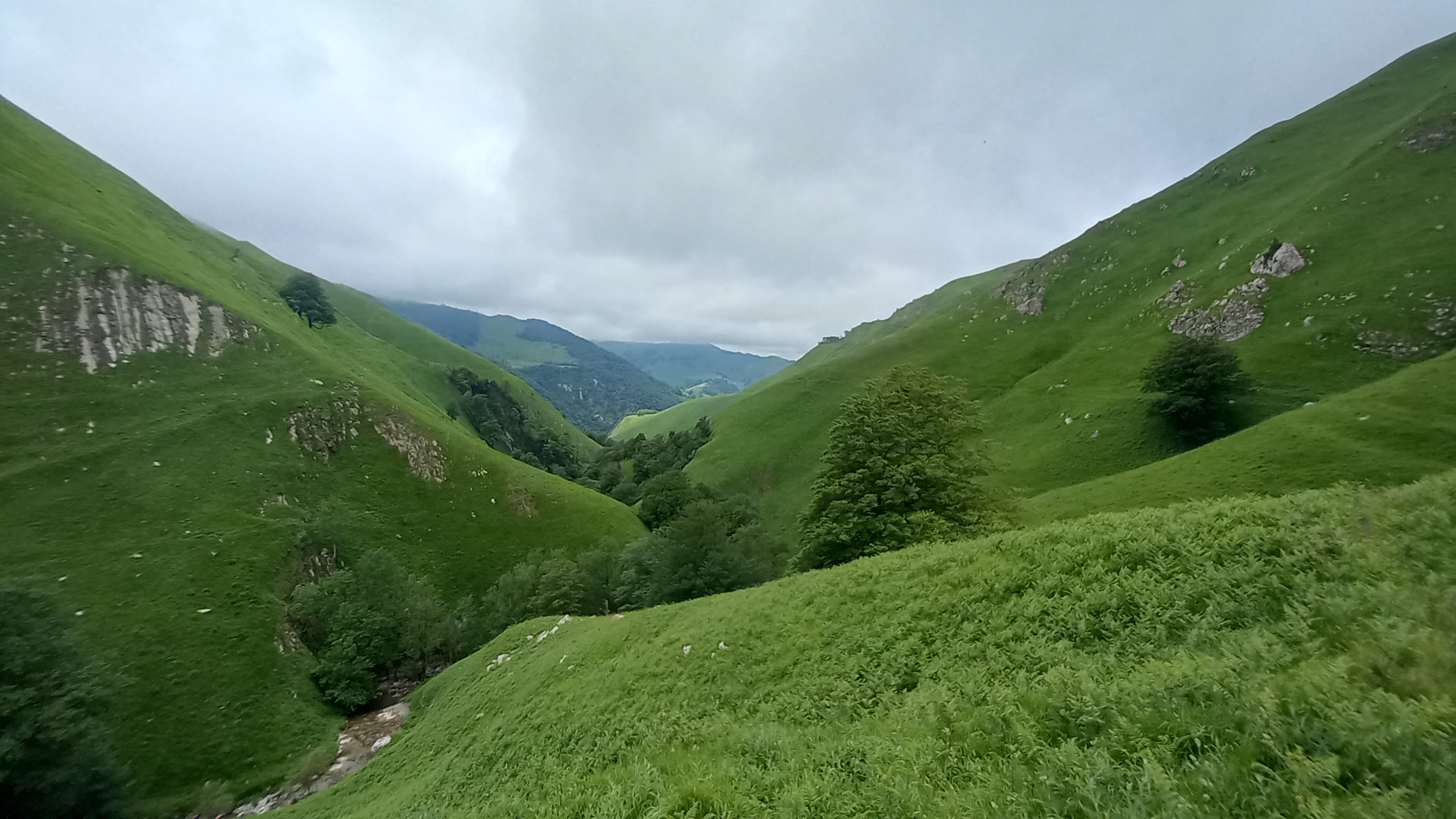
For the first mile or three the views would open nicely once in a while showing the deep fertile valleys below.

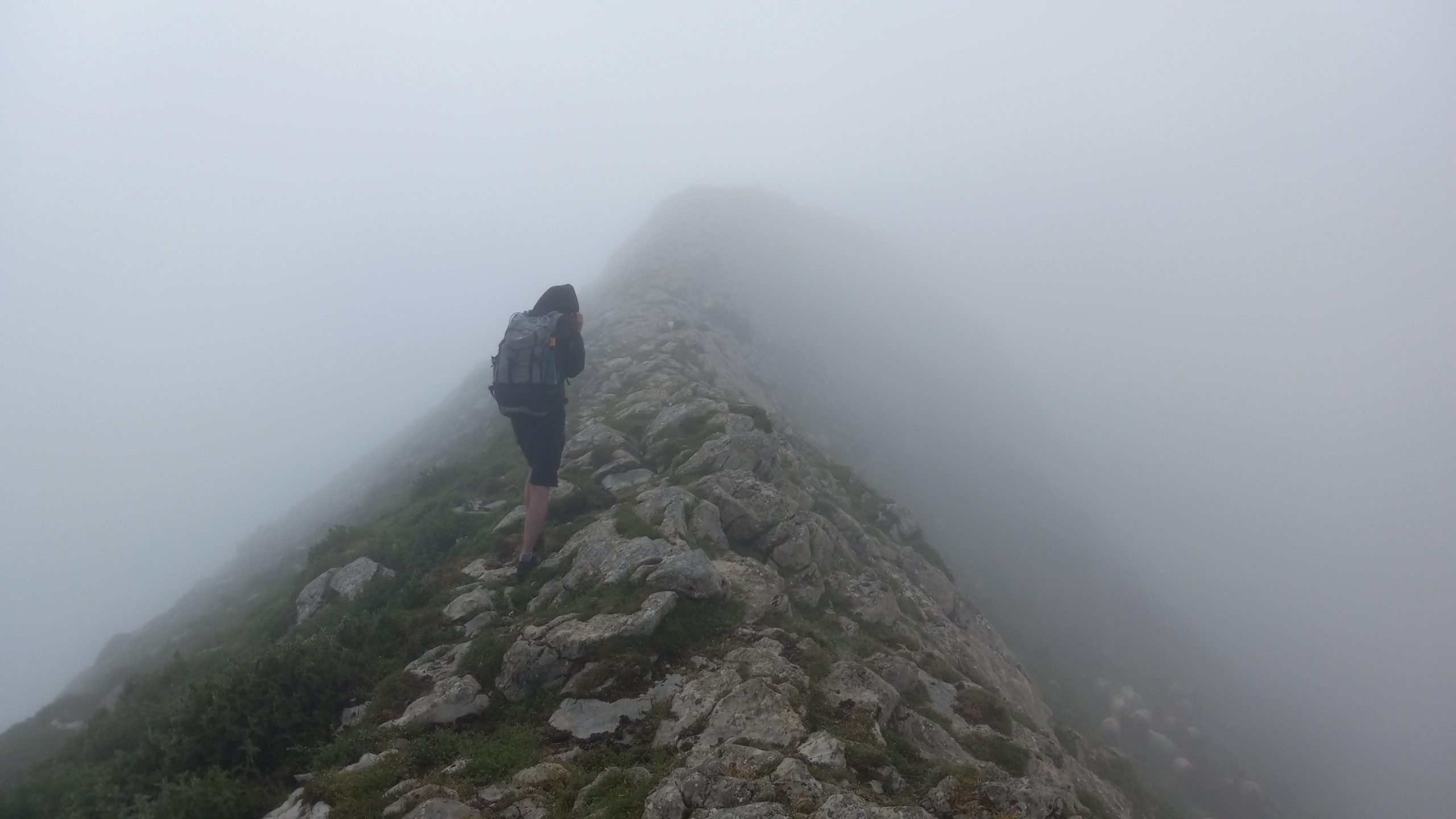
Then the real ascent on the peak began and it was up and into the cloud. The wind was howling along the ridges, easily sustained 50mph with stronger gusts that threatened to push us over the edge down the rocky cliffs below.
When I faced the prospect of having to crossithe knives edge in that wind for the first time in a long time I was genuinely scared stiff.
At one point we kept to the ridge when the path dropped a bit to get around a dangerously narrow section of ridgeline. When I faced the prospect of having to crossithe knives edge in that wind for the first time in a long time I was genuinely scared stiff. I turned around and shook my head ‘no’, we consulted the GPS and realized we were slightly off so then backtracked to find the safe passage.
We summited safely but didn’t stay for more than a couple moments due to the inhospitable conditions. A couple hours later the skies cleared up mostly, but it didn’t look like it ever did on Orhi.
The path swung around ridges for five miles or so with sun shining, but cold wind still gusting hard. Eventually the single track led to a double track that descended into a protected valley and the recommended destination for the day, the unmanned Ardane refuge:

It was so early that after a short consultation we decided to press on for another 6 miles or so to get another long ascent and steep descent out of the way and get withing a day’s hike from the town of Lescun.
We forged in up a long gradual dirt road that turned to single track as it reached the pass. The next few miles followed a contour generally through three little valleys and over two small passes, a beautiful afternoon hike.

Over the final pass the view opened up to the high peaks we would enter the following day. I descended and stopped in the bar at the refuge to have a cervesa and wait for Johan to catch up.

We walked a short distance past and found a nice spot on the edge of the woods out of sight from the road and any prying eyes (wild camping in Spain is technically illegal.)
Day 8 – Refuge de Belagua to Lescun
~11.2 miles; 2,619ft ascent; 4,359ft descent
The first thing I noticed when I woke up was no condensation in my tent, ‘excellent’ I thought. The next thing I noticed after opening the vestibule was sun in the trees and not a cloud in the sky, “WHOOP WHOOP!” I exclaimed.
The start of the day led through a beautiful shade forest. At one point I stopped to take a picture of a tiger salamander and just as I did a beautiful woman appeared out of nowhere. I pointed out the natural treasure I had found and she sighed lovingly, then went on without another word. For the next hour I would see her disappearing ahead around distant corners or into treeline. I think she was fae.

The trail crested into what the guidbook described as a “limestone labyrinth”. It was reminiscent of the high alpine of Colorado, of The Wind River Range, and of The High Sierra, but was also unlike any of them.
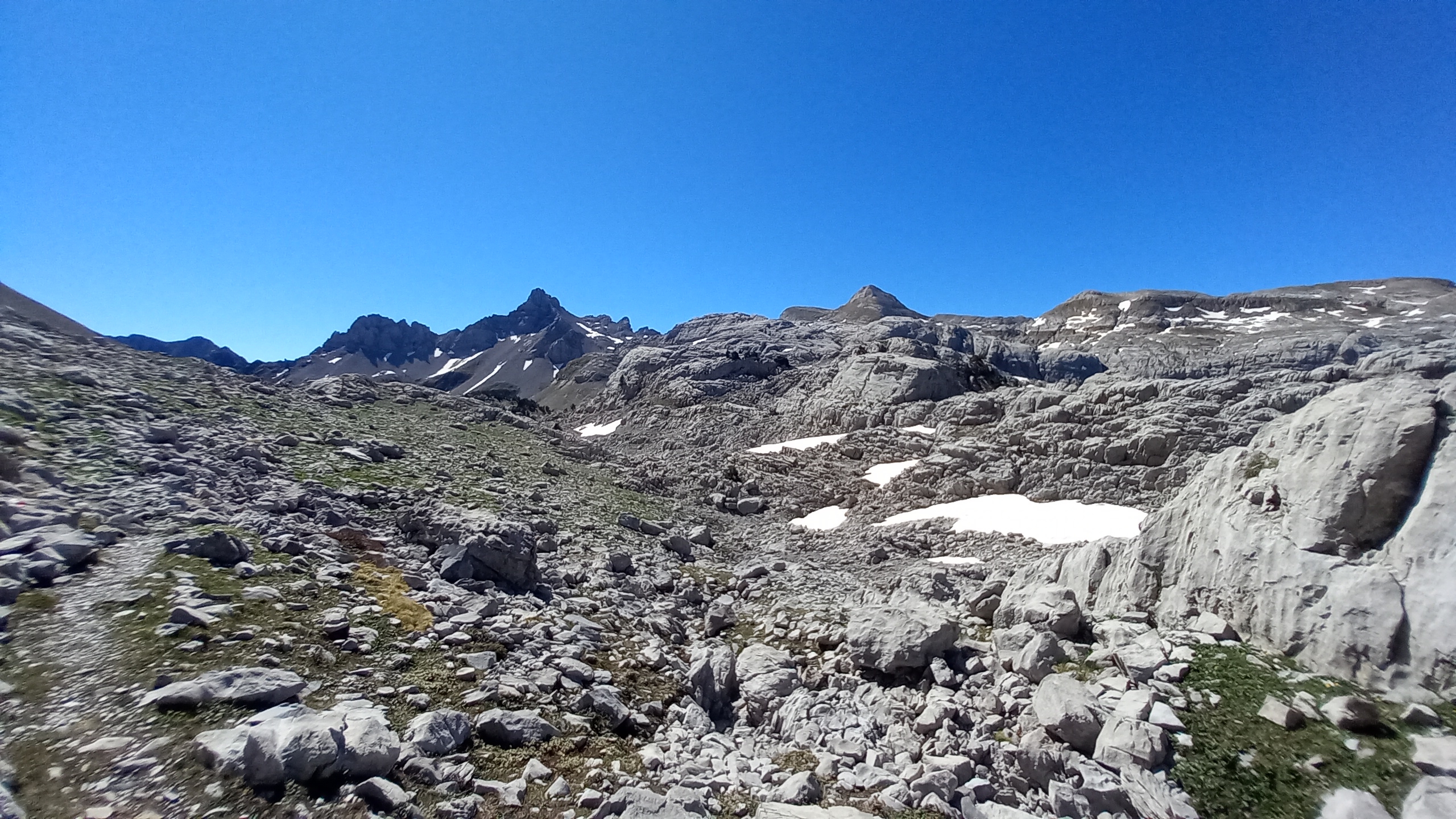

After bouncing around through the boulder filled valleys, paying close attention to the red and white stripes that mark the safe path through, the path topped a snow patch covered pass. It then dropped down to a gurgling mountain stream, The Source de Manitou, a perfect spot for a lunch break and a short nap.

I was expecting Johan to catch up here but after waiting a couple hours with no sign of him I decided to head down and meet him in town. The prospect of beer and ice cream, showers and laundry summoned me forth.
The descent was long, nearly 4,000ft down over 5 miles or so. After passing through a shady forest and following switchbacks beside a hidden waterfall the trail spat me out on a plateau with a few car campers and vanlifers underneath massive cliffs.

The last mile or two into Lescun followed a dirt road which turned to tarmac and dropped gently into the little medieval town in the East end of the valley.

I secured a bed in the gîte at the center of town, got that laundry and the first of two showers in, and made dinner and breakfast arrangements with the hotel across the road.
Waiting for dinner I had a beer at the little shop in town and as I was sipping suds Johan stumbled in. He decided to stay at the campground below the town. We had a beer and swapped stories from the day, then said ‘see ya tomorrow’.
I had dinner with a handful of GR10 hikers- a salad of tomatoes and peppers, tomato based grain and vegetable dish with a Basque sausage, several cups of good red wine, and creme brulée for dessert. After stuffing myself I took a short walk around town and enjoyed the sunset.

Day 9 – Lescun
0 miles
First zero of the hike. I took time sleeping in a bit (but took a short walk to catch the early mountain light on the surrounding peaks) and another shower, then a leisurely breakfast. I bought my resupply for the next couple of days and some postcards.

After lunch I moved down to the campground to wait for my buddy Rewind, we met on The Pacific Northwest Trail and he will join me for the rest of the HRP.
It was a super mellow rather hot day enjoying rest and relaxation before the next gnarly stretch in the the real high mountain Pyrenees. I’m super stoked for what’s to come!

This website contains affiliate links, which means The Trek may receive a percentage of any product or service you purchase using the links in the articles or advertisements. The buyer pays the same price as they would otherwise, and your purchase helps to support The Trek's ongoing goal to serve you quality backpacking advice and information. Thanks for your support!
To learn more, please visit the About This Site page.

Comments 1
Beautiful pictures and recount!