 ">
">
300 miles later
It is amazing what two zero days can do to change one’s spirit and appetite. Some things never change, though. My walk out of Fontana Village started how my walk into it ended: in the rain. Not just any rain, but a cold 35 degree rain. That didn’t stop me from embarking on a 16 mile day into the Smokies.
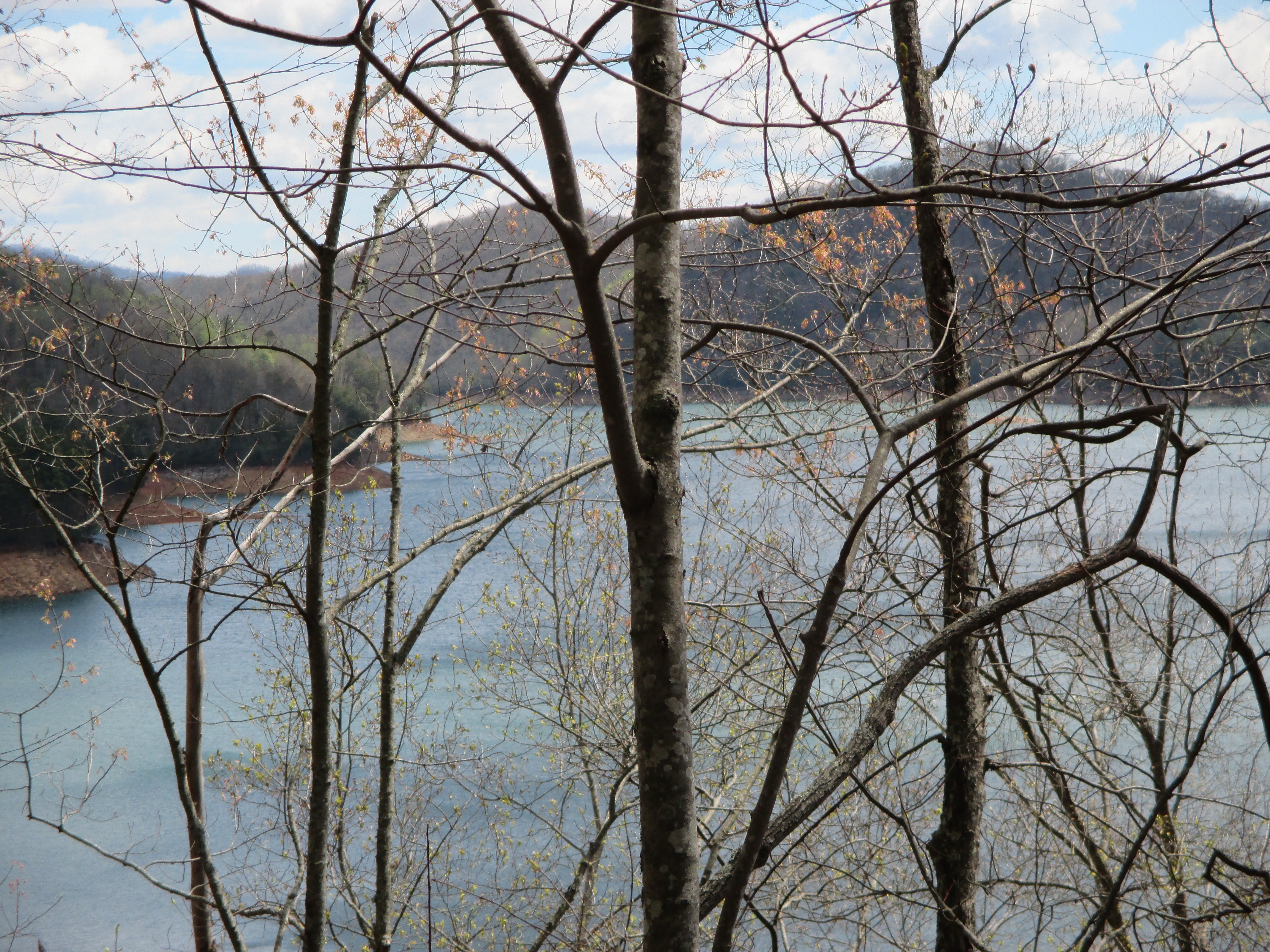
Great Smoky Mountains National Park contains the final 92 miles of the BMT. Unlike the AT which quickly ascends to the top of the Smokies, the BMT begins on the lower elevation Lakeshore Trail and runs alongside Fontana Lake for thirty or so miles. This route is a warmer route, and it allowed me to miss all of the wind and snow that my AT comrades experienced higher up. Even better, the route made it possible for me to camp in my tent away from shelters each night through the park.
On my first night, I camped at Proctor, an old logging town. As has been true each night so far on the BMT, I camped alone. I really enjoyed learning about the history of Proctor on my way into the campsite. An old house, built in 1928, stands nearby, along with other widely scattered evidence of the once bustling town (like the cool car body below). You’d never know that so many people once lived here.

The rain finally ended in the night, but it was a struggle to get out of my sleeping bag and pack everything up the next morning in the damp, chilly air. Once I got rolling, I hiked 21 miles over mercifully easy terrain to my next campsite on Lower Forney Creek. Along the way, I glimpsed a peek of the snow-capped ridgeline high above. Mostly, I was treated to views of Fontana Lake through trees just beginning to leaf for the spring.
The next morning started cold again, but warmed up quickly by afternoon. This day would be defined by countless stream crossings, including two challenging ones across a swollen Noland Creek. The first crossing (shown below) was thigh deep, but not too bad. The second crossing almost caused me to turn around. But since the only possible detour was a long and arduous up and down over Clingmans Dome, I was hell bent on fording it. After backing out during my first try–the water was just too deep and fast–I ended up bushwhacking downstream a hundred yards where the current was slower. I cautiously waded through the waist deep water and made it across, though my legs and feet were nearly numb by the time I got to the other side. Why must it always rain right before the toughest fords?

That evening, I made it to my reserved campsite in sopping wet shoes after 16 miles. When I got there, I learned that I would have to share a campsite for the first time. I have come to enjoy–actually love–camping alone, so this was a bit of a letdown, but how can I complain when I have had every night to myself for the previous 242 miles?
Awakening early the next morning, I covered 12 miles by noon to US 441 where I hitched into Cherokee for my final BMT resupply and town stay. Tourist season has obviously arrived because this town was packed with people who obviously don’t live there. The AYCE restaurant I hit just in time for Sunday lunch was pure chaos with screaming kids and non-stop chatter. What a change from the trail! Nearly everyone was hacking and sneezing, so being the germophobe I am, I passed on the buffet line and ordered from the menu.
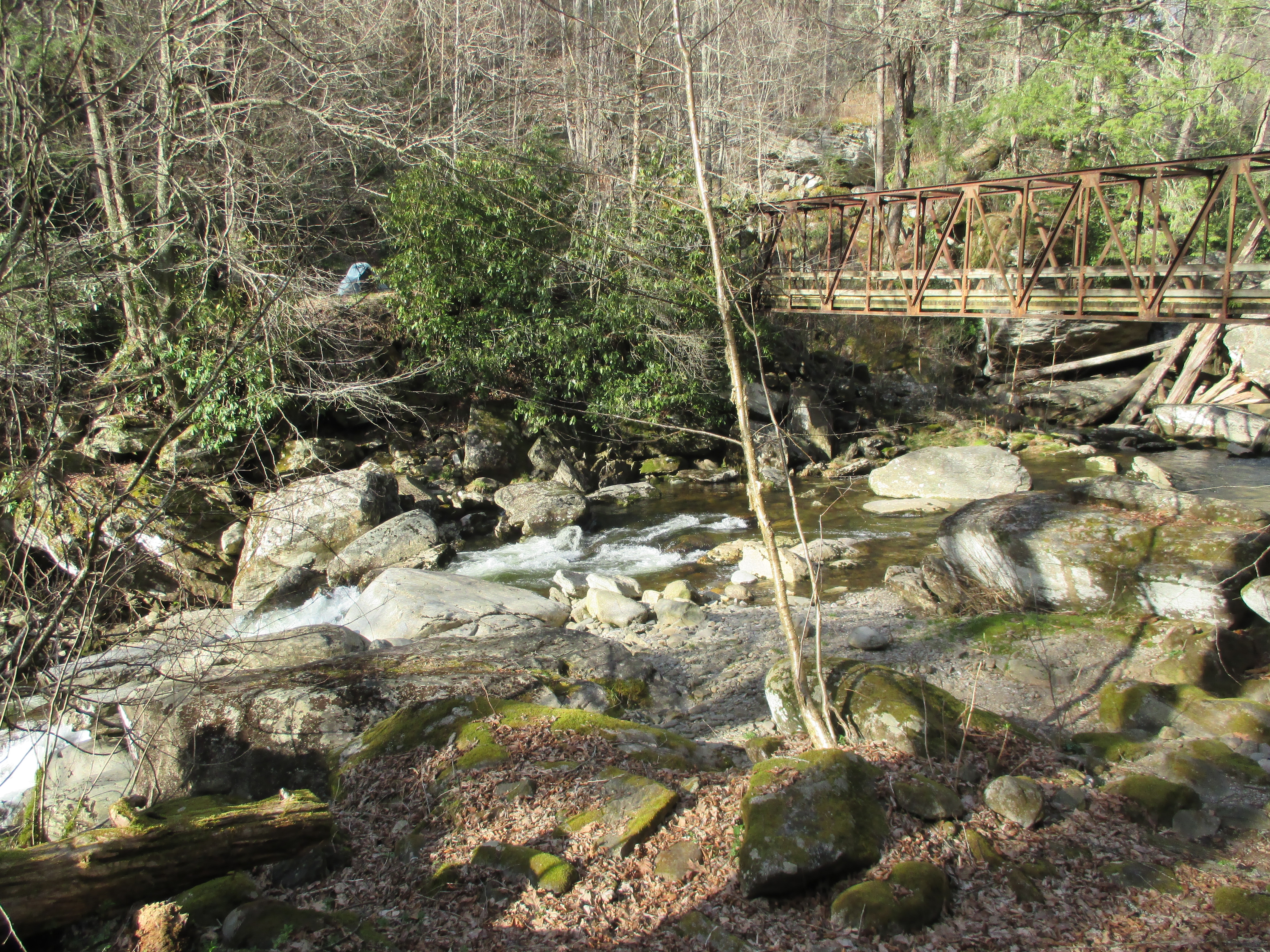
A short 10 mile day brought me out of Cherokee to my campsite at Enloe Creek located next to a striking waterfall (can you spot my tent in the photo below?). I thought I would be alone for the night until a father and his young daughter arrived. I didn’t mind much. In fact, as I watched them pitch their economy tent and cook on their Coleman stove, I thought to myself, this is what it is all about. Far from thru hiking with thousands of dollars of gear, here were two people who just threw some stuff on their backs to enjoy nature for a couple of nights. Maybe we thru hikers need to lighten up in more ways than the usual?
My last full day on the BMT took me on a long climb up to Mount Sterling. At 5,842 feet, it is the highest point on the trail and the BMT’s version of Katahdin, standing just 6 miles from the trail’s end. I camped for the night at the summit after a 16 mile day and then descended the final 6 miles the following morning to Big Creek campground. With little fanfare, I crossed the bridge marking the BMT’s northern terminus. And just like that, I had completed a thru hike of the Benton MacKaye Trail. Stay tuned for a summary in my next post along with what’s next!


This website contains affiliate links, which means The Trek may receive a percentage of any product or service you purchase using the links in the articles or advertisements. The buyer pays the same price as they would otherwise, and your purchase helps to support The Trek's ongoing goal to serve you quality backpacking advice and information. Thanks for your support!
To learn more, please visit the About This Site page.

Comments 1
Hi Ronn, I really enjoyed your blog post of your Benton Mackaye Trail hike. I am planning on doing this trail or the Pinhoti in mid Nov of this year and was wondering if you have any experience or opinions on the weather during November on these trails? Also, how many miles were road walking?
Thanks,
Jason