 ">
">
8 Things I Loved About the Sierra High Route
What is the Sierra High Route?
The Sierra high route is a 195 mile “Route” through the heart of the Sierra Nevada along the same corridor as the Nüümü Poyo (AKA John Muir Trail) originally scouted and developed by Steve Roper, a climber, historian, and explorer of the High Sierra, who published the detailed guidebook “Sierra High Route: Traversing Timberline Country” in 1997.
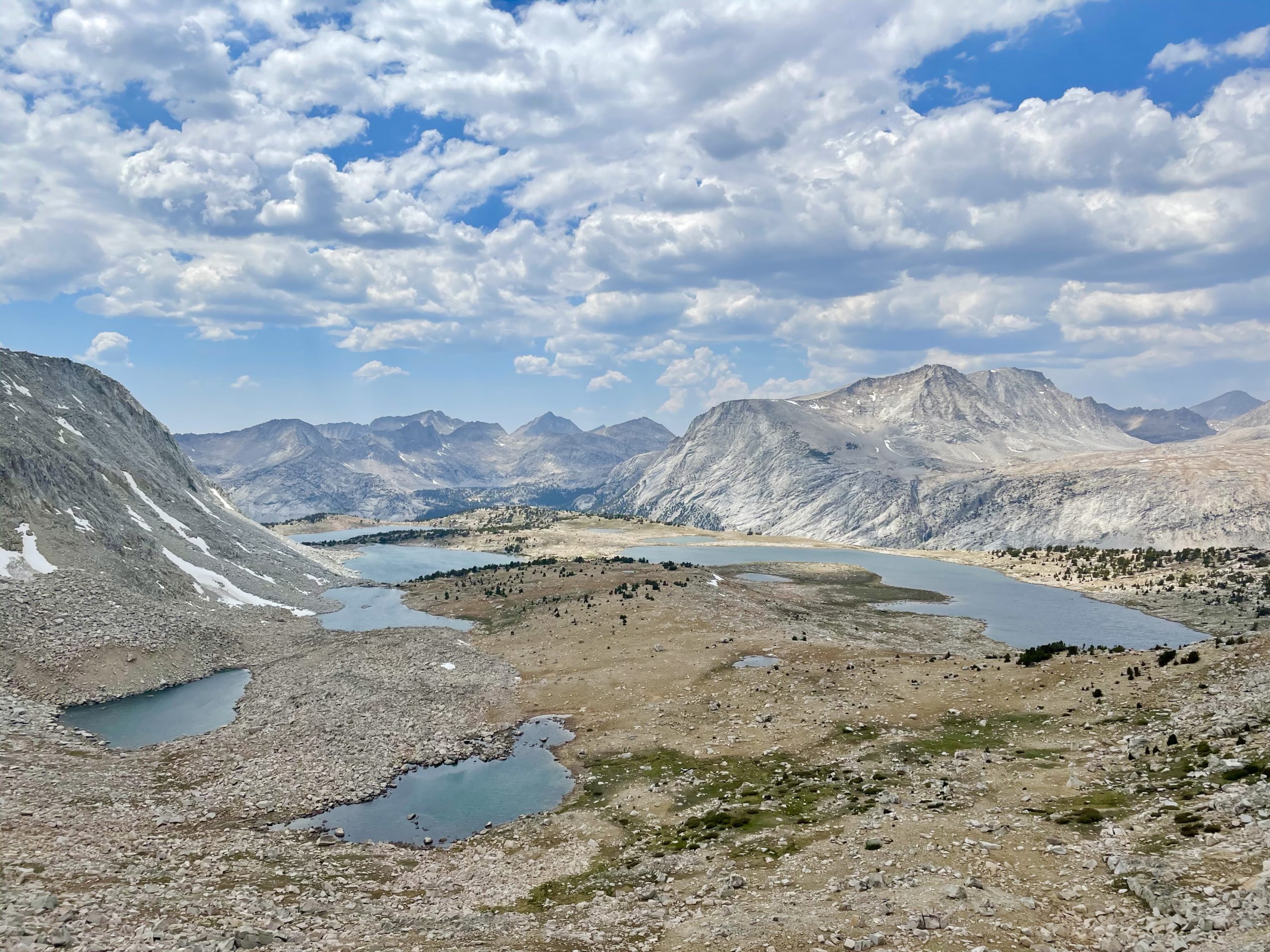
Starting in Kings Canyon Sequoia National Park, the route is approximately 50% off-trail. Weaving through the mountains with a mix of footpaths, bouldery scrambles, sweeping valleys, basins, and countless lakes and rivers, the route covers over 25 passes before ending in northern Yosemite National Park.
When my hiking partner “Uncle Nutsack” and I began planning for the Sierra High Route, we dreamed of a trek that would challenge us physically and mentally. We got exactly what we asked for on the ten days we spent hiking it. The route delivered a perfect blend of easily navigable terrain, incredible beauty, and well-spaced focused intensity.

Here are 8 of my favorite things about the route and our hike together this year
1. Sense of adventure
High routes combine a mix of footpaths and off-trail navigation, some more off-trail than others, but this route was about half and half. Each day we would like at least a few miles on trails. Still, inevitably we would always turn off and up on slabs or grass ramps and climb into the people-less regions of boulder scrambles and waving seas of granite in the higher elevation country.
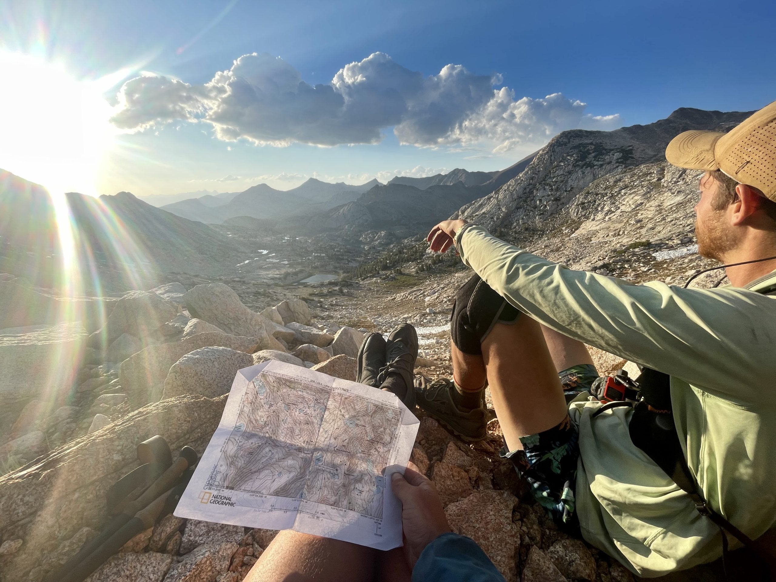
Up there, away from the trails and signed junctions and well-flattened campsites, the security of knowing where you’re going starts to fade away. Attention transitions from conversation to navigation, and your eyes go from lazily admiring an alpine lake to scouting routes over the passes and flitting over the topographic maps with little red dots, scribbled over with notes that used to be legible a few days ago.
That mindless walking feeling of being guided and tugged along down the path fades, footsteps become calculated choices for almost every step. This rock or that rock? This way or that? Here or there? We were always talking, almost always choosing a way and a direction, and I’ll be damned if that compass and those printed paper maps didn’t become our best friends (besides each other, of course).
Away from the trail, which can sometimes feel like a sedated, once wild place, above and below passes, in the space between the trekked and pounded pathways, it becomes a Sierra of the past. Long forgotten in the wake of modern backpacking trips and over-priced boxed-up resupplies at VVR it feels wild up there, truly wild, and the wind whipped up our psyche as much as it whips your face.

2. The Solitude
Except for when we neared popular trailheads and the Pacific Crest and John Muir trails, we rarely saw another hiker. Only once, between Mather and Muir, we ran into another person attempting the SHR.
Other than that, between pathways, it was just Nutsack and myself romping through meadows and suffering over the boulder-laden fields of the alpine, totally alone climbing up over the passes and ridgelines. Twice we shared a tent site with other hikers. In Evolution basin, we camped with Happy, a PCT thru-hiker we had met climbing up over Muir pass.
He joined us for our nightly check-in we call “nighty nights.” We all shared our gratitude for the mountains. Happy told us about an unfortunate incident experimenting with gossamer gear’s “crotch pot,” which ended in an explosion in the pants while hiking into camp. We laughed for hours. When we woke up in the morning and departed, we didn’t talk to anyone else for another few days. Away from the classic treks of the Sierra, we were alone together.
Not a human or a trail in sight…
3. Constant Engagement
Since my first thru-hike in 2018, I’ve completed a handful of other shorter trails and routes and put some miles under my belt. I love thru-hiking on trails. I love being on a dirt ribbon of space-time, getting lost in the magic, fun, and incredible community of a long trail. I deeply love routes, too, just for different reasons. This one, in particular, stands out in high contrast to my experience hiking well-trafficked trails like the PCT and Colorado trail, both of which are well signed and easy to navigate. On them, it’s pretty hard (not impossible but hard) to get lost or too far off the backcountry highways.
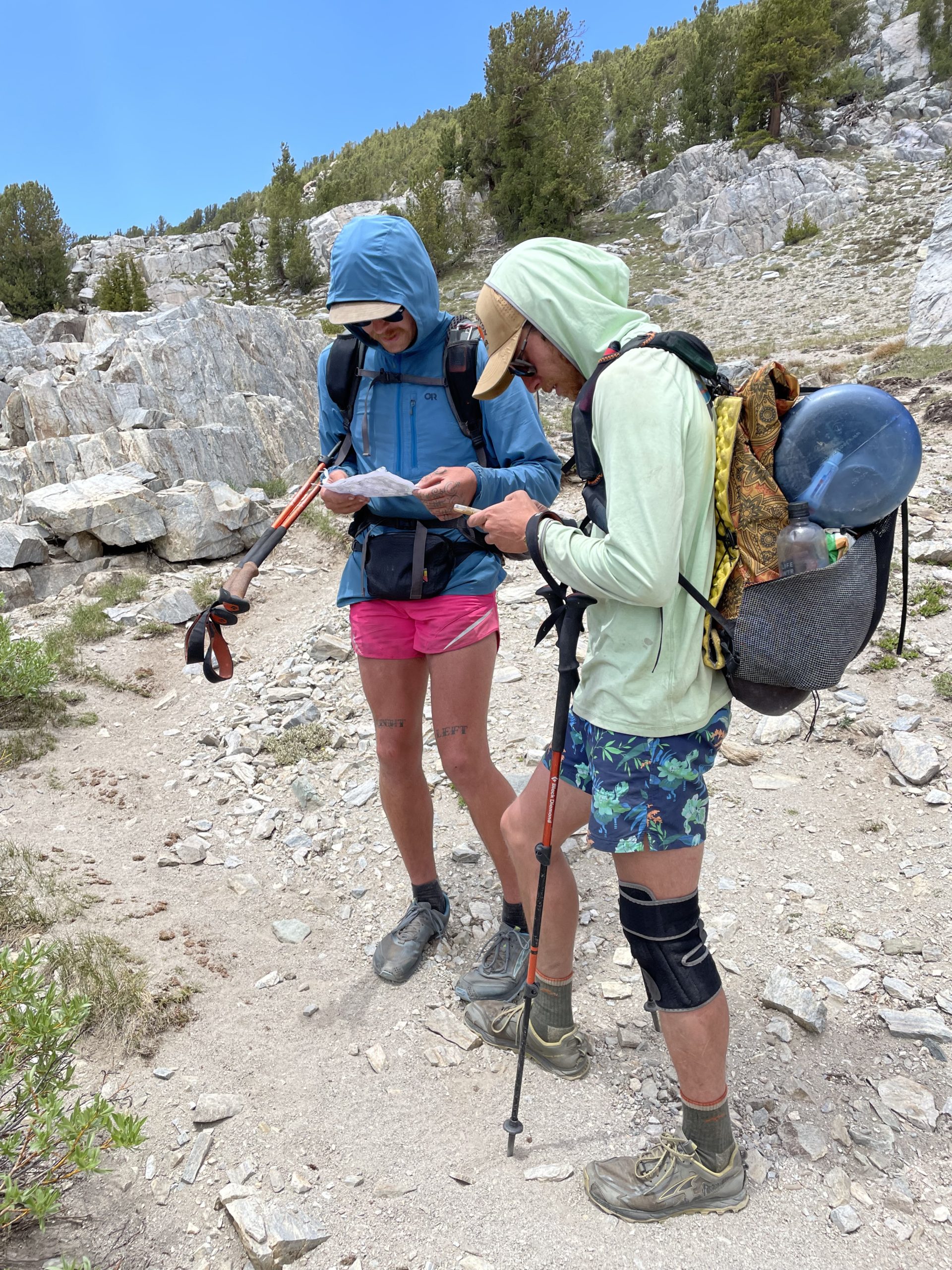
This isn’t the same on the high route. Off the trail, and even on the less traveled trails, we were always navigating, talking about the route, and collaborating on decisions about where to go and how to get there. Frequently (sometimes every thirty minutes or less), we would stop and break out the maps to ensure we were heading the right way. The high route asks for and requires map reading and navigation skills. Having a compass and knowing how to use it was at times invaluable. We were also aided by the offline maps in the Gaia GPS app, which was incredibly helpful for finding exactly where we stood in the mountains and how far off our desired path we were. Then we would find our line off in the distance.
“I think it’s that way,” I’d suggest.
“No, look,” Nutsack would point to the map and then a peak far away, “it’s that one we have to go around.”
We’d get halfway there and have a different perspective or run into a previously unseen obstacle and do the same thing all over again. At the bottoms of slabs and cliffs, we would make new decisions about getting there easily and safely. Sometimes we didn’t agree, or one of us was damn sure about the line, and we’d have to believe in the other’s idea, trusting the call. Daily, many times over, we collaborated and trusted both of our instincts and knowledge. Focused always and frequently figuring out where we were going is a lot of work. My brain was just as tired as my body at the end of every day from thinking so damn much (which really was an awesome feeling). Being so tuned in to the maps, land, and each other made it all really engaging and gratifying.
Shout-of-Relief Pass. We cried and hugged at the top. It was the 4th pass of the day and the most beautiful of the whole trek.
4. The Challenge
It’s tough walking, let me tell you. The only other time I’ve ever been so tired was during Nutsack and I’s Wind River High Route hike the year before. The Sierra can be punishing terrain. The hiking is hard out, off trails and on. It’s steep as hell, especially on the trails that are not the PCT, and it’s even steeper and harder when you turn away from them and start to climb into the less-traveled places.
Every single day we slogged up one hard pass after another, desperately using our poles to push up big steps and loose gravel and scree. On the uphills, our poles were helpful. We usually put them away on the descents and used our hands to clamber down around the boulders and wobbly talus slopes. The terrain often becomes class 2 and class 3 scrambles, which means it’s frickin’ steep and full-on.
Fear only entered the equation once on Snow Tongue Pass, which was equally physically difficult and terrifying. It can be described as a loose choss pile, accidentally dislodging large rocks and attempting not to slip on the hard gravely ground and tumble down to the bottom. Finishing the descent was electrifying, and we both felt a rush of adrenaline and gratitude making it down safely.
While it wasn’t essential, we decided to attempt the route quickly (as if it’s not hard enough already). We set an itinerary for 10 days of hiking and one optional zero-day in Mammoth with Nutsack’s girlfriend (which we mostly spent soaking in hot springs and laying down not moving at all). Some of the driving motivation was for Nutsack to be home to meet visiting family, but generally, we wanted to push ourselves. Wow, we were pushed. There were only two days of the hike we made it to our intended destinations for the day, which was heading into Reds Meadow and finishing the hike at Twin Lakes.
Walking far is hard regardless of where and for how long. High Routes have made me realize how nice hiking on trails is. We sweat and struggle and cried through a lot of the miles. Every day we would get to camp and lay down for a while before having enough energy to get up and cook dinner. Every day was incredibly hard and incredibly rewarding and incredibly beautiful.

Feeling totally gassed and stoked on the last pass of the Route, Horse Creek Pass.
5. Walking Together
Simple, I know, but it was so much fun walking right next to my best friend and favorite hiking partner. We were together, through and through as partners. For much of the trek, we hiked right next to each other. Without a footpath placing one person in front, we were side by side often. It made conversation easier and I felt like we were more together. If I needed to stop and swim in a lake (which I did every single day), we stopped together. There’s no “see you later at camp” when Nutsack and I walk. We were in it as partners and stoked about it all the time. I trust Nutsack so much and communicate with him so well. I’ve never had a better hiking partner who I’m lucky to call my best friend and I’m so grateful to do badass adventures with him.

6. No Guthook (yes, it’s nice, but also not)
I appreciate Guthook, and I often use it for hiking. On PCT and Colorado trail, I was so glad to have so much information at my fingertips. It’s so easy! But high routes arent trails and arent5 supposed to be easy. And honestly, it’s really nice to put my phone away and do it old school.
Steve Roper’s guige book has incredibly well-detailed descriptions of the route to go along with the maps he curated, but books are heavy, and I’m lazy, so we took Skurka’s maps and did a 1-hour logistics and map review session before heading out.
We had no elevation profile or waypoint distance to obsess over. I had a spreadsheet with the mileage of major waypoints and some red dots on the maps to follow. We thought it would be a great idea not to bring any route descriptions at all (which it was for us and created another layer of exciting difficulty) – just the notations we made on our maps and datasheet (which I would not recommend if you’re new to map and compass routes like this). But, we felt pretty comfortable and confident with the skillset we share between us not to have all the available information.
Overall, maps and compass really bring me into the moment and place. They have helped me develop a more intimate understanding of the land and terrain I’m walking in. We learned more names of peaks and lakes than we otherwise would have as they were important landmarks for finding our way. I felt more there, and a lot of that had to do with not being on my phone looking at waypoints and instead looking at the land around us.
“Where are we again?”
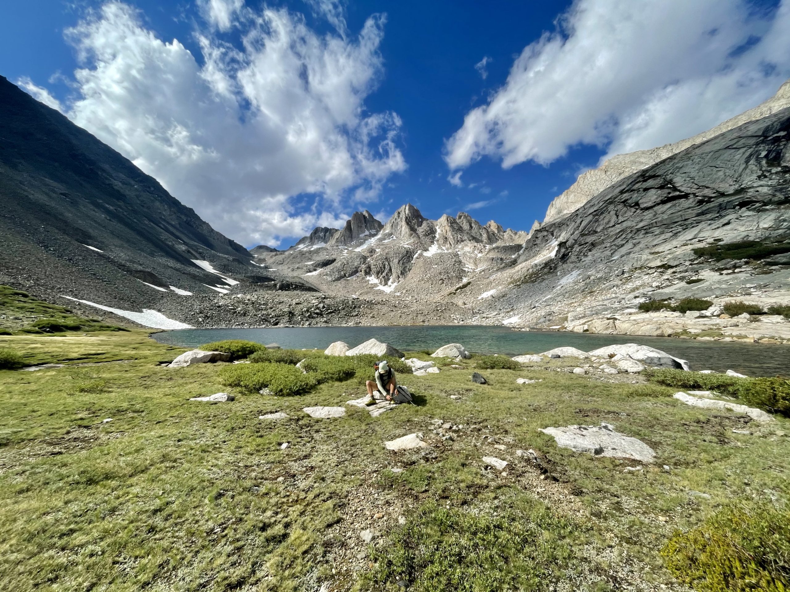
7. Alpine Lake Swims – Setting Intentions and Following Thru
The Last time I was in the Sierra was on the PCT in 2018. I blazed by the mountains. Rushed to hit mileage goals every day I rarely took time for myself to enjoy the trail, to rest, or relax in such a beautiful place. Further along the PCT, I met people who had taken time to swim in lakes and rivers every day. Looking back on my experience I wished I had as well.
This year, I set the goal to swim in an alpine lake every day on the route, and by the end of it, I was 10 for 10, including two extra swims soaking in hot springs outside of Mammoth during out zero. It ended up being one of the most magical aspects of the trip for me, part of taking action on my larger goal to do things I want to do this year, and not do things I don’t want to do.
I felt like I was living in the moment, being fully true to myself, hiking the route the way I dreamed of – listening to my heart and spending time communing with the mountains, taking it all in and not letting opportunities slip by because I feared losing control over the goals we had set out to accomplish. We lived it. Even the dying light of the day didn’t stop me from soaking in the bliss of a crystal clear alpine bath.

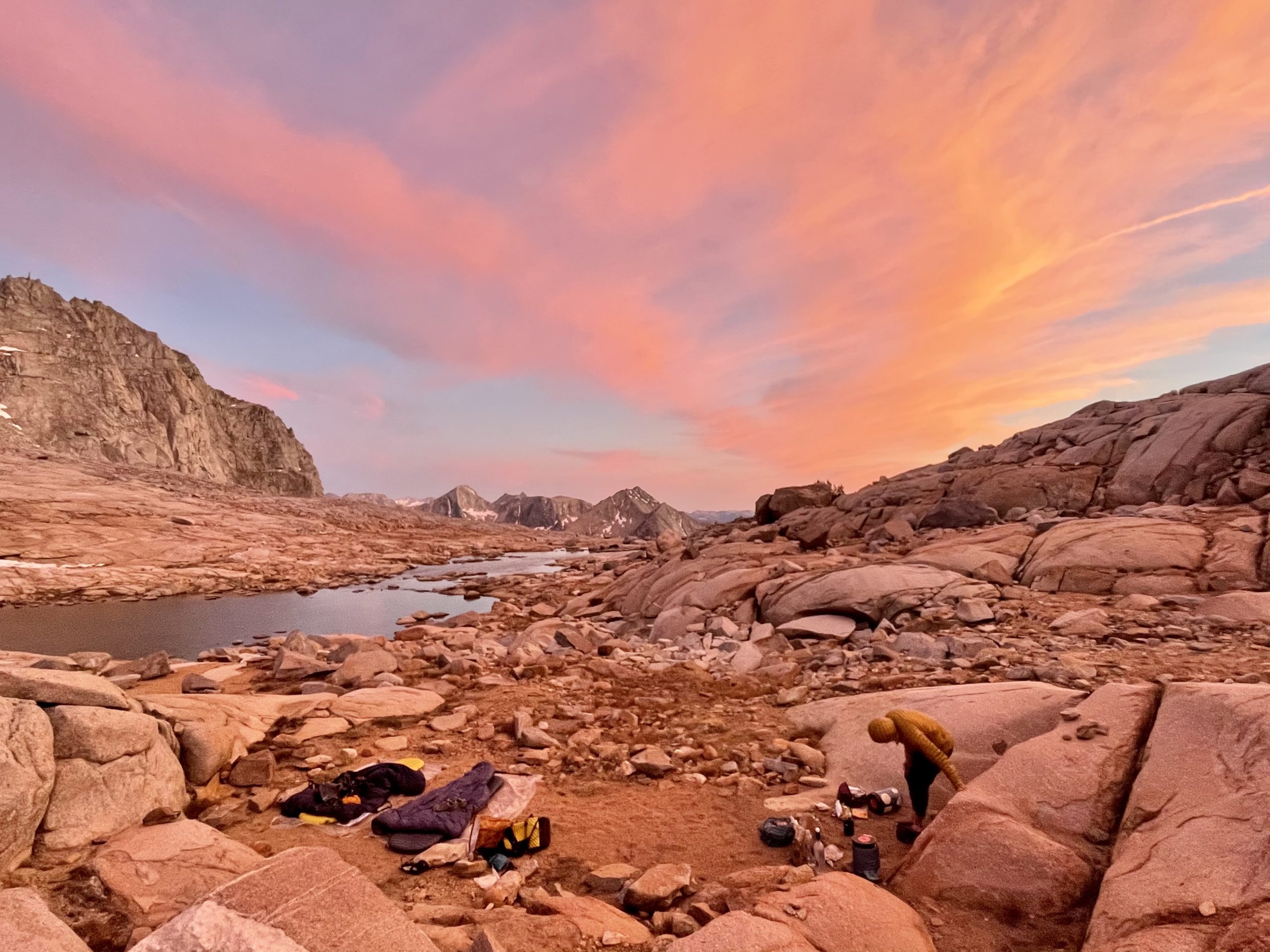
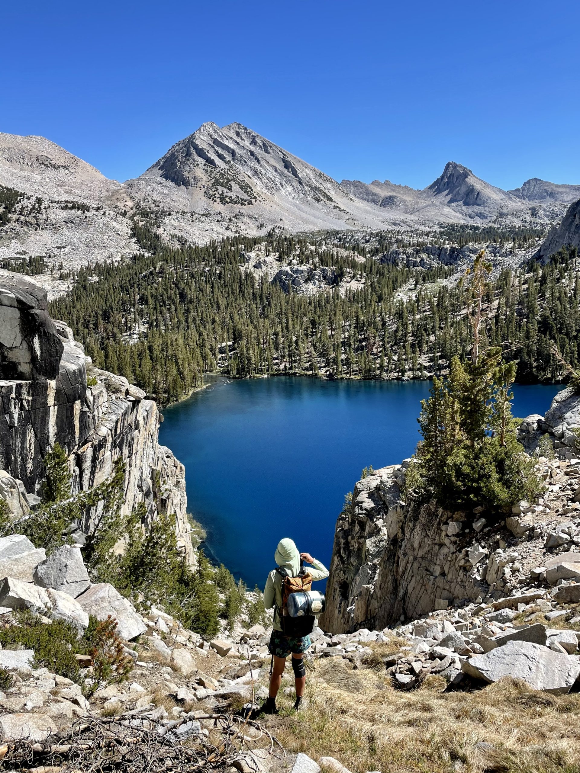
A lake below Shout-of-Relief Pass at the end of day 5
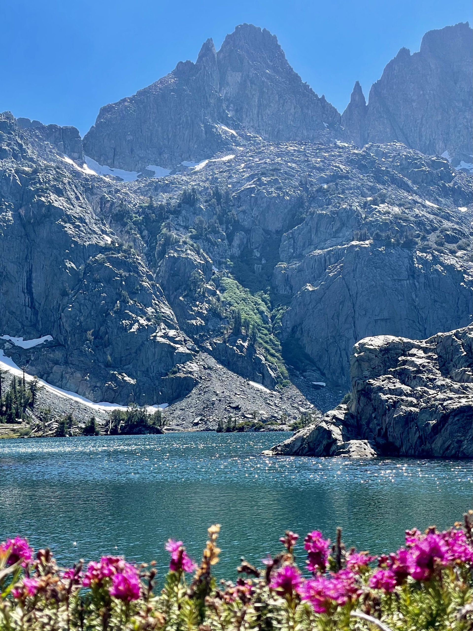
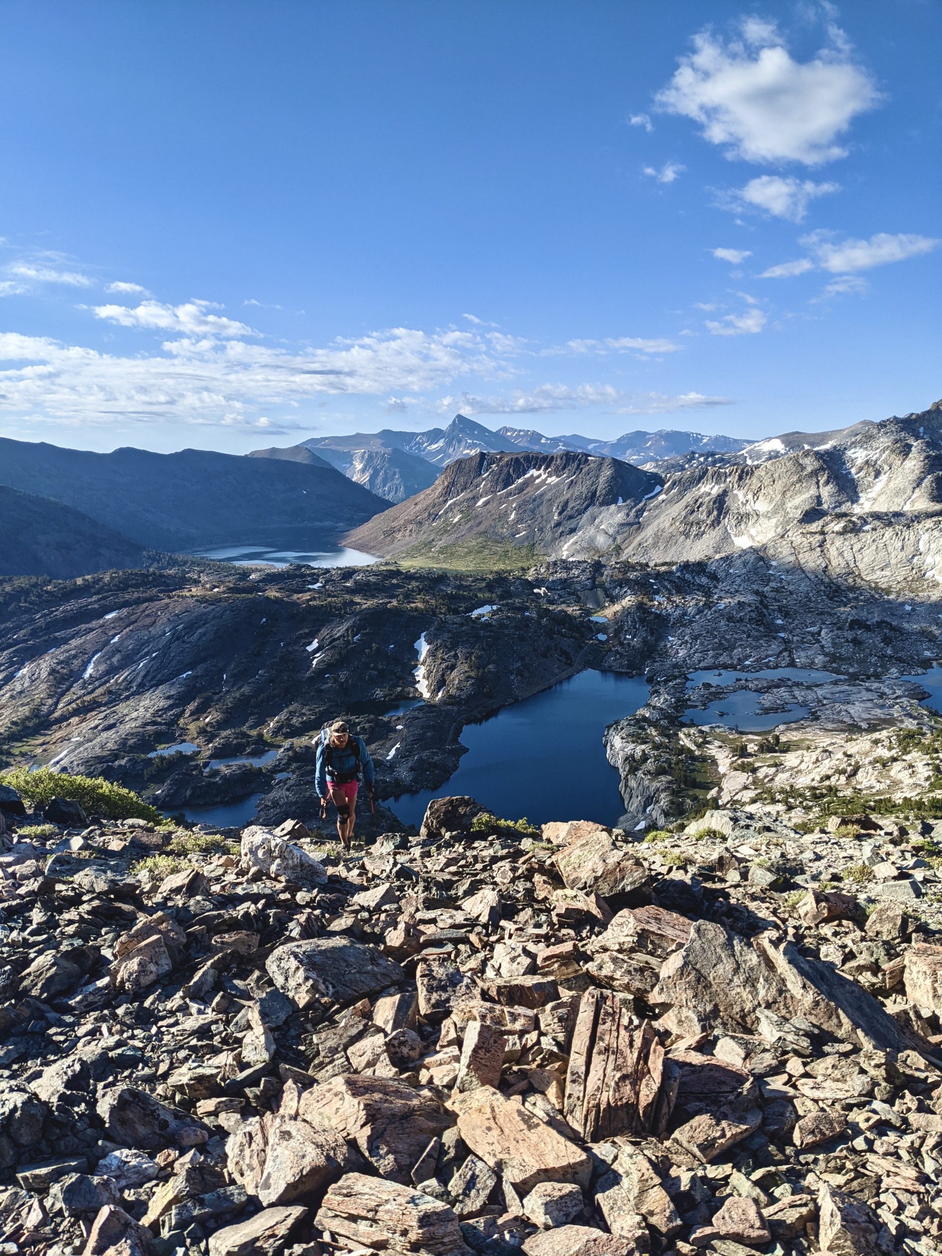
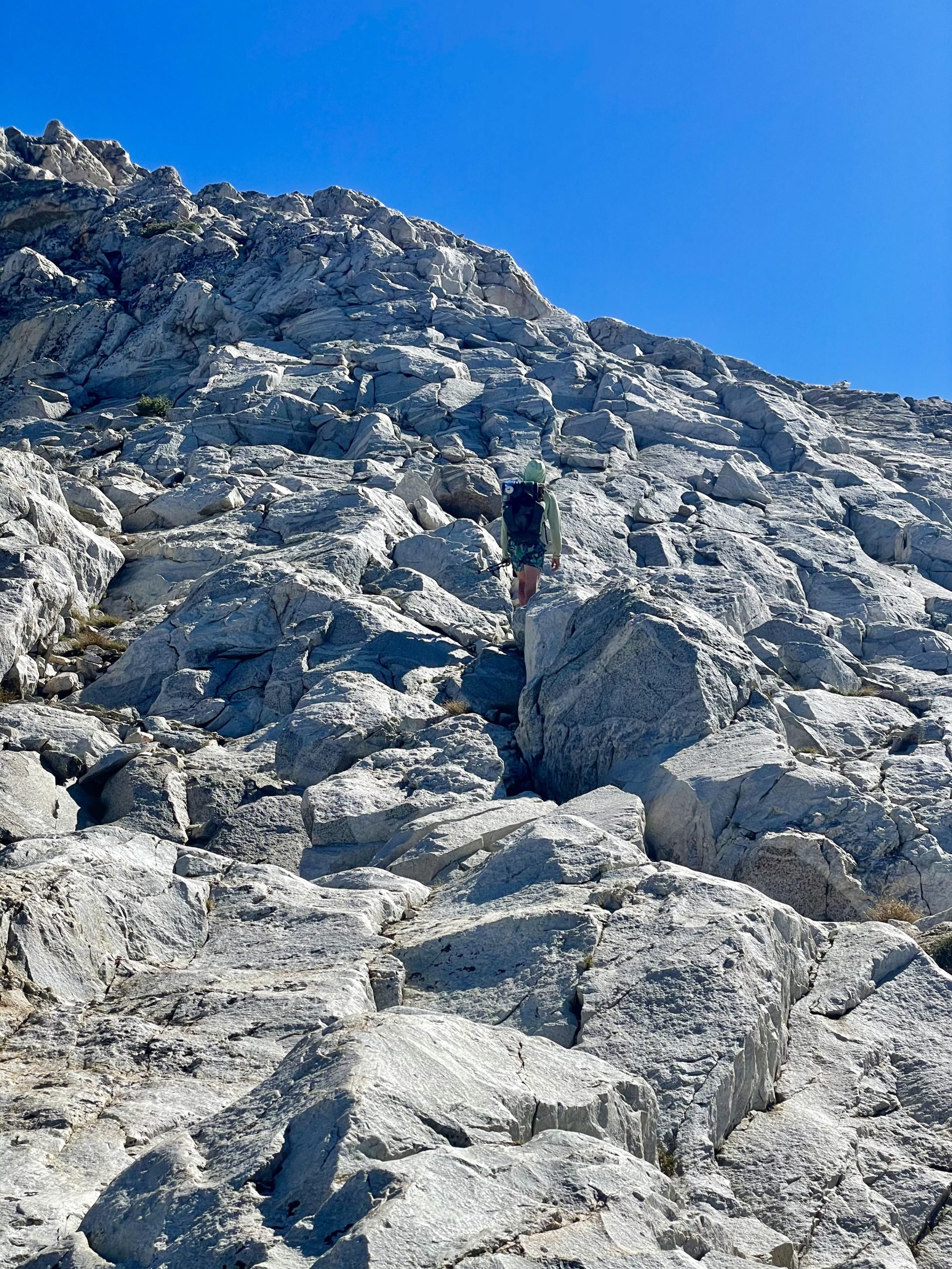
8. Beauty
I think I’ll just let some photos do the talking here…

The Minarets, looking into the hardest section of the trail for us

View looking back from Sky Pilot Col

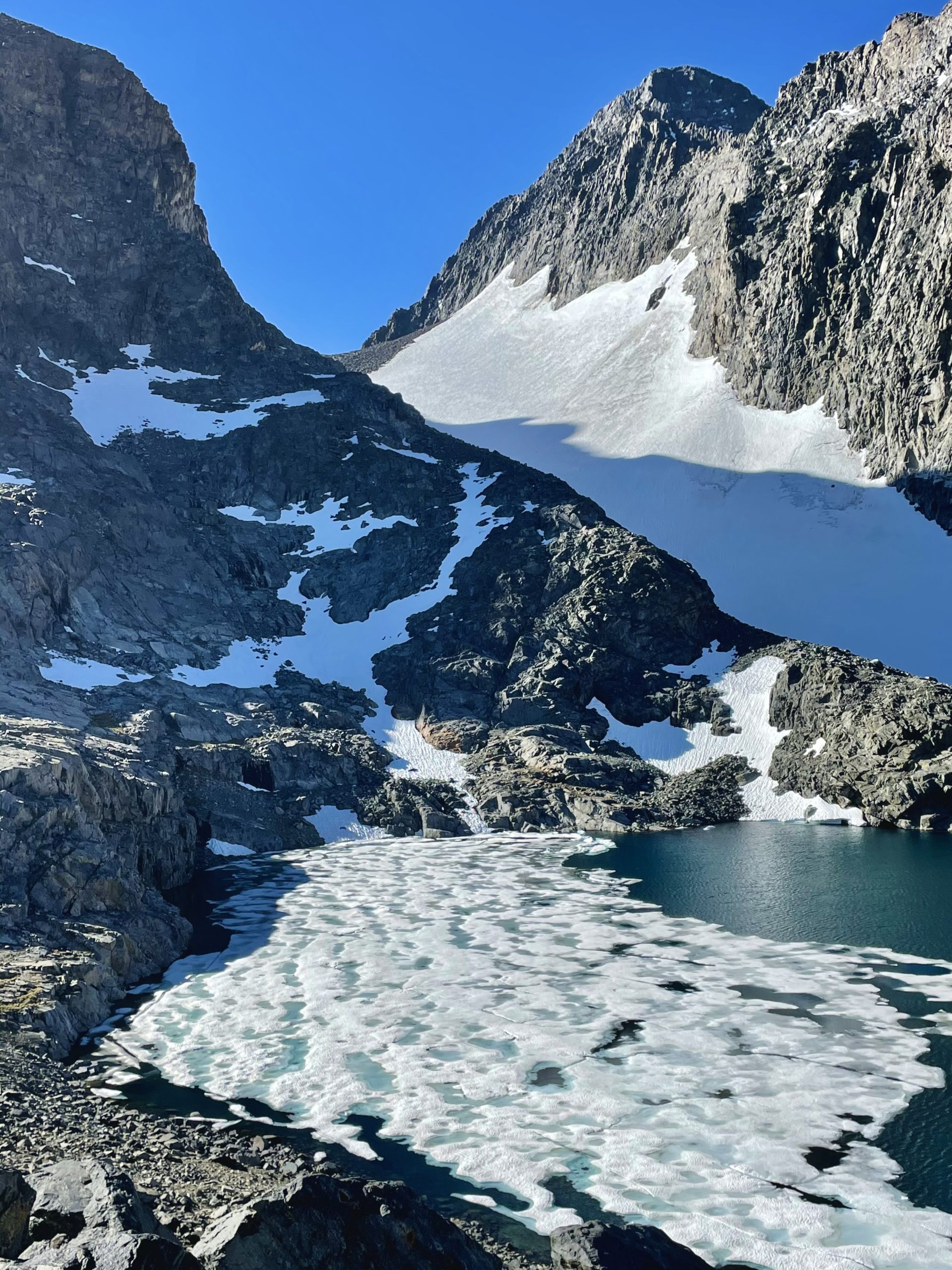
In the Distance is Conness Glacier far left, and Sky Pilot Col way off toward the right
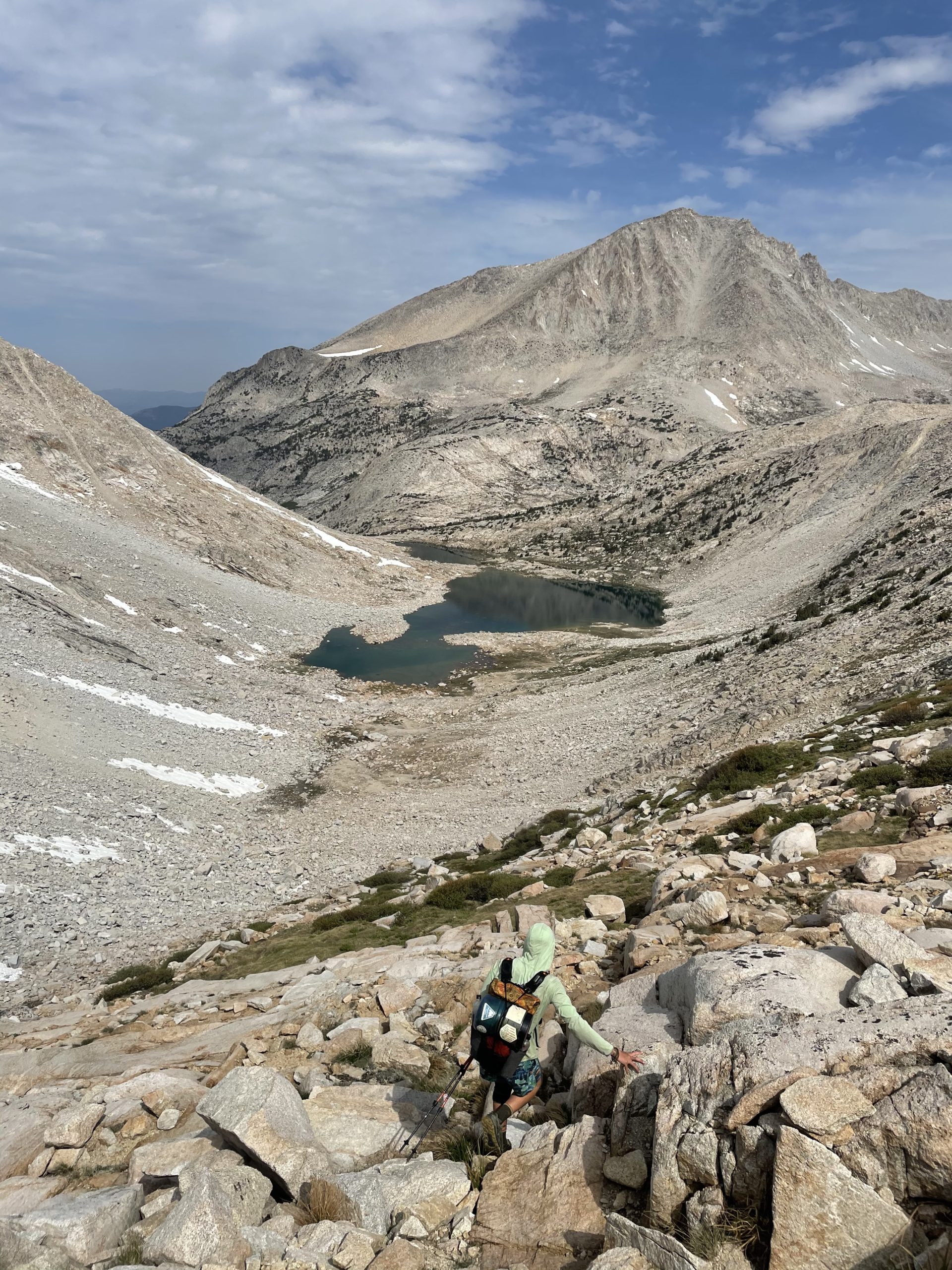
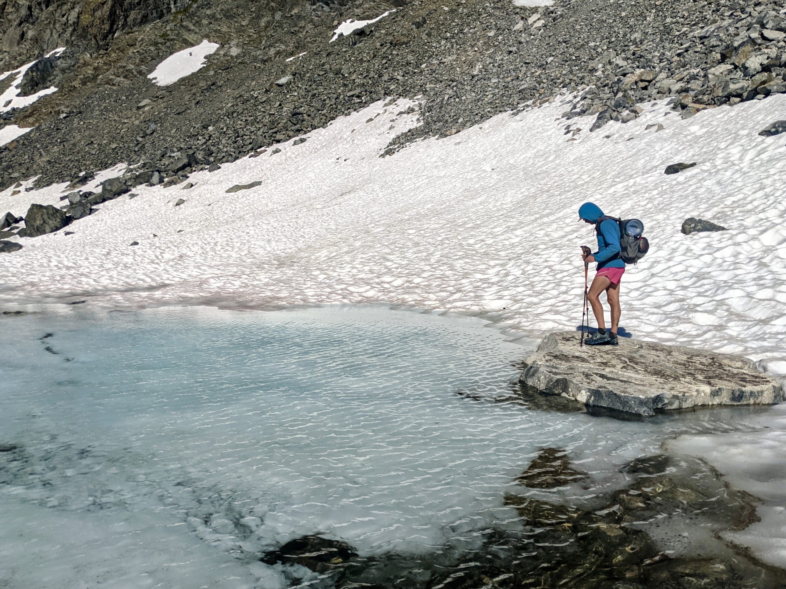
Looking back at the descent on the North Side of Sky Pilot Col

Snow Tongue Pass. Yikes…

Slippery feeling class three downclimb on the last day

Descending the top of Horse Creek Pass

The last few miles before arriving at Red’s Meadow for our resupply; Day 6
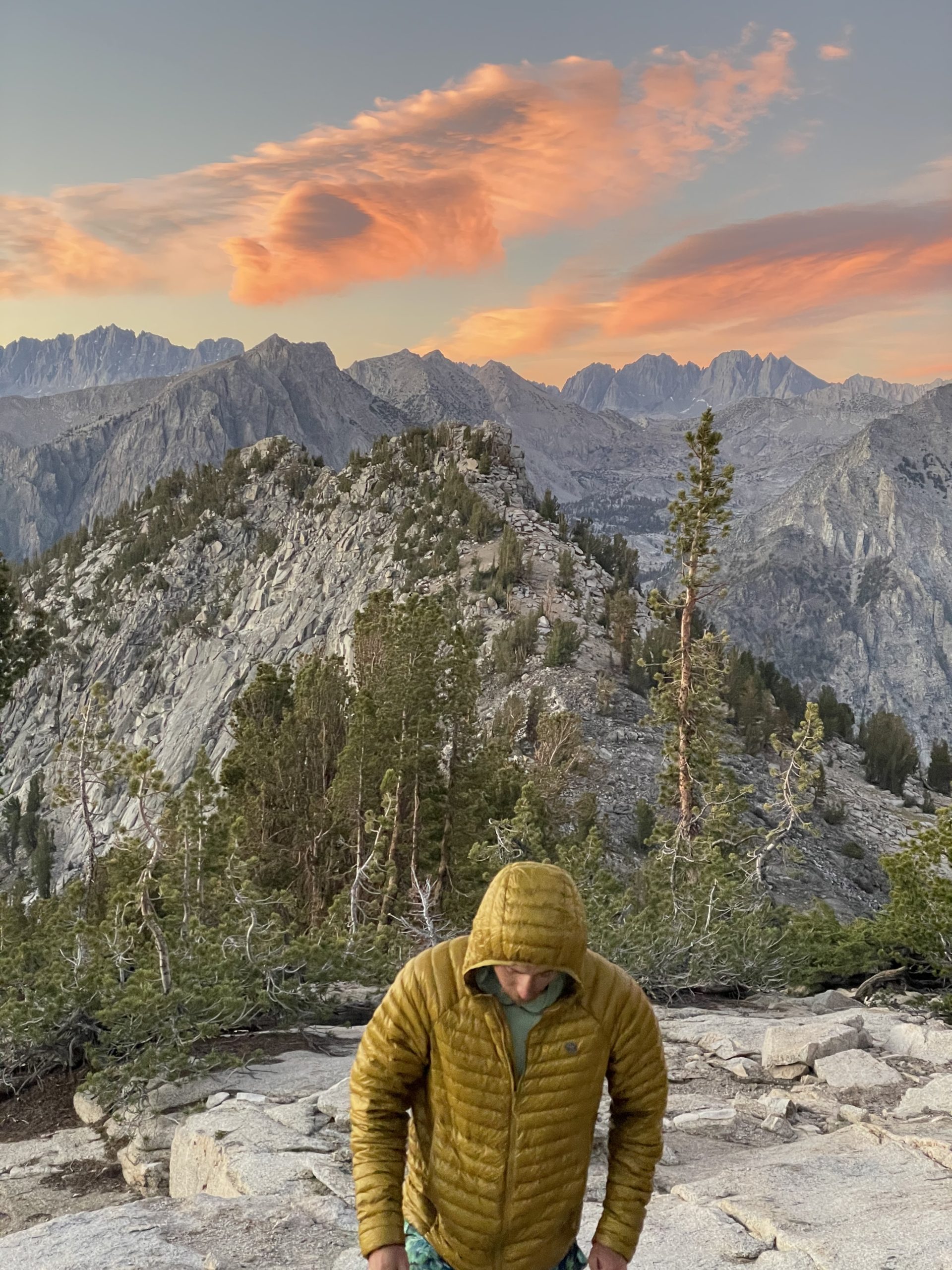
Sunset & campsite on night one at the top of Windy Ridge
Campsite #2
Start of day three, way above the PCT down in the valley between Mather and Muir Pass
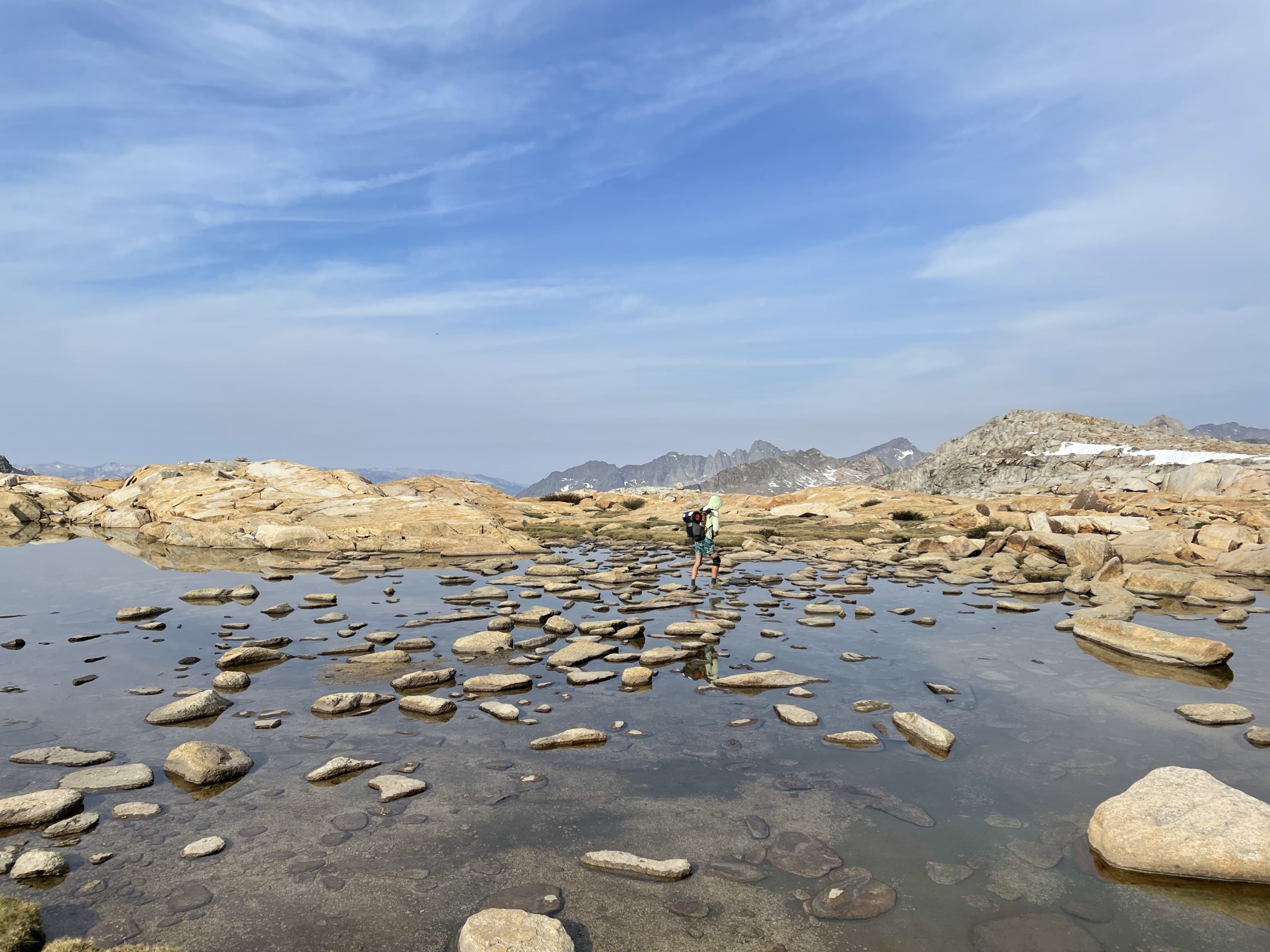
So many boulders…
Alpine Lake I swam in #7

Late afternoon magic on day 7(?)

Entering the Minarets, before we knew how challenging it would be
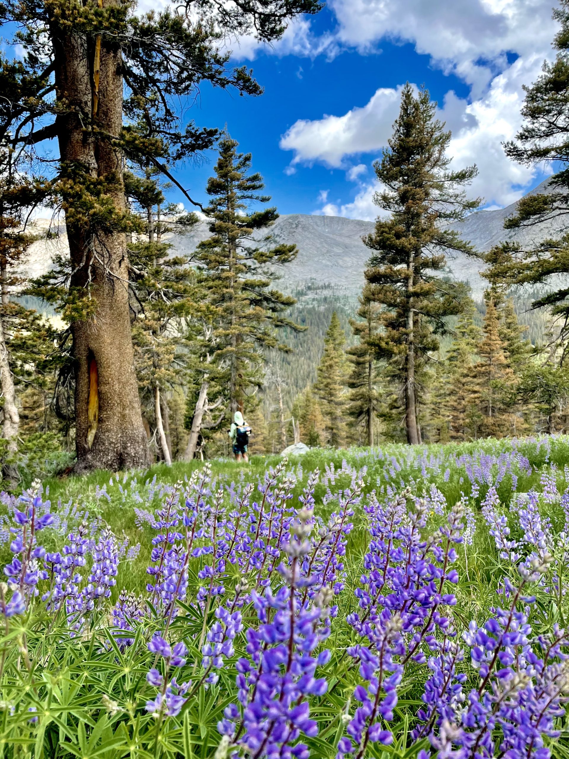
Near the bottom of the descent from Snow Pilot Col we walked through at least a mile of Lupine fields
Another Snow Pilot Col shot
Totally gassed on Horse Creek Pass, the 4th of the day and last of the High Route

Nutsack on Horse Creek

Looking back toward Snow Tongue Pass somewhere off in the distance

The look you have doing 20 mile days on the route
“mild” class two terrain


This website contains affiliate links, which means The Trek may receive a percentage of any product or service you purchase using the links in the articles or advertisements. The buyer pays the same price as they would otherwise, and your purchase helps to support The Trek's ongoing goal to serve you quality backpacking advice and information. Thanks for your support!
To learn more, please visit the About This Site page.

Comments 4
Thanks for the encouraging write-up. I’m looking at starting sections of the SHR next year.
Great post. What section did you do? From where to where? Great shots too!!!
Jeff, we did the full route starting down at the southern terminus Roads End and ended at Twin Lakes, the northern terminus.