 ">
">
Stealth camping and hiking in the heat (6/11, 6/12, 6/13)
Day 106, 6/11: Cornwall Bridge, CT -> camping near Rand’s view (17.3 miles)
We had the intention of getting on trail early because of the heat, but ended up enjoying our hotel time and hung out until 9am. We walked the 0.2 miles to the country market store, and a nice hiker in a car moved his car seats around and gave us a ride to the trailhead. It was warm when we started, and didn’t take long to heat up to uncomfortable levels. We were all sweating and I was having a hard time with the hills. We went through a smaller version of the lemon squeezer, and the air between the rocks was gloriously cool.
 Stopping for a break after going through the lesser lemon squeezer
We stopped for water and I took some short videos. Piñata found 2 separate millipedes crawling on her shirt. I French braided her hair as we stalled, not wanting to get back on trail. We finally got motivation to get going, and hiked another few hours until the heat became unbearable and we stopped at a campsite. Rash and I hung out hammocks and I relaxed with my snacks, out of reach of the bugs.
 Piñata with a millipede on her shirt
 Piñata showing off her French braid
We spent an hour relaxing away from the heat, but still had 9 miles to do and it was 3:30. We passed through a meadow and then walked by a chicken BBQ at a high school for the farmers association. We could see the smoke from the grill and smell the chicken. If we had more time, we would have definitely stopped and see if they would let us have or buy some chicken. Unfortunately, we were already getting to the campsite late, and didn’t have time to spare.
We had a nice stretch of flat hiking along a river, and then passed a hydroelectric plant. We walked across a cool bridge, and then passed a few beautiful houses and a huge waterfall. We had what looked like a steep (on the maps) 1.8 mile climb. The climb ended up not being too steep, but walking on the large flat rocks hurt my feet.
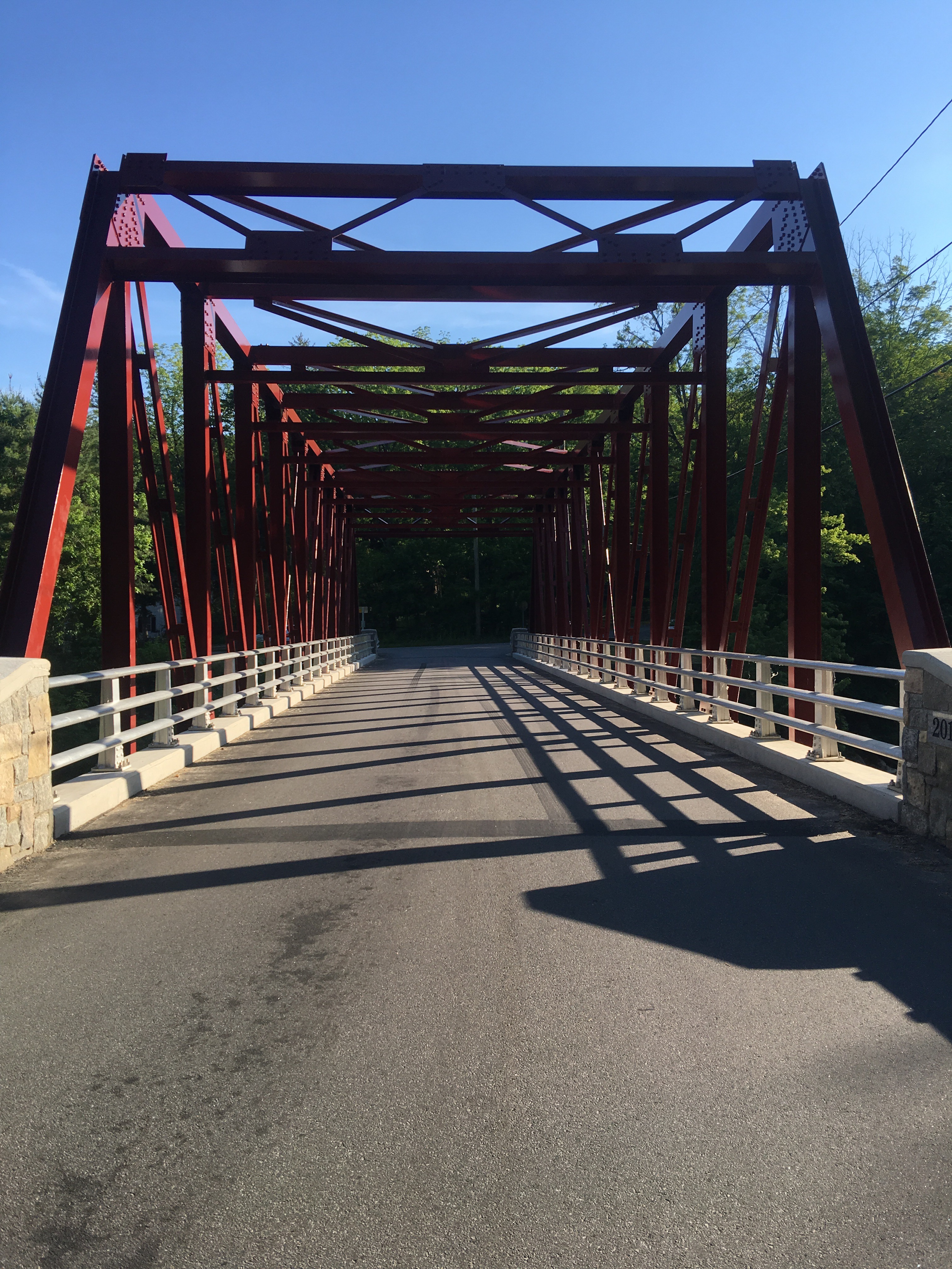 The neat bridge by the hydroelectric plant
We passed the shelter, which is 0.5 miles off trail, and I stayed with the packs as Rash and Piñata went the 0.1 miles down to get water to pack out. They got destroyed by mosquitoes while they were there, and we rushed with our water 0.2 miles down to the field where Piñata thought it would be cool to camp. There was a huge field with a beautiful tree line and an outstanding view of the mountains. We watched the sunset while eating dinner, and Rash stayed up to get pictures of the stars.
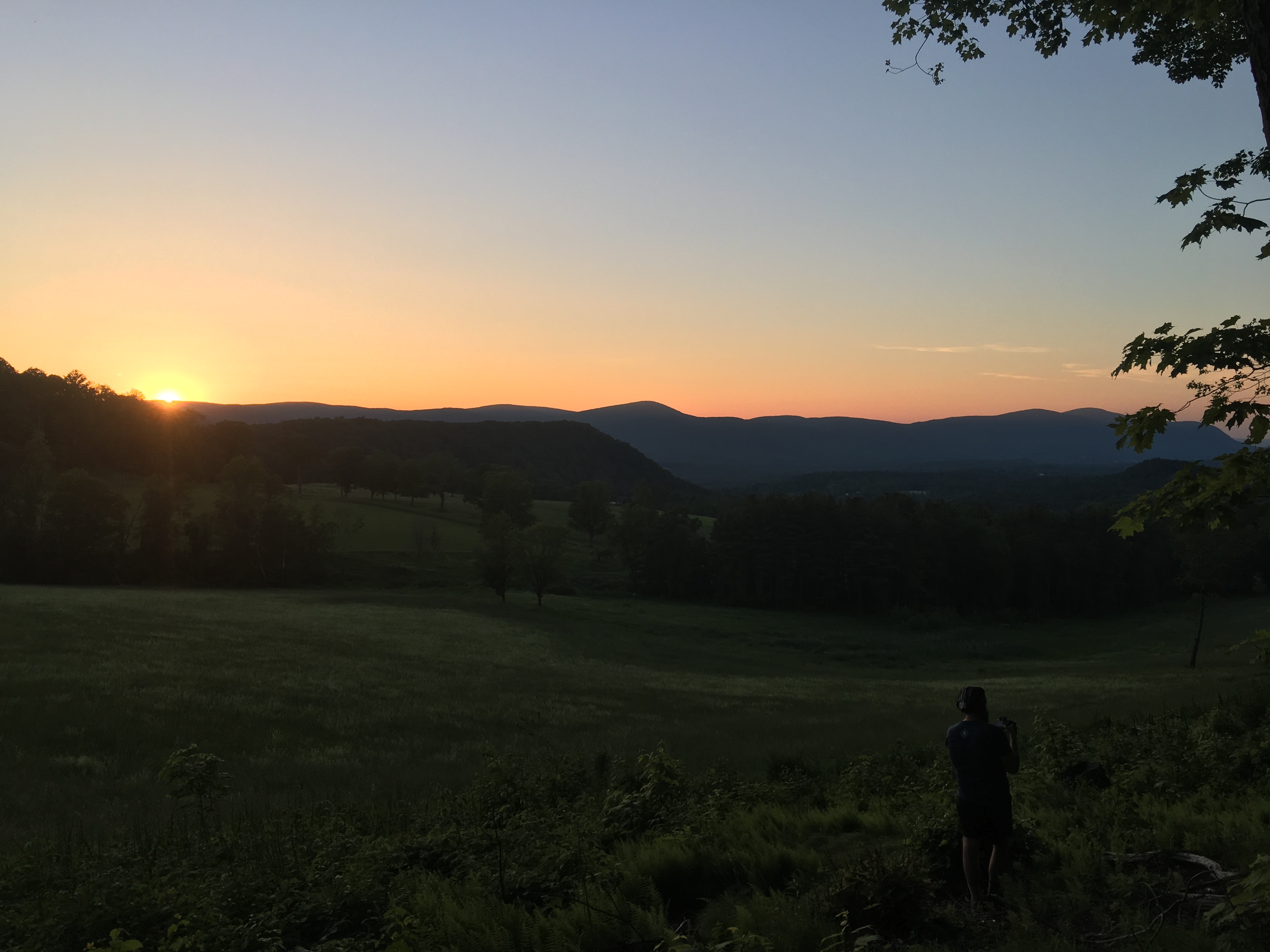 Sunset
Day 107, 6/12: camping near Rand’s view -> Hemlocks shelter (16.9 miles)
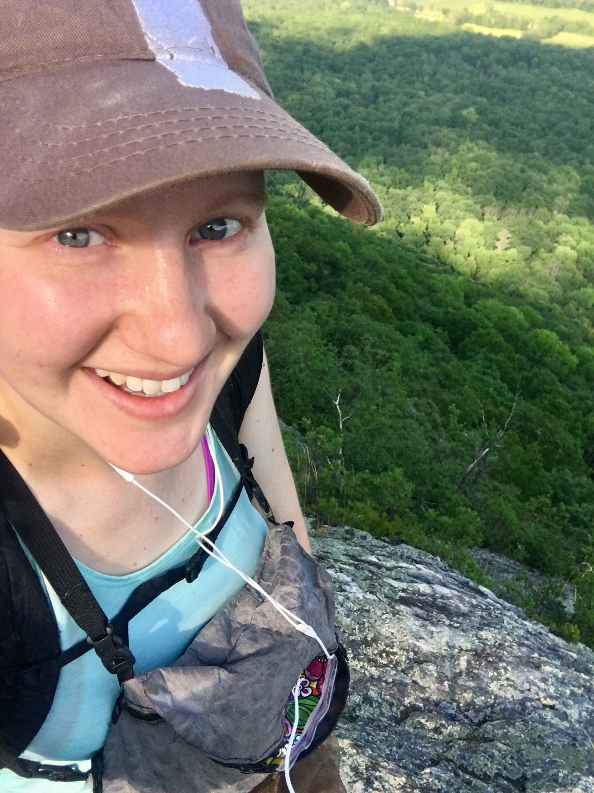
Overnight, I kept waking to rustling in the woods. It was unnerving but I ignored it and went back to sleep. We heard sheep or goats baaing in the distance. I woke up before 6am to a spectacular view of the mountains and tree line.
 Rand’s view in the morning
We got on trail by 7:30am to try and beat the heat today. The morning was muggy, but the heat was bearable. I put on the bugnet I got at the outfitter thanks to gnats trying to fly into my eyes. The morning hike wasn’t terrible and the terrain was forgiving. We passed Salisbury, CT and the 1,500 mile mark near a privy next to a road, so Piñata made a stick sign.
 1,500 miles!
We started our climbs for the day, starting with Lion’s Head. The day was starting to heat up. My right knee started hurting during the climb, so I took it slow, and thankfully the pain went away. We got to the top of the climb and decided to lunch at Brassie Brook shelter, which was another 2 miles. The terrain wasn’t terrible, but my right outer foot started hurting. The pain was annoying at first, but then I started favoring it. Those 2 miles seemed like an eternity. When we got to the shelter, I got water and took my socks and shoes off to massage my foot. I was nervous about getting an injury right before the Whites.
 Our climbs for the day
Rash and Piñata took naps on their pads, and I lay on the shelter floor and used my food bag as a pillow. The nap was well needed. I didn’t have a great appetite, and I felt a little nauseous, so I didn’t eat much. I left a little before Rash and Piñata so I could take it slow if my foot started hurting again, but thankfully it didn’t. Bear Mountain looked difficult on the maps, but it was day hiker friendly, so the trail was wide and not too challenging. A girl my age with a day pack followed me up the mountain. Most of the top was exposed, and the sun was beating down in full force. At the top was a big pile of rocks with a few hikers chatting on top. On the way down, I ran into Jacob, a ridge runner doing an internship for college. We had a nice chat, and Rash and Piñata caught up. The descent was worse than the ascent, and parts we had to slide down on our butts. The trail walked along a large stream for a ways, and there were a few pretty waterfalls.
 Waterfalls
We came to a sign for the Connecticut-Massachusetts border, even though the real border was a mile back. The bugs were terrible, and I took my bug net off for the group picture, but immediately put it back on. We hiked on and then stopped for water before the last 2 climbs of the day. I downloaded some podcasts to try and learn some Spanish. We hiked on, but early into climbing Mt Race, I felt lightheaded and hungry. I stopped to eat, and told Rash and Piñata I’d meet them at the shelter.
 Bugnet selfie
After eating and drinking, I felt a lot better. I finished Mt Race, and enjoyed the beautiful walk along the ridge line. The trees down below were different colors and I could see lakes in the background. After descending, I very slowly summitted the steep Mt Everett. Most of the ascent was straight up massive boulders, but the AT club thankfully drilled into the rock and put wood steps up the rock.
 The view from the ridge line of Mt Race. The trees were all different shades of green.
 Summitting Mt Everett
At the top near the old fire tower site, I found out that the little black flies that I thought were just flying around me actually were biting flies, and were just waiting for me to sweat my Deet off, which apparently happened during my Mt Everett climb. I reapplied a little Deet to get me to the shelter intact.
I found Rash and Piñata hanging out at the shelter, and we decided not to push on to stealth camp like we had thought about this morning. We were all exhausted, dehydrated, and ready for bed. Piñata wasn’t feeling well and didn’t cook. I was going to wait and get water in the morning, but I drank so much during dinner I had to refill before bed.
Day 108, 6/13: Hemlocks shelter -> Mt Wilcox South shelter (19.7 miles)
I didn’t sleep well last night because I heard rustling in the woods behind me. Another hiker came in later and tented. We all ate breakfast at the picnic table and got on trail by 8:00. We were trying to get an early start since we had to go into town to resupply. We topped off our water on the way out. Rash and Piñata hiked ahead of me, and I told them I’d meet them at the road.
It was hot early on, but the morning hiking was shaded enough where the heat wasn’t too much of an issue. The descent was steep, and I passed a large group of boy-scouts descending on the rocky ledges. After the descent, the trail went through a couple large, open fields. There was a big stone marker for Shay’s Rebellion last stand in 1787. The date listed was Feb 27, which is one day after I started the trail.
 Shay’s Rebellion’s last stand
Walking through the exposed fields was hard. I started feeling overheated, and my lukewarm water wasn’t helping to cool me off. I stopped under a tree halfway through the fields and took a break. I wanted to sit, but everywhere was grassy, and last time I sat in grass I found 2 ticks crawling on me. I settled for leaning on my trekking poles. I checked my phone and watched Cassie’s snap of Dr. Lewis saying goodbye since it was his last day soon. That gave me enough motivation to push through the last exposed field back into the safety of the shaded woods.
 Taking refuge in a shaded spot
I met up with Rash and Piñata, who decided to wait for me in the woods rather than bake at the exposed road. We walked to the road together, and hitched to the Dollar General. We were picked up almost immediately by a pickup. We road the 2 miles in the back with the wind blowing, cooling us down. We resupplied food, and then took our time walking around, enjoying the wonderful AC.
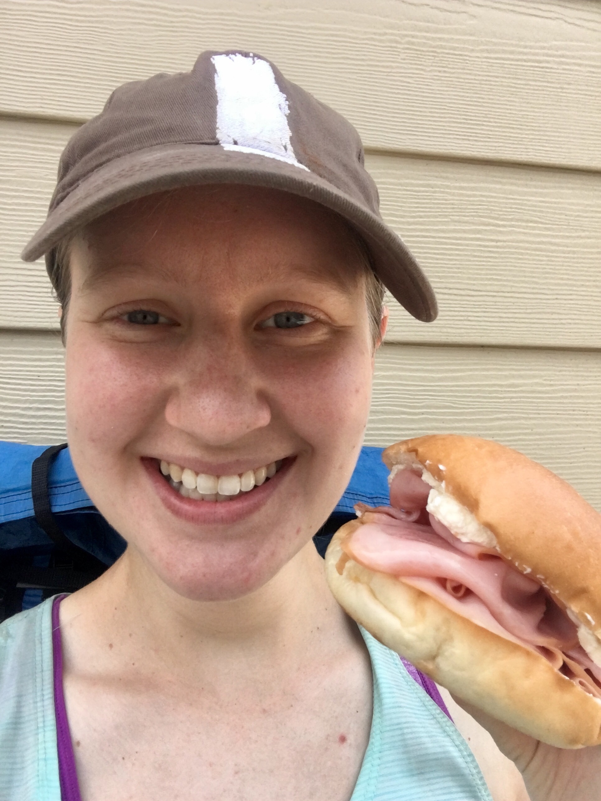
We decided to split cream cheese and ham bagels for lunch finished off with fudge drumsticks (which we ate first so it wouldn’t melt). Everything tasted amazing. We were sitting on the side of the Dollar General in the shade, and lots of people stopped to talk with us. A nice lady gave us each a bottle of water, and it was perfect timing because we were running low.
 Splitting lunch
We relaxed for a while, then went back inside to use the restrooms, and I filled my bottles up at the water fountain. We went to the road for a hitch, but instead of being picked up immediately like last time, we waited for 5 minutes. The minutes ticking by felt like an eternity with the sun beating down on the blacktop. Another pickup stopped and gave us a lift. He said that he once hitched from New Mexico to West Virginia and loves picking up hitchhikers. We thanked him, and got back on trail as quickly as we could to get back in the shade.
 Hitching back to the trail
Soon after starting to hike, we passed a field being ploughed. I turned around to talk to Piñata, and instead of Piñata, I found 2 hikers on my heels. I let them pass, and they zoomed by. We walked along a shallow river, and then crossed the river on a bridge. Going back into the woods, we found the 2 hikers sitting on a rock, sweating profusely. They were part of the large group of boy-scouts I saw earlier. One of the boys in the group overheated, and they were trying to hike to the shelter 6 miles away to get to the car parked nearby. I showed them the topo map on Guthooks which included a pretty big climb. We suggested trying to walk back to the road and hitching instead of trying to hike to the parking area. They took our advice, and went back to the road.
I had Rash and Piñata go ahead of me, because I knew I was going to lag on the climbs. We stopped to get water from the only fast flowing stream that wasn’t a swamp, and I left before Rash and Piñata. I took the climbs slow, and I was pouring sweat. My Deet had sweated off, and I reapplied a small amount because the mosquitoes were so bad. There were rain clouds and thunder in the distance, and at one point there was a thunderclap that shook the forest. The rain never came, though, and I was disappointed because it would’ve cooled things off. I stopped at a rock at the blue blaze to the first shelter. I could see the shelter down through the trees, but I didn’t want to add any mileage to the already crazy day. I ate snacks and rehydrated, and Rash and Piñata soon joined me.
On the trail after the shelter, we found a smaller group of the boy-scouts from earlier. The 2 from earlier did get a hitch and got to their cars OK. The smaller group was going southbound from the parking area to the shelter. It was good to see things come full circle, and that everyone was safe.
The last climb had a beautiful view of the sun setting. I met Rash and Piñata at the shelter after packing out water from the bottom of the hill. We ate dinner and hung our hammocks. We didn’t get finished until after dark, which still isn’t bad for doing almost 20 miles on a resupply day.
 The sun setting
 My bugnet. The best $5 I’ve ever spent.

This website contains affiliate links, which means The Trek may receive a percentage of any product or service you purchase using the links in the articles or advertisements. The buyer pays the same price as they would otherwise, and your purchase helps to support The Trek's ongoing goal to serve you quality backpacking advice and information. Thanks for your support!
To learn more, please visit the About This Site page.
