Appalachian Trail State Profile: Pennsylvania
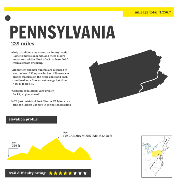
Pennsylvania—somewhat affectionately known as “Rocksylvania” amongst AT hikers—represents 229 miles of the Appalachian Trail. The state falls at the midpoint of the Appalachian Trail, beginning at NOBO mile 1,066 at the Mason-Dixon Line and continuing on a flat-ish, rocky-ish path to the New Jersey border at NOBO mile 1,295.
What to Expect on the Appalachian Trail Through Pennsylvania
Being home to the midpoint means means the state’s legendary rock fields have NOBOs and SOBOs fearing the foot bruising, rolled ankles, and miles of staring at your feet with each careful step. Sure, Pennsylvania has that, but the state overall isn’t that bad—in fact, the southern half is downright lovely. It’s really just the northern half of the state with the rock fields, and the terrain is so flat and low that hikers can crush huge miles start to finish.
The southern half of Pennsylvania is some of the easiest hiking on the entire Appalachian Trail, and the local trail club (PATC) is one of the most active on the trail. The shelters are beautiful and well maintained, the trail towns are friendly and conveniently located (several right on the trail), and the restaurants are inexpensive. It gets exhausting watching every step in the northern half of the state, but even that isn’t as bad as people make it out to be.
Terrain

Photo: Jenni Thompson
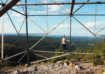
Flat and low. Elevation ranges from 200 feet to 2,000 feet, and the steep climbs are few and far between. You’ll hike through rolling fields, well-graded wooded trail, and under blazing hot power line breaks in the hillside. Cruiser terrain and mild climbs define the first half of Pennsylvania.
In the northern half, the rocks really come into play. Narrow ridgelines are indistinguishable under rocks ranging from baseball-sized rollers threatening your ankles’ well-being, to boulders requiring nearly technical climbing moves to maneuver over. And it’s not all rock hopping. Many of the rocks are loose and unstable, requiring attention to each step that becomes exhausting after full days. Foot bruising and shoe shredding is real… but don’t despair. This is just one 150-ish mile section of a very long trail, and it too will pass.
Water, Camping, and Resupply

Photo: Ryne Tobar
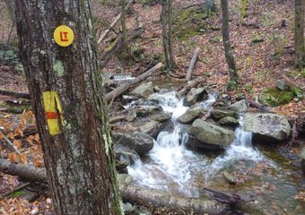
Water: Most SOBOs and NOBOs hit Pennsylvania in the dead of summer, and there are a few sections where water can be scarce. It’s likely going to be hot as balls, so carry plenty of water and stay up to date on seasonal sources. Additionally, many of the water sources through Pennsylvania are down steep, rocky side trails.
Camping: Easy. Shelters are plentiful and well maintained, and the camping sites have plenty of space for tents. State parks abound and have tent sites and facilities, but will incur a camping fee.
Resupply: Again, easy. No need to send drop boxes, and you walk right through trail towns like Boiling Springs, Duncannon, and Delaware Water Gap. Hikers can make big miles through here, and won’t need to carry as much food. Hamburg has a massive Cabela’s that is worth a stop just to see the epic taxidermy.
Appalachian Trail Pennsylvania Highlights

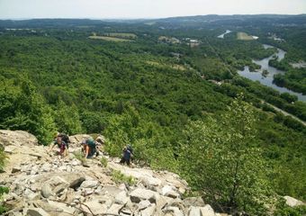
Scrambling out of Lehigh Gap. Photo: Maggie Slepian
Mile 1,066: Maryland / Pennsylvania Border
Right at Pen Mar County Park and home to the Mason Dixon Line. Yogi’ing is easy here, but there is no camping.
Mile 1,084: Caledonia State Park
Pennsylvania has a plethora of charming state parks right off the trail. Caledonia State Park has vending machines, a snack bar (seasonal), and a pool. Camping costs $35 per site, so you’re better off moving on up the trail.
Mile 1,096: Official Appalachian Trail Midpoint

Posing with the official AT midway marker. Photo: Danny Strayer
This marker changes every year, and sits at 1,096 for 2019.
Mile 1,104: Pine Grove Furnace State Park

One of us finished the Half-Gallon Challenge and it wasn’t me. Photo: Maggie Slepian
Home to the famous Half-Gallon Challenge, the AT Museum, and a well-stocked general store. There are grills in the picnic area, and it’s a friendly place to spend the afternoon.
Mile 1,123: Boiling Springs (Trail Town)
One of the nicest towns on the entire trail, and the AT goes right through. The ATC Regional Office is on the trail on the way into town, and the food, lodging, and overall vibe of this town make it hard to leave. Expect ducks splashing in the seven-acre Children’s Lake, quaint brick buildings, and townwide barbecues and outdoor events throughout the summer.
Mile 1,149: Duncannon (Trail Town)

The legendary Doyle. Photo: Maggie Slepian
Even if you don’t stay in Duncannon, you need to at least walk into the trail-famous Doyle and snap a photo. Duncannon has inexpensive food and ice cream, and it’s another town the trail goes right through.
Mile 1,159: Table Rock
The sunrise and sunset view, expansive camping space, and 360-degree vistas make this spot totally worth packing water up to. It’s a bit of a climb to get up there, and it is a dry campsite, but again… worth it.
Mile 1,219: Port Clinton (Trail Town)
Port Clinton is worth a stop to stock up at the Peanut Shop, an old-fashioned candy store. Feeling brave? Someone should do a full resupply here and tell us if it’s possible.
Mile 1,259: Superfund Trailhead / Lehigh Gap (pictured above)
This 900-foot, seemingly vertical rock scramble out of Palmerton takes hikers by surprise after a relatively flat 200 miles. There is a blue-blazed detour for those who want to avoid the rock scramble, but for hikers looking to use all four limbs to gain the ridge, it’s actually pretty fun.
Mile 1,295: Delaware Water Gap (Trail Town)
There is no water, and this isn’t in Delaware, but the town has some of the best pie on trail, as well as a pay-what-you-can church hostel. This is also right before the New Jersey border, so say goodbye to Pennsylvania, but be aware that the rocks don’t totally end just because you crossed the state line.
Dispatches from Pennsylvania
More Backpacking Trails in Pennsylvania

Photo: Colleen Goldhorn
More from This Series
This website contains affiliate links, which means The Trek may receive a percentage of any product or service you purchase using the links in the articles or advertisements. The buyer pays the same price as they would otherwise, and your purchase helps to support The Trek's ongoing goal to serve you quality backpacking advice and information. Thanks for your support!
To learn more, please visit the About This Site page.





Comments 4
One item that I feel was either miscommunicated or misunderstood for the flat section section called Pennsylvania, is that as a thru hiker you would be able to crush out long miles. For me, in 2018, it just didn’t happen. Sure, the southern section was nice, but if the rocks are about 150 miles then it only leaves about 80 miles of nice “mile crushing” terrain. So 3-4 days of long mile days? In my experience the rocks completely negate the value of the flatness. There’s just not enough flat, rockless miles here to make it worth getting excited over. My opinion.
Nice article. But, you stated or implied that the southern half of the A.T. in PA is ALL maintained by PATC. It’s not. PATC is GREAT. But they only maintain from the Mason Dixon to Pine Grove Furnace. Mountain Club of Maryland, Cumberland Valley ATC and Susquehanna ATC maintain the rest.
NOBOs hear about the monstrosity that is “Rocksylvania,” then start poo-pooing the whole thing by the time they hit Duncannon. “This isn’t so bad,” they say. “Buncha wimps exaggerating, is all!”
And then. And then. Then they get a couple or a few days past Duncannon and all the tough-talk and bravado starts to recede. By the time most (not all, but definitely most *honest* hikers) hit Delaware Water Gap, they may not acknowledge how arrogant and foolish they were to dismiss the tribulation that is “Penns-hell-vania,” but they sure as hell know that it’s not just a myth. Those rocks are a pain in the ass.
And yes, it’s true: From there north, rocks are the rule, rather than the exception. By the time you hit NH/ME, rocks rule your experience, most days. But having meandered up from Georgia, the fact is, Pennsylvania rocks really are an eye-opener. Anyone who says they are no big deal is probably just trying to sound cool or tough.
~Pony