 ">
">
AT Day 14 – The Other Side Of The Smokies
Double Spring Gap Shelter to Peck’s Corner Shelter
I’ve Been In Tennessee This Whole Time? Camp to Livin La Vida Smokies Camp
AT miles: 21.4
Total miles: 226.4
Elevation change: 5266ft gain, 5505ft loss
Twenty miles doesn’t always feel like a long way in terms of ecosystems and geology. Shoot, it’s possible to walk for weeks without noticing a shift, whether it be in the terrain, the rocks, the flora, or whatever. That’s what made today so unique. So much changed over the course of the day, or really just a short part of it, that I found myself wondering, “when did that happen?” The Appalachians shifted today, and it feels like I’m in a new range now. Pretty cool for a day’s walk. Twenty miles does always feel like a long way to my legs, though. I’m tired. No change there.
Anxious for the day to begin, I kept waking up in the night thinking that sunrise was just around the corner. 2:30, then 4:30. After that, I set my alarm so that my mind would be at ease, which worked. I slept until 5:30am, no problemo. The usual snoozing, eating, pooping, and packing carried me until 7am, my planned departure time, a little earlier than usual to allow for some tourist time on the AT highpoint. I said goodbye to the others who were eating breakfast in the shelter.
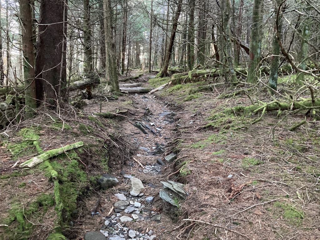
The trail was all up from Double Spring Gap, but the morning freshness in my legs leveled out all the inclines for me. I felt surprisingly recovered from the difficult yesterday, and thanked my body for being such an awesome instrument and enabler. The trail worked through the new spruce-fir forest (that’s what the guide calls it. I’m no arborist.), which was deeply shaded and dark. A thin velvet of green moss blanketed most surfaces, the ground, fallen logs and limbs, trunks of living trees. The rocky trail was the only bare surface around.
The wind whooshed through the canopy above me, while only the occasional breeze bothered the air at my level. A few open points afforded views to the west, and of Clingmans Dome ahead, but the bright sun was perched on the summit, washing out all detail.
After a few miles, I turned onto the paved footpath that leads from a parking lot to the top of the Dome. It was as wide as a single lane road, and it was deserted. On such a beautiful morning, I was shocked. Shortly ahead was the observation tower, a concrete ramp spiraling 270 degrees to a viewing platform above the trees. I made airplane noises to myself and extended my arms as I banked around and up to the top.

I have to admit, the whole thing was cooler than I’d expected it to be. And I wasn’t expecting to have it all to myself. I dropped my pack and took my time reading the four signs and looking long in each direction. To the south, I could see all the way to Standing Indian Mountain in North Georgia. To the east, I could see a bunch of crumpled ridgelines all the way to Mount Mitchell, which, if one believes the sign, is a long way away. North, was the flat expanse of Eastern Tennessee, like a pool table. West, of course, were all the hills and bumps I had sweated over yesterday. It seemed like a small distance for such a large effort from up here. The classic, “it’s all downhill from here” jokes made their rounds. Wait, no they didn’t. I was alone. The sweat on my back was dry by the time I saddled up and spiraled back down into the trees.

It was cool and dark again back in the forest, the shade preserving the last bastion of Winter’s ice. The trail was smooth and easy going, so navigating the slick spots was simple, though it required my full attention. And it really did seem like it was all downhill from the top as the trail followed the gently sloping shoulder of Clingmans eastward. I passed a hiker who reminded me to think “only good waves” and then a couple out for a dayhike that got me thinking about sandwiches. My knee and shin felt great on the slight decline, which was, err um, great.

A couple hours of that and I reached the highway at Newfound Gap. With it as quiet as it had been, even in the most visited national park in the country, I was not prepared for the mob in and around the parking lot. Cars and motorcycles buzzing around, a bunch of people taking pictures with the NC-TN border sign. It was cool to see all these people enjoying such a beautiful place, but I wanted nothing to do with it. However, before I could even throw away my trash and read a sign about the CCC, I was surrounded by a family asking about my hike. They were all super friendly, and even offered me pizza. Somehow, the little vegan guy on my right shoulder convinced me to pass it up. They were also all more impressed by my deeds than I felt was warranted, except for the daughter who was decidedly unimpressed and let us all know about it. I sided with her just to get away.
I scurried up the wide trail, feeling fast and antisocial, just wanting to find a quiet spot to enjoy my lunch in peace. I burned the jets for a mile or so, scooped some water off of a trickling rock, then posted up in the shade a few yards from the trail. I grew chilled as I worked my way through the various baggies of chunky things that, when combined, I call a balanced diet. A final squeeze of coffee almond butter, and I was back on the trail, needing to move fast to warm up and recover from all my dilly dallying.

Charlie’s Bunion was a cool spot a few miles further down the well-graded trail. Still within reach of the masses day hiking from Newfound Gap, I was again surprised to have this epic spot all to myself. The bunion turned out to be a gnarly cliff of rock protruding from the hillside like a flying buttress. The signs warning parents to control their kids made sense. The rocky point was worn smooth by decades of shoes and butts, and it was a long way to fall indeed. The view was airy and epic, certainly worth the hike.
The remaining miles to camp were easily my favorite of the AT so far, and I was so grateful to catch them with such incredible weather. The trail stuck true to the ridge, often riding on the spine itself, no more than a yard across. Without the trees and brush on each side, I thought, this would have been one terrifying adventure. Views were limited, but frequent, offering the option to gaze down thousands of feet of air to the crenellated edges of the mountains.

It was around this time that it dawned on me just how drastically different this stretch of trail was when compared to the trail of yesterday. Same moutains, very different vibe. Yesterday, the ridges rounded and bulged, flat space was abundant. Here, the slopes were steep, the ridges rocky and sharp. The closest comparison I could come up with was the San Bernardino mountains north of Los Angeles. I remembered a similar feeling of airiness while I hiked the PCT along their crest. The Mojave desert, like Eastern Tennessee, stretched impossibly flat to the north, both close, due to the mountain’s steepness, and far away. These Appalachians may be old and worn down, but some sharpness remains. It was truly a thrill to ride the edge, as the sun sunk low on the horizon, losing the power to warm my face while amping up the visual warmth of the surrounding hillsides.

I was feeling pretty stumpy when I turned down the side trail to Peck’s Corner Shelter at around 6pm. It was .4 miles off trail, but I had no choice but to add the minimal bonus miles. Three Gen Zers looked like they were up to no good when I got there, but they were friendly and told me where everything was. I pitched my tent, filtered water, stretched out my aches, then got horizontal with a jar of cold beans, all before the dusty purple alpenglow faded to the glittery black of night.
Considering my favorite moment of the day, it soon became clear that a warm ridgewalk with a view to my right and a mini peanut butter cup melting in my mouth is hard to beat. I’ll take that anyday.
This post was originally published on my blog hikefordays.com. Check it out for trip reports from my other hikes including the CDT and Sierra High Route.

This website contains affiliate links, which means The Trek may receive a percentage of any product or service you purchase using the links in the articles or advertisements. The buyer pays the same price as they would otherwise, and your purchase helps to support The Trek's ongoing goal to serve you quality backpacking advice and information. Thanks for your support!
To learn more, please visit the About This Site page.

Comments 1
“…thanked my body for being such an awesome instrument and enabler.”
Love this – such an important part of using our bodies that is so easily forgotten. I have made it part of my daily gratitude practice and encourage everyone to do the same 🙂