 ">
">
AT Day 87 – Is There An Easy Mile In The Whites?
Mount Wolf to Liberty Slope
Lumpy Camp to Gloomy Hummus Camp
AT miles: 13.6
Total miles: 1830.6
Elevation change: 4222ft gain, 4951ft loss
Is there an easy mile in The Whites? This was a legitimate question that I pondered for most of today. And even though I discovered the answer when I hit a smooth mile near a trailhead, I think that I asked the question is telling. Most of the day was not easy. Actually, most of the day was extremely challenging at a level that far exceeded anything else on the AT so far, save Moosilauke yesterday. The flatish morning miles were a slow obstacle course of mud, rocks, blowdowns, spiderwebs, and roots. The steep midday miles were a relentless scramble up a trickling cascade of snowmelt. The following descent, a tricky mix of steep ice and rocks. Even the flat connecting ridge between South and North Kinsman was full of shirtless bros that needed dodging. So what was the payoff? Well, let me tell you, the views were great and the satisfaction greater. If you ignore the mileage total, then today stands as one of the good ones. Not that up until this point the goal has always been about hiking big miles, but the focus has shifted now in these mountains. Each step is more mindful, each mile more precious. I even treasured that one boring, easy mile that I did get like it was the greatest gift I’d ever received. Slowing down, appreciating the mundane alongside the spectacular, that’s what it’s all about.
I slept surprisingly well on my rooty lump of a bed. Three positions had been comfortable enough, and I rotisseried between them all night. I awoke mostly rested, but weary of the constant movement needed to comfortably stay still. I ate a bunch of trail mix, and got hiking.
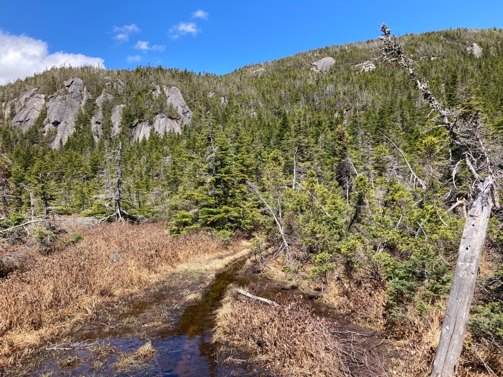
The morning was cool and damp in the moist forest, and I wondered if this place ever felt dry. The trees were so dense, the moss so thick. Even when it warmed up as I climbed away from the cooling stream where I’d slept, it was still humid and sticky. Deep puddles of water and mud collected on all the flat spots of trail, and the rock steps only just barely poked above the surface, if there were rocks at all. I fought with everything I had to keep my feet dry, but they were soon soaked through after many slippery missteps. In between the puddles was an endless obstacle course of slick roots and giant slabs of granite. Each step was questionable and needed consideration. Blown over trees lying across the trail formed another formidable barrier, especially when they blocked passage over a puddle, where crawling on hands and knees wasn’t an option. Despite moving as fast as I could, I wasn’t surprised to see that the first mile took me 37 minutes, and my second 34.

The forest and trail finally opened up and dried out as I neared Eliza Brook Shelter. I made it there, used the privy, then sat in the glorious dryness of the hot sun while filtering water and letting my shoes, feet, and socks dry. Up ahead was the massive climb up and over the Kinsmans, and I wanted to recuperate and rehydrate before getting underway. Honestly, I could have stayed there all day. The spot was perfect and profoundly beautiful. It felt remote, yet had all the comforts that I could ask for. The trees were large and widely spaced, letting the ideal mixture of sunlight and shade move about on the forest floor. The shelter was clean and new, the nearby Brook icy and wild. Birds sang. A slice of paradise.
But there was a big mountain to climb, so I dragged on damp socks and got hiking again. And if the miles felt slow before, then they were glacial now. At first, I followed the blazes up what was essentially a bouldery creek, then turned skyward up a 2000ft ladder of roots and rocks. I sweated hard in the punishing sun, or sweated hard in the humid forest. I pulled and pushed myself up the endless parade of rocks and slabs, alternating between using my poles and bare hands. I was grateful that at least there was no significant snow or ice to contend with. This aspect of the mountain clearly got a lot of sun, as I was finding out for myself. I could just make out a day hiker and their dog through the trees ahead of me, but then they left me in their dust as my pace wilted.

The trail finally leveled out. Oh thank goodness. But it wasn’t the top. After a short, snowy section of flat, I resumed the scramble. Fortunately, the final climb was over quickly, and I found myself on a flat slab of granite amid a stubbled covering of stunted pine trees. Mount Moosilauke was the big thing that I recognized, looming large against a backdrop of the unfamiliar. Puffy white clouds floated overhead, not yet menacing, but worth keeping an eye on.

The true summit of South Kinsman had less to offer in the view department, so I scooted on by towards the north summit. A thin track of snow delivered me there quickly and safely, but I had to chuckle at the aforementioned shirtless bros going the other way. However, perhaps I had forgotten myself. “Sun’s out, guns out,” is close to gospel for some, and as a reformed bro myself, I had to appreciate their dedication to that mantra. On the forested summit of North Kinsman, I called a halt for food and water. It was lunch time, and I was hot and thirsty. I watched the Saturday crowds come and go, and joined them in gazing to Franconia Ridge across the deep valley of Franconia Notch. I was headed up there tomorrow, and so was particularly interested to see what I was getting myself into. Besides, the forecast was calling for rain all day, so this was probably going to be the best view I got.

The long climb down was tricky and slow. The northern slope of the mountain was clinging hard to its ice and snow, so I stretched my microspikes over my shoes and crunched down carefully. It was easy at first, but when the tread flickered from ice to rock, and back again, things were a little interesting. Spikes are good on ice, bad on rock. Rubber is good on rock, bad on ice. Picking one or the other never lasted long, and I let out a deep sigh of relief when the trail leveled out on the warm, lower slopes. My brain was fried, my quads thrashed.

I took a short break when I reached Lonesome Lake and the humongous mountain refuge perched near its shore. There was drinking water from a spigot, and acoustic guitar murmurings from an open window. Day hikers flocked around the stinky hiker in their midst as I sat with my feet pruny and bare in the shade next to the lake. It was yet another gorgeous spot where I could have lingered for days. I was envious of the relaxed summer vibes that the day visitors carried with light banter and untired faces. A relaxing weekend trip to the mountains sounded nice.

The final three miles to the trailhead were mostly flat, but not all easy. Still, I felt like I was flying compared with my earlier pace. An intimidating water crossing was the only challenge to contend with as I dropped back into the warm world of beech buds and brown leaves.

Thunder rumbled and the rain pelted down as I hunkered along Route 3 looking for a ride into Lincoln. Feeling the warm air of the lowlands while a mighty thunderhead raged above reminded me of so many storms in the Owens Valley in back in California. They were good memories, comforting and cozy in this land so far from home. A kind local took pity on me and drove me the five miles into town, dropping me off at the local gear shop. I changed out the tips on my trekking poles, then wandered down the street to the grocery store to resupply. Forks of lightning split the sky, and the torrential rain returned once I was safely under cover with the shopping carts. It was a sight to behold, and I was so so so grateful to be right where I was. This was close enough to the show for me.
Reprovisioned, I guzzled my can of lentil soup, then stuck out my thumb again for a ride back to the trail. It was obviously tempting to stay in town for the evening, but one night would need to be two, if the weather forecast was to be believed. There would be rain, but no lightning for a day and a half, just long enough for me to get over Franconia Ridge and the Twins, and back to low country, or so I hoped.

A ride from another friendly local was soon forthcoming, so in far too short of a time, I was back on trail, walking in the warm rain uphill. My mood was gloomy, for the rain, for the stress of the upcoming unknown, for the new ache in the arch of my right foot. Was this the same discomfort that developed on my last day of hiking the GR221 in Mallorca? The one that nixed my Canary Islands ambitions? I made it a mile to camp, and stood under my umbrella, waiting for a break in the rain to pitch my tent. Alas, my patience was rewarded with harder rain, so I was quite damp when I finally got under my quilt. I was warm though, and full of bread and hummus, which lifted my spirits. And at least there wasn’t a huge root in my back. I was tired, I told myself, and tomorrow would not yield any easy miles. I wasn’t fool enough to placate my mood with that lie. However, a night of sleep would do me good. I couldn’t argue with that.
This post was originally published on my blog hikefordays.com. Check it out for trip reports from my other hikes including the CDT and Sierra High Route.

This website contains affiliate links, which means The Trek may receive a percentage of any product or service you purchase using the links in the articles or advertisements. The buyer pays the same price as they would otherwise, and your purchase helps to support The Trek's ongoing goal to serve you quality backpacking advice and information. Thanks for your support!
To learn more, please visit the About This Site page.
