 ">
">
AT Days 1-3
Day 1: Approach Trail 8.5 miles + Springer Mt to Stover Creek Shelter 2.5 miles
On Sunday, March 28th, at 8:30 AM a shuttle service arrived outside of my hotel to take my dad and me to Amicalola Falls State Park Visitor’s Center. Months upon months of research, planning, and training led up to this moment. All that was left to do now was walk.
After pictures were taken at the famous archway outside the visitors center, my dad and I began our hike down the approach trail to Springer Mt., the southern terminus of the AT 8.5 miles away.
Less than 10 minutes into our hike, the thunderstorms predicted for the day rolled in. Storms in Southern Appalachia are intense. We made our way up and over a few steep hills in the midst of the thunderstorm before the rain let up. Before we knew it, we arrived at Springer Mountain. Finally being at the plaque was so surreal; no amount of bad weather could hinder our high spirits.
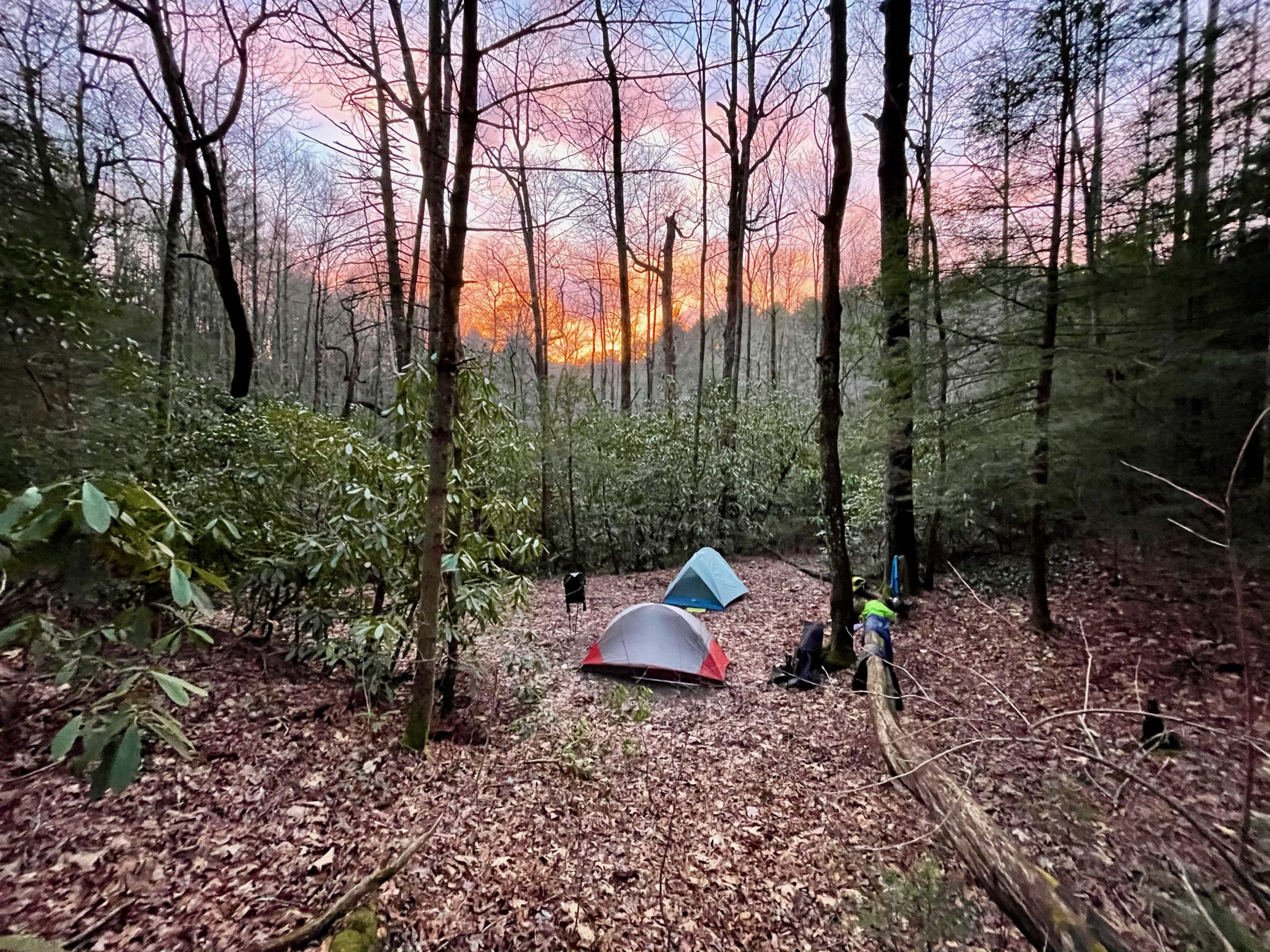
We took some photos at the plaque that marked the beginning of the AT and pushed on in the dense fog. Our destination for the evening was Stover Creek Shelter, 2.5 miles away. A long, gradual descent led us to the shelter, where we pitched our tents in an open, flat spot in a nestle of rhododendrons.


Day 2: Stover Creek Shelter to Justus Creek, 11.5 miles
After a chilly morning breaking down camp, the forecast called for clear skies all day. We descended another mile through rhododendron tunnels to Three Forks gap, before beginning the AT’s first bigger climb up Hawk Mountain.
Up and down was the theme of the day; the AT will climb up a mountain before dropping down into to a gap; which is a road that lies in the space between mountain peaks.
The AT descends into Hightower Gap where my dad had his car parked. We said our goodbyes and both headed north, except I’ll be walking North instead of driving.
Sassafras Mountain followed after Hawk, proving to be the biggest challenge yet. I was pretty tired when arriving at the campsites at Justus Creek Campsites, 11.5 miles in for the day. It was around 3:45, setting me up for a relaxing afternoon/evening hanging out and talking with other hikers.
Day 3: Justus Creek to Lance Creek, 10 miles
I took my time with my morning routine and was on trail by 8:45. The day began with some gradual climbing before dropping down to Gooch Gap.
As you may have guessed, climbing and descending was yet again a reoccurring theme. The climb up Ramrock Mountain provided the first open view of the mountains I have been living in the past few days.
The climb out of Woody Gap up Big Cedar Mountain was one of the steepest climbs yet, but I was greeted by stunning views of Georgia’s Blue Ridge Mountains surrounding me. Looking back, this day may have been one of the best days I’ve had hiking. I have a feeling I’ll be saying that a lot.
Arriving at Lance Creek at around 3:00, I was happy to see some familiar faces from the previous night at Justus Creek. We hung out around camp and swapped stories for hours. Blood Mountain looms, and the talk around camp is of the rainy weather we will encounter while climbing Georgia’s sixth highest peak.


My Thoughts Three Days In
So far my time spent on the AT has been nothing short of phenomenal. I have met so many amazing people already, and everyone has been nothing but friendly. Shoutout to the Justice Creek/Lance Creek Campsite Crew for making my transition to the AT a smooth one. It was cool helping give Strings his trail name; named after the guitar he carries out on trail with him.
My spirits remain through the roof, and physically I couldn’t feel better; just some tired legs at the end of the day. One main reason why I’m out here is because I want to challenge myself and see what I’m capable of as a long-distance hiker. the AT is providing just that, and I know it will continue to do so when I start pushing bigger miles in the coming weeks.
Gear Notes
A couple of weeks before departing I made the bold decision to change packs; switching to the Hyperlite Mountain Gear 3400 Southwest in a successful attempt to lessen my base weight. The move has been paying off; the heavily water-resistant pack passed the test during the approach trail, and the pack feels very comfortable all around.
I am very impressed with how water-resistant Chicken Tramper’s chest pouches actually are. I keep my phone in the pouch, and I was relieved to see that not a drop of water was on my phone after hiking in the rain for hours on Sunday. Both the Chest Pouch and 1L Chest water bottle sleeve are proving to be great additions to my pack; I enjoy being able to access my phone, snacks, and water without having to stop and take my pack off.

This website contains affiliate links, which means The Trek may receive a percentage of any product or service you purchase using the links in the articles or advertisements. The buyer pays the same price as they would otherwise, and your purchase helps to support The Trek's ongoing goal to serve you quality backpacking advice and information. Thanks for your support!
To learn more, please visit the About This Site page.

Comments 7
Looking forward to more posts and hopefully fewer thunderstorms!
Always wanted to make that thru hike. Wish you the best on your adventure.
Thank you, Michael!
My son and I enjoyed meeting you on the trail today. Looking forward to following your progress!
Thanks, Angie! Pleasure meeting you.
Georgia is hard, but it sets you up great for the rest of the trail. You won’t hit some of those climbs until the completion and you’ll be in great shape by then. Happy trails!
I love your post they make me feel like I’m there too. I am not physically able to make such a journey but it has always been a dream of mine. I wish you success and blessings. Stay safe!!!