 ">
">
AT Days 44 & 45
VA Route 100 to Wind Rocks, 27.5 miles
The shuttle driver dropped me back off at the Pearis Cemetery Trailhead at 7:30 as I headed back into the woods, solo. The first seven miles of the hike consisted of gradual inclines and flat stretches to ascend back up to above 3,000 feet to Peter’s Mountain Ridge. From there, a flat seven-mile hike on the tree-covered ridge followed.
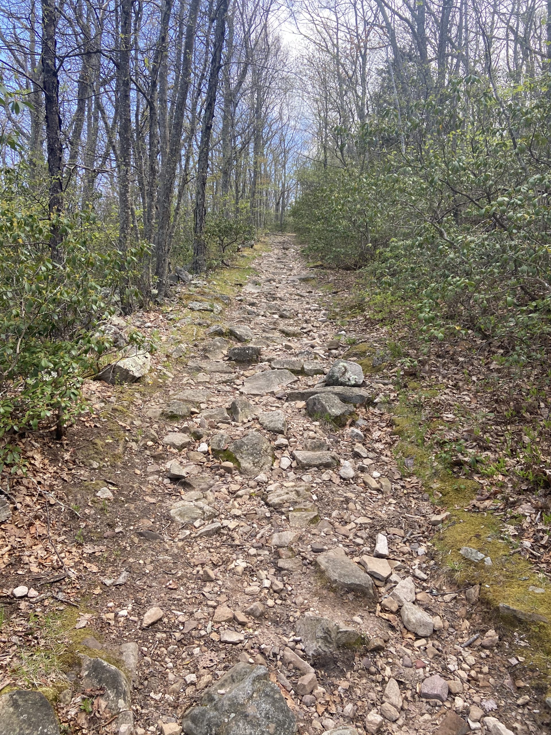
The first four miles of the ridge walk were some of the worse maintained trail I’ve ever hiked on; I was constantly moving over and around blowdowns and ducking under low hanging branches, and I was beginning to feel slightly frustrated. The trail finally opened up to a brief meadow walk before dipping back into the woods. The rest of the ridge walk was rocky and on uneven trail. This stretch taught me that just because a trail is mostly flat doesn’t mean that it’s always easy.
The AT descends Peter Mountain Ridge by way of several switchbacks, and a flat three miles in a rhododendron forest along a large stream followed. 21 miles in for the day, the AT began to ascend over 1,000 feet of elevation in a little over a mile; the steepest climb I’ve faced in a long time.
When faced with a big climb at the end of your day you have two options; feel sorry for yourself and go slow, or hype yourself up and rip that sh*t. I ate a caffeinated Clif Bar, popped my headphones in, and charged up the hill at full speed ahead.
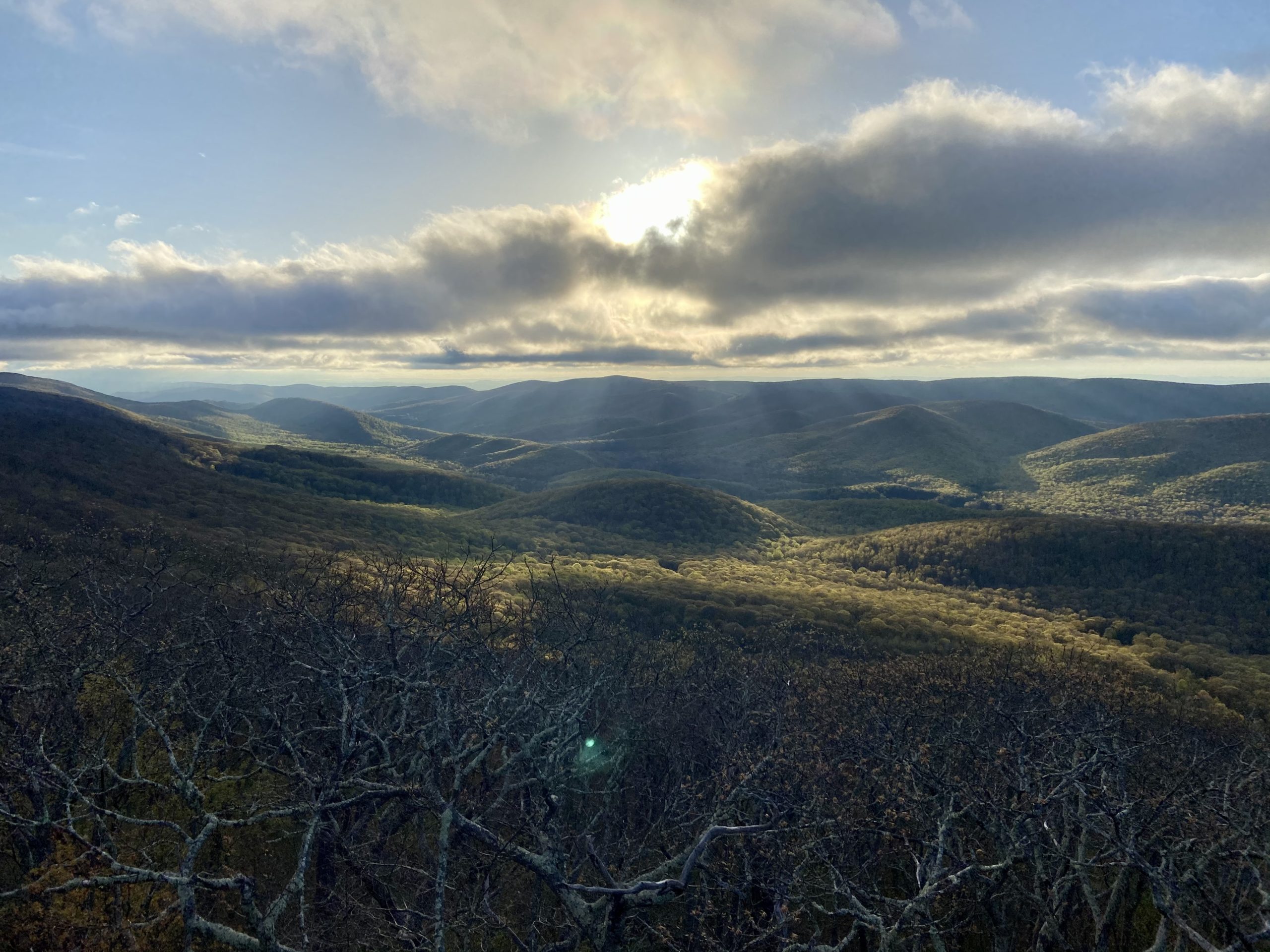
The next three miles after the climb consisted of some of the rockiest trail I’ve hiked on thus far, but eventually, the rocks began to clear up and I soon arrived at Wind Rocks overlook; offering the best view I’ve seen yet in Virginia. There were many flat tent sites to choose from, and I was to be the only hiker camping here for the night.
It was my biggest day yet and I am glad I decided to push myself, even though the day’s hike wasn’t the most exciting or scenic. To be honest, it was some of my least favorite hiking yet on trail, but as I mentioned in my previous blog, not every mile on the AT can be thrilling or exciting.

Wind Rocks to Sarver Hollow Shelter, 17.8 miles
My legs were slightly sore in the morning but felt great by the time I was a mile into my hike. The first couple miles of the day were flat before descending down to VA Route 632. From there, the first big climb of the day up and over Kelly Knob was underway. The AT ascends over 1,700 feet in just over 2.5 miles. It started off as a gradual climb before soon becoming very steep and very rocky. This was the toughest climb so far in Virginia in my opinion.
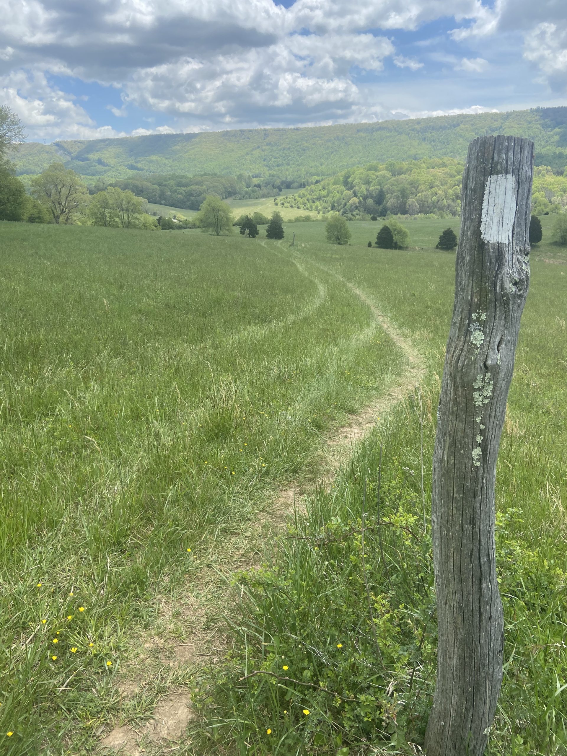
A short side trail leads to a decent viewpoint on Kelly’s Knob, then descends for 3 miles down to VA Route 42 with the last mile crossing through open cow pastures. Other than catching the occasional whiff of cow poop, I really enjoyed the scenic pasture walk, stopping to take my lunch break on a bridge right before reaching the road.
The final climb of the day began right after the road; a 1,300 foot climb over the span of 3 miles. This climb consists of switchbacks whereas the Kelly’s Knob climb didn’t, but the switchbacks were still steep and challenging. A ridge walk for about a mile follows before leading to the side trail to Sarver Hollow Shelter, which was .4 miles away.
I was at just under 18 miles in for the day and still feeling good, but decided to enjoy a shorter day and a relaxing afternoon after the big push the day before. I want to make sure that I don’t overdo it, as I know a few people who are starting to deal with shin splints and other overuse-related injuries. I arrived at the shelter just after 3:30 and hung out at the scenic camping area for a while before calling it a night.


This website contains affiliate links, which means The Trek may receive a percentage of any product or service you purchase using the links in the articles or advertisements. The buyer pays the same price as they would otherwise, and your purchase helps to support The Trek's ongoing goal to serve you quality backpacking advice and information. Thanks for your support!
To learn more, please visit the About This Site page.

Comments 7
Well written posts and good photos. Good luck on your trek.
Thanks Dave!
Headphones on the AT?!! Blasphemy.
Still loving your pictures & trail descriptions!
How was Sarver Hollow shelter? I helped build the shelter and outhouse! 😉
Very nice shelter and surrounding area, and well maintained. Thank you for your hard work!