 ">
">
Baxter State Park – So Much More Than Just Katahdin!
Thousands of people visit Baxter State Park every year, but you’d probably be surprised to learn that of all the people in that park, AT hikers – be it NoBo’s, SoBo’s, Flippers, or section hikers – only make up 2-3% of the people coming in every year (Wildnotes, 2015 edition). For many AT hikers Katahdin is the only reason they’re visiting, but I’d like to make a case for the rest of this very large park. AT hikers only get to walk on about 15 miles of trails here despite the fact there are approximately 250 miles of developed trails. Here are a few other highlights you should try to visit in Baxter State Park:
The Blueberry Ledges Trail –
This 4.2 mile out-and-back hike can begin from outside BSP, which is great for those days when you can’t get a day use parking reservation (or DUPR) but you’d still like to see the park. The first 1.5 miles from the AT are relatively flat on an old logging road. We saw lots of evidence of moose scat and moose tracks on this section during our hike here in June 2013. The trail opens up onto a large area of what we like to call “rock highway”, basically large granite slabs where the trail is marked by cairns. Blueberry picking is also abundant on this trail in later summer, hence the name of the trail. There is also a side trail marked by cairns and red paint which will take you to an overlook on Katahdin Stream. While this trail is technically an out-and-back trail, those of you who would like a loop hike can make a loop easily with this trail and then hop on the AT from Katahdin Stream Campground, hiking back out to your car at Abol Bridge for about 12 miles of some of the easiest trail in Maine.
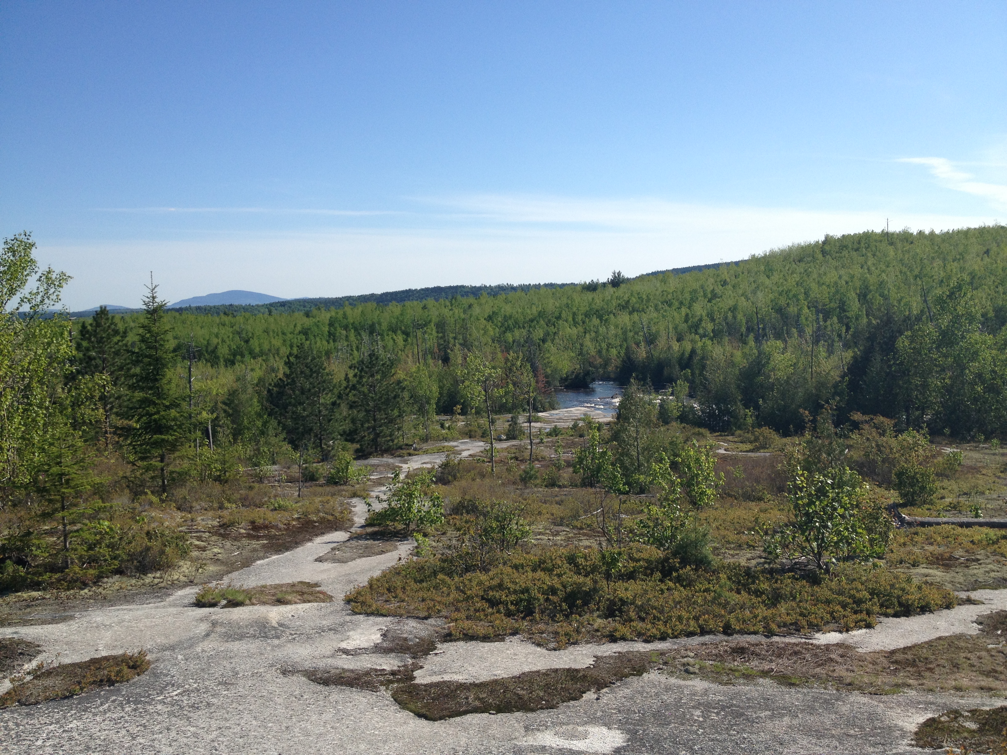
The “rock highway” on the Blueberry Ledges Trail.
South Branch Mountain Trail –
This loop hike is at the north end of Baxter State Park, which is what NoKey and I call “the quiet” end. Getting to the north end of the park from Millinocket is no easy task – either driving the 20 mph Tote Road an hour and a half from the Togue Pond Gatehouse or driving up 1-95 20 miles to the Sherman/Patten exit and then driving 30 miles to the Matagammon Gatehouse – but trust me when I say the north end of the park is absolutely worth the drive! This loop hike of South Branch Mountain will start and end at Lower South Branch Pond. You get a strenuous climb up South Branch Mountain with stunning views to the north into Aroostook County and after climbing up a little higher, you’re rewarded with views of North Traveler Mountain, The Traveler, Center Ridge, and The Knife’s Edge on Katahdin. After a brief and steep dip, you’ll climb again to the second peak – Black Cat Mountain. You’ll get amazing views of all of these mountains again with some bonus views of ponds and ridge lines far into the distance. Coming down the back side of this mountain is no picnic either, heading down scree and granite “rock highways” down to Upper South Branch pond. From here, take the Pogy Notch Trail, which is relatively flat and crosses Howe Brook, back to your car at Lower South Branch Pond. This loop is only 6.5 miles, but much tougher than it looks on paper. You get both low land walking and views above tree line and is well worth the drive!

Looking at the Traveler Loop from Black Cat Mountain.
The Traveler Loop Trail –
Traveler Loop is also located at the north end of Baxter State Park and starts at Lower South Branch Pond. This strenuous and difficult hike has an early recommended start time much like Katahdin. This 10.9-mile hike will take you up steeply along the spine of North Traveler Mountain and treat you to more above tree line walking than you will get anywhere else in the park, including hiking the Helon Taylor Trail on the Knife’s Edge! Getting up North Traveler Mountain is only the beginning though, because you’ll steeply descend and then just as quickly ascend several times before reaching the peak of The Traveler. Both of these mountain tops have beautiful 360-degree views of the surrounding area ponds and mountains, including views of the Chimney Pond side of Katahdin. Descend and ascend one more time to Center Ridge before coming back down to Pogy Notch Trail where you’ll cross Howe Brook and head back to your car at the Lower South Branch Pond parking area.

This view is from only halfway up North Traveler Mountain… and it’s already stunning!
If all of these things sound tough to you and you’re just looking to relax, there lots of other things Baxter State Park has to offer. There are easier trails, like the 0.5-mile out-and-back South Branch Falls Trail, a nature trail in the South Branch Pond area, two shorter loop trails from the Roaring Brook parking lot, a short loop hike around Daicey Pond, a short loop arund Tracy and Elbow Ponds, and a day use site at Abol Beach where you can see Abol Falls. Baxter State Park also offers canoe or kayak rental at several popular day use areas for only $1 per hour – paddle and life jacket included. We have gone canoeing on both Grand Lake Matagammon and Lower South Branch pond and often have been the only people on the water, seeing moose and loon nearly each time we visit.
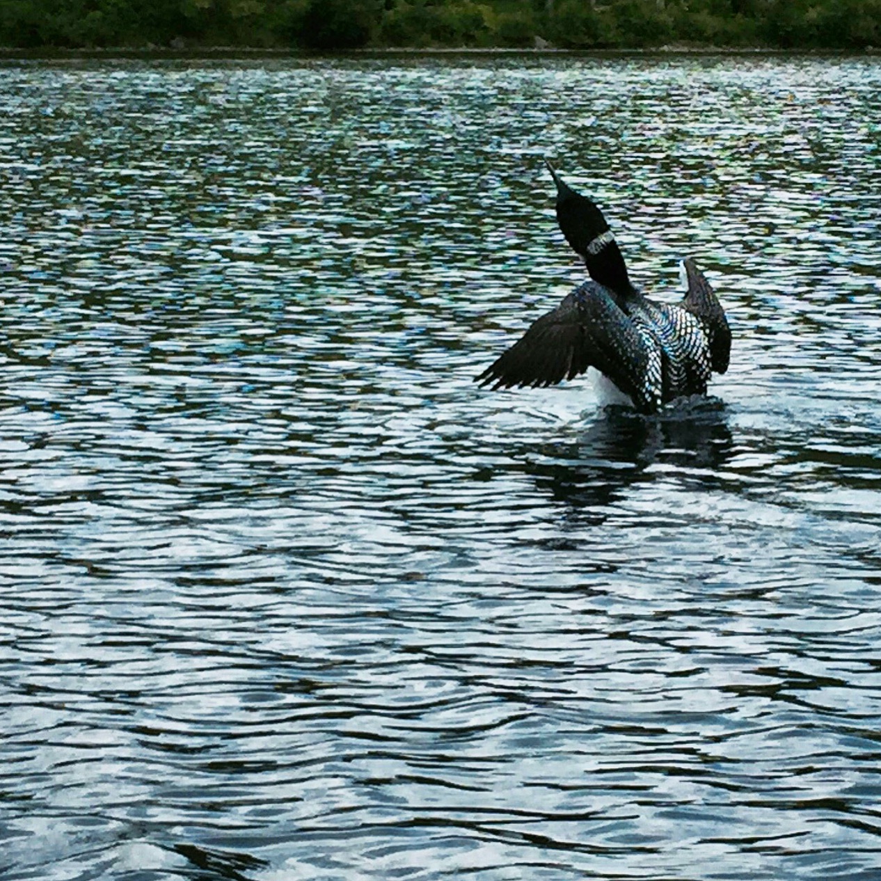
A loon taking flight off Lower South Branch Pond.
For hikers visiting Baxter State Park during their hike, no matter starting, ending, or just somewhere in the middle, I highly recommend taking some time to see the other sights in the park, especially if you have a family member visiting with you in a car. When I lived in the Millinocket area in 2013 I got to spend a lot of time in this park and see some of the hidden gems not many AT hikers get to see. This park is absolutely worth the extra time, especially for people who don’t want their adventure to end just because they summited Katahdin. If you want more information about visiting Baxter State Park, check out their website at baxterstateparkauthority.com to check out maps, the history of the area, get reservations, and more.
Have you done any other hiking or paddling in Baxter State Park? I’d love to hear what trails and ponds you like in this amazing place – leave me a comment below!

This website contains affiliate links, which means The Trek may receive a percentage of any product or service you purchase using the links in the articles or advertisements. The buyer pays the same price as they would otherwise, and your purchase helps to support The Trek's ongoing goal to serve you quality backpacking advice and information. Thanks for your support!
To learn more, please visit the About This Site page.

Comments 2
Many many thanks for the great article here follow http://coolmathgamesjunction.net and seen the cool maths games this is the great fun to all of you players.
Value the wild regions for their absence of human movement. This park seems to give a zone to this sort of experience. Readmore: https://www.ukessaywriters.co.uk/assignment-writing-service.php