 ">
">
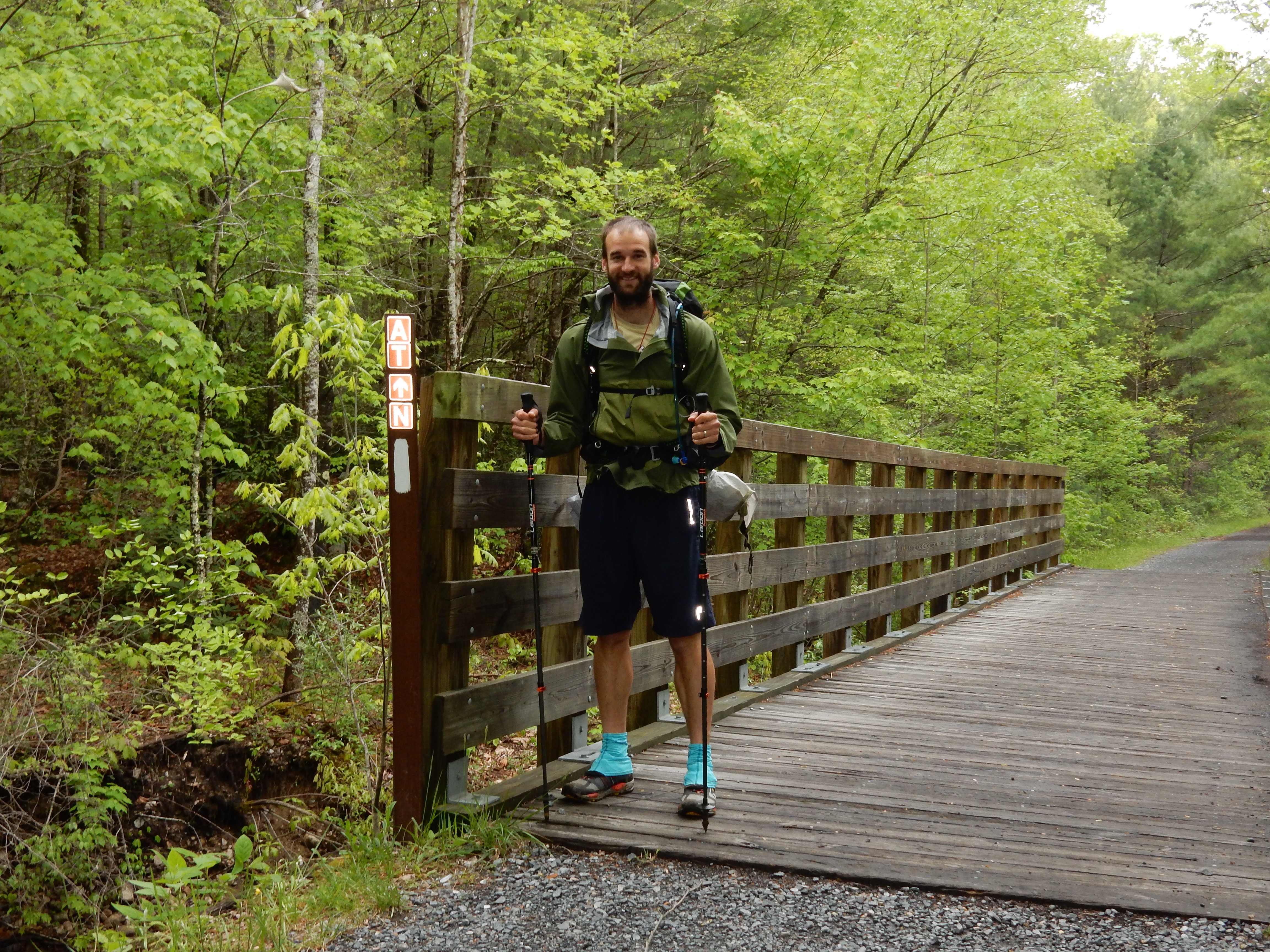
Celebrate! Miles 400-500: Elk River to Massie Gap
Mountaineer Falls greeted us after crossing 400 miles. Some kind soul put in a bench with a view along the trail. North of Moreland Gap Shelter was decimated by forest fires less than 2 weeks before we were there. 1700 acres were destroyed and we walked straight through it on the trail. Dennis Cove Rd offers a few hostel options. Laurel Falls was incredible and the trail skirts around the rock ledges before heading back into the woods. Nice 2,000 ft climb up to Pond Flats and down the other side to Shook Branch Recreation Area on Lake Watauga. The following 4 miles or so has had so much bear activity that they closed the shelter (it was also closed the past 2 years due to bears and just reopened this season) and recommended no stopping, picnicking or camping. Made it to the dam with no issues. Beautiful views of lake from ridge. Crossed into Virginia at mile 465.1! (We’ll be here for about 550 miles.) Quite a landmark for us! Damascus is an All-American trail town. The trail coincides with the Virginia Creeper at a few points, which was a nice, flat, change of pace. We summited Whitetop Mt, dipped into Elk Garden and entered Lewis Fork Wilderness. After taking a side trail, we visited the highest point in the state of Virginia, Mt. Rogers. Lastly, we descended down to Rhododendron Gap, Fatman Squeeze, and into Grayson Highlands State Park to see the wild ponies.

Rolling terrain of VA
Highlights and Surprises
Lollygag has gotten so efficient at packing up in the morning, the new folks we meet say he’s a misnomer! Lollygagging has become more of a state of mind than a physical practice these days. Also, Lollygag is not losing weight and has no blisters! These were his two biggest worries before starting the trail, and so far his prevention strategies are working.
Little Rhino is enjoying herself as well! Good health, good spirits, and a solid love for walking.
The trail is a lived experience! We are glad that we read and prepared and talked to all the hikers we could find, but ultimately we have adapted to the way we want to hike while we are out here. No amount of reading could give us (or you, Dear Reader) the full picture of what it’s like.

Wildfires burned 1700 acres <2 weeks before we came through. This is what the trail looks like north of Moreland shelter for several miles. This is the downside of dry conditions. Rain is easier to deal with than fire! Luckily this section was already re-opened but we know a lot of hikers that have been evacuated and shuttled around sections of the trail due to fires.

Laurel Falls, during a rain storm
Favorite Recipes from 5th 100 Miles
BBQ Chicken & Rice
1.5 cups rice, 1 cup TVP chicken chunks, 1/2 cup peas/corn, 4 Tbsp carrots, 2 Tbsp celery, 2 Tbsp Cajun seasoning, 1 Tbsp onion powder, 2 tsp salt, pinch jalapeño, pinch ginger
Chili Mac
2 packs Harmony House chili, 1 pkg mac’n’cheese, 1 cup pinto beans, 1/2 cup carrots, 2 Tbsp cumin/Honduran seasoning, 2 tsp salt, dash pepper, ground red pepper, fennel
Where We Stayed/Mileage
Black Bear Resort (19), Carberrys (8.6 and 0), Vandeventer (9.1), Double Spring Gap (19.8), Hiker’s Inn, Damascus, VA (13.3), Lost Mountain (15.8), Thomas Knob (12.3), hiked remainder of 500 miles and on to Hurricane Mountain on day 47 (16.1)
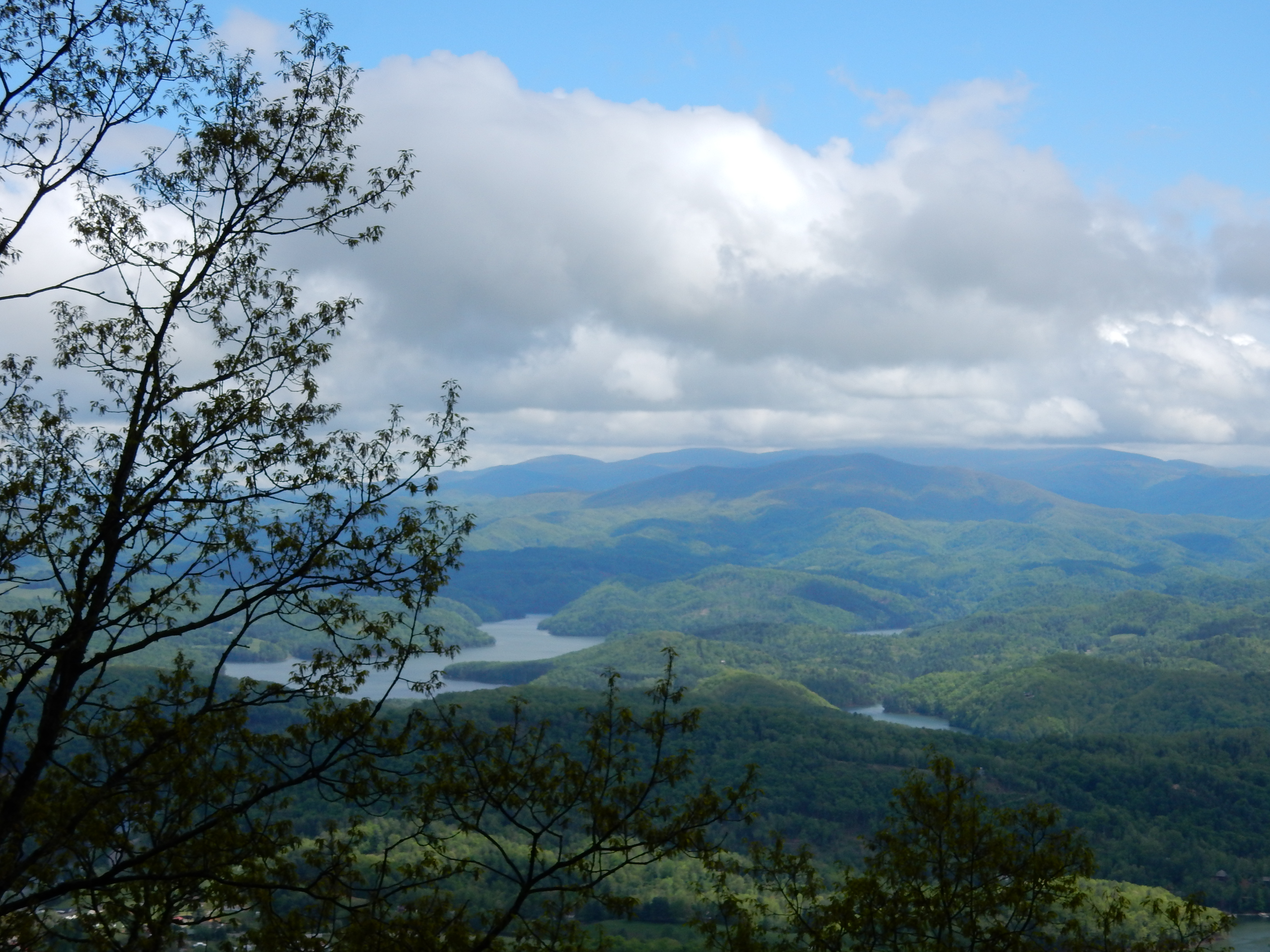
Views from Vandeventer Shelter
Virginia Creeper Trail is a Rails to Trails project that converted an old railway into a great biking/hiking trail! Andrew brought Claudia here to bike ride the Creeper Trail for her birthday back in 2009.
Wildlife
Cows, geese, squirrels, chipmunks, birds (Eastern Towhees were common in this stretch, we’re using a new app to identify birds… stay tuned!), wild ponies(!!!)
Little Rhino was bit by a goose at Shook Branch! She was minding her own business, reading her Kindle, when a goose came up from behind and nibbled on her index finger.
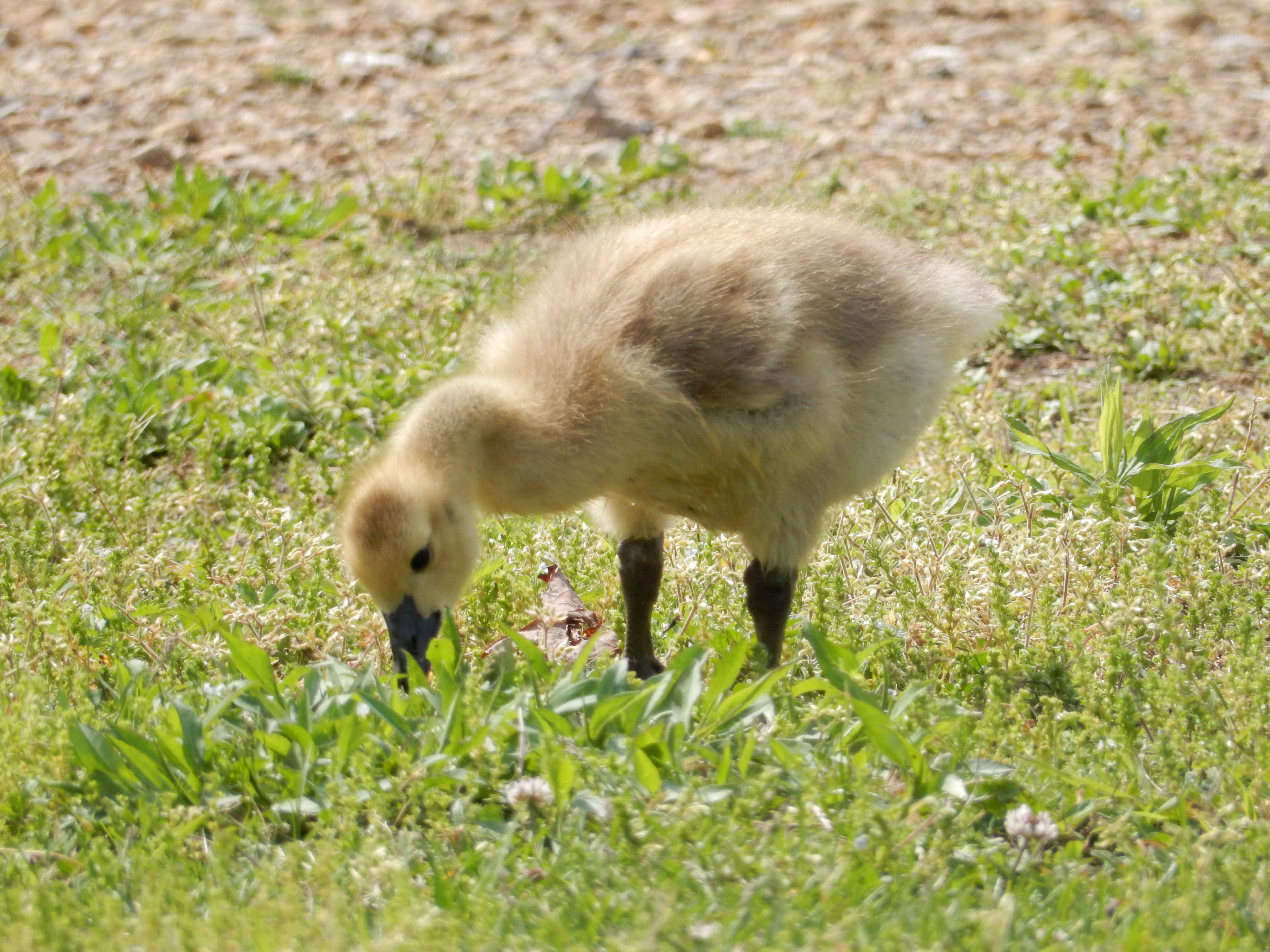
Innocent baby goose at Shook Branch Recreation Area

Wild pony in Mt. Rogers Recreation Area
What We’re Reading
Furiously Happy by Jenny Lawson (Claudia) and The Goldfinch by Donna Tartt; A Million Miles in a Thousand Years by Donald Miller; Telling God’s Story: The Biblical Narrative from Beginning to End; and The Organic Farmer’s Business Handbook: A Complete Guide to Managing Finances, Crops and Staff – and Making a Profit (Andrew). Andrew upgraded to a Kindle Paperwhite and is thoroughly enjoying it!
Trail Beta for Future Hikers
- WASH YOUR HANDS!! Sanitizer doesn’t kill viruses, such as the notorious Norovirus. We use Dr. Bronner’s soap and wash several times each day.
- At Dennis Cove Road you’ll have 2 choices- Black Bear Resort or Kincora. Definitely go to Kincora! Bob Peoples is a legendary trail angel and trail builder with a group called Hard Core. He does have 17 cats but has special accommodations for those of us with allergies (which I didn’t know and stayed at Black Bear Resort). He asks for a $5 donation. We had our boxes delivered there and he fed us lunch.
- How to identify Birds: Download the (free) Cornell Lab of Ornithology’s Merlin Bird ID app! It uses your current location, time, and other information you input about the bird to help you figure out what you saw, and since it’s an app it weighs nothing!
- Joke’s on us- Mt. Roger’s is in the middle of the woods! No views but it is the highest spot in the state of VA. We left our packs at the Thomas Knob Shelter and took a little 1.2 mile evening stroll to the top after a day of backpacking… good thing we like to walk.
- Don’t feed or pet the ponies! Some are super friendly and it’s tempting! However, they can bite and often carry ticks and fleas.

Bob Peoples at Kincora- Saw graffiti in a shelter that read, “Bob Peoples can count to infinity- twice.” He’s kind of a legend!

Joke’s on us- Mt. Roger’s is in the middle of the woods! No views but it is the highest spot in the state of VA.

Fields are awesome, and flat.

This website contains affiliate links, which means The Trek may receive a percentage of any product or service you purchase using the links in the articles or advertisements. The buyer pays the same price as they would otherwise, and your purchase helps to support The Trek's ongoing goal to serve you quality backpacking advice and information. Thanks for your support!
To learn more, please visit the About This Site page.

Comments 3
Thanks for your journal/blog and pictures.
Love reading about Your adventure. Pictures and commentary are well received. Look forward to the next chapter. Lions and fires and bears, Oh My !!
Your adventure is so exciting. Thanks for bringing us along.
I lived in VA for almost nine years. It’s an absolutely beautiful state. I always wished for time to explore.
Love and prayers to you and for you.