ECT Day 138 – Thank You, Gaspésie
If you’re just joining us or are confused about what is going on (ECT, what’s that?) then check out my intro article for a thorough explanation. Sometimes even I need to read it to remember what I’m doing next.
Camping de la Riviére to Camping Mont Jacques-Cartier
No Need For Legs Camp to Caribou School Camp
ECT miles: 17.6
Total miles: 2722.3
Elevation change: 5305ft gain, 4032ft loss
Thank you, Gaspésie. Thank you for the stellar mountains, the challenging weather, the good trail, and the extra bag of potato chips. Thank you for the wind, the clear air, the clear water, and the rainbows. Thank you for the solitude and empty refuges. Thank you for the people watching and the hot shower. Thank you for it all. The final full day in Gaspésie National Park was one of the most wild, exhausting, and rewarding days of the IAT so far. A fitting climax for our final foray into the high mountains. I had focused so much on Mont Albert, that Mont Jacques-Cartier had evaded my attention, and thus it was a welcome surprise to find myself once again hiking for miles with SpiceRack above treeline through a landscape just slightly less desolate than the moon. It was empty up there, no trees, no animals, no people, yet I left the lonely summit full. Full of gratitude, full of wonder, full of laughter, full of life, full of excitement, full of longing, and filled to the brim with cold wind. As we descended back into the trees I felt sadness for leaving the mountains behind, but was heartened to note that I only felt that way because I had experienced, and so recognized, the greatness that we were leaving behind. I had already received so much, and it was time to move on. Who knows when, or if, I’ll return to the Chic-Chocs of Gaspésie with so many other places to explore in this world. I hope so, but if not, then at least I have my memories, Spice’s memories, and this blog to remind me of the wild wind.

The can Ka-chshhhhhh-ed opened. Ahhh, the sound of coffee brewing in the morning. I took a sip of the dark fluid, then cleared my throat in reaction to the biting bitterness. I’m no coffee purist. I drink it for the caffeine and prefer a sweet and creamy latté over a perfect pour-over, so I had no qualms when Spice suggested that we fix up our brew with a hefty dose of chocolate milk. Who doesn’t like a morning mocha? It went down smoother after that, giving the granola company on its ride down my esophagus. When the dregs had drained, we packed up our comfy home and got hiking.

We passed by the large visitor center, then followed the trail crests onto an old dirt road. We congratulated ourselves on this lucky twist, determined to appreciate the heck out of the wide track while we could. A million white flowers kept us company as we ascended gradually, passing numerous junctions marked with various trail signage which hinted at this area’s popularity within the snow-shoeing community. No snow today, though. Just the white flowers and a couple pits of deep mud.
At an unexpected parking lot, we joined a long procession of day hikers on a beautifully manicured trail. Hiking near other people for the first time in weeks, Spice and I struggled with the awkwardness of hiking faster than some, and slower than those who like to take frequent breaks. We stuck close to one another, fearing getting separated and carried apart, sneaking quick water breaks when the trail was clear, and hiking hard when we needed to pass so that we looked strong and could open up some breathing room. It was a game that neither of us wanted to play.

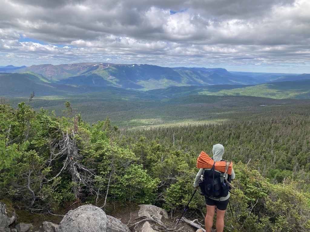
The crowd thinned out when we passed the junction to the Refuge and Lac aux Americains, and we sighed in relief when we realized that we would now be able to pee in peace if done strategically. The trail steepened and got a lot rockier from there as it zigged in long switchbacks to the ridge above. The trees shrunk as we climbed higher, until eventually they were just five feet tall, permitting us to see over them. Mont Albert and the cliffy northern wall of Gaspésie popped from the horizon, surprisingly distant already across a wide valley of evergreens. The orange rock burned in the roaming patches of bright sunshine, adorned with gleaming splashes of snow that clung to the sheltered aspects. The coat of green on Albert’s shoulders looked velvety and soft from this distance, hiding the rugged truth of the rocky tumble.

We broke out of the trees on the final part of the ridge to Mont Xalibu. The wind hit us hard there, and we put on our jackets while guessing how to pronounce that name. A sinewy runner ascended past us, essentially floating up a steep pile of talus, and we followed, feeling like hippopotamuses and struggling to stay on our feet in the gusting wind. I staggered behind Spice, keeping my legs and poles wide in order to stay upright.

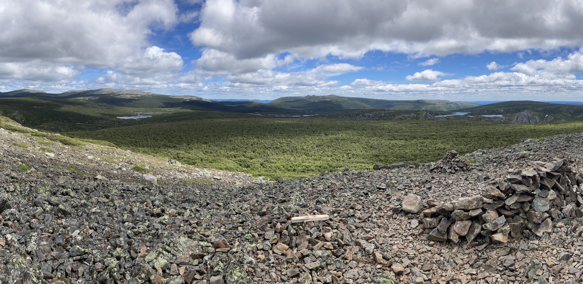
On Xalibu’s rocky summit, we hunkered in the shelter of a horseshoe windbreak of stacked rocks. I swiveled my head between greedy mouthfuls of BBQ Lays, appreciating the fantastic summit panorama that revealed the most thrilling view yet. Mont Albert and all that good stuff behind us was still there and magnificent, and now I had something new to ogle at. Ahead was a high plateau/basin of stunted pine and glittering lakes. It was amazing. On the far side rose an undulating wave of bald summits that practically touched the speeding tufts of cumulous. I spied an unnatural dot on the top of the highpoint, honing in on our objective for the day, Mont Jacques-Cartier, the top of Southern Quebec. There was so much to see and explore captured with a slight turn of the head. This wasn’t just an isolated ridge or mountain, a small island of alpine. Like the vast sweep of Mont Albert, there was a whole world of possibilities and mysteries hiding up here. Mont Xalibu was a portal into a mountain extravaganza. I was bewildered with enthusiasm, and couldn’t wait to dive in.

The wind diminished to sputtering gusts after we dipped into the pine, and the cool air suddenly felt warm. The day hikers also dwindled, and quite abruptly, we were the only hikers in town. Shortly, we made it to Le Tétras Refuge and stepped inside for a protected lunch break. The cabin was filled with the entrapped cold of last night, so we stoked a small fire in the stove and pulled on our warm layers. Gravity filtered our water while we dug in to our remaining lunch baggies. The extra bag of chips purchased last night had helped, but I was ravenous with mountain hunger and needed to throttle back my mindless snacking. We were due in town tomorrow evening, which didn’t seem like such a long time from now, but it would feel very long indeed if I ate all my food today. Finally, looking for an excuse to linger in the warming cabin after we finished eating, Spice started listing everything that we had done in the past year. The list was long, and while not everything was pleasant at the time (ex. building out a van in winter, in Portland), there was a lot to be proud of. So much that we inexplicably forgot to write down the Sierra High Route. Jeez, it’s not like that was a 10-year dream of mine. Yep, a lot to be proud of, a lot to be grateful for.

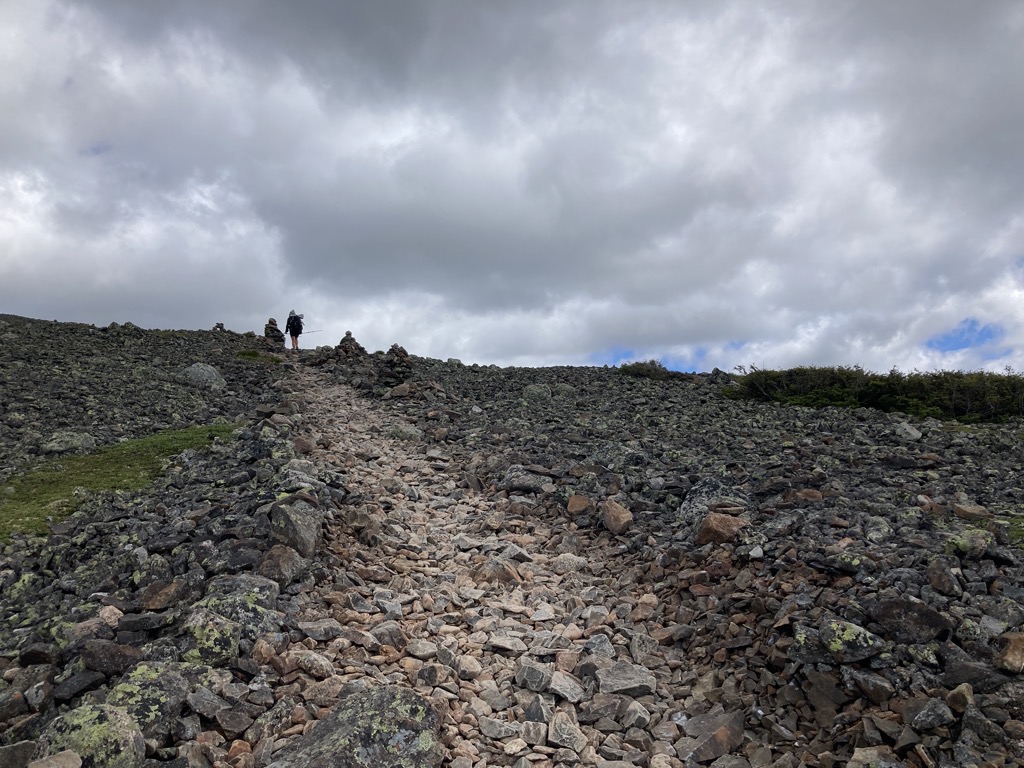
After an hour and a half, we decided that it was probably time to get moving again. The big mountain still pulled us ahead, and the endless stream of clouds looked suspiciously similar to the clouds of yesterday that had ultimately produced that transcendent rainbow. Would it rain? Who knew. We hiked in our puffy jackets for warmth, but stripped them off after a mile, when the flat walking turned into an uphill talus hop. Attention turned to my feet, choosing and placing each step carefully, with just fleeting glances up to target the next cairn in order to stay on track. Although this stone also looked like granite to me, it was a different variety from the rusty orange on Mont Albert. This was a dull gray, mottled with black and green lichens, which made it easy to spot the most popular route by following the stones that had worn bald under the grind of thousands of rubber-shod steps. It was a delight to share some mutual adoration of the scenery with two parents and their three young daughters, and even better to watch them disappear into the vastness behind us.

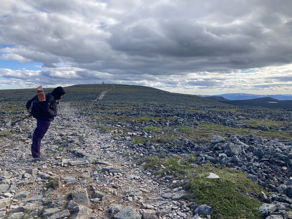
We tottered on the talus, then skated on a long patch of snow around Mont Comte. Not that this other stuff had been anything short of awesome, but finally we were at the base of Jacques-Cartier. Soul-shaking gusts of wind lashed the exposed bulge of rock as we carefully climbed up the jumble of pointy hard things. The trail was nonexistent at this point, but also totally unneeded. The cairns did a good enough job of keeping us on track, and we each found our own way from pile to pile. In this wind it would have been impossible to stay on a narrow trail anyway. I leaned into it, tipping deeper with each gust, calibrating each step and pole placement to land where it needed to go, resisting the pull of the wind to the right. It was easy to forget how much I pushed until the wind ebbed momentarily, which provoked the same sickening feeling as the instant one tips too far back in a chair. I would catch myself with a wave of the arms or stuttered shuffle. My hood cracked in my ears, my nose froze, and I felt the drag in my beard. We wiggled on, slowly making progress to the lookout tower ahead.

It was taller than I expected, continuing to grow as we crested the gradual horizon until it stood three stories high. It looked like a square lighthouse, lonely and proud of it, perched on the edge of the world, out of view of anything else human. Spice and I huddled inside on the top floor, eating a bar and feeling the warmth return to our cheeks. The full surround of windows invited us to slowly consider the view in every direction, and there wasn’t a stinker among them. Staring across Mont Albert, it was easy to pick out the point of Mont Logan all the way on the other side of Gaspésie National Park. Further east were more alpine mountains with flat tops and steep sides that begged for slow exploration. They were the edge of the high Chic-Chocs, before they faded into a low roll of green hills. And to the north, the immense hulk of Jacques-Cartier plunged gently to the St. Lawrence River. That was our route, one that filled me with anticipation.

On the outside balcony, Spice and I played with the wind, running circles around the tower, feeling the forces buffet and change around each corner. It felt like riding a rocket going downwind, and gave a brutal wallop when rounding upwind. Silly and satisfied, we warmed up once more inside, then said goodbye to the summit and kept on moving.

The trail down the other side of the mountain followed an old jeep road that had been built to maintain a long-gone summit military base for the Canadian Army. It eased our descent greatly, although the wind kept us off balance the entire time. The constant tempest chilled me even in my puffy, and nipped at my exposed fingertips. Because of this, I hiked with my hands in my pockets, but then missed my poles for their added stability. As we staggered, I frequently turned to look back as if one more glance would be what I needed to remember every detail forever. Proud of ourselves and one another, Spice and I hiked side by side, grateful to be with the other for this moment and the miles ahead.

A masterfully-built flight of wooden stairs guided us down and out of the alpine environment for the final time during my ECT journey. Spice had more coming in Maine and New Hampshire on her AT sobo, but I was done for the foreseeable future. It was hard to say goodbye to the mountains, just as it always is at the end of an alpine tryst, but I tried to remain fortunate that these mountains existed in the first place. I hadn’t expected them when this ECT attempt was first considered, and I don’t think that I fully grasped how cool this part of the IAT would be until I was in the middle of it. I’d gained so much more than I was now losing. I was richer for the experience, more open to the overlooked corners of the world and the treasures they might hold.

At the bottom of the stairs, some informational signs taught us all about the local caribou population, answering literally every question that we had except for one. What’s the difference between caribou and reindeer? After getting educated, we sunk into our loopy tiredness, following the rocky road out of the wind and into the calm embrace of the forest. A couple miles later, we ambled into yet another campground, dropping our packs in front of the closed museum and mindlessly absorbed even more information on caribou. And you better believe that they answered our single remaining question! I gazed longingly at the bald shoulder that loomed over there. I imagined the rush of the wind that vibrated across the tiny plants, the crunch of my footsteps in the patches of snow, the lengthening shadows casting huge drapes of darkness across the low valleys. Goodbye, thank you. Goodbye.

The campground was practically empty, so we found a good spot right along trail and did the evening right. It was just 7:30pm, a relatively early end for us, but we didn’t waste any time cooking beans and getting to bed. The wind had sapped our energy, and I felt like a stumpy husk. It was a good feeling though, one that is born of the best of days. With a shred of extra energy, Spice fed me cookies while I lay on my back. I didn’t last long like that, letting sleep take hold and carry me away like a cloud in the wind.
This website contains affiliate links, which means The Trek may receive a percentage of any product or service you purchase using the links in the articles or advertisements. The buyer pays the same price as they would otherwise, and your purchase helps to support The Trek's ongoing goal to serve you quality backpacking advice and information. Thanks for your support!
To learn more, please visit the About This Site page.

