 ">
">
In A Big Country: The White Mountains
But more than anything, I couldn’t stop thinking about what was next. Just across the river was New Hampshire, where I would soon come face-to-face with the White Mountains, perhaps the most rugged yet majestic range this side of the Mississippi. A land of brutal weather and ankle-busting rocks. I admit, I was a little daunted. But the moment my new shoes arrived, fear turned into furor. Anxiety be damned, it was time to go.
Folks, let’s get wet ‘n’ wild.
Come Up Screaming
My first night was spent in Hanover, home to Dartmouth College, several posh restaurants and shops, but not a single damn place to get ice cream after 5 PM. Some real Ivy League thinking there, folks. Once I left town, the trail started easing me in with progressively steeper climbs and progressively nicer views. It was beautiful trail, but not even close to what New Hampshire is known for. The legendary challenges of the Whites wouldn’t begin until my 5th day in New Hampshire, when I reached the cold, windy alpine zone of Mount Moosilauke.
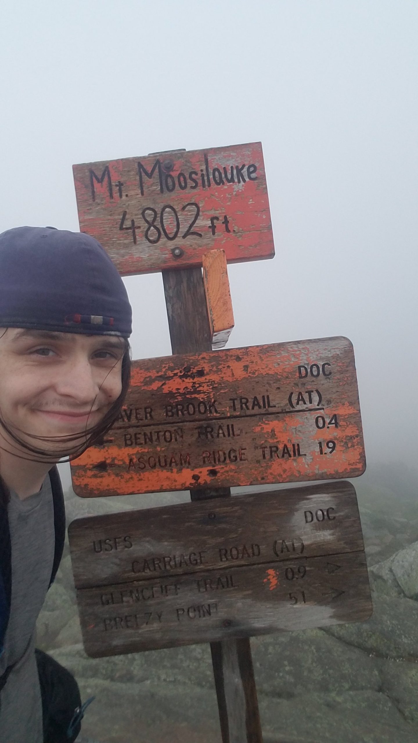
More like no-view-silauke
Being in the clouds above treeline is a hard sensation to describe to those of you who haven’t experienced it. Sure, you can’t see anything, but you’re floating in an island in the sky. Who needs views? Crossing over Moosilauke was like entering a portal to a Tolkeinesque realm filled with magical mountains and smooth paths. (Wait, did I say smooth paths, I meant evil rockslides).
The descent down Moosilauke is perhaps one of the worst on the whole trail, and I made the mistake of completing another 16 miles of leg-crushing hills immediately afterwards. Looking back, if I had taken it easier that day, I would have felt less pain going through the rest of the Whites… but I suppose I like to keep myself in harm’s way. Thankfully I had the Notch Hostel there with a bed, shower, and an opportunity to rest a couple of nights. Serena, Declan, if y’all are reading this, thanks so much for everything.
In any case, if I wasn’t taking the Whites seriously yet, I sure was now. It was time to shift to a lower gear.
I’m Not Expecting to Grow Flowers in a Desert…
I used my downtime to plan out my trek through the Whites, right down to where I would camp each night. It was the first time I’d really planned that far ahead on the trail and I was certain it would save me from committing unforced errors. (Reader: it did not). I went through Franconia Ridge wearing a tank top but no sun screen, and felt the consequences for days. I camped in a spot so overrun with black flies that it sounded like rain was falling on my tarp. Also, I stepped in human shit! It’s truly remarkable how the trail never allows me to be confident for too long.
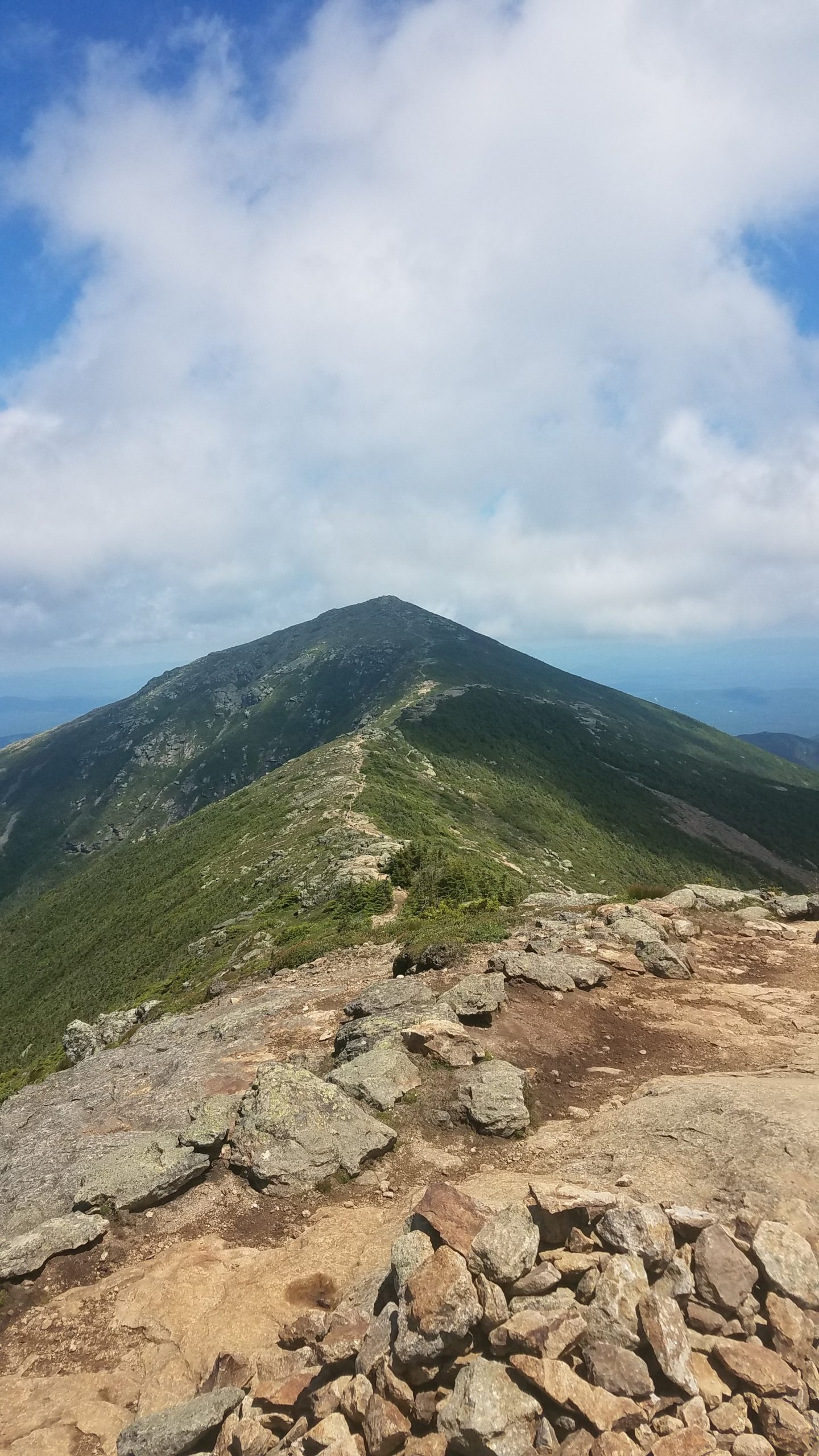
The sunburning view atop Franconia Ridge
While the Whites punished my hubris, they ended up rewarding my patience later on. On an exceedingly wet day, I was stuck on the Presidential Traverse, arguably the rockiest and most exposed section of the entire Appalachian Trail. With steady winds and rain, it was tempting to try and rush through, but I decided to take it slow and pay my respects to the storm spirit whose domain I was entering.
Side note, let’s talk about that spirit for a sec.
A Brief Tangent About “Mt. Washington”
The highest point on the northern AT has been known by many names over millennia, each of which predate its naming of “Mt. Washington” by colonists. Perhaps the most fitting name for the peak, home to the some of the most extreme weather on the continent, is “Agiocochook,” Abenaki for “the place of the Storm Spirit.” There is little reference to the mountain’s indigenous history in the building on the summit, but anyone who has been caught in the rain up here would be hard-pressed to deny that some force of nature is up here commanding you to kneel before them. Personally, using the colonial name of Mt. Washington feels disrespectful if not sinful, in the same way the first European ascent of the mountain in 1642 was a deliberate middle finger to the local tribes.
I still slip up on using indigenous place names and doing land acknowledgements and will continue to do so, but I’m making a point to refer to the Place of the Storm Spirit by its proper name. George Washington has hundreds of places named after him in this country, I’m sure losing one won’t hurt his legacy. Agiocochook is a mountain that demands reverence when you are in its vicinity, and I will humbly oblige. I encourage y’all to do the same.
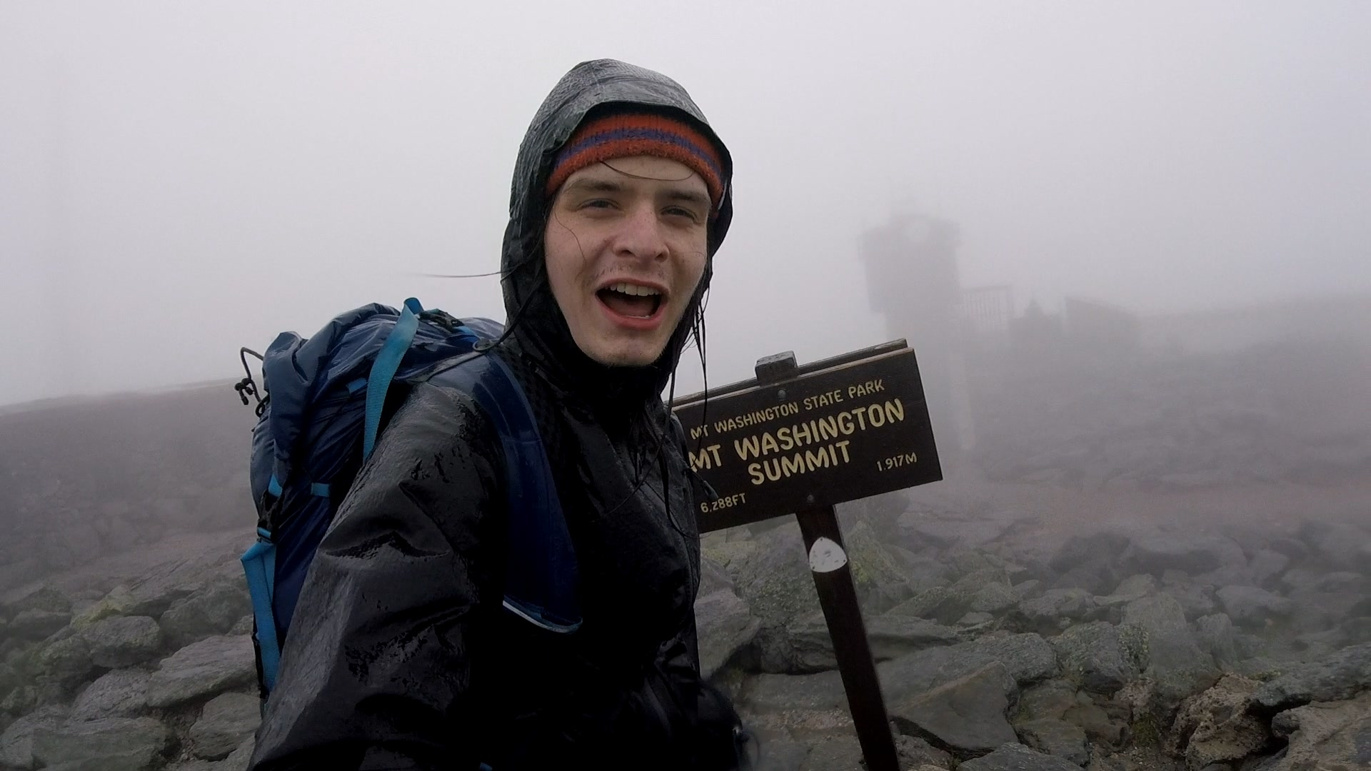
No matter the name, a successful ascent is a successful ascent
End of Tangent
Okay, so at the summit of Agiocochook is a huge building with a cafeteria and gift shop. It’s definitely out of place, but I was grateful to have a place to eat hot food and dry off. I ended up spending 4 hours inside doting on junk food and telling my story to any day visitors passing by. At one point (and I cannot make this up) a large group of Mennonites surrounded me and immediately started asking me questions about what I was doing. That might be the closest I ever get to being a celebrity.
I kept taking it slow, occasionally stumbling but never falling until I made it below treeline and set up camp, still processing everything that had just happened in the past week. If the trail hadn’t thrown everything it had at me yet, it sure was doing so now.
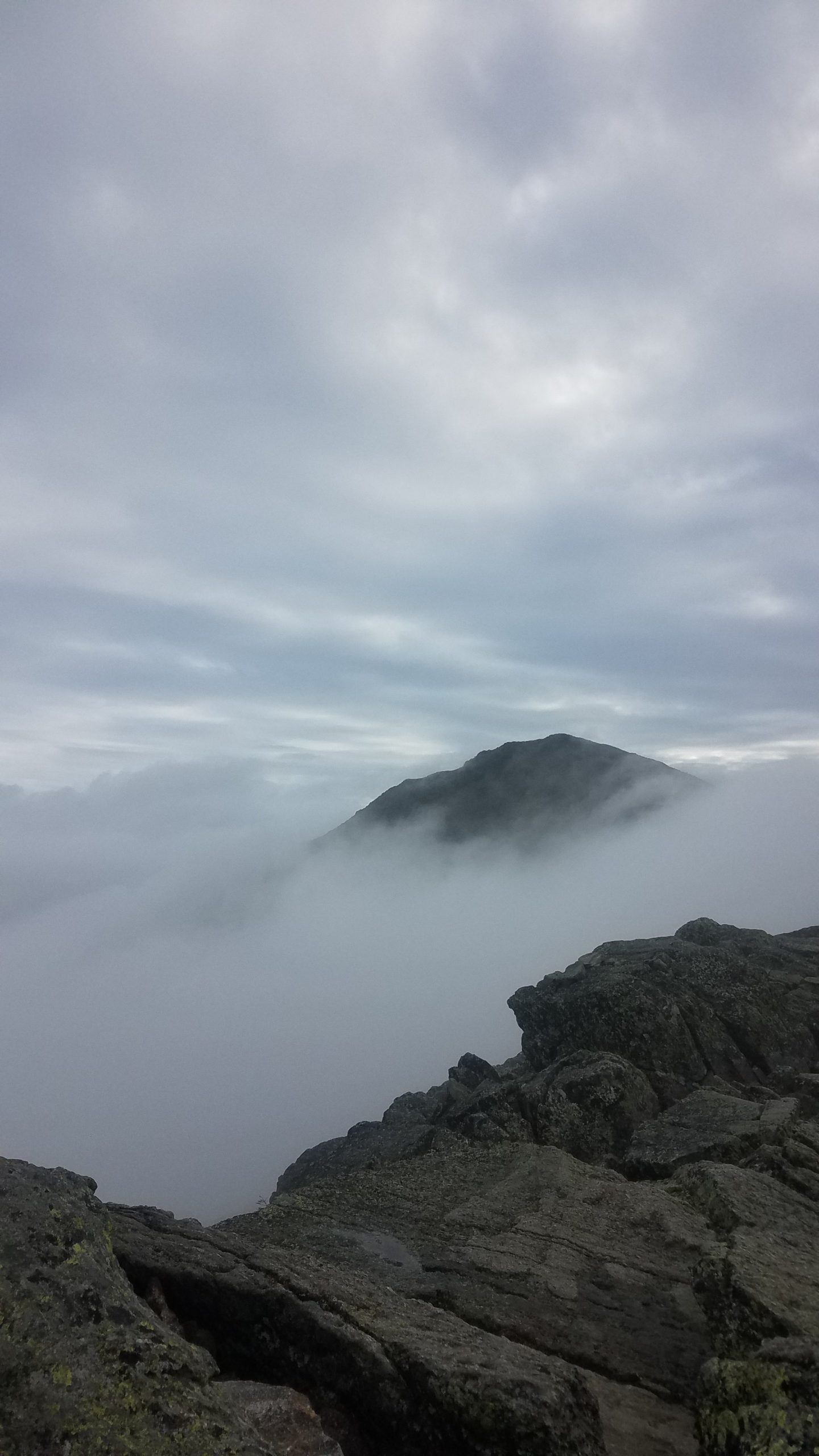
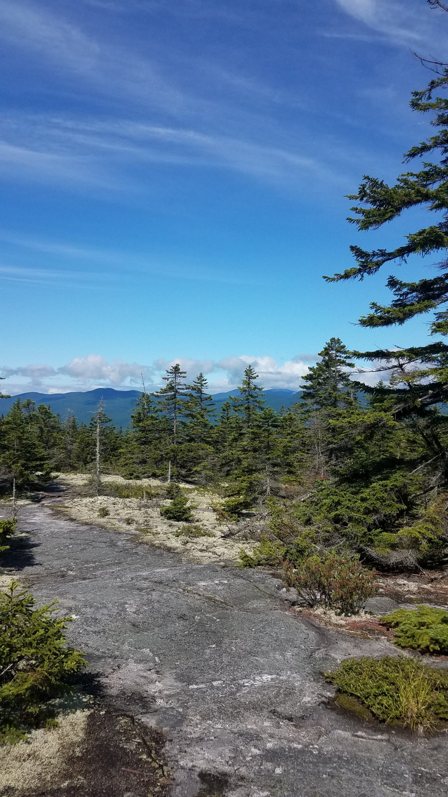
A typical day in the Whites looked like this, but wetter
Because It’s Happened, Doesn’t Mean You’ve Been Discarded
After the Presidential Traverse, I played on easy mode for a couple of days. With the help of the Rattle River Lodge (seriously, New Hampshire has some S-tier hostels), I completed the remainder of the nights in two days, including a 21-mile slackpack (a word which here means, “making a rainy and unpleasant stretch more tolerable by leaving the pack at home and only walking with snacks and water) through the Wildcats. Each of those two nights, I was rewarded with a shower, non-trail food, and a place to relax with other hikers. Although my ankles were hurting more than ever, I felt triumphant and ready to charge on.
The next day, with less than twenty miles to go in New Hampshire, things started looking brighter.
Wait, I thought it wasn’t supposed to be bright out here
On the way, I encountered a group of NOBOs that I’d met before; little did I know that I would be walking lockstep with them to Katahdin from here on out. New Hampshire finally said goodbye with a few more evil rock climbs, some gorgeous views, and a bald peak appropriately named Mount Success. Also, someone crashed their plane nearby.
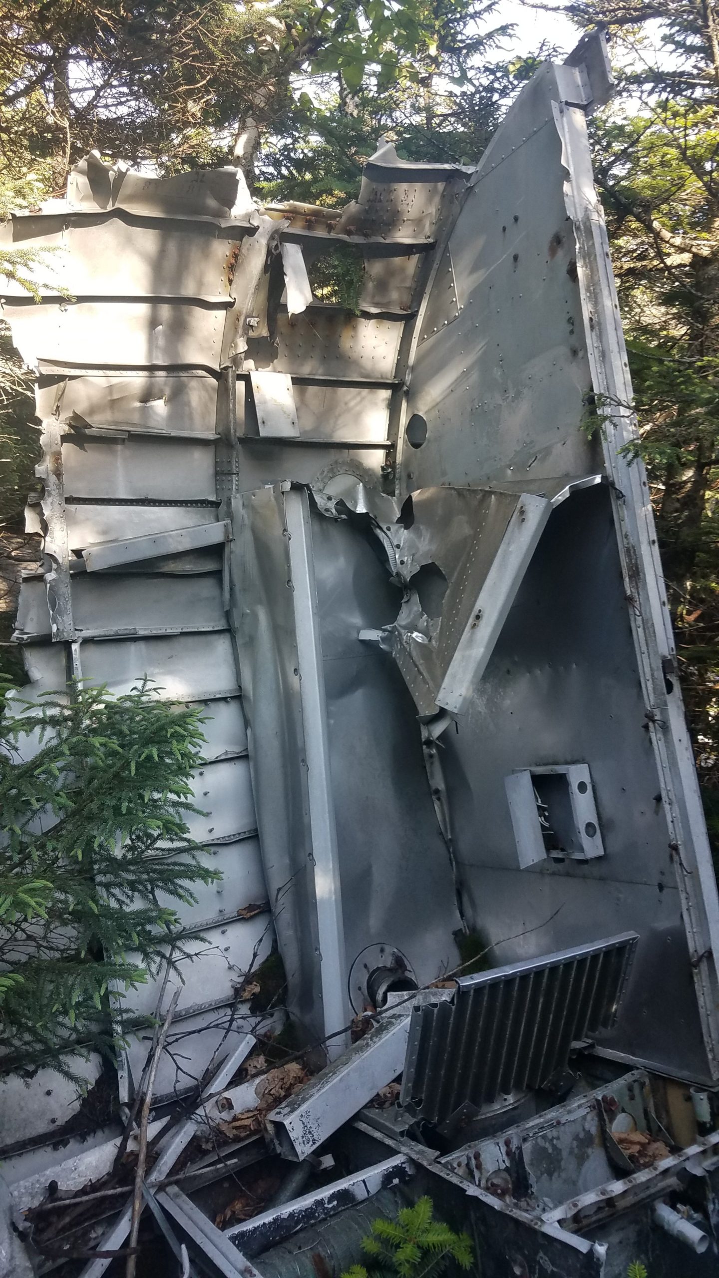
Hmmm, looks like my flight’s been delayed.

This website contains affiliate links, which means The Trek may receive a percentage of any product or service you purchase using the links in the articles or advertisements. The buyer pays the same price as they would otherwise, and your purchase helps to support The Trek's ongoing goal to serve you quality backpacking advice and information. Thanks for your support!
To learn more, please visit the About This Site page.

Comments 2
George Washington wasn’t born until at least 115 years after the first English colony was settled in the US so he isn’t a “colonist.” But then again all you do is find things to complain about.
Way to both miss the point and say something shitty for no reason!