 ">
">
In the meantime, hiking at Letchworth
Your registration T13260 was cancelled.
I finally did it. It’s official. I canceled my June 1, 2021 Appalachian Trail northbound registration. It’s not going to happen this year. Crap. Plan A was 2020. Plan B was 2021. Now it’s on to Plan C.
I wrote about my reasons for postponing in previous post. In short it is not wanting to thru-hike with Covid-19 hanging over the AT community.
Plan C
My biggest enemy is inertia. That’s the beauty of a long trek. You only have to start once. After that, you just have to keep on keeping on. Inertia can almost be your friend. The default is to get up and get going so you might as well do it.
Inertia is not my friend now. I have to decide what I am going to do in 2021 then haul myself up and out and go do it.
For now, I’m getting out for a day hike once a week. Meeting a hiking buddy at the trailhead gives me a deadline for getting out of the house. I am thankful to have plenty of good hiking close by.
For the rest of 2021, I am looking seriously at an end-to-end on the Finger Lakes Trail (FLT, 580 miles) and at the Northville Lake Placid Trail (NTP, 133 miles), both within New York State, where we are doing better with the pandemic than are many other states. The FLT is such that I would do it in sections; the NTP would be a two or three-week hike.
I’ll write about the FLT and NTP in future posts. In the meantime, I’ll tell you about the shorter jaunts.
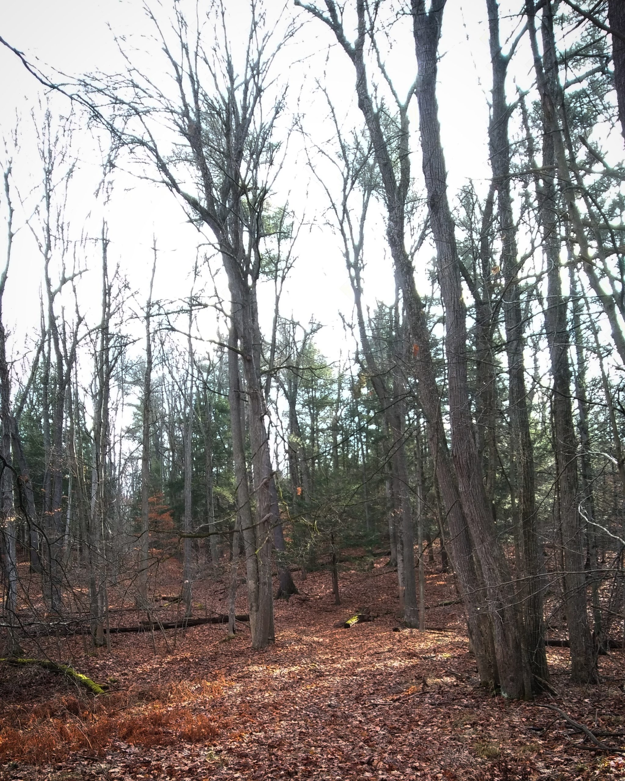
Trail 16 at Letchworth State Park
Letchworth is about an hour away, which makes it good for day hikes. There is a host of park trails, largely on the west side of the Genesee River gorge, plus the FLT Letchworth Branch that runs the length of the park on the east side of the gorge.
On January 16 I met my hiking buddy at the trailhead for trail 16 on the east side of the park. The trailhead is well marked as it is also an access point for the FLT. The park guidebook I had with me showed the trail going beyond the FLT with two connected legs and a loop. The more recent map removes the south leg and connector but is still optimistic. The only section that is marked and maintained is the FLT access. The rest exists as shown, but is in sad need of some TLC. But it was a lovely day to be out.

From the trailhead on River Road, the trail followed an old two-track until the first turn-off to the right. After that, it narrowed and followed the edge of one of the many deepening gullies that eventually make it to the river. We soon came to the FLT junction. The FLT southbound made a hard left across the gully while the northbound leg continued along the edge. The blue trail 16 markers gave way to the yellow FLT blazes. The snow from a few weeks previous was long gone. The FLT gradually turned north. The FLT was a single track but well maintained and marked. I wondered what had happened to trail 16. We passed through a mature forest with a thick leaf blanket and little undergrowth. Beautiful.
We eventually came to what I was pretty sure was the north leg of trail 16, following an old dirt roadway to the left and right. The FLT continued straight. We turned left, toward the river. We followed along until we passed a pathway off to the right. I remarked that it was probably where the loop shown on the map rejoined the main trail (it was). I was reasonably sure of where we were, but after a little while, Sue said she wasn’t comfortable following an unmarked trail. She headed back and followed the FLT north. She got in a good hike before turning around and heading back to the cars. I went on exploring. At my tender age, I have a decent sense of where to go and where not to.
The old roadway continued toward the river with a mostly gradual descent. I eventually came to a park sign warning against attempting to enter the river. (As in, please don’t be an idiot. The signs are there for good reason. The river looks gentle in this stretch. It isn’t.) The sign confirmed that I was on what at least had once been an established trail. Though I didn’t realize it at the time, this was also the other end of the side loop.

I took a couple of photos with the phone so I could post them on Instagram for Sue. I took some black and white photographs with the Ondu 135 pinhole camera for myself. I find it is much easier for me to stop and take pictures when hiking solo and setting my own pace.

Ahead.

Another head.
Looking back with the phone.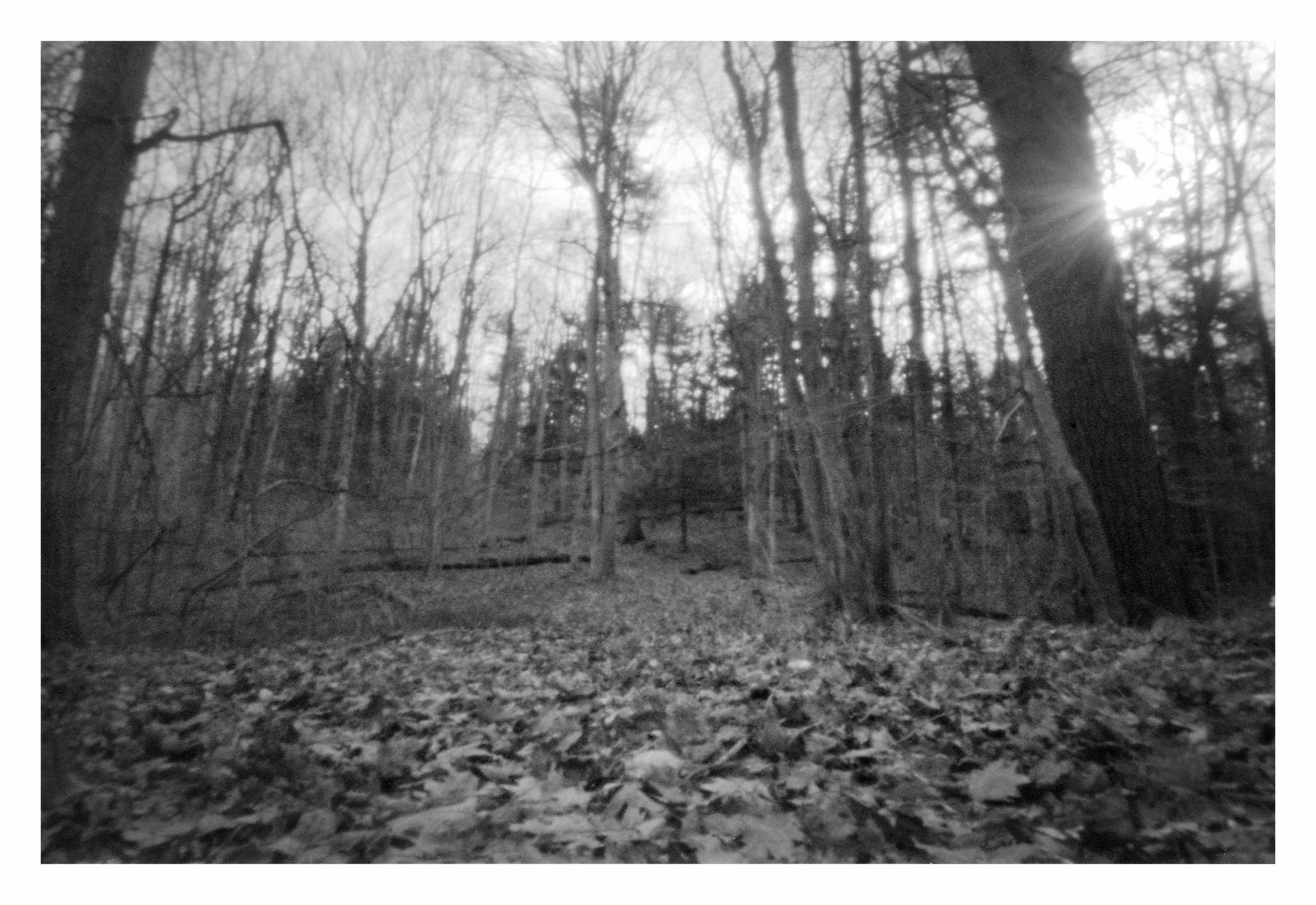
And with the pinhole camera.
The trail continued ahead and down. It was not as well-traveled here and the trail gradually dwindled. At the last descent to the river, it faded into oblivion. It would have taken bushwhacking down a steep incline to get all the way to the river. I didn’t bother. Taking reasonable risks is one thing; inviting injury when I’m by myself is quite another.
The brush by this point was too thick for the pinhole camera and its stubby tripod. I took some photos with the phone then headed back up the hill.
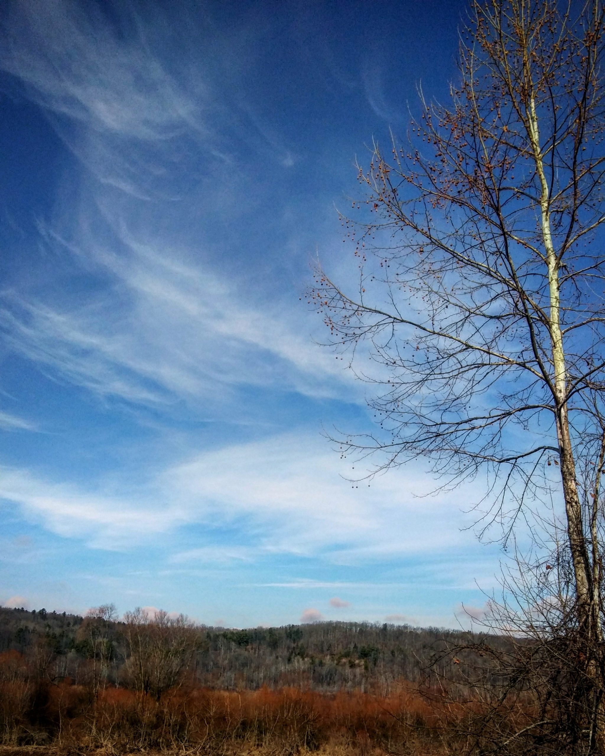
End of the trail. The sun put in an appearance, gloriously.

You can see the river if you look closely a quarter of the way down from the top.
On the way back I explored the side loop. It faded out shortly before rejoining the main trail at the sign. I explored the remains of the old connecting trail. It ended at the washout ravine that was all that remained of the old south spur. A short bushwhack east took me back to the FLT. I took one more side trip down the first trail 16 turnoff we had passed on the way in (the one shown on the map). It continued north with woods on the left and a farmer’s field on the right. I got about to where it turned west, but the old roadway was getting increasingly muddy and icy and I was not wearing my Microspikes. I never did find the center trail 16 leg shown on the map. I headed back to the car.

Not sure where I took this one, but it seemed a good choice to end with. It really was a pretty day.
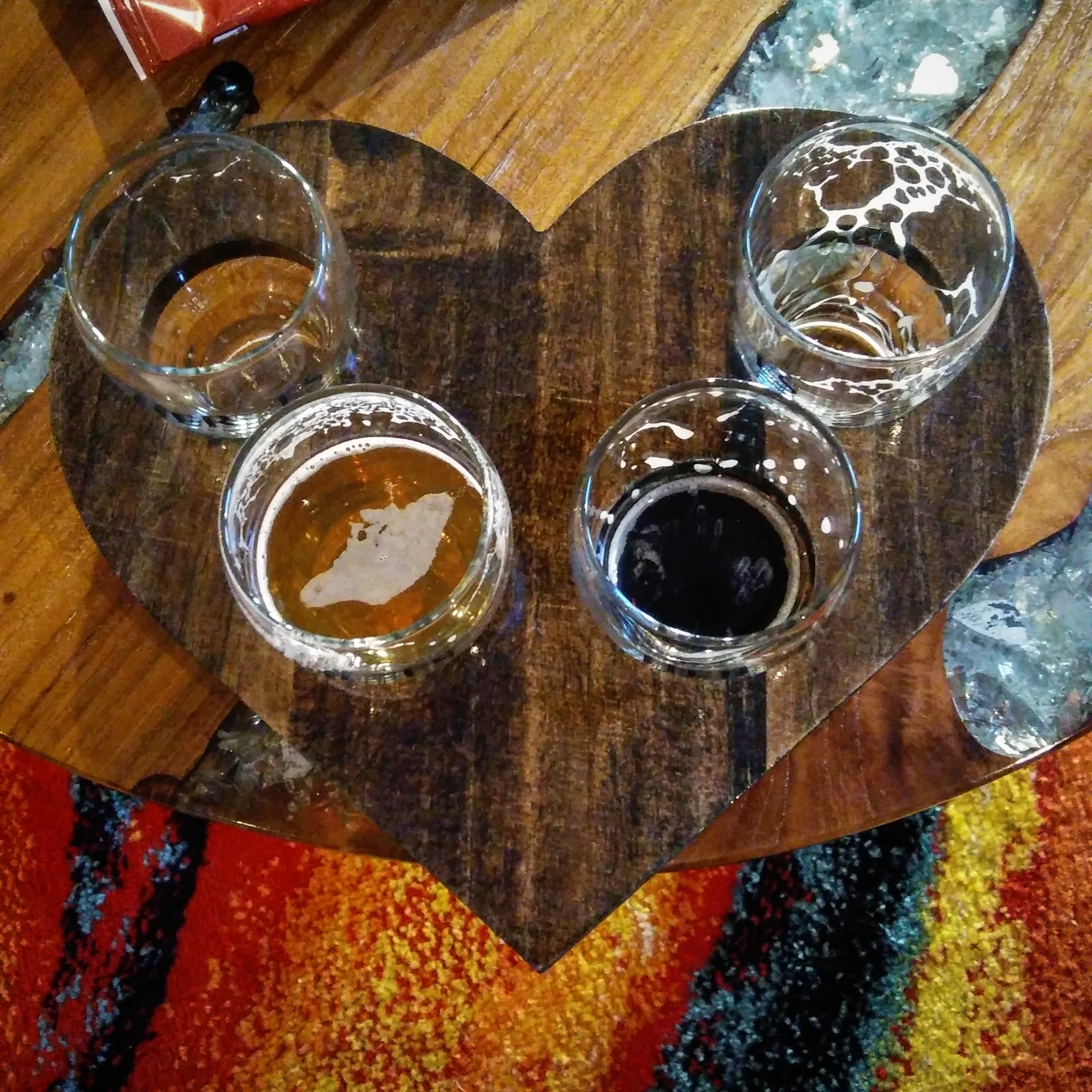
Some mighty good beer at Heroes Brewing Company on the way home.
Blessings,
Steve / pearwood
Soli Deo Gloria

This website contains affiliate links, which means The Trek may receive a percentage of any product or service you purchase using the links in the articles or advertisements. The buyer pays the same price as they would otherwise, and your purchase helps to support The Trek's ongoing goal to serve you quality backpacking advice and information. Thanks for your support!
To learn more, please visit the About This Site page.

Comments 11
Well .. I think you’ll apprecieate it even more when you actually get to do it without worrying about the pandemic…you’ll get there
Thanks, Dave.
Love your updates. Stay positive, but glad you are making the tough decision that is right for you! Keep blogging about your adventures and photography. And most of all, happy hiking!
Thanks, Katie!
Are you blogging in 2021?
I know the feeling. 2019 I ran afoul of medical issues, small things but is delayed my trip. Then the plague stuck. As of now even registering for
AT is contingent on receiving the vaccine. So at 71 I still go out locally to parks which there are many. I’m near Williamsburg, Va. so there is the Colonial Parkway. 23 miles Jamestown to Yorktown. York River State Park and Virginia Capital Trail, 53 mile’s from Jamestown to Richmond.
I think you would like the Coffee Ruck Trail (my designation) through Colonial Williamsburg) 12 miles of coffee shops and college of William and Mary campus.
Best of luck. I will register, may be only a section hike out of Damascus, Va however it will be a start.
Take care, stay safe.
Russ
Thanks, Russ. I turn 71 in June. The original plan was was to celebrate number 70 on the trail. Now I’m planning my 72nd birthday party.
Blessings,
Steve
Sooo great to start my day reading about and seeing familiar places I love. Terrific pics. I’m a transplant out of my native Rochester. While Covid has kept you off the AT, it’s kept me from coming home to see family and enjoy the countless beautiful trails and waterways of home. Don’t take them for granted. Grass isn’t always greener…. Be safe. Enjoy the trails. ?
Sarah,
Thank you! I’m pearwoodphoto on Instagram if you want more Rochester and environs photographs.
Blessings,
Steve
I am feeling the weight of inertia myself. The days have simply dissolved behind me – is it really February already? -! Keep going. We’ll all get to the A.T. at some point!
Yes, will.