 ">
">
Looking Back
- Day 35: Erwin, TN to Cherry Gap Shelter (17.3 miles, marker 361.4)
Today’s hike took me over Unaka Mountain, another truly stunning place and a lesson to myself. My original plan was to camp on top of Unaka Mountain because it was supposed to be reminiscent of the lush greens of the Smokey’s. I discussed this with the people I was hiking with and their idea was to go to the shelter afterwards.in order to avoid carrying water up the mountain (there was no source on top). There was a sign pointing to an unexpected water source just before the ascent, but I ignored it because I was heading to the shelter. As soon as I got to the top I instantly regretted that choice. It was like the fairy forests of the Smokey’s, but with a perfect bed of pine needles everywhere, and tons of nice flat camping areas. I made the decision there and then I would choose my camping based on beauty and not social connections.

Also, the feet are still hurting. I’ve attempted a couple different ways of tying my shoes but haven’t worked out a good system. Ultimately I think I need to step up a size, but am not completely sure that will solve the problems. If I tie too loosely they rub and my toes hit the front. If I ties too tightly it hurts the top of my feet. If I create a cinch point mid foot, it starts to bother my plantar fascia. Can’t seem to win.
Day 36: Cherry Gap Shelter to Ash Gap (15.7 miles, marker 377.1)
This was a very nice day of hiking through the woods with pleasant weather and decent terrain. There was a bit of a climb at the end, but my feet were feeling a little better, so the 15+ miles weren’t terrible. The campsite was at a beautiful spot, tucked into the woods on a high gap most of the way up into the Roan Highlands. It was a perfect place for an evening and morning fire.


Day 37: Ash Gap to Doll Flats (15.2 miles, marker 392.3)
Today I traversed The Roan Highlands which involved three balds, and then went over two additional mountains, Little Hump and Hump. Besides the incredible views, the best part of today’s hike was being able to see where we came from and where we were going to. The first mountain, Round Bald, had overlooks with signs showing the mountains in the distance. It was nice to be able to see the upcoming mountains and the distance between them. This was followed by Jane Bald and Grassy Ridge Bald, all gorgeous. I then hiked on to the next range and was delighted to see that as I climbed Hump Mountain I could look back and see exactly where we came from.
The day was rounded out by a beautiful campsite, a lovely fire, and a good game of chess.


Day 38: Doll Flats to Slide Hollow (12.6 miles, marker 404.9)
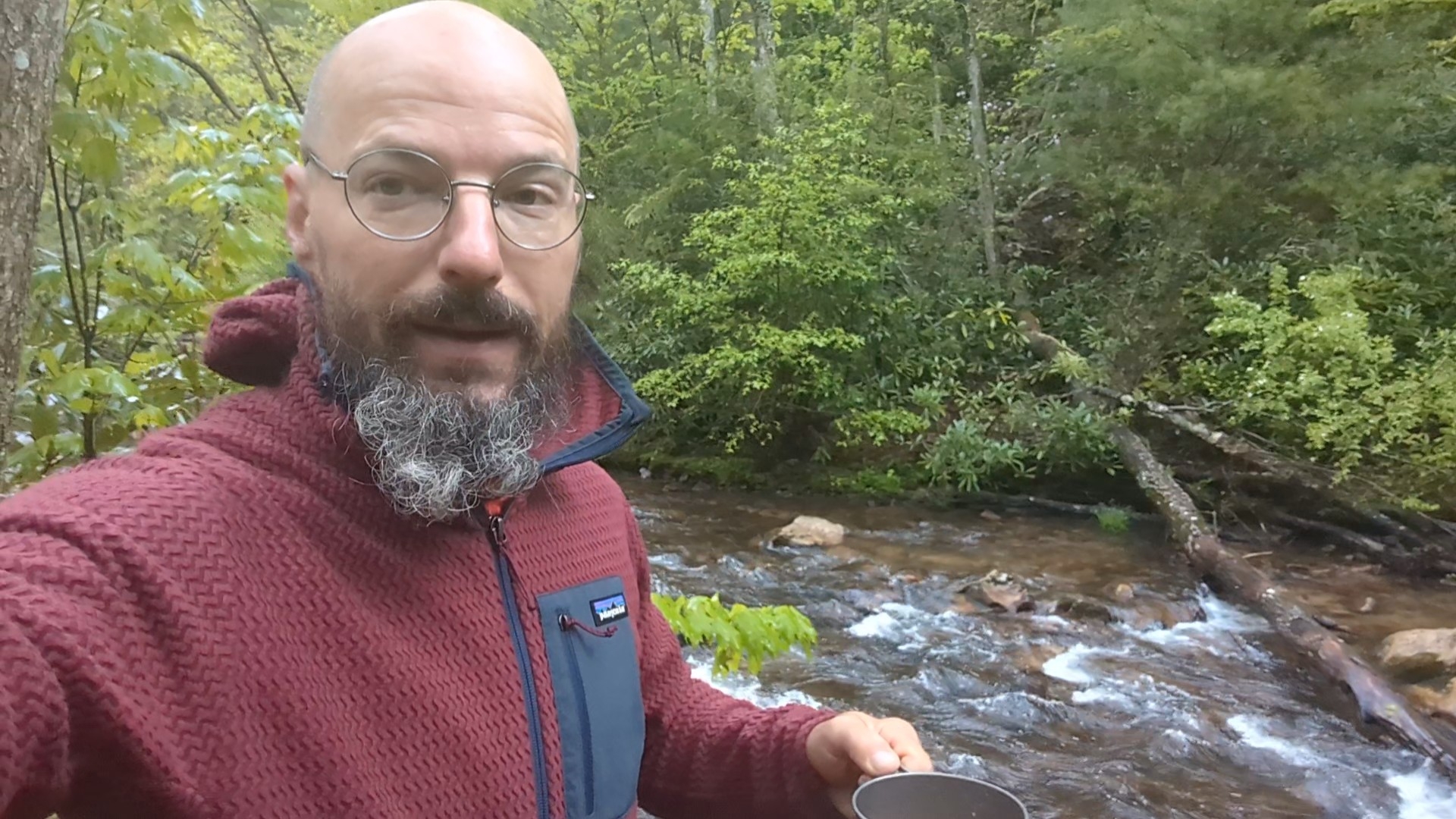
Decent day today. Got up early and walked three miles to Mountain Harbour, a beautiful hostel known for it’s breakfast. I went for a small resupply and just to relax for a few, charge my devices, and bid Pinky farewell, as his section is done. I then continued through woods and fields under overcast sky. I blue blazed a side trail to Jones Falls, which has a fantastic and treacherous side trail to the top of the falls (actually halfway up) that of course I had to take. I was about to look and see if the trail went any higher, but it began to rain lightly, which prompted a quick descent to avoid a wet and dangerous climb down. The rest of the walk was in light rain. The campsite I’d chosen sits next to a stream, and the painfully cold water felt amazing on my feet. The rain stopped just long enough for me to make dinner and stretch before and climbing into my tent for the evening.


Day 39: Slide Hollow to Pond Mountain Wilderness (17.2 miles, marker 422.1)
Today turned out to be a very pleasant day, even though much of it was in the rain. The first nine miles was a meandering through the woods without anything extra spectacular, and a very light rain. I stopped for lunch at a shelter to get some cover, and then continued on. At about fifteen miles I reached Dennis Cove Road, which was the place my folks dropped me off last year when I section hiked to Damascus for Trail Days. This marked to the beginning of the Pond Mountain Wilderness, an absolutely beautiful part of the trail which I now have gotten to hike through in the rain twice. This time though, I took a dip in the water by the waterfall. It was absolutely freezing, but very refreshing. I had been hiking the last bit of this area with a fellow hiker named Platinum, so we found a nice camping spot along the river and set up for the night.


Day 40: Pond Mountain Wilderness to Boots Off Hostel (6.4 miles, marker 428.5)
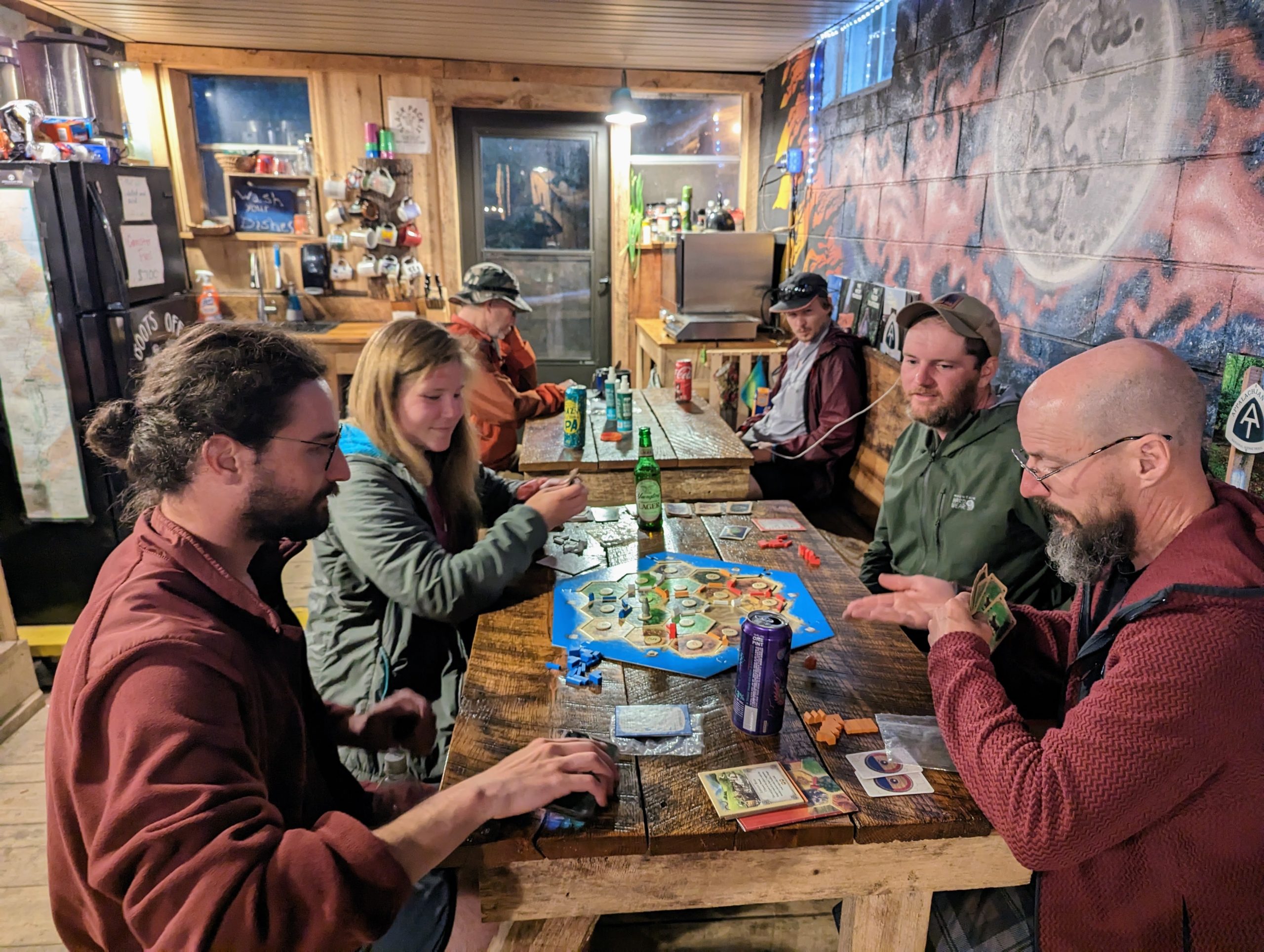
Short hike today up and over an unnamed ridge to reach Boots Off Hostel. Unfortunately, bunks were all sold out (tried to book online yesterday and the site kept glitching) so I got a tentsite, which comes with complete use of the facility and showers for $15. I was willing to pay a bit more to avoid the rain, but it seems less than the reports at this point, so I might have lucked out. I get to save a few bucks and enjoy my own space. Soon to go out to the store for a resupply and then choice of Subway or McDonalds for dinner. Afterwards a friendly game of Catan and staying up way too late… possibly even 10:00 pm.
Day 41: Boots Off Hostel to Iron Mountain Shelter (16 miles, marker 444.5)
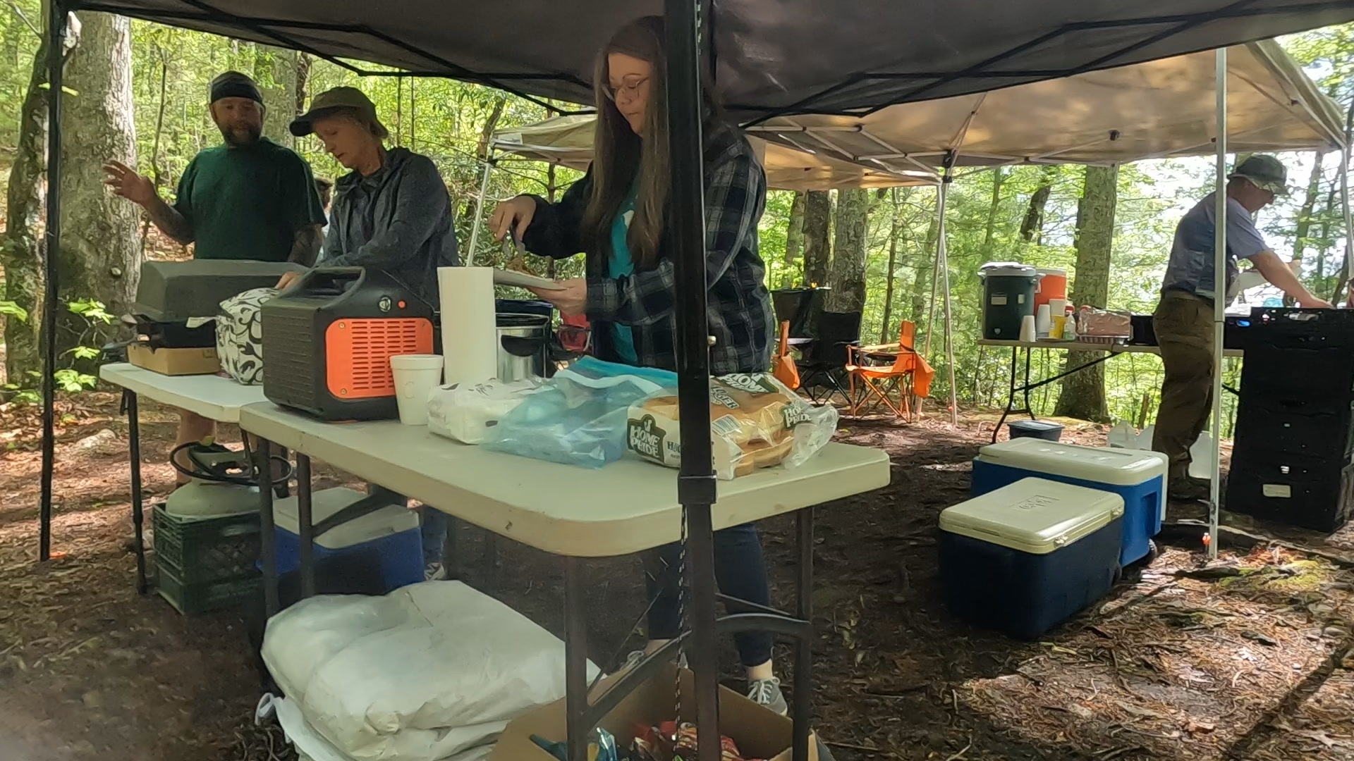
Today was both pretty and relatively easy. The climbs were not too steep. It began with a four mile walk around Watauga Lake, and eventually over Watauga Lake Dam before ascending. Soon into the climb we crossed Wilbur Dam Road and ran into some lovely trail magic, nice folks serving pulled pork sandwiches and corn on the cob with fresh made pastries as well as soda, coffee, and a few free resupply snacks and the like. This was exactly where I had planned my first break so it couldn’t have been more perfect.


Lunch was had halfway through the hike at the Vandeventer Shelter which is famous for hosting an ax murder in 1975, and possibly the ghost of said victim. More importantly were the amazing views of the countryside by which to enjoy my lunch. The rest of the hike was uneventful, and camp was typical: nice company, nice fire, sleep by 9:00 pm.

Day 42: Iron Mountain Shelter to Abington Gap Shelter (16 miles, marker 460.5)
Today was a beautiful hike. It rained on and off, and got rather cold during some of the rain, but the trail and the views were mystical and gorgeous. Along the way I passed a memorial to Uncle Nick Grindstaff, whom it seems lived close by in these woods. And his epitaph reads, “Born alone, Suffered alone, Died alone”. Quite the legacy.
Most of the folks I camped with last night also planned to hike the 16 miles to Abington Gap, so we tended to leap frog each other all day as we hiked. I find that I tend to hike a bit faster than most people, especially on the downhills, but also break more often. Since it was cold, my brakes were much shorter. As it was, I arrived at Abington Gap far enough ahead of most of the others that I was able to get completely set up before anyone else arrived. After about half a dozen people showed up, I grabbed my empty pack and offered to grab water for anyone who needed it, which was a quarter mile down a steep path. I was amazed by how taken aback everyone was that I was offering to do this. While most everyone I’ve met out here would risk life and limb to help a fellow hiker in trouble, it seems like everyone has also become so fiercely independent that they don’t really think to help their fellow hiker in these ways. I was happy to change that norm, if just for a moment in a very simple way.


After some social time around the fire and a game of chess with Platinum, the night turned very cold and windy and I retreated to my tent for the rest of the evening.
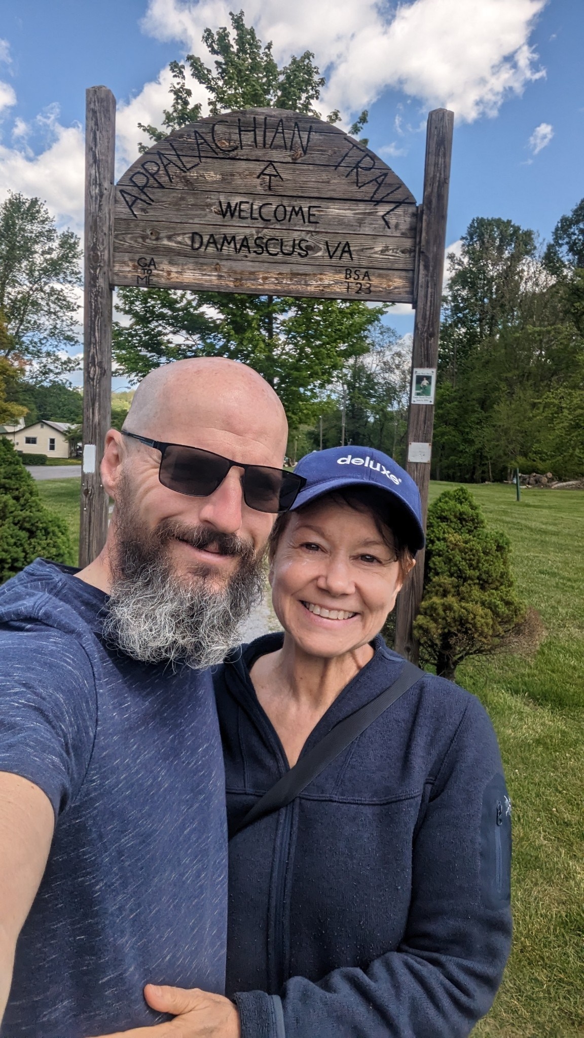
Day 43: Abington Gap Shelter to Damascus, VA (10.2 miles, marker 470.7)
This was a fast smooth hike into town. The terrain was easy, and it was nice to enter a new state, Virginia, two thirds into the hike. Getting into town was nice. After walking through the arch and along the park, the trail turns down the main street in town and passes right by the outfitter and many other spots before reaching the bed and breakfast I was staying at, The Dragonfly. After a shower and a hot meal at the local diner, I returned to the B&B to relax and wait for Sabrina who was picking me up for a short break and our annual Beltane Festival.

This website contains affiliate links, which means The Trek may receive a percentage of any product or service you purchase using the links in the articles or advertisements. The buyer pays the same price as they would otherwise, and your purchase helps to support The Trek's ongoing goal to serve you quality backpacking advice and information. Thanks for your support!
To learn more, please visit the About This Site page.

Comments 2
Uncle Nick’s epitaph makes me sad. But I’m glad you posted piggy pictures!
Zen, I have enjoyed your AT stories and beautiful photos. Someday I would like to tell you about my son Michael and his plans to hike the Trail. Travel safely and keep writing, Jean