 ">
">
New Hampshire: Whatever it Takes
On a bright, bluebird-sky day, I walked across the New Hampshire state line. I made my way through Hanover to the post office, and switched out gear for the Whites as yuppies wrinkled their noses at my thru-hiker stench and gave my sidewalk pack explosion a wide berth. That night, I stayed in an airbnb with a kind local who cooked me dinner, and we stayed up talking about our respective life’s adventures.

The next morning, I woke up and shamelessly loitered in the Dartmouth dining hall for most of the day, nero-ing out of town to the next shelter only 1.5 miles away. That night was surprisingly warm after a string of chilly evenings, and I tossed and turned in my new, warmer underquilt.
The next day, I pushed 20+ miles to the top of Smarts Mountain, barely missing sunset. I strung up my hammock at the base of the fire tower and promised myself I would wake up for sunrise. I was glad that I did – it was one of my favorite sunrises on trail.
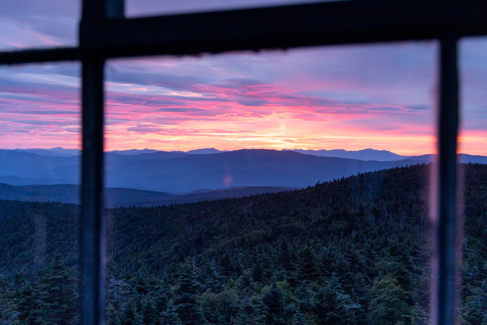
After watching the sunrise, I booked it to Hiker’s Welcome Hostel – the last hostel before the Whites. The hostel was full to the brim, and I ran into hikers I hadn’t seen since the Shenandoahs. The hostel was buzzing with excited, expectant energy, and I didn’t sleep very well.
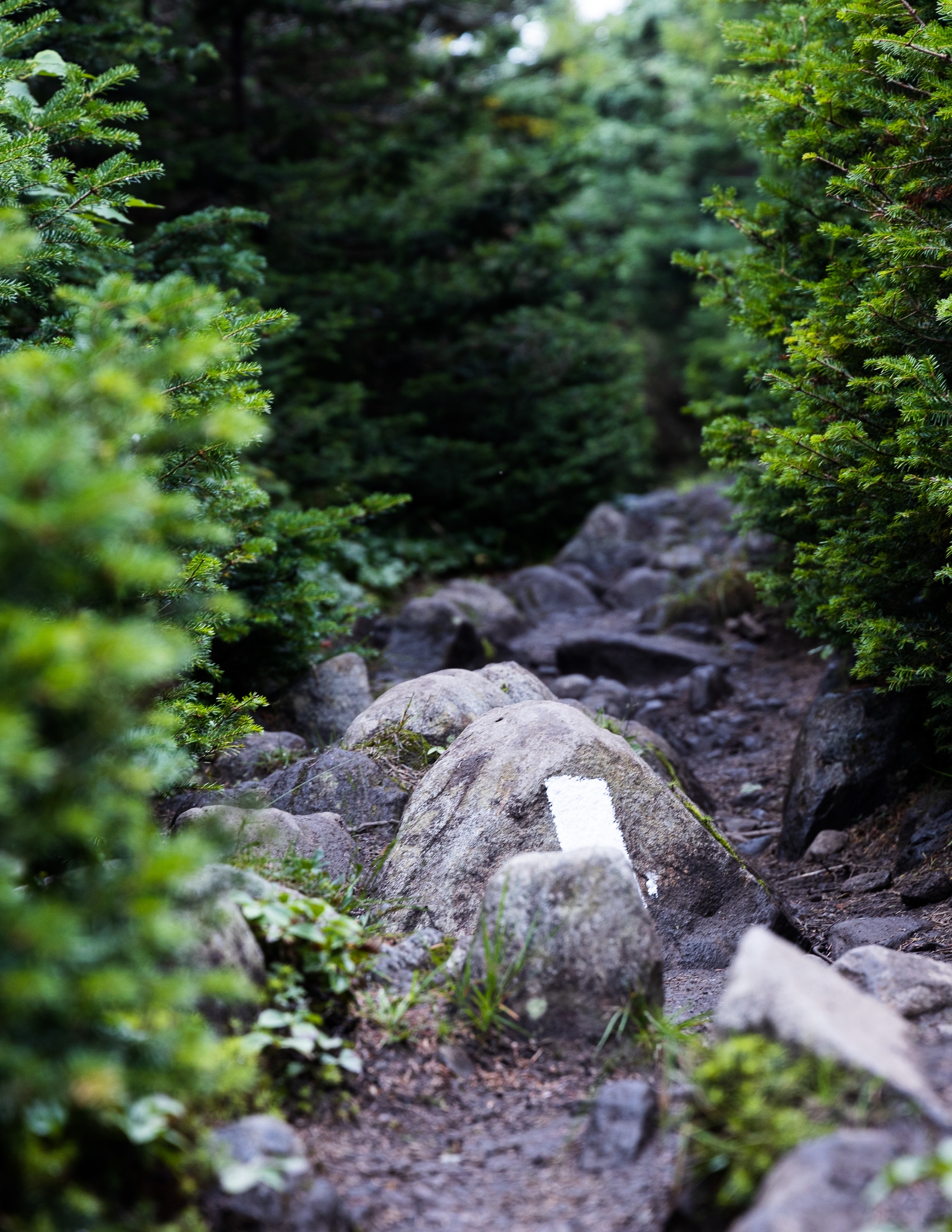
The Beginning of the Whites
I set off early to get back to the trail. My goal was to get over Mt. Moosilauke and up the notch to the next camping area. The hostel owners had briefed us all on the conditions that lay ahead, and had emphasized the difficulty of the northbound Moosilauke descent, urging us to slackpack southbound (especially if rain was in the forecast.) I hadn’t slackpacked yet, and while I didn’t consider myself a purist, I figured I might as well finish out strong. I was so close to the end of the trail, after all.
A grueling 9.5 miles later, my mindset had completely changed.
The ascent up Moosilauke was long, but not particularly difficult. The exposed summit was socked in, windy, and damp, so I hustled back to treeline. The moment I began the treacherous descent of Moosilauke, a steady, cold, drizzling rain began – a few hours earlier than forecasted. I’d just finished a rocky section, and thought the worst part was behind me. I was wrong. I was so, so wrong.

Slick roots, sharp rocks, and sheer granite slabs shone malevolently in the grim, overcast light as I slipped, slid, and fell my way down that mountain. Occasionally, there was a wooden step drilled into the side of a particularly treacherous granite slab, but they were little comfort as they were covered in slippery, wet moss.
I found a flat-ish spot, plopped down, took off my pack, and had a complete panic attack. Then, as the chill set in, I kept moving, survival instincts kicking in. I knew that I had to keep moving to stay warm and keep my wits about me. I knew that I had to get into town. I wasn’t even going to try to camp that night. I was too cold, too wet, and too stunned by the difficulty of the terrain. I needed to regroup. 
Hiking Through Quicksand
When I made it to the base of the notch, I stumbled out of the woods into the tail end of trail magic. Stitches gave me some solid advice about the upcoming trail, and commiserated with my shock at Moosilauke’s difficulty. For the first time, I regretted not slackpacking when it was clearly the safer choice. A couple hikers appeared and said they were headed to a ski lodge that was operating as a hostel in the off season. I hopped on the shuttle that arrived to collect them and made my way into town for the night. The ski lodge hostel was officially at capacity with my late arrival, and I ran into many people I hadn’t seen in weeks or months.
We’d all climbed over Moosilauke at that point, and there was a shellshocked quality to the air inside that hostel. Well, at least for the NOBOs. The SOBOs, having finished the last stretch of the Whites, were exuberant and ready to cruise on to Georgia. When they asked me about what lay ahead, I told them that they wouldn’t encounter anything as difficult as Moosilauke from here to Springer.
The next day was almost as difficult as Moosilauke. I collapsed into my hammock after only 7.5 grueling miles, and woke up sore – in my arms, legs, and back – from climbing over car-sized boulders. It was the first time I’d felt sore in a very long time, and the realization sank deeper: I knew that the Trail was only going to get more challenging.

As I went up and over the Kinsmans, I felt exhausted and demoralized as I finished another 10-miles-or-less day. I hiked from sunup to sundown, and felt like I was hiking through quicksand as I clambered over boulders, pulled myself and my pack up near-vertical rock slabs by hanging on to roots and minuscule cracks in the rock, and slid down sheer granite faces.
On one of the peaks, I found some service and checked the weather. Thunderstorms loomed in the next day’s forecast. Shit. I booked a night at Galehead Hut, cringing at the price tag but reminding myself of how utterly spent I’d been after the rainy day on Moosilauke. It was worth being warm, dry, and safe.
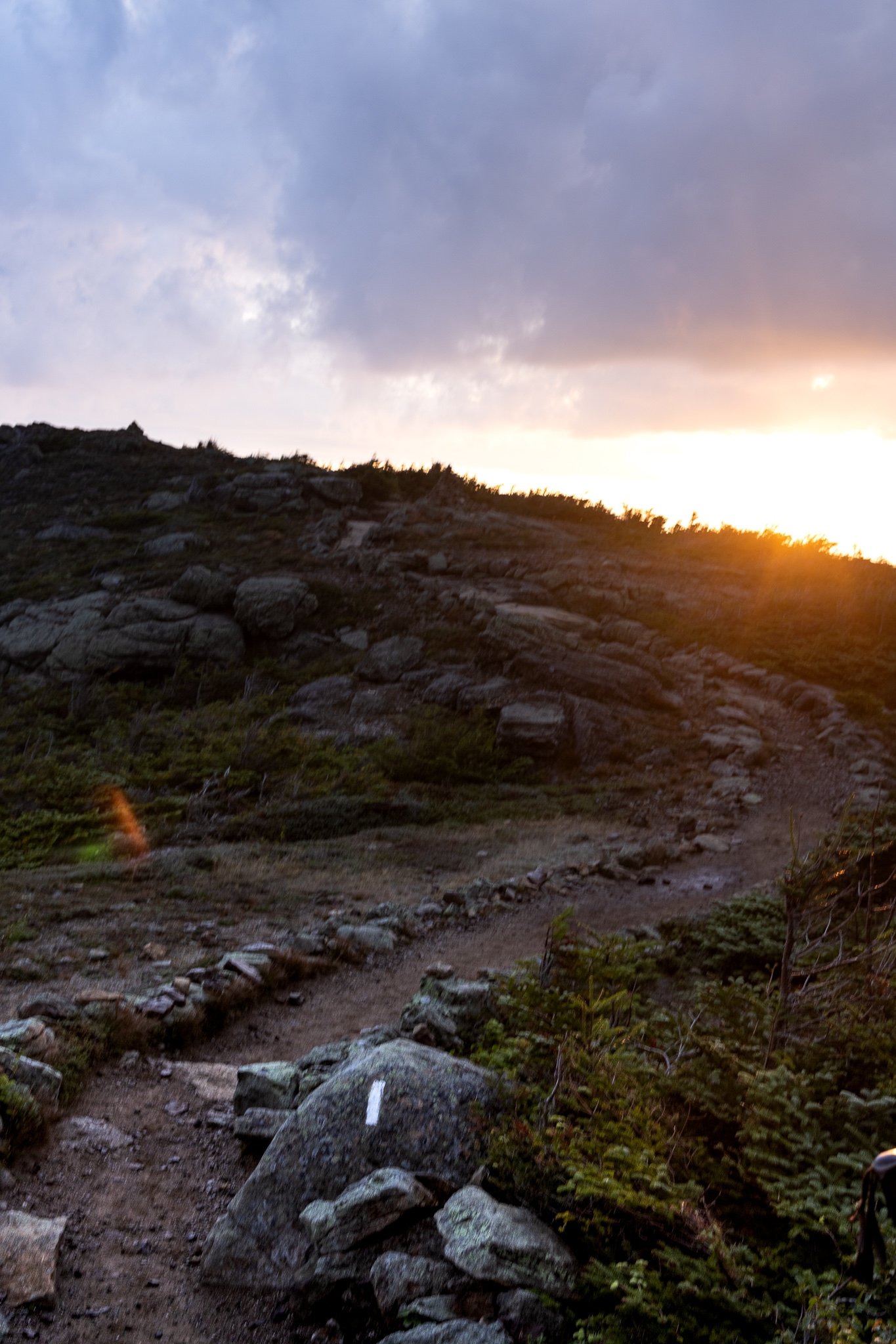
I stopped by Lonesome Lake Hut to get the final weather report for the next day, and decided to do sunrise at the Franconia Ridge – to get below treelike before bad weather rolled in.
Despite the difficulty of the surrounding terrain, the Franconia Ridge was, and is, my favorite section of the Appalachian Trail. As daylight broke through the clouds, I walked on in wonder and awe. I had the entire ridge to myself, and took a million pictures.
As I hiked up Mt. Lafayette, the weather shifted. Clouds rolled in on howling winds, and a stinging, bitterly cold rain pelted the left side of my face. I put on all my waterproof layers and hiked on. When I reached the summit, the clouds scurried away as quickly as they’d arrived, clearing the ridge for a final, breathtaking view.

The predicted thunderstorm rolled in as soon as the door closed behind me at Galehead Hut, and I was instantly thankful that I’d spent way too much on a bunk. I slept fitfully on the thin mattress, and woke up early, eager to get going. I was packed before breakfast, and after eating my fill, headed out to tackle South Twin and Zealand mountains.

The next day, I hiked down to a road, where I hitched to grab a resupply, hitched back, then went over Mt. Webster and Mt. Jackson to complete another sub-10 mile day. My thru-hiker brain was struggling to comprehend how I could hike from sunup to sundown, put forth that much effort while hiking, and still only hike 10 miles a day.
The Presidentials & Wildcats
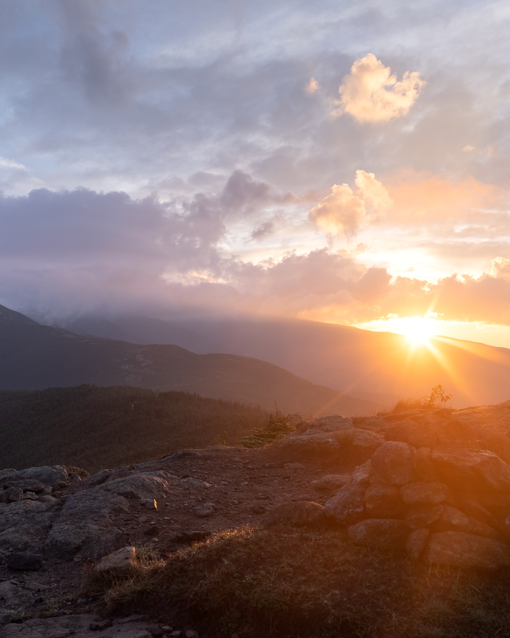
When I set out the next morning at 4am up Mt. Pierce, my mood was sour. But then, as I summited, the clouds broke wide open and reminded me, loud and clear, why I was on the trail. This was the most incredible sunrise of the trail, and I sat there for nearly an hour taking it all in.
I hiked on to Lake of the Clouds Hut, then continued to Mt. Washington as the clouds began to break. As I hiked, I was cold – and then a stray beam of sunlight would hit me, and I would be warm again. I climbed the socked-in summit of Mt. Washington without incident, then continued on after charging my devices for a couple hours at the visitor center. When I left, the fog parted, and I got a view of the summit as I hiked along the exposed ridgeline towards Mt. Madison.

I made it to Madison Spring Hut with only 30 minutes of daylight left, and 12 other hikers and I convinced the croo to let us sleep on the floor. We waited outside while the hut guests wrapped up dinner, and as soon as the lights went out, we descended on the dining area, quietly scooting benches around to create makeshift elevated cots. Since I was in a hammock, I no longer had a sleeping pad – so I stuffed my pack liner with extra clothes and my underquilt to create a little bit of cushion.
The next morning, I powered up Mt. Madison on fumes, having not slept well at all on my makeshift cot. As 50mph wind gusts threatened to topple me with each step of the rocky, treacherous descent, I decided to get into town and zero. I’d nero’d out of Hanover, but hadn’t had a true zero since Great Barrington, MA. It was time. I used precious battery life and booked two nights at a hotel in Gorham. I hitched into town from Pinkham Notch and stayed in my hotel for most of those two days, sleeping 18 hours the first day. While I was in Gorham, I ran into Napster, who I had been trailing behind since my knee injury in Georgia. It took me 13 states to do it, but I’d finally caught up with my very first hiking buddy!
The hike out of Pinkham Notch would’ve been impossible without the rest I’d gotten on my zero day in Gorham. The climb up Wildcat D Peak was more rock climbing than hiking, and I cussed the entire way up the side of that mountain. It was ridiculous, and I was done. Honestly, I had been ready to be done since Hanover – it was why I hadn’t zeroed since Massachusetts. There was only one goal in mind: make it to Katahdin.
Whatever it Takes
In my hotel room in Gorham, I’d stood in front of the mirror and looked at myself. I was thin. Too thin. My pack was famous for being deceptively tiny, yet “sturdy” with the food weight I was known for carrying. I never ran out of food on trail, but the amount of energy I was extending was outpacing the amount of calories I could feasibly consume. At this point, I knew that I was in a race – against the weather as fall approached, and against my body as my health deteriorated.
I was pissed. As I counted the bumps along the stark ridgeline of my spine, and puffed out my cheeks to fill their hollowed shadows, I was angry at the trail for becoming unbelievably difficult right as I’d fallen into a good hiking rhythm. As I looked at my shins, which were a mass of bruises, I was frustrated with the nonsensical, dangerous trail routing through the Whites. As my entire body ached and screamed for rest, I was seeing red over the fact that I very well may not be able to make it to the end… because my body would give out before my spirit did.
I was amazed at how quickly the tide had turned. In Vermont, I had felt completely in my element: strong, healthy, motivated. Now, just a few short weeks later, the unrelenting difficulty of the terrain had worn my motivation down to a nub.
The last few days in New Hampshire, I put my head down and hiked over 10 miles a day, focusing all my intent and energy on putting miles behind me. I had to make it to Maine. I barely noticed the trail as I walked. There are few pictures from that time. By the time I made it to the state line, I was no longer enjoying the Trail. I was done, but I wasn’t done yet. There were still miles ahead, and that was the only thing that mattered.
On my last day in New Hampshire, I wrote: “It almost feels like Maine was inevitable. Like, of course I made it here. I knew I could. I knew I would. The time has come, but I feel nothing.”
I didn’t cry when I walked the last few steps into the last state of the Appalachian Trail. At that point, I was so spent, so tired, so exhausted, and so ready to be done… that it was just another state line. I stood at the sign alone for a few minutes, waiting for a tidal wave of emotion that never came.
Then, as a few other hikers joined me and began celebrating, I turned and hiked on. As I walked, I felt tiny waves breaking. With each step a new one rolled in.
Katahdin.
I could feel it then. A magnetic pull. The countdown. The final miles.
Katahdin.
I would do whatever it took, I realized with a mix of determination and ebbing guilt. Because by that, I knew that I would truly do whatever it took. If I had to crawl, I would. If I had to break, I would. If I had to ignore my body as it begged for me to stop, I would ask of her just one more mile, until the miles ran out.
There was no ending other than Katahdin. The hardest mile of the trail, the Mahoosuc Notch, and the treacherous climb up the Arm were just ahead. But I’d already survived everything the Trail had thrown at me. There was nothing that could stop me now.
Not even myself.

This website contains affiliate links, which means The Trek may receive a percentage of any product or service you purchase using the links in the articles or advertisements. The buyer pays the same price as they would otherwise, and your purchase helps to support The Trek's ongoing goal to serve you quality backpacking advice and information. Thanks for your support!
To learn more, please visit the About This Site page.

Comments 4
We did the Franconia Ridge Trail Oct 7 and found it to be the hardest hike we have ever done. It literally took us 16 hours to complete, from the campground and back. We are day hikers but hike on the AT a lot. Congratulations. Keep hiking and complete your journey.
Hi-I completely understand your feelings during this time. Trail became a struggle for me and each day I thought about quitting. I started April 2nd and on August 7th I did quit at Whitehouse Landing-46 miles to go. Reason? Knees on descents bad but mainly when I was in Monson I found out my wife of 6 years moved out. Good news I went back and finished September 20-22. Katahdin didn’t beat me! ?
Mary you can do it! I’m with you in spirit. New Hampshire is hellish & I’m not surprised you made it to Maine. Looking forward to your next post…