New York: Must-See Day Hikes on the Appalachian Trail
The Empire State is known throughout the AT community for being tough on hikers. Steep, yet short ups-and-downs paired with a decent amount of rocks makes most elevation profiles of the state look unimposing. However, hikers can agree that the trail through New York has a way of knocking you on your ass.
Don’t let the state’s reputation scare you away though; the trail through New York is covered by beautiful rock outcrops, pristine lakes, and mountain meadows. The state is also home to both the first completed section of the AT and the lowest elevation on the trail, which makes New York pretty exciting for those hikers into trail history. All of this, paired with tons of road crossings / trail heads, and ride sharing apps being easily accessible in the area*, means day hiking throughout the state can be a breeze.
So, forget the big apple: it’s time to lace up your boots, grab some water, and discover what New York is actually all about!
1. Bear Mountain

Total Distance: 3.6 miles (with longer options available)
About The Hike: Located only an hour outside of NYC, Bear Mountain holds a special place in the hearts of the trail community. This section of trail is not only one of the most heavily trafficked 20-mile segments, but it was the first stretch of the AT to be completed back in 1923. Today, there is a stone observation tower on the summit which is open in the summer months and welcomes 100,000+ visitors each year. There are multiple ways up the mountain, and each offers killer views of the Lower Hudson Valley not only at the summit, but also at multiple vantage points along the hike.
The Details: Option 1) 3.6 miles: The most common way up the mountain is to park at Bear Mountain Recreation Area and hike southbound for 1.8 miles to the summit. After taking in the views, follow the AT back down 1.8 miles to your car. Option 2) 4.8 miles: Prefer to share the trail with fewer hikers? Try hiking up the backside of the mountain by parking at the “1777 Trailhead” off of Seven Lakes Parkway (N41.304050 W74.016136). Then, follow the AT northbound for 2.4 miles until you reach the summit. You will pass multiple overlooks along your way to the top, making this route slightly more scenic. When finished at the top, retrace your steps 2.4 miles back down to the parking lot.
2. The Lemon Squeezer

image via
Total Distance: 4 miles
About The Hike: As one of the most well known features on the trail, the Lemon Squeezer is a fun, yet challenging, crevasse-like opening through some of the giant boulders that seem to completely cover the trail in New York. The trail gets incredibly narrow through this section, and requires many hikers to completely remove their packs and hand over hand climb through the opening. Leading up to the boulders, the trail passes through both the beautiful meadows of Harrison State Park, and skirts scenic Island Pond, making this the perfect hike for a summer afternoon.
The Details: Park at the “Elk Park Trailhead” parking lot, which is located off Arden Valley Road (N41.264755 W74.154221). Follow the AT northbound for 2 miles, passing Island Pond and multiple meadows along the way, until you reach the Lemon Squeezer. When finished, retrace your steps 2 miles back down the mountain and to your car.
3. Anthony’s Nose

Total Distance: 2.2 miles (with longer options available)
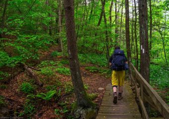
About The Hike: Often skipped by thru-hikers due to its .6 mile blue blaze, Anthony’s Nose is one of the best views along the Appalachian Trail in New York. This local favorite is a definite must see, and consequently gets crowded during the summer months. However, once at the top, it’s easy to understand the popularity as the bare rock faces offer views of the Hudson River, Bear Mountain, Iona Island, and Salisbury Meadow. Choosing the longer route for this hike? The AT will cross over one of the most beautiful boardwalks on the trail and pass through a serene forest surrounded by mountain streams.
The Details: Option 1) 2.2 miles: Park along the road on US Route 9D (N41.322491 W73976402). Although there is a ton of room for parking, getting there early ensures a spot during peak times. Hike northbound for .5 miles to the top of the mountain until you reach a trail intersection for a blue blazed forest road. Turning right, follow this road for .6 miles until you reach the overlook. Retrace your steps back down the mountain to complete your hike. Option 2) 10.6 miles: Looking for a longer and slightly more scenic hike? There is a trailhead at the intersection of US Route 9 and NY Route 403 (N41.35088 W73.926102), which has space for a few cars along the side of the road. Hike southbound across the boardwalk and along the AT for 4.7 miles until you intersect the .6 blue blazed side trail to the overlook. Once finished, follow the AT northbound back down to the road and to your car.
4. Prospect Rock

Total Distance: 5.2 miles (with longer options available)
About The Hike: Located just .4 miles from the NY/NJ border, Prospect Rock is the highest point on the trail in New York. The bare rocks offer room to spread out while looking out to Greenwood Lake and the NYC skyline, on exceptionally clear days. If hiking southbound to the vista, you will be passing through multiple sections of steep cliffs and rocks; some of these even feature metal bars and ladders to assist hikers up and down the mountain, making for a unique hike. If approaching Prospect Rock from the north, you will have a chance to cross the state border on the trail, which is marked by a painted white line along the rocky section.
The Details: Option 1) 5.2 miles: Starting in New Jersey, park along the road on Longhouse Drive (N41.195732, W74.370895), and follow the trail northbound for 2.6 miles. Once crossing the state border, and reaching Prospect Rock, backtrack 2.6 miles until you reach your car. Option 2) 11.2 miles: Park in the trailhead parking lot along NY Route 17A (N41.245856 W74.285194). Follow the AT southbound for 5.6 miles until reaching the overlook. Once finished, retrace your steps 5.6 miles back to your car.
5. West Mountain Shelter

Total Distance: 4.8 miles (with longer options available)
About The Hike: Easily in the running for one of the best views from a shelter along the AT, the West Mountain Shelter allows backpackers the chance to watch a mountain sunset from the comfort of their sleeping bag. For day hikers, the shelter is a great place to stop for lunch, while taking in views of the Hudson River and New York skyline. Sitting right on top of West Mountain, and just inches away from an overlook, the shelter is truly one of a kind, and a popular destination for backpackers and day hikers alike.
The Details: Option 1) 4.8 miles: Park at the “1777 Trailhead” parking lot off of Seven Lakes Parkway (N41.304050 W74.016136) and follow the AT southbound for 1.8 miles. Once reaching the trail intersection marked by a wooden post towards the top of the mountain, follow this blue blazed trail an additional .6 miles to the shelter. After stopping for a snack and taking in the views, follow the AT back down the mountain and to your car. Option 2) 12 miles: Park along Seven Lakes Parkway (N41.287487 W74.074646) and hike northbound for 5.4 miles until reaching the trail intersection for the shelter. Follow the blue blazed trail for .6 miles until you reach the shelter. Retrace your steps down the blue blazed trail and southbound on the AT to
complete your hike.
(PRO TIP: The AT crosses Seven Lakes Parkway 4 times throughout the state of New York. Be sure to double check your maps and coordinates to ensure you are starting your hike at the right trailhead along this road.)
6. Fitzgerald Falls

image via
Total Distance: .6 miles (with longer options available)
About The Hike: Standing at 25 feet high, Fitzgerald Falls is a popular destination for day hikers. It’s close proximity to the road means that this hike can easily be completed in a quick a afternoon or early morning trip to avoid the crowds that can often be found here in the summer months. The official route of the AT crosses a stream at the base of the falls, and offers hikers a perfect vantage point to take in the views. As with most waterfalls, Fitzgerald Falls often goes dry in the late summer months. For best conditions, hike this section in the spring, or after a big summer rainstorm!
The Details: Option 1) .6 miles. Start your hike at Lakes Road (N41.273598, W74.254227) and follow the trail northbound for .3 miles until you reach the falls. Retrace your steps to complete your hike and return to your car. Option 2) 6.2 miles: Park along the pull off on West Mombasha Road (N41.270058, W74.214722) and follow the AT southbound for 3.1 miles until you reach the falls. Then, backtrack 3.1 miles to return to your car.
*PRO TIP: Don’t want to drive two cars to two separate trailheads? Uber (as well as other ride sharing apps) is now active and readily available throughout most AT road crossings in New York! Simply park your car at one trail head, call an Uber to drive you to the starting point of your hike, and then walk back to your car!

Related
This website contains affiliate links, which means The Trek may receive a percentage of any product or service you purchase using the links in the articles or advertisements. The buyer pays the same price as they would otherwise, and your purchase helps to support The Trek's ongoing goal to serve you quality backpacking advice and information. Thanks for your support!
To learn more, please visit the About This Site page.

 ">
">

