 ">
">
Northern Virginia, Part 2: Getting Somewhere
Days 87-89:
On day 87, I woke up and went through my normal morning routine: collected my bear bag, started warming up some water, and slowly packed while checking out the FarOut app to see where I was heading the next day. As I tapped through the upcoming shelters, water sources, and campsites, I noticed that one shelter was exactly 26.2 miles away. Intrigued, I scrolled through the comments, and saw that there was a pizza party happening there – that night – hosted by trail angel B. He’d also messaged me on Instagram to let me know about it.
I finished off breakfast and started my first marathon hike Pinefield Hut shelter, feeling more energetic than I had in what felt like years. This strange new energy kept me going through torrential morning rain and 5500ft of elevation gain throughout the day. I finished the marathon in just over 12 hours, right before sundown, and was able to grab one of the last remaining slices of pizza.
On day 88, I woke up sore and hiked a much shorter day as I was tormented by bugs and relentless heat and humidity.

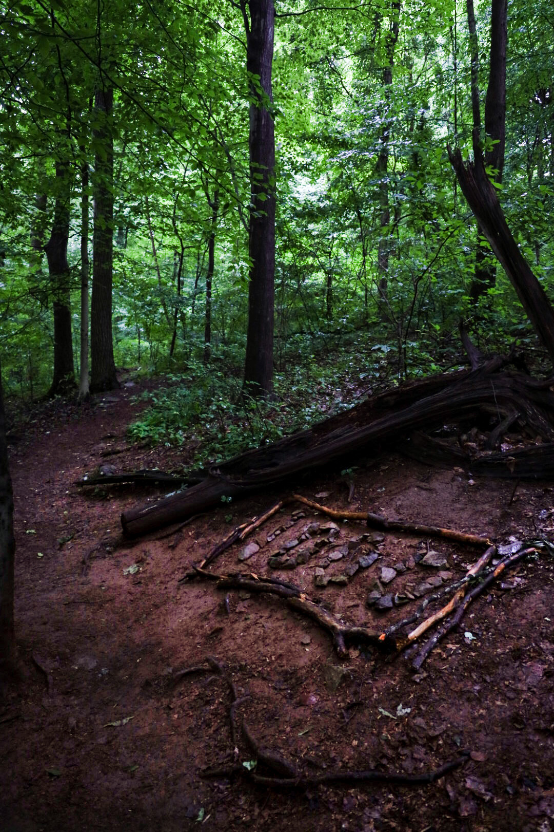
On day 89, I visited my first wayside station just in time to avoid a torrential thunderstorm, finished off a blackberry milkshake, and then hiked over a ridge to the next campsite.

As I was hiking, I saw two bears just off trail – they were heading towards a couple hammocks. They didn’t “shoo” as quickly as I’d like – one of them lingered long enough for me to get a video – but they did leave and I was able to let the overnighters whose hammocks the bears were drooling over know about their new friends. They immediately jumped to their feet to secure their food bags. That night, a thru-hiker I’d been hiking with would have her food bag stolen – likely by the same bears that I’d seen. The Shennies are no joke when it comes to habituated bears.
Days 90-93:
On day 90, I found myself at yet another wayside station to eat real food and charge up my devices. Despite the long break, I still hiked about 18 miles.
Day 91 was a bright, windy, sunny day – after the humidity and stillness and bugs, it was as if all of our prayers for some wind were answered at once, with gusto. The wind howled all day, and I made my way to the last shelter of the Shenandoah National Park.
On day 92, I had one mission with three stages: get to town, shower, and sleep in a real bed. I made my way to the adorable town of Front Royal, and made myself at home at Vibrissa Brewing, where I did my laundry and showered despite having a room booked at a local hotel. I drank beer, found shrimp and grits (which was great, even by Louisiana standards!) When I got to the hotel, I showered again.


On day 93, the post office was closed, but I didn’t feel too down about having to stay another night. I’d been feeling pretty worn out the last couple days, so a zero suited me just fine. My sleeping pad had developed a slow leak that I was having trouble finding, so I decided to buy a new pad and ship my old one back to REI for a refund.
Days 94-96:
On day 94, I woke up and went to the post office as soon as it opened to ship off my old sleeping pad, ship off birthday presents for my parents, and collect Clementine’s care package.
The previous day, I’d been running on autopilot and had done a full resupply. The fact that I managed to fit all the snacks and goodies from the care package in my pack alongside everything I’d already gotten was a herculean task that I happily took on. Despite the joy of new snacks (I always pack out too much food because I love snacking all day), I struggled out of town and only hiked 5 miles.
On day 95, I hiked in the rain… and it kept raining. This, I was used to, and I trudged on through it.
But at one point in the afternoon, the air grew suddenly and strangely calm. Then, the sky went black. I felt nervous, keeping my head on the swivel, listening for thunder and wind. I hesitated in the middle of the trail and held my breath, listening. I didn’t hear thunder, but I could hear something else happening in the distance.
As soon as the sound registered, my blood went cold. SNAP, SNAP, SNAP – trees falling, one by one, getting closer and louder. I didn’t think… I ran.
As I ran, a tree fell with a crash about 10 yards behind me. I sprinted to the closest road crossing and jumped into the ditch.

The howling wind passed over, leaving twisted and snapped trunks in its wake. I hadn’t felt that scared since my night on the ridge in Pearisburg. As I climbed out of the ditch and stood, shaking, on the shoulder of the highway, I decided that Virginia was trying to kill me, and I needed to get the hell out of there.
 Luckily, I crossed into West Virginia the very next day.
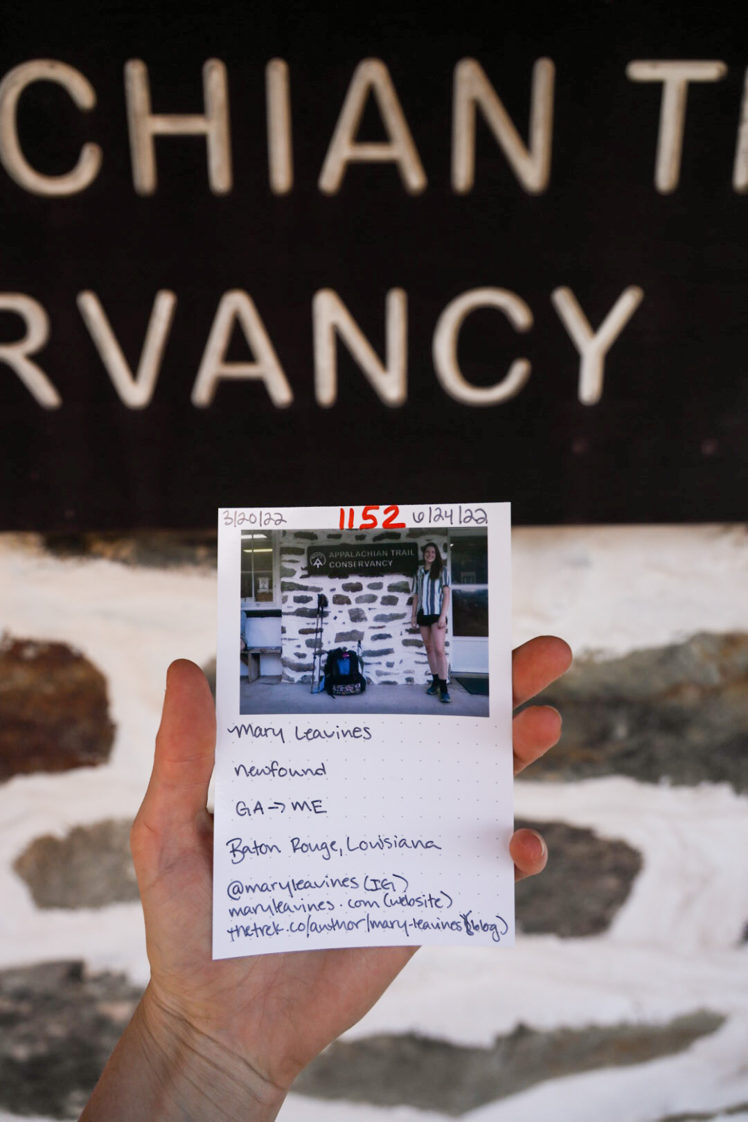
On day 96, I survived the roller coaster, passed the 1,000 mile marker, walked over the Shenandoah River, up the side of a ridge, and followed blazed to the ATC Headquarters in Harper’s Ferry, West Virginia.

As I followed the blue blazes to the headquarters, walking alone down a brick promenade shaded by large oaks, I felt out-of-body, lightheaded, disbelieving. I’d walked here. I’d walked to Harper’s Ferry, the spiritual halfway point of the trail. At just over 1,000 miles, it’s not quite halfway – but for hikers it’s a huge milestone. When you reach the headquarters, you get your picture taken, write down your name, trail name, the day you started, and where you’re headed, and tuck your photograph in a binder alongside thousands of other hikers. This tradition started in the late ’70’s:
“The tradition of taking hiker photographs began as a lark. A Polaroid camera was given to ATC staff member Jean Cashin (known to legions of hikers as “Trail Mom”) for Christmas in 1979. She decided to bring it to work and started taking pictures of hikers for fun. Over time, the practice became a standard procedure, and a numbering system was developed that serves as an informal registration.” –Appalachian Trail Conservancy
I had my photo taken and slipped my picture into the binder alongside all the other hikers. The gravity of that simple action wasn’t lost on me – by standing for a picture and writing my name, I’d joined legions of other hikers in Appalachian Trail history.
After taking my picture, I wandered around the headquarters, studying a 3D topographic map of the trail. I was stunned to see how far I’d come. The last time I’d looked at a trail map had been way back in Damascus, and I’d vowed to not look at another map since the progress I’d made then had seemed pitiful at best. But now, the little dot of Harper’s Ferry told me a different story.
I wasn’t quite halfway, but I would be in less than a week. I traced my finger over the spine of the Appalachians, tracing the same path as other hikers had done before me, judging by the worn-off paint. I could see how far I’d come. I could see the astonishing distance of how far I had to go.
I felt relieved, and terrified. Ready, and hesitant. Joyful, and thoughtful.
But, then again… I’ve made it this far, haven’t I?

This website contains affiliate links, which means The Trek may receive a percentage of any product or service you purchase using the links in the articles or advertisements. The buyer pays the same price as they would otherwise, and your purchase helps to support The Trek's ongoing goal to serve you quality backpacking advice and information. Thanks for your support!
To learn more, please visit the About This Site page.
