 ">
">
Over 100 miles hiked!
Over 100 miles hiked!
When I look at the stats of how far we’ve come next to how far we have left, it feels like barely any progress has been made. But we’re loving the journey and excited to pass these milestones – 100 miles down!
Day 9
3.5 miles to Plumorchard Gap Shelter
We hung around the hostel for most of the morning – organizing gear and hanging out with other hikers. I met 2 thru hikers who I would see continuously over the next few days: Radar, a weathered, grizzly bearded man who’s hiked the entire trail before, and Lat, an easy-going, younger guy who’s carrying a very heavy pack.
By the time we got on the trail, it was around noon. Lisa, one of the hostel’s owners, was kind enough to drive us the half mile back to the trailhead. Though it wouldn’t have been far to walk, it was alongside a semi-busy road, so we were thankful for the ride.
We kept the day easy, and did 3.5 miles to the next shelter.
Shelters are one of two ways to camp along the AT. Shelter areas include a shelter (duh), along with areas to set up tents and hammocks. There’s usually a reliable water source nearby, a privy (pit toilet), and occasionally cables or boxes to store your food. You’ll find a shelter every 8 miles or so along the trail.
The other option for camping is to stay at established camp sites along the trail. These sites are scattered throughout, and may or may not be listed on the trail map. They may (or may not) have a water source nearby. There are no other amenities.
Last week, we mostly stayed at these dispersed campsites, as the shelters weren’t always timing out right. But generally, I prefer staying in shelter areas. While I don’t care for sleeping in the shelters (too many mice), I do enjoy having a table to cook on and a place to sit/lay down/stretch out that isn’t the dirt. There’s also the hiker camaraderie that happens at shelters, and of course the escape it provides from the rain.
Day 10
12.2 miles to Standing Indian Shelter
Today was a big milestone day, as we crossed our first state line. We are now in North Carolina!
There’s a small wooden sign engraved with GA-NC that marks the border. Here is where I would share a picture of us with that sign, except I walked right past the sign without realizing, so no picture.
Much of the morning was spent climbing and walking along ridgelines at higher elevations. The wind was blowing crazy and there was a heavy fog that made for a cool (and spooky) landscape:


Radar and Lat made it to the same shelter that night, along with a couple of section hikers I’d seen off and on over the last few days.
Something I’ve encountered a lot of lately, has been the generosity of section hikers. On 3 separate occasions, I’ve been with section hikers who are nearing the end of their trip, and looking to offload their unused fuel and food. While my resupply boxes have me set on food, I’m always down for more fuel and extra snacks. And, they tend to be those money snacks – the kind section hikers can afford, but thru hikers can’t.

Day 11
16.3 miles to Long Branch Shelter
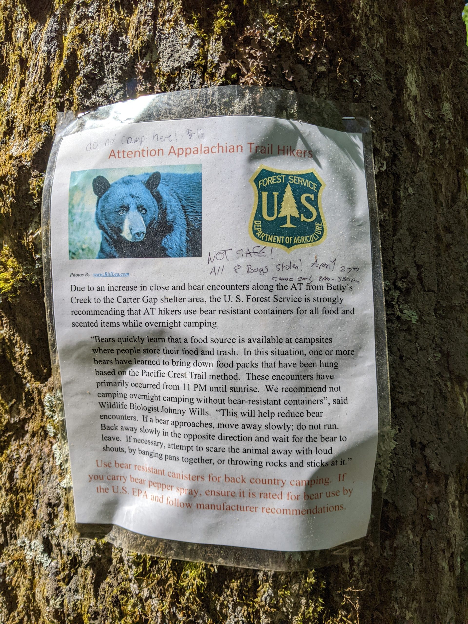
This section of trail has seen a lot of bear activity lately, so we decided to push through and camp on the other side.
While we didn’t see any bears, we did see a lot of scat, along with these wanted-style warning flyers posted around:
Our higher mileage day also let us hit another milestone. We passed the 100 mile mark! (and I got a picture this time):

Shortly before the milestone, we climbed Albert Mountain, a straight up vertical rock scramble, with an old fire tower at the top.

If you’d like, you can climb to the top of the 40 foot tower and get a better view of the valley below. But after the mountain climb we just made to get there, I was not interested in stairs. We settled for a selfie at the base instead (Bonsai was not into it):

From there, the rest of the hike was downhill (both figuratively and literally). The shelter was only a few miles away, but as the elevation dropped, my knee hurt more and more. It’s mostly been an off and on minor pain, but long miles downhill make it killer.
Day 12
7.3 miles to Gooder’s Grove Hostel
My general goal is to stop at a hostel about once a week to clean up, rest, and recover. The timing isn’t always perfect though, and because Franklin, NC was a town I wanted to stop in, we came off trail a little shy of that once a week ideal.
The town itself is about 10 miles from the trail, so Zen, the owner of the hostel came and picked us up. We made it to the gap with plenty of time to rest before he got here.

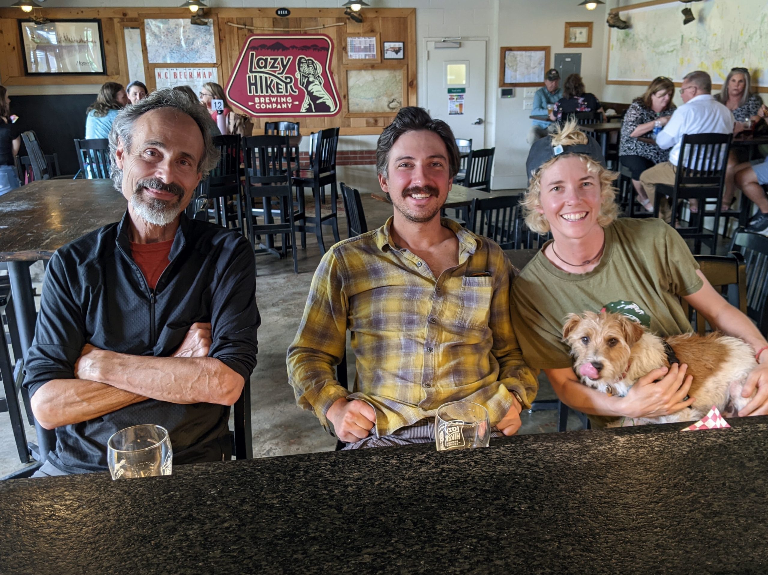
Once at the hostel, the town is only a short walk away. I went to the thrift store (new book), Dollar General (ibuprofen), and then met up at the Lazy Hiker with a few hikers for dinner and drinks (and darts). Meet Don Quixote and Sancho, two of the coolest guys on trail:
Day 13
Zero
A zero day on trail is when you don’t hike any miles. Today was my first zero day.
Initially thinking I’d only spend one night at the hostel, I reconsidered and decided it’d be best to rest longer and heal my knee. So, I took the day off. And got a massage.
A massage was something I’d been considering on trail, as I think the knee pain is due to tightness in my hip and IT band, and a massage is an effective way to relieve this. But massages are expensive and I’m on a budget.
Nonetheless, when I came off trail at Winding Stair Gap, right there waiting for me was a business card for a massage therapist. I took this as fate and booked the appointment.
The massage was called the “Hiker’s Relief Package”, and focused on loosening up all of those tight, over-used hiker muscles. I left feeling brand new.
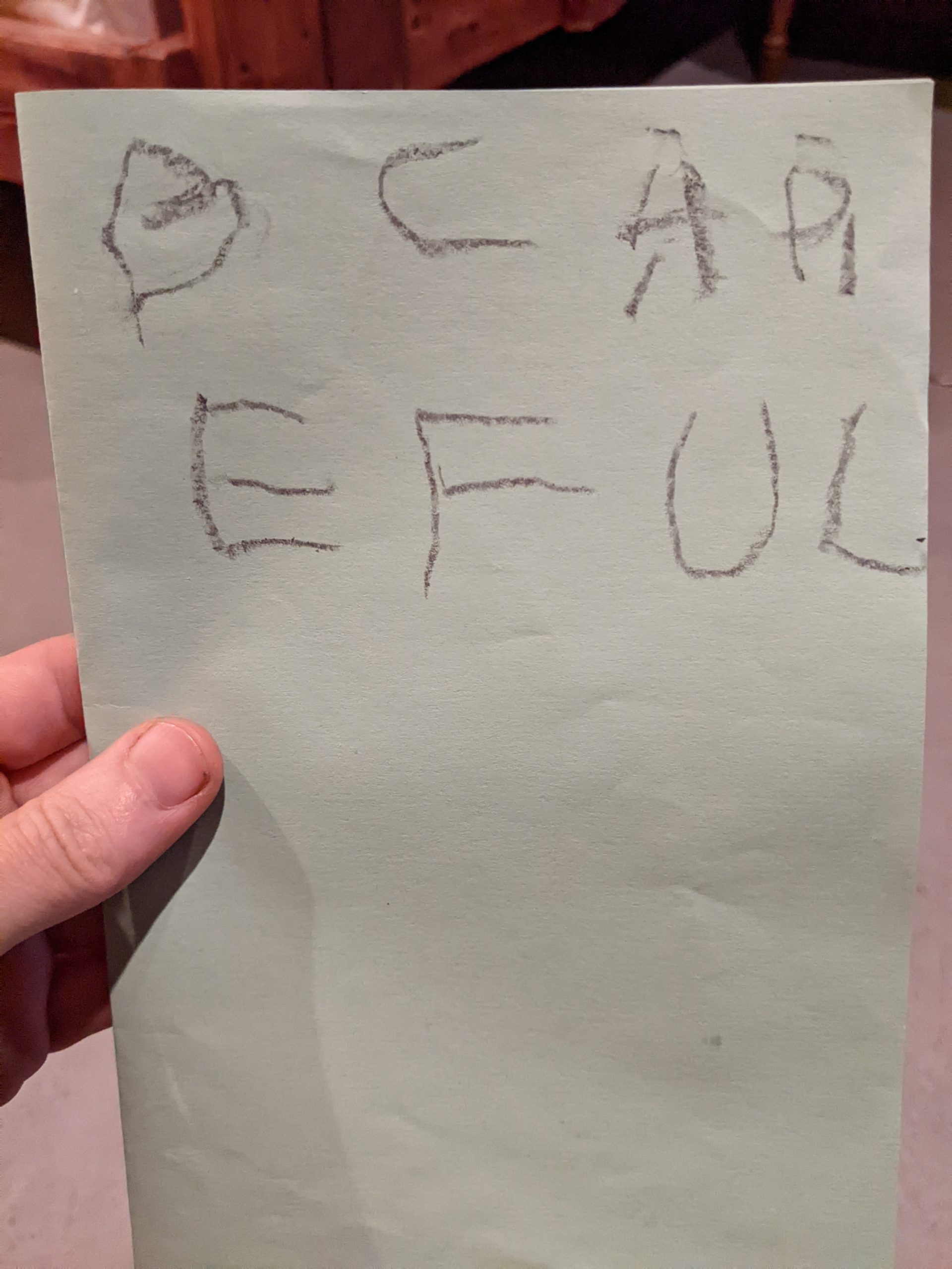
Each week, I get a resupply box sent to the hostel I’m staying it. It’s mostly food and supplies for the upcoming week, but my family has also been throwing in some surprise treats. Opening up the box and seeing what my nephews sent me has become something I look forward to each time.
Carson sent a sweet (ominous) card:
And Mason sent a dope necklace. He designed it to be lightweight, made out of yarn and paper. Can’t wait to wear it on the trail! (Pics to come!)

This website contains affiliate links, which means The Trek may receive a percentage of any product or service you purchase using the links in the articles or advertisements. The buyer pays the same price as they would otherwise, and your purchase helps to support The Trek's ongoing goal to serve you quality backpacking advice and information. Thanks for your support!
To learn more, please visit the About This Site page.

Comments 3
You got some beautiful photographs, Ashley. The one of Bonsai on the ridge is a gem.
Blessings on your way,
Steve / pearwood
Loving this more and more. Georgia is no joke! Congratulations to you both!
Met a fellow named Deets on trail today. He was obsessed over the details of his hike. How fast, inclines etc. He said after Laurel Falls it was an ascent of 1800 feet at an incline over 520 ft/mile. Roughly the same on the way down, which is what killed my left knee. And that by this time he calculated a total elevation gain of 100,000 feet!
I had read some about the Kincora hostel on Trek (it was how I discovered Trek and your blog!)
When you come off trail there will be signs pointing you to the Boots Off Hostel. Most thru hikers seem to stop over for a night or a zero. $15 gets you a campsite (you can of course splurge on a private cabin for $60) and hot shower and a continental breakfast as well as a 6pm shuttle to town (they ring a bell and shuttle leaves from in front of bunkhouse) for resupply, and Subway/McDs. If you do the McD thing, be sure to download the app as you get free food.
After Laurel falls (before the hostel) there are some awesome campsites next to the river before the ascent, which I might have done if I had more time.
Buen Camino!