 ">
">
Over the River and Through the Woods: From Vermont to New Hampshire
Time for an update! Last week, I was in the middle of the Green Mountains; now, I’m in the foothills of the Whites. As I sit here at Hikers Welcome Hostel and look up at Mount Moosilauke across the street, it’s hard to concentrate on much else — but I’ll give it a try.
1. Midsummer
My hundredth day on trail was the summer solstice. Andrea and I had walked out from Manchester together the night before and set up at a tent site just two miles in. We got up before sunrise on the solstice and finally parted ways on Bromley Peak. It was cold and cloudy with a breeze, the temperature settling into the mid 50s. Not the best weather for a celebration of the summer sun, but I made the most of it.
The view from Bromley.
A few miles after Bromley at Peru Peak, the trail crosses the Laurentian Divide, where the Vermont Valley slopes down north towards Lake Champlain. I think it’s a shame this spot doesn’t get more attention, but I suppose since the trail crosses back to the Atlantic side after 43 miles it’s not as noteworthy as the other divide down in Virginia. It’s still kind of amazing to think that the trail passes streams that flow down to both Louisiana and Quebec, spanning the whole of eastern North America.
I trekked on into the afternoon, passing by lakes and bogs and hills and brooks. At Little Rock Pond, it started raining. And, although I’d given up on Naked Hiking Day myself thanks to the weather, I passed a whole troop of local guys who bare it all every year to mark the occasion. They claimed to be enjoying the cold breeze as they hiked around the lake, but I’m a little skeptical!

Whoever made this solstice circle, it’s beautiful.
Towards the end of the day, I passed into a wild forest full of huge white boulders and looming spruce. There were some ‘rock gardens’ where the quartzite rocks had been arranged into intricate designs — a heart, a circle, a spaceship! And at the side trail to White Rocks overlook, I found a beautiful circle of spiraling rocks and leaves and cones and bits of moss, with astrological symbols drawn around the edges. It was the first real sign of the solstice I’d seen all day, and it made up for the clouds and the drizzle as the evening set in. I stood and meditated on it for a few minutes before going down to the cliffs and breathing in the wildness of the wind and stunted spruces on the jagged white rock.
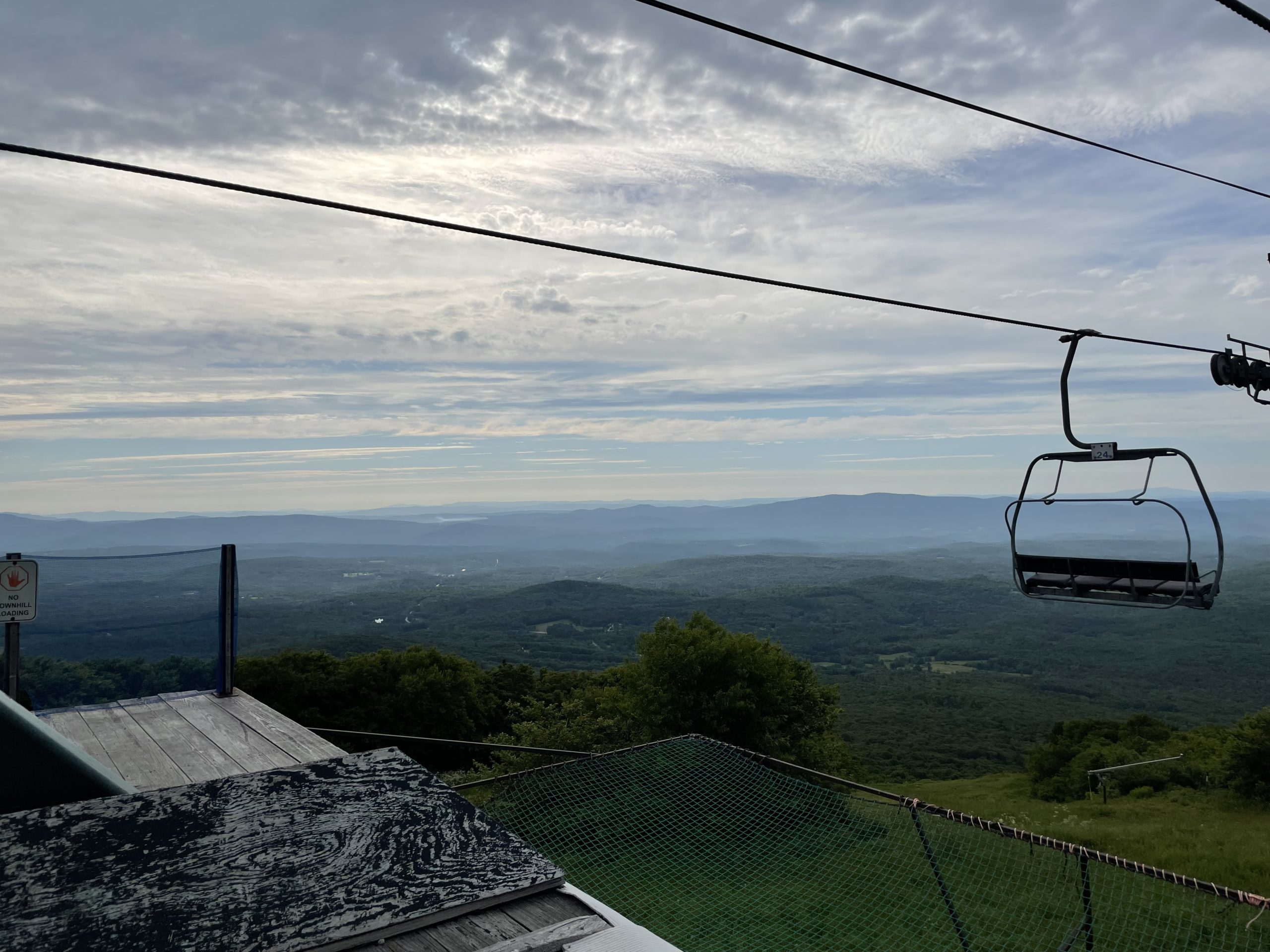
2. Killingtons
The next day, I pushed on towards Killington Peak. The first ten miles or so were gentler terrain, though some places, like Clarendon Gorge, were quite dramatic. I had some of the best trail magic I’ve seen on the trail, a delicious wild rice salad with herbs and veggies and a cooler full of local craft beer. It was another cool day, with a high of 52, and certainly didn’t feel like summer.
Around four in the afternoon, the path started climbing towards the peak. It was a long, gradual ascent of 2000 feet, becoming steeper and steeper towards the top. Finally I was up above 3800 feet, in a pure boreal forest of dense fir and spruce, shrouded in the cool mist of a cloud.

Killington peak on a cloudy day.
I dropped my pack at the shelter and climbed up a steep side trail to the summit, maneuvering over giant boulders slick with dew till I reached the bare rock face at 4000 feet. There was no view, just a howling wind and a cold fog, and the rattling of the walls on the weather tower. I stayed a few minutes to take in the scene and then started slowly back down the treacherous steep rocks.
I walked two more miles in the fading light, and set up camp at ‘Jungle Junction’ near Pico Peak. As night set in, I heard the call of a Bicknell’s thrush, a rare and elusive bird that only lives on the high peaks. I tried to catch a glimpse of it, but it was hidden in the mist, somewhere deep in the firs that waved in the wind.

The magical forest up near Pico Peak.
The next day was all downhill. I came off the mountain, crossed Route 4, and passed the spot where the Long Trail branches off to the north. I found this a little unsettling, as it’s the only place on the whole Appalachian Trail where white blazes go in two directions. You come to rely on those blazes to point you towards Katahdin and develop a sort of faith in them. Watching them point two ways felt very odd.
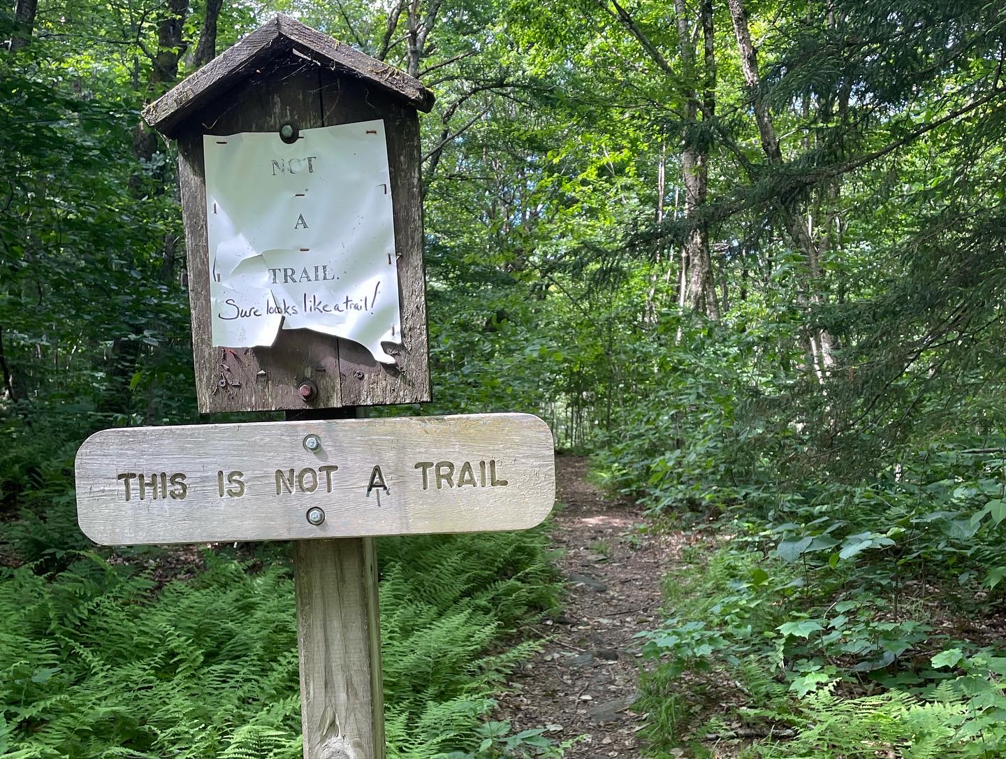
One of the paths away from Maine Junction is officially Not A Trail.
I went down from there into the town of Killington, a spread-out strip sprawling along the highway. It was one of my less memorable resupply stops, though I was able to get everything I needed from Base Camp and ducked out of the rain for a sandwich at the deli. The place was nearly a mile off the trail, a mixture of exposed road walking and the dizzying switchbacks of the bike shop’s pump track. On the bright side, I saw some loons at a nearby lake!
3. Through the Woods
Killington is the beginning of the trail’s eastward turn, where it cuts across the Vermont foothills towards New Hampshire. The hills here are lower (though they are still steep!) and the forest is not as deep. Pastures and clearcuts break through the woods, and views are few and far between.

The Lookout.
It took me about two days to hike through this section. I camped near a buggy creek the night after Killington, and some sort of animal walked back and forth all night near my tent. The next morning I was treated to a gorgeous view from the roof of the Lookout, a private cabin that’s kept open for hikers. I had another pleasant surprise that afternoon, when I stumbled across a farm stand near the town of Woodstock. They had homemade pastries and pies, ice cream, coffee and everything else a hiker might want to eat. I dug in to an excellent rhubarb pie before continuing along my way.
Late that evening I came to the White River, and the village of West Hartford. It had been a hot, sweaty day, and I jumped into the river as quick as I could. I could see crayfish scuttling along the sandy bottom, until the water became too deep for me to see. It was my first real swim for 200 miles, and it felt amazing.

The ‘Dutch Boys’, Digit and Honeybag, taking a dip in the river.
Across the bridge was the ‘blue AT barn’, which Linda, a local trail angel, keeps open as a shelter for hikers. I ran into a bunch of people I knew there, and decided to stay the night camped in the backyard. I spent a few hours chatting on the porch, hearing about how the town flooded and was almost washed away back in 2011 when Hurricane Irene came through. I left the next morning with fond memories of the place, and incredibly grateful for Linda’s hospitality. Can you imagine hosting dozens of hungry hikers every night for weeks on end?
4. Hiking to College
Around noon the next day, I went ‘over the river.’ That would be the Connecticut River, which separates Vermont from New Hampshire. Another state checked off my list, and only two more to go!
Just over the river is the town of Hanover, home to the elite and bucolic Dartmouth College. Things started getting fancy even before I left Vermont, as I walked by stately homes with perfect lawns along the streets of Norwich. After the bridge, the dress code seemed to change, and I felt a little out of place not wearing dockers.

The Dartmouth Green.
I’m very much a creature of college towns myself though, and I loved the main street with its little bookshops and cafes. I settled down at one of them to eat a few croissants, and the food was great — even though the business seemed to have a side hustle selling RFK Jr.’s conspiracy theories. Keep New Hampshire Weird, I guess.
I ambled my way through town, making my way to a Nepalese restaurant that has a hiker-friendly reputation. Funnily enough, it’s also called Base Camp! I had a phenomenal mushroom and jackfruit curry there, and felt incredibly spoiled by the food. It’s been hard to adjust back to dehydrated meals and trail mix the last few days.
Nevertheless, I eventually had to go back into the woods. I skirted the Dartmouth athletic fields and turned uphill through the maple and birch, walking a few miles until I found a site. The next day, I’d enter the foothills of the Whites.
5. ‘Little’ Mountains
I was woken up by day hikers crashing by my tent. Apparently, I was at the base of a popular mountain! After a while, I joined them, and made my way up the hill. It was a surprisingly steep thousand-foot climb to the summit of Moose Mountain, but I didn’t think much of it at the time. The day was still young, after all.
The day was also shaping up to be very hot. For the first time in weeks, I took off my shirt to hike, bugs or no bugs. At lower elevations it climbed above 90 degrees, but I’m not sure how hot it was where I was. It certainly felt like 90 in the humid air, and I was straining through sweat all day long.

Holts Ledge in the morning.
There was a deep notch between Moose Mountain and the lower, but more dramatic, hill called Holt’s Ledge. A sheer cliff face gave views to the south and west, where hills rolled down to the Connecticut and back up again to the Green Mountains. To the east, Smarts Mountain loomed high above the rest at 3200 feet.
Oh, right, and Smarts Mountain was the next one I had to go up. I found myself squinting at it, wondering why I hadn’t heard of it before. It did not look easy.

Smarts Mountain in the afternoon.
About two hours later, I found myself huffing and puffing up a very steep rock face that showed no signs of levelling off. Every now and then, the trees would clear out and I’d see the Whites stretching away in the distance. I think I could even see Mt Lafayette way off towards the horizon. Smarts Mountain may be a ‘foothill’, but it is tall, and it isn’t an easy climb.
There was a campsite at the top and I was tempted to stop, but instead I just climbed the fire tower, took in the view, and moved on. I didn’t want to get stuck climbing Mt Cube in the rain.

Mount Cube in the evening.
So instead, I climbed Mt Cube at the end of this long day, crawling up yet another 1500-foot climb. I paused halfway up to get a look at the Hexacuba Shelter, a whimsically designed six-sided structure complete with a five-sided ‘Penta Privy.’ I made dinner on the summit after sunset, and watched the stars come out over the hazy mountains down below. Then I had to climb down the steep north face by the light of my headlamp, which — let’s just say it wasn’t my best idea.
So, I had a formidable and exhausting 24-mile day, climbing over four peaks that were an ‘appetizer’ to the Whites. But I also had some of my best wildlife sightings of the trail! In the morning, I noticed a porcupine lumbering down the slope, and in the afternoon, I saw what looked like a lanky black cat clamber down one tree and up another. I walked to the base of the tree and stared up at a thin whiskered face that looked back down at me with wary curiosity. I had spotted a fisher!
After that long day, I stayed in my tent till after nine as the rain poured down outside. It was hard to get going, and the damp warm rain soaked me through as I trudged down the trail. I was so sore and tired from the previous day that the eleven miles to the hostel seemed endless. Somehow I didn’t get in till nearly three.
And now, fattened up with a pint or two of ice cream and rested with a good night’s sleep, I’m looking up at Moosilauke across the way. Did you know it’s a 3800-foot climb from the base? In just under six miles? And it doesn’t get any easier from there?
I’m planning to hit the trail in about an hour. Wish me luck!

This website contains affiliate links, which means The Trek may receive a percentage of any product or service you purchase using the links in the articles or advertisements. The buyer pays the same price as they would otherwise, and your purchase helps to support The Trek's ongoing goal to serve you quality backpacking advice and information. Thanks for your support!
To learn more, please visit the About This Site page.
