 ">
">
AT Part Ten: The Road to Katahdin
Mount Success, NH, to Mount Katahdin, ME
Distance: 283.7 miles
Total distance: 2,192 miles
I reached the peak of White Cap Mountain on a clear, sunny morning. After taking a moment to admire the view, I proceeded down the trail and around a bend.
That’s when I saw it.
Katahdin.
The mountain seemingly rose out of nowhere to dominate the surrounding landscape. I knew that I was still 70 miles away, but it felt close enough to touch.

As I stood there gazing at the hill in the distance, it took a minute for the notion to fully sink in: my journey on the Appalachian Trail was coming to an end.
The Longest Mile

If I was looking for some relaxation after conquering the White Mountains of New Hampshire, I would not find any in Southern Maine. A few miles after crossing the Maine border, I entered the infamous Mahoosuc Notch, a jigsaw of giant boulders that stretched for over a mile.
Even though the area was in the midst of a heat wave, I could feel it was easily 30 degrees cooler in the notch. I even found patches of ice in the deepest crevasses.
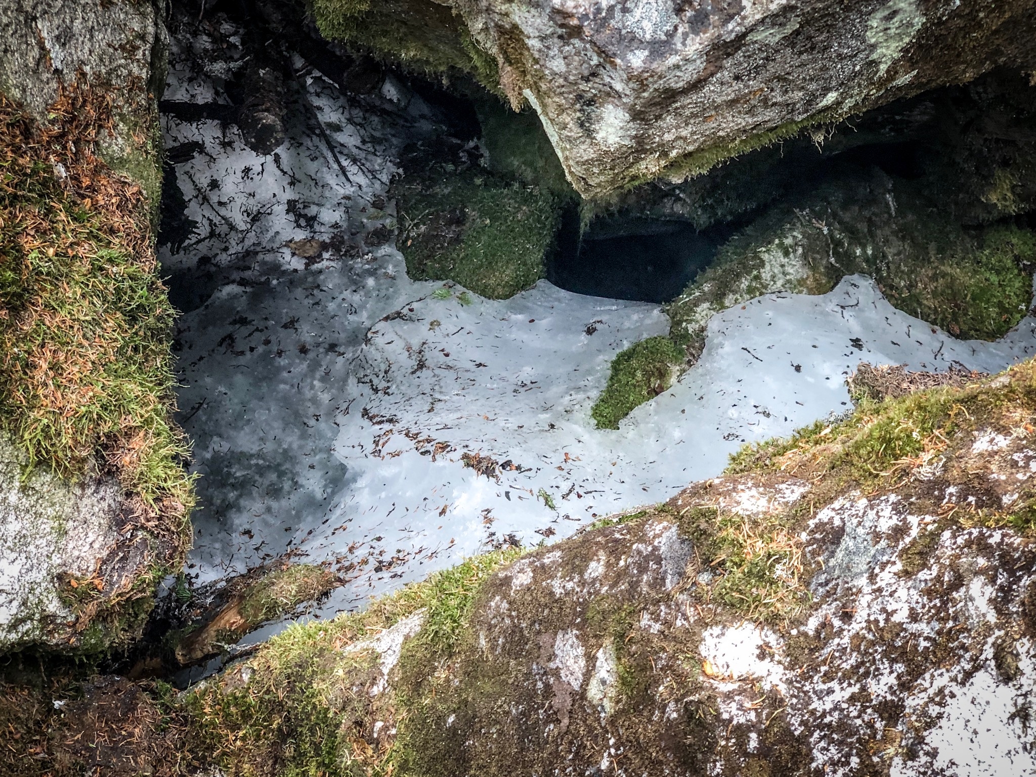
It was almost 90 degrees outside, but cold as ice in the notch.
Some consider Mahoosuc Notch to be the hardest mile on the AT. Scrambling over, under, and through the massive rocks was taxing, but it was also a lot of fun.
I felt the hour it took to get through went by pretty fast.
Crossing the Bigelows and 2,000 Miles

The rest of Southern Maine was a series of rugged climbs and incredible views. One of my favorite sections of the entire trail was hiking above treeline over Saddleback Mountain and The Horn.

I hit the 2,000-mile mark just before the town of Stratton. It definitely felt like a big accomplishment, and I really started to feel like I was on the homestretch.

The Bigelow Mountain Range proved to be another tough but rewarding section. I was surrounded by dramatic cloud formations when I crossed over West Peak and Avery Peak, but made it through mostly dry.
My favorite part of the Bigelows was knowing that they were the last peaks over 4,000 feet until Katahdin.
Maine: The Way Life Should Be

It was pretty impossible not to fall in love with the raw beauty and pristine wilderness of Maine.
I sat on mountaintops feasting on wild blueberries during the day and listened to the haunting calls of loons at dusk. I forded gentle streams and passed through dense pine forests that were dark as night.
Ponds and lakes grew more and more plentiful as I traveled farther north. Nearly every day I found an amazing spot to go swimming.

Lounging on a sandy lakeside beach, the world silent except for the gentle lapping of the waves and the occasional buzz of a dragonfly, I tried my best to keep any thoughts about the future at bay.
I found myself in a paradoxical situation: I desperately wanted to finish my hike, yet at the same time didn’t want it to end.
Into the Wilderness

After taking a zero to rest and resupply at Shaw’s Hiker Hostel in Monson, I started the final push to Katahdin by entering the 100-Mile Wilderness. A welcoming sign reminded me that it was the most remote section of the Appalachian Trail.

As remote as the area was, I never felt alone. Aside from fellow thru-hikers, there were a number of day hikers and large groups of backpackers trekking through the area.
Once I passed White Cap Mountain, I continued to catch glimpses of Katahdin. My excitement and nervousness elevated as the mountain grew closer.
Navigating Baxter State Park

Baxter State Park has some strict rules about how many thru-hikers are allowed to camp at The Birches–the last shelter before Katahdin. Luckily, I had an amazing friend who drove up to meet me outside the park at Abol Bridge, so I avoided the need to claim a spot there.
I knocked out the ten-mile section of the AT between Abol Bridge to Katahdin Stream Campground while my friend found us a place to stay in the park. It was at a campsite over an hour’s drive from Katahdin Stream, but it didn’t matter. I had just five miles left to complete my thru-hike.
That evening, my friend prepared a celebratory pre-summit feast while I tried my best to relax. I didn’t get much sleep knowing where I was headed the next day.
The Final Summit

The next morning we drove back to Katahdin Stream Campground. I glanced up at Mount Katahdin to find its peak engulfed completely in a cloud.
It was going to be a wild finish.
Although the climb was incredibly steep and slippery, I had a nearly empty pack and was running on pure adrenaline. I basically floated up the trail.
As I neared the peak, the wind and rain really started whipping across the rocks. The temperature dropped. I quickly found shelter behind a bolder to put on another layer of clothing.
I eventually reached the tableland, a flat section one mile before the summit. Visibility was poor, but at least the rain had stopped.

I passed by other thru-hikers on their way back down and we congratulated each other. After what seemed like an eternity, I finally could make out the summit sign in the distance.
I felt a lump in my throat.
Over the past four and a half months, I spent many nights lying awake in my tent visualizing what it would feel like to touch that sign. I imagined myself tracing the rough, engraved white letters of “KATAHDIN” with my finger.

Before I climbed on top of it, that’s exactly what I did.

This website contains affiliate links, which means The Trek may receive a percentage of any product or service you purchase using the links in the articles or advertisements. The buyer pays the same price as they would otherwise, and your purchase helps to support The Trek's ongoing goal to serve you quality backpacking advice and information. Thanks for your support!
To learn more, please visit the About This Site page.

Comments 2
I’m excited to read your experience on the A.T.! I lived in Maine for 15 years and only ever hiked Cadillac Mt, Saddleback and other local hikes. Not sure why I didn’t tackle Katahdin. It would’ve been much “easier” back then (17 years ago). Now I live in Fla and will have to fly up to Maine… I’m going to do the Maine leg of the AT w my boyfriend who will be doing the whole trek starting in April.