 ">
">
Shaking It Down in AT Prep Town: Part Two
Welcome to the second installment of my blog miniseries, in which I talk your ears off — eyes out? — about a few more hiking trips I’ve done with my adventure partner, Garrett, over the past year or so. (Here’s part one, in case you missed it.) These trips were a little bit about physical prep/just getting out there and hiking, and a lotta bit about testing gear for the thru-hike we’ve been dreaming of and planning for. Included are some details about a couple of overnight adventures, gear test updates, why all thru-hikers (false: everyone on the planet) should go to Shaw’s Hiker Hostel in Monson, ME, and my encounter with the biggest horde of mosquitoes EVER! Read on, friends.

It’s wicked friggin’ scenic out there bub! (That’s my attempt at Mainer speak for yah.)
Overnight in the 100-Mile Wilderness (6/1 – 6/2/18)
After returning to Maine (following the LHHT experience) with the start of our summer jobs mid-May, we quickly decided to organize another little jaunt into the woods. This planning coincided with the long-awaited arrival of our new packs from Superior Wilderness Designs (SWD). We were almost desperate to throw them on and get a feel for them.
An overnight trip was the answer. New and exciting trail lay ahead for Garrett, while I could reconnect with a familiar stretch on the AT. We’d hike north from the Pleasant River ford to the Carl Newhall Shelter in the 100-Mile Wilderness. For those who aren’t familiar, the 100-Mile Wilderness in Maine is the last stretch heading north toward the summit of Katahdin, the AT’s Northern Terminus. Between Monson and Abol Bridge (100 miles), there are very limited roads and no real resupply points for food, supplies, etc. Nowadays though, you could arrange to have a food drop about halfway if you can spare the cash. Regardless, it’s a section of trail billed as one of the most remote and potentially dangerous on the AT.

Truly beautiful and pristine acreage stretches as far as the eye can see along the trail in the 100-Mile Wilderness.
Even having hiked its entirety in 2015, the 100-Mile Wilderness remains a respectable challenge. Add in a vehicle and directions to an obscure gravel road that crosses the AT within this section, and you’ve got a recipe for a fun, manageable, and beautiful out-and-back excursion. At just 5.6 miles from car to shelter, we weren’t overly concerned about timing. Immediately after we strapped on our packs, an afternoon storm rolled overhead, unleashing a torrent of rain, thunder, and lightning. Fun times when you’re fording a river! Though the thunder and lightning quickly moved off, the rain continued most of the way up to the shelter. We arrived quite soggy — wet from rain and sweaty from the humid warmth of the day.
Gear Notes
Our SWD packs are made with water-resistant fabric and we did not seam seal them, so they did get soaked externally. There was also a bit of dampness inside the packs. No complaints, though; the compactor trash bags we used to line our packs kept all of the essentials dry. Reminder: This pack is my backup/alternate for the AT due to its extensive capacity with my current gear lineup.
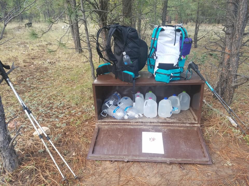
Our SWD packs are ready for anything. (Seen here not in Maine, but in Arizona.)
The impromptu storm gave us a chance to really see how effective our rain gear was. Over the previous winter, I snagged a discounted Outdoor Research Helium II rain jacket off the REI Outlet. Despite a ton of hikers and randos on the interwebs harping about the OR Helium II not having pit-zips, I really love this jacket. It’s kept me dry, and it blocks wind like nobody’s business, plus the teal color is rad as shit. Final thoughts: It’s definitely a keeper on the list for our AT thru-hike this year.
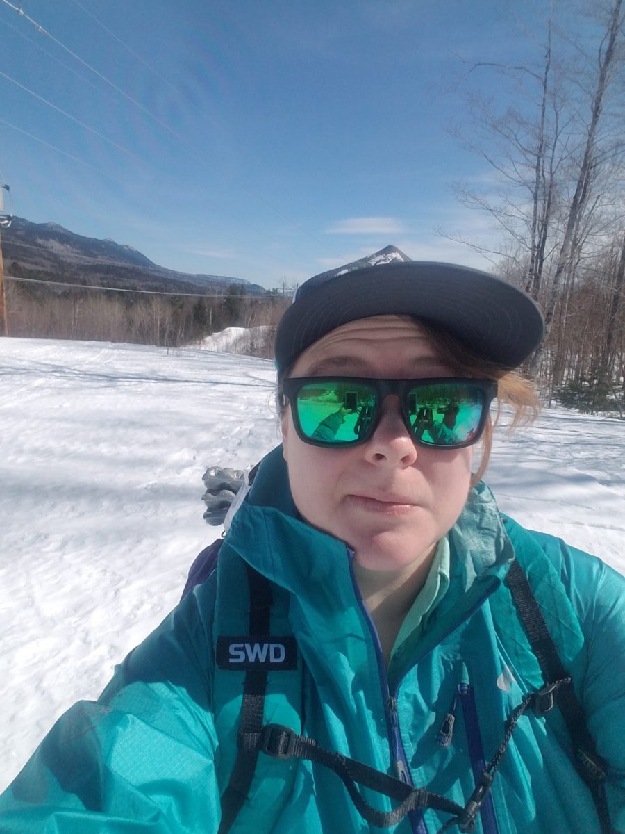
Rockin’ it. (March 2019, on a loop hike accessible behind our house.)
I was similarly trying out a Swing Trek Liteflex umbrella (found on Amazon), and a Mountain Laurel Designs (MLD) rain kilt. I’ll be bringing the MLD rain kilt on the AT, especially since it only weighs a couple of ounces. The rain skirt/kilt will work better than full-on rain pants for me, as I tend to sweat a lot and I’d rather be wet from rain and keep air movement instead of melt inside a pair of pants. Found this out on the AT in 2015 while trying to deal with days of rain in Georgia in the full Frogg Toggs rain suit. To hell with that!

Straight outta Hot Springs, 2015. Whole lotta nope. Photo cred: Twister ;P
In terms of the umbrella, I am not fully committed to it yet for the thru-hike. We’d initially bought them with the intention of hiking the PCT this year, not the AT, where an umbrella as a sunshade made a ton of sense. With a good rain jacket and rain skirt, there isn’t much need for an umbrella, aside from protecting my non-waterproof pack and keeping my upper body dry. We’ll see. If anyone has solid reasons for including an umbrella on a gear list for the AT, let me hear them so I can make up my mind.
Gulf Hagas Loop
Our second day of this out-and-back trip was about ten miles. Backtracking south on the AT to the Gulf Hagas junction, we took the blue-blazed side trail and followed its winding track to the old Pleasant River Tote Road, eventually merging with the Gulf Hagas Rim Trail. We began trekking back toward the AT along the river’s edge, climbing with the rise and fall of steep, rocky embankments, which dropped away on our right down to the water.

This trail was moderate to difficult due to quick and dirty elevation changes, as well as numerous sections of slippery rocks and roots. Definitely not made easier when we encountered several humongous blowndowns, having to slog around and over giant trees through cold mud and deep puddles from the prior afternoon’s monsoon.
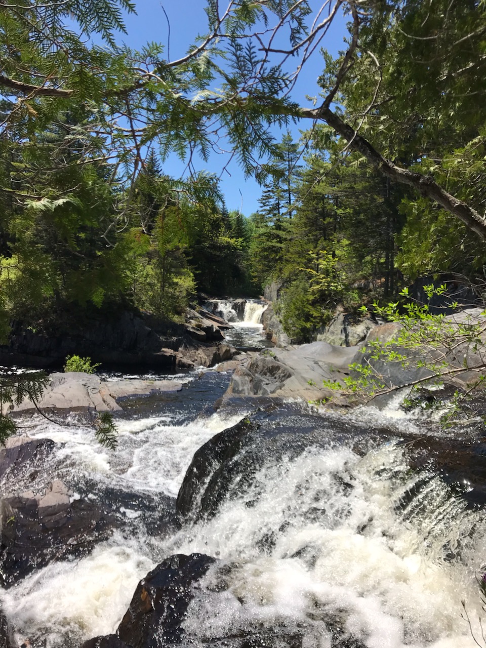
Photo cred: Garrett
The takeaway of this trail is the many vistas and craggy outcroppings, from which gorgeous views abound as you look out at various waterfalls and down into the surging river below. Now go out there and chase some Maine waterfalls!

I spy with my little eye… a Garrett on a rock!
Get Your Boots and Booty to Shaw’s
Another reason we picked/I pushed this area of trail was the exciting prospect of crashing for a night at Shaw’s Hiker Hostel and devouring the epic breakfast whipped up by Poet, one of the owners. Shaw’s is a long-standing AT hostel in Monson that holds many fond memories for me from 2015:
Meeting owners Poet and Hippie Chick and experiencing their amazing openness, friendliness, and hospitality, as well as the Poet pack shakedown (entertaining and informative).
Meeting early northbounders within a week or so of them finishing,
Spending time with bold southbounders who had made it through the trials of the 100-Mile Wilderness right out of the gate.
Finding new trail family (tramily) members as a result of spending several days in Monson.
Legendary breakfast. Do not miss it.

Poet at Shaw’s, 2015.
Reconnecting with friends in the trail community tends to have that “returning home” feeling; it’s hard to explain, but it’s awesome.
Overnight on the Cutler Coast (8/6 – 8/7/18)
Early August saw us out on Maine’s Bold Coast within the Cutler Coast Public Reserved Lands. Close enough to the Canadian border that our phones tried to tell us that we were, in fact, in Canada. The Bold Coast’s network of hiking trails follows a rocky shoreline that overlooks the Gulf of Maine, and the Bay of Fundy to the north.

Camping spots are limited to specific areas in an effort to keep damage to fragile ecosystems at a minimum. Snagging one is based on a confusing combination of filling out a sign-in sheet itinerary at the trailhead and the last one to a tent site is a rotten egg. We saw more people camped out at different tent areas than were listed on the sign-in paper. In favor of taking a spot we luckily came across instead, we ended up not pressing on to our planned destination (which only had three sites).

Check out that tent site, yo! Photo cred: Garrett
Gear Notes
The main thing we were logging more miles with on this overnight was our LightHeart Gear Duo tent, and the SWD packs. The tent was a challenge to set up at our selected site due to soft terrain that wouldn’t hold our tent stakes, but it wasn’t the tent’s fault. Navigating the tent became a noticeable struggle with both of our sleep systems ready and gear inside — especially for Garrett, who has flexibility issues. This trip was the beginning of the end for our Duo, though we didn’t really know it at the time. I’ll chat more about this in the next and final miniseries post.

Trade-off for a nice view is no privacy.
Mosquito Horde from Hell
This hike left us with endlessly gorgeous views of rocky coastline, unspoiled coves, and turquoise waters. Unfortunately, we also encountered a mass of needle-nosed bloodsuckers that numbered in the hundreds. Never have I seen that many droning around an area at the same time. The trek out to camp had been a stagnant one, very hot, with no breeze to speak of. Strange for a hike along the ocean coastline. We had dinner on a small pebble beach near camp and finished up around dusk. Perhaps the heat kept bugs at bay, but once the sun began to disappear it was like a switch had been flipped.

The inlet where we camped in morning light, sans mosquitoes.
The return to our tent after eating and cleaning up for the night was a battle amidst the trees. I suffer on a regular basis from being overly attractive to mosquitoes, and this night was exceptionally bad. Hundreds within a thick swarm poked and bumped into the mesh door on my side after I dove in. Effectively trapped inside, we watched the bugs corral themselves between the half-open vestibule wall and main body of the tent. I’ve read horror stories of mosquito swarms on the AT when weather conditions are just right, but nothing I dealt with in 2015 even comes remotely close to this experience. Fingers crossed we’ll avoid thick mosquito clouds on our thru-hike, but with my luck, probably not.


This website contains affiliate links, which means The Trek may receive a percentage of any product or service you purchase using the links in the articles or advertisements. The buyer pays the same price as they would otherwise, and your purchase helps to support The Trek's ongoing goal to serve you quality backpacking advice and information. Thanks for your support!
To learn more, please visit the About This Site page.

Comments 2
What a great post. I am going to save and re-read several times. Bravo! Well written.
Why I keep an umbrella — for rain simply, no matter when–rain in cold and even with the best rain jacket, the rain on the shoulders sure lowers my core temp.
But maybe that is just me.
Regardless, keep up the good work.
Well done
Really enjoying your informative and entertaining blog! Your pictures are great and effectively enticing … the beauty of the land and seascapes you are privileged to enjoy on your hikes truly inspires a love of nature and a real desire to protect our wilderness areas. Thanks for sharing 🙂