
 ">

Six Southern AT Sections Worth Hiking Again and Again
This is a guest post by Amber and Josh Niven. The Nivens latest guidebook, Hiking the Appalachian Trail through Georgia, North Carolina and Tennessee, is out now.
From Springer Mountain in Georgia to Damascus, Virginia, the Appalachian Trail winds through more than 470 miles of the South: grassy balds, rhododendron tunnels, rugged peaks, verdant valleys, salamanders, misty mountains, Cherokee heritage, Civil War history, and small towns worth slowing down for. With that much trail to love, how do you choose where to start?
Whether you’re new to the AT or a trail nerd like us, here are six sections we keep returning to. Come in May for wildflowers or October for the leaves. Winter opens up the views through bare trees and thins the crowds. Summer means lightning bugs and cold creek crossings. Pick your season, pick your trailhead, and go!
Springer Mountain to Neel Gap
If you’re going to start somewhere on the AT, why not start at the beginning?
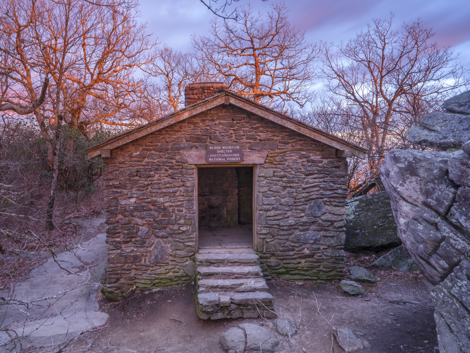
Blood Mountain
Springer Mountain is where the whole 2,180+ mile story kicks off for many hikers. Even if you’re only here for a section, there’s something about standing on that summit that gets under your skin.
The trail rolls through deep forest, crossing streams and climbing ridges, with Ramrack Mountain, Preaching Rock, and Big Cedar Mountain all serving up open ledges and wide views along the way.
Then comes Blood Mountain, Georgia’s highest point on the trail at 4,458 feet, named for a battle between the Creek and Cherokee nations that, legend has it, left the slopes red. The views from the top are worth every step, and the old stone-walled shelter up there is the oldest still standing on the entire trail. From the summit you drop down to Neel Gap, where Mountain Crossings outfitter sits directly on the trail. Their staff is friendly and know their stuff!
With six shelters and several road accesses, you can stretch this into a laid-back multi-day trip or chip away at it in pieces. It’s an excellent introduction into backpacking but demands fitness.
Distance: 31.3 miles
Difficulty: Moderate due to steep ascents and descents
Trailhead GPS: 34.637467, -84.195317 (Springer Mountain parking area)
Nearest Trail Town: Dahlonega, GA
Good to know: The southern terminus of the Appalachian Trail is accessible solely on foot, hikers need to walk south for 0.9 miles from the Springer Mountain Parking lot to reach the summit, then retrace their steps to trek north. Both the eastern and western routes to the USFS 42 parking lot are rough roads and spring freeze/thaw cycles may develop ruts that make driving risky.
Winding Stair Gap to Tellico Gap
A picturesque high-elevation stretch along the main ridge of the Nantahala mountain range, steeped in Cherokee history.

Siler Bald. Photo: Joshua Niven
This segment of the AT balances historical landmarks with some of the best panoramas in the Southern Appalachians.The standouts are Siler Bald and Wayah Bald, both wide-open summits with expansive views.
Wildflower lovers should keep an eye out for flame azalea, fire pink, evening primrose, and bee balm. In July and August, wild blueberries and blackberries ripen, becoming one of the better trail snacks you’ll find anywhere on the AT. Frequent road crossings and trail junctions make this section easy to customize for your pace and group size.
Distance: 19.4 miles
Difficulty: Strenuous due to distance and numerous ascents and descents.
Nearest town: Franklin, NC
Trailhead GPS: 35.1196, -83.548
Good to know: Bear cables or boxes are not available throughout his section. Due to numerous close and serious bear encounters, it is strongly recommended to use bear-proof containers for food storage.
Fun Fact: Wayah, which translates to “wolf” in Cherokee, is the namesake of Wayah Bald, honoring the red wolves that once roamed this region. Archaeological evidence reveals indigenous hunting grounds dating back more than 11,000 years, with ancient spear points offering a glimpse into that history.
Botanists have attributed the open balds to a combination of acidic soil, toxic root systems, and grazing by large herbivores like elk and woolly mammoths. Cherokee lore, however, offers alternative explanations. One story recounts how the Great Spirit used lightning to vanquish a giant hornet that threatened the land. Another legend tells of the Nunnehi, eternal spirit beings who maintained these clearings to aid in eagle hunting for rabbits.
Newfound Gap to Davenport Gap
Journey through the heart of the Great Smoky Mountains along one of the most rugged and rewarding stretches of the entire Southern AT.
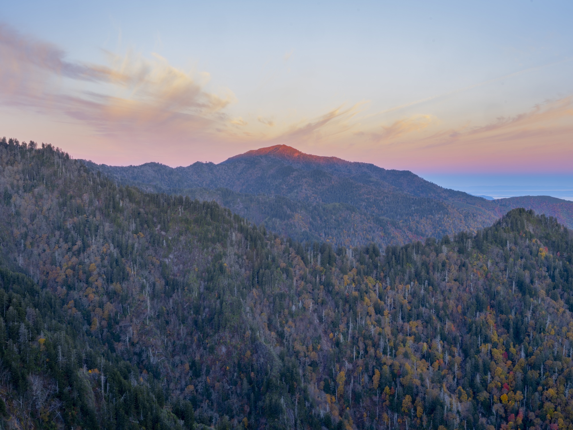
View from Charlie’s Bunion. Photo: Joshua Niven
This section earns its reputation. Charlies Bunion, a dramatic rocky outcrop early in the hike, delivers breathtaking views of surrounding peaks and valleys. The landscape is especially stunning in fall color. Hughes Ridge offers a chance to reflect on Cherokee heritage woven into the landscape. And the climb to Mount Cammerer’s historic fire tower is worth every step, with views that stretch in every direction.
From exposed rocky ledges to dense old-growth forest, the terrain stays wild throughout, with a majority of the hike above 5,000 feet. Total elevation gain runs roughly 4,600 feet if hiking northbound, more than 7,650 if hiking south. Plan your food and water carefully, and give yourself extra time on the climbs. There are four shelters spaced throughout this stretch.
Distance: 31.4 miles
Difficulty: Strenuous due to distance and high elevation exposure.
Trailhead GPS: 35.6112, -83.4257
Nearest town: Gatlinburg, TN
Good to know: This is a very popular day-hike destination as Charlie’s Bunion is only 4 miles away from Newfound Gap. Expect crowds. Overnight permits are required to camp within the Great Smoky Mountains National Park. Restrooms are located at the Newfound Gap trailhead
Fun Fact: On September 2, 1940, President Roosevelt formally dedicated the Great Smoky Mountains National Park at Newfound Gap “for the enjoyment of the people.”
Before becoming a park, the land was held by Cherokee communities, local farming families, and timber companies. The Smokies was the first national park in the US to require fundraising and the purchase of land from private owners. The Rockefeller Memorial along the AT’s path commemorates the many people, including the Rockefeller family, who donated land and money to make it happen.
Max Patch to Hot Springs
From stunning panoramic views to one of the friendliest trail towns, this section is great for wildflower enthusiasts, families and beginner backpackers.
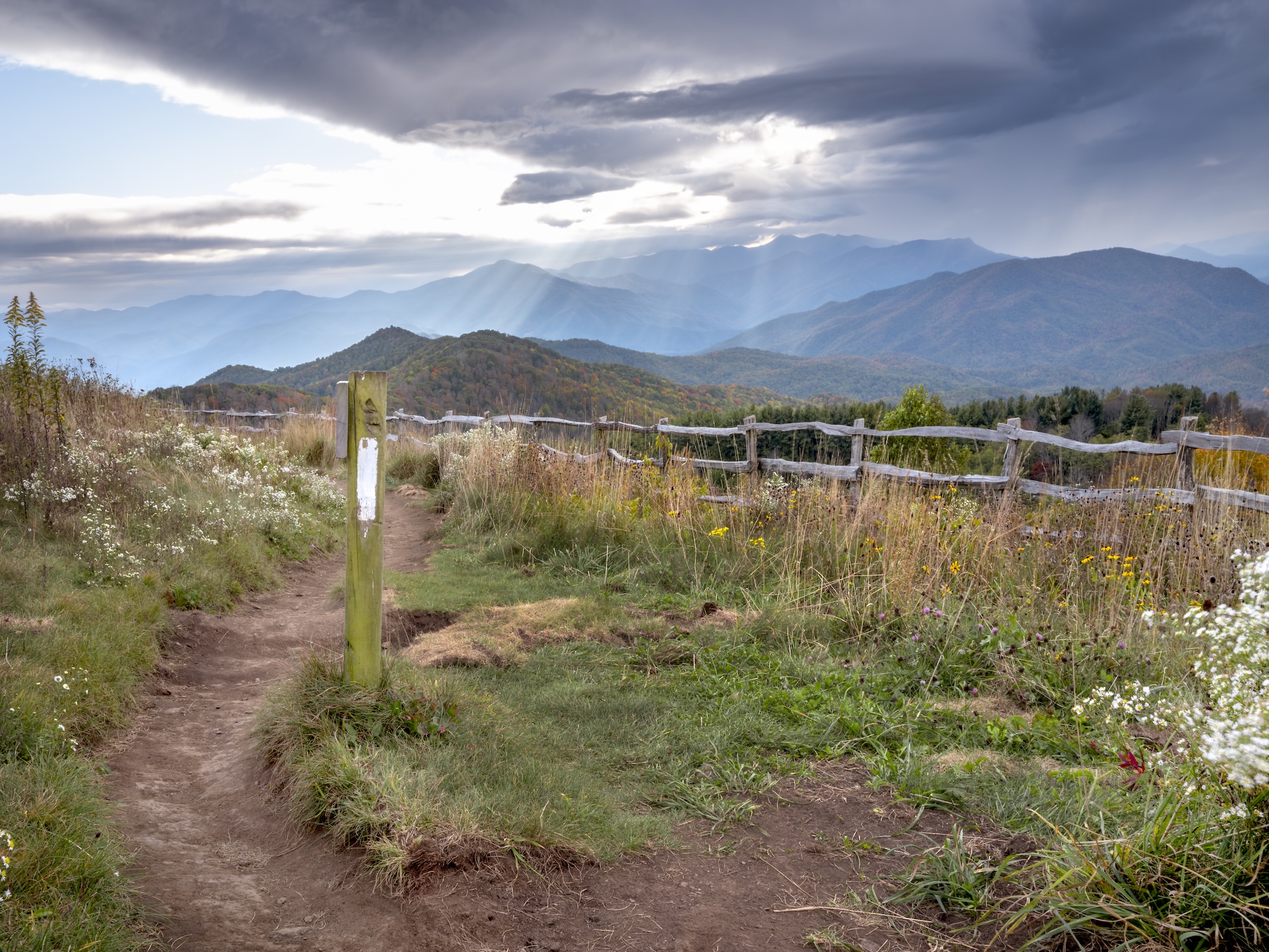
Max Patch. Photo: Joshua Niven
The undeniable highlight of this section is the 4,629 ft. summit of Max Patch, a sweeping grassy bald with views of surrounding mountain ranges such as the Great Smoky Mountains, the Black Mountains, and Mount Mitchell. It’s the kind of place that welcomes lingering.
The trail undulates in and out of gaps, roaming through forest, and across the wooded summit of Bluff Mountain before a long descent into Hot Springs, a historic trail town with deep AT roots. Finish on Main Street, where you can grab a meal, soak in the natural hot springs, or browse the shelves at Bluff Mountain Outfitters.
With several good campsites and shelters along the way, this section is easy to stretch into two or three nights, making it a good fit for families or newer backpackers who want to take their time.
Distance: 20.5 miles
Difficulty: Moderate with challenging, lengthy descent.
Trailhead GPS: 35.796, -82.9627
Nearest trail town: Hot Springs, NC
Good to know: There are shuttle services available in Hot Springs. Check-in with Bluff Mountain Outfitters. If you plan to leave a vehicle at the Max Patch parking area, avoid driving without four-wheel drive after heavy rain or snow. The gravel access road can become muddy and dangerous.
Carvers Gap to Highway 19E
Trek across five summits rising above 5,400 feet, each with views that make the climbing worth every bit of effort.

Roan Highlands. Photo: Joshua Niven
The hike begins at Carvers Gap, where rhododendron tunnels open onto the wide grassy balds of Round Bald and Jane Bald. Enjoy panoramic views in every direction.
In June and July, Catawba rhododendron and flame azalea paint the balds in deep pink and orange, drawing crowds that are entirely warranted. Peak bloom typically falls around mid-June.
The trail skirts the shoulder of Grassy Ridge before descending into valley terrain, passing the former Overmountain Shelter along the way. Total elevation gain is approximately 2,500 feet northbound and 5,000 feet southbound.
Come prepared for fast-changing weather. Much of the route runs at high elevation where temperatures typically run 10–15°F cooler than in the towns below, and snow is possible into early spring.
Distance: 14.8 miles
Difficulty: Moderately strenuous due to numerous climbs.
Trailhead GPS: 36.1068, -82.1106
Nearest town: Roan Mountain, TN
Good to know: Due to local vandalism, overnight parking at Hwy 19E or Bear Branch Road is not recommended. Arrange to leave your vehicle at either nearby hostel.
Fun Fact: The original route of the AT did not include the Roan Highlands. We have Stan Murray to thank for his leadership alongside the U.S. Forest Service in rerouting the AT across the balds. Murray served as the ATC chairman from 1961 to 1975 and later founded the Southern Appalachian Highlands Conservancy. A plaque located on Hump Mountain honors him, where his ashes were scattered.
Dennis Cove Road to Wilbur Dam Road
A visually diverse stretch of sheer rock walls, cascading falls, lake views, and striking geology.
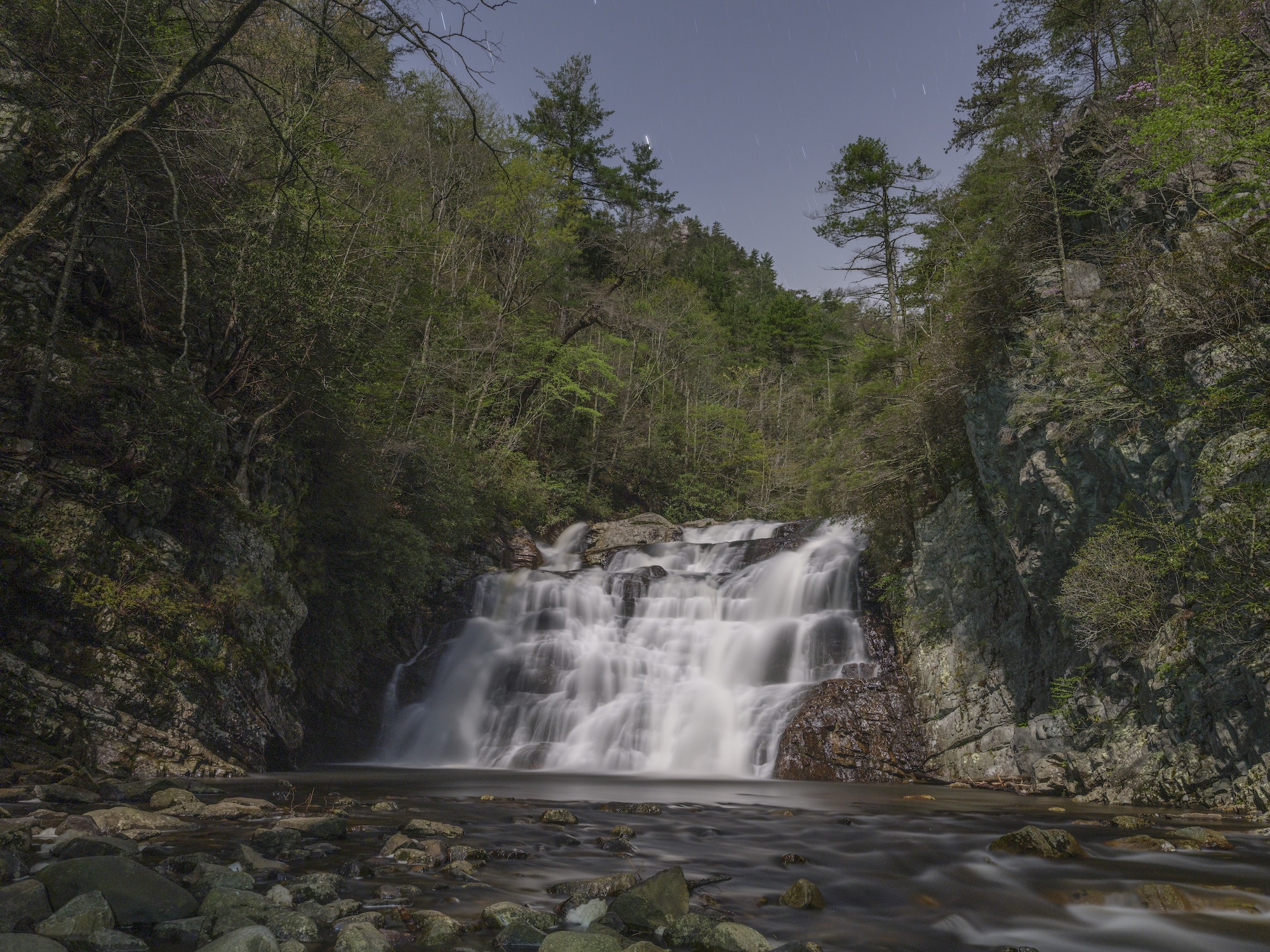
Laurel Falls. Photo: Joshua Niven
This 13-mile section in the Cherokee National Forest packs a lot in. The route traverses the rugged gorge of Laurel Fork, where sheer rock walls and rushing rapids frame the trail before reaching Laurel Falls. Geologists will want to linger near the quartz veins and thrust faults that are exposed throughout the canyon walls.
Wildflowers line the trail corridor in spring and summer, and the riverside terrain offers some of the best hammock camping on this stretch of the AT. The hike wraps up at the Shook Branch Recreation Area along the shore of Watauga Lake, finishing with a walk across Watauga Dam and the wide lake views that come with it.
Distance: 13 miles
Difficulty: Moderate but challenging due to rugged, rocky terrain.
Trailhead GPS: 36.264150, -82.123260
Nearest trail town: Hampton, TN
Which of these sections have you hiked? Which ones are still on your list? Let us know in the comments.
About the Authors
Amber and Joshua Niven are co-authors of the Appalachian Trail guidebook series from Falcon Guides. Their latest, Hiking the Appalachian Trail through Georgia, North Carolina and Tennessee (2026), covers every mile from Springer Mountain to Damascus, Virginia. Hiking through Virginia and West Virginia releases Spring 2027, with two more books in the series on the way.
The Nivens live in Madison County, North Carolina with their three children. Learn more about their books, retreats, and other creative projects at GoodMorningAppalachia.com.
All photographs by Joshua Niven. Featured image graphic design by Mackenzie Fischer.

This website contains affiliate links, which means The Trek may receive a percentage of any product or service you purchase using the links in the articles or advertisements. The buyer pays the same price as they would otherwise, and your purchase helps to support The Trek's ongoing goal to serve you quality backpacking advice and information. Thanks for your support!
To learn more, please visit the About This Site page.
