 ">
">
Staying Found pt. 1: Lost on the Lincoln Woods Trail
When we assemble enough of our gear in preparation for a thru-hike or any significant trip, we feel ready to take the show on the road and we dive right in. For me, heading out to begin my thru-hike on Springer Mountain, GA in around 10 days, I’ve been cheering for the temperature to dip below freezing since committing to my start date and have since spent many nights on my front lawn, staring at the stars and practicing with my sleep system. Along the way, I sketched out plans for something larger and truer to the experience on the AT: my first multi-day hike.
Living in New Hampshire, I naturally headed up to the White Mountains. My training grounds: the Pemigewasset Wilderness, namely the “Pemi Loop,” 31.5 miles and 9,160 feet of elevation change. In 2005, Backpacker Magazine listed it as #2 on their “America’s Hardest Dayhikes” feature. Having committed to the challenge of a thru-hike, the Pemi Loop felt aligned and harder to what I’d normally face throughout the South when starting out. It’s like me to take on the highest challenge to set my expectations that much higher. I also knew this was going to be a big outing and that I’d learn a lot. And lessons I did learn.

Entering the Pemi Wilderness.
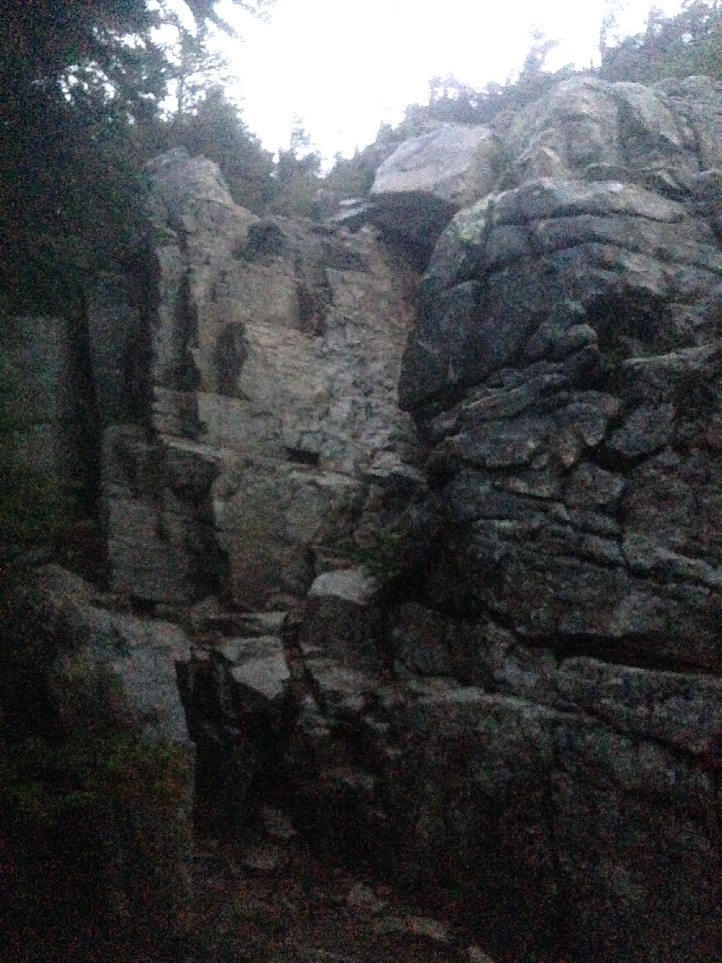
Let’s jump right to the events that made this hike a memorable one. The Pemi Loop, in either direction, begins with a flat and long pathway named the Lincoln Woods Trail. You simply follow it to a river and then find the trail, I believed. Thinking that the most challenging obstacles were those of the trail, I ended up crossing the river and it’s tricky rocks and the real adventure began.

Where there’s no trail, there should be no you.
Why was it about to get tougher? I brought a series of screen shot images on my phone for a map; I didn’t think to use a compass to help inform my location; I didn’t know the blazes to look for; I have a sense of how far I needed to go (or not go). While it was in the morning when I unknowingly went miles off trail, the darkness was already all around me: I was completely lost, bushwhacking at times, following whatever I could justify as a trail.
The first of my lessons, which in hindsight, I’d be happy learning and heading home to do in earnest: study, rehearse and bring a sufficient map and learn the basic navigational skills and tools that help unlock the mysteries of the trail you’ll encounter.

Being on “a” trail doesn’t mean you’re not lost.
After checking the boxes for “encounter with a black bear” and “5 miles of off-trail sightseeing,” I retraced my steps to where I was absolutely certain the trail existed, the last trail directional signs. Now back on the 2 mile trail that brought me to the ill-fated river crossing and finally spotting a painted arrow near it, I realized I got lost on most basic of trails to be had on the Pemi Loop, the Lincoln Woods Trail. Again, it’s flat, straight and ends with one turn, the one I missed.
Lesson: Trails shouldn’t be impossible to find. If they are, what you’re trying to go down probably isn’t the trail. For example, if there’s a pile of logs and brush blocking what you think is the trail, stop. It’s probably there for a reason. Get out the map and tools to figure out what you need to be looking for to guide your way. If not, you may experience the next lesson.
Knowing I’m about two hours behind schedule, I made the decision to continue from feeling proud that I didn’t give up. I high tail it on the trail for a few hours, sensing the light start to wane as the late afternoon drew near. I begin to hit the tree line and the views are breathtaking, knowing sights like these will be common on the AT, I’m surging with adrenaline and confident in my steps.

Feeling great, 50% of the way there with only a couple hours of light left.
At one point, I need to be confident in my vertical climbing skills to make it to the ridge I’d spend the next two hours on to reach Guyot Shelter, the spot where the Loop meets the AT itself.
Straight up to reach the ridge.
Yet, it was doomed. Dusk came quickly, the winds howled, the rain came, and I was all the sudden in a washing machine with my headlamp being the one item I could rely on at this point.

If you can see clearly for miles here, stop reading this, call me and teach me how you do it.
Lesson: Avoid hiking after dark when the weather becomes inclement, especially on a ridge, and especially when you’re not confident about the route. Doing so will likely lead to the next lesson.
The view on Bond Cliff trail along the ridge line, even with 90mph winds and rain, is truly humbling. At one point as I looked to my left and saw Mount West Bond, a dark giant looking on me, a little ant-sized thing with hiking poles, I was in awe. In the dark, though, it’s hard to get perspective on where you’re heading when seeing nothing but seven feet ahead of you. The trail felt endless and I grew more anxious along the way, pushing me to rush and leading me to question myself even more. At one point I summited one of many peaks and, being on a bald, searched for the direction. After walking to the edge of what I thought was the way, dwarf spruce told me to turn around. And I did, bringing a cairn into sight… yes! That’s the way; I proceeded to descend the peak and soon encountered a boulder that I was sure I climbed up before. It was preposterous to believe that I was going the wrong way.

Without visibility and clear knowledge of the trail, making mistakes with larger consequences are nearly certain.
Lesson: You’ll go the wrong way when you’re tired, anxious, and confused. If you continue, the next lesson will most certainly ensue.
On my way through another descent, my tired legs went too quickly for my boots to grip on a wet rock and I earned a stress fracture on my 5th metatarsal (as an under-pronating ultra runner, meaning landing your foot strike with the outside edge of your feet, this wasn’t the first time). I knew I needed to get off my feet immediately and imagined other injuries I’d get from now being tired, anxious, confused and newly unable to walk securely. I soon did a double-take on a mossy, flat area along the ridge bordered by a semi-circle of dwarf spruce, inflated my pad while winds threatened to take it and my belongings over the cliff, and tucked into my sleeping bag. The time? 6:30pm. I had over 12 hours ahead of me before dawn. This was far from what I imagined my first night to be like.
Lesson: You’ll likely get hurt when you proceed hastily. A cool, collected mind, when not carrying a GPS beacon/device, may be the only asset left at this point. Channel it and use it.
Understandably, I decided in the morning to make this a one night trip. It took me a handful of more miles of backtracking to realize that, upon reaching Guyot Shelter to the north and swearing the compass was wrong all morning (back to the first lesson), I turned around in my tracks the evening before and was heading away from the shelter last night. Frustration, yes, and also some relief to finally know where I was as I went back to where I came from the day before.

The trail back down.
Major lesson: The trail isn’t simple, straightforward (literally), intuitive or forgiving. Labels aren’t useful here. The trail just is. It doesn’t give hints, it doesn’t give you 50:50, allow you to phone a friend or poll the audience. Like Mount West Bond, it’s there to observe, to watch you navigate it through your own skills, experience, and preparation. Even on the Lincoln Woods Trail, a straight pathway that many were leisurely accessing the Bond Cliff Trail when I was heading back to my car, I lost my way.
For me, staying found while on the AT isn’t something I’m taking for granted. Further, I’m now committed to knowing the how, when, and why of the “where” I am when hiking.
Finally, you may have noticed that this post is “Part 1” – I’ll happily to follow up with what have become the silver linings, even new sunlight, of this learning experience in the near future!

This website contains affiliate links, which means The Trek may receive a percentage of any product or service you purchase using the links in the articles or advertisements. The buyer pays the same price as they would otherwise, and your purchase helps to support The Trek's ongoing goal to serve you quality backpacking advice and information. Thanks for your support!
To learn more, please visit the About This Site page.

Comments 3
I’m heading out New Year’s Day. I hope to see you there.
Awesome! Connect with me through any of the ways on my mini-profile above or my email, I’d love to e-meet you before Springer.