 ">
">
Sweet (North) Carolin(a) – Neil Diamond
A State of Three Halves
North Carolina runs for approximately 314 miles through the AT. There are three distinct sections to traverse: From the Georgia state line to Fontana Dam, the Great Smoky Mountains National Park, and the constant back and forthing between North Carolina and Tennessee as the trail weaves along the state line.
The Journey to Fontana Dam
One State Down
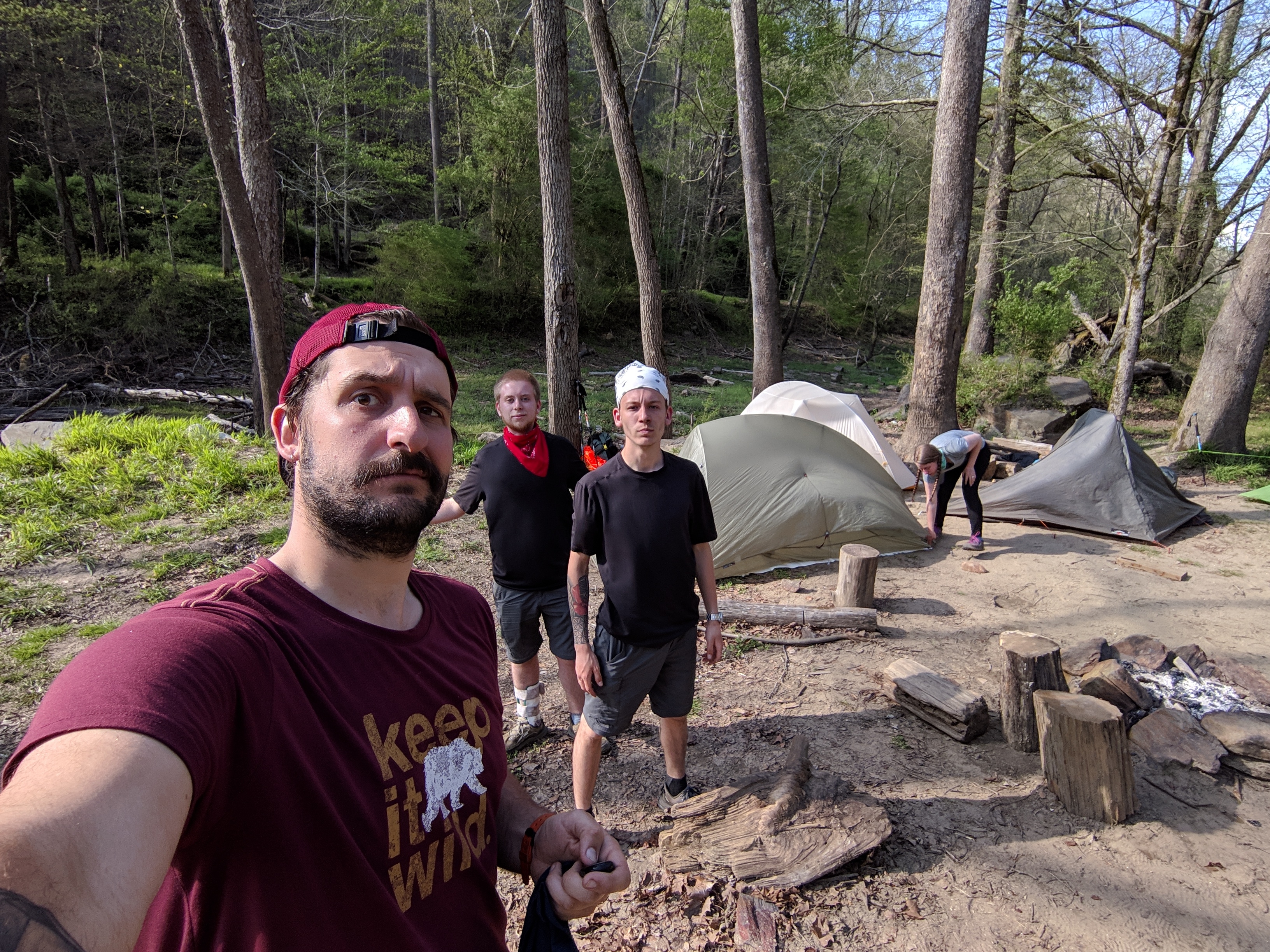
With everything I had experienced in Georgia I was excited to see what North Carolina had in store for me. Immediately after crossing the state line I stopped for lunch and chatted to Hurricane (a kiwi from Wellington) and some European ladies. Taking a look to our left we could see two huge hills. Sure enough, these were the hills we had to climb. It was an altitude increase of just under 1,000 feet in 1.4 miles.
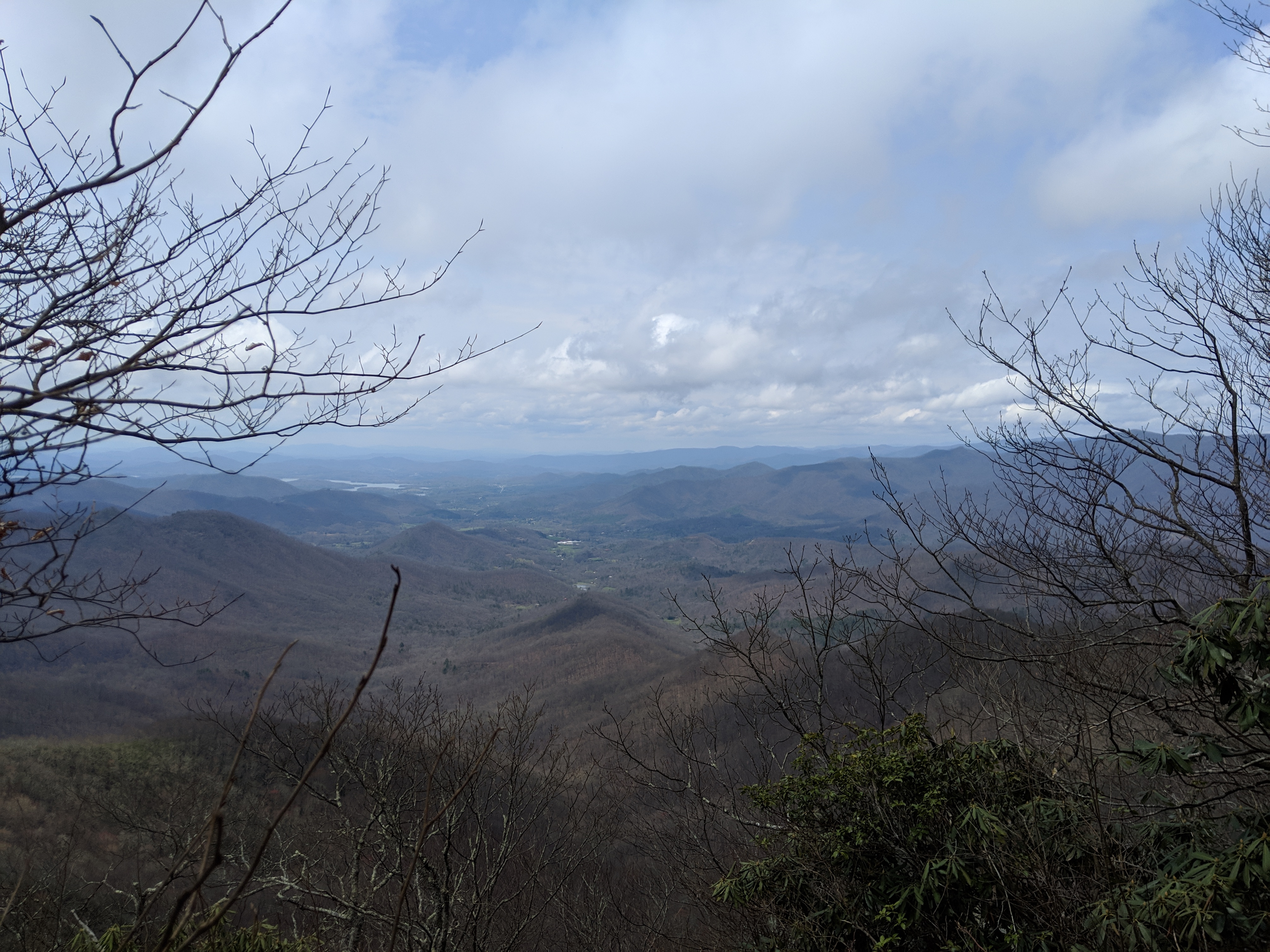
First mountain views in North Carolina.
Clearly Georgia had been the training wheels and North Carolina was going to be that much more challenging. What this doesn’t take into account are legs that feel stronger by the day, feeling slightly less out of breath, and the routine of walking that thru-hikers begin to fall into.
Getting into a Routine
The next couple of days felt very structured. Each day Hurricane and I would wake up at a tent site, deciding that the shelter distances were too little or too much based on the terrain. I would set off earlier to face a big climb.
On my first full day in NC I climbed up Standing Indian Mountain in heavy cloud cover. The one word I would use to describe the ascent is switchbacks. The AT in the South allows you to climb steep terrains on a more gentle path by winding back and forth. I am certain I got to double figures on the switchbacks before the path continued forward. When I made it to the signed area it made no difference. As is common for many hikers there was no view. I know there will be plenty of views so this does not bother me; it is simply the time of day and the luck of the weather.
Hurricane got ahead of me while I took an extended lunch break. My mistake. It started to pour with rain during the last mile of my descent to Betty Creek Gap. I’ve been told by other hikers it was a lovely place to camp (when dry). In heavy rain it is hard to set up your tent, especially when most of the designated areas are under water. I managed to get my tent set up, with the inside dry, and enjoyed a quiet afternoon of reading and snacking.
Getting the First 100 Miles Under the Belt
Of course it was raining the next morning so I packed up my tent hastily and hit the trail. This was to be a big day. The rain quickly stopped (go figure) and I marched toward Albert Mountain. This is the 100-mile mark of the AT. The elevation increase is just under 1,000 feet in 2.5 miles. Most of this is in the last quarter of a mile.
Climbing hand over foot to reach Albert Mountain.
People say the trail makes you work to achieve your goal, and truer words have never been said about Albert Mountain. Most of the elevation increase is in the last quarter of a mile. This leads to some scrambling and what I’m sure would qualify as bouldering. The fire tower at the summit was beautiful. The view was nonexistent. No matter, as another major milestone had just been achieved.

Pure joy at the 100-mile marker on Albert Mountain.
The weather cleared up to some blue skies and beautiful mountain views. I descended to Winding Stair Gap, where I was headed to Franklin, NC, for my first full zero day. (A zero is a day without hiking on trail.)
Franklin – The Friendliest of Trail Towns
I waited on the highway as I was expecting a shuttle from the hostel to come and pick me up. I also had 90 minutes to kill and some sunshine, so I set my tent up on the highway. As I wasn’t pegging it in on concrete I had to be creative. Crocs and hiking poles and even my body held the ground sheet in place and allowed the top sheet to dry in the warm and breezy afternoon.

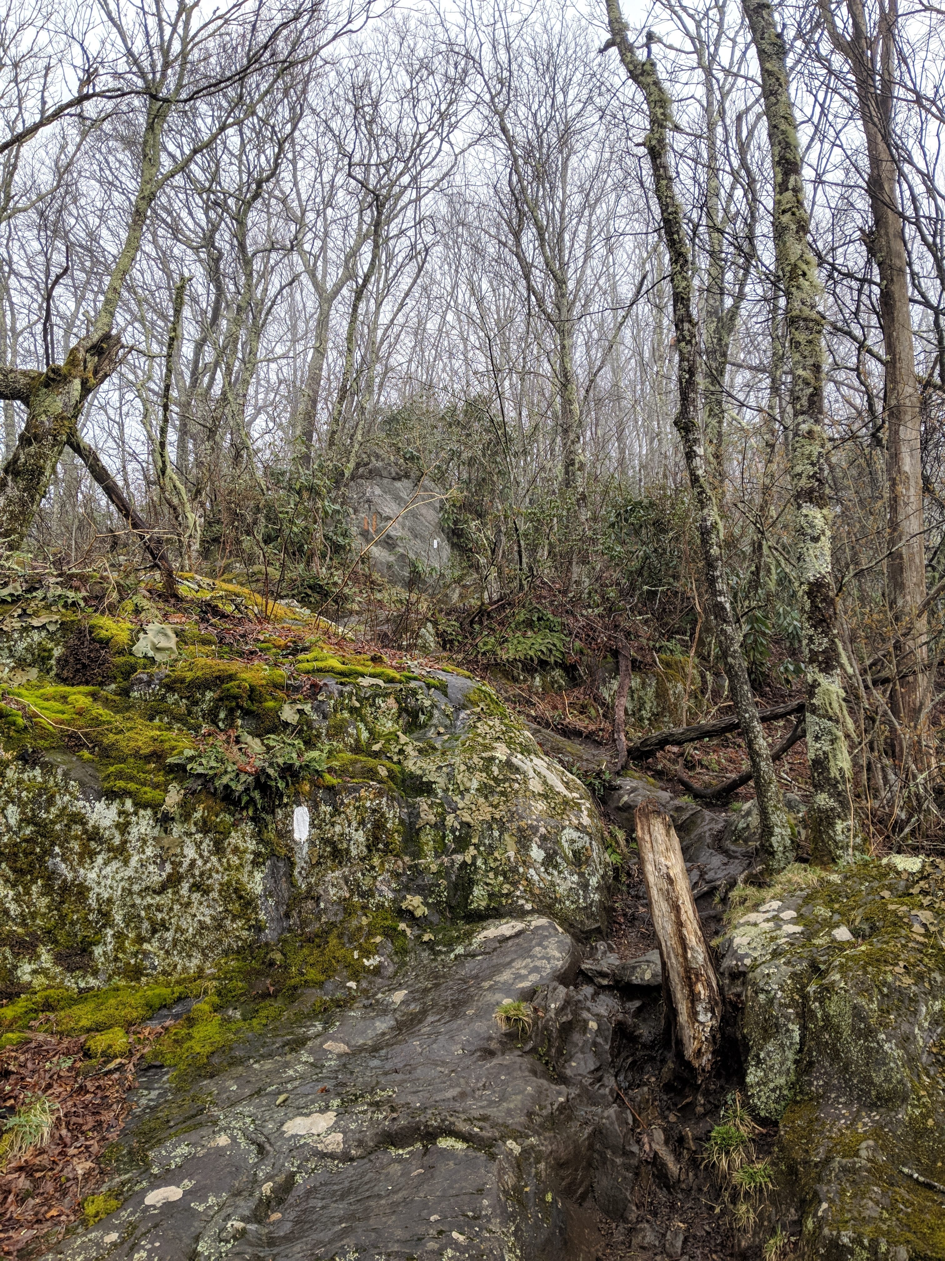
Highway trail marker at Winding Stair Gap.
Soon a pair of trail angels showed up. The pair were a mother and daughter, with the daughter a thru-hiker from 2018. Hurricane showed up a little after another hiker named Texas Pete. We all dug into the snacks heartily. Although the timing was good, many hikers had stayed in the previous shelter in order to hide out from another impending storm. Texas Pete’s ride to town showed up, and Hurricane and I said goodbye as he continued north on the trail.
As the storm broke the trail angels packed up and as my ride hadn’t come, they kindly took me to Franklin, as it wasn’t too far out their way.
I said goodbye and thank you and entered my hostel. As so many people decided to stay an extra day because of the weather I lucked out with a private room for a dorm price. I prioritized shower, laundry, and Netflix downloads.
Meeting Up with Old Friends
I went to the Lazy Hiker Brewing Company, which is popular with locals and hikers alike, where I met up with Eric (now Hops), who was in my original group of hiking pals. Also there were Huggy Bear and Tater Bag among others I had met on trail. We spent a good time telling stories, sharing experiences, and arguing about lobster brains.

Tater Bag, Huggy Bear, Hops and me (Showstopper) before the lobster brain argument.
Trail towns are usually a pretty great way to catch up with other hikers. Down South many are a shuttle or hitch away (from five to 15 miles). As you move north you find towns that are literally a part of the trail. You trade tips of gear, find out how other hikers are doing, and of course eat and drink to your heart’s content.
Resupply
After a lovely evening and a very comfortable sleep I checked over all my gear before heading out to breakfast. I wanted KT tape to replace my knee brace. The knee brace says it is for L/XL, but clearly hasn’t met a Tierney thigh before. The tape would provide support without rolling awkwardly at the back. I also needed new boots!
Boots and shoes generally should last between 300 – 600 miles, even on the tough AT terrain. I was no more than 130 miles into hiking in my Keen Targhees and found that they were delaminating on both sides of both footboxes. I called their customer service and was told to fill in a warranty claim. With a hike to return to tomorrow I decided new shoes would be quicker.
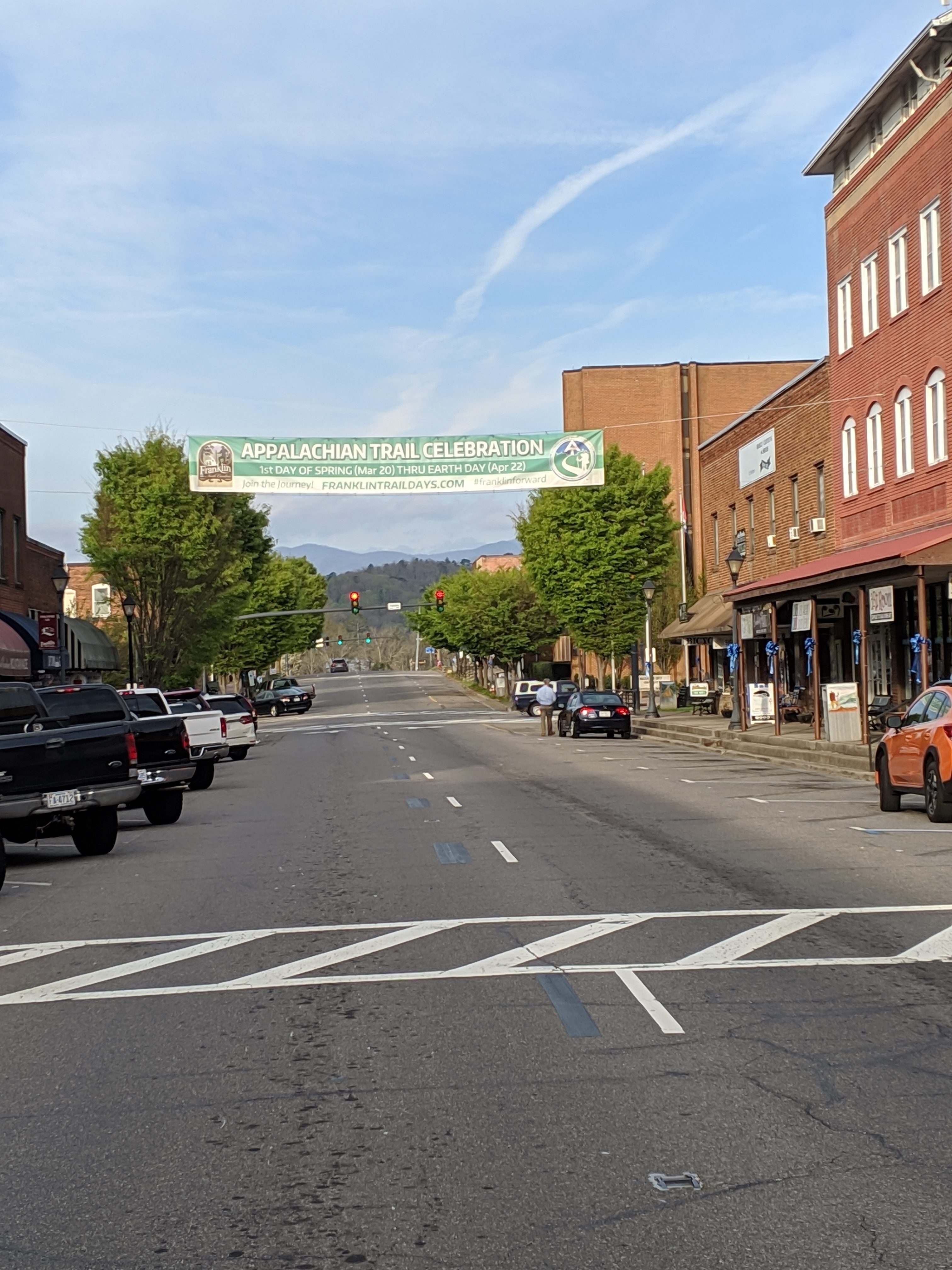
Franklin High Street: a very hiker-friendly town.
I couldn’t find anything I wanted to eat for breakfast so started my errands. I did a full resupply at the Ingles supermarket. My best find was that fruit snacks were on offer: three boxes of ten for $5. I also picked up more hummus as it’s delicious and I don’t care how heavy it is.
Reality Check
Then I went to Outdoor 76. This is a retailer known for being really helpful to thru-hikers, especially with shoes. I spoke to Dan first and we were just chatting about hiking and camping. When I mentioned I needed new shoes he took me straight to Rob. I have never had anyone take so much care and time with me before.
Rob spent three full hours with me. This was so much more than someone selling me shoes. He asked why I needed new shoes. I explained that they were falling apart and am getting on trail tomorrow. He then asked my about any pains I had. I mentioned my sore knee (even though it was feeling better) and some tenderness on top of the opposite leg foot.
At the mention of this Rob asked me how much I was hiking per day. Mentioning the 18- and 17-mile days from my first week Rob immediately said I had to slow down. I explained how I had rested after my painful climb up Tray Mountain.
Don’t Write a Check Your Body Can’t Cash
Rob was correct that a thru-hiker is a professional athlete. You walk, you eat, you sleep. He also was correct to say that as my last 18 months had been office and bar work my body needed time to adjust. If my body is good for eight miles every day, but I’m charging 15 or more miles to card there will come a time I’ll ask for my body to do more and it will decline.
He didn’t shame me overdoing it, but he also helped me to realize that even with a visa and time limit, this is the time to listen to your body. Even if you feel good at mile ten, there’s no reason to keep going right now.
I was then set up with a really cool pair of Hoka trail shoes that genuinely feel amazing. The foam is so compact that I have not felt any rocks or sticks that I’ve stepped on since.
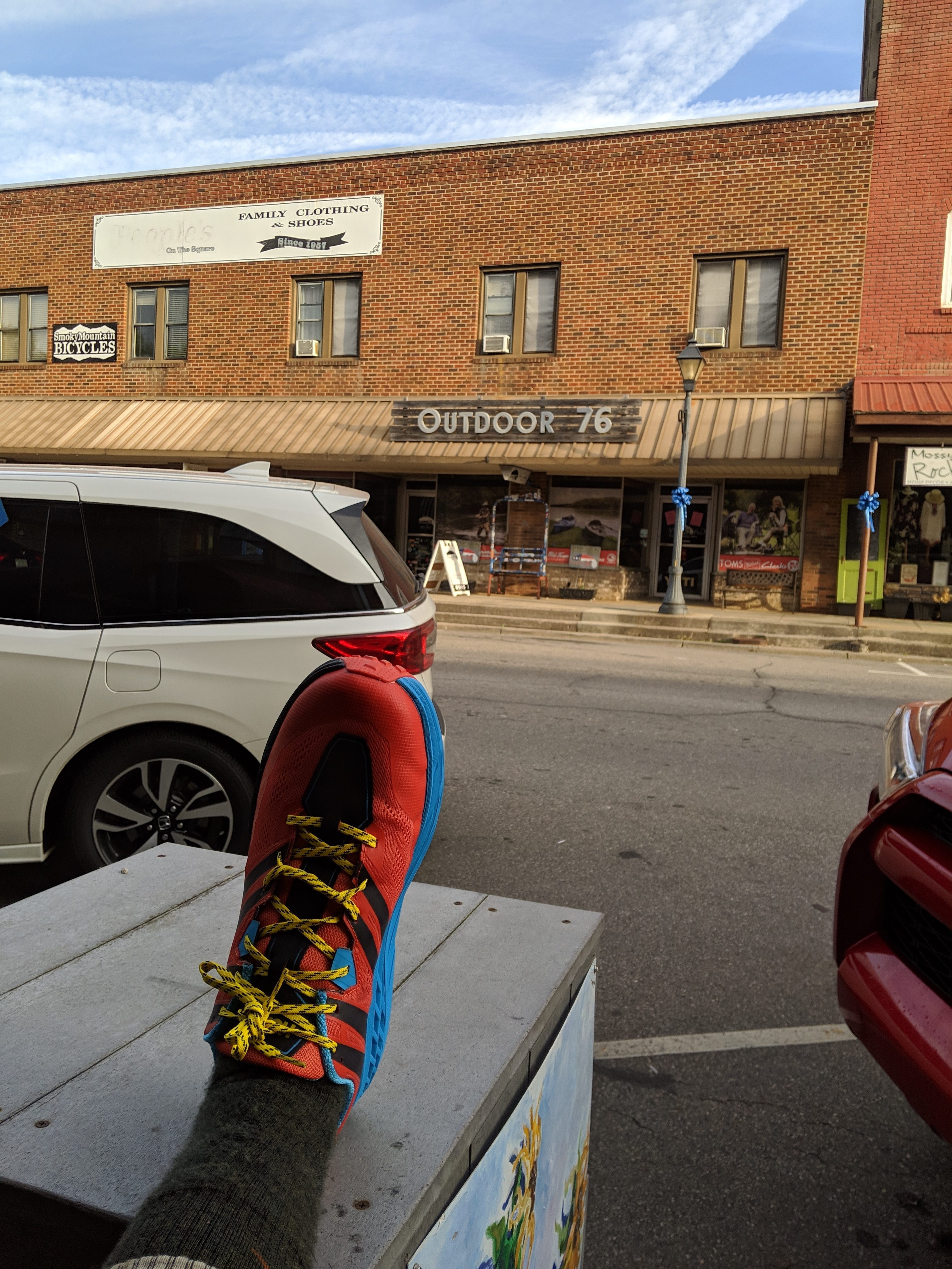
New kicks after my time with Rob at Outdoor 76.
Signing my trail name on their thru-hiker 2019 banner, I said my final thank yous, feeling humbled and ready to back off the gas pedal. I ate lunch in a wonderful diner and then relaxed at the hostel.
I spoke to several hikers who had been off trail for a week or even more. They had pushed themselves too hard and had to take time to recover. This cemented Rob’s words more than ever.
The State of Balds
Back on the trail I had a few great days. As usual there was some wind and cloud. But I kept shorter mileage. That’s not to say I walked slowly. I was finished each day around 1 p.m., allowing me time to stretch fully, read, and chat to other hikers at the shelters.
The views that I had missed from the mountains before Franklin were replaced by the stunning views from the balds. Balds are areas of mountains where the trees have gone, traditionally kept grassy to feed livestock.

Wayah Bald views.
Wayah Bald has a beautiful stone tower and the views were endless. I could even see the Albert Mountain fire tower from days before. The winds blew strongly, but I spent my time there and fully took in the views. North Carolina may have tough terrain, but a single view like this is worth all the difficulty.
Wesser Bald I came to a day later on a cloudier day, but climbing the rickety tower still afforded more panoramic views. That was a little harder to get up and down as fire towers seem to be made to be really scary to climb.

A scary climb to see the Wesser Bald.
Meeting Junior Hikers
I got to talking to a PE teacher and a student who hadn’t made the whole way up one of the balds while I ate my lunch. I was quick to congratulate the student on getting as far as they did and maybe next time they could go even farther. This wasn’t to be polite—these mountains are tough! I wouldn’t have been happy climbing that in PE aged nine either.
As we spoke about hiking and the mountains of NC more students showed up. I explained that I was hiking the full trail and even had a couple of the students try on my pack (approx 35 pounds at this point). They agreed that it was heavy but they reckoned they could handle it!

Trail markers come in all shapes and sizes.
Meeting New Friends
When in Franklin I saw a couple of people that I recognized. I hadn’t met them, but they were some of the first people that were thru-hiking in 2019 that I was following on Instagram. They waved across the road and I assumed I’d catch them at some point.
In actual fact I met them at the first shelter I came to back on the trail. Spirit and Chevrolegs were the Instagram duo and they are hiking with Puma and Expedia, who they met on trail. They are a fun and friendly group who I have had the pleasure of spending several nights with through North Carolina.
Hanging with Spirit, Chevrolegs, Expedia, and Puma.
We spoke about how strange it was to meet someone whose journeys we had been following, never having met. I am glad to have met them all. Spirit, a member of the Cherokee nation, is so knowledgeable on the land in the Appalachian Mountains. He’s a writer and has battled through a sprained ankle to continue his hike. Chevrolegs is pure energy, and a talented musician to boot. He has tough moments, but his positivity will carry him as far as his powerful legs will. Puma is a New Yorker who hikes the AT as she found the idea fascinating from a young age. She sets off early and arrives to camp first usually. She thinks she is slow, but I am certain she’ll go far. Expedia is fiercely determined, has a dry sense of humor, and is pretty fearless. They make a great group!
The Nantahala Outdoor Center
The NOC is a great stop off for all hikers. There is the promise of great food (vegan options included), a small resupply, and if you’re feeling adventurous you can white water kayak or raft.
Another person I had found myself spending time with was Huggy Bear. We have similar interests in music and video games and spent a fair amount of time trading vegan food tips for the hike. We both descended into the NOC down a several-mile section of trail. Huggy pointed out that the first smell of spring was really in the air. There was more green than anything we had seen, and even a few flowers and fiddleheads popping up.

Fiddleheads sprouting in the spring.
The sun began to shine as we entered the center and we made a beeline for the outfitter for new fuel, North Carolina badges, and snacks. With chips and soda to fuel us we then went for vegan burgers because the hunger is real. We caught up with friends and family on the center Wi-Fi and then walked along the river to where we could stealth camp. The afternoon was spent lazily enjoying the sound of the river, and even a little hobo shower, although the water was still very cold.
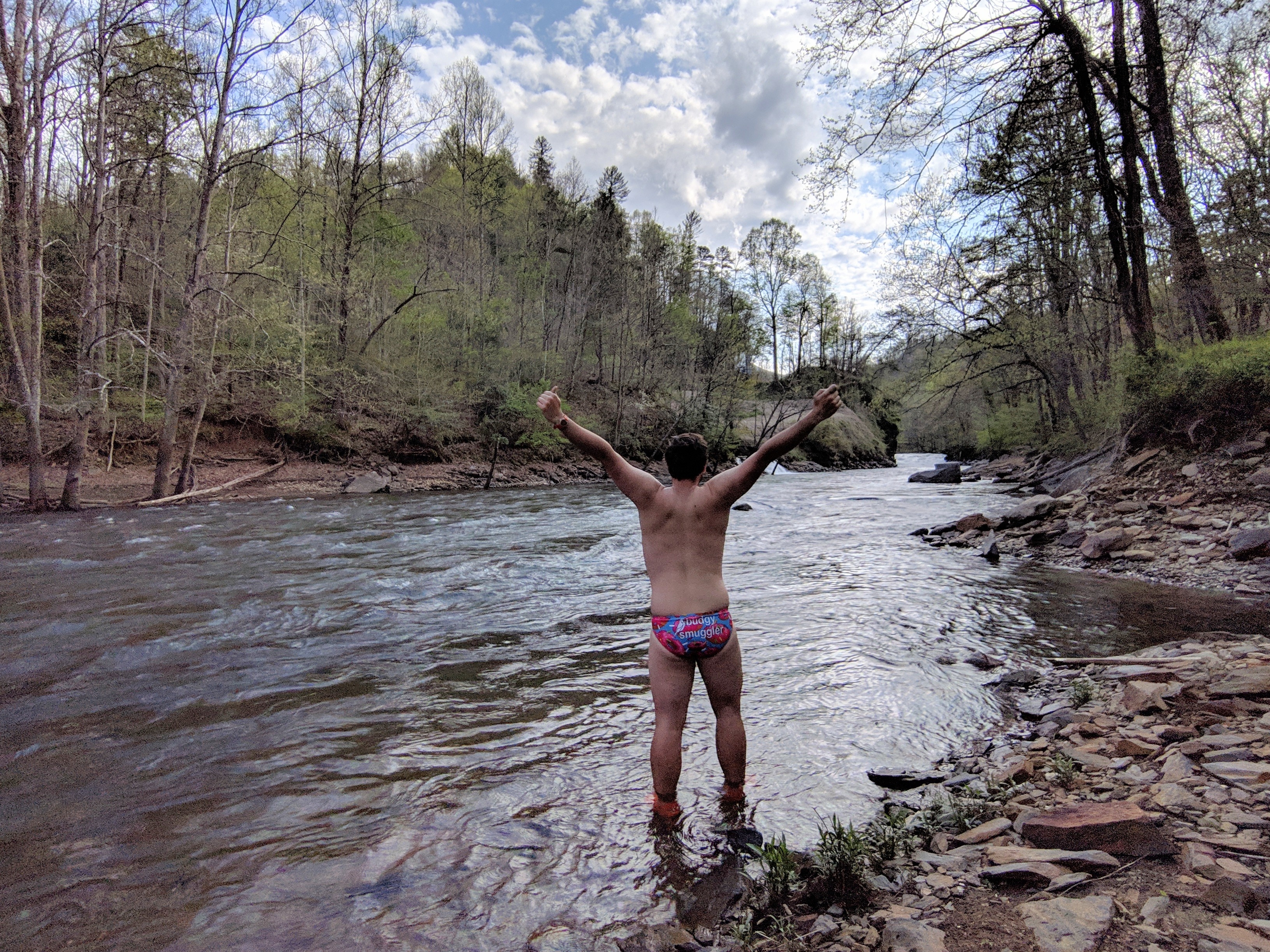
Enjoying the river at the NOC.
Mittens (formerly Mum) came in the evening for dinner as she was to rejoin the trail the next day from the NOC after rest and recuperation for her knee. We caught up and planned our next steps.
Downpour
The next morning I left the NOC early and hit the six or so mile steep incline toward Sassafras Gap Shelter. I wasn’t aiming for farther as one hour into this ascent the heavens opened and didn’t stop. It was freezing. It was windy. And you can probably guess that it was also windy. I was very happy to reach the shelter where several people were taking a zero day to avoid the weather.
One by one the shelter filled up with more and more wet and weary hikers, including Huggy, Mittens, Spirit, Chevrolegs, and Puma. We all got into our dry clothes and into our sleeping bags and sat watching the rain and steam rise off our wet clothes. I also met new hikers, including Journeyman—an older gentleman with calves of steel. He successfully thru-hiked the AT in 2016 and was out again for a section to prepare for his upcoming trip on the John Muir Trail. Apparently doing one thru-hike doesn’t get it out of your system.
We were granted a small reprieve by the rains and were able to hang our wet clothes on a line buffeted by a cool breeze. There was time for us to sort ourselves out and then the rain continued. We stayed dry for the rest of the evening, wrapped in our warmest gear.

Hitching on and off the Trail
The next morning was dry, and I set off for an easier nine-mile day. Putting on wet clothes is never ideal, although I’d rather always keep a set of dry clothes for when I get to camp. The clothes dried out quickly and I descended into Stecoah Gap. I hadn’t planned to resupply in the nearby town of Robbinsville, but was curious to see if I could get a hitch by myself.
The second car picked me up! I let that decide that I would resupply. I also managed to fill up at a Mexican restaurant. With a full belly I hitched back (also the second car) to Stecoah Gap. I have been told it’s very easy to hitch in the South and tougher up north. Only time will tell.
I met Mittens at the gap, who was really struggling with her knees. We walked together up a steep climb, chatting away. Texas Pete joined us and we all talked and walked. It wasn’t until we reached the shelter that I found out we had climbed Jacob’s Ladder, a particularly difficult ascent. I was glad to have not known and to have had the distraction. There’s definitely something to be said for not making mountains out of molehills; or in this case, mountains.

Sunset at Brown Fork Gap Shelter.
Down to the Dam
I said goodbye to Mittens in the morning as she wasn’t sure she was going to continue the hike. She was going to take it slow and steady and make a decision in the next few days. This was sad as I enjoy hanging out with her.

Last night camping with Mittens.
I hiked a long 13 miles, during a warm and sunny spring day. The descent into the Fontana Dam is steep at times, with lots of steps. The hardest aspect is that you can see the views for miles and it never seems to get closer. I saw some views with Chilly Bin and Raiden, and we commented that this would be a great place for a bald. The trees were still bare and we finally got the view as we approached.
The Fontana Hilton
The shelter is known as the Hilton as it is large, fairly new, with stunning views over the lake. Did I mention there are also hot showers? That was wonderful.

Arrival to the Fontana Hilton.
I wandered down to the dam visitor center to learn about the history and work that went into this structure. It’s difficult not to notice the impending mass of the Smoky Mountains in the background. They are framed by the flat and still waters of the dam, rising momentously into the skies .
I spent the afternoon stretching and getting to know Journeyman, Chilly Bin, and Raiden better.
Here I Come, Smokies
As I sat looking at the mountains that I was soon to enter, I thought about all I had achieved to get to mile marker 164.7. The Smokies are spoken about as a real challenge, with the highest point on the whole trail. Many people quit before exiting the Smokies. I will enjoy myself. I will succeed in this next stage of my endeavor. All I know is it will be tough. Very tough!

The Smokies are looking over Fontana Dam.

This website contains affiliate links, which means The Trek may receive a percentage of any product or service you purchase using the links in the articles or advertisements. The buyer pays the same price as they would otherwise, and your purchase helps to support The Trek's ongoing goal to serve you quality backpacking advice and information. Thanks for your support!
To learn more, please visit the About This Site page.
