 ">
">
Testing My Nerve on the Yorkshire Three Peaks
The Yorkshire Three Peaks is a circular, 26-mile route that takes in the summits of Pen-y-ghent, Whernside, and Ingleborough. It starts and ends in the village of Horton-in-Ribblesdale in the Yorkshire Dales (a popular walking destination in England). As a child I spent every October half term walking in this area and from about the year I turned 12 the full three peaks route was added to our annual list of walks.
For my first solo overnight hiking trip I decided that this route would be a good destination because it would be challenging but familiar. Next week I am heading to a section of the Hadrian’s Wall trail, which will be flatter but completely unfamiliar to me. I split the walk into two days. The first would cover the two larger hills, Whernside and Ingleborough, and the second day would take me up the smallest peak, Pen-y-ghent, and over the long stretch of rolling countryside between Pen-y-ghent and Whernside. Helpfully there’s a train station near the base of Whernside, next to the impressive Ribblehead viaduct, and another station in the village, so getting to and from my start point was easy.
Day One
I’d used this trip as an excuse to visit a friend in York so I awoke at 6 a.m. and tried to get ready as quickly and quietly as possible so as not to wake her flatmate. I felt very out of place surrounded by commuters waiting for the 7:09 train to Leeds. Two hours later I arrived at Ribblehead. I’d been excited to return to the area, having not visited in over four years, but this excitement turned to trepidation the nearer I got. Even from the train I could see that Whernside had snow on. This I was not expecting. The strong wind that had been forecast was also present in abundance. A lack of phone signal was all that prevented me from making a “mummy, I’m scared” phone call. I decided that there was nothing for it but to start walking.
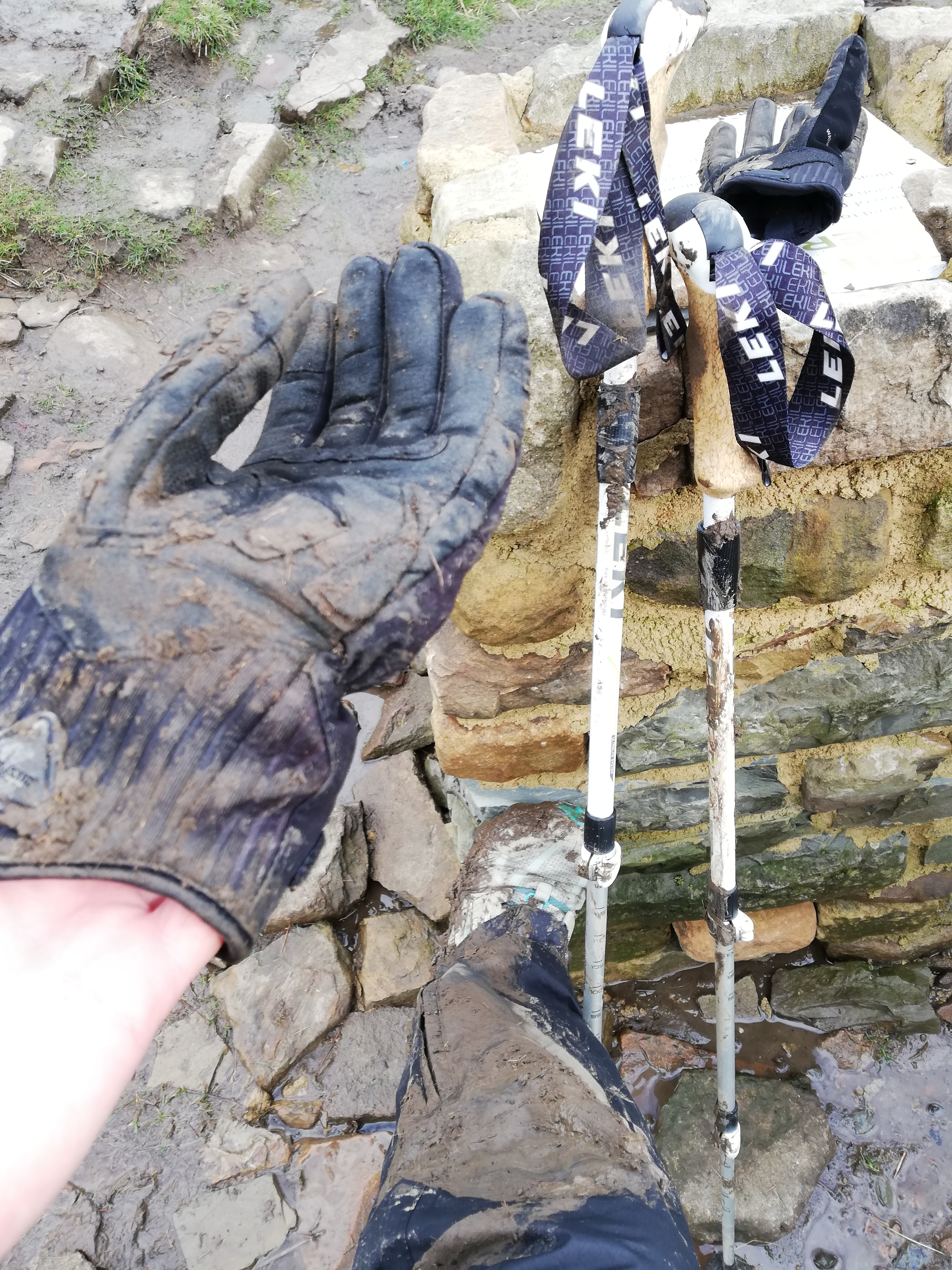
By the viaduct I stopped to take a few photos. The photo below is genuinely as close as I could get to a smile. The thoughts running through my mind at that moment were something like: “I am cold, I am tired, my pack weighs a ton, I haven’t walked up a hill in months, I have no experience in the snow, I am completely alone, what am I doing here?”

What am I doing here?
I told myself that I’d only go as far as I was comfortable. If I got part way up and the conditions were dangerous all I had to do was turn around and walk back to the station. It took me awhile to come around to the idea that it really did not matter if I made it to the top or not. The goal I’d set myself of completing the route was completely arbitrary. It made no difference if I did it or not; I was there to test my own limits and to get used to using my gear. I also had no time limit. If I for some reason got stuck somewhere I had everything I’d need to survive a night right there on my back. This was the first time I really felt how freeing backpacking could be.
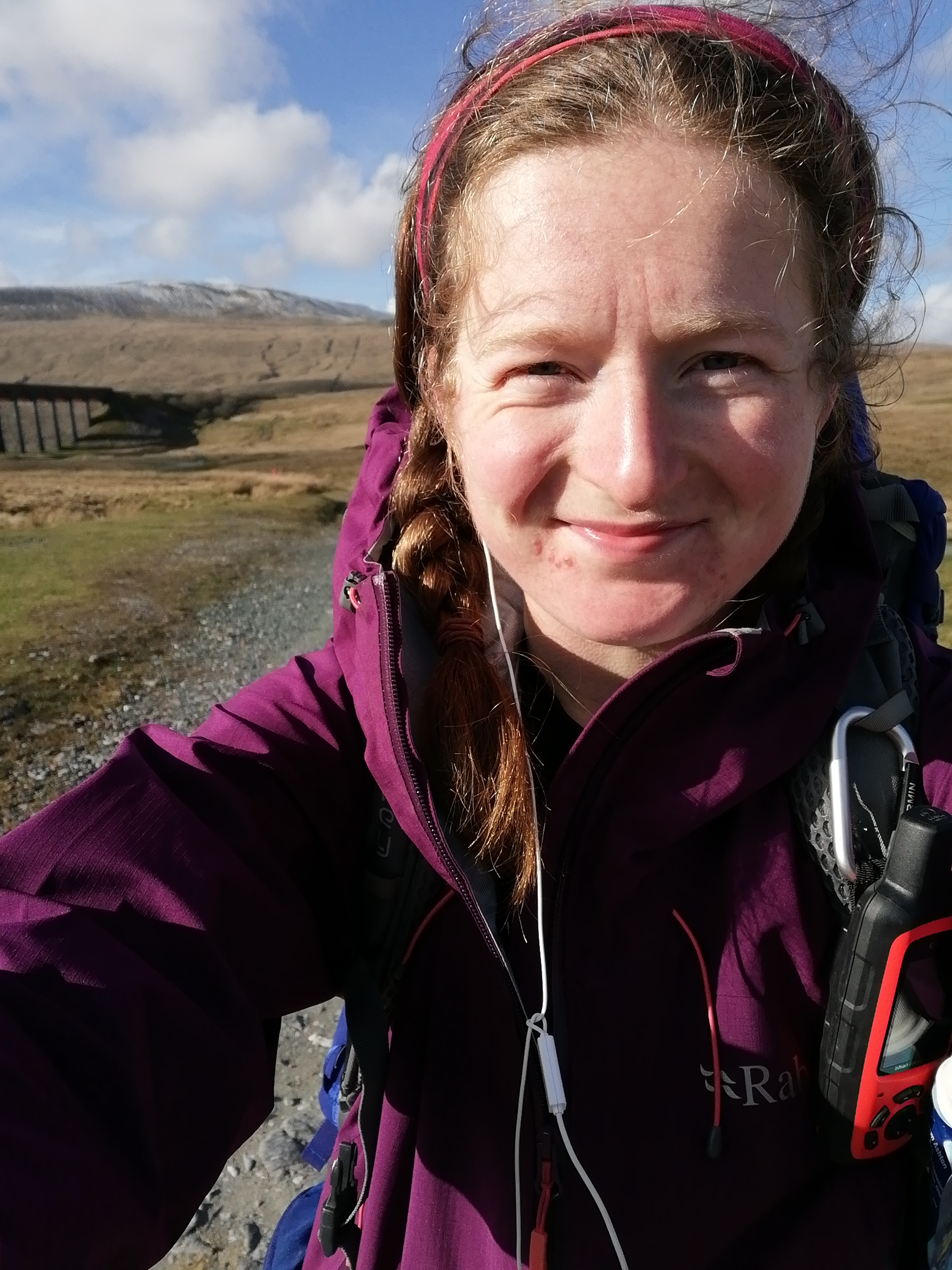
Thirty minutes later the nerves had eased. I had seen two other people and the sun had come out slightly. I headed into the main climb in a much more optimistic mind-set. My memories of Whernside were that once you got onto the top ridge there was a long walk and endless false summits until you reached the top. I was surprised to find myself at the summit in what felt like minutes. It was only an hour and a half since I’d been standing by the viaduct taking my self-pitying pictures. All I remember thinking was, “How was that so easy?” and “I’ve missed these views.”

Standing on the summit of Whernside.
Then I remembered why it felt so easy. Because it’s the going down that’s the hard bit!
Shortly after the summit the steep path became a series of muddy footholes interspersed with rocks that may or may not move when you stand on them. I was thinking about how it was good that I was wearing my over trousers so that my leggings wouldn’t get muddy if I slipped. Next thing I knew my legs had gone from underneath me and the weight of my pack dragged me into a full barrel roll. I felt like I did when I was learning to ski last year, trying to heave myself up using my poles, a definite laugh-or-cry moment. I slowly made my way to the next patch of flat land and assessed the damage. My knees and arm felt slightly bruised but nothing more serious than that. The main problem was the mud. I was completely covered! Annoyingly, my trousers, coat, and gloves would now be muddy for the rest of my trip. In the time that I was standing there I watched two fell runners effortlessly make their way down the patch of land that had given me so much trouble. I was thankful that they didn’t seem to have seen me fall.
Mud, mud, glorious mud!
I opened my phone to see my father’s reply to the last picture I’d sent:
“Go carefully on the way down, it may be slippery.”
Thanks, Dad!
The next challenge to face me was Ingleborough, although actually a few meters shorter than Whernside, Ingleborough is definitely the most intimidating of the peaks. It’s distinctive flat top and dark, rocky coloring makes it instantly stand out from the grassy rolling hills that surround it. The other thing that sets it apart is the steepness of the ascent. The Three Peaks route takes the most direct route up. which starts gently by meandering through an area called Humphrey Bottom (saying “We’re going up Humphrey’s Bottom used to amuse us a lot!). The path skirts around parts of the impressive limestone pavement for which the area is known and along some slippery boardwalks over patches of marshy land. It then deposits you at the foot of the steepest climb of the route. In my memories of doing this walk this was the only part where I remember thinking, “OK, this really hurts,” so I was apprehensive about heading up with an additional 30 pounds on my back. In the end, it was OK, definitely hard work but nothing worse than I’d expected. I was pleased to see that a fell runner who’d overtaken me at the bottom of the climb wasn’t pulling away from me at any great rate.

Next stop, Ingleborough!
Another few minutes of steep, rocky climbing and I was on the summit. The next challenge was to find the trig point. My mum always refers to the summit of Ingleborough as a lunarscape and I completely agree. It is vast, flat, and rocky, and when encased in cloud there is very little to distinguish the way you just came from and the way you’re going. I’d decided to follow the cairns around one edge with the thought that, even if I didn’t find the trig point, at least I’d be able to find my way back down. Part way along I saw the fell runner emerging from my left having, I assumed, just visited the summit. After a brief chat with him I headed in the direction he had come from, assuming this to be the right way. Big mistake! A few minutes later I found myself in the middle of the vast expanse, completely surrounded by gray rocks and even grayer cloud. I stopped to think. Inside my head I generally have a pretty good sense of direction but after looking around me for a few moments I even started to question which way I’d come from. This was exactly the situation I’d been dreading. I’d known that this would be my hardest navigational challenge and had bought a compass the day before specifically to help me find my way off Ingleborough if I found myself in this situation. Before getting my map out I thought I’d give my Garmin Inreach its first test. I zoomed in on the map to see where it thought the summit was and rotated around until my tracker arrow was pointing toward it. I tentatively walked in that direction until the big dark outline of the summit shelter emerged from the cloud. I have never been so relieved to see a big pile of rocks!

It looked like this in every direction.
From looking at my tracking trace on my Garmin I could see that I had, in fact, been on the correct path until I’d stopped to talk to the runner. I followed my Garmin back until I found a rock that I’d been careful to make a mental note of as it marked the descent point from the summit. Shortly after that the path forked and instead of taking the steep route down to Humphrey Bottom I took the path that I knew after about four miles would eventually lead me to Horton, the village where I would be spending the night. The route down was pretty much as I remembered, with the addition of a little hailstorm to keep things interesting.
I was the only person at the campsite that night. I arrived at about 4 p.m. and didn’t leave my tent all evening other than to visit the wash block. This was partly due to the rain and partly because the gentleman who ran the campsite had informed me that both the village pubs were closed that evening so there wasn’t actually anywhere to go. The first hour in my tent was not particularly enjoyable. I was cold, damp, tired, and apprehensive about the night ahead. However, after a hot meal and a phone call home I was feeling a lot better about the whole thing. By about 8:30 p.m. I was drifting off to sleep.
Day Two
Having only woken up a couple of times in the night I was feeling relatively well rested when I eventually decided it was morning. This was at about 6:45 a.m. It took me until 9:15 to be packed up and ready to go. This was partly because I was unused to the process and partly due to the constant rain on the outside of my tent that was making me really not want to go outside. I decided that I would leave my tent pitched as I was returning to the same campsite that night. I’d intended to pack it up and carry it as I will on trail but I didn’t see any point in getting my inner wet if I didn’t have to. The small bit of weight I’d left behind in the form of my tent felt like it made a massive difference to the weight of my pack. This was just the morale boost I needed as I saw that Pen-y-ghent was now covered in snow and thick, ominous cloud. As I began to make my way up the rain had lessened but the wind had increased. I met two walkers coming in the opposite direction who told me that they had “chickened out” of going to the top due to the wind; this was slightly concerning but their advice was to head for the top gate and see for myself.
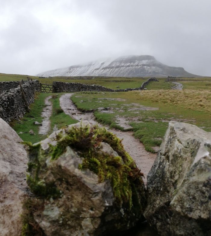
Heading up Pen-y-ghent.
Knowing the route I knew that there was a gate at the top of the fields, at which point the path turns left and starts a steep, rocky climb to the summit. In that sense, Pen-y-ghent is essentially a mini-Ingleborough. I told myself I’d make a decision at this gate. Standing there the wind was so strong it was hard to stand upright. But I noticed that while the wind was coming from the front of the hill, the climb itself worked its way up and around the side of the hill and would therefore be sheltered from the wind. I decided to keep making my way up to see if this was the case. I knew there was one point at which I would need to do some hand-over-hand scrambling. That would be the point at which, once I’d gone up it, I wouldn’t be able to turn around as it would be dangerous to climb down in the wind. I kept telling myself that until that point, I could always turn back if needed. As I momentarily paused to assess the situation the wind blew my pack cover off and it swung round to hit me in the face. The force at which the wind had moved that scared me the most and at that point I was pretty certain I’d turn back. But that’s when the little voice in my head started talking. “You’re so close.” “Just up this bit then it’s flat.” “You’ve been up here in the wind before.” All of these things were true; I had memories of my parents literally having to hold onto me as a young teenager so that I didn’t get blown of the side of this very hill. One translation of the name Pen-y-ghent is “Hill of wind.”
I stubbornly kept creeping up until the point at which it became a scramble. Decision time. The wind was still present but was definitely less on this side of the hill. Well, I thought, I’d come this far.
Five minutes of sweating, scrambling, and thinking, “I should not be doing this” later and I was on the gently sloping path to the trig point.

The flat footpath was a welcome sight after almost getting blown off the side of the hill.
Getting to the top was a pretty good feeling. I’d stood in that exact spot many times before but never had getting there been such a challenge. That was definitely the worst wind I’d encountered up there; I’d never carried a full pack up and I’d never done it alone. This was the first point at which I thought I might actually stand a chance on the AT.
Getting off the top meant walking pretty much straight into the wind. There were still patches of slushy snow on parts of the path so part of me still worried that I had misjudged things and that I would struggle to get down the other side. In the end it was fine, just very windy. But from memory, it always is. I remembered one year when we’d stopped to take pictures along this path. We’d been leaning against the wind as if it was a solid wall. This wind continued until I’d dropped quite a bit of height. Keeping my head bowed against the wind I could see one set of footprints going in the same direction as mine. All I was thinking was, if they could do it then so could I.

Happy to have Pen-y-ghent behind me.
The rest of the walk had a few gentle ups and downs as the route wound its way back to Ribblehead. Since I first did this walk a new path has been put in for most of this stretch. Before this wet, boggy marshland had made this one of the most difficult sections of the route. I vividly remember my dad once sinking thigh-deep into a patch of bog and shouting at my brother, “Don’t just stand there laughing, pull me out!” Needless to say, I was grateful for the new path.
I arrived back at Ribblehead two hours before the next train so I wandered down to the viaduct and was able to spend some time soaking in the views. It was still windy but the sun had now come out. I spent a considerable amount of time choosing a nice rock to sit and have lunch on. From this spot I could see all three of the peaks and I marveled at the fact that I had got myself onto the top each of them, completely by myself.
Standing in the same spot as the first photo of this post was taken. This time I knew exactly why I was there.
Back at the campsite my tent had not blown away in the wind like I feared it might. The cloud had lifted so I had a view of Pen-y-ghent as I sat cooking my evening meal. There was now also one other tent in the campsite; maybe I wasn’t crazy for being here after all?
I spent a second evening cocooned in my tent and was even warm enough in the night that I considered taking off a layer. There was strong wind and rain all night but not a drop of it made its way anywhere near my inner. Seeing my gear perform well in these conditions has given me an extra bit of confidence as I head toward the real thing.
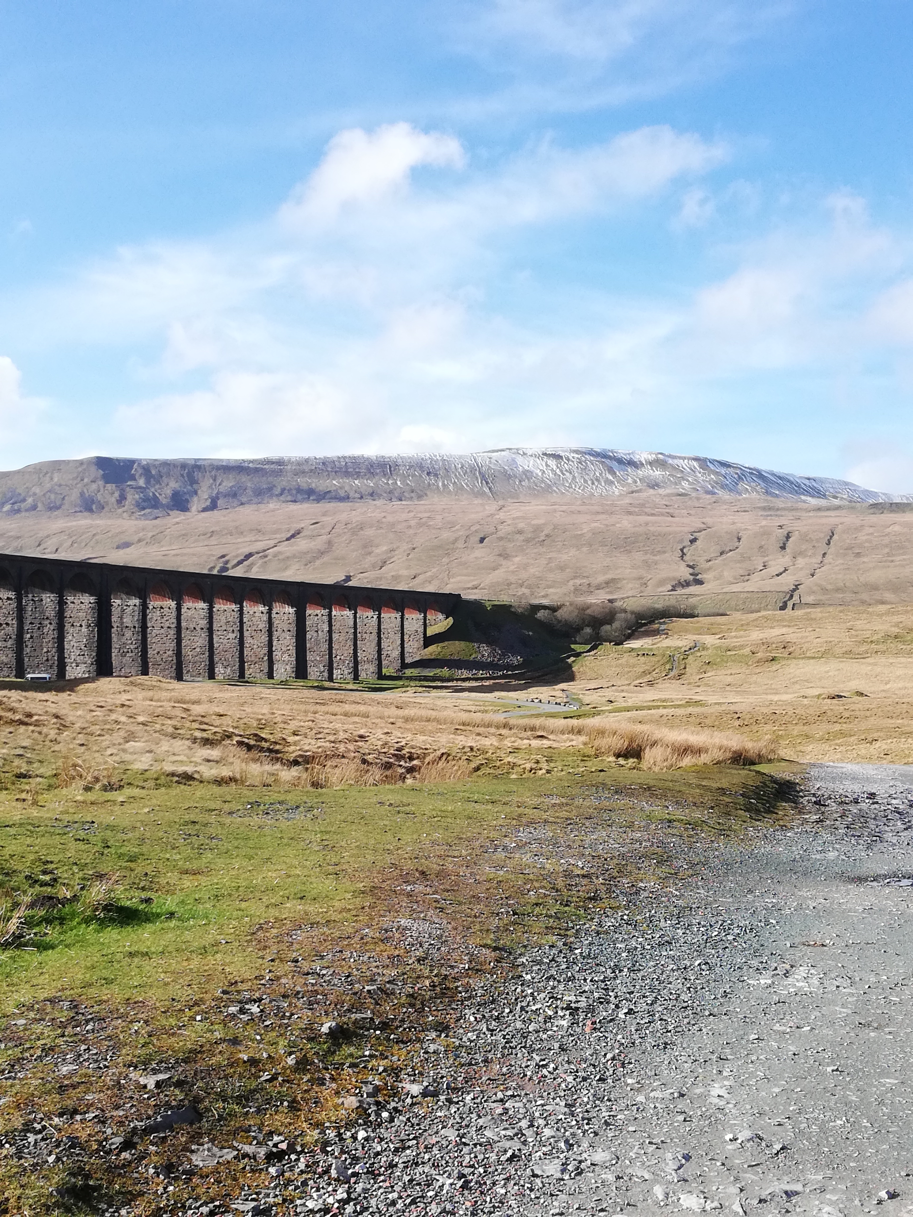
Ribblehead Viaduct and Whernside in the sun.
There were definitely times over these two days that I thought I wouldn’t complete the route. There were times I’d almost cried. But there were also times I’d laughed out loud to myself and times that I knew there was nowhere else I’d rather be. Although only a short trip this had felt like a proper adventure. I’d tested my limits and found that, actually, they weren’t my limits. This trip gave me the nearest insight I’ll get into what my life on trail might be like and all I can say is, bring it on.

This website contains affiliate links, which means The Trek may receive a percentage of any product or service you purchase using the links in the articles or advertisements. The buyer pays the same price as they would otherwise, and your purchase helps to support The Trek's ongoing goal to serve you quality backpacking advice and information. Thanks for your support!
To learn more, please visit the About This Site page.

Comments 1
Hi for the final time before you head for those rather large hills overseas. Looks like you got in some decent practise in Yorkshire (glad the tent held up ok), now multiply that trip by about 100 and you’ve got the AT all lined up and calling your name. Can you hear it?
I was in the Peak District last year but made the mistake of caving beneath the Three Peaks rather than walking over them, got wedged in the CheesePress – not an experience I recommend – and had to wriggle out backwards. Bad cave, bad. So now I’m keeping my feet firmly on terra firma, not under it. There’s just something about having a million tonnes of rock overhead while crawling through a gap no wider than your shoulders that’s a little unnerving. So it’s walking all the way from here on.
Anyway, enough about me, just wanted to wish you a final Good Luck before you head out. Trek it, hike it, just make sure you like it! TC