 ">
">
The Grayson Highlands: AT Days 35-38
Damascus, VA to stealth site mile marker 489.3, 18.5 miles
Damascus lived up to the hype and proved to be the perfect spot to enjoy a double-zero day. After spending two nights in a cozy private room at Dancing Bear (thanks again for the birthday present mom and dad, you guys rock), I was excited to get back on trail and begin my trek through the state of Virginia.
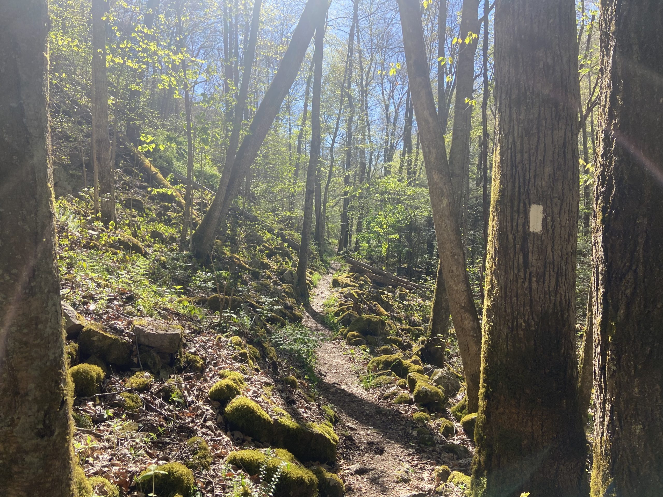
An easier climb out of Damascus led to some flat but technical terrain for the first several miles of the day. Only one more climb was lined up for the day; a 1,000-foot climb to the Saunders Shelter that consists of switchbacks to the top. I was hanging out and snacking at the top when Trail Candy arrived, and we agreed to meet back up at a campsite roughly 10 miles away.
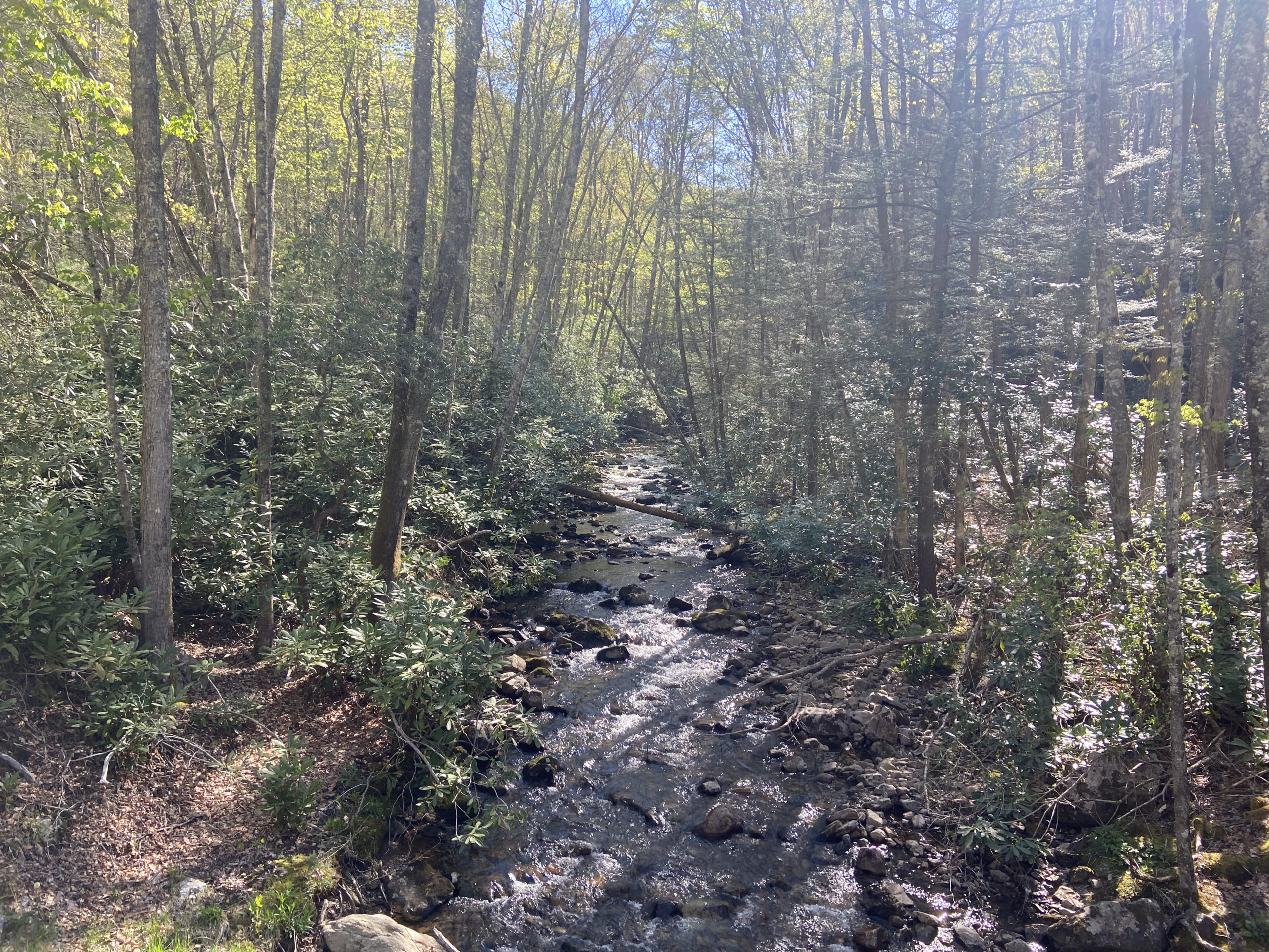
It was a cruisy descent down to the Creeper Trail: a popular 44-mile bike trail that runs from Whitetop Mountain, through Damascus, to the town of Abingdon. The AT joins the gravel bike trail for about a mile, making for quick and easy walking. The trail remained mostly flat for the remainder of our day, until the beginning of the climb up Whitetop Mountain.
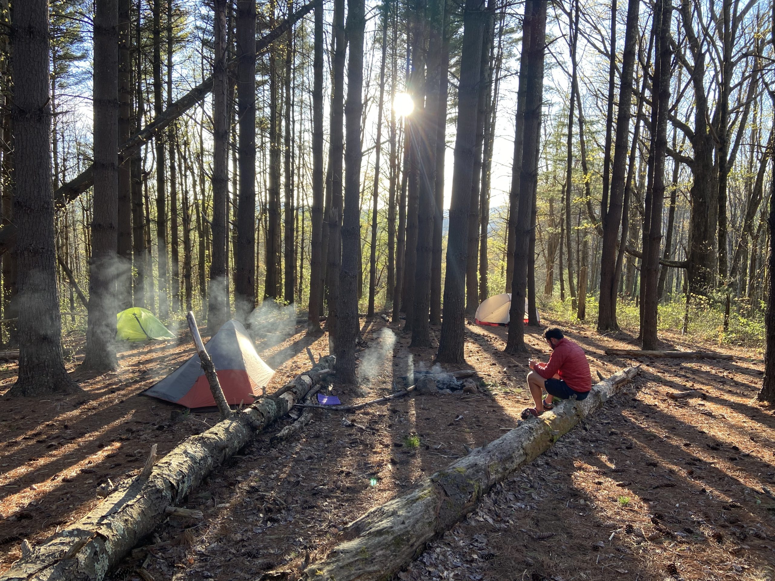
Just at the base of the mountain lies a Pine Forest with several “stealth-sites,” or unofficial campsites, that proved to be the perfect spot to call home for the evening. Trail Candy arrived not too long after and we hung out around a fire for a while before retiring to our tents early. The Grayson Highlands lie ahead and we are both stoked to get a chance to see the wild ponies everyone has been talking about.
Stealth-site mile marker 489.3 to stealth-site mile marker 511.7, 22.4 miles
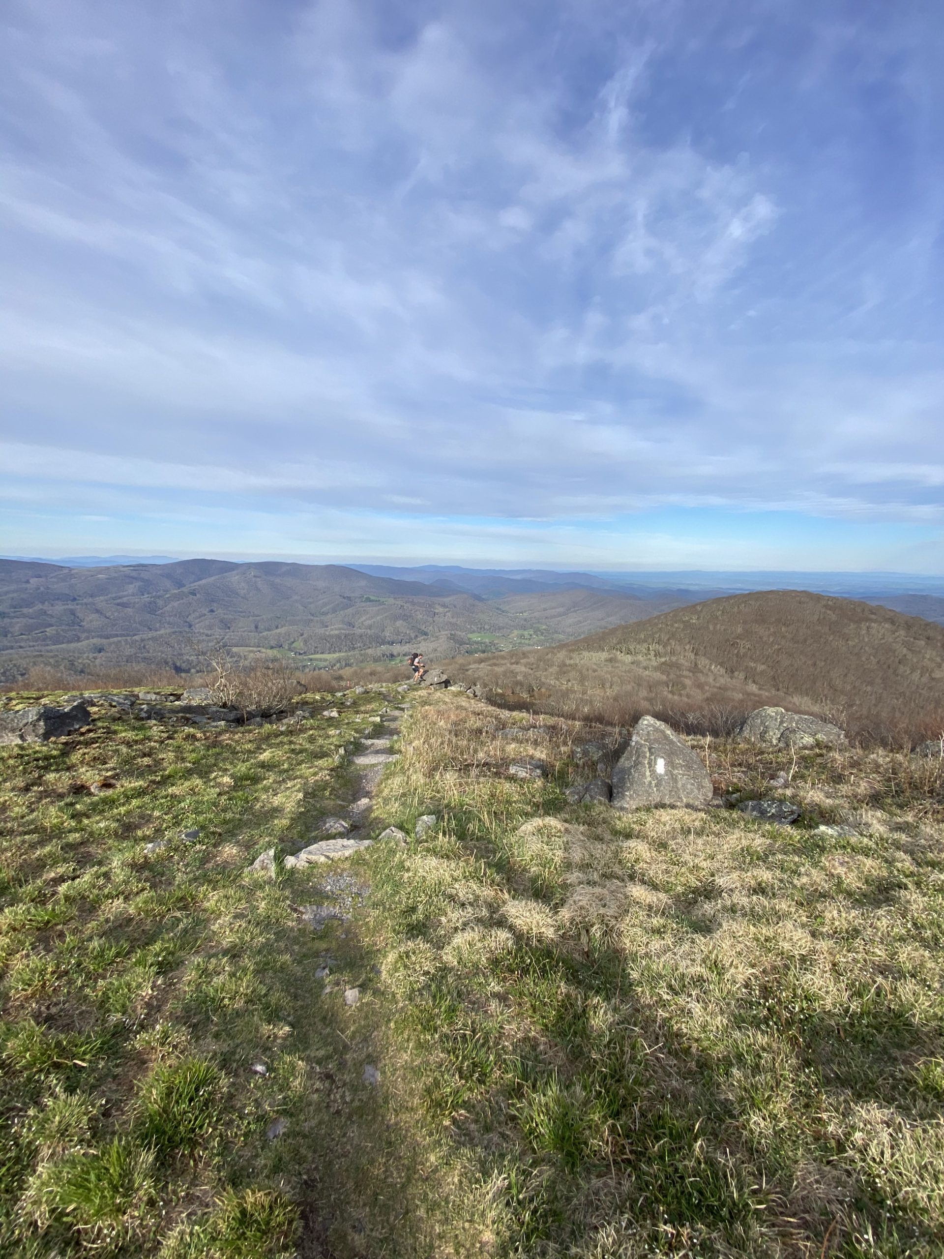
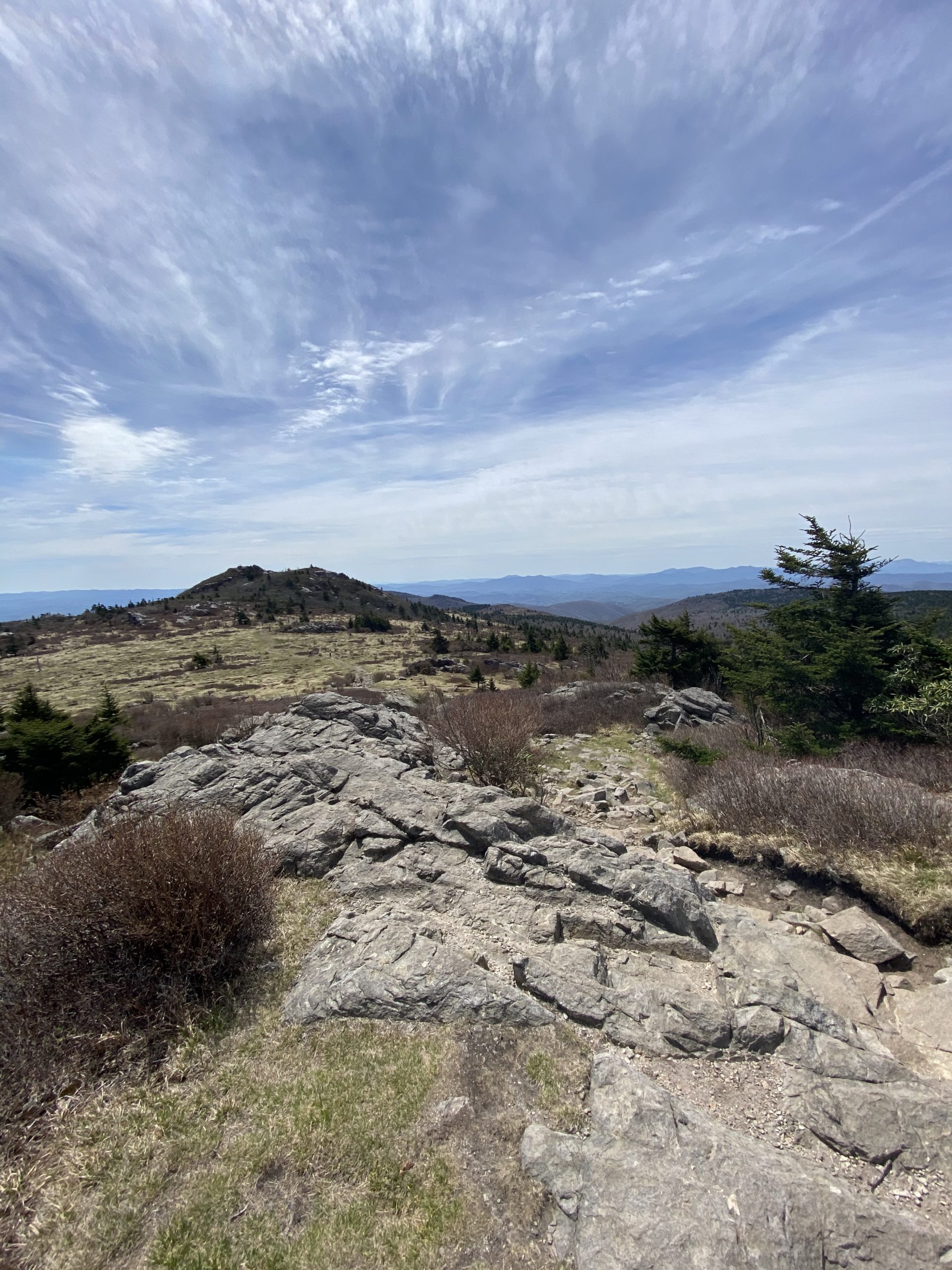
The day began with the long, gradual climb to the summit of Whitetop Mountain at over 5,000 feet. It was another spectacular grassy summit offering 360-degree views. The trail dipped back into the woods for a couple of miles before reaching Elk Garden parking lot, where the AT then begins the climb up to the Grayson Highlands.
The rocky, technical climb back up to 5,000 feet was much tougher than I had anticipated, and I was feeling pretty low on energy by the time I reached the top, but crossing the Grayson Highlands State Park boundary completely rejuvenated my energy as I was hyped to finally hike through this highly anticipated section of the trail.
The Grayson Highlands blew me away similar to how the Roan Highlands had blown me away. These highlands were somewhat like the Roan Highlands, but much flatter, with more trees and a lot more rocks. Rocky outcrops offering fantastic views were present throughout, along with the wild ponies that can be seen alongside the trail. I took my time hiking through this section, soaking in what is one of the most scenic sections I have hiked through yet. I was hiking on and off all day with Trail Candy, who surely was getting some amazing shots of the scenery with his DSLR.
After about 5 miles of open expansive views and ponies, the trail exits the state park and descends back down into the forests, where it remained for the rest of my hike. An uneventful several miles led me to a brook that had several open campsites nearby. The next shelter was 3 miles away and it was already 5;00 so I decided to call this unofficial stealth site my home for the night.


Stealth Site mile-marker 511.7 to Partnership Shelter, 22.8 miles
A gradual climb up to Hurricane Shelter was the perfect warm-up for my legs, as the trail remains mostly flat for the next several miles. There were no grand views in today’s hike, but I was thoroughly enjoying the dense, green forests I was traversing all day.
For the first 15 miles of the day I was in the zone; thanks to the flat and easy terrain I was able to go on “auto-pilot” and cruise at a fast pace for most of the day. My energy levels were through the roof, and it was just one of those days where I was grateful to be out here doing what I love every day. There are some days when the miles seem to take forever and I find myself constantly checking my Garmin watch or Guthook, but most days I can fully enjoy the moment and the miles will fly by, in a good way.
Dark, ominous clouds lingered all day which began to dump some rain just as I was finishing up my lunch break. From here, the intensity of the trail turned up a notch; the AT climbs up to a ridge where it follows the spine with many steep, relentless ups and downs for the remaining 7 miles of my hike. My endorphin rush was completely gone, as these steep bursts of uphill, on top of the 15 miles I had already hiked, started to kick my butt and I soon found myself counting down the miles until the nearest shelter.
The Partnership Shelter was full of people and I was glad to see Trail Candy and a couple of other familiar faces hanging out outside of the shelter. After two nights of quiet stealth camping, it was nice to have a more social scene. The shelter is very close to a road, so some hikers were ordering pizza and soda to the shelter. One guy even dropped off a 24 rack of beer at the shelter as trail magic. It honestly felt like I was “glamping” with several friends. Hiker midnight (9:00 PM) quickly approached and everyone retired to their sleeping bags/tents for the night.

Partnership Shelter to Lee Highway, 11.2 miles
It was a short 11-mile day into town to pick up my first mail drop package, and I was hiking just after 7:00. The first 5 miles of the day were no joke as the terrain consists of steep climbs and descents. Throw in a ton of slippery rocks, roots, and blowdowns, and you have yourself some tough, slow-going hiking. The trail has been extremely rocky and technical as of very recent; everyone talks about the rocks of Northern Pennsylvania, but never the rocks of Southern Virginia. There were more rocks in this 5-mile stretch than all of the Georgia section.
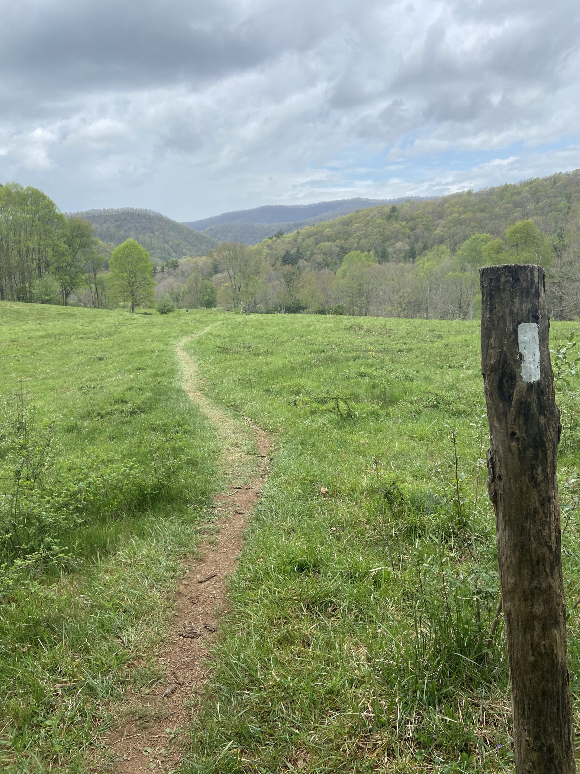
The trail eventually levels out and a gradual descent through rhododendrons leads to some grassy, open meadow walking, which is something I have become fond of recently. An old schoolhouse built back in the 1800s sits right next to the trail, so of course, I had to go inside to check it out.
I eventually arrived at the town of Atkins on Lee Highway just after 11:15, where I picked up my resupply package at the Relax Inn. Trail Candy arrived not too long after and we got a ride to nearby Marion to spend the night and to eat lots of Mexican food before beginning the next stretch of trail the following day.


This website contains affiliate links, which means The Trek may receive a percentage of any product or service you purchase using the links in the articles or advertisements. The buyer pays the same price as they would otherwise, and your purchase helps to support The Trek's ongoing goal to serve you quality backpacking advice and information. Thanks for your support!
To learn more, please visit the About This Site page.

Comments 2
Loved the ponies and the pizza & beer 😀
Glad you made it out of the “spooky fog” and abandoned schoolhouse ok 😉
Great photos as normal Max.