 ">
">
The Great Smokey Mountains National Park
From end to end in GSMNP, the AT covers 72.4 miles.
Nothing prepared me for the grueling hike to Clingman’s Dome. The Dome is the highest peak on the trail and the 200-mile-marker for hikers. This iconic spot is the centerpiece of GSMNP thanks to an observation tower providing 360 ° views on a clear day. The tower and path from the parking lot is wheelchair accessible, so kudos to the parks service for this forward and inclusive design.
But, let’s go back a bit.
Why did the second 100 miles seem to go faster than the first?
I spent my final night before entering GSMNP at the Fontana “Hilton,” the largest shelter on the AT. The shelter sleeps 24, so the dozen or so of us had plenty of space to spread out. An outdoor pump produces well water and there’s even a solar phone charger.
A short walk up the hill and you’re at a restroom facility with not only flushing toilets but also an actual hot shower. For a stinky, sweaty hiker, this shelter approaches nirvana.
It was here that I was spoiled before beginning some seriously strenuous (for me, anyway ) hiking.
A heavy pack
I had recently re-supplied and had eight days of food (translate that to mean about 12 extra lbs.). My plan was to hike through the Smokies without a town stop.
Thankfully, the cool yet sunny morning brightened my outlook on the day’s hike. The FarOut app showed 11.8 miles to the first shelter, Mollie’s Ridge. That sounded doable…until I checked the elevation profile. The first uphill of the day is always the toughest for me. Heh. That first hill was about 10 miles long.
I don’t know if I’ve mentioned it before, but I’m in my 50s. My lifetime hiking experience could fit on a cocktail napkin. A ten-mile ascent had my confidence shook. But…upon entering the Smokies, I did have three weeks of hiking under my feet. Maybe it wouldn’t be that bad.
An exhausting climb
Eight hours after beginning my ascent, the shelter came into view. I’m not ashamed to admit that I cried with relief. I might not have gotten my hiker’s legs quite yet, but the climb certainly confirmed my strength and endurance were improving.

Mollie’s Ridge Shelter was a welcome sight, indeed.
The next few days were rainy, foggy, cold. I had no cell service (as is typical of national parks) thus no contact with my greatest cheerleader, my husband.
Miserable weather and lack of contact combined brought on the mental demons.
What are you doing here?
What makes you think you can hike this whole trail?
You are utterly alone. No one here even knows your name.
Still, I pressed on. And I was rewarded with some other-worldly forest scenery.

The sun broke through the “smoke” of the Smokies.
No views
When I finally arrived at Clingman’s Dome, the weather was as it had been for days—gray. The peak was socked in. Zero visibility, no view.

Socked in. I’ll have to return someday and visit when the weather is clear and sunny.
I began the descent. A few hundred feet below the Dome, bits of sunlight broke through here and there and allowed for some lovely views.

Below the Dome I was rewarded with great views.
I really didn’t want to stop in town
Although my plans did not include Gatlinburg, TN, the weather of the previous days had most of my gear wet or damp. The “smoke” in the smokies is cloud vapor that permeates everything. With the forecast warning of a 30-degree night and colder wind chill with 40 mph gusts, I chose not to freeze. A couple of trail angels, Ron and Carolyn from Ohio, offered a lift (more about them and other NC/TN trail angels in another blog).
I dried out my gear at the Gatlinburg Quality Inn, showered, chatted with my husband, got a great night’s sleep, and returned to the trail the next morning.

Holy cow! This sign at Newfound Gap made me realize I had broken under the 2,000 mile mark!
Catching up with other hikers
The second half of the Smokies was much more…what’s the best word to describe it? Civilized. It was also more fun as I caught up to some tramily who had been putting in bigger miles.

Ice ribbons–I had seen them in videos by YouTubers but never expected to see them on my hike. So cool!
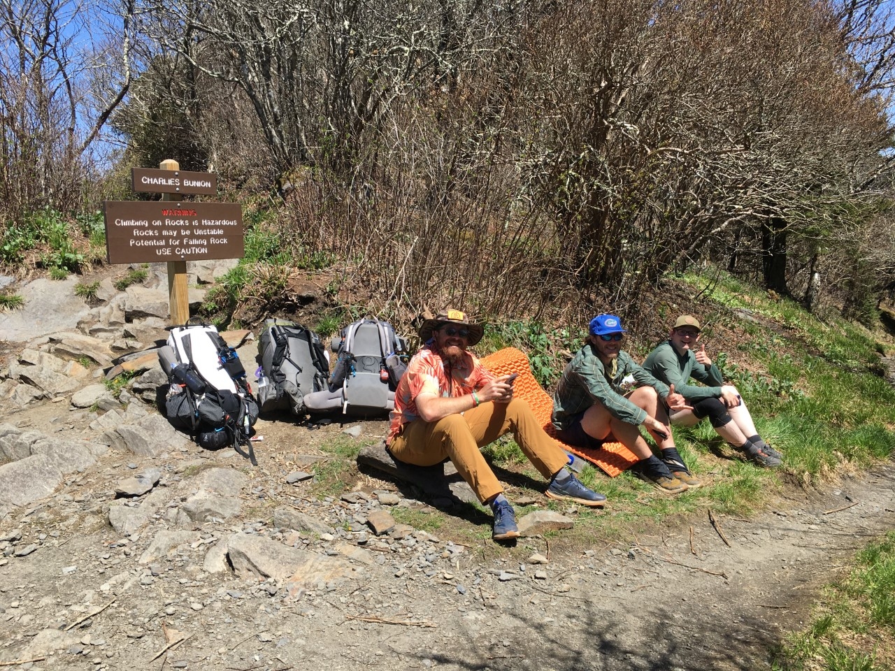
Dos Entradas, Gator, and SugaJay soaked up some sun in an area sheltered from the fierce wind near Charlie’s Bunion.
Long, gradual ascents had replaced the steep climbs. Ridge walks rife with sunny views, hillsides carpeted in scented wildflowers, and points of interest all contributed to a more positive mood.
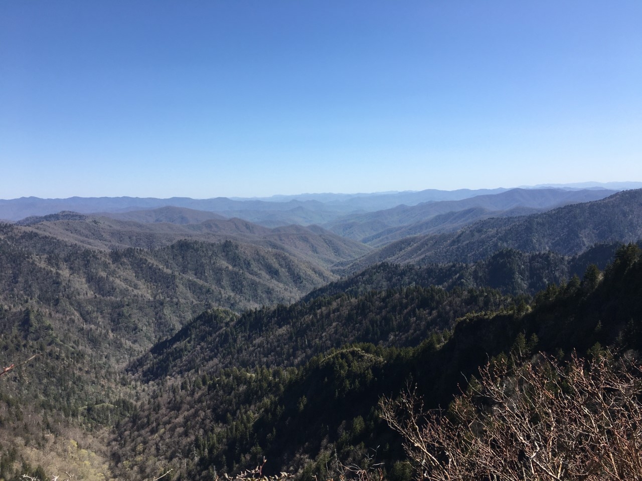
Finally, some great views!

The remnants of a US Air Force RF-4C Phantom II that disintegrated as it crashed into The Smokies on January 4, 1984.

Wild miniature irises.
Hoping to see a bear…
The final descent from GSMNP was interrupted by one final shelter: Davenport Gap. This is the only remaining shelter that is still fenced in to provide bear protection. With the prospect of seeing a bear and being completely safe, of course I stayed there!

I stayed in “the cage” hoping to see a bear.
Four other hikers joined me. Unfortunately, there was no bear sighting.
Only 1,953.9 miles to go!
Now out of the Smokies, I can look back an appreciate the learning experience, the fortitude gained, the introspection. The mental demons were silenced. The climbs didn’t beat me down.


This website contains affiliate links, which means The Trek may receive a percentage of any product or service you purchase using the links in the articles or advertisements. The buyer pays the same price as they would otherwise, and your purchase helps to support The Trek's ongoing goal to serve you quality backpacking advice and information. Thanks for your support!
To learn more, please visit the About This Site page.

Comments 2
Nice post, keeping on hiking you’re doing great.
Thanks, Denis!