 ">
">
The One with Questionable Sanity in the Whites [AT mile 1803.7-1894.8]
Day 140: Zero day!
Day 141: 11.5 miles from Kinsman Notch to Kinsman Pond Shelter
Day 142: 14.7 miles to Mt. Garfield
Day 143: 12.4 miles to Thoreau Falls
Day 144: 11.7 miles to Mizpah Spring Hut
Day 145: 14.3 miles to Mt. Madison
Day 146: 8.2 miles to Wildcat Mountain Peak D
Day 147: 18.1 miles to Gorham, New Hampshire
Day 148: Zero day!
Total miles on the Appalachian Trail: 1894.8
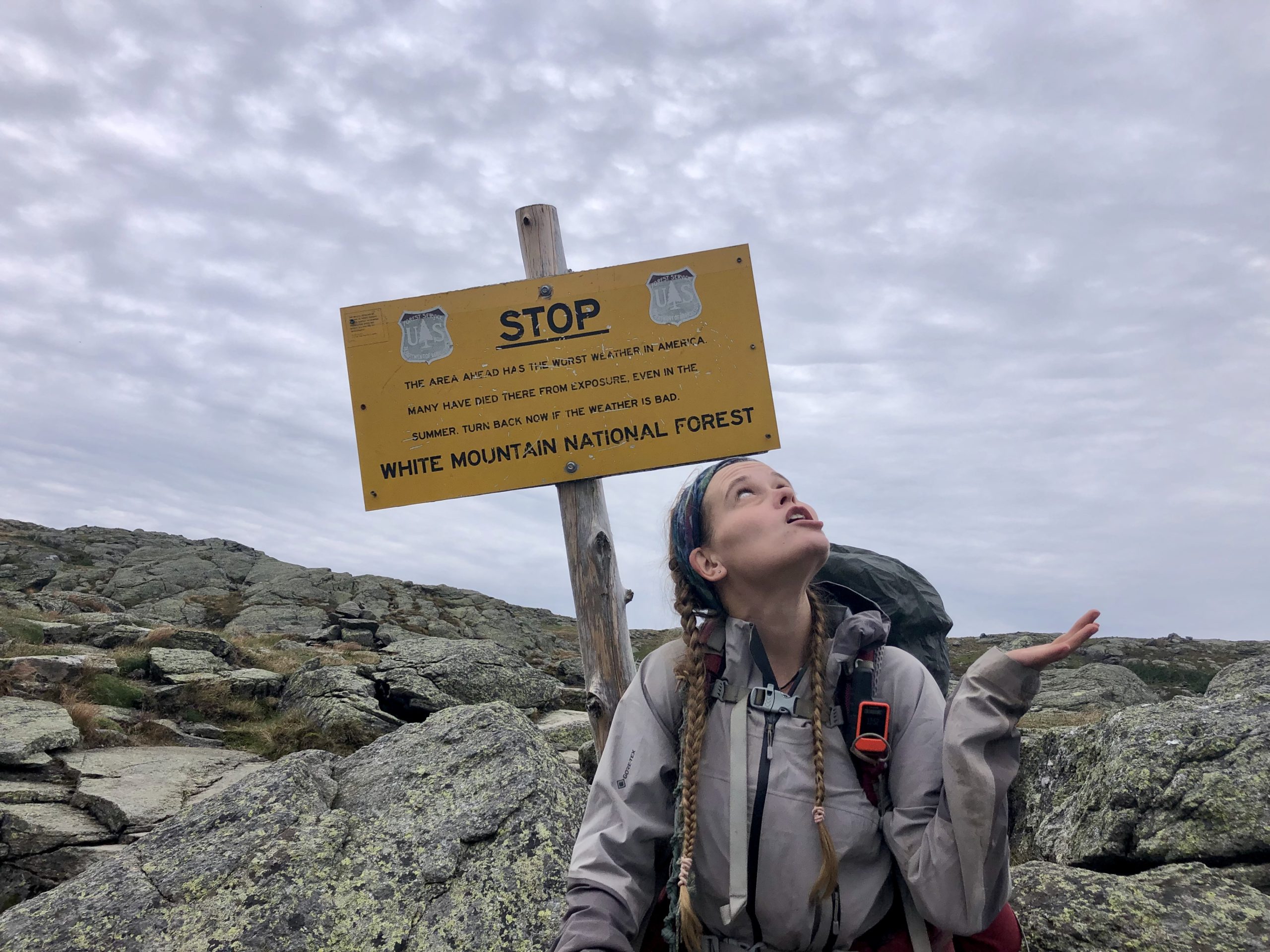
Wildest weather?
I’ve been nervous about entering the White Mountains since long before I began my thru-hike, mainly because of the crazy weather stories I’ve read. The weather in the Whites is supposed to unpredictable, rapidly changing, and, during bad weather, severe. I’m not saying that weather does not exist in the Whites, because it definitely does. But we got super lucky–our experience was the exact opposite. Clear blue skies granted perfect views and great stargazing. Only a few rumbles of thunder, but they randomly disappeared before reaching my location. And a few rain showers, but never when a view was imminent. We even got a view from Mt. Washington, which is pretty rare (I think Pace’s guidebook said only about 55 days of the year are clear from the summit). We definitely didn’t experience any of the “wildest weather in America” that Mt. Washington is famous for.
Overall, we definitely had best case scenario with our experience in the Whites, and for that I am super grateful.
Ready for the Whites
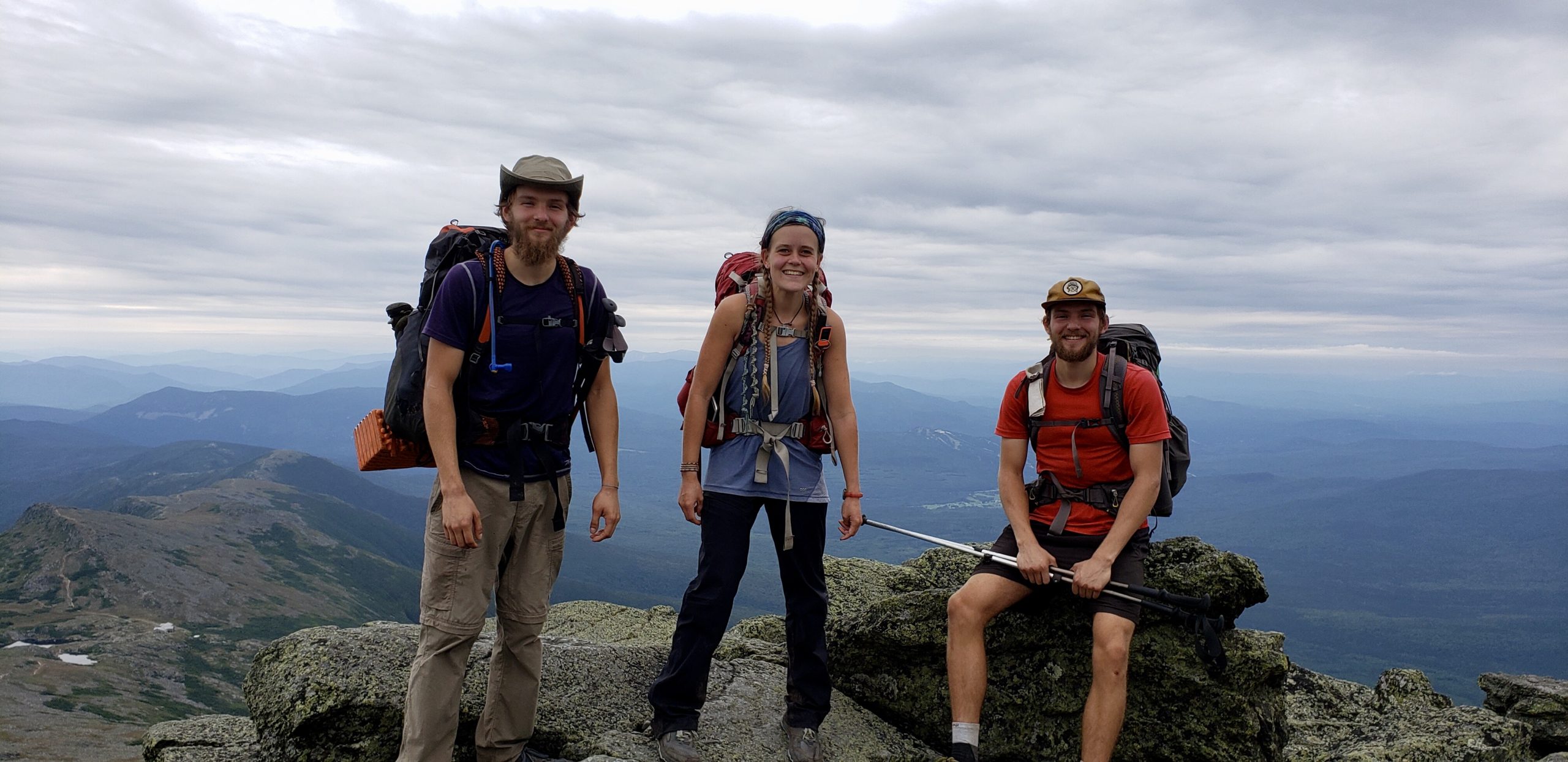
After zeroing in Lincoln, New Hampshire, I set off into the White Mountains with my friends Fiddlehead and Pace, and five days of food. In Lincoln, we made a very detailed plan (the most planned I’ve ever been on trail) of where to camp until Pinkham Notch, where we intended to resupply before finishing out the Whites. Five days of food was more than we had carried in a while, and we returned to the Whites with a bang–climbing Mt. Kinsman.
I’ve heard a lot of debate about whether Kinsman (technically comprised of North and South Kinsman Mountains) or Moosilauke (covered in my last post) is more difficult. Personally, despite carrying almost no food for Moosilauke and being loaded down with five days worth for Kinsman, I found the former to be more challenging. Moosilauke felt all around steeper, especially on the descent, and was a much longer climb. Kinsman had more technical rock scrambling, but I love that, and often would rather scramble than hike steeply up what is essentially a rock pile (which is SUPER common in the Whites).

View from Kinsman
My opinion on the mountains could also be largely due to conditions. I hiked Moosilauke on a very wet day after hiking hard for many weeks, while I hit Kinsman on a beautiful day after resting well on a zero. So that very well could’ve affected how difficult each mountain felt.
I also was blessed with a spectacular view on Kinsman, rather than a wall of fog. And Kinsman was just a taste of what I would experience as I continued on through the Whites.
…Did I leave the country?
Every time someone asks me what my favorite part of the trail is, I have always answered with Grayson Highlands. Until now. Franconia Ridge has blown it away.
I don’t know how to begin describing Franconia. It’s grandeur cannot be contained, or even remotely conveyed, in words. So I’m going to let pictures do most of the work for me.

Mt. Lincoln
Franconia is only 2.8 miles and 3 mountains long, but we spent HOURS (like, easily 3-4) walking it because it was just so beautiful. We would walk a tenth of a mile or two, and then have to stop and just look at the majesty around us. My eyes drank it in like a parched and panting hiker, the need to absorb every detail too desperate to do while walking.

I felt as though we’d hiked right out of the U.S. and into The Sound of Music (so, like, somewhere in Austria or something) with the grassy hills and grey-green mottled rocks, surrounded by tall blue mountains in all directions. The mountains, which included Mt. Lafayette, the tallest in the Whites outside of the Presidential Range, didn’t feel steep at all with my legs fueled by the magnificence around me.

Mt. Lafayette
We did end up racing night to Mt. Garfield because we took so long going across Franconia, but I have exactly zero regrets. If I could go back and redo that day, I would gladly fly down Lafayette (a not super easy decent) ignoring my screaming knees over and over again just to spend the day on Franconia.
Hiking Twin with a twin
On the day after Franconia, I climbed South Twin Mountain, a highly underrated mountain. The climb isn’t nearly as difficult as it appears on the elevation profile, it’s 1500 feet of elevation gain in 1.4 miles but honestly doesn’t feel like it.
The view from the top is what makes me say it’s so underrated. Being in the heart of the White Mountains, you’re surrounded by beautiful green and blue peaks are in every direction. You can see Franconia looking back down the trail, which gives me a huge sense of satisfaction to see where I’ve come from.

Fiddlehead joined me a few minutes after I reached the top, and we lamented the fact that his twin brother Pace was somewhere way far ahead of us. I thought they needed a picture with the Twinway Trail sign, but oh well.
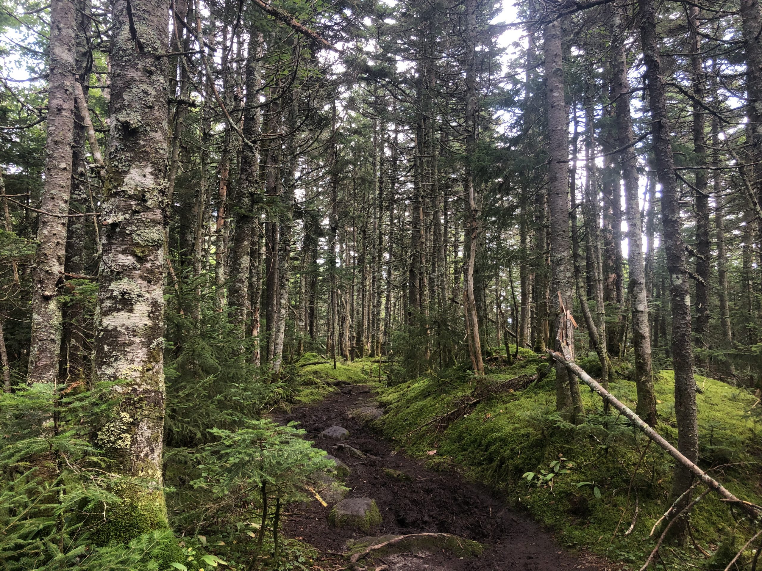
Later that day we walked a beautiful, crazy flat section along the edge of a ridge overlooking a ravine. The trail was gloriously smooth, being both root- and rock-free, which I don’t think has ever happened before. And did I mention the beautiful view? The Whites continually amaze me.

Proof I’ve gone insane
On the morning of the day we were to hike the Presidential Range, while sitting at a table in Mizpah Hut, we made a startling discovery. For the first time since literally ever, the Appalachian Trail wasn’t taking the hardest route possible to get us from point A to point B. Usually, the trail takes us up and over every single mountain in the area, most of which are tree-covered summits, for no apparent reason. Often times it would be shorter to not climb every mountain, yet up them all we go. The Presidential Range is the one exception to this rule.

Our first view of Mt. Washington from Webster Cliffs
Of the Presidential mountains, the AT summits Mounts Pierce, Franklin, Washington and Madison, while avoiding Mounts Eisenhower, Monroe, Clay, Jefferson, and Adams. (I may just be very uneducated, but I don’t have a clue who Mt. Clay was named after.) As my friends and I neared Eisenhower, the first of the skipped peaks, I felt an odd sensation growing in my stomach. It took me a minute to identify, but I finally realized I was experiencing FOMO. Fear of missing out. Which was utterly insane.
The AT is a difficult trail. We climb thousands of mountains and see so many views. Yet here I was, in the middle of the Whites (the most difficult section of trail in my opinion), with tons of mountains to climb, hating the fact that we were skipping five. I confessed as much to the boys, and they admitted to feeling the same. We hiked slower and slower, until about 100 feet after we passed the spur trail to Eisenhower, we stopped.
Fiddlehead suggested we flip a coin. Heads we hike all the blue blazes to climb all the mountains. Tails we don’t. One of them pulled a coin from somewhere and Fiddlehead flipped it. He didn’t catch it (he’s got the hand-eye coordination of a hiker) and it rolled to a stop in the dirt at my feet. I bent over to see the result. Tails.
I looked up at the boys, feeling the disappointment settling in my stomach, and was surprised to see the same reflected in their faces.
“We’re hiking them.” I announced, and spun around to return to the Eisenhower spur, not looking to see if they followed. They did. Making all three of us possibly definitely insane.

Mr. President
The views along the Presidential Range are absolutely beautiful, although I liked Franconia just a little better (the Presidentials are all very rocky, so you don’t have the bright green grass that Franconia has that I loved so much).
We had been able to see Mt. Washington, the tallest peak in New Hampshire and the northeast, for days, and it steadily grew closer with each peak we climbed. We added Mts. Eisenhower and Monroe on our way to Washington, and stopped briefly at Lake of the Clouds Hut for a brownie before heading up.

Lake of the Clouds Hut and Mt. Washington
Washington is one of those climbs you hear horror stories about. Some of them are weather related, which like I said earlier, thankfully wasn’t a factor for us. But I’ve also heard from so many hikers about how difficult the climb is. Honestly, I didn’t think it was that hard. We zoomed past a lot of people on our way up (it was a Saturday, so SUPER crowded) and I almost sort of kept up with the boys (they’re much faster than me, but I kept them in sight the whole climb so I was proud).
My corn brain can’t handle this. –Pace (For weeks I’ve been making fun of the boys for living in Indiana, the land of corn. This was Pace’s reaction to the view from Mt. Washington.)
The view from the top was very satisfying. I could clearly see everywhere we’d hiked for the last few days and actually identify specific mountains (which I am usually terrible at). After enjoying the view for a bit, we went into the restaurant/gift shop at the top (Washington is very touristy with multiple buildings at the summit as well as a road and a train providing access). I was very overwhelmed at the number of people streaming through the building after only seeing the same eight or so for the last many days. But it was well worth the little bit of stress to enjoy a hot and filling bowl of chili.

View from Washington
The hardest descent
After leaving Washington, we had four more mountains to climb before we would be below treeline and able to set up camp. And we were rapidly losing daylight. On the top of Jefferson, I began thinking that maybe summiting all the Presidentials in one day wasn’t the best idea. The sun was going down, it looked like it was trying to rain, and my knees were absolutely screaming in pain. So I told the boys that I wasn’t going to climb Adams, the last off-trail mountain, that I was just going to stay on the AT so I could get to camp faster. It was the responsible, listening-to-my-body decision.

Mts. Jefferson, Adams, and Madison
Instead of heading off down the side trail towards Adams without me as I expected them to do since I said I wasn’t taking it, the boys waited for me at the sign announcing the split.
“You’re not really going to skip the last mountain, are you?” asked Fiddlehead when I walked up. That was the straw that broke the camel’s back. I was already second guessing my decision to not hike Adams, and trying so hard to convince myself that it was the right call. In hindsight, it was the right call to not hike Adams. But I did not make the right call.
Up and down Adams we went, stopping briefly at Madison Spring Hut to refill our water bottles before attacking the final climb. The clouds were closing in on us, the sky beginning to spit rain, but I stood on Madison’s summit and let out a howl of triumph. We’d hiked the entire Presidential Range–every single peak (at least those accessible from the AT)–in one day. This may be super common, I don’t know, but that does not change how amazing it felt having done it myself.
The descent down Madison is notorious. Quite possibly the hardest descent of the whole trail. I was warned heavily about it by hiker friends ahead of me, and then proceeded to hike it in almost the worst conditions possible. In the rain. And the dark.

The rain coming for us
It took us FOREVER. Fiddlehead said at one point we were doing 0.6 mph. AKA the pace of a sick and elderly snail. The trail is over large rocks that were very very slippery in the rain, and we were walking by headlight which isn’t as speedy as when you can see everything at once. But finally, around 9pm, we made it to a place we could camp.
Really should’ve skipped Adams. Well, we really should’ve just stuck to the AT and not added extra mountains to it. But I’m so glad we did and that I’m hiking with boys equally as sane as I am.

Photo cred: Fiddlehead
Zooming down to Gorham
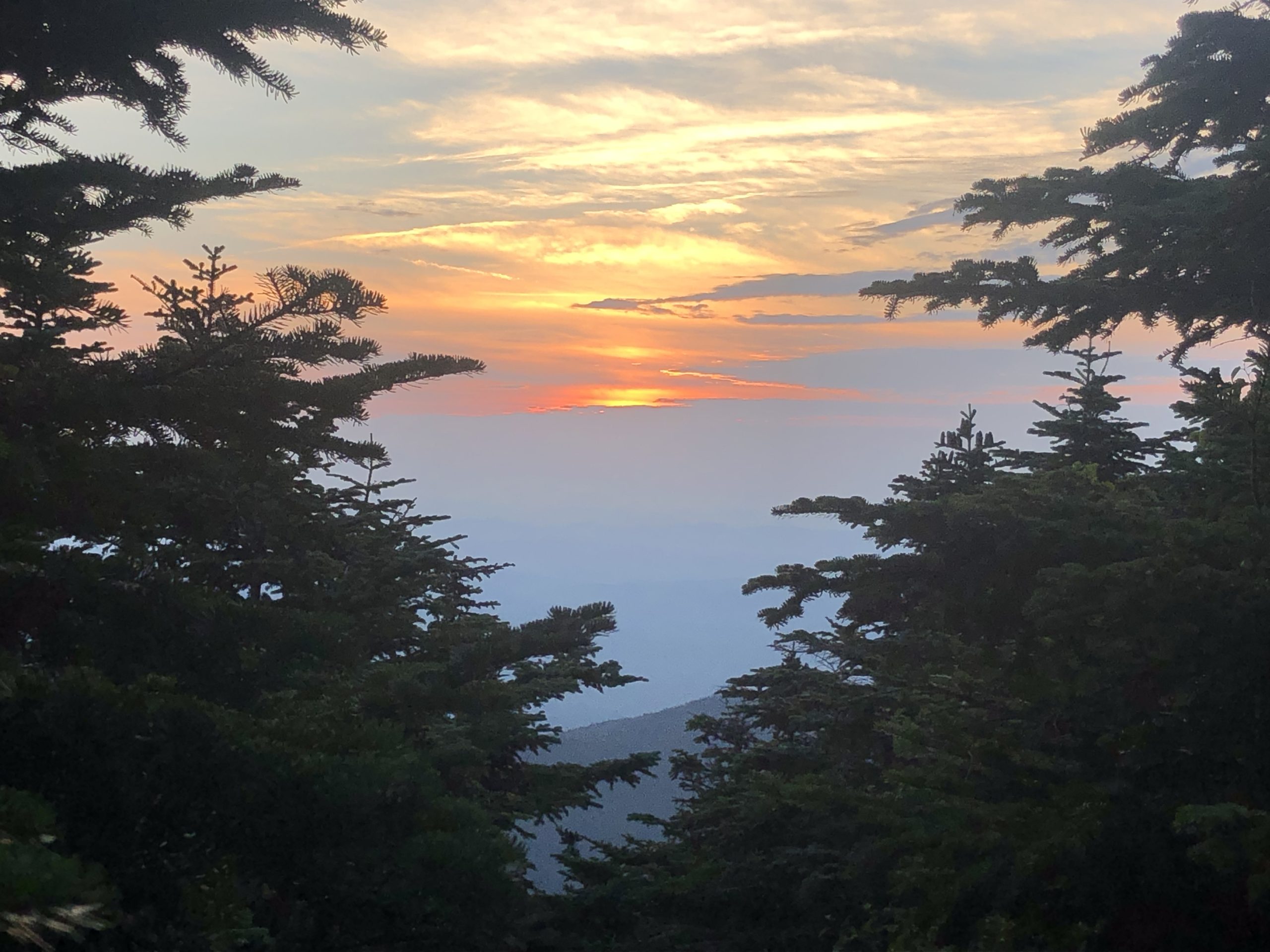
We slept real late into the morning after coming down Madison, which we desperately needed. Then we hiked down to Pinkham Notch where we resupplied at the Visitor’s Center. This is a very pricey and very limited resupply, but it had enough to get us the day and a half we needed to get to Gorham, NH. After resupplying we hiked up to Wildcat Peak D (apparently the mountain naming people ran out of names because the peaks of the Wildcat Range are literally just letters) where we enjoyed a SPECTACULAR sunset behind Mt. Washington.
The next day we hiked 18 miles in the rain over the rest of the Wildcats, Carter Dome, Mt. Moriah, and down to a real road where we hitched into Gorham for a well-deserved and much-needed zero.
Gotta rest up–Maine is in 16 miles!
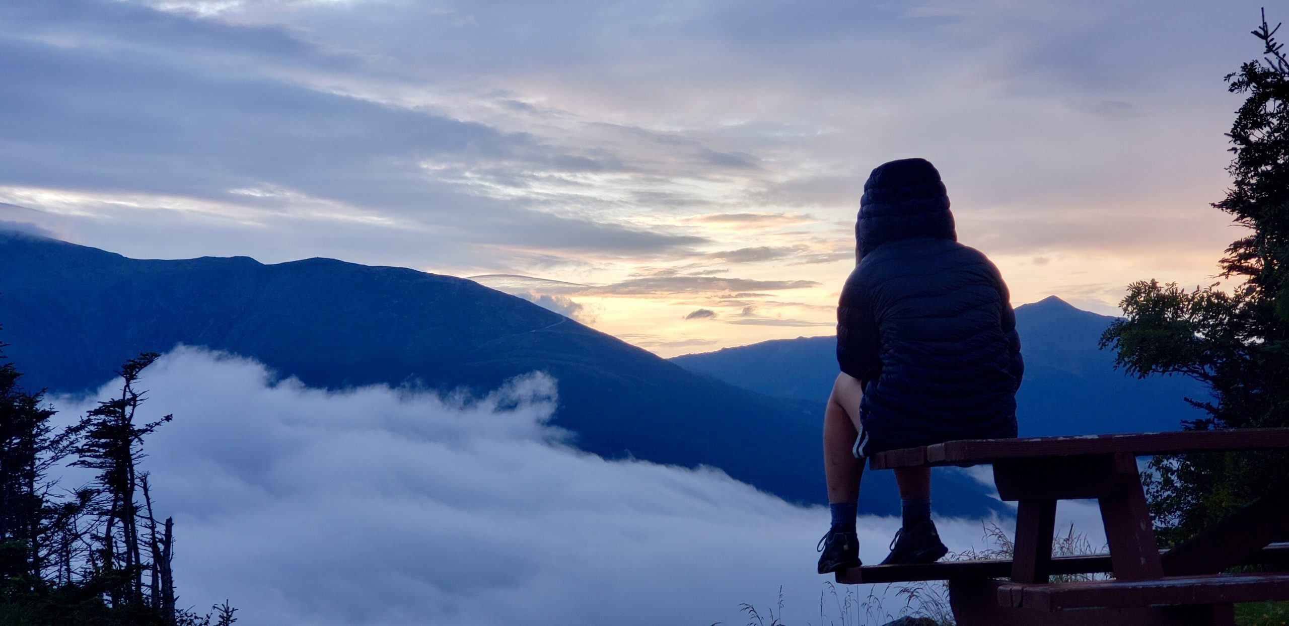
Photo cred: Fiddlehead

This website contains affiliate links, which means The Trek may receive a percentage of any product or service you purchase using the links in the articles or advertisements. The buyer pays the same price as they would otherwise, and your purchase helps to support The Trek's ongoing goal to serve you quality backpacking advice and information. Thanks for your support!
To learn more, please visit the About This Site page.

Comments 5
I’ve said it once, I’ll say it again, “You go Girl”
I love your posts, the writing and photo’s are great (if you’re with or see “Fiddlehead”, also good job with the photo’s).
After proceeding with your journey/adventure the way you have, you definetly deserve the great weather and views you’ve gotten throughout the “Whites and Presidentials”. I’ve been up and down Mt. Washington 4 times and have yet to get the views you were blessed with. This post in particular may be the post that inspires me (puts me over the top) to finally and seriously plan my AT through hike.
Keep up the good work. I, as a not such an accomplished hiker, know you see the end is near and that is both good and bad. I think most hikers can’t wait to get to the end and they also want it never to end. Keep enjoying what your doing!!! Good luck….and I’ll keep on reading ?
Do you realize what the three of you did!?!? A Presidential Traverse! That is a really big deal among many New Englanders. Some do it as a day hike, others reserve a bunk at one of the huts and split it into two days. Congratulations on both the achievement and getting good weather for it!
Yes, by climbing all the peaks in the presidential range in one day, you did the Presidential Traverse! That is an amazing achievement and be glad that you were able to fit Mt Adams in the day! And to have good weather for it is an epic hike. Be very proud of your traverse and savor the memories for years. What an amazing hike
Wow- phenomenal feat!