 ">
">
The Quarter-Trail Update (Part 1: So It Begins)
Since I’ve been so terrible about updating this blog, here’s one massive update (in multiple parts) to let you know what I’ve been up to for the past 550 miles.
The first days
This adventure really starts a couple days before I even set foot on the AT approach trail. My wonderful parents were kind enough to drive me from NC down to Amicalola. As we gained elevation, we started to notice snow appearing on the ground. By the time we got to the state park, the ground was completely covered. Not going to lie, my heart sank a bit. I knew I was going to encounter snow, but starting in it? Well, we had planned to spend a couple days hanging out at Amicalola and experiencing the beginning of the 2016 kickoff, and when we woke up the next morning, much of the snow had melted. We decided to hike down the stairs to check out the falls (so yes, I ended up hiking those stairs twice). The next morning, we got to the visitor center as soon as it opened so I could sign the register and begin my hike for real. I ended up being the 374th hiker to sign the register. After some photos and hugs, I walked under the arch to begin the approach trail (I actually ended up starting at the same time as Oats, another hiker who’ve been hiking off and on with since then).
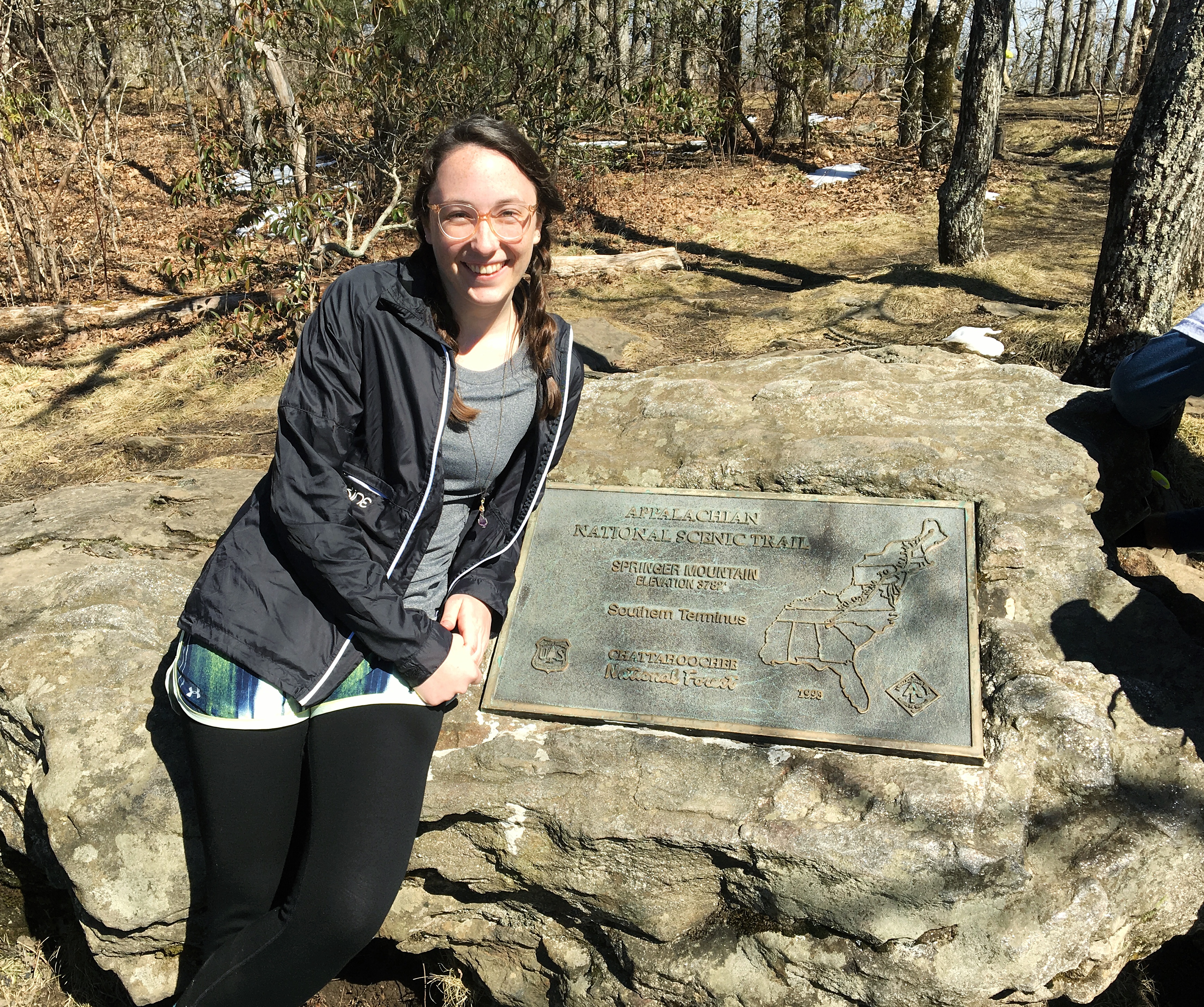
I made it up to the summit of Springer, and was rewarded with what was honestly a kind of underwhelming view. There were a lot of other people up there, though, so it was nice to talk to other thru-hikers, day hikers, and a ridgerunner. I stopped for a while to eat, and then continued the last 2.5 miles to Stover Creek Shelter for the night. There I met 4 other thru-hikers, who I’ve continued to run into throughout my time on the trail. The shelter was very clean (thanks to the ridgerunner who had cleaned it out the day before), so we all ended up staying in there. That night in the shelter was probably one of the most difficult ones I’ve had on the trail. I started thinking ‘What am I doing out here?’ ‘Why did I decide to do this?’ ‘I’ve made too big a deal out of this, so now I have to finish it.’ Well, I woke up the next morning, the sun was shining, the world was beautiful, and I hiked on and never looked back.
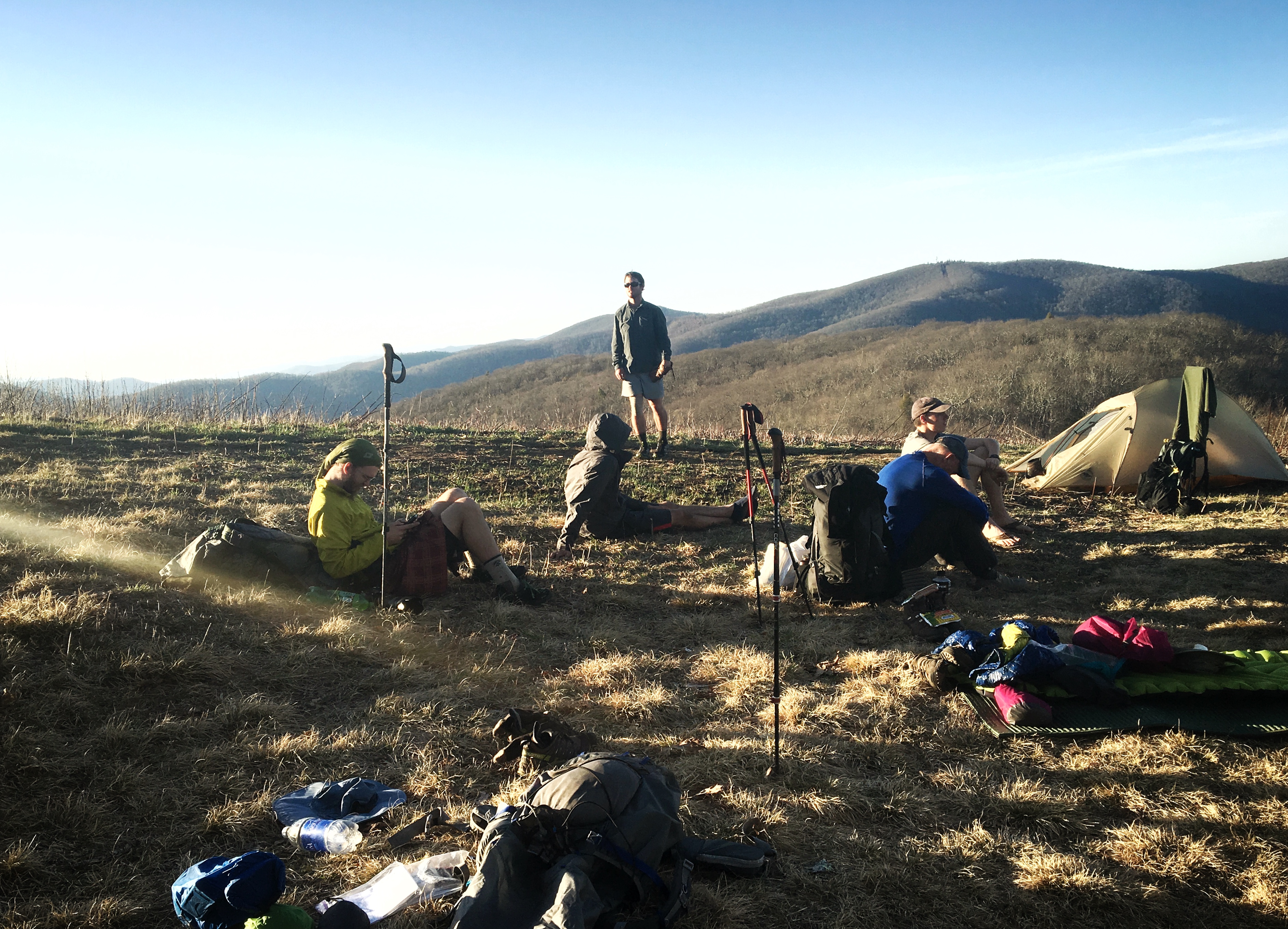
Those of you who know the beginning of the AT probably know that there’s a short stretch where bear canisters are required. You also probably know that no thru-hiker wants to carry the weight and bulk of a bear canister. This leads to either a very short day (so you can go all the way through that area to Neel Gap the next day), or a very long day. I ended up deciding on the first option and bunching up at the Lance Creek Campsite with at least 20 other hikers. The next day we hiked a great day over Blood Mountain, and ended up splitting the cost of a cabin at Neel Gap on the other side.

One of many amazing views off the top of Blood Mountain.
It’s amazing how fast you can form friendships with other hikers out here. It was only the fourth day, and I already felt like I was forming a trail family. We ended up hiking together for a few more days until Dick’s Creek Gap, when some decided to take a first zero day. Just before the gap, I had the first night where I camped mostly by myself. I didn’t feel the need to stay at the hostel, so I stopped a little early and camped at a beautiful vista.
Rainy days
At Top of Georgia Hostel, I picked up my first resupply box and was able to do laundry. We hiked out to the next shelter for the night and were greeted with warnings about an epic snorer. Needless to say, I didn’t sleep as well as I could’ve, and woke up to the first rain I had experienced on the trail. Despite the less-than-sunny weather, it was a good day of hiking, and we crossed our first state border! We were now officially in my home state of North Carolina.

Our destination that night was Standing Indian Shelter. The shelter was packed, and I wasn’t sure how I felt about the people there, so I ended up tenting a ways away from the shelter.
The next day I ended up getting caught in an epic downpour when I was about 45 minutes away from the shelter, but after that, our luck began to improve, and the next day I was able to take a nap in the sun on top of Siler Bald and cowboy camp there that night. We enjoyed a beautiful sunset and hot dogs cooked on the campfire (fellow hiker friends who stopped in Franklin packed them out).
The campsite on Siler Bald.
The first zero
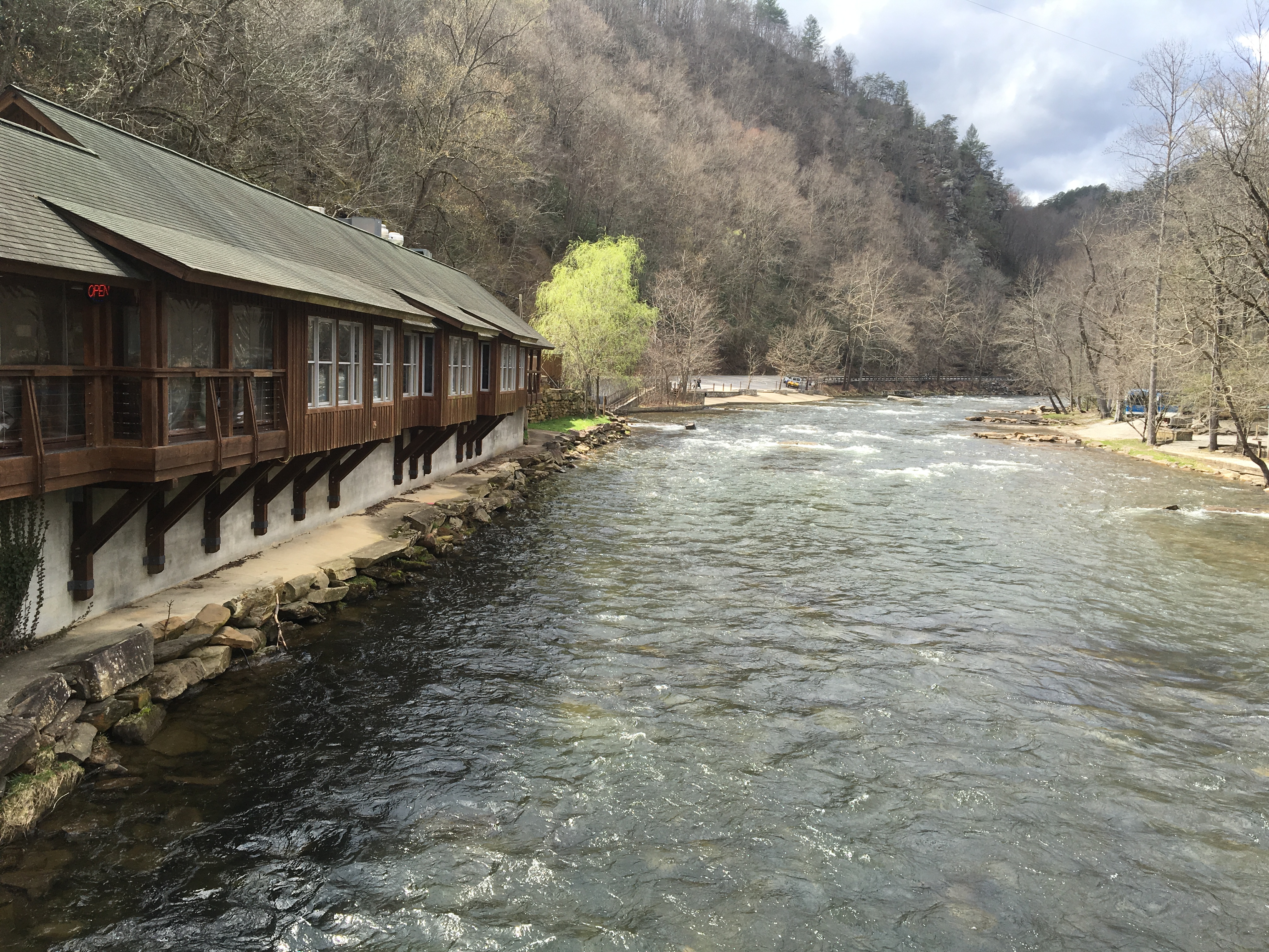
The weather continued to be amazing all the way to the Nantahala Outdoor Center where we were able to spend two near-o days and a zero relaxing around the river with friends (thanks for coming to visit, Nettie, Janie, and Catherine!). Eating real food and drinking good beer for the first time in a while was a nice treat. Being able to take a shower and do laundry is also always welcome.
What was your experience of the first 100+ miles? Share in the comments.

This website contains affiliate links, which means The Trek may receive a percentage of any product or service you purchase using the links in the articles or advertisements. The buyer pays the same price as they would otherwise, and your purchase helps to support The Trek's ongoing goal to serve you quality backpacking advice and information. Thanks for your support!
To learn more, please visit the About This Site page.
