 ">
">
The Virginia Triple Crown: AT Days 46-48
Sarver Hollow Shelter to VA Route 624, 23.0 miles
I was motivated to get an early start on the day and was breaking down camp by 6:30. The day’s hike started off with a classic Virginia rocky and technical ridge walk for three miles before descending down to VA Route 621. I chatted with a day hiker there who was very intrigued by my journey; I always love taking the time to talk to other day hikers about my hike. It wasn’t too long ago when I was that day hiker fascinated by the stories and accomplishments of other thru-hikers.
A long 2.5-mile, 1,400-foot climb up Branch Mountain soon followed. The climb was all switchbacks and I was firing on all cylinders on this climb, reaching the top before I began to feel fatigued. It was cold and windy on the 4-mile flat ridge walk that followed, again having me question why it has been so chilly in mid-May.
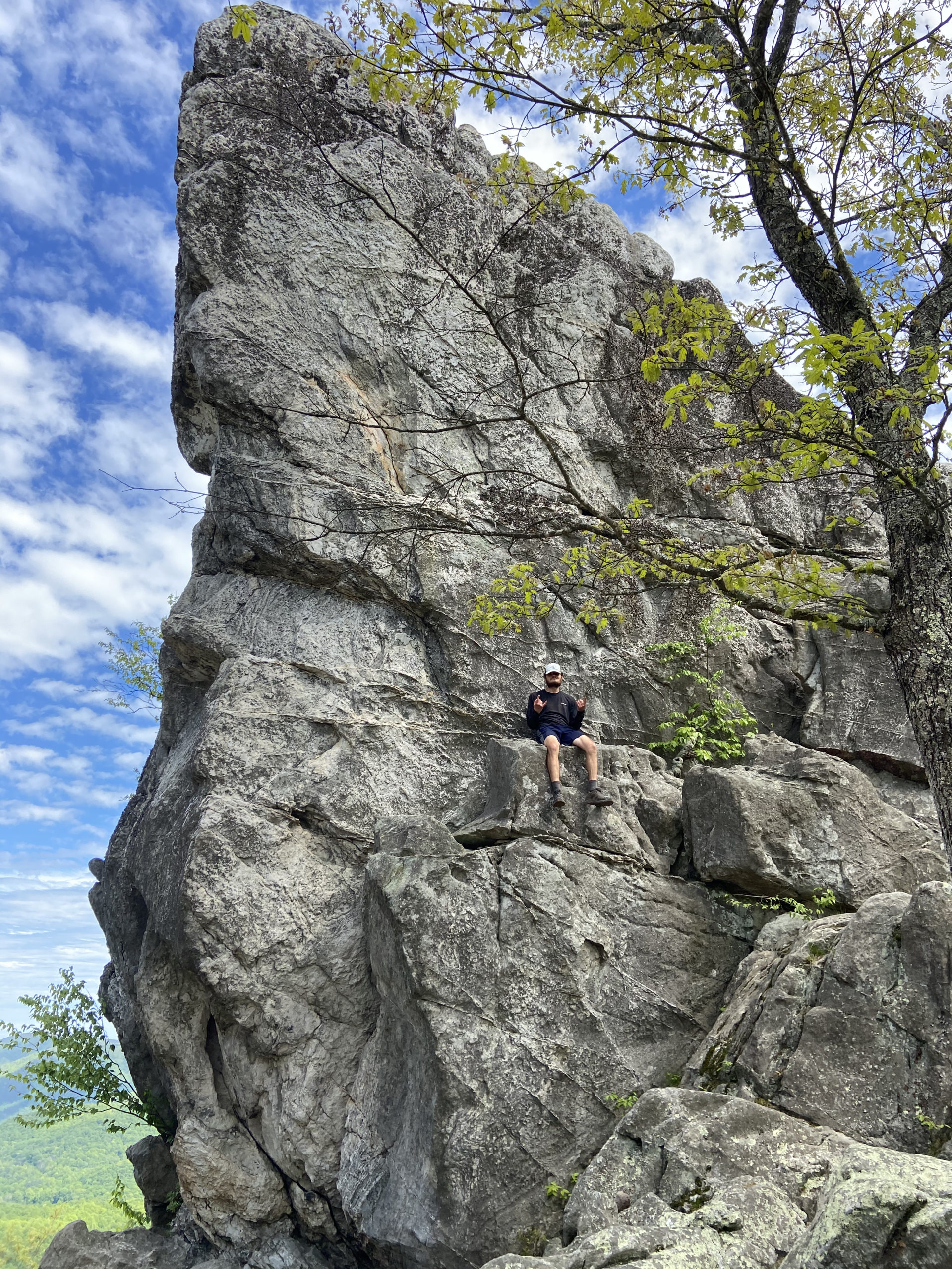
I descended down to VA Route 620 where a case of beer was waiting for me at the trailhead. Trail magic! I haven’t had any since before entering Virginia, so this was a nice surprise. I enjoyed the can of calories with my lunch before beginning the ascent to the iconic Dragon’s Tooth, part 1 of the Virginia Triple Crown.
The milestone had to be earned for sure: many switchbacks, followed by a rocky ridge walk full of steep bursts of technical inclines finally leads to the rocky monolith that is Dragon’s Tooth. I snapped a few photos before the final descent down to VA Route 632. I heard from Trail Candy for the first time since Pearisburg and he told me of his plans of staying the night at nearby Four Pines Hostel. There was no good camping nearby and no water sources listed on Guthook for miles, so I decided that spending the night at the hostel might be a good move as well. Another beer and a warm shower didn’t sound terrible, either.

VA Route 624 to Lamberts Meadow Campsites, 16.5 miles
I had a shorter 16.5-mile day planned since camping at designated sites was required in this certain wildernesses area, so I didn’t leave the hostel until around 8:30. The day started off through cow pastures, where a huge squad of cows was hanging out right on the side of the trail. Gradual climbs and descents then lead to VA Route 311, the last road crossing before the climb up to the iconic McAfee Knob.
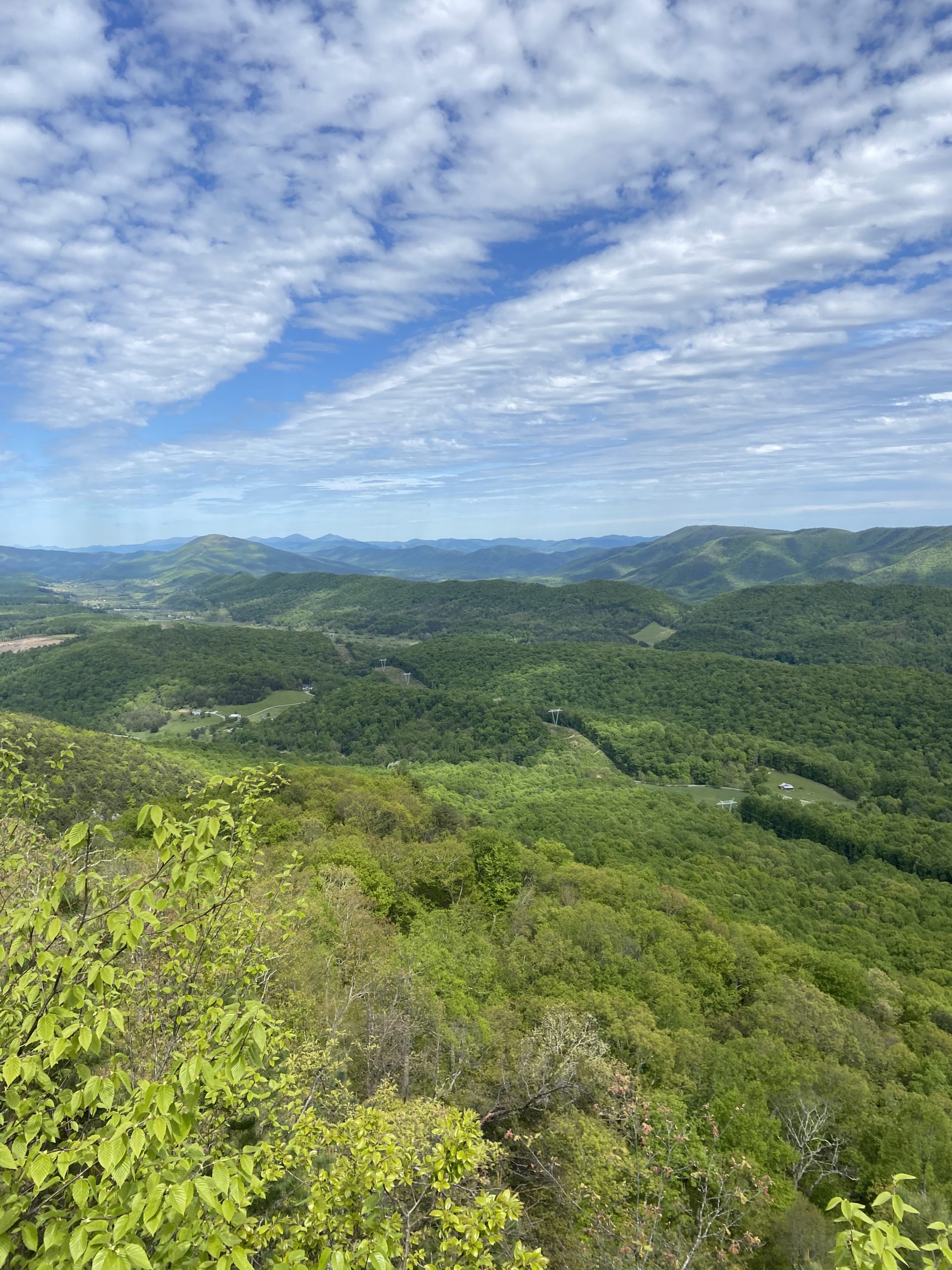
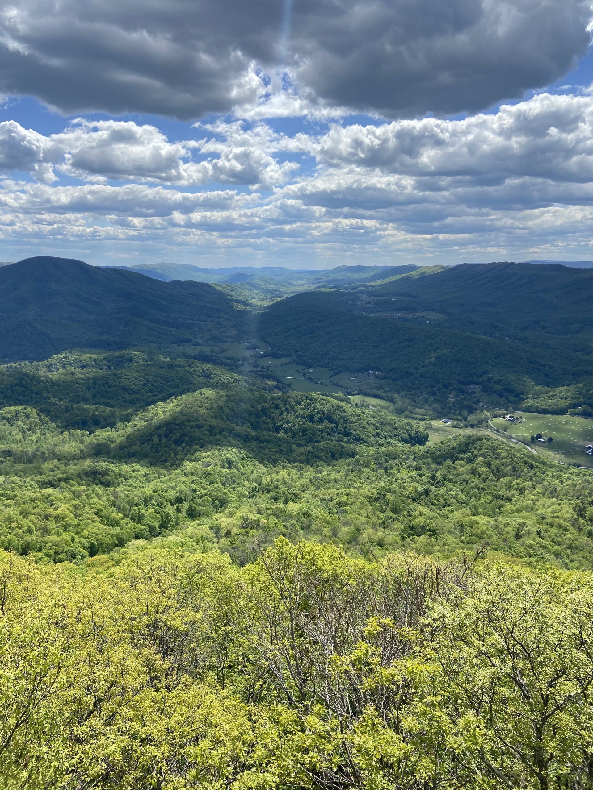
It was a very gentle 3-mile ascent to the rocky outcrop which provided stunning views of the surrounding valleys and ridges. McAfee’s Knob is an iconic landmark on the AT, and it felt surreal finally arriving. I took my photos and hung out for well over an hour on the rocky summit with Goosebump and Meatloaf, two hikers my age I met and hung out with at the hostel the previous night. We agreed to meet up later that night at the Lampert Meadow Campsites.
After descending the knob, a mostly flat uneventful four miles leads to the tough climb up to Tinker Cliffs; the final piece of the puzzle to the Virginia Triple Crown. The AT steeply climbs for a bit before leveling off; repeating this process several times over the next 1.3 miles. Each incline was longer and steeper than the previous one. “These cliffs better be awesome,” I told myself as I began to become fatigued on the final steep push to the top.
The tough climb was worth it, as a .25 mile cliff-side walk provided more stunning views, arguably better than the views from McAfee Knob; which was easily visible from the cliffs. From there, it was an easy 1.7-mile descent down to camp, thus completing the iconic Virginia Triple Crown. Another AT milestone checked off the list. Goosebump and Meatloaf would arrive at camp not too long after me.


Lambert’s Meadow Campground to US Route 220, 9.3 miles
It was only 9 miles down to town for my near-o day, but I was hiking by 6:45 with the hopes of arriving in town early to get my town chores out of the way so I could have all day to relax. The day was mostly flat through pine forests, also passing by blooming mountain laurel and other wildflowers. I assumed it was going to be a casual nature walk all the way into town, but a 2 mile rocky and technical ridge walk with steep bursts of inclines and scrambles proved me wrong.
Several switchbacks took me off the ridge down to US Route 220 in Daleville where I was spending the night at the Super 8, steps from the AT. A short walk down the highway took me to Outdoor Trails Outfitter where I had a package waiting for me.
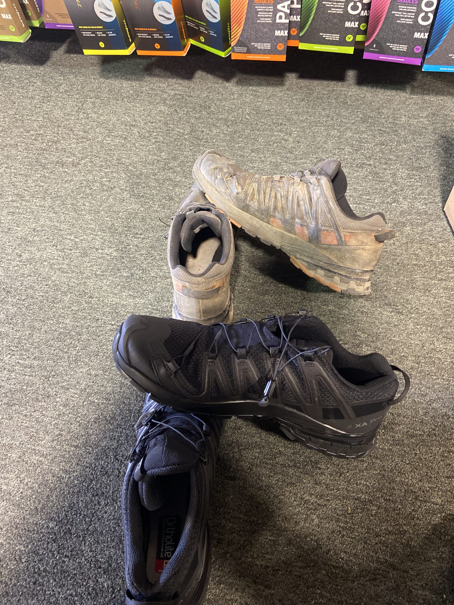
Opening the package, I found an awesome surprise: my first new pair of shoes on trail. I’ve used the same Salomon XA Pro 3D shoes the entire time and am super impressed with their durability. I knew it was time to get new shoes when I had zero traction attempting to climb to the very top of Dragon’s Tooth, and I was planning on buying a new pair at the outfitter. However, my parents surprised me with the new shoes just at the perfect time. Huge shoutout to you, mom and dad.


This website contains affiliate links, which means The Trek may receive a percentage of any product or service you purchase using the links in the articles or advertisements. The buyer pays the same price as they would otherwise, and your purchase helps to support The Trek's ongoing goal to serve you quality backpacking advice and information. Thanks for your support!
To learn more, please visit the About This Site page.

Comments 2
Interesting perspective on those iconic VA spots, and nice shout out to the parents!
Great photos and information as normal, BUT there is no way I will sit on that rock next year, jajaja