Day 133
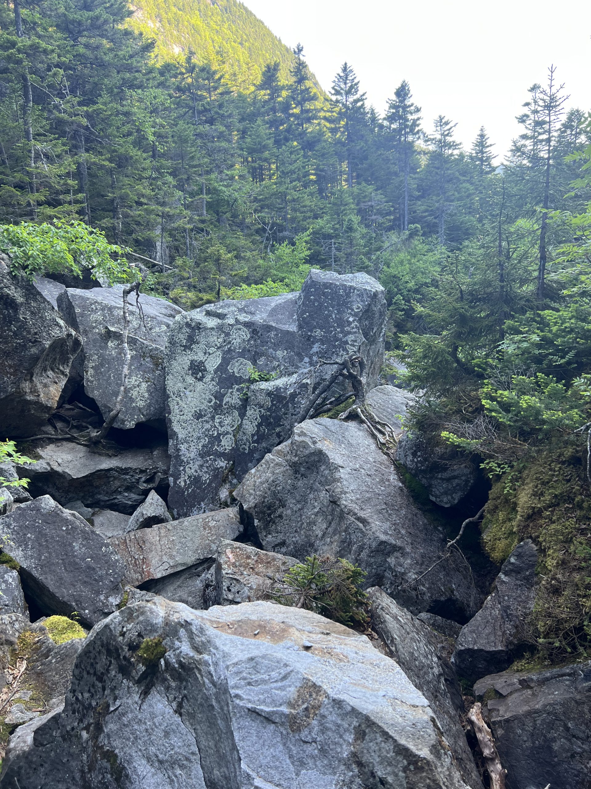
This morning I headed down the trail toward the infamous Mahoosuc Notch, often called the hardest/most fun mile on the whole trail. The Notch is a deep ravine filled with car-sized boulders that the trail leads hikers over, around, and under, sometimes using arrows painted on the rocks to direct hikers through particularly tight squeezes. I entered the Notch and started making my way through the obstacle course with a lot of butt sliding and large steps.

The trail has been more boulders than dirt the last couple weeks
I decided that this section of trail wasn’t all that different than many of the other boulder covered areas I’d done recently, and just required a lot of careful planning to make it through. While it wasn’t the hardest mile on trail for me, it was the slowest, especially with having to take off my pack and push it through tight squeezes ahead of me a couple times. After I exited the Notch I turned and started a very steep climb up the Mahoosuc Arm toward the top of Old Speck Mountain. This climb was way harder than the Notch had been, super steep with tons of scrabbling up sheer rock faces. It took me a long time, but I finally made it to the top of Old Speck Mountain and started down the other side. Fortunately the descent was a little less steep, with a lot of rock stairs. A more gradual descent usually means a longer one as well, and I felt like I was hiking down off that mountain for forever, as I slowly made my way past some cascading creeks and finally made it to the parking lot. In the parking lot I met up with my shuttle and headed into the small town of Bethel for the night. I ordered a large pizza (which I absolutely demolished), and I headed to bed pretty early, very tired from the last few days.
Day 134
I decided to take a zero day in Bethel, my first since Killing, Vermont. My hotel was perfectly located in the middle of town, and the grocery store was just two buildings down. I made the dumb mistake of going to the grocery store before I’d had breakfast, and with my large hunger influencing me, I was piling snacks into my basket for the next stretch of trail. It wasn’t until I’d gotten back to the hotel room and unpacked all my food that I realized my mistake. I’d gotten way too much food, I could barely stuff it all into my food bag! I resigned myself to a heavy pack for the next couple days, and started trying to eat some of my excessive snacks as I got back to relaxing for the rest of the zero day.
Day 135
I packed back up feeling refreshed, although not super excited to head back out into the wilderness. I got into the hotel shuttle heading back to the trail, and was about halfway there when the car I was riding in suddenly got a flat tire. The shuttle driver was an elderly gentleman who didn’t seem up to much heavy lifting, which left me in charge of changing the tire (oh boy…). For changing a tire by myself for the first time, it went surprisingly well and I remembered all the important steps. After half an hour we were back on the road and avoided any other mishaps on the drive to the trailhead. Back on trail I started up towards West Baldpate mountain, and I immediately realized that my heavy pack was even worse than I thought it would be. I struggled slowly uphill, glad that the trail was mostly rock steps and not boulder scrambling. It took me a very long time to make it to the top, and then I looked over and saw the extensive bare rock faces on East Baldpate and unenthusiastically made my way over and began scrambling up.

The view of East Baldpate from the west peak
Finally done tackling the big mountains for the day, I descended East Baldpate, which started out steep but became a nice gradual descent. I passed some cascades at the very bottom, and was a little jealous of a really nice campsite that someone had nabbed right above the cascade, but I still had more miles to go, and pushed on. A couple miles later I made it to Surplus Pond, and found a workable tent site near the banks. I quickly put up my tent and dove inside to try and get away from the mosquitoes, and then hung out there for the rest of the evening before going to bed.
Day 136
After sleeping pretty well next to the pond I woke up early and got back on trail pretty quickly. I tackled the fairly easy climb up Wyman Mountain, then started a steep downhill back way down to the base of Moody Mountain. This mountain really just looked like a PUD, gaining over a thousand feet of elevation and then immediately going all the way back down to where it started. The climb was pretty tough, with rebar ladders and rock steps, and the descent was only a little better especially since it started sprinkling on me for a while during the descent.

Here’s a Spruce Grouse I saw
I was struggling to get in the groove for the day, and paused for lunch after finishing the descent off of Moody. I sat down for lunch next to the road, and a woman waiting to meet her thru hiking daughter gave me a cold orange soda, very appreciated. After lunch I started the big climb up Old Blue Mountain, which was another steep one, but I was feeling more energized from lunch, and steadily worked my way upwards. After cresting the mountain, the trail dipped down to a small stream, and while I was filling up my water bottles two hiker friends I hadn’t seen in a while appeared behind me! We chatted for a bit before we all pushed onward, but despite my best efforts I couldn’t keep up with them as they pushed on toward the shelter. The last four miles of the day were tough, I was pretty tired and I dragged myself up and over rocky and rooty Bemis Mountain. Even the descent from this mountain was tougher than I thought it would be, even though the elevation profile showed a steady decline, for every five steps down I took I would have to take two or three back up and over a big pile of rocks or roots. This tricky hiking was very frustrating at the very end of the day, and as storm clouds started moving in I was feeling pretty annoyed at my slow progress, the hard trail, and the possibility of getting wet. I ended up almost jogging the last .2 miles as thunder rumbled overhead and a huge wall of dark clouds descended, I could very clearly see the light fading as the clouds obscured the sun. I sprinted into the Bemis Mountain lean to shelter right as the first raindrops started falling, and managed to snag a spot in the shelter for the night to watch the rain come down. I made a big dinner in the crowded shelter and then relaxed listening to the rain until it got dark.
Day 137
When sleeping in a shelter you wake up once other people start making noise, so I was up by 5:30 and on the trail in less than an hour. The morning started off a little misty as I wound my way across many bare rock outcrops.

Misty morning trees near Bemis Mountain
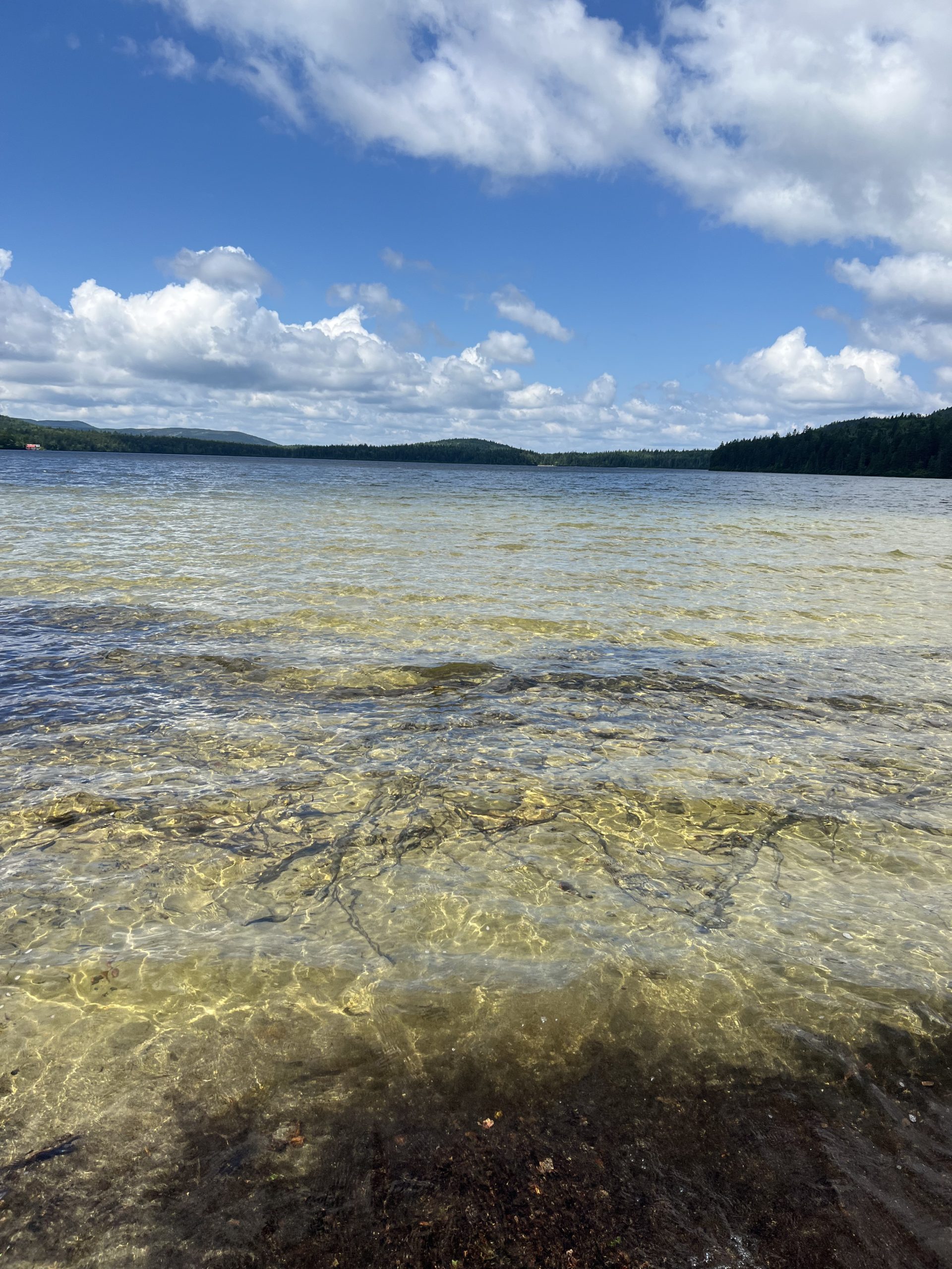
For the first time so far on trail I noticed some ripe blueberries on the small bushes growing on the rocky balds, and I snagged a few of the bluer ones available as I passed. The trail made its way steeply down from the Bemis Mountain to a stream before angling up and climbing a thousand feet back up. The climb wasn’t too arduous, and after finishing the climb the trail turned mostly flat, with no elevation changes more than a couple hundred feet. This flat terrain lasted for twelve miles, and was a great break from the steep mountains I’d been traversing lately. With the flatter trail I was also able to hike faster than I had since early in New Hampshire, which was another satisfying break from the norm of the last couple weeks. I passed by a number of small ponds during the day, which were all very clear and had frogs croaking along their edges.

One of the nice ponds
Along with the ponds came a good amount of mud and marshy terrain swarming with mosquitoes and flies, which was not very fun to walk through. I made it to the shelter I was aiming for by 5:30, and although I could’ve stopped, with more rain predicted for tomorrow I decided to push farther uphill toward the summit of the next mountain, hopefully setting myself up to get through the major climbs tomorrow before the storm. I found a nice camp spot next to Eddy Pond, and sat dipping my feet in the water for a while before making dinner. The temperature felt like it was cooling off quickly as the sun set, and I cozied myself into my quilt early to stay warm for the night.
Day 138
I woke up unenthusiastic about the day, especially with storms forecasted for most of the afternoon. I slowly made my way up above treeline to the top of Saddleback Mountain, which had 360 degree views of the mountains and ponds around me.
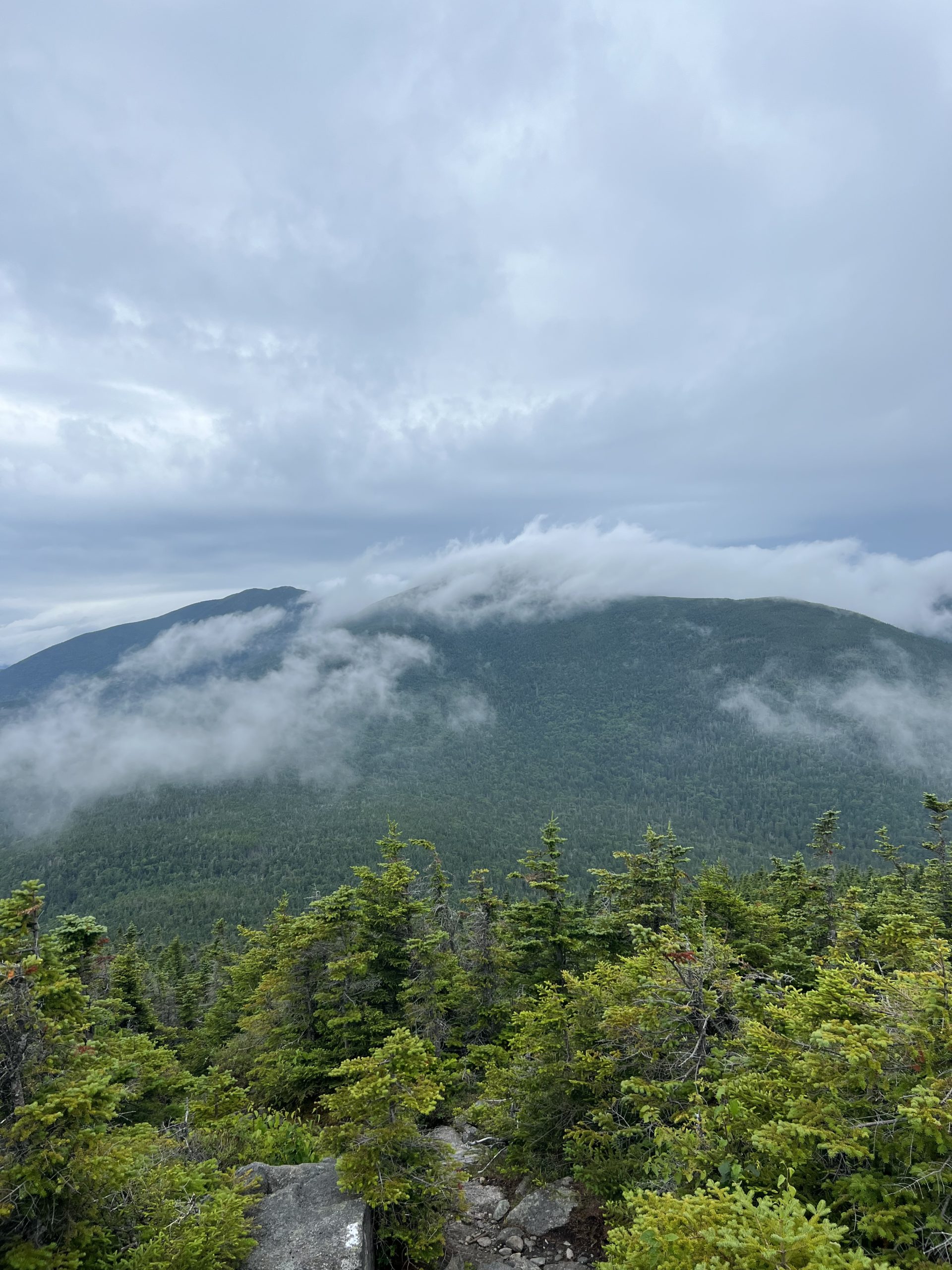
Then it was a steep descent before climbing all the way back up to the Horn, a slightly narrower peak that combined with Saddleback, looks like a western saddle. Finally I went up and over a third steep hill, Saddleback junior. I was going really slowly and wasn’t enjoying most of these climbs, I just wasn’t in the mood to hike hard (or even hike at all) this morning. After so long on the trail, some days feel more like forcing yourself to go to work than an exciting day of hiking, but you still have to get up and face the trail if you want to make it to Katahdin. Early in the afternoon thick clouds started rolling in and rain began pattering down, which actually distracted me from my grouchy thoughts about not wanting to hike, and amazingly improved my mood.

Low hanging rain clouds moving in
I walked about a mile in the rain to the Poplar Ridge lean to, where I ducked inside to dry off and eat some lunch. I hung around the shelter for a couple hours waiting for the rain to stop, and finally set back out around 4 pm. The rest of the day was surprisingly easy given how hard the morning had been, and I enjoyed the easy walking next to cascading streams, and some very lush forests for most of the evening. Late in the day I made it to the Spaulding Mountain lean to, and grabbed a dry spot in the shelter for the night. I was very glad to change into my dry sleep clothes and jump in my warm bag for the night.
Day 139
The morning started off with a quick climb up Spaulding Mountain, before descending way down to the Carrabassett River. The trail was still damp from the rain the day before, and I had to pay extra attention not to slip on the wet roots as I worked my way down. After I made it down to the river I turned and started back up South Crocker Mountain. The trail was steep but not too technical, and I maintained a pretty steady pace as I hiked up. Right after I made it to the peak I passed the 2000 mile mark, and saw a few different bark and rock markers showing my mileage.

2000 miles hiked!
Only 194 to go from there, what a crazy low number! I traversed the dip between the south and north peak, before starting the final descent off the Crockers. The hike down was long but not too steep, and I tried to keep up a steady pace as the hours of downhill wore on and I started feeling more tired. Finally around 4 pm I made it to the parking lot and hitched a ride to the nearby grocery store to grab a resupply for the next few days, before I headed to the Hostel of Maine for the night. The hostel was in a nice large wooden cabin type house with tons of comfortable chairs and bunks. I showered and ate some dinner while talking to the other guests before heading to bed.
Affiliate Disclosure
This website contains affiliate links, which means The Trek may receive a percentage of any product or service you purchase using the links in the articles or advertisements. The buyer pays the same price as they would otherwise, and your purchase helps to support The Trek's ongoing goal to serve you quality backpacking advice and information. Thanks for your support!
To learn more, please visit the About This Site page.
 ">
">