 ">
">
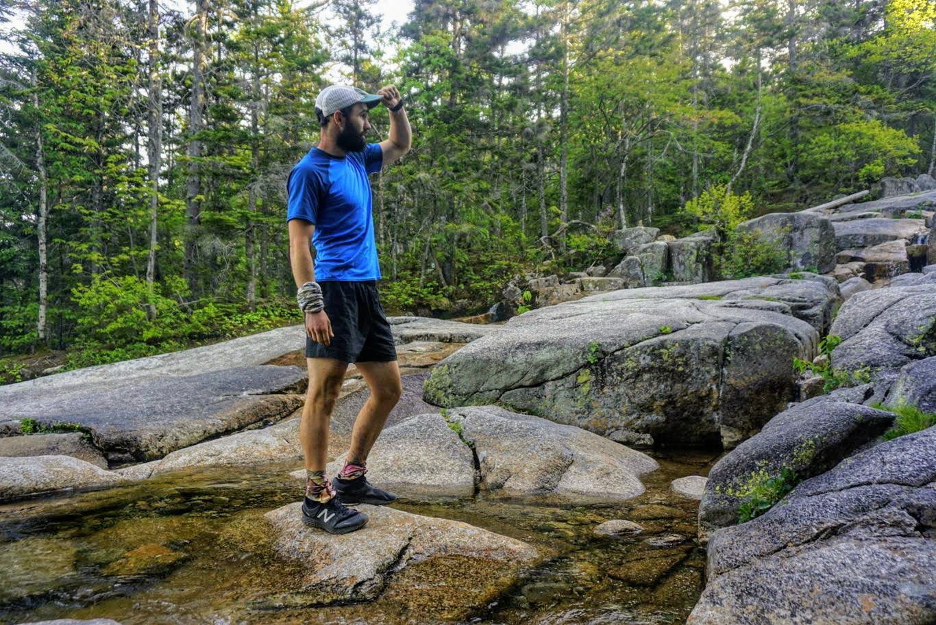
Weekly Trail Update Twelve: Days 78 – 84
Welcome back for another trail update!
Day 78: Campsite at mm1768 to Jeffers Brook Shelter- 25.4mi
Logs left a few minutes before me this morning, but we were both on the trail around 530, my earliest yet. We’d camped right off the side of the trail so it was quick to get going. I was super tired last night and slept like a rock, but I could tell as soon as I started hiking that it was going to be a tough day.
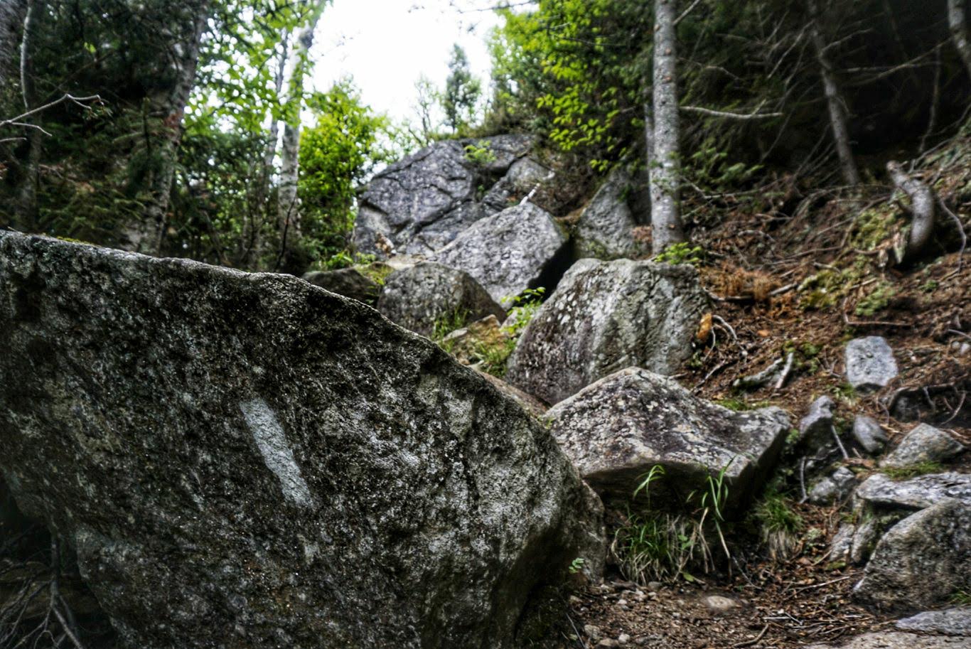
The first climb, which started almost immediately, was Smarts Mountain, which was an ascent of 2,000ft over several miles with multiple false summits. The next was Mt. Cube, which was slightly shorter at 1,500ft but more steep. Each of the climbs were completely riddled with roots and giant rock slabs that made it take forever to get to the top. I felt gassed on each one, like I just couldn’t muster the energy to propel myself as usual. I took a lot of breaks – several more than usual – but just couldn’t kick the feeling. I tried eating more which sometimes helps but it didn’t do much this time.
I kept moving as fast as I could manage, taking the smaller ups and downs along the way. The roots continued and it was slow going all day.
At about the 19-mile mark for the day, I got my first trail magic in as long as I can remember. At one of the road crossings, a guy by the trail name of ‘Granite’ was there with his wife waiting for hikers. He hiked the trail in 2016 and he said they come out a few weekends per year to various spots in the area. I chatted with them for over half an hour while eating multiple peanut butter and jelly sandwiches and drinking two Gatorades. They also gave me some snacks to take with me, which was nice. When I signed their register I noticed that Logs had passed through two hours earlier and was clearly way ahead.
By that point, I knew I wasn’t going to make it to the shelter that was 32mi away, as I had hoped. I had been going so slow and taking lots of breaks which really ate into the day. It was 430pm by the time I departed the parking lot where Granite was, and I still had over 7mi to make it to the closest shelter which was 7mi from the one I’d planned to get to. There was no way I could do 14mi more in any capacity, so I once again had to cut my mileage.
I finally made it to the Jeffers Brook Shelter just after 7pm. It was a long slog to get here and I was happy to be done for the day. Logs isn’t here, so I assume he pushed on to the next one. There are two other people here, who I only exchanged a few words with while I set up.
Because I didn’t make it to the further shelter, I have to do another 25mi day tomorrow into Lincoln, NH. Tomorrow has even more climbing than today, so who knows what kind of condition I’ll be in when I arrive.
Day 79: Jeffers Brook Shelter to Lincoln, NH – 24.8mi
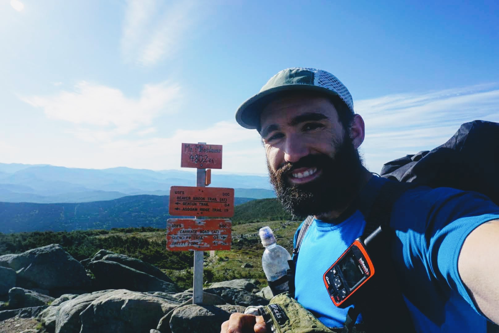
I was on the trail at my normal time and immediately began the ascent up Mt. Musilauke. It was a climb of over 2,000ft but took place over several miles. I had been dreading it, but it turned out to be easier than expected. Long, for sure, but not terrible. It took me a couple hours to get to the summit, and when I finally regained service I saw I had a message from Logs saying, “Musilauke ain’t sh*t!”. Hilarious and true. It was cold and windy at the top which was at an elevation of 4,800ft, the likes of which we haven’t seen since Virginia. I didn’t spend much time there and immediately headed down to get back below the treeline.
While the ascent was manageable, the descent was ridiculous. It was extremely steep, rocky, and slippery. It took me quite a bit longer to get down than it did to get up, which is rare. There were lots of day hikers making the ascent from that side as well (it was Sunday and great weather) and I felt bad for them for getting the tougher side. At one point I saw two older gentlemen approaching and I stood off the trail to let them pass. The guy behind acknowledged me but apparently the one in front hadn’t seen me. When he got close and finally noticed, he got spooked and started spouting, “Jesus Christ, man, you have to SAY SOMETHING” as if I had jumped out of the bushes at him. He was clearly exhausted and frustrated by the climb so I guess this was his outlet. His friend more or less told him to zip it and then let me pass. As I continued down the trail I could hear the guy still mouthing off, but I decided it wasn’t worth addressing. I’ve got bigger things to worry about, like not falling off this damn mountain.
When I finally reached the bottom, I saw an information board about the trail and on the top it said “White Mountain National Forest”. Oh damn, I’m already in the Whites! I thought I wouldn’t get there until tomorrow, but I guess my calculation was off. I was beginning to wonder how much harder they could possibly be than what I’ve already faced, but apparently I was already doing it. Nice.
The next climb started immediately after Musilauke and brought me to the top of Wolf Mountain. This climb wasn’t as big as Musilauke, but somehow it was harder. The rocks got bigger and the trail got more rooty, if that’s even possible. I spent most of the afternoon slogging to the top, only to descend again and start my third and final giant climb up Kinsman Mountain.
Kinsman is what I imagine the Whites to be. It was the most vertical and extreme climb I’ve faced thus far. For mile after mile, you’re scrambling over boulders, covering huge elevation in a short distance. At times I would have to look almost straight up to see where the trail went, and I’d think there was no way I could get up there. But sure enough, it’s possible when you just take it slow and look for one foothold at a time.
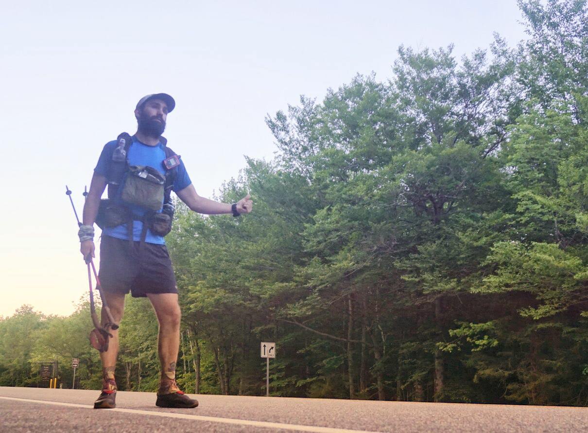
By the time I made it to the summit, I was totally spent. I had only covered about 19mi by that point, but it was close to 10,000ft of elevation gain. The descent was long, slow, and technical for most of the way while smoothing out slightly toward the end. My destination was the Rodeway Inn in Lincoln, NH, about 3mi from the trail. What I didn’t realize when doing my research is that you have to take a 1mispur trail from the AT just to get to the road so that you can try to hitch a ride. Great.
When I reached the road, it was about 815 pm. I texted Logs to see where he was and he said that he got a ride into town to resupply but then wasn’t able to get a hitch to the hotel after trying for over an hour. Instead he called a nearby hostel and had them pick him up. Pretty crazy. I soon realized what he was talking about, as I was unable to get a hitch myself. Very few cars passed me, and none pulled over so I ended up walking all the way to the hotel. There’s no Uber or Lyft here, so I was stuck. I might have called the hostel myself if I didn’t have my resupply box already waiting for me at the hotel.
I finally arrived after 9pm and was dead. My feet were aching badly and I couldn’t wait to lay down and put the day behind me.
Day 80: Zero Day in Lincoln, NH
I was on the fence for a couple of days about taking a zero here. Although I had it on my schedule and I’m back on track with it, the weather has been great and I would have liked to take advantage of it and get some more miles behind me in the Whites. However, as I’ve mentioned, I’ve been struggling with the climbs and just feel drained and exhausted at the end of each day. I sleep at least 7 hours per night, but the miles have caught up with me so I decided to take the break. I’m hoping to be able to power through the rest of the Whites feeling better than I have been for the last few days. This will likely be the last day I take off, as I have less than three weeks left on the trail. Unbelievable!
Today I didn’t do much at all, which was great. I woke up later than usual and went to check out the breakfast option. Their offerings were abysmal, as expected, so I just had a couple of bagels with cream cheese and coffee. This hotel is a dump, but it was cheap and the TV works so it’s fine. This is the first zero I’ve taken at a hotel, so it’s nice to have my own room for the whole day for once.
This part of town is also a bit strange. It’s a cliché mountain tourist town with motels like the “Indian Head Resort” with gaudy signs, a water park, and not much else. Although there are several restaurants nearby, nothing is open. Some of them seem to be abandoned but others appear just not to be open for the season. I guess it isn’t actually summer yet. This whole place seems like something that would be in a National Lampoon’s movie.
In addition to taking care of some stuff online and repacking my stuff for tomorrow, I walked down to the gas station (the only place open) to get some lunch. I was able to cobble a meal together from their minimal options which included two hot dogs and a pint of Ben and Jerry’s ice cream. Back at the hotel I watched The Office on TV, took a nap, talked to Veronica, and laid around. It was nice.
In the evening, I planned to order takeout from one of the places in the next town over. I called three different establishments and none delivered, so I was out of luck. I walked back down to the gas station and picked up a frozen burrito and a protein bar which did the trick. I then soaked my feet in the bathtub, watched some more TV, and got ready for bed.
I have the feeling I’m not going to get a hitch back to the trail tomorrow morning, so unfortunately I’ll likely have to walk. Really not looking forward to it. Because I’m in the Whites, I’ve planned to do shorter days until I get through (which I hope will be in 4 days). Throughout the area, the Appalachian Mountain Club (AMC) has huts that people can stay at for a fee. They are geared toward weekend hikers and groups, not thru-hikers, and they charge upwards of $175 per night for a bunk. However, they let thru-hikers do a “work for stay” option wherein they help with dishes or cleanup for the paying customers and then get to sleep on the dining room room and eat leftovers for free. Not a bad deal, especially since I hear the meals are great and you get a roof over your head when it’s cold out. They only take a couple hikers per day for this option, but I’m hoping to score a slot at three different huts in the Whites. It should be feasible given that there are so few people ahead of me at this point, so I’m hoping it works out.
Nevertheless, the next few days are going to be hard. The climbs will be similar to what I went through yesterday, with the exception of Mt. Washington which is higher and harder. As I said, this is the toughest part of the entire trail and I’m excited both to get into it and to get it over with. The forecast looks good for the next couple of days days, but with my luck that’ll change and I’ll get the added obstacle of rain. Either way, I’ll get it done.
Day 81: Lincoln, NH to Zealand Falls Hut – 21mi
I started the day by getting up at my normal time of 5am. I packed the remainder of my stuff, made some terrible coffee in my room, and ate a bagel I had takenfrom yesterday’s “breakfast”. Better than nothing, I guess. I dropped my keys off in the dropbox and then headed to the road to start walking. As expected, there were no cars on the road. A couple passed in the opposite direction, but none going my way. I walked about halfway to the trailhead when, out of nowhere, a car appeared in the distance. Not expecting anything, I put out my thumb for the hell of it. To my shock and surprise, the car pulled over. Lo and behold, the driver was a day hiker who was heading to the trail himself. His name is Tom and he’s a mailman from Pennsylvania who does week-long hikes a couple of times per year as well as trail maintenance with his local club. I told him how to get to the trailhead, and he was happy to give me a lift. I was super grateful that I didn’t have to schlep the rest of the way.
I started hiking first, but Tom soon passed me. He’s in good shape and had a light pack, so I expected it. The trail started off with a long and protracted climb to the top of the Franconia Ridge, about 4,000ft of ascent, and it reminded me of going up Mt. Musilauke in that it was mostly walkable yet quite difficult. Near the top, I ran into Tom again as he was finishing up a break and we hiked together for a couple of hours.
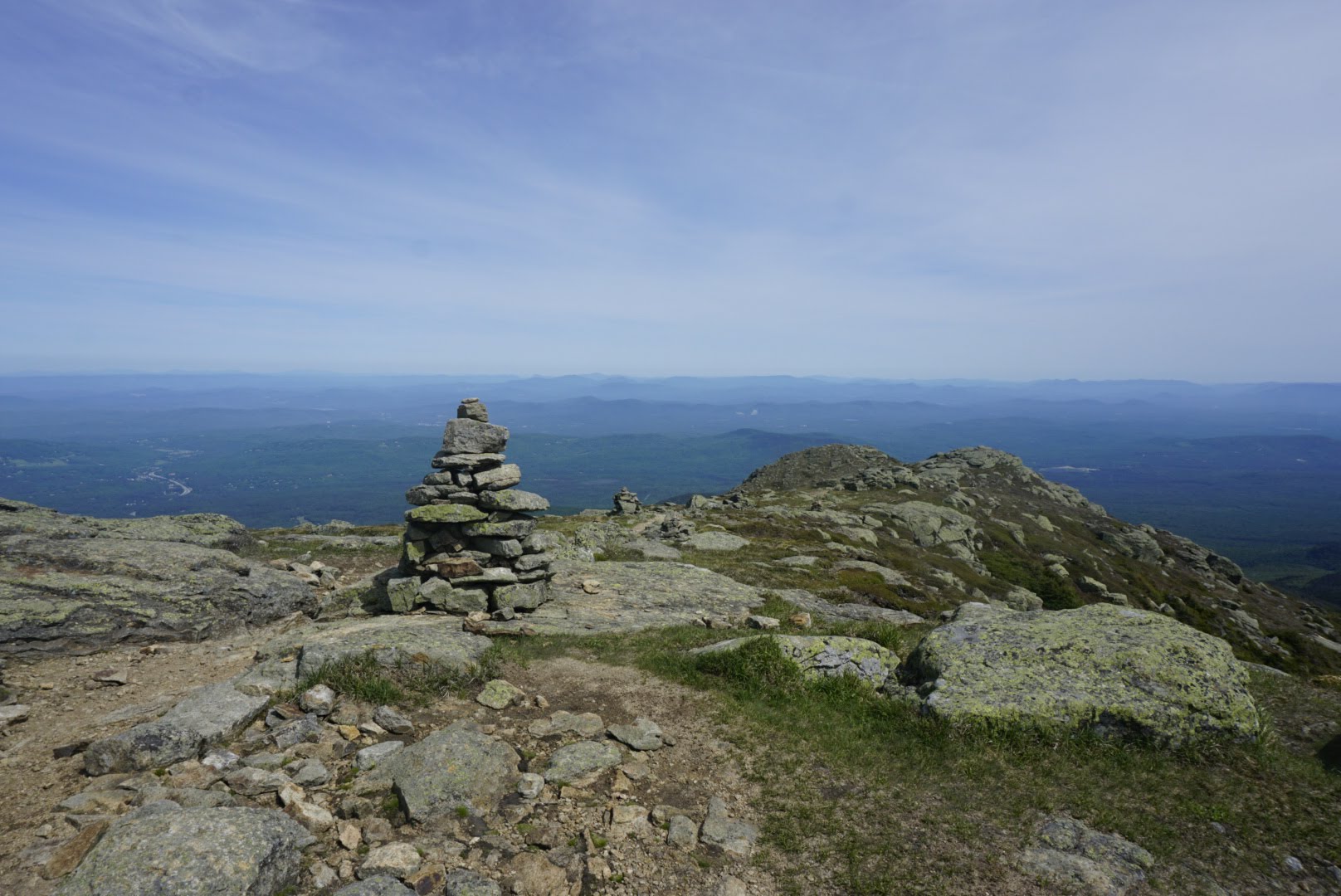
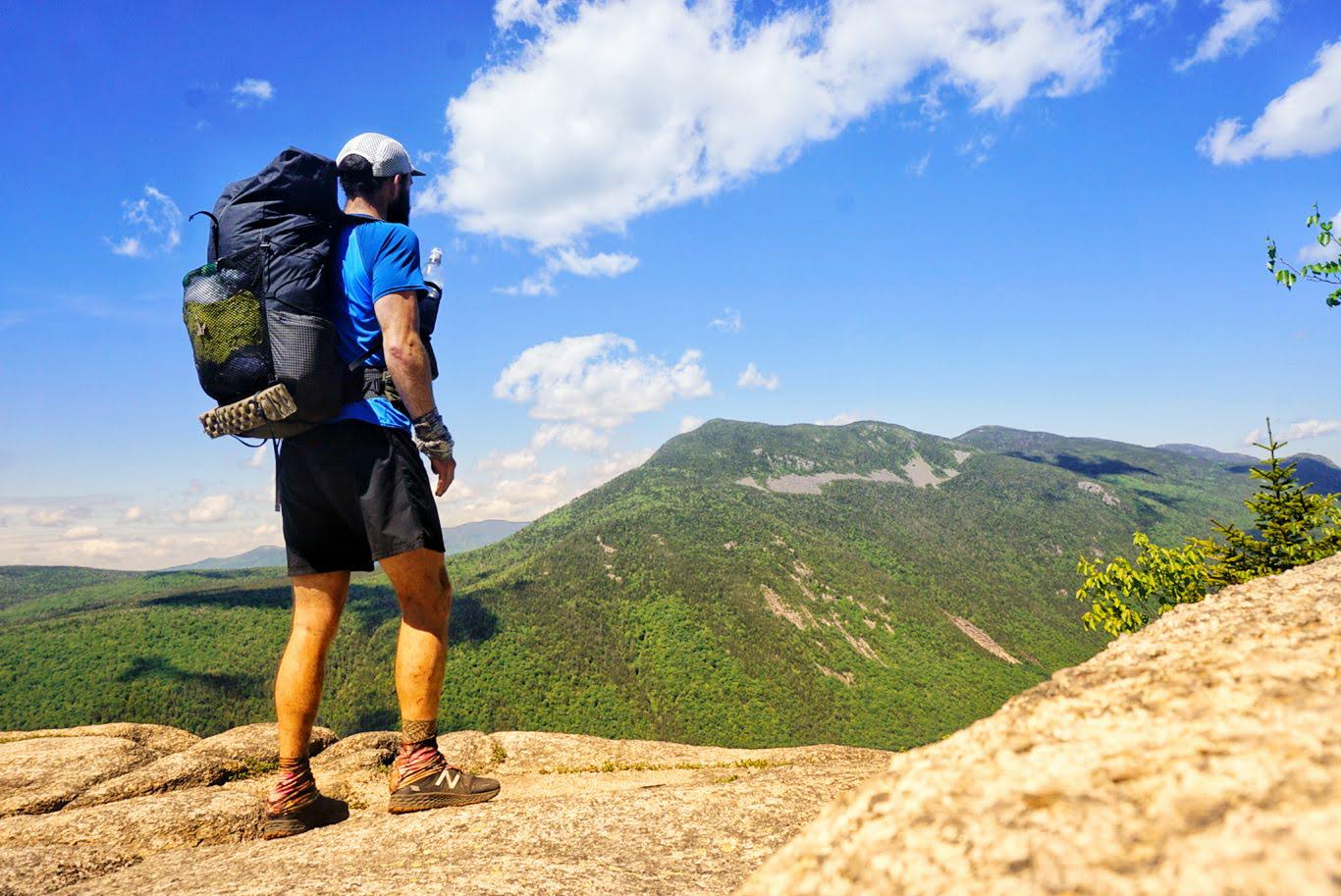
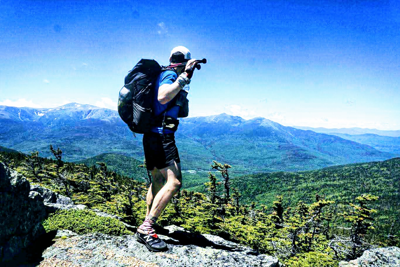
Up on the Franconia Ridge are not only spectacular views of the surrounding mountains, but also several peaks. Within stretch of just under 3 miles, the trail goes over the summits of Little Haystack, Mt. Lincoln, and Lafayette Mountain, each a little higher than the previous. The wind was whipping pretty good, but the weather was gorgeous so it wasn’t too cold. Tom turned around at Lafayette to head back to his car, but I pressed on. By that point I’d been hiking for just over 4 hours and ha only covered 6.6mi. Yikes.
The trail proceeded over several more peaks that were over 4,000ft high, including Mts. Garfield, Galehead, South Twin, Guyot, and Zealand. I’ve never traversed so many peaks I a single day, it was pretty wild.
The trail itself varied between almost walkable dirt to steep and sketchy rock, much like I’ve already experienced in the Whites. It’s extremely slow but the views are very rewarding. I feel much better after taking the day off yesterday, so I wasn’t struggling as much with the climbs as I had been.
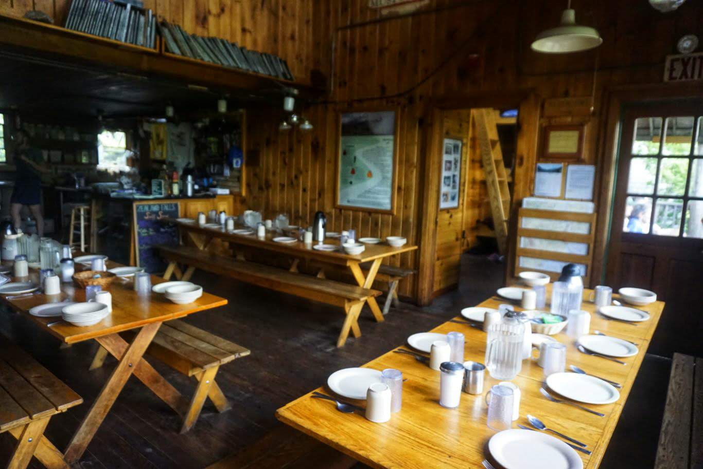
My destination for the night was the Zealand Hut. As I mentioned, these places offer work-for-stay (WFS) to a couple of hikers and I’m exchange for helping with some chores you get to sleep inside and get fed dinner. My understanding is that you need to arrive between 4 and 6pm or else they won’t take you, so I was busting ass to get there in time. Although my mileage was short, it was a super tough day. I ended up arriving at the hut at 545pm, just in the nick of time. They didn’t have any other hikers there so I was able to take a WFS slot. There’s a group of maybe 20 young hikers and chaperones here, so once they finish eating I’ll help clean up and call it a night. Glad I made it!
I’m planning to stay at another hut tomorrow, which is a little closer I think. It looks like rain is in the forecast starting tomorrow afternoon so I plan to start hiking early as usual in case I get bogged down with that.
Day 82: Zealand Falls Hut to Lakes of the Clouds Hut – 18.8mi
My experience at the Zealand Falls hut was awesome. I had to wait around for the paying customers to have dinner and then I ate with the “croo” (staff). While I was waiting, another group of 3 hikers rolled in but weren’t planning to stay. Long story short, they knew one of the croo members and they ended up not only eating with us but also sleeping there as well. They were nice guys and I didn’t mind, but I thought it was messed up that I was going to have to work and they weren’t. In the end, there was nothing to do so none of us worked!
They also serve breakfast in the morning, but we wouldn’t get to eat until after 8am and I decided not to wait around. I was up at 5 and one of the croo members was up soon after to start cooking. He made some coffee for us which was great, and I sipped it while I ate my oatmeal. I was on the trail just after 6.
This section of the trail is odd in that it started with a short descent and then 6mi of nearly flat trail (although there were some rocks and roots). This continued down to Rt 302, which was a nice break, and then the real climbing started. Much like yesterday, the trail made its way up to a high and exposed ridgeline which was very steep and difficult. The first peak was Mt. Webster, a 2,700ft climb from the road. It was quite a slog. The weather was sunny and warm, which was great.
The rest of the day was spent on this ridgeline, overtaking very steep and precarious summits. Luckily the wind was minimal, which helped keep me from blowing off the mountain. By 130pm, I had covered just over 14mi, which was due to the easy morning terrain. I stopped at the Mizpah hut to fill up on water and take a break, and I noticed they had some breakfast leftovers. They normally give these to thru hikers who stop by, and the croo was happy to let me have at it when I asked. It was only one small pancake, some scrambled eggs, and a bit of oatmeal, but it was damn good. I barely had to get into my pack for food all day!
After filling up at the hut, I began climbing again. I only had about 4.5mi to go, but I knew it was going to be rough – and it was. Along this stretch I summited Mt. Pierce and Mt. Monroe, which are part of the “presidential range” of the Whites. The climbs here were pretty short, but always steep and extremely rocky. I was scrambling in many spots and really taking my time to make sure I didn’t fall or twist an ankle. It’d take a long time to get help out here if I needed it.
6g?key=SlVrRGhoTzMxQVN5WGsta28xRzRMV2paTDRZbEh3&source=ctrlq.org”>
I reached the Lakes of the Clouds hut at about 5pm and easily secured another work-for-stay. This hut is the largest one and can sleep 90, so it’s quite a bit busier than the last. As in the other hut, there’s a large group of school kids here all running around. I just need to stay out of the way for a bit and then assist with cleanup or something to pay my way. Easy enough.
I’m glad that I’m taking it slower through this section. I could probably squeak out another 5mi or so each day if I really wanted to, but I’d be wrecked and wouldn’t be able to appreciate any of the breathtaking views. I’m precisely on schedule so it’s not like I’m falling behind, and doing 20s through here is still quite respectable.
Tomorrow I’ll go up and over the famous Mt Washington, which is just a mile and a half from the hut. It’s known for having “the worst weather in the world”, and given the forecast it might not be very nice up there tomorrow. It was calling for possible rain today and tomorrow, but it didn’t come today. Hopefully it holds off until I get off the summit tomorrow as well.
I was planning to do a 21mi day to another hut tomorrow, but I’ve decided to switch things up a little. The hostel that I was going to stay at in 2 days also picks up at Pinkham Notch, which is just 15mi from here, and if you stay two nights they’ll bring you back in the morning for free. So tomorrow I’ll get picked up there to avoid any terrible weather, and then the following day I’ll get dropped off and hike back to the hostel for the second night. That way I’m covering the same mileage but staying inside in a nice hostel to minimize my exposure.
As usual, tomorrow will be tough so I’m looking forward to resting up tonight.
Day 83: Lakes of the Clouds Hut to Pinkham Notch – 15mi
Today’s hike was the most miserable I’ve ever had. More on that later, but first a quick note on my second great experience at an AMC hut. The Lakes of the Clouds but can sleep 95 patrons, and last night it was booked. As such, there was a lot of work to do and so we didn’t end up eating until almost 9pm. We had pulled pork, mashed potatoes, peas, and ice cream. It was fabulous. I then helped wash dishes and got ready for bed. As it turns out, one of the croo members is from Southwest Harbor, just a few minutes from my hometown. He’s quite a bit younger than me so we never knew each other, but it was cool to find out.
I slept well again and woke up just after 5am. When I sat up and looked outside, all I saw was fog and wet windows. Not a great sign given the wonderfully clear views I’d been experiencing. I sat around for quite a while, hoping that the fog would miraculously clear right as I was ready to step outside. Of course that didn’t happen, so I eventually packed up and prepared to head out. The following ten hours were some of the worst I’ve spent on the trail.
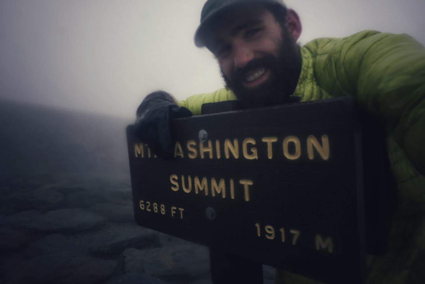
Right when I left the hut, after thanking the croo once again, the wind began to pick up. I had just 1.5mi to hike to the summit of Mt. Washington, and it wasn’t too bad at first. The wind was blowing but it wasn’t too wet, so I had on my puffy down jacket to stay warm and nothing else. As I began to climb to the summit, the wind picked up. Although it wasn’t technically raining, there was enough moisture in the air to soak the rocks underfoot making them difficult to navigate. As I got higher, the fog thickened until I couldn’t see more than than 20ft in front of me. Just then, I saw a huge structure right in front of me and realized it was the weather station at the summit. I had no idea how close it was that I almost ran right into it. Mt. Washington is known for having “the worst weather in the world”, and mother nature seemed to want to prove it today. As I stepped around the summit building, I was slammed by a wall of wind so forceful I lost my balance and stumbled, nearly falling over with the force (I checked the weather the next day and the wind speed was up to 80mph!). This was an indication of what was to come. I dug in and forced my way to the summit sign to snap my one and only photo of the day.
The weather was getting serious and I needed to get off the X, as it was. Little did I know at the time that I wouldn’t be leaving the exposed ridgeline for several miles.
My first stop was to be the Madison Hut, another AMC establishment. It was 7mifrom where I started, and the entire way was just like Mt Washington – wet, rocky, and windy. By now there was more rain mixed in with the intense wind, so I attempted to put on my poncho. That failed miserably, as it immediately turned into a parachute and whipped so hard that it blew into my face and blocked my already limited vision. I kept it on since its all I had. My down jacket was doing a great job of keeping me warm, but it was taking on a lot of water.
I began to realize that this hike was going to be tougher than anticipated, and I gritted my teeth and pushed on. After some stumbling, I found myself in front of a giant sheet of snow – something that I had not expected to encounter. It seemed unpassable, so I began looking for alternate routes. Because the fog was so thick, it was extremely difficult to see even the next cairn or marking, let alone where the trail actually went. I decided I’d try to go around the snow by hiking uphill and then reconnecting on the other side. After a hard slog up, I cut across the top of the ice shelf by trampling over rocks and foliage. After a couple minutes, I couldn’t see any way to get down to the other side of the snow and rejoin the trail. In fact, there was no way at all to even get down from where I was. What’s more, I was even more exposed there than I was near the snow and the wind continued to pick up. I couldn’t find a way down and I desperately needed shelter from the wind. I tried to use my phone for navigation to see if I could see where the trail connects, but because my hands were so wet I couldn’t unlock the screen and get to Guthook’s app. I felt my heart rate increase and I began to breathe more shallow as I struggled with how to proceed. This is as close as I’ve gotten to having a panic attack. I was able to talk out of it by reminding myself to stay calm and to retrace my steps back to the last marker. I did so, and within 10 minutes I was back where I’d started. Only then did I notice that there was a worn path across the snow, indicating that others had traversed it. I made a go of it myself, being especially careful not to slip as it was a long fall down and I had no way to self-arrest if needed. With baby steps and luck, I made it across.
I continued in this manner for several more miles – keeping a low center of gravity to avoid being blown over while watching my steps closely. The trail, at this point, was a giant puzzle. Because I could only see as far as the next cairn, I’d focus in on the location and then strategize on how to get there. Every step was a calculation – is the inertia created by the soles of my shoes enough to overcome the forces of gravity and motion on these slick rocks? If the answer seemed like a ‘no’, I stepped elsewhere which sometimes led to me retracing steps so I could try a new angle. Because the trail was entirely rocks for miles on end, I was running this calculation in my head thousands of times. Sometimes I got it wrong, and I took several spills as a result.
After 7.3 awful miles, I arrived at the Madison AMC hut. I walked in, dripping wet, and slung off my pack. I’d been holding on to my poncho in my hand to keep it from whipping around in the wind, but it served no purpose other than a hood at that point. I peeled off my down jacket and wrung it outside where a steady stream of water poured out from its threads. I put on the only dry shirt I had, and inquired about leftovers from the croo. They gave me some oatmeal and blueberry cake, which I was grateful for, and I sat at a table eating while drinking hot water to try and warm myself up. Meanwhile, water was pooling at my feet from where it was seeping off my pants and through my shoes. One of the croo members saw me shivering and offered me a blanket, which I wrapped myself in immediately. It took a long time to lose the shivers, and I must have drunk about half a gallon of hot water. I was extremely tempted to just stay there for the night, but since I had a friend meeting me at the bottom as well as a hostel reservation, I knew I needed to push on. I also knew that the treeline was 1.5mi away, and that once I got there I wouldn’t be as exposed to the elements. Begrudgingly and slowly, I put my wet clothes back on, took a deep breath, and walked back out into the wind.
Immediately after leaving the hut, the trail ascends half a mile to the summit of Mt. Madison. The climb and subsequent summiting of this mountain was absolutely dreadful. As before, I was battling 80mph winds and sharp rain with nearly zero visibility. I was completely exposed the entire time, and on more than one occasion I seriously considered turning around. However, I knew salvation was nigh so I took my time, yelled a few obscenities into the wind, and literally crawled my way across the ridgeline.
Very slowly, vegetation began to appear and I knew I was getting close to the treeline. Thank God. As the shrubs grew to bushes and then into trees, the wind became more and more mild. Eventually I was ensconced in a full forest, which almost completely blocked all incoming weather. It was so calm that I had to stop and collect myself for a moment before continuing. I couldn’t believe I was out of it, and I couldn’t have been happier. Although the trail was still wet from prior rainfall, I was quite literally bounding down due to my glee. I can’t overstate how harrowing the weather was on the mountaintops and how ecstatic I was to be out of it.
I had about 6mi to get through before my arrival at Pinkham Notch, and it went by quickly. I saw one other hiker heading up toward Mt. Monroe, and I strongly urged him to be cautious. He was not dressed for the weather so I implored him to reevaluate once he got to the treeline, which he said he would do. After that, it was off to the races.
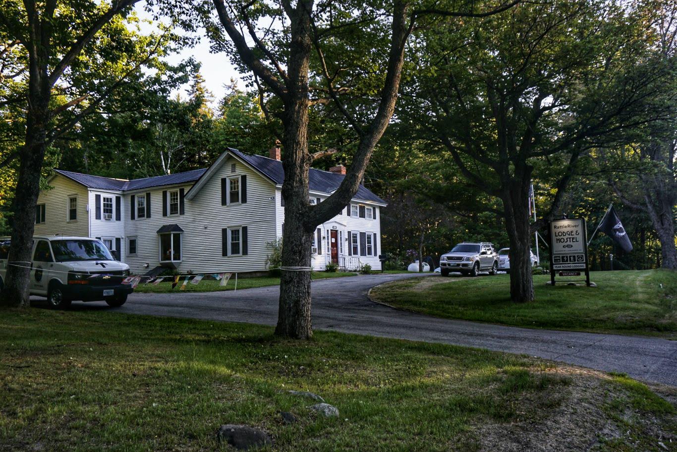
At Pinkham Notch I met a family friend and Trail Angel, Kate. Kate has a contagious love for all things Appalachian Trail and drove over two hours just to come up and do trail magic for me and the other hikers passing through. Unfortunately, I was the only one to come through that day (perhaps the weather made others reconsider!), but I couldn’t have been happier to see her after getting off the trail. She had all the thru-hiker essentials like brownies, soda, and beer. This isn’t her first rodeo! She was gracious enough to give me a ride not only to Wal-Mart, but also to the Rattle River Hostel where I’d be staying that night. I was exceedingly grateful for her generosity. It’s people like Kate that truly make hiking the AT an extraordinary experience. Unfortunately she’s moving to Nebraska for a new job soon, so this year’s bubble of hikers will miss out!
At the hostel I showered, did laundry, and settled in for the night. One of the things I needed to do was set up a new phone that I had shipped there, which always takes a long time to do. My current device started showing black lines and discolorations on the screen about 5 days ago. It was annoying, but still usable. However, I figured it could stop working altogether at any time so I might as well see if I could get it replaced. Thankfully it’s still under warranty, so I was able to have a new one sent out.
After configuring my phone and having some pizza for dinner, it was lights out.
Day 84: Pinkham Notch to Rattle River Hostel – 21.2mi
After a nice breakfast of waffles at the hostel, I hopped into their shuttle at 7am for a ride back to Pinkham Notch. I began hiking at 730 with the plan to hike my way back to the hostel. This section of the trail is still very much in the Whites, and thus it was just as difficult.
The day began with a long hike to the top of Wildcat Mountain – over 2,000ft of elevation gain which took me a couple of hours to do. When I started, the sky was gray and overcast with thick fog lingering. It began slowly burn off, but slowly.
Once on top of Wildcat, there was a series of ups and downs which brought me over Carter Dome, Mt Hight, and North, Middle, and South Carter mountains. About 6miinto the hike was Carter Notch, home to the final AMC hut in the Whites. I stopped by to refill my water bottles and inquire about leftovers, and I was treated with some oatmeals do chocolate chips. I’ll take it!
The climbs were quite steep, as usual, and the descents precarious as ever. The fog eventually burned off completely and there were some stunning views of the Presidential Range (where I was yesterday) and surrounding mountains.
I took great care on the descents to avoid slips, as I am still quite sore from my falls yesterday. I clung to tree branches and inched my way down the giant slabs, watching every step carefully.
Otherwise, the day was rather uneventful. The last couple of miles were easy downhill and led directly to the hostel (which the AT passes by) and I was in by 730. It took me 12 hours to cover just over 21 miles, which seems slow until you look at the elevation profile.
At the hostel I made dinner (a pizza I bought at Walmart yesterday), drank a couple beers, and washed up. I am now officially out of the White Mountains, and tomorrow I’ll be in Maine which is unbelievable. There are still a few big climbs to get through, but after that it should be relatively nice.
That’s all of this week!

This website contains affiliate links, which means The Trek may receive a percentage of any product or service you purchase using the links in the articles or advertisements. The buyer pays the same price as they would otherwise, and your purchase helps to support The Trek's ongoing goal to serve you quality backpacking advice and information. Thanks for your support!
To learn more, please visit the About This Site page.
