Day 16
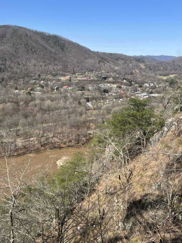
I woke up nicely rested in the hotel bed, nervous but ready to head back onto the trail. I ate another giant breakfast from the hotel buffet, packed up all my gear, and then waited. For a while. I figured that as it warmed up during the day the snow would melt and the trail would be easier to hike, so I was waiting until the 11 am shuttle to head back out. A little before 11 I hauled my stuff up to the lobby to wait and was offered a ride to the trail head by a hiker I had eaten dinner with the night before who was hiking the Benton Mackaye trail. After getting to the trailhead I headed across Fontana Dam and officially into the Smokies. At first the trail was pretty clear of snow, but as I got up in elevation more snow started appearing on the trail.

Some snowy terrain.
Even worse than the snow was the slippery slush and mud which I found hard to hike uphill in because my steps kept sliding back down a couple inches. Eventually, I finished the first major climb and reached the Shuckstack fire tower. I kept going another few miles and reached the Mollie’s Ridge Shelter a little before six. It had only been a 13-mile day but I was as tired as I had been on my 16-17 mile days. There were a bunch of spring break and weekend campers also at the shelter, but it was a big enough shelter that everyone could fit. I snuggled into my quilt with all my layers on and my water filter in the bottom of my bag, because the lows for the night were going to be in the mid-20s.
Day 17
After a solid night’s sleep, I woke up early but stayed hunkered down in my quilt for a while trying to avoid having to expose myself to the freezing air outside of my enclosed bag. Eventually, I forced myself up and started all the morning chores: use the facili-trees (lol), change into my hiking clothes, pack up all my sleep stuff, brush my teeth and hair, put on my trail runners, make breakfast, filter water, put everything in the pack, and head then finally out. There’s a lot to do in the mornings.
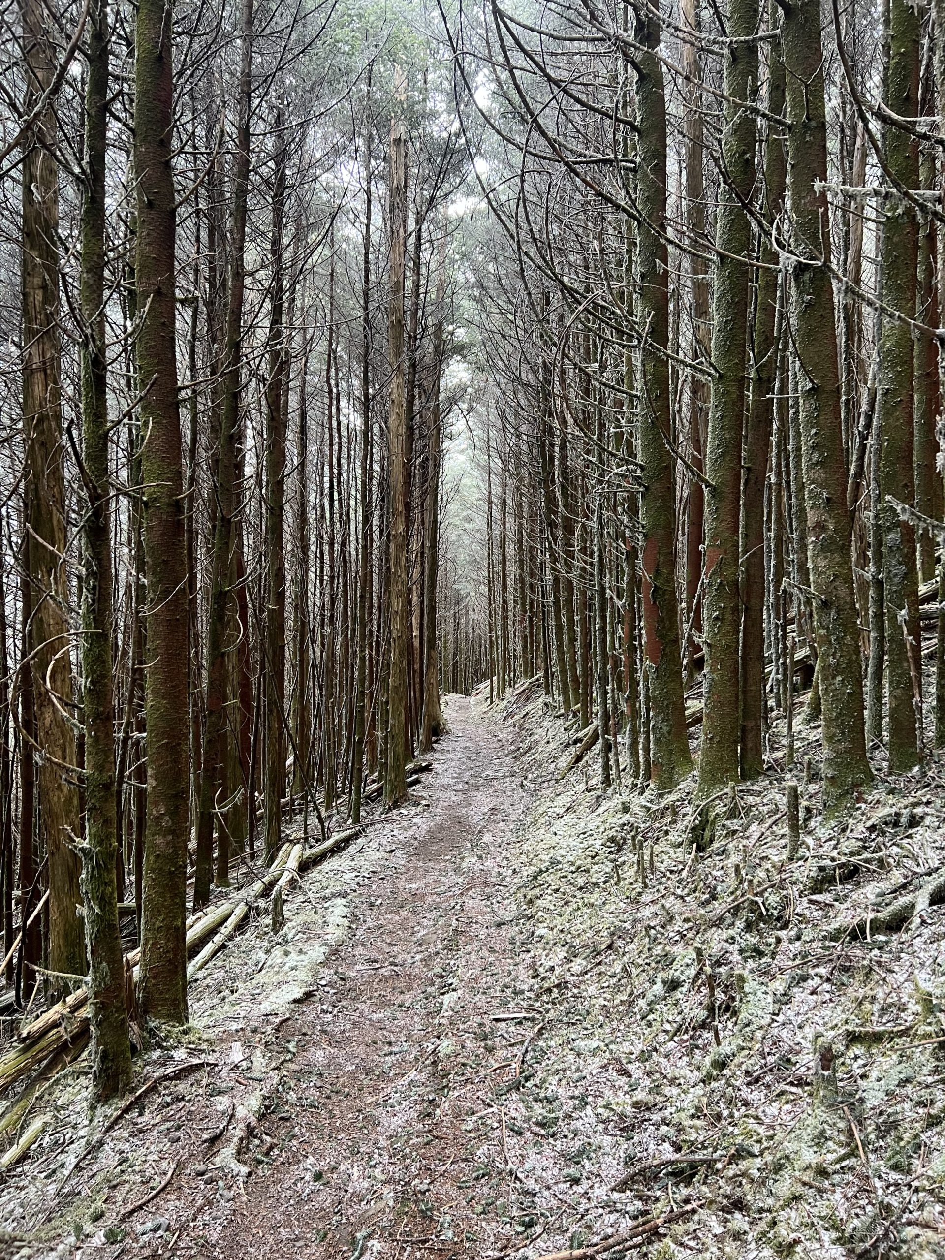
I had to struggle to jam my feet into my frozen shoes, even though I had loosened them extra the night before just for this reason, and my toes were freezing for a while before they managed to thaw the shoes out. Because it was so cold I took the time to make a hot breakfast, which helped warm me up a bit. I only made it a few feet up the trail before pausing to put on microspikes to help deal with the ice. I’m honestly glad I got to use them, they’re pretty heavy, and I’d be miffed if I carried them for a month but never had reason to use them.

Microspikes in action on the icy trail
The trail hadn’t looked super rugged on the map, but due to the snow, ice, and slush the miles passed very slowly. I think one out of every four steps I took involved slipping or sliding in the slush, mud, and ice, and by mid afternoon I found myself getting a little grouchy and really struggling up the trail. The last mile and a half to the shelter crawled by, and I finally finished my 12-mile day around 7.5 hours after I started, making my average speed around 1.5 miles an hour for the day. There was a big group of over 15 thru-hikers at Derrick Knob shelter, and as we talked about our day many of them also said that this had been one of their hardest days in trail so far, making me feel a little better about my day. We talked around the fire for a couple hours before the dropping temperature forced us to retire to our warm sleeping bags and wait until it was dark enough to fall asleep
Day 18
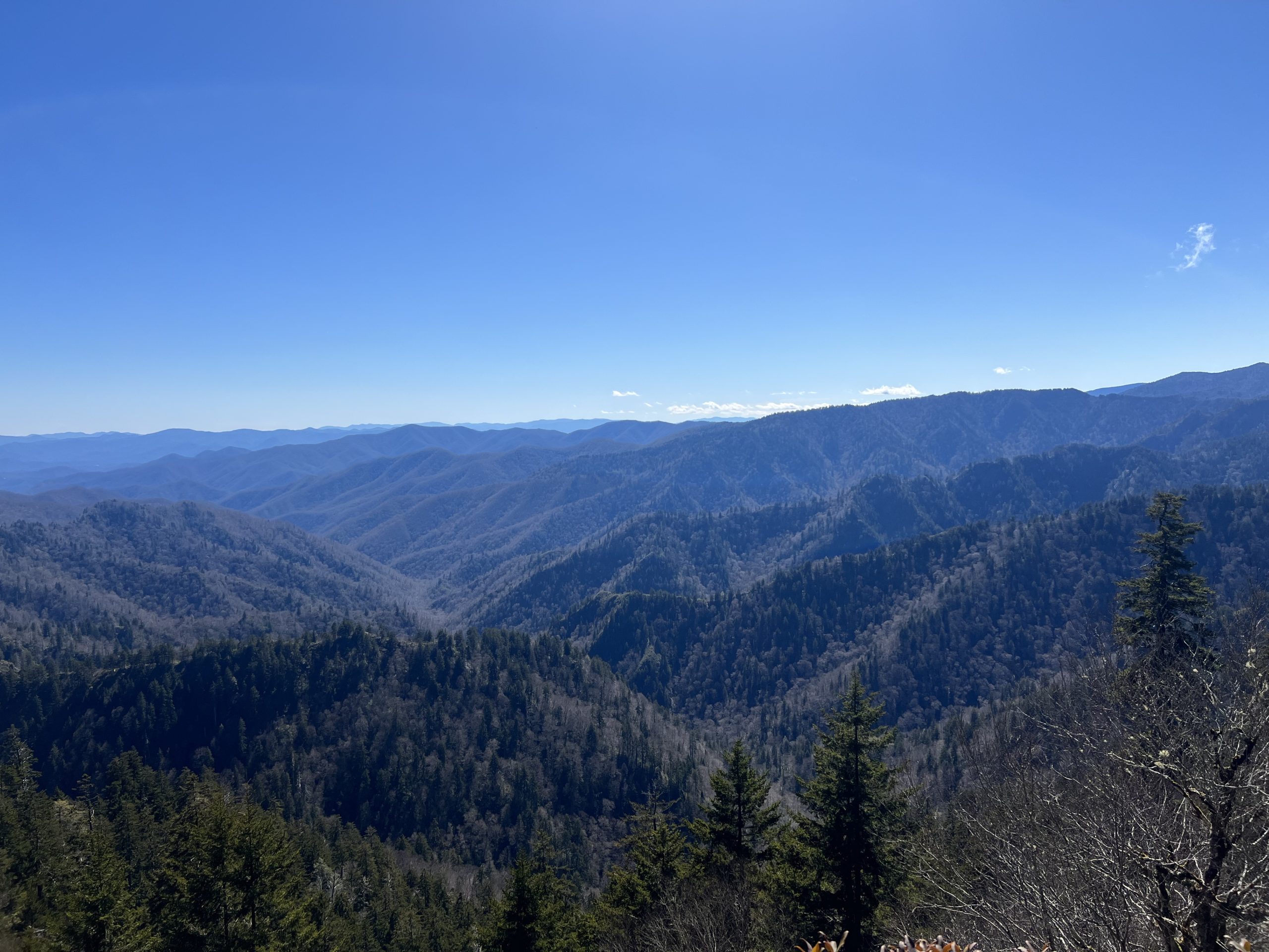
I was glad to see that most of the snow had continued to melt overnight when I woke up, and I was able to continue the mostly uphill climb up to Clingman’s Dome without as much difficulty as the day before. Although the day was mostly uphill, the climbs didn’t feel super steep, and without as much slush and ice as the day before I was able to get through miles much quicker. I also had some motivation to hike fast because I was meeting a special someone during the day. My boyfriend was hiking in from Newfound Gap to meet me and camp out with me for one night, and I was very excited to see him and have a hiking partner for the day. As the miles and elevation increased the landscape slowly changed from a drier mostly hardwood forest, to a wetter, moss-covered, evergreen-dominated forest ecosystem, which I thought was an awesome change.

The higher elevation evergreen forests make for some very pretty pictures.
The day was fairly cool and cloudy, with more clouds moving in as I got closer to Clingmans Dome. After meeting my boyfriend we continued to the top, passing the 200-mile marker on the way. Due to the clouds, I didn’t quite get the amazing 360 views that the signs boast, but climbing the spiral viewing tower and the cloudy views we did get were still fun.
The hike down started off feeling much nicer than the uphill, with only a couple miles to the Mt Collins Shelter, but when we got there we decided to keep going to Newfound Gap, so we could avoid hiking in the rain that was coming the next morning. Newfound Gap was only another 4.5 miles away, but after already long days for both of us, my boyfriend and I started flagging pretty quickly. We finally crawled into Newfound Gap around 6 pm after 17-18 mile days for the both of us. After a drive down the winding road into Gatlinburg, we were happy to make it into town and grab a hotel room.
Days 19-21
Oh Gatlinburg, Gatlinburg. What a town. Pros: it’s very colorful and there are lots of fun shops to look at, A+ people watching, a solid aquarium, and good food options. Cons: what an insane tourist trap of a place, also there’s a ton of traffic and crowds. My boyfriend and I spent three days wandering around town, looking at the touristy sights, and eating good food. These days were very relaxing and let my sore legs recover, just what I needed to tackle the second half of the Smokies that were coming up.
Day 22
After the three zeroes, a lot of packing, driving back to Newfound Gap, and saying bye to my boyfriend I made it back on the trail with my latest start yet around 11:15 am. It was a sunny and pretty warm Saturday morning, so the Newfound Gap parking lot and the trail all the way to Charlie’s Bunion were fairly crowded with day hikers. After Charlie’s Bunion, the trail emptied considerably, and I felt pretty good with no soreness and a lot of energy from my past three days of good eating.
I’d already section hiked the northern half of the Smokies a few years ago with my dad, and I was enjoying remembering the shelters and trail scenery as I passed them. This part of the trail was also gorgeous, with more mossy evergreens, and tons of nice views.

Just one of the gorgeous views from this section
I wasn’t sure how many miles I would be able to make with such a late start, but by three p.m. I was passing the shelter I thought I’d stay at, and decided to push another five miles to the Tricorner Knob shelter, which made it a 15.7-mile day. I didn’t get there until around 6:15, but with the recent daylight savings time change, there was still plenty of light. The shelter was very crowded but I set up my tent nearby and quickly made some dinner as it was getting colder fast. As I settled in for the nice I made the unpleasant discovery that my sleeping pad had developed a hole, and I spent the next 30 minutes trying to find it. Sorry to the people tenting nearby that had to hear me repeatedly reinflating my pad and muttering to myself about the leak while they were trying to get to sleep. This gear failure had me worried because the temperature was predicted to go below freezing overnight, and not having a pad to insulate me from the cold ground would have led to a very bad night’s sleep at best and potential hypothermia at worst. Eventually, I found the hole and covered it with a patch and duct tape to be doubly safe. Then it was off to sleep for the night with fingers crossed that the patch would hold.
Day 23
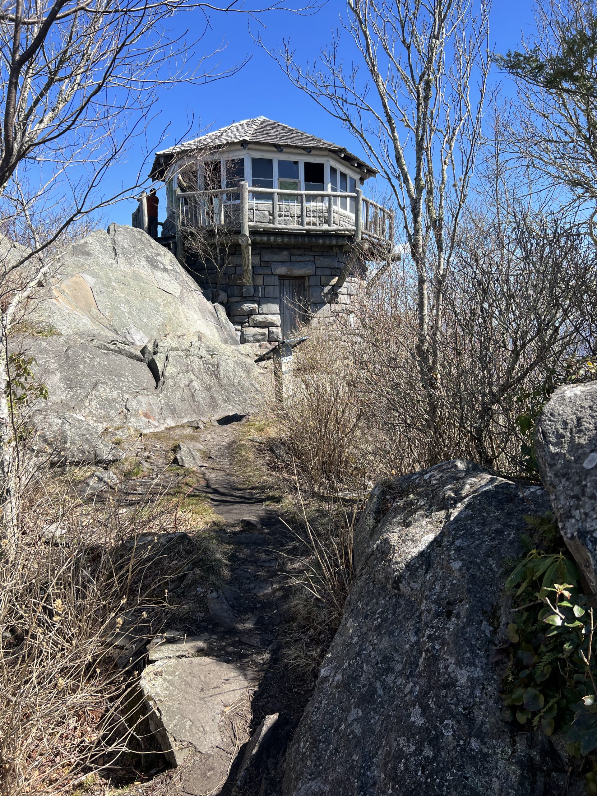
It was a very cold night despite going to bed wearing nearly every article of clothing I had with me, and there was a light dusting of snow on the ground when I left my tent. I also woke up to my air mattress being more deflated than it should have been, although not completely flat, so I added “fix hasty patch from last night“ to my list of morning chores. My fingers were freezing taking down my tent, and it wasn’t until a little while into my first uphill climb of the day that I started to warm up. I spent a good amount of the morning talking with another hiker as we walked, and the miles went by quickly. I took a relatively long 0.6-mile side trail to see the Mt. Camerer fire tower and the 360 views that it provides while eating lunch, but I got too cold to really sit sound and enjoy the views for long.

Here’s the cool stone fire tower.
After lunch, it was a long downhill stretch out of the Smokies, and my feet started to ache so I had to pause and grab some ibuprofen. In the Smokies hikers are required to sleep in or nearby the shelters, but the shelter spacing along this stretch of trail didn’t seem like it was going to work out for me, with the Davenport Gap shelter too close, and the next one too far away to reach. Fortunately, shortly after passing the Davenport Gap Shelter I exited the Smokies and regained the option to tent wherever I felt like. Most people I met were going to stop at Standing Bear Farm Hostel, but since I had just left Gatlinburg the day before I wasn’t feeling that option either. A few miles later I found a secluded tenting spot by a stream, which made my day 20.4 miles long (21.6 if you count the length of the fire tower side trail, even though it’s not the AT). For my first 20+ mile day, I didn’t feel too bad, and I was able to set up my tent and slide into my quilt with plenty of time before dark.
Day 24
I woke up feeling pretty good, and got packed up and back on trail by around 8:30. I realized pretty quickly that my legs only felt like they had 75% energy each, and the uphills took a long time to finish with many short breaks on the way up. Snowbird Mountain was the first accomplishment of the day, with a nice little bald at the top, and a weirdly shaped FAA control center building near the top as well (I am intrigued, why are there FAA control buildings on random mountains?!).

The trail along the bald on Snowbird Mountain was well marked and made for a nice picture.
Most of the morning was spent doing multiple two-mile-long uphill and downhill stretches which definitely kept my legs tired. Thankfully the weather was much nicer than the day before, slowly reaching the low 60s with a nice breeze throughout the day. In the early afternoon, I climbed my way up to Max Patch, a very large grassy bald area, and I enjoyed the expansive views from the top while eating a nice trail magic cookie I was given.

The view was awesome, but honestly this cookie made my day, so here’s both of them.
I passed by a couple smaller fields on the way down and paused for about half an hour to lay down and relax in the sun in one of these. Thankfully after Max Patch the rest of the day was downhill because my feet and legs were getting tired quickly. After a few more miles I found a nice spot near a creek to pitch my tent, and since someone had already left a good supply of wood, I built a little fire. For dinner I tried out a thru-hiker staple for the first time, the Ramen-Bomb: a packet of ramen mixed with a pack of instant mashed potatoes.

The Ramen-Bomb in all its glory.
It was very tasty and filling, although a little too salty. Next time I’ll try not adding the ramen flavor packet to the mix. I headed to bed at dusk with the soft sounds of a creek lulling me to sleep for the second night in a row.
Day 25
I had a slightly lazier morning than usual after letting myself doze for a bit past sunrise and then even after grabbing some breakfast I laid back down in my warm quilt cocoon for a little while. It was just too cozy to get up. After finally packing up and getting moving for the day I tackled the only two big climbs of the day without any major issues, and then enjoyed the long downhill from the top of Bluff Mountain.
The day started getting pretty warm, and despite looking like it was going to be all downhill to Hot Springs, the trail went over many smaller uphills that started wearing me out and making my feet hurt toward the beginning of the afternoon. Eventually, I put on some music and pushed through the last sweaty miles to town.
Hot Springs came into sight at last at the top of the last ridge, and it was nice to see the town slowly grow in size as I made my way down the final hill. The trail goes directly down the main street of Hot Springs so I was able to walk the whole town and chose a restaurant along the main strip for lunch. I ate a whole flatbread pizza and a container of pasta salad, the hiker hunger is definitely starting to kick in.
After that, I checked in at the Hot Spring resort and showered while waiting for my second visitor of the trip to arrive, my mom!

A nice pre-shower moment, sometimes I like to revel in just how amazingly dirty I get out there
After she arrived we wandered around town a bit and stopped to grab dinner and beers at one of the few open restaurants, and there were a ton of other hikers there that we chatted with for a bit. At this point I was already feeling tired, it was already past 8:30 after all, but we had late appointments to soak in the famous natural hot tubs at the resort, so we got changed and headed to soak. The water was nice and warm and felt good on my sore feet and legs. After that, it was right to bed, because it was definitely past hiker midnight (it was actually almost real midnight).
Day 26
My fifth zero day so far. Mom and I got a big breakfast at the Smoky Mountain Diner in Hot Springs and then I started my town chores (laundry, resupply, cleaning gear, etc.). We strolled around the few shops in town and the surrounding neighborhoods and grabbed some beer and chips before relaxing in the hotel room. We took another soak in the resort hot tubs as the sun started going down and then I made sure I got to bed earlier than the day before, I wanted to be well-rested for the next day’s hiking.
Day 27
I spent the first part of the morning lounging around and packing up my bag as mom worked, and then we headed back to the Smoky Mountain Diner for another big breakfast. After breakfast, mom walked with me along the bridge that spans the French Broad River and down to where the trail re-enters the woods. We said our goodbyes and had a last hug before I started down the trail along the river. The trail took a sharp left turn and started up a steep climb that provided good views of the shrinking town below.
The view of town as you hike up the trail.
The trail kept heading up as it usually does when it exits a major town or gap, and despite the rest from the day before I felt tired and a little bummed about being alone again as I ground out the miles. By around 4:45 I made it 11 miles to the first shelter and decided to call it an early night. Spring Mountain shelter is pretty old with room for only about five people and has some noticeable gaps in the walls and floorboards, so I was the only person to set up in it, while a few more people decided to tent nearby. This gave me plenty of room for the night which I didn’t mind, and since the breeze died down quickly after sunset I managed to stay nice and warm while waiting to get sleepy.
Day 28
During the night I heard an animal that was probably a rat running around under the shelter multiple times, but I woke up to thankfully find that it had left my pack and hung food alone. The hiking for the day started off pretty easy but eventually, I came to a five-mile uphill climb, which was long and took a while but thankfully wasn’t too steep. A thick branch got caught between my legs during a step and caused me to fall down, but I popped back up and kept going. As the day wore on it started getting colder, and I put my warm layers back on as the day wore on. After the climb, I was rewarded with a relatively flat section that offered a couple side trails to various views. As this section wore on it got rockier, with a lot of the rocks being bright white which stood out a lot with the dark moss and dirt. Then the trail got even rockier and steeper and wound its way along a very exposed ridge with amazing views on all sides.

The expansive view from the ridge walk.
There was more rock than dirt underfoot here, and while taking a step I placed a foot unevenly on a rock and came crashing to the ground for the second time that day, and much harder than the first time. I needed a few seconds on the ground to recover after this fall, and took the time to examine my torn rain paints and scraped knee, but after a little bit, I got back up and kept going. Some of the short climbs were pretty steep and required more rock scrambling and two-hand climbing than I’d done before on the trail. Just after the worst of the rocks ended and the trail went back down into the trees I passed the 300-mile mark, but I didn’t pause for long since it was getting colder and the shelter was only a couple miles away.

The 300-mile marker.
I was glad to see that the shelter was still empty when I arrived since some rain and light snow were predicted for the night, and I set up my stuff and started on dinner quickly even though it was only about four p.m. I was glad to see a few other hikers I recognized coming down the trail but a few of them chose to push into the next shelter. While I was trying to motivate a hiker to keep going, I said a phrase I say/think semi-frequently, “get zazzed!” (i.e. Get pumped!). Steamboat suggested the trail name “Zazz” for me and I decided to officially adopt it as my trail name. After dinner, I got a fire going in the shelter fireplace in the hopes of keeping slightly warmer overnight, and a bunch of us sat around chatting while everyone made dinner. Only three other people chose to sleep in the six-person shelter, giving me another shelter night with plenty of room. Tomorrow marks one full month on the trail, and I now have a trail name and have gone 300 miles. In a few days I’ll be heading into Erwin, TN, then finally leaving North Carolina, and entering Virginia soon after.
 ">
">


Comments 4
A very spiffy trail name.
Yay, Zazz!
Yeah Zazz!!! Question – when you’re the first at a shelter for the night, where is the prime spot? Is the middle or next to a wall the most wanted space? If it’s two stories, the bottom or top deck? Just wondering.
Ooooh I like next to the wall since I get a couple extra inches there to lean my stuff sacks and water bottle during the night and no one will roll over onto it. I’d say in general bottom deck for me unless there’s not enough space to fully sit up. In the smokies I got stuck on the top deck next to the wall and had a VERY hard time climbing over two other people to get to the ladder in the middle of the night to pee, I definitely don’t want to do that again!