 ">
">
Yes, Virginia, There Is an End to You
After a week off in Myrtle Beach, I rejoined the Snail Brethren and hiked out of Front Royal. I have to admit that after a week of not doing much, the hike seemed harder. It did not help that we had a pretty long uphill and it was very hot. The little black flies and mosquitoes also did not make the hiking any easier. Throughout the hike we heard thunder and saw lightning but the storm simply bounced around us without any rain until the end. The first shelter we hit had a solar shower but we did not partake.
At the end of the day, we had to cross railroad tracks but there was a train blocking the way and it was not going anywhere. So what do hikers do when they confront a downed tree, large muddy puddles? We go around it.

Terrain
One of the things that I like about hiking the AT is the different landscapes we see. For instance, in one day we went through an extremely narrow path with thick shrubs and trees surrounding us. It felt extremely claustrophobic since we could not see anything. Then, suddenly, we were in meadows where we could see for miles around us. We can scramble up rocks, then the next thing we are walking on pine needles. Some days we hike in fog or clouds then the next day it is bright and sunny. Never a dull moment.


Roller Coaster #%#@##
I am not sure why they thought this was a good idea. You go up and down 13 mountains in 13.5 miles just to end up at the same elevation. So not only do they do this, the trail is littered with rocks, and they move. And to make matters worse, since we have had so much rain, the trail turns into a creek and muddy. I would like to meet that trail boss in a dark alley one day.
I passed the 1,000-mile mark in the Roller Coaster. Not sure exactly where since there were three different markers.
Right after the Roller Coaster, we encountered my first timber rattlesnake. It was huge. It did not seem very interested in moving so we decided it would be best to bushwhack around him. So far Yankee has simply stepped over the other snakes we have seen (nonpoisonous).
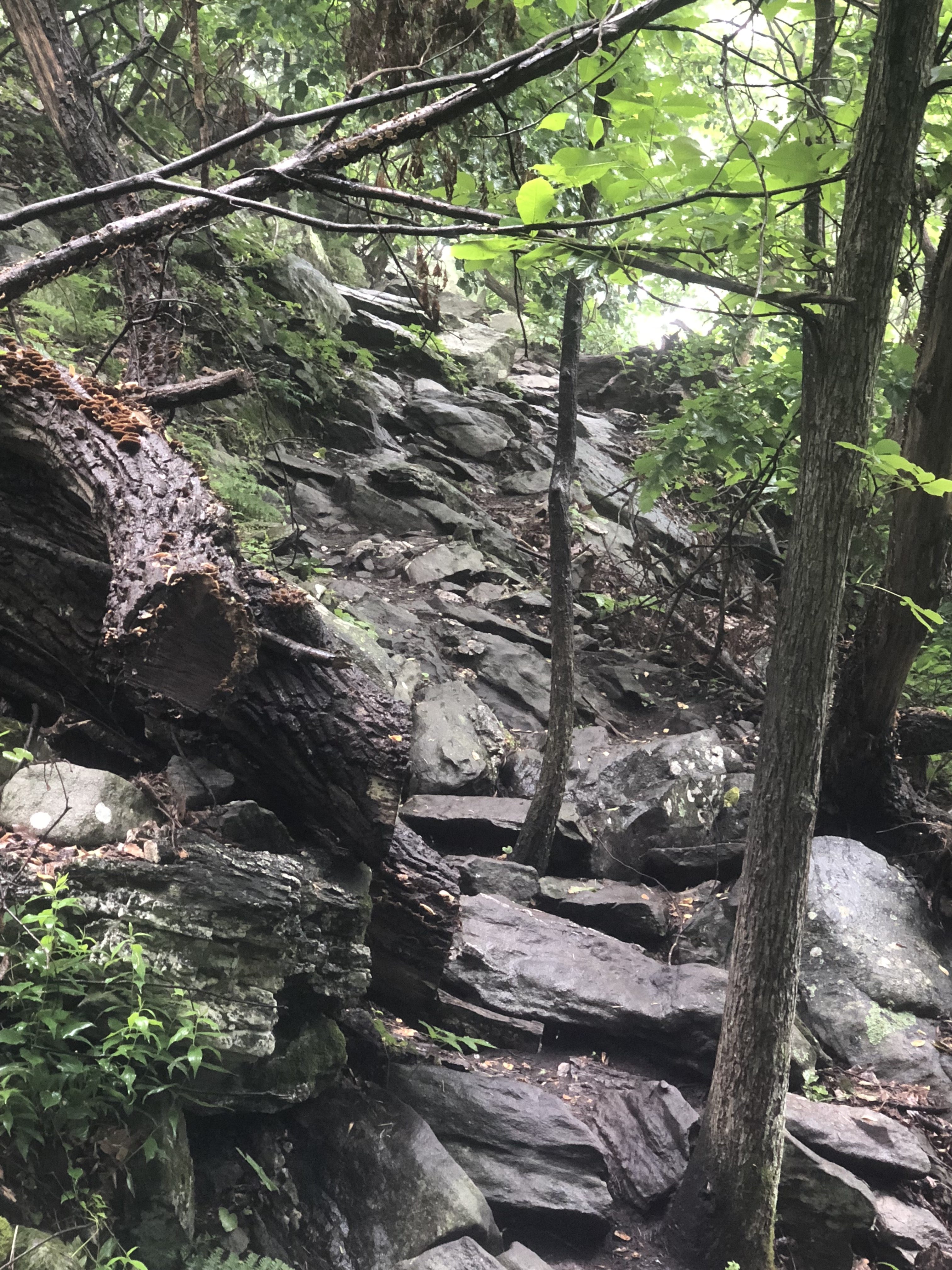
The beginning of the Roller Coaster.


Have I reached 1,000 miles? Not yet, according to the map.

Is this it? Nope, passed it already.

Still not it.
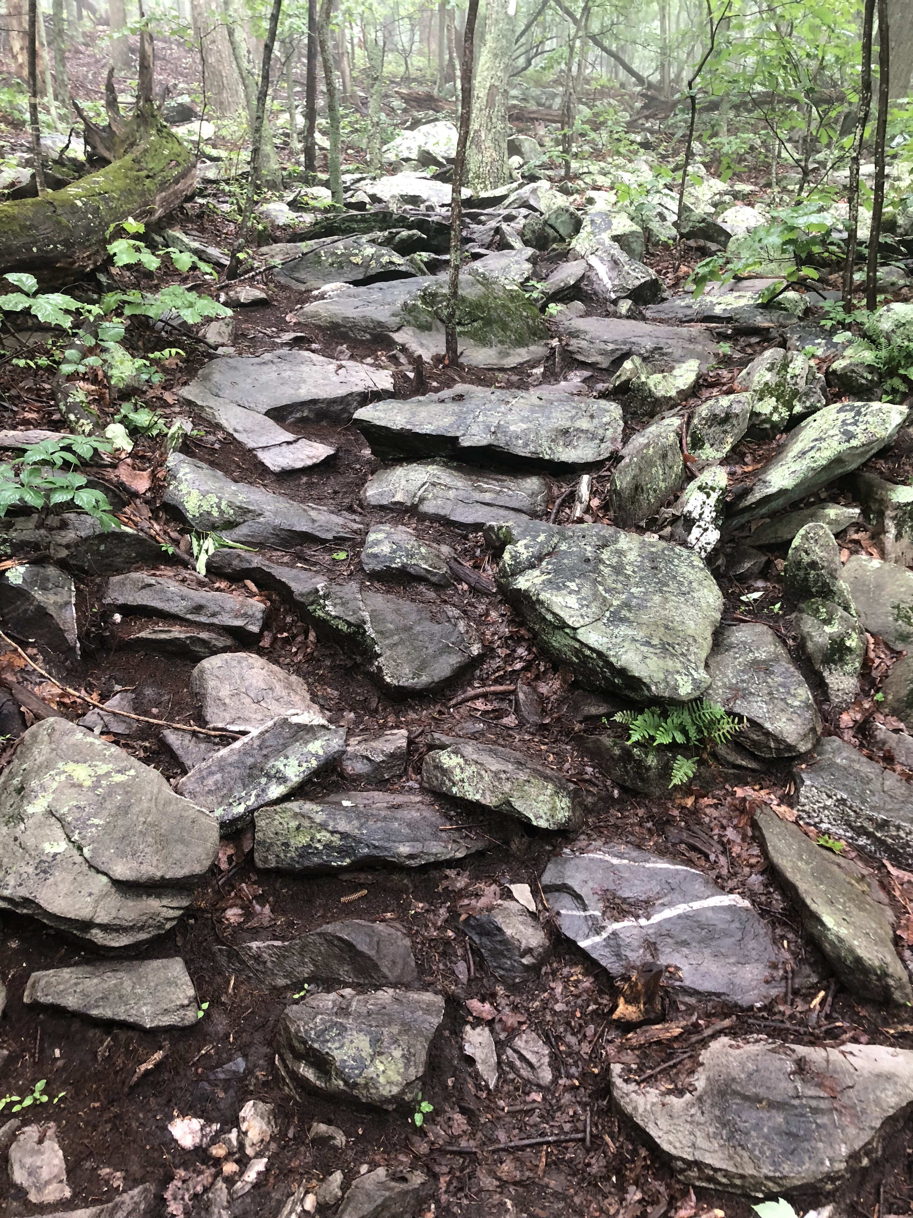
Rocks, small and large.
More rocks.

The end of the Roller Coaster.

The End of Virginia
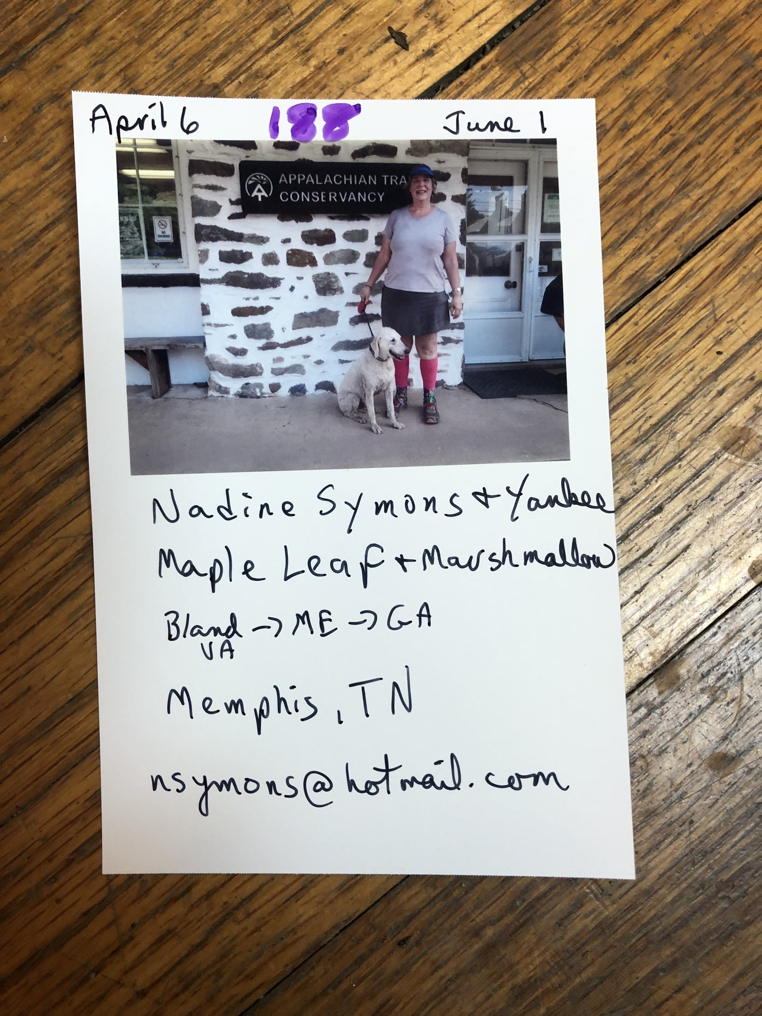
After the Roller Coaster, the Snail Brethren and I were getting close to West Virginia. I decided to hike an extra five miles into Harpers Ferry while they took a shuttle back. I knew that they would eventually have to go back to Virginia to finish the 55 miles they had skipped so I wanted to see if I could do the 12 miles. I was running against the clock since the Appalachian Trail Conservancy closes at 5 p.m. This is where the unofficial halfway point is and where the hikers get their picture taken. I wanted mine on the day I arrived in Harpers Ferry, not the next day. I made it with ten minutes to spare. The descent into the town was not the easiest due to some big boulders I had to navigate. Yankee never seems to have a problem with the downs.
West Virginia
Not much to say about this state since it is only about 17 miles long, although you walk in and out of it. It is beautiful since it meanders throughout Harpers Ferry and you pass by several old buildings and the town has a lot of history.

Jefferson Rock. They propped it up because they were afraid the rock might tumble down and injure the people in the town
Start of Maryland
The trail crosses into Maryland along a long pedestrian bridge, then ambles along the Potomac River on the C&O Canal path for three miles (yay, it was all flat). The path was pretty muddy and we were surrounded by water. A few days prior to our hiking that bridge, it had been closed due to the river being so high, it was deemed unsafe. Two days after we crossed it, it again closed due to flooding. We were lucky we did not have to take a detour.

The steps leading off the bridge on the Maryland side. Yankee definitely did not like the metal grill.
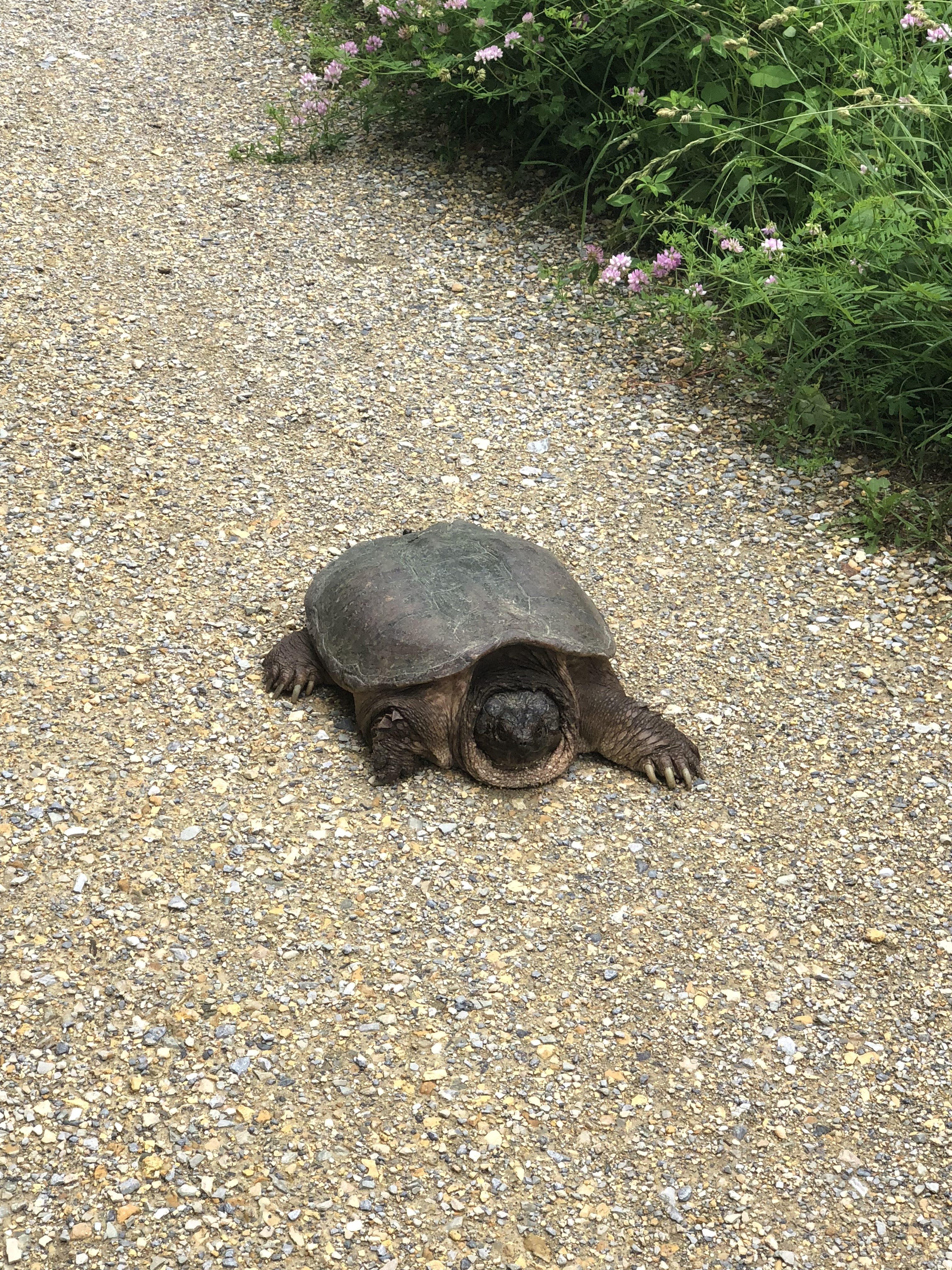
Big turtle, maybe snapping, but I did not get close to it to find out.

Yankee eating grass and contemplating whether he wants to go in the Potomac River.

Lots of little turtles in the canal water.
The Rest of Maryland
I was going to do a separate blog for Maryland but there is not much to say about it. It is 40 miles long. The first monument erected for Washington is right by the trail. You pass the Mason-Dixon line into Pennsylvania. And, of course, more mud.

I have pictures of the Washington monument as well as the Mason-Dixon line, but somehow my phone will not give up those pictures.
Ahead to the rocks of Pennsylvania.

This website contains affiliate links, which means The Trek may receive a percentage of any product or service you purchase using the links in the articles or advertisements. The buyer pays the same price as they would otherwise, and your purchase helps to support The Trek's ongoing goal to serve you quality backpacking advice and information. Thanks for your support!
To learn more, please visit the About This Site page.

Comments 4
1000 miles! Woo Hoo!!! You are totally awesome (geeez, I sound like a Valley Girl) but you are! Your photo journalism skills are exceptional, the highlight of my day each time you post. Hope that Pennsylvania is as beautiful as Virginia was/is. And Kudos to Yankee, he is a real trooper! M
I don’t think that turtle is a snapper. Snappers have ridges on their backs. I think if that turtle that you photographed bit you on the ankle, you would need a crowbar to release it’s jaws.
1000 MILES !!!WHOOOO HOOOOOOO! Felicidades Nadine and Yankee!! Great story telling and photos! Can’t wait to see Pennsylvania! You visiting Eleanora???
1000 miles is awesome Nadine!! And, these photos are amazing!
I am so proud of your hard work and an impressed by Yankee too!