
 ">

AZT Days 32-37: Fire and a 32 Mile Day!
Day 32:
This was a resupply day in Pine, and well deserved. We made som breakfast sandwiches in our VRBO then headed into town to enjoy some quaint shops before doing our resupply. Had an incredible steak salad at the Pinewood Tavern, then stocked up. Found out today that Vince is the guy if you need a lift around town. His info is on FarOut somewhere but it’s not easy to track down. We cooked supper at our house too, a vast amount of pasta that we could not finish.
Day 33:
Vince drove us bright and early over to the Pine trailhead, and we enjoyed the day hiking below the Mogollon Rim with beautiful views of their mighty cliffs to the north and to the south a vast forest. We set a lofty goal of reaching Washington Park, an area at the base of “the climb” to the top of the Rim. Unfortunately, camping spots were scarce and the night was chilly but we made it through.

Looking up at the Rim… Gorgeous.
Day 34:
The hike up to the top of the Rim was probably worth doing slower as there was tons of history in that beautiful vale. The headwaters of the East Verde River were gorgeous. Conquering the Rim was easier than we thought it would be, but we were in much better hiking shape. Getting up onto the plateau was a very dramatic shift, and welcome with lots of shade, gently rolling terrain, and not as much pressure on our legs and feet.
In the afternoon, we spotted smoke. It wasn’t a concern until it was… The trail inconveniently turned and guided us straight towards it. We came down a hill to a front country campground and were met by some rangers in a truck who advised us that a prescribed burn was taking place over the trail and we needed to reroute. To soften the blow he mentioned that the ranger station nearby had cold pop and ice cream of we made it there before the end of the work day. We didn’t, but as staff trickled out they generously let us in to buy an ice cream sandwich for a buck!
Deciding on what to do took some pondering. The smoke was blowing across the road, and also onto the reroute so we decided to camp and see if it was better in the morning. We found a spot adjacent to the ranger station because we wanted to be able to access the station’s pit toilets, picnic tables and water spigot in the morning.

There’s fire behind that AZT gate!
Day 35:
When we awoke, the smoke was no longer blowing over our campsite. However, fires were smouldering in the burn area still, and smoke was thick over the reroute. We decided to tough it out, and it took almost 2 hours to clear the smoke.
As we approached lunch time a new challenge arose: storm clouds ahead. Little bits of precipitation started and the temperature dropped significantly. We set up a tarp in the boughs of a tree and had lunch underneath it as soft hail (or round snow) began falling. Thunder sounded in the distance but thankfully moved off. The cold temperatures continued as we forged on. We got to a cattle tank for water and found another hiker hiding out in her tent waiting out the weather. We decided to try pushing on, and finally pitched our tents around 6pm, eating a rushed chilly supper and jumping into our tents for the night.

That’s right, hit 500 miles today!
Day 36:
Thankfully, the cold night was as bad as it got. We were coming into the Mormon Lake area, and there were several front country options for camping, and Cruisy ground in between. Unfortunately, my digestive system decided it didn’t like changing water constantly, and it was a hard day of confusing messages and wondering if I was going to poop or just fart every time my guts wiggled. As we reached Dairy Springs Campground, myself and TC ran to the outhouses hoping they had been unlocked. A cooperative custodian granted our wish and I dosed myself that night with Imodium.
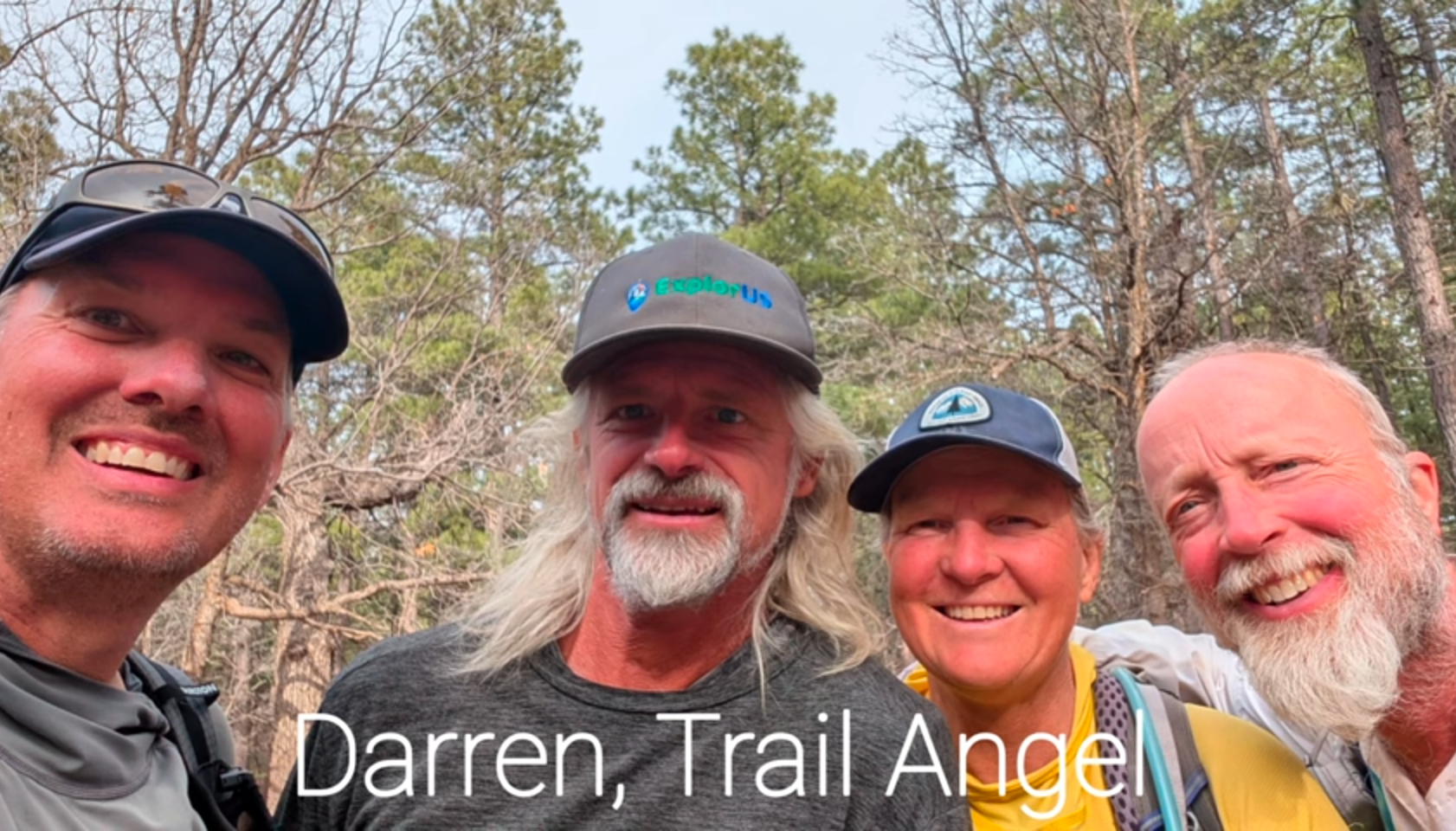
He didn’t know he was a trail angel until he was!
Day 37:
Our initial plan today was going to do some big miles and set ourselves up for a good Near0 in Flagstaff, strolling into town on Day 38 after a handful of miles. But by lunchtime we were feeling good and had about 13 miles in the bag, so we agreed: let’s push for a record day and do 32 miles, and finish at the Chinese buffet! Considering our previous best was only 24 miles, this was a huge reach.
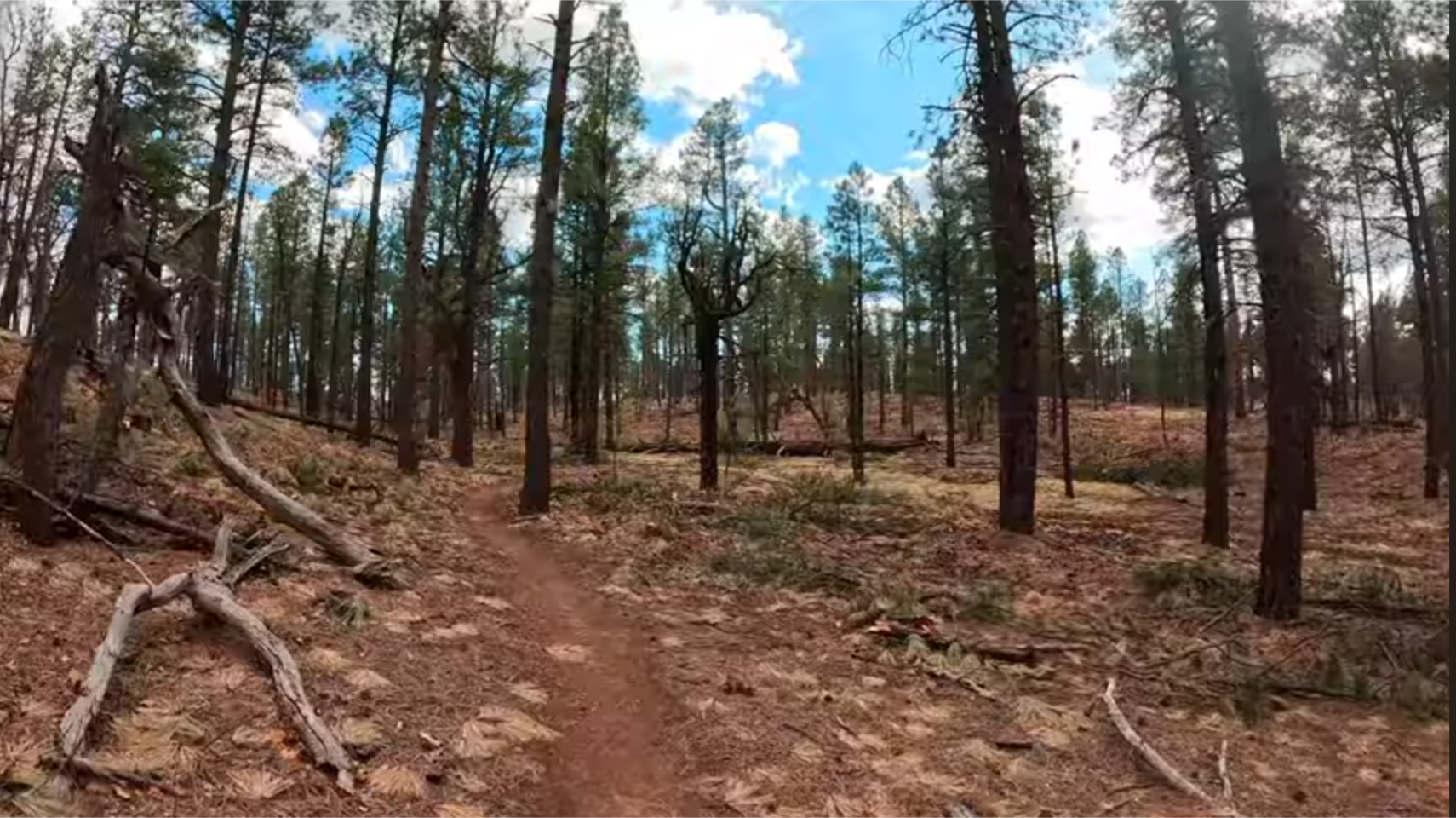
This is what selective logging looks like.
It was not without obstacles. I was disappointed that some selective logging dominated about 5 miles of trail, scarring the landscape. But worse, when we were about 10 miles out, the Cruisy, soft dirt trails were desecrated by hoofmarks: after the last rainstorm some horseback riders took their steeds out for a ride and their hooves turned some of the best, smoothest trail into a rough, broken mess. Our ankles took a huge beating for about 7 miles and I hope the AZTA makes clear to horse riders in the future not to use the trail after precipitation, to let the trail dry first.
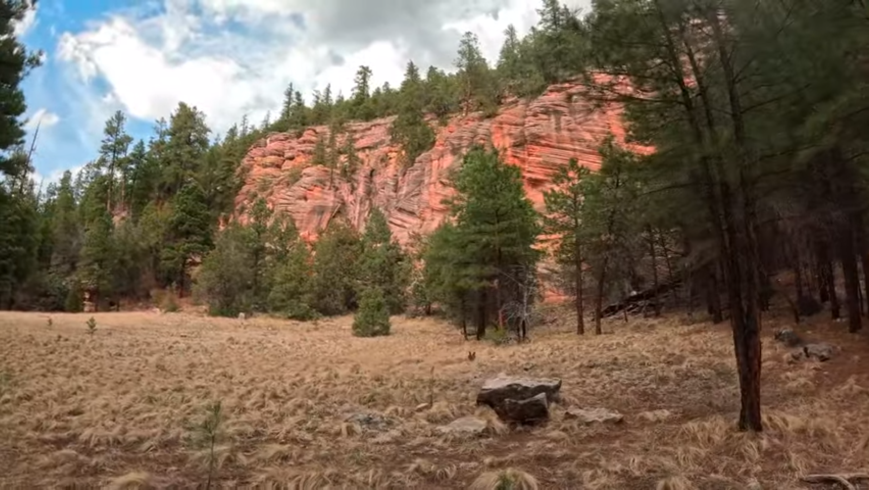
But this little canyon on the edge of Flagstaff was gorgeous!
The trail down the blue line into Flagstaff was very pretty though. Especially the narrow canyons. We pushed out of those and onto some rising and falling pine knolls, and the sound of the distant freeway was heard through strange echoes that encouraged us. Sadly it wasn’t that close but when we finally reached the overpass, our sighs of relief were palpable. With our last reserves of energy we hiked up to Route 66 and into the Chinese restaurant just as the sun sank below the horizon at 7:10!
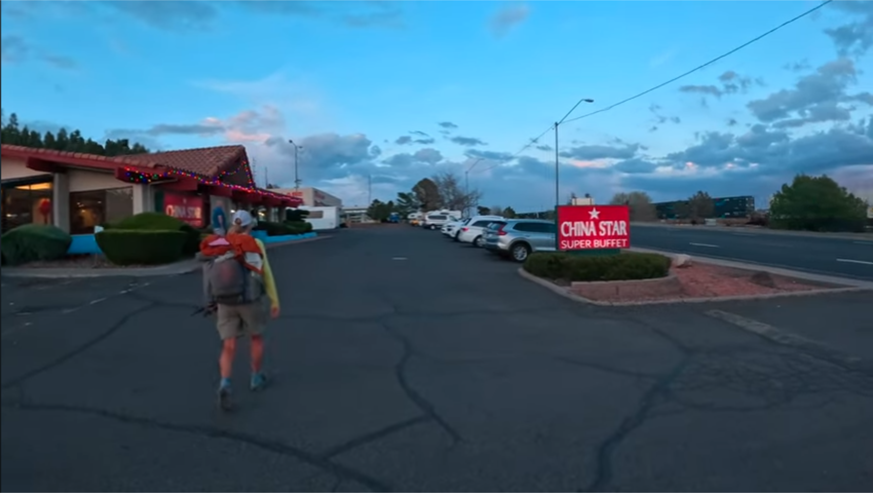
Chinese buffet at sunset! 32 miles in a day!

This website contains affiliate links, which means The Trek may receive a percentage of any product or service you purchase using the links in the articles or advertisements. The buyer pays the same price as they would otherwise, and your purchase helps to support The Trek's ongoing goal to serve you quality backpacking advice and information. Thanks for your support!
To learn more, please visit the About This Site page.
