 ">
">
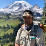
CDT Days 84-99: Northern Montana

Johnson Lake to Helena
The Northern Montana section of the CDT began with a 1,200 ft. climb on day 84. It brought us to Warren Lake, which for my money, was one of the most scenic lakes I’d seen in hundreds of miles. Around 18 miles deep, Cleansweep and I arrived at a junction: we could take the redline CDT around Butte, Montana, or take the Anaconda Cutoff. The cutoff would bring us through the community of Anaconda, as well as slice off some miles from our total. We opted for the alternate, which immediately delighted us with beautiful mountain views and a cool breeze. That afternoon we passed some of the last sobos of our journey. We made camp at USFS Spring Hill campground near MT Highway 1.
Day 85 began early: we were walking on the highway by 4:30 AM. Around 8 AM we are in Anaconda. Here we enjoyed a meal at the local diner (Mountain Dew for breakfast, always) and resupplied at the local grocery store. The road walk out of town was hot, and dodging traffic felt dangerous. A few cars yelled at me out their windows, “get a job!” – if only they realized how long I’ve saved up money for this journey, how much money I was bleeding via rent at home. That evening I arrived back on the official CDT, high above the Anaconda valley. Somehow, despite resupplying, we still managed over 36 miles.
Northern Montana’s section of the CDT was kind to me on day 86. Trail through Champion Pass was over rolling hills full of cattle; perhaps not as scenic as other sections, but at least it was easy to walk on. Around noon the air felt hot and stuffy. We lunched, I drank a boatload of caffeine, and we pushed on by more montane lakes and meadows. In the evening we enjoyed fresh sustenance from a water cache, compliments of Janky Joints of Helena, MT. I pitched my tent next to a serene lake. The calls of a bull moose in the distance lulled me to sleep.
Town days = early wakeups. By 4:30 we were walking quickly down the dirt road toward Helena. The only stop I made was to enjoy trail magic (a lukewarm cola in a cooler). Eventually we made it to the highway, where we saw our first nobos in a good while. They’d taken the Big Sky cutoff, so naturally we missed them through the last 700 miles or so. In town I exchanged my darn tuffs for fresh socks, resupplied, and did laundry. Helena was over 95 degrees that day… walking from where we got dropped off, to our hotel, was hardly enjoyable.

Helena to Augusta
We hit trail around 9:30 AM on day 88, but not before nabbing breakfast and catching a ride with the local trail angel. The footpath was mainly dirt road for the first 30 miles out of town. No complaints – I averaged 3 miles per hour without much difficulty through most of the day. Cleansweep and I chatted and hiked with another nobo, Pure Stoke, and marveled at some grizzly tracks we saw on the road. Still, this section didn’t feel very wild. I got buzzed by a low-flying helicopter, we crossed many dirt roads, and the glimmer of small towns could be seen far in the valley below us.
The following morning once again began at 4 AM. Good thing, too, because we camped on a ridge, and by 6 AM, lightning lit the sky where we had been several hours previously. I took a dirt road all the way to Stempler Pass. Here I visited Dave, who is a gear junky who sells boutique ultralight items in the middle of nowhere Montana. He used to perform a similar service on the PCT, which I used in 2016, so naturally I wanted to check out his inventory. I copped a few snacks and continued to Flesher Pass. A nice couple gave Cleansweep and I water here, which we gratefully gulped down in the hot sun. That afternoon we followed a ridgeline for 10 miles or so, fleeing from thunderheads looming in the distance. Finally, we descended into Roger Pass, where we were gifted beers by a traveler who was on a road trip. We climbed the northbound ridge and made camp in a backcountry yurt. Crashing in the yurt was the perfect way to end another 40+ mile day.
It was difficult to leave the yurt in the darkness of morning 90. I collected water at a spring at the break of day, but should have grabbed more. Little did I realize that the following section would be one of the driest on trail since New Mexico. We enjoyed the yips of a coyote somewhere in the valley below us, its cries echoing off the surrounding mountains. I’m chagrined to admit that I was negligent in checking my water sources on the guiding app: each water source I came across was dryer than the last. My 1l of water I had filtered ended up lasting me about 20 miles before I could refill. Cleansweep and I lunched at the first flowing water we found. Shortly after, we dropped down into the Dearborn River. Walking was easy the remainder of the day. We made camp in the Scapegoat Wilderness on the edge of a meadow, under the shade of a dramatic mountain face.
Day 91’s goal: make it into Augusta. We were up and hiking by 4:30. Trail brought us up a small ridge, but was otherwise a mild descent and followed a wild river valley. By late morning we arrived at the trailhead which leads to Benchmark Ranch, a popular attraction for local recreational enthusiasts. We had no luck hitching, so I used my Garmin to text a local trail angel to request a ride. In town, Cleansweep’s resupply box hadn’t arrived yet, but mine had. We secured lodging, choked down a disgusting meal at the local pub, and did our best to stay off our feet the rest of the day.

Augusta to East Glacier
Cleansweep’s resupply box was available at the post office on day 92. At 9:30 AM we delved into a wilderness I had been eagerly anticipating for months: Bob Marshall. “The Bob”, as it is affectionately called, ended up being less remote than I anticipated: most of the day was spent dodging day hikers and horsepackers alike. Truly, the trail itself stank of horse manure. Things got better that evening when the CDT brought us up an incline and into a more forested area. Here I had the opportunity to marvel at a natural phenomenon: the Chinese Wall. The Wall, which is a grand escarpment of rock several miles long, was the most dramatic features I’d seen since Wyoming. Despite its unoriginal name, I felt satisfied as I settled into my tent that night: seeing the Chinese Wall meant the Divide was nearly over.
A deer disrupted our camp all night bleeding into day 93; the deer was harmless, but given the Bob’s notoriety for grizzlies, it was hard to sleep nonetheless. To add onto that, I learned that a boutique chocolate bar I had received in my resupply box (my partner at home is so thoughtful) had melted all over the inside of my Ursack. I gulped down was remained of the rich, delicious Neapolitan chocolate best I could in the darkness of the morning. We left the beauty of the Chinese Wall behind and continued down the Spotted Bear alternate, which cutoff a few miles from the official CDT. In the afternoon I enjoyed sprinkles from some overhanging clouds while navigating a burn area. We crushed dinner deep in the forest, crossed the Flathead River, and made camp near a ranger station.
The trail stayed flat for most of the 94th day. We rejoined the CDT shortly after breaking camp. Paw prints and bear scat littered the landscape it seemed, but there were no bears to be seen that day. Unfortunately we soon were walking through a large burn scar, so the heat beat upon our backs and sweat beaded upon our brows. Luckily, the afternoon provided ample shade and flowing water to replenish our bodies and spirits. I collected water from the pump at Badger Creek ranger station, then took the Kitchen alternate to skip a blowdown section many sobos had been fear mongering over.
Day 95 was one to remember – after all, it was the day I arrived in Glacier National Park! Early in the morning we crossed several streams, eventually rejoining the official CDT. Near Marias Pass I took advantage of a restroom and potable water spigots, then ventured headfirst through the National Park boundary. The trail was overgrown and thick with vegetation in this section. Still, with hardly any elevation or other hikers to block the path, I made good time. East Glacier as a community was a bit of a letdown: lodging was poor, resupply was overpriced, and restaurants were laughably bad. Still, it was a good opportunity to rest before our final stretch: CANADA.

East Glacier to Chief Mountain
Day 96 began the way any good day should: with an oversized cinnamon roll from the local bakery. I hiked out of East Glacier and into the park proper. The southside of the pass I was climbing was bereft of foot traffic, but the north side was riddled with day hikers and tourists alike. We dropped into Two Medicine, where we acquired backcountry permits for our duration in the park. The general store offered powerful beers and sweet candies, both of which I enjoyed, before continuing on. We opted to take the Dawson Pass alternate. It was incredibly scenic. From the bull moose at the bottom of the climb, to the majestic 360 degree views at the top, Glacier made an immediate impression. Trail took us along the side of a ridge that reminded me of the PCT. In the afternoon we rejoined with the official CDT and dropped into the valley below, where we saw a huge cow moose grazing. Our campsite for the night was at Atlantic Creek.
Traveling with a backcountry permit meant our campsites and daily mileage were premeditated. Since we’d only be hiking mid 20s for the remainder of the journey, we decided to sleep-in on the morning of day 97. I was glad for the extra rest. Trail immediately climbed up Triple Divide Pass. Between the wildflowers and deeply hued rocks, the colors of Glacier really blew me away. On the pass we walked by some bighorn sheep. The landscape opened up into a wide river valley that was marred by a burned forest. We lunched at Red Hawk Lake, then followed the CDT along St. Mary Lake. Things were lonely most of the day, but in the evening we were ambushed by tourists as we approached the Going to the Sun Road. Cleansweep and I made camp at Reynolds Creek Camp and told stories before bed.
The morning of day 98 was hot and stuffy as ever. I shouldered by day hikers on my way up the beautiful Piegan Pass. Like the day before, the northern side of the pass was uninhabited, and we enjoyed solitude on our jaunt down into Many Glacier. Once at Many Glacier, I enjoyed a fancy meal at the local lodge, as well as a cocktail and beer. I managed to grab a raspberry fritter on my out of the lodge. It was only 8 miles to our final campsite of the trip, but I was admittedly more inebriated than I intended to be, plus the sun was incredibly hot. The result: a very, very uncomfortable and hot walk. By the time I arrived at Poia Lake, which was the final campground for me on the entire Divide, I was exhausted.
My alarm buzzed me awake at 4 AM. This was it: the last day of the thru hike. Around 4:30 AM, we circled around Poia Lake. Cleansweep saw a pair of eyes glaring back at us in the darkness: a grizzly? No, only a bull moose. I’m not sure which is more dangerous. The moose let us pass, granting us entry to our final climb which was up and over Red Gap Pass. I marveled at mountain goats in the distance while considering all I had been through on this trip… the windswept deserts of New Mexico, to the Wind River Range, the grasslands of Idaho, tall peaks of Colorado, and finally, Montana. Miles evaporated beneath my feet despite the hot weather. Surprisingly, the last 10 miles of the CDT were perhaps the most crowded I had seen the trail since beginning back in May. We arrived at the Canadian border in time for lunch. Nobody manned the border kiosk, and no border patrol or rangers stopped us. The two of us sauntered over the Canadian border to the terminus, marking the end of our epic hike.
The thru hike is about the journey, not the destination. This rang abundantly true as I arrived at Chief Mountain. It was an anticlimactic affair; frankly, I just wanted to lay down and sleep. If that isn’t the spirit of a thru hike, then I’m not sure what is. Looking for some sage wisdom and perspective? No… just tired feet and a rumbly belly. The introspection comes for a later blog entry.


This website contains affiliate links, which means The Trek may receive a percentage of any product or service you purchase using the links in the articles or advertisements. The buyer pays the same price as they would otherwise, and your purchase helps to support The Trek's ongoing goal to serve you quality backpacking advice and information. Thanks for your support!
To learn more, please visit the About This Site page.
Comments 6
Congratulations on finishing your CDT hike. Enjoyed your excellent journal. David Odell AT71 PCT72 CDT77
Thanks so much for the support, David! I imagine the trail must’ve been much more wild when you hiked. Cheers!
Thank you for sharing your journey Joseph! Congratulations!
Thank you for following along, Rania!
Really enjoyed reading about your CDT hike (all in one sitting). Do you need a passport to cross into Canada to reach the northern terminus? –Pale Rider
Hey Rick/Pale Rider, thanks for reading. My understanding is that you don’t need a passport to visit the Northern Terminus monuments if you’re walking right back to the US, but that you’d otherwise need a passport AND entry to Canada permit to enter the country fully. I can’t speak to the Waterton terminus, but I found the Chief Mountain border unmanned and I approached the terminus with no issue on the Canadian side.
My PCT experience was different because I entered Manning Park, BC, then took a greyhound through BC and back to Seattle. For that I needed a passport as well as the aforementioned entry to Canada permit, as distributed by the Canadian government. I hope this helps!