 ">
">
The Future of the Continental Divide Trail: Part II
This article is part two of a two part story on the Continental Divide Trail Coalition and their goals for the CDT. If you missed the first article, you can read it here.
The Overall Vision
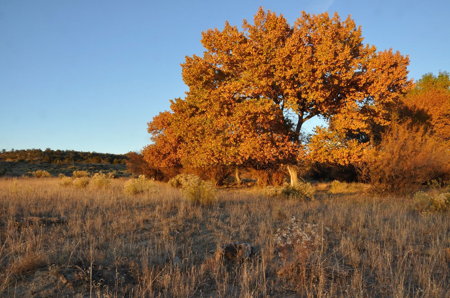
Photo of Alamocita Creek: Courtesy Continental Divide Trail Coalition
“Trail completion is always on the back of our minds (but) it’s a little complicated depending on what your perception of completed is,” said Guthrie Alexander, former Conservation Program Manager with the Continential Divide Trail Coalition (CDTC).
For the CDTC, it’s all about protection. Currently, 92% of the trail traverses federally protected public lands, and another 2% passes through state lands. This leaves just over 180 miles of the CDT that still pass through private lands and are in need of protection for the trail to be truly complete.
To work towards protection, the CDTC has two major processes they must complete. The first is relocating all of the intermediate roadwalks that exist along the CDT. For the most part, the roadwalks are on federally owned land that doesn’t have existing single track trails for the CDT to transition to. The CDT community works together to identify where the trail should go and then physically construct the new route. On average, 30 miles of new trail are created each year through this process.
The second process is identifying land not owned federally and helping transition those lands to federal ownership. This can lead to congressional designation of protected trail.
There are currently three major roadwalks along the trail that are not federally owned. Each one is in discussion for the construction of reroutes or easements to help fill in the gaps between the trail. These are a little more difficult than relocating federally owned roadwalks, as it often means working towards land acquisition deals or long-term agreements with existing owners willing to let CDT users pass through their land for decades to come.
The first land acquisition along the CDT occurred recently in 2015.
Between Grants and Pie Town in New Mexico, there was once a 52 mile highway walk leading trail users from one section of trail to the next. According to the Environmental Assessment for Continental Divide National Scenic Trail, Alamocita Creek: Land Acquisition, “The Grants and Pie Town trail gap is at high risk for failure due to expanding subdivision developments occurring on adjacent private land; and a trend toward large private land holdings for exclusive hunting opportunities.”
Alamocita Creek, a 5,867 acre parcel between these two sections of trail, was the solution to this problem. Alamocita Creek is situated in a way that made it impossible to bypass without the lengthy roadwalk. In order to reroute the existing 52 miles, many managing organizations needed to work together to build either land acquisition or easement agreements with existing private owners.
In 2015, a deal was made with the existing landowners, allowing the Bureau of Land Management to purchase the parcel of land for the purpose of the CDNST. In total, the agreement took two managing agencies and cost $2.8 million.
The Challenges in Achieving Goals

Wildflowers along the CDT: Courtesy Continental Divide Trail Coalition
It should come as no surprise that working towards the protection of the CDT is no easy task.
Just in numbers alone, one could see the immense amount of moving pieces, funding, and time it takes to put together land acquisition deals. And that’s just one part of the entire narrative.
The first process of rerouting gaps on existing federal land may be the easiest process for the CDTC to work towards trail completion, but it can involve years of work. The CDTC has been hard at work over the past few years to build a consistent voice for the trail, a challenge when considering the current state of the agencies they’re in partnership with.
In order to work towards these reroutes, the CDTC must foster strong relationships with workers within these agencies, building dedication and excitement towards various projects. However, due to high turnover rates and changes within these agencies, years of momentum can often be lost as employees transfer to other agencies, Alexander said. Sometimes projects are completely halted until positions are refilled, if they ever are, and then the CDTC is back at square one working to rebuild relationships with new agency workers.
With the second process towards protection, relocating roadwalks on non-federally owned land, the CDTC faces even more challenges. “While that’s the top priority, it’s also the hardest to do and takes the most amount of time,” said Alexander.
The entire process requires identifying property and owners willing to sell, then raising the funds necessary to acquire the land before transferring it into federal ownership. Sometimes this means settling on easement agreements where the CDTC creates legally binding agreements with landowners that will allow access along a corridor on privately owned land. Agreements can vary depending on the preferences of the landowners, including who can use the easement and a time frame in which the easement is available. Typically, the CDTC builds agreements that allow for a thirty year easement that can be transferred with the sale of the land, in case the current owner ends up selling their property before the contract expires.
While easements are helpful in the overall picture of moving towards trail completion, the CDTC prefers land acquisition agreements as they allow for more control of the land by the managing agencies. Land acquisition deals, however, are an expensive and time-intensive process.
Although the CDT was designated as a trail in 1978, it didn’t begin receiving federal funding until 1997-98. This funding was used for organizational costs for the CDTA as well as maintenance and relocation projects along public lands. It wasn’t until 2009 that CDT advocates were legally allowed to work towards land acquisition deals.
The Land and Water Conservation Fund (LWCF) is the major reason why the CDTC can acquire land. According to the National Park Service website, the LWCF is used to “fulfill a bipartisan commitment to safeguard our natural areas, water resources and cultural heritage, and to provide recreation opportunities to all Americans.” Created in 1964, the LWCF uses earnings from offshore oil and gas drilling to “strengthen communities, preserve our history and protect our national endowment of lands and waters.”
“The LWCF program can be divided into the “State Side” which provides grants to State and local governments, and the “Federal Side” which is used to acquire lands, waters, and interests therein necessary to achieve the natural, cultural, wildlife, and recreation management objectives of federal land management agencies.”
The CDTC’s annual budget is approximately $500,000. “I don’t want to say that completion of the trail would be impossible,” Alexander said, but there is definitely a need for additional funding to complete land purchases. Through the LWCF, the CDTC can work towards land acquisition agreements with private owners without burning through their entire annual budget.
While the LWCF provides a major source of funding for land purchases, the CDTC often has to work with numerous partners to raise additional funding for these deals. For example, for the land acquisition deal along Alamocita Creek, three sources of funding were used including the BLM, the LWCF, and the Rocky Mountain Elk Foundation. Finding those sources of funding can take a lot of work but are crucial elements for the long term vision of the CDT.
The LWCF is set to expire on September 30, 2018 unless congress approves the renewal of the fund. “If the law expires this year, it removes those funds from the pool for any of the national scenic trails to acquire land with,” said Alexander.
It shouldn’t be a hard sell to renew the LWCF since it doesn’t pull funding from taxpayers or other programs, Alexander believes, but land conservation has never seemed like a priority of the federal government. For instance, the LWCF should be obtaining $900 million from offshore gas and drilling each year, but it’s never received more than 50% of that since its creation in 1964. This is due largely to a lack of enforcement from the federal agencies managing the LWCF.
While the renewal of the LWCF may not be a priority for some, it is extremely important for the long distance hiking community when it comes to preserving and protecting the trails we care about most. For Alexander and the CDTC, this means we must take things into our own hands to try to influence the decisions that are being made about land conservation.
A Community Coming Together

Photo courtesy Continental Divide Trail Coalition
The largest way people can get involved is by becoming politically active within their communities, Alexander explained.
The CDTC has been working to build a narrative for the CDT that can encourage better practices on a federal level for the protected status of this and other National Scenic Trails. It’s a hefty goal when considering the priorities of the federal government, but one that may paint a picture for national decision makers as to why it’s vital to protect and grow long-distance trails.
With the expiration of the LWCF scheduled for later this year, the CDTC is urging members of the hiker community to call their local senators and representatives to encourage them to renew the LWCF in September. If members of the community can help paint a narrative for their local constituents as to why the National Scenic Trail System is important to them, it might help influence the decision made over the LWCF.
If you’re not sure how to contact your local district, the LWCF Coalition has a helpful resource page that can direct you to your constituents, including information on what you can say to your senators and representatives.
Another way that the hiker community can become politically active is by participating in forest planning. The CDT goes through 20 national forests, each with designated “forest plans” that describe where development can occur on the land. These forest plans last for approximately thirty years, and five of them are currently up for renewal with the potential for fifteen total forest plans being altered in the next five years.
The process for reconstructing forest plans is public, so if you live near any of the national forests that the CDT goes through you can attend meetings and information sessions where you can voice your opinion. “It’s a great way to help steer the priorities of that forest for sometimes up to 30 years,” said Alexander. If you don’t live near one of the national forests, you can write in also.
For more information on this process, and to see if the national forest you live near is revising their plans, you can check out the CDTC’s webpage on forest planning.
Members of the hiker community can also help by donating money or becoming members of the CDTC. All donations are used to help further advance the CDTC’s vision of protecting the trail in perpetuity. To donate or become a member, check out the CDTC website here.
Featured image used with permission from the Continental Divide Trail Coalition website.
A note: On March 26, 2018 we tweaked some details of this post to more clearly reflect the mission and history of the CDTC.

This website contains affiliate links, which means The Trek may receive a percentage of any product or service you purchase using the links in the articles or advertisements. The buyer pays the same price as they would otherwise, and your purchase helps to support The Trek's ongoing goal to serve you quality backpacking advice and information. Thanks for your support!
To learn more, please visit the About This Site page.

Comments 2
Suuuuuper interesting! When are you gonna hike it? 😉 I hope this raises awareness of the situation and helps make a difference!
🙂 so tempting after last year, right? Thanks Otter!