
 ">


Why Most CDT Hikers Leave the Official Trail to Hike This Unique Alternate
The Continental Divide Trail is a 3,038.2-mile trail from Mexico to Canada, spanning five states and largely adhering to the geographic Continental Divide of the country. Technically.
In practice, almost every single person who thru-hikes this trail will walk a different path, as the custom of the trail is to find cool alternates and side trails along the way to piece together your continuous footpath across the United States.
Some alternates are more popular than others. Most hikers will deviate from the official red line of the trail to explore the Wind River Range in some greater capacity, many will choose to bypass Idaho all together, and the vast majority will leave the trail in Southern New Mexico to spend about a hundred miles walking alongside the Gila River.
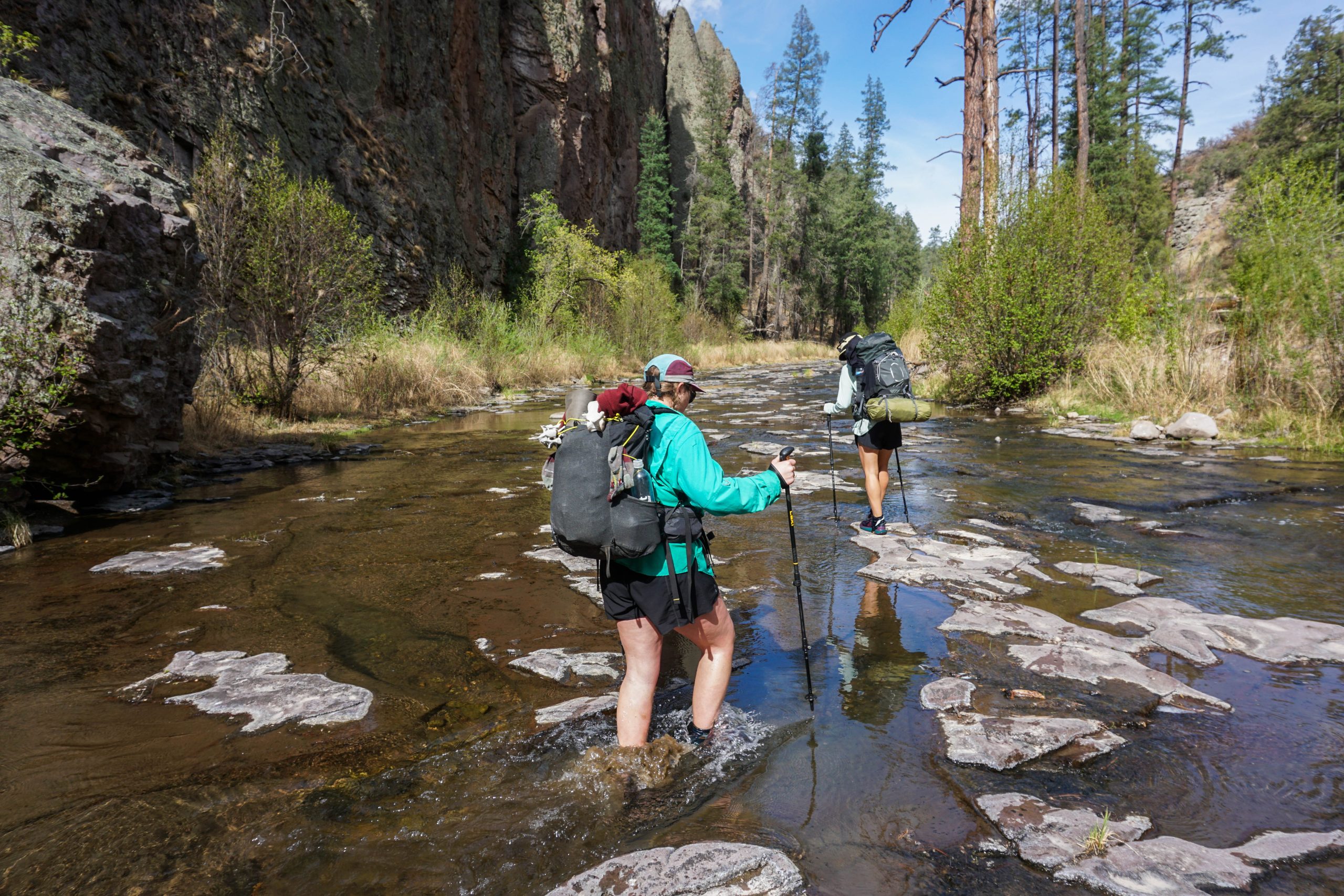
Much of the trail through this section is walking upstream in the river, or on constantly-disappearing sections of trail on the adjoining riverbed. Photo via Katie Jackson
This article is my love letter to the Gila Alternate. I’ll break down what it is, what you can expect from it, and why so many people choose to leave the CDT proper to spend almost a week with wet feet.
What Is the Gila Alternate?
Soon after a NOBO hiker leaves Silver City, they’re confronted with the choice of taking the Gila Alternate or staying on the official CDT through the Black Range of New Mexico. If you choose to take the Gila route, you’ll bypass about 178 miles of the main CDT and spend the next 104 miles heading (mostly) due north along the Gila River.
Yes, this does mean shaving 74 miles off the total length of the CDT, but the area you hike through is often cited as one of the coolest parts of the entire Continental Divide Trail.
The official trail winds circuitously through the ridgeline of the Black Range, with few spots to collect water and, often, total isolation. The Gila route descends down in a canyon network that has been carved through the rock by a river and, for arguably the first time in a northbounder’s journey, clean, flowing water is never more than a few feet away.
After reaching the bottom of the canyon, you follow the Middle Fork of the Gila River north. The trail passes the Jordan Hot Springs, briefly pops up to the general store at Doc Campbell’s Post, and even lets you take a tour of some 13th-century cliff dwellings. Unlike the brutal exposure of the bootheel, the Gila Alternate is absolutely crossed with ponderosas, cottonwoods, and sycamores.
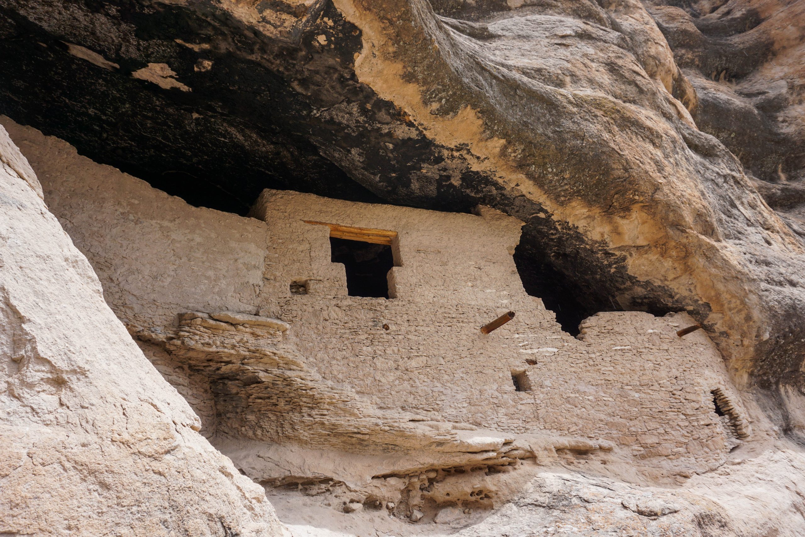
The cliff dwellings are an easy walk from Doc Campbell’s Post. Photo via Katie Jackson
Eventually, you exit the canyon near Snow Lake and have a brief walk on some dirt forest service roads before you connect back with the official redline just south of Pie Town.
Benefits of Taking the Gila Alternate
After 150 miles of heavy water carries, taking breaks every afternoon to hide from the worst of the heat, and going to bed with sand covering every inch of my body, dropping into a water-filled canyon felt like heaven.
For my entire time in the Gila, I didn’t feel the need to carry any water. Whenever I wanted a drink, it was very easy to just reach down and grab some water. Taking breaks also became much more enjoyable; the cliffs lining both sides and the trees inside the canyon gave me a reprieve from the sun for the first time since starting the trail.
Especially when I compared this experience to the experiences of people who went through the Black Range, I found myself even more appreciative of fresh water and the lack of burned trees.
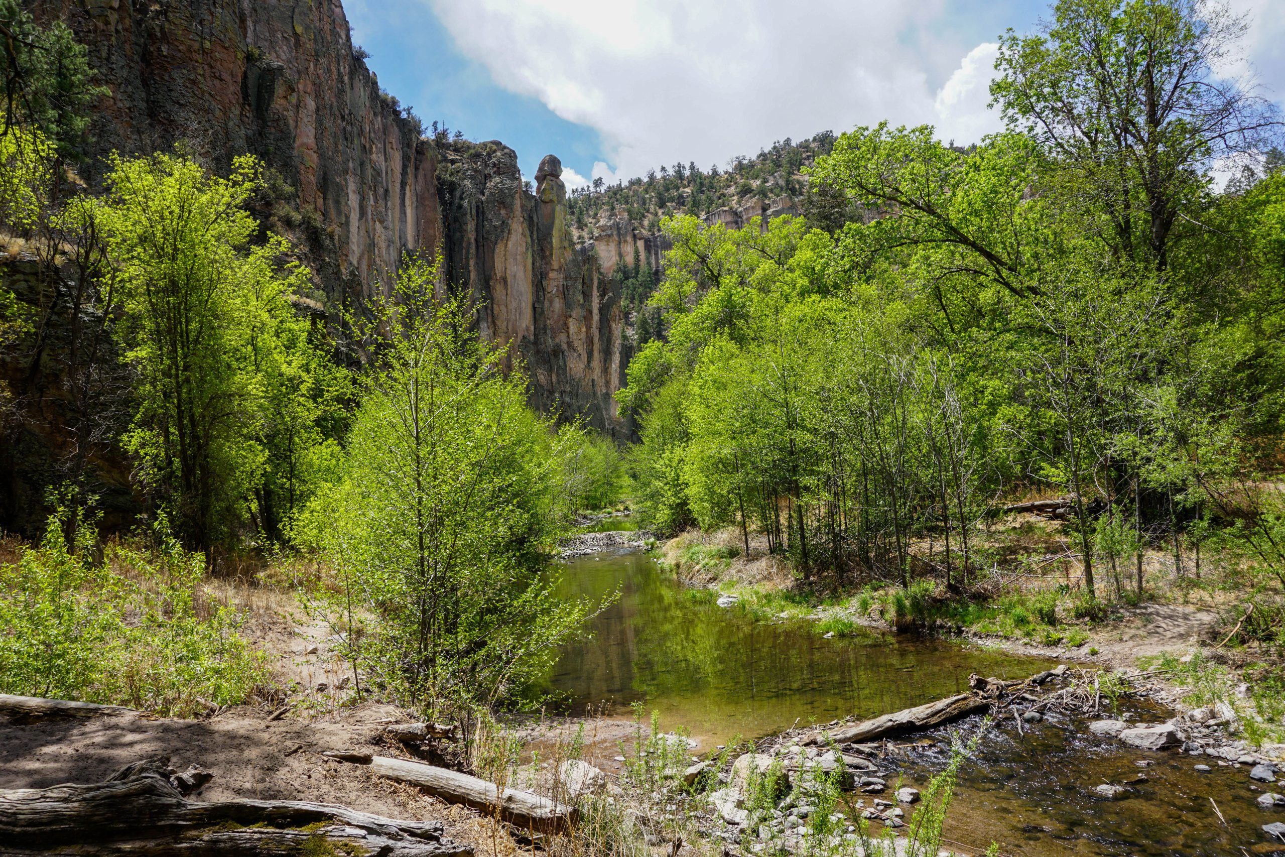
Fresh water and shade is never far from reach. Photo via Katie Jackson
Plus, the Gila Alternate is genuinely historically fascinating. The Gila Wilderness became the world’s first designated wilderness area in 1924. Also, a short side trail will take you to Mogollon cliff dwellings that have been preserved for 700 years, and you’ll experience a level of remoteness you can’t find anywhere else on the trail except for maybe the Bob Marshall Wilderness or the Wind River Range.
The camping through this stretch is also quite unique. Most nights, I cowboy camped on sandbars by the river, fell asleep to the sound of moving water, and could see the most incredible blanket of stars between the canyon walls whenever I’d open my eyes.
Challenges of the Gila Alternate
Even though I believe taking the Gila Alternate to be a no-brainer, there definitely are some frustrating elements of hiking that are specific to the Gila.
Throughout the course of this alternate, I crossed the river well over 150 times. These crossings fluctuated from ankle-deep splashes to chest-high, rushing rivers that forced me to swim a few strokes to get to the other side. The depth of the river changes drastically from year to year depending on early-season snowmelt and recent rainfall in the area, but expect a handful of deeper crossings. However, with enough time and patience, there is typically a good spot to cross each time.
Additionally, you can use the USGS Gila River Gauge to check the flow rate of the river in advance. Under 100 CFS means straightforward wading, 150 to 250 CFS means fast-moving knee-to-thigh water, and anything over 300 to 400 CFS makes the high route worth considering.
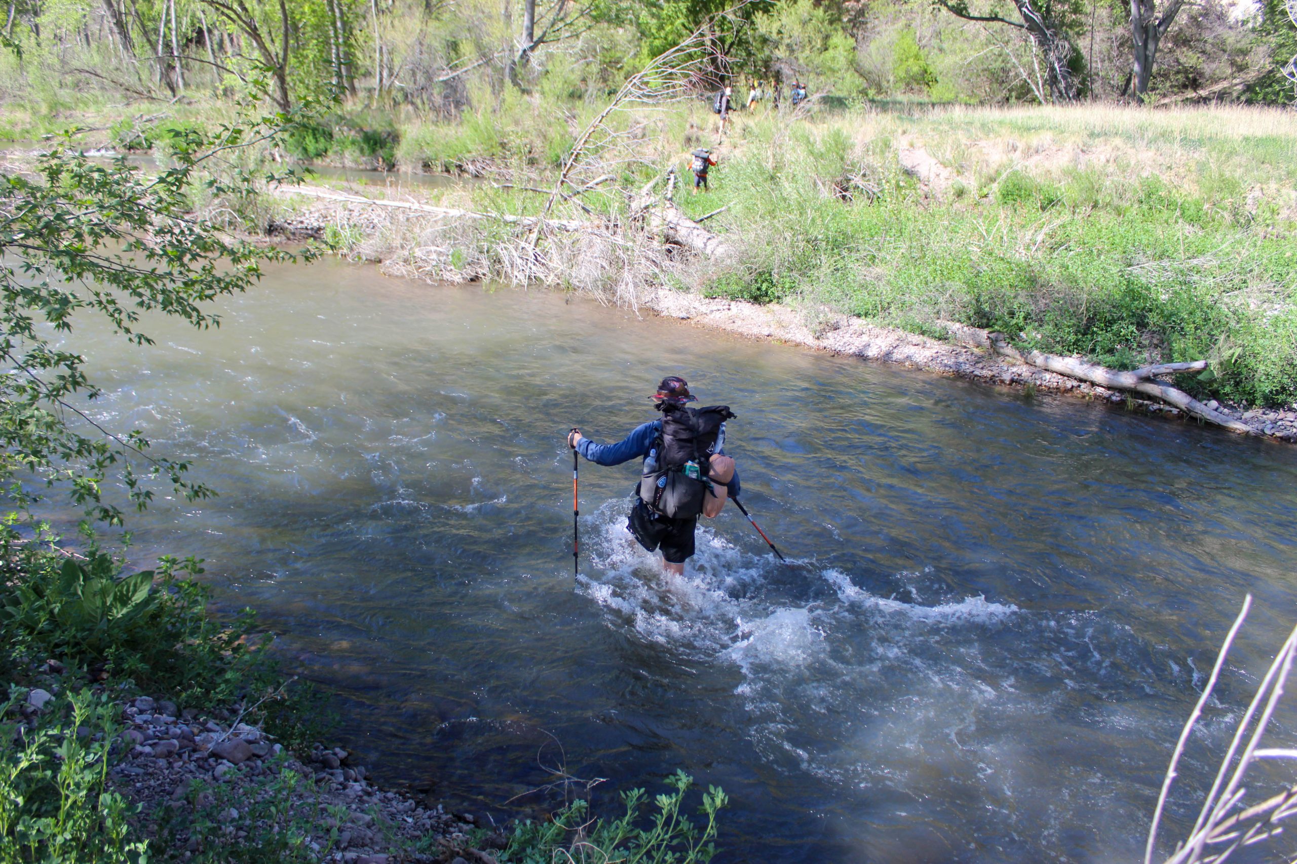
Will “ROVA” Standish crosses a deeper section of the river. Photo via Katie Jackson
Slow Hiking, Cold, and Chafing
Many of the rocks in the river are very slippery, which makes it challenging to walk in the river upstream, but the riverbeds can be equally challenging to walk on. The days are spent on sand and washed out banks, which means each step takes more energy and the trail often disappears and reappears randomly. Expect your daily pace to fall drastically. In the desert, I’d been hiking around 25 miles a day; in the Gila, I was averaging around 15.
The change in temperature can be jarring, though it can also be quite welcome. Since the canyon walls keep you in shadow until much later in the day than normal, temperatures are much cooler compared to the rest of the trail. Especially when at least my feet were wet for most of the day, I found myself too chilly. Still, even when I was shivering in my quilt, dreading getting up for the morning, I never regretted my choice to take this route.
All of this sand took its toll on my body in a different way, too. While my feet had toughened up significantly after a week and a half on trail, submerging them for this long every day softened the skin. The sand and river grit worked its way into my shoes and did some damage to the newly-softened skin. Combining that with the sand and wet shorts rubbing against my legs all day, and I left the Gila with a handful of new blisters and my first-ever chafing experience.
Gear Recommendations for the Gila Alternate
I would recommend trail runners over waterproof hiking boots for this section. I was very happy with my feet’s ability to dry out during breaks as opposed to being trapped in all the water that would overflow into a waterproof shoe.
Additionally, a woman in Silver City had cautioned me about chafing in the Gila and talked me into carrying a little sample of body lotion with me through the canyon. I owe that woman my undying gratitude, and would suggest the same gear modification to you.
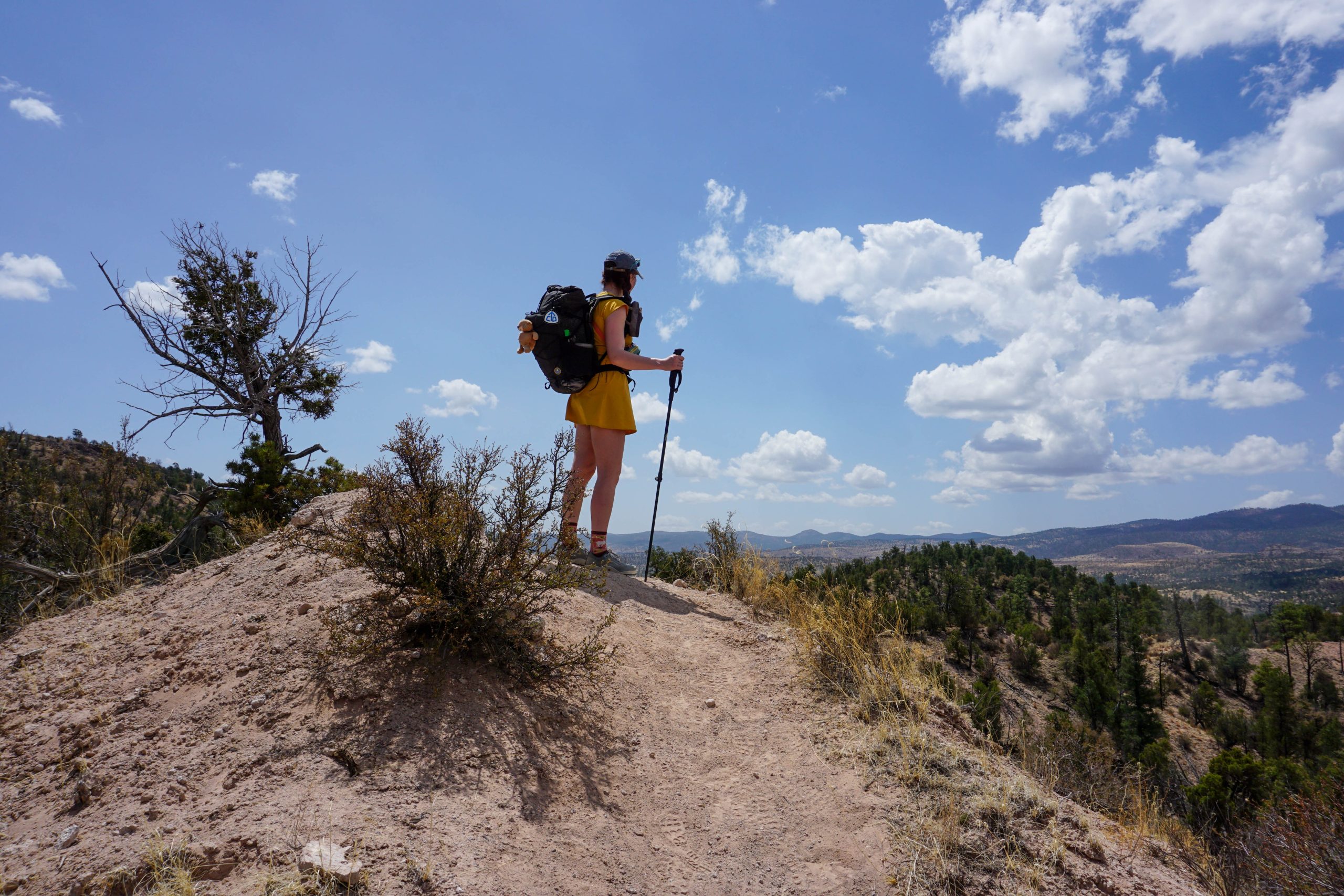
Taken just before dropping into the canyon after Doc Campbell’s Post. Photo via Katie Jackson
Route Variations Along the Gila
When most people think of the Gila, they think of walking directly through the Middle Fork of the Gila River and one billion river crossings. However, there is also a high route that runs along the rim of the canyon and keeps you off the canyon floor. Historically, thru-hikers have opted for this high route when conditions made the river crossings genuinely dangerous.
In years past, it was one or the other: staying in the canyon committed you to hiking the entire way along the river, and taking the high route meant you’d never get to experience the canyon floor. However, two connector trails (Trail #28 and Trail #730) now give you practical bailouts to change your decision or choose to experience a little bit of both.
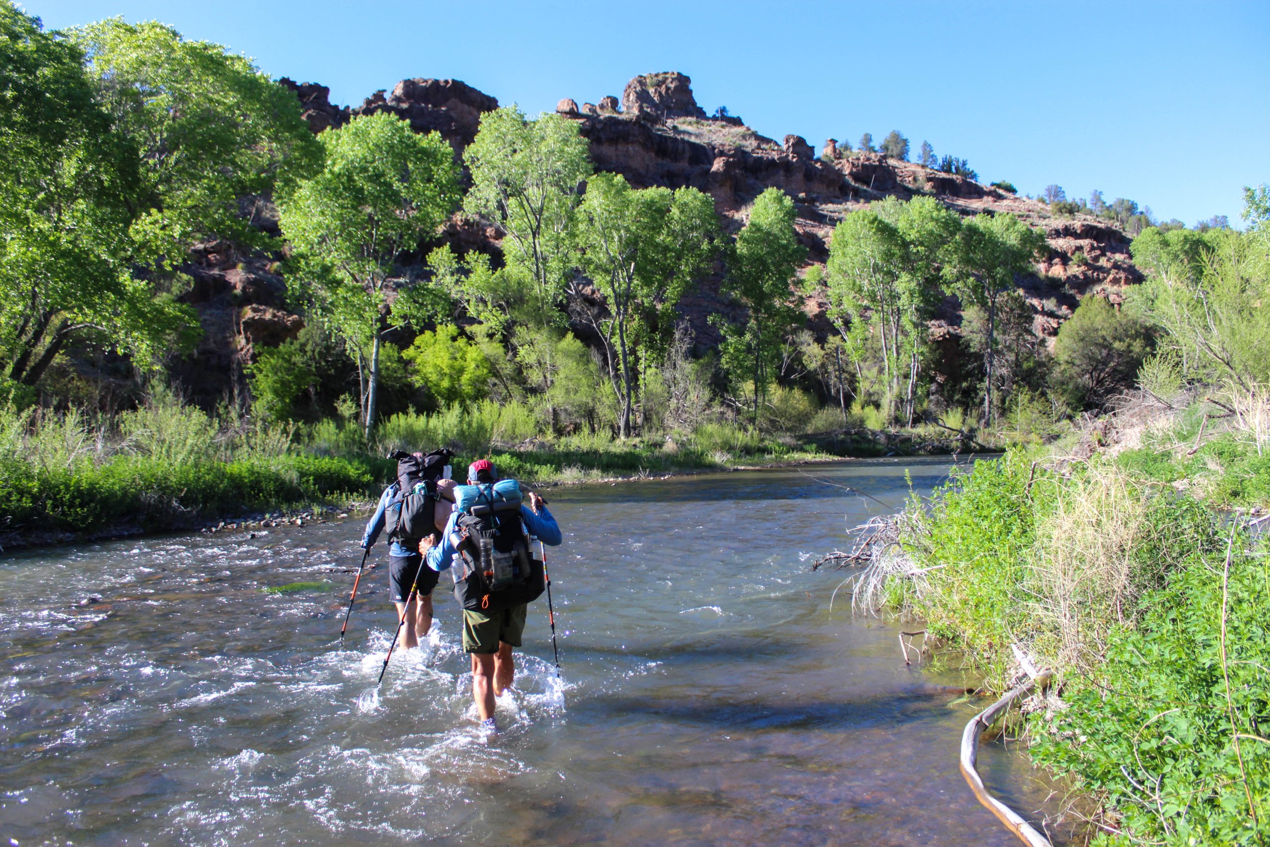
I would recommend experiencing the canyon base unless conditions force you onto the rim. Photo via Katie Jackson
If you want to hike into the lower canyon, soak in the hot springs, and check out the cliff dwellings, you can then use the Big Bear Trail or Coop Mesa to climb back out onto the rim if you don’t want to go through all the crossings of the rest of the river. Having the option to mix and match really comes back to the overall ethos of the CDT: choose your own adventure.
Taking Alternates on the CDT
Purists will always be there to argue over the validity of alternates compared to staying on the red line. Skipping the Black Range in New Mexico does mean missing a particularly rugged stretch of trail, but the Gila Alternate will give you an experience unlike any other.
Southern New Mexico will have plenty of dry, long stretches of redline trail waiting for you after Pie Town; do yourself a favor and opt for wet feet, clear water, and an awe-inspiring landscape while you can.

This website contains affiliate links, which means The Trek may receive a percentage of any product or service you purchase using the links in the articles or advertisements. The buyer pays the same price as they would otherwise, and your purchase helps to support The Trek's ongoing goal to serve you quality backpacking advice and information. Thanks for your support!
To learn more, please visit the About This Site page.

Comments 3
“Purists will always be there to argue over the validity of alternates compared to staying on the red line.”
I have never met anyone actually making that argument on the CDT.
When you hike the CDT SOBO, you end up in the Gila in the October or November autumn when the trees are a beautiful yellow, and the water levels are modest, never much above the knee. I stayed in the Ponderosa forest and went down into the Middle Fork only through the section where the warm spring is. Also, once the three forks come together, hikers can take a path that makes 55 crossings of the full Gila River.
I like that you included a picture of ROVA.