 ">
">
Crossing Alabama’s High Point
Day 5 (14mi)
Dry Ridge Across Horn Mountain
I followed a winding and gradual trail that repeatedly crossed a forest service road. Spiderwort continued to dot the ground, but in much sparser numbers than yesterday. There were multiple narcissus daffodils in bloom and lots of good viewpoints. I may change my mind about this after seeing more, but so far I disagree with the people who said Pinhoti lacks viewpoints.

Morning sun poking its way through the trees to my campsite
Jogloma Dam
I got to Jogloma dam and was grateful for the first water source in a few hours. While I was filtering a lizard stared me down from the rock it was resting on. Then, fast as lightning it decided it had enough and ran up a nearby tree.

Fire pink greeted me where the trail turned to head towards Jogloma Dam
There was a rather tricky water crossing that I was just barely able to stay dry for with a long jump. My spirits were crushed by a crossing absolutely impossible to stay dry through maybe a quarter mile further ahead. I was able to take off my shoes and spare my socks at least. On the other side of the crossing bamboo lined the trail.
I felt pretty good about making it across dry here
Less than Optimal Planning
I stopped for the night soon before Porters Gap. My food situation was starting to weigh on me as it looked like I underpacked by one day. I brought out 4 days, which was the correct amount for how long to Cheaha and my next resupply, but I neglected to account for needing food for the day of my resupply. Oh well, too late to do anything but manage with what I have. My phone battery also died midway through the day, so Day 6 and the first half of Day 7 will use pictures I took on different days.
Day 6 (17mi)
Here Come the Hills
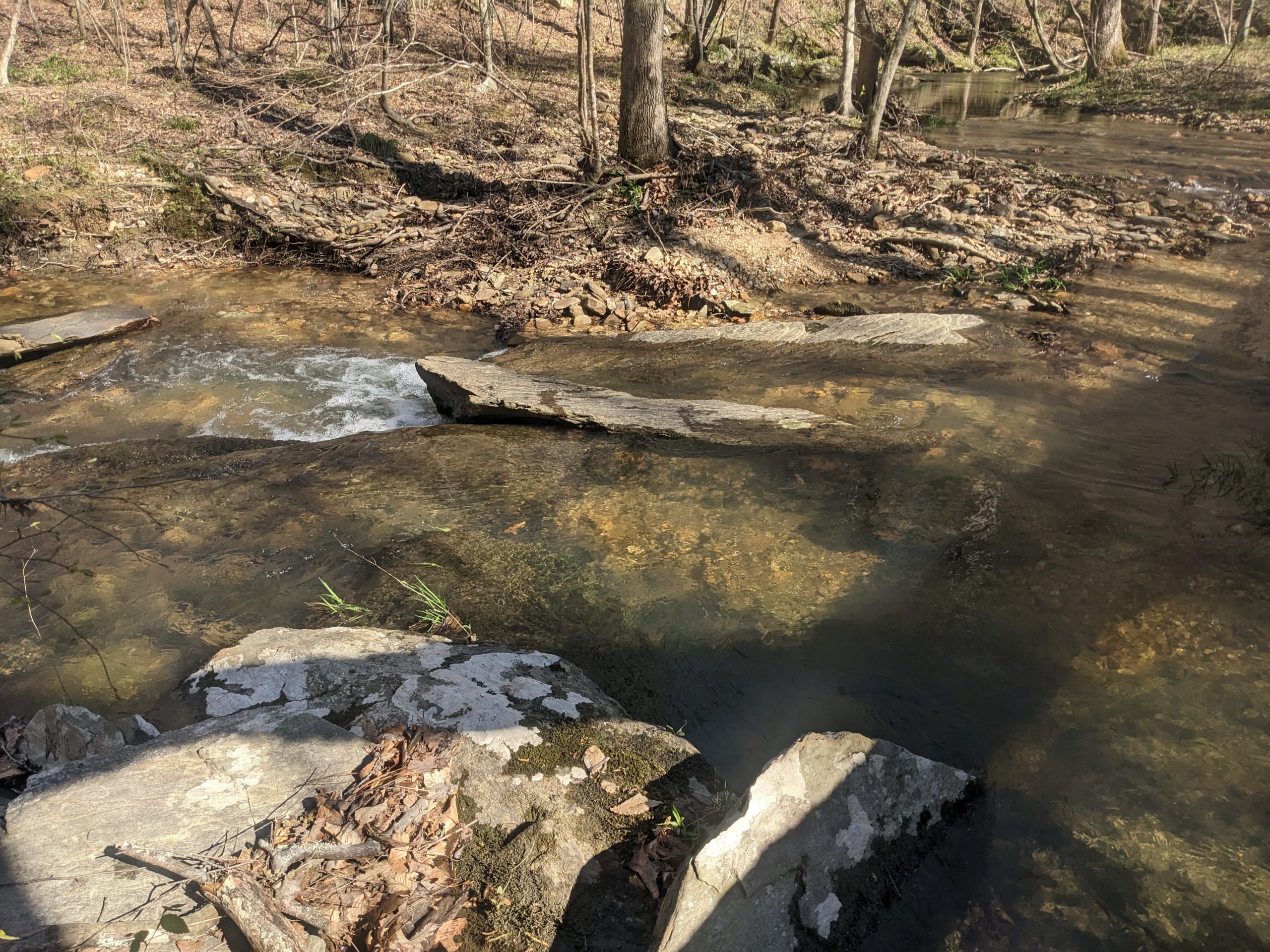
Day 6 saw me over Clairmont and Adams Gaps over increasingly rocky and hilly terrain. The trail is starting to pick up a bit and is getting more varied ground. There are frequent rock gardens to cross as well as frequent streams. It’s fascinating to see how deeply the small creeks have cut into the land over the millennia.
Floral Friends
The main attraction of the day was hundreds of rue anemone growing along the trail, most concentrated in the couple miles preceding Adams Gap. Also some big patches of quaker ladies.
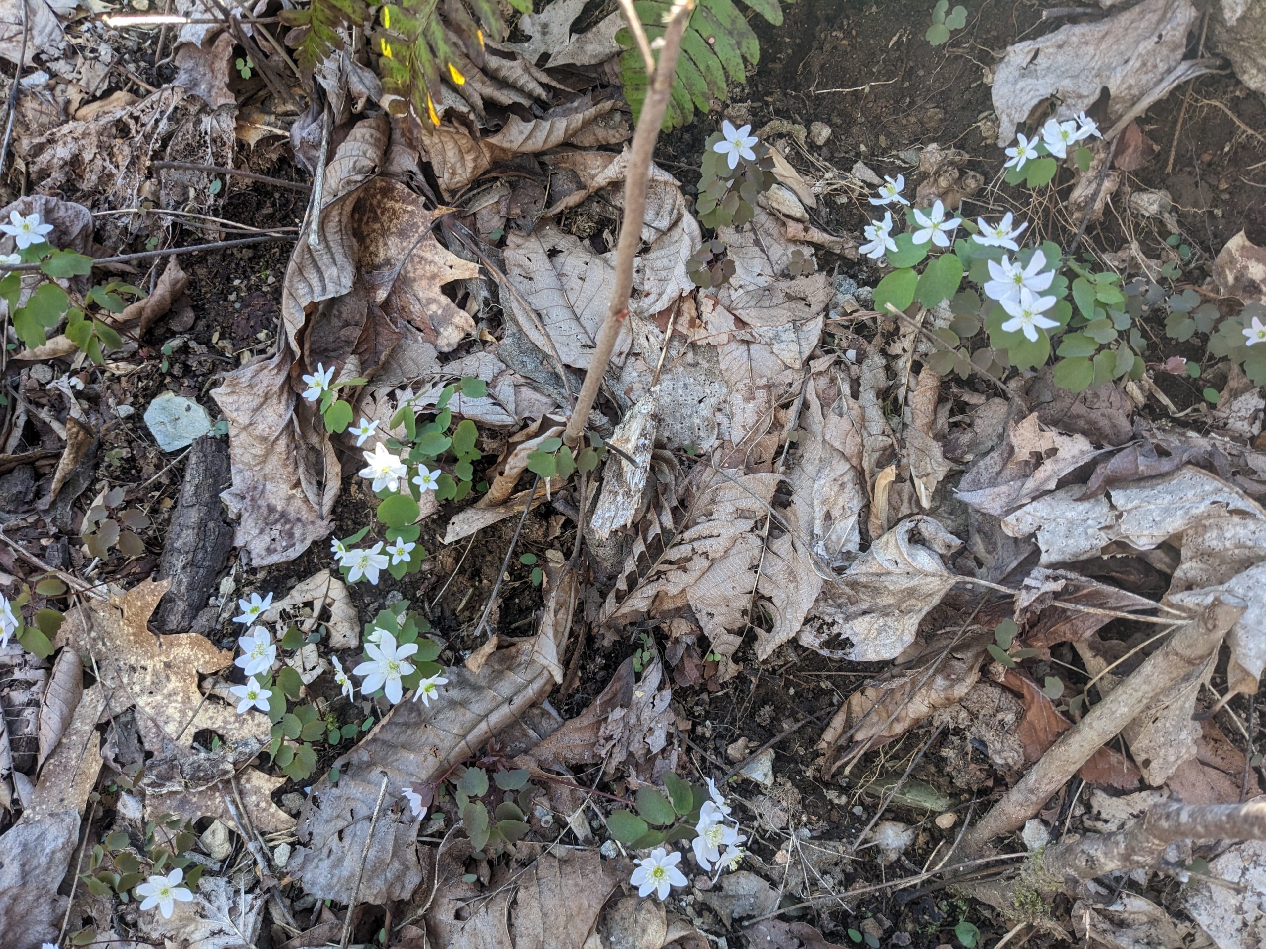
Rue anemone
I’ve been enjoying sitting down and looking close at some of the wildflowers. They’re much more complex plants than meets the eye. Take quaker ladies: most only see them as small blue flowers and nothing more. But if you sit down and take the time to study them, you can see their perfect symmetry with a single petal split into 4 sections, their yellow core dipping below the flower itself, the tiny ridges along the stem an inch below the flower, and their round green leaves almost touching the forest floor they’re so low down. They’re full of a dozen small details you’ll miss without taking more time to look deeper.

A patch of quaker ladies
I stopped for the night approximately 8 to 9 miles before Cheaha, with the third in a row bitterly cold night reaching the 20s. To think I picked this trail to avoid the cold.
Day 7 (10.5mi)
Cold Mornings
Waking up to a cold and crisp morning is always difficult to find the motivation to pick yourself out of bed. You know that as soon as you let the air out of your sleeping pad, you’re going to be shivering for the next half hour before you’re packed up and can keep warm through exercise again. And that’s exactly what happened, after spending 10 or 15 minutes dreading it beforehand. There’s a lesson here that procrastinating does nothing to help and only builds the fear for no reason, but clearly I can’t learn that lesson because I always do this on cold mornings.
Stairway to Heaven
Heading up to the ridge of Odum Point is surprisingly steep and strenuous compared to what I expected for 2000 foot peaks. The trail is also harder to follow through this section, being much more faint as it goes through a large rocky section. I was told by another hiker that it’s named the stairway to heaven. There’s great payoff a the top as you get clear and unobstructed views towards Cheaha and McDill Point, and can see the ridge you’ll be walking along to get there.
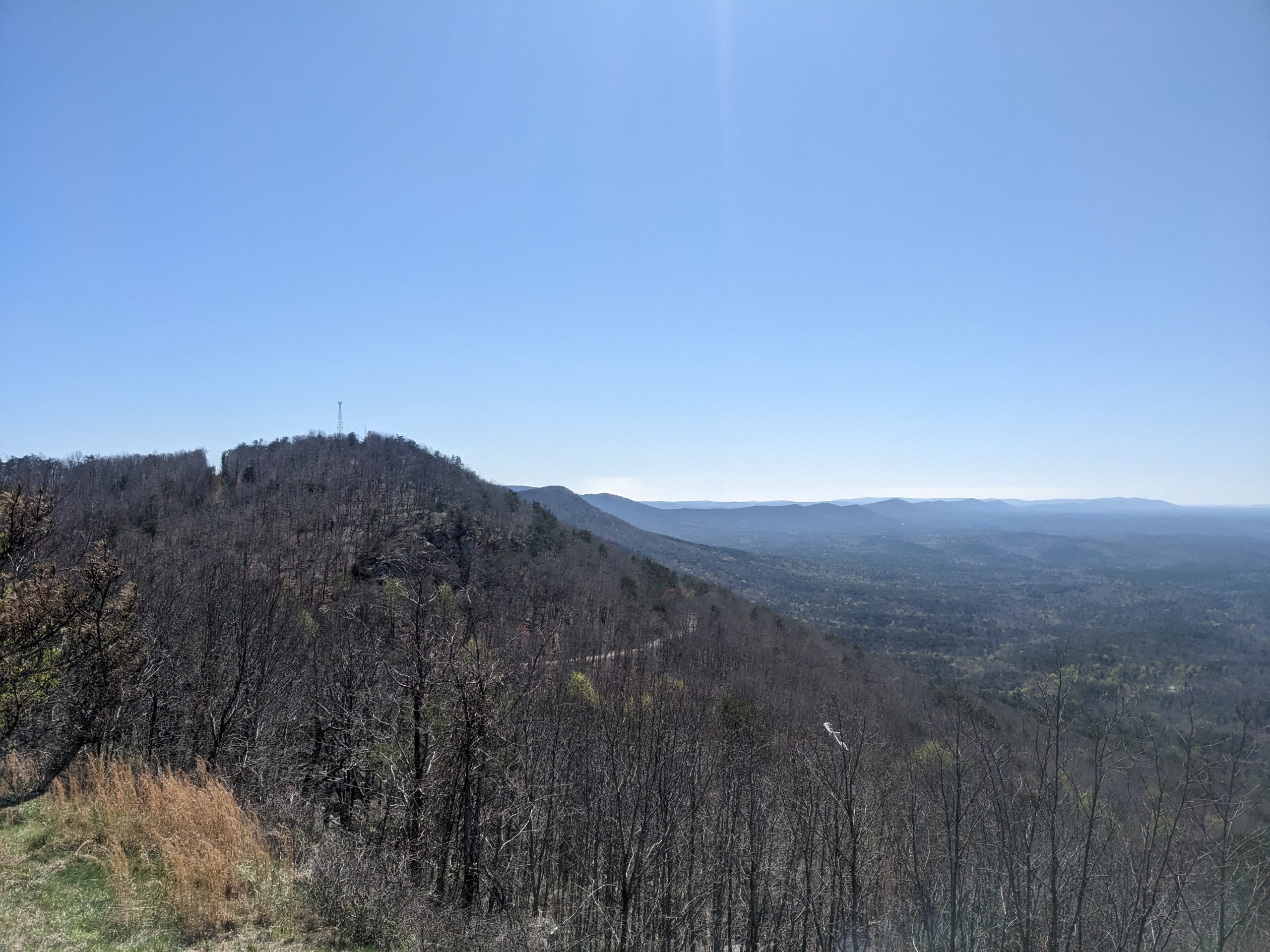
Looking from Cheaha back to McDill Point
McDill Point
After finishing the climb the trail gets mellow again as it gently winds along a ridge. You’ll pass by a few different intersections for side trails before getting to a sign for a quarter mile spur to McDill Point overlook. This is a side trip well worth taking, if only to see the bulk of a crashed plane halfway to the overlook.
The overlook itself parallels what you find on the ridge of Odum Point. Which is to say it’s a pile of boulders ever so slightly jutting out from the forest, giving a clear view towards the ridgeline you took to get to this spot.
There was a raven sitting on one of the rocks beneath me and I was lucky enough to see it jump off and take flight, after it looked at me curiously for a few minutes. Do you think birds get fear when they jump off of a cliff, similar to the fear humans can get when they go parachuting or base jumping? Certainly they must when they’re young because most birds require some nudging from their parents to take the leap of faith for their first flight.
Alabama’s High Point
Moving the last couple miles towards Cheaha I saw more people than I had seen the rest of the week combined, and it’s not even a weekend. I passed about 20 people in 6 or so groups, most of them day hikers and lots with kids in tow or an accompanying dog.
Upon reaching Cheaha, my first order of business was a $5 shower to make myself somewhat presentable. The shower was around a mile away from the country store, but I was planning on going around that loop regardless to reach the state high point. The shower was lukewarm and slightly too high for comfort water pressure, but I was still thrilled to be able to be clean for the first time in a week.

Looking out from Cheaha. You can see at least 30 miles out from here
Resupply #2
The country store itself is about as overpriced as you would expect for a touristy gift shop. Thankfully I only needed two days of food to make it the 30-odd miles to Heflin (plus food for today, which I actually remembered this time after having to walk the 8 miles to Cheaha on a single nature valley bar!).
I loitered behind the cliff side event building for most of the afternoon to charge my power brick and phone. Lots of people going for the viewpoint bemoaned that the former cliff side restaurant was now an event rental area instead, but I was secretly thankful for the relatively private power outlet it gave me.
Back to the Woods
Just before dark I left for the 2.5 miles to Blue Mountain Shelter, which is the first double decker shelter I’ve seen. It’s very tidy and clean, and judging by the logbook doesn’t see much of any use.
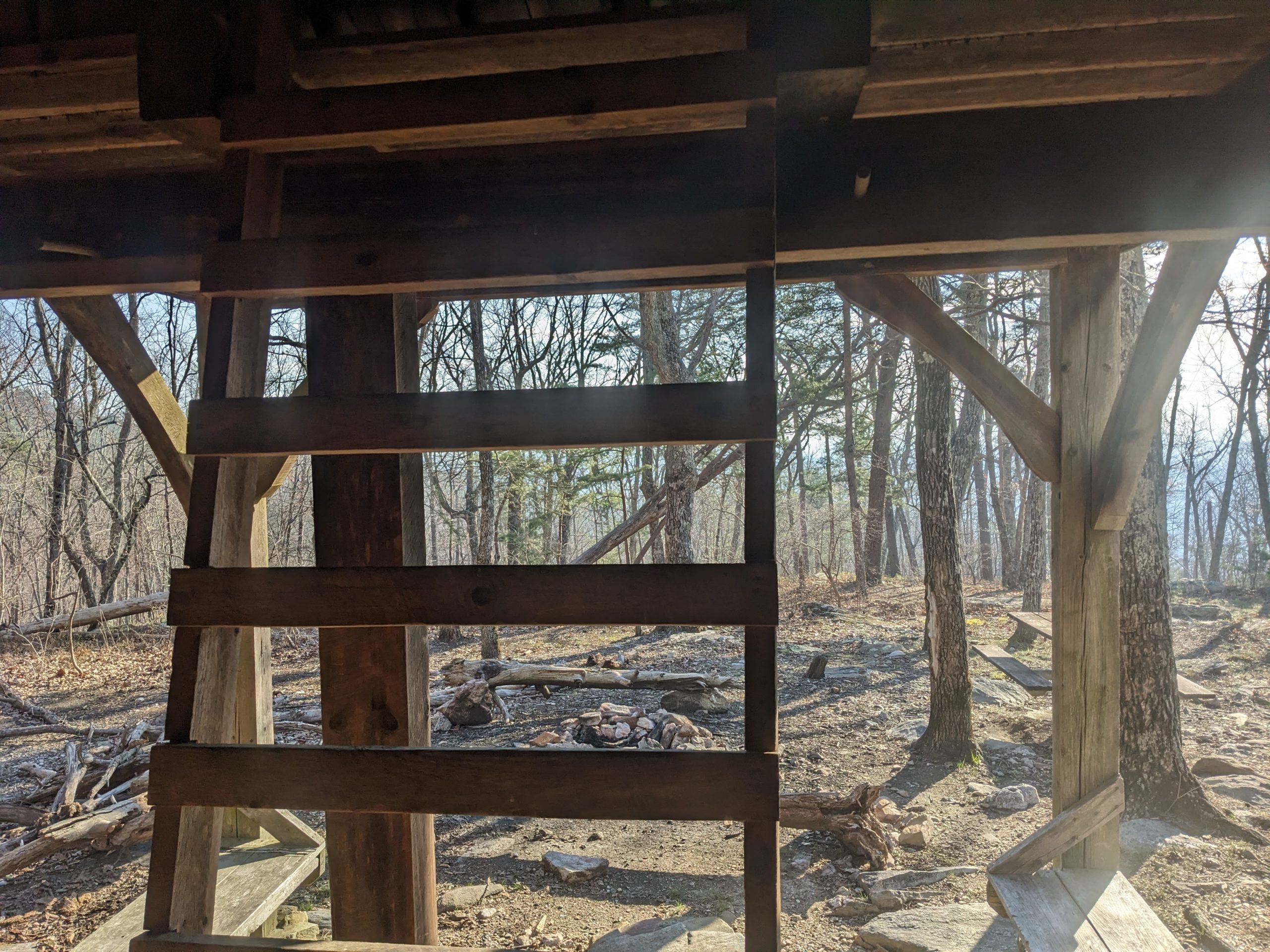
The ladder to Blue Mountain Shelter’s top floor
Tonight will make yet another night below freezing, before a brief respite tomorrow at a forecasted 50 degrees overnight. After that it’ll plunge below freezing for 4 more nights in a row, with Sunday the 19th reaching an especially chilly 20 degrees. Good thing I brought my 10 degree bag for this trip. I almost brought a 30 degree one instead, which would have been disastrous.

This website contains affiliate links, which means The Trek may receive a percentage of any product or service you purchase using the links in the articles or advertisements. The buyer pays the same price as they would otherwise, and your purchase helps to support The Trek's ongoing goal to serve you quality backpacking advice and information. Thanks for your support!
To learn more, please visit the About This Site page.

Comments 1