 ">
">
GDT Section B – A Smoky Rollercoaster
Section B Overview
Well, Section B certainly had its challenges, but I feel like the most challenging aspect of this section was the smoke. It stole my energy and some of my views, but mostly it was just a grim reminder of the devastation back home in Lytton. Every breath was a reminder that things were not okay in the community I’ve called my home since 2014. And yet I was out here. I choose to be homeless for the summer because hiking is how I heal. It’s where I needed to be to begin to work through everything.
Day 6 – Coleman to Window Mountain Lake
Total distance: 24 km
The first test of today was to see how much breakfast I could actually eat. Breakfast is easily one of my favourite foods, but I feel like I might have overindulged (thanks in large part to the enormous serving that Alannah provided for us). By the time I finished eating, it felt as though it would be easier to roll away from the table than it would be to walk. However, there were town chores to do before getting back to the trail.
Alannah offered to take Sebastian and I to the IGA in Blairmore to grab wraps for the next section as it was the only thing that I couldn’t find in Coleman. After a quick trip to the grocery store, I was as ready as I was going to be to truly start Section B. Alannah was kind enough to offer me a ride to the road off of the highway so that I could skip (not miss) the 2.5 km highway road walk. I generally don’t turn down offers of help and walking beside a highway has never appealed to me so I took her up on the offer.
At the trail (finally)
Once at the road (and still incredibly full), I began the 11 km road walk to the start of the High Rock Trail. This section was not particularly scenic, or enjoyable, but it wasn’t bad. However, the smoke obstructed part of the view and the ATVs and dirt bikes ripping by disturbed any sense of peace in the area.
At one point I stopped to chat with an older cowboy who was out for a ride on his horse. We chatted about some of his experiences in the area, my hike along the GDT so far, and some of what I could expect to see in Section B. I’ve always found that one of the things I appreciate the most about thru-hiking are the various people that you meet along the way; you tend to run in to some of the most interesting characters and each interaction feels unique in a way that most social interactions don’t. Maybe its because there’s no need to pretend to be someone you’re not, or maybe its because there’s no societal expectations and it allows people to express themselves freely. Either way, the connections feel significant.

Look at this guy. He’s pretty happy out there.
Bocce time
By the time I reached Window Mountain Lake, it was dinner time and I finally caught up to Gabrielle and Peter. We enjoyed some lakeside dinner before playing a few rounds of bocce. I know I said that I liked carrying some luxury weight, but before beginning I forgot to take out a set of trail bocce from the outer mesh pocket and carried it from Waterton to this point. Despite having the option to send it home in Coleman, I decided to carry it with me for the next section in the hopes of getting in at least one game.
Day 7 – Window Mountain Lake to Dutch Creek Campsite
Total Distance: 38 km
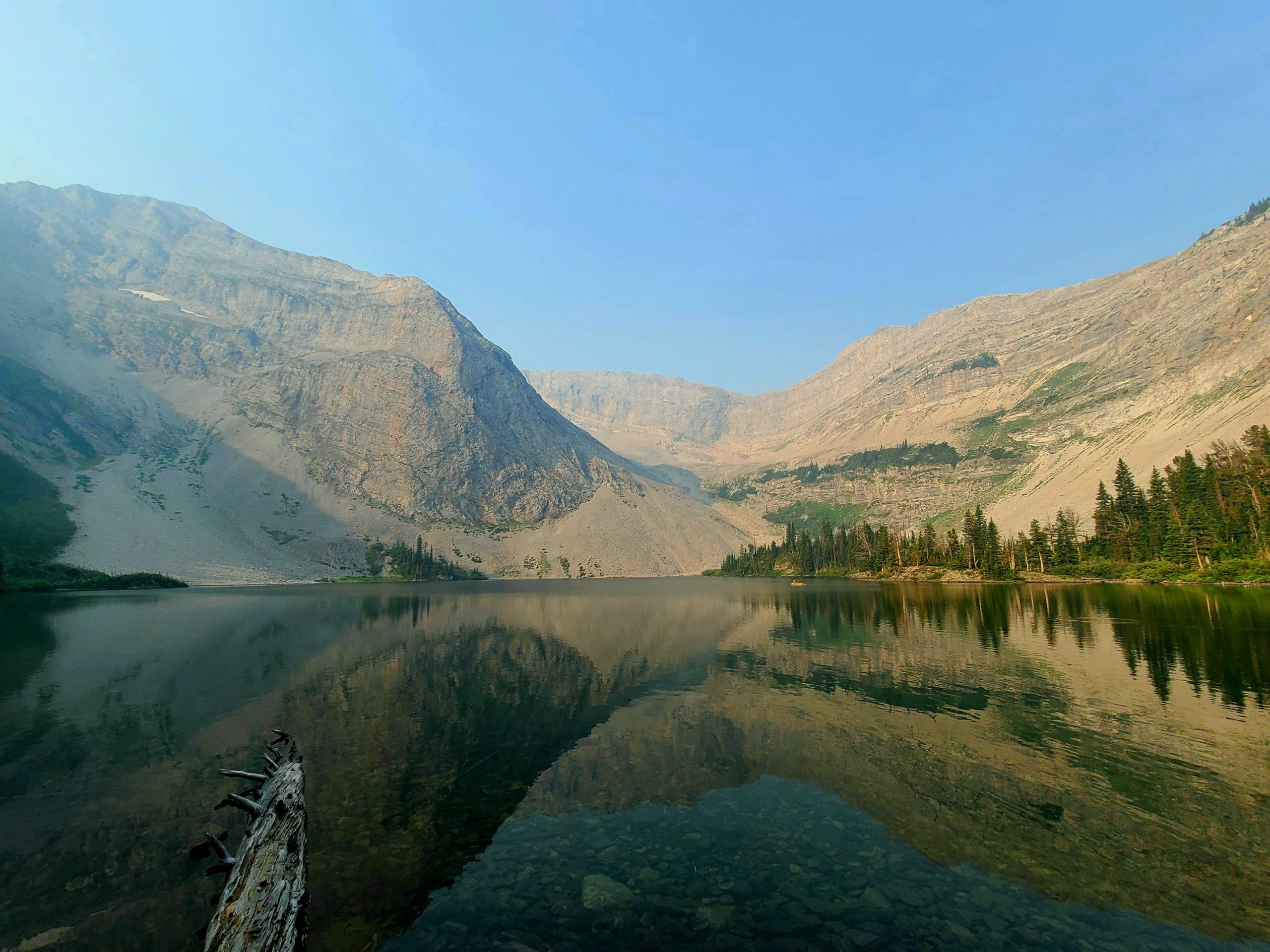
A calm Window Mountain Lake in the morning.
I woke up to the smell of smoke hanging heavy in the air and for a moment I wondered if the fire was anywhere near me. Eventually, I decided it wasn’t likely, but I knew that I was in for another day of limited views and harder ascents. I felt a little sluggish, but still managed to start hiking by about halfway past 8; I have a pretty firm policy of not setting an alarm while hiking and get up when my body feels like getting up. Not only does this make hiking feel like I’m kind of taking a vacation, but when I get out of my sleeping bag in the morning I’m pretty well rested and ready to to handle anything the day throws my way.
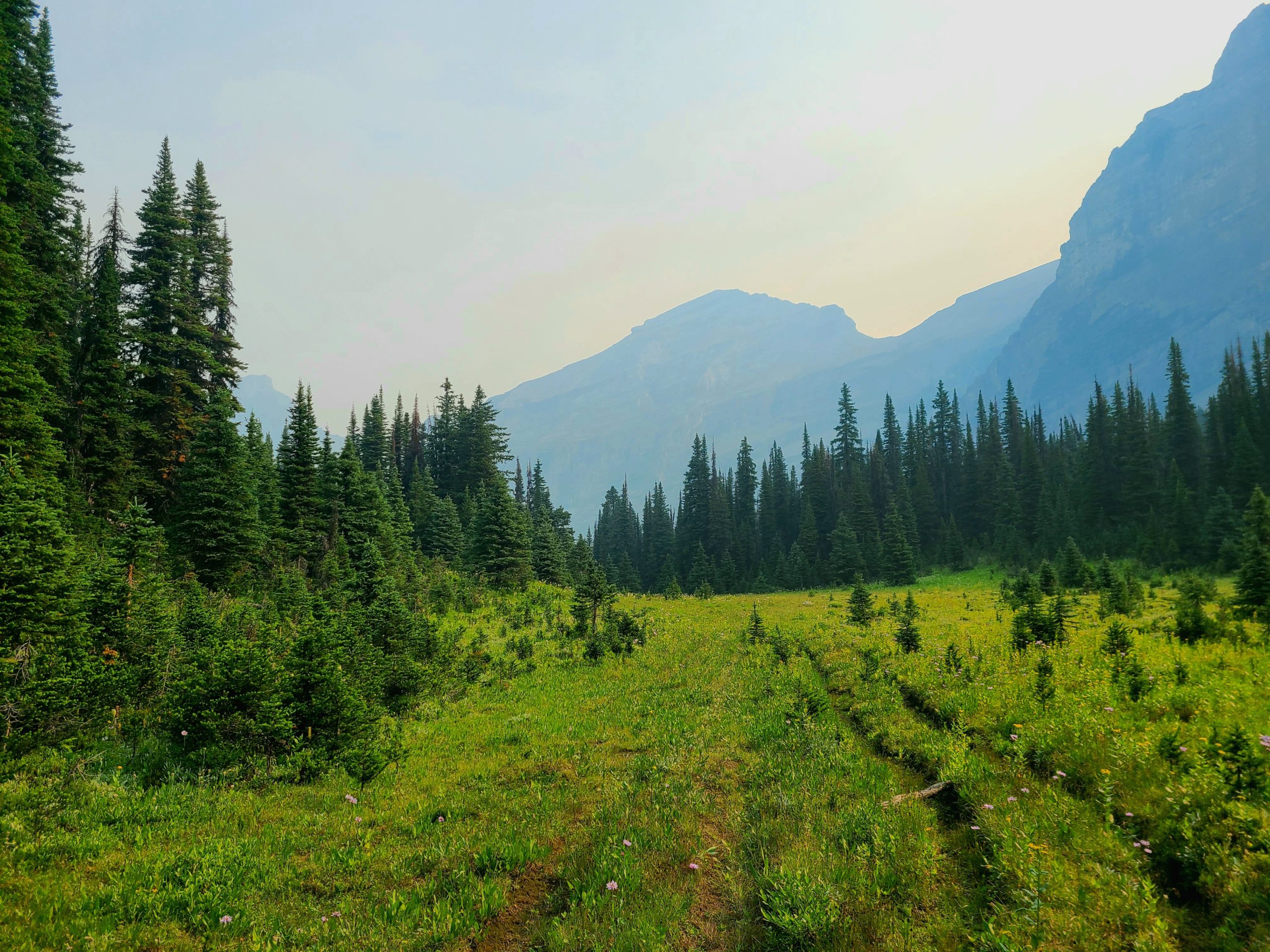
The climb towards Racehorse Pass passes through a decent section of larches which are one of my favourite trees because they’re a coniferous tree that turns a radiant yellow before it loses its needles in the fall. The north side of many of the shoulders and ridges along this section are home to numerous larches that tower overhead. They are easily some of the largest larches that I’ve seen whilst hiking.

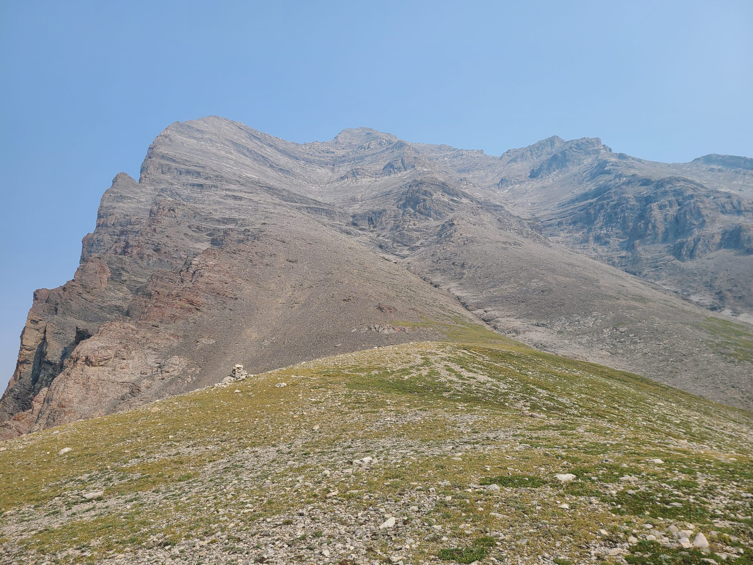
The view from Racehorse Pass towards Racehorse Shoulder.
Onto the rollercoaster…
The trail flattens out for a bit after Racehorse Pass before sharply ascending to Racehorse Shoulder. Thankfully, as I was on my way down the other side of the shoulder, I ran into a trail crew of GDTA volunteers who were there to put in a trail with switchbacks. The descent to their campsite was a breeze as it was the section of trail that had just been done; it felt like I was back on the PCT and hiking a properly graded trail.

The new trail through the larches.
The rest of the day was a series of smaller climbs and descents with the only reward being a good trail and more smoke. I caught up once again to Gabrielle and Peter at Dutch Creek Bridge where I thought I would stay for the night. The site there didn’t look super appealing so we continued on to Dutch Creek Campsite about 4 km further along a muddy ATV road. The campsite was surrounded by tall grass which looked perfect for losing a bocce ball in so we opted to just hangout over dinner and retired once the bugs were too hungry.

A neat boulder field before Dutch Creek Campsite.
Day 8 – Dutch Creek Campsite to Lyall Creek Campsite
Total Distance: 31.3 km
I’ve gotten used to waking up to an empty campsite because I usually feel more like sleeping in and starting late. This policy almost led to some night hiking as there were some pretty big ascents today and I wasn’t as fast as I normally am. I think that it was a combination of the smoke and the elevation which led to me getting much more tired from climbs that I knew shouldn’t have exhausted me.
Tornado Pass. I ended up missing the turnoff here and just kept on walking…
The first climb to Tornado Saddle was one of these. First, it is super steep. Second, the last stretch has some very loose footing which sort of felt like going 1 step backwards with every 2 steps forward. Upon reaching the top of the saddle I ran into a herd of Rocky Mountain sheep that were just chilling in the morning sun. The closest group of them walked past me, while the others stayed where they were and watched me take my break at the top.
Looking towards Tornado Mountain from Tornado Saddle.
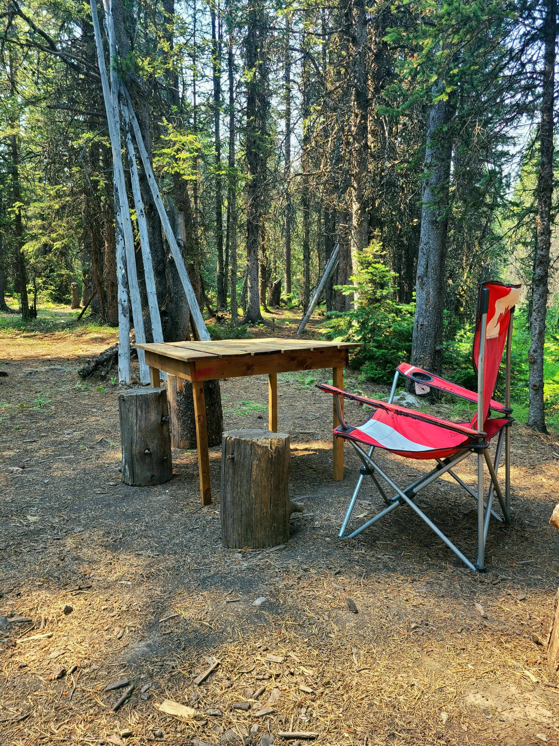
My next break wasn’t until the recliner chair at Hidden Creek campsite where I took a quick lunch. Most of my time was spent battling horse flies and regular flies who were just as hungry for me as I was for my tuna wrap. I quickly devoured that and cut my break short so that I could try to get away from the flies who had been noticeably voracious all morning.

One of the few spots today where I wasn’t assaulted by any bugs. Thank you wind.
The rest of the day seemed to drag on as I battled flies, smoke, and never ending climbs. When I finally caught up to Peter and Gabrielle around dinner time I was fully exhausted and incredibly hungry. I was on the fence about camping at Beehive Creek as I knew that tomorrow was already going to be a big day and if I stopped short of my anticipated goal then it would be even bigger. I decided to let dinner decide if I would continue. That long awaited hiker hunger was finally settling in and today was one of the first days where I had zero issues finishing all of my snacks before dinner.

Sunset at the top of the final climb before descending to Lyall Creek.
I ended up feeling fully refreshed after dinner and pressed on to Lyall Creek. When I stopped, it took me a few moments to realize what was weird, but I noticed that the bugs were noticeably absent…
Day 9 – Lyall Creek Campsite to Etherington Creek
Total Distance: 37.3 km
Well, I figured out why there were so few bugs last night. I had unknowingly entered spider city. The first clue was the lack of bugs. But the second wasn’t entirely evident until the next day when the spiders had had time to repair and reset their webs. I quickly developed a rule for myself: if I ran into 3 webs in under three minutes then it was time to put on my bug net. This at least offered my head a bit of a reprieve from the constant webs that I bashed through. However, because I would eventually get too hot moving in the bug net I always ended up removing my protection after a while because I couldn’t bear it any longer.

Oldman Lake, where I had originally planned to stay last night. Sure looked good in the morning though.
Today was another roller coaster with plenty of ascents and descents with little reward due to the smoke. It felt as though whoever planned that section realllllllly loved ridges and ridge walks. It seemed the goal of every climb was to get to the top of the ridge before descending sharply to the next water source and then climbing to the next ridge.

Despite having no bugs, my site was pretty damp last night and my things needed to be dried off. Lunch time is the perfect time for a yard sale.
After the first series of smaller climbs, I reached Lost Creek and I was ready for a break. Some absolute gem of a human left a real camping chair there, so I extended my break by about a half hour. It isn’t often you get to sit in a real chair while thru-hiking and I intended to make the most of that luxury. I still had two more significant climbs to go before reaching Etherington Creek, but the trail wasn’t going anywhere and it was early in the afternoon.
Perfect place to have a break.
When I reached Etherington Creek, I settled on a fine spot for my tent and then went to get some water. I built a small nest for my Pepsi to chill in the icy creek while I filtered water on the shoreline. By the time I was done filtering water, my Pepsi was ice cold and I was ready for some dinner and a sit down before bed.

One of the smoky ridges before heading down Etherington Creek
Day 10 – Etherington Creek to Riverside Recreation Site
Total Distance: 40.1 km

A smoky sunrise.
This morning tragedy struck. Before I started hiking, the O ring for my filter fell out of my Sawyer and into the creek where it was swept away. If you’ve never tried filtering water with a Sawyer Squeeze with no O ring, I’d highly advise against it. I did eventually figure out that the filter worked okay if I drank through it instead of trying to filter into another container. However, it was an annoying process to take the water bottle in and out of my side mesh with the filter attached. Anyways, after I realized I could do nothing about my O ring, I started the climb to Fording River Pass.

A small tarn before Fording River Pass. The true pass is to the right of the lake.
So the GDT red route on Guthooks that supposedly takes you to Fording River Pass actually takes you through an area away from an already established trail and far away from the pass itself. After following this nothing route via the GPS I gave up on it, switched to Gaia, and made my way to the true Fording River Pass where I had lunch and figured out my options. There’s a decent cut block that I was able to follow down a ways until it ended abruptly in a bit of a brushy section. Apparently I was on trail, but I could see no trail. so I bushwhacked through some medium brushes and eventually found my way to a section that looked more trail-y than what I was previously on so I stuck with it. This eventually became the actual trail that took me all the way to the bottom.

Upper Aldridge Creek. It’s possible to keep your feet dry, but it takes time and careful attention. Probably easier to just stomp through.
Once at the bottom, I quickly encountered Aldridge Creek and did my best to try to keep my feet dry. Don’t do this. It’s much easier to just get your feet wet than it is to try to keep them dry. Also, keeping your feet dry after Aldridge is pretty much impossible unless you take your shoes off. I opted for wet feet and hiked quickly towards Riverside Recreation Site. This was largely due to the ridiculous amount of horseflies on the Elk Valley Road. By the time I reached the site, I had killed 20 or so horseflies while moving.

Elk Valley Road. Not pictured: all of the horseflies who want to eat you.
Day 11 – Riverside Recreation Site to Boulton Creek Campground
Total Distance: 22.1 km

Early morning on Elk Valley Road.
Today, I set my alarm for the first time this summer because I needed to hitchhike to Canmore. I’m thankful that I did because it led to one of the most incredible moments for me. Just after I woke up, I heard wolves howling to one another throughout the valley; that mournful sound settled deep inside of me, like a call for a lover lost or a friends forgotten. I walked away from that campground melancholy. However, I was also aware that I was in prime bear habitat so I tossed on some tunes and started hiking.

Lower Elk Lake.
I reached a placid Lower Elk Lake and took a moment to appreciate the sun and calmness. The climb to Elk Pass was quick and easy. Soon enough, I was running into more and more people, many of whom had just seen a grizzly bear. With that in mind, my tunes went up a notch once I was out of earshot of the others. Thankfully, didn’t see anything before reaching the parking lot. It was time to start the long process of hitchhiking.

Waiting for a hitchhike back to Boulton Creek.
All told, it took of 1.5 hours to wait for the 3 hitches and to get down to Canmore. My stay in town was incredibly brief; I needed 5 minutes to find the part I needed at Home Hardware, and 45 minutes for some lunch. It then took another 45 minutes of waiting for another 3 hitches to get back to Boulton Creek campsite. I made it back with time to spare before Nicole, a trail angel, dropped off a resupply package for me. Huge shoutout to the support I’ve received along the way; I wouldn’t have made it without the kindness and generosity of strangers.
Check out my Instagram.
Miss any of my other posts?
Check out Part 2 of Section C.
I was looking forward to a day off during Section C.
Definitely learned a bit during Section A.
Check out My GDT Gear List – Living in Luxury
Read about How to Plan to Thru-Hike the GDT.
Read about Why I’m Hiking the Great Divide Trail (GDT) during COVID-19.

This website contains affiliate links, which means The Trek may receive a percentage of any product or service you purchase using the links in the articles or advertisements. The buyer pays the same price as they would otherwise, and your purchase helps to support The Trek's ongoing goal to serve you quality backpacking advice and information. Thanks for your support!
To learn more, please visit the About This Site page.

Comments 2