 ">
">
Hiking the Monadnock Sunapee Greenway: A Tiny Appalachian Trail
My Fourth of July weekend was packed with MSG.
The Monadnock Sunapee Greenway is a 48 mile trail from peak to peak that runs vertically up the spine of South Western New Hampshire. It sat patiently on my bucket list for years while I overlooked it for larger accomplishments, but after returning from the AT and living the caged life of a normal working apartment dweller and contributing member of society, it became my primary goal.

We had 3 days to hike 53 miles from parking lot to parking lot, and I was a little nervous about whether or not we were still in good enough hiking shape to finish in the time we gave ourselves. Fortunately, the trail is fairly flat in the middle, exceptionally well blazed, and full of great water sources so we were able to make good time.

As we hiked, I realized it was like a miniature AT. In only 48 miles there were bald, rocky mountain tops that required hand over hand scrambling, open exposed ridges, flat woodland sections, exposed dusty road walks, and quaint little trail towns. We had friendly locals let us use their spigots and cozy shelters built by volunteers. There were also, of course, a couple harrowing road crossings, some overgrown or washed out sections of trail, and plenty of confused day hikers. The trail is even marked with… you guessed it – White Blazes! In short, it would make a pretty great training hike for the AT.

But Chuckles, how do I hike the Greenway? Good question. Here’s a heaping serving of information about the trail:
History – One of the best parts of the trail is that it winds through a lively history of Western New Hampshire. The history buffs who loved Virginia and Maryland on the AT will enjoy that the trail frequently opens into little towns filled with stories.

The church in Nelson Center
A man named Allen Chamberlain was the Greenway’s own Benton MacKaye, dreaming up the plans for the trail that were finally laid out in 1921. There are many parallels between the creation of the Greenway and the creation of the Appalachian Trail. Much like MacKaye’s own far-reaching goals, Chamberlain hoped to eventually connect the Greenway to the White Mountains. The original trail wound past inns in small villages where travelers could pay a nominal fee for room and board.
There is even a memorial to Steve Galpin, devoted trail maintainer who carried out the hard work of dreamers and engineers much like Myron Avery (although perhaps less contentiously), on top of Lovewell Mountain that reminded me of the Bigelow Mountain memorial to Avery.

Since 1994 the Trail has had its own maintenance group, the Monadnock Sunapee Greenway Trail Maintenance Club that does widespread volunteer work to keep it beautiful. With the trail crossing three state parks as well as the private land of 80 different landowners, it is a massive community effort that represents the hiking friendly attitude of Western NH.

Maybe you’ll walk through a town where everyone’s mailbox can fit under the same roof.
There are many more stories than that. While hiking, we heard about the history of Stoddard NH from a friendly local and saw countless old buildings. The trail is laced with ghosts and memories and all you have to do to uncover them is hike it with a discerning eye.

Did anyone leave this here in 1950?
Timing – This trail is best in the Summer or Fall, but it is at a low elevation so it is definitely a great backpacking option in the winter or spring if you have good winter camping gear and snowshoes. The trail makes use of several snowmobile trails so be cautious in the winter.

Based on our experience with trail flooding in July, I wouldn’t choose to hike the Greenway in April.
I would recommend hiking this in four days. We did it in three and it was a blast but we had very little time to stop and appreciate the trail. If I had the time, I would have spent an extra day exploring side trails, visiting with people in Washington Center, and lying on sunny rocks.
Maps – A full waterproof topographical map (10 dollars) and guidebook (18 dollars) are available from Monadnock Sunapee Greenway Trail Club.

Water Sources – All rivers that are consistent year-round are marked on the map. In addition, people in town were very friendly and let us use their hoses several times. Definitely bring water treatment, though, because the area is rampant with beaver dams and the streams often have red, pitchy water. I’m not the best source for this information, though, since we hiked during and immediately following a flash flood (I just love wet boots and beaver fever.)

One thing that isn’t well marked on the map is the fact that most shelters don’t have water sources directly next to them. Almost every shelter we passed had a brook roughly .3 or .2 miles South of it on trail that you should make sure to fill up at.
Cell Reception – Our friend spent several hours asking day hikers who won the world cup between France and Germany. You should definitely bring your cellphone so that you can take pictures, remember that you are disconnected whenever you look at it and see the ‘extended 1F’, and use it to barter with someone in exchange for use of their land line if you should need to call for help.

Verizon has only recently realized that New Hampshire has actual towns and cities in addition to its ski slopes, so unless you are on top of Sunapee or Monadnock, don’t count on reception during this trip. I would advise bringing a GPS if you have one, but your best bet is to pay attention to the blazes very closely.
Camping / Fires – The amazing thing about the Greenway is that it runs right through people’s backyards. It is a true community effort, and a lot of the people who allowed shelters and privies on their land also helped to build those very structures. Because of this, it’s important to respect the restrictions on this privately owned land and refrain from building fires or camping in non-designated areas, if possible.
True, it’s not the full wild experience that many people expect of the AT, but it is akin to similar regulations that are prohibitive of camping and fires in many places on the AT. If you want something to prepare you for the majority of Appalachian Trail hiking and many of the rules that accompany it, the Greenway is more appropriate than the Pacific Crest Trail.
Shelters – There are beautiful shelters along the way. They have very few nails for holding stuff, but are blissfully empty. Few people do the Greenway, which means that mice won’t find many crumbs in those pristine sleep shacks – so you won’t be waking up to furry friends dancing on your food in the pale moonlight.

Yes, there are some privies.
Locals guard these well kept secrets for serious hikers, so you’ll have to get yourself a map to find their locations.
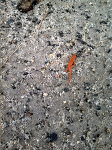
Flora/Fauna – These guys are everywhere, so don’t step on them. That would be a bummer.
Resupply – You might be scoffing at the idea of planning resupply for a 53 mile hike, but the trail actually goes right by a general store in the middle of it, so you can travel pretty light if you want to.
Mile 31.6 Washington Center
Address: 29 N Main Street, Washington, NH 03280
Phone: (603) 495-3131
Hours: 6 AM to 7 PM (grill closes at 6:15)
CASH OR CHECK ONLY!!
Parking – There is parking all along the trail and it is well marked on the maps (better than water sources, in fact.) If you don’t have three or four days and you want to break this hike up, there are some great day hikes you can do starting from multiple parking spots. No matter what you do, if you are going to stay overnight leave a note under your windshield. Western NH has a small, involved hiking community that concerns itself with hiker safety.
Mile 0 (START): Monadnock State Park
White Cross or White Dot trail (2.1 / 2 miles to peak) – 116 Poole Road Jaffrey NH 03452 GPS coordinates 42.845472 -72.087896
You have to pay to park here (unless you have NH state park plates) but it is the easiest parking location to stage a car at. This is a really fun climb up Monadnock but does involve stepping over and possibly on several hundred people as you ascend. Make sure you check in with the office and let them know your plan so they don’t send out a search team when they find an unclaimed car that night.
Birchtoft trail to Red Spot trail to Pumpelly trail(3.4 miles) – 585 Dublin Road Jaffrey NH 03452 GPS 42.860868 -72.061898
You also have to pay to park here but it is right next to the hikers-only camping area at Monadnock. It costs $5 per person to camp at Monadnock but is an easy option if you want to get an early start the next day (It is also the only money you’ll spend on camping this whole trip which, for NH, is pretty good). Make sure you also check in and warn the park workers before leaving your car here for several days.
Marlboro Trail (2.1 miles) – GPS 42.858598 -72.137898
This trail will definitely help you avoid the crowds by taking you up the backside of Monadnock, but connects to the ridge you are going to be walking so that you’ll need to retrace your steps about a quarter mile after summiting and then bear a right on the Dublin trail instead of a left.
Metacomet Monadnock Trail / Halfway House Road to White Arrow Trail (2.3 miles) – GPS 42.834696 -72.113691
This is a nice option if you want to avoid the crowds on the White dot/cross trails and avoid paying for parking. You can walk up Halfway House Road until it connects to the White Arrow trail for an easier approach, or walk route 124 for about half a mile from the parking lot and take the Metacomet trail.

Mile 2.2: Old Troy Road – GPS 42.885745 -72.125328
If the climb up Monadnock is a little more than you’re bargaining for or you wanted to mountain bike this trail, you can start from this parking lot at the bottom of the mountain.

Eliza Brook Gorge
Mile 15: Route 9 – GPS 43.022707 -72.125466
There is a large parking area here; if you were looking for one section of the map to do, I would recommend walking in to Crider Shelter from this point at night and hiking through Andorra Forest and over Oak hill the next day to Washington Center (2.9 miles to Crider; 13.8 from Crider to Washington). It’s fairly flat with some great views you don’t have to work incredibly hard for. Wear long pants.

The tunnel under route 9 adds a delightful hobo flare to the whole adventure.
Mile 31.7: Washington Center – GPS 43.17598 -72.095723
Mile 33.6: Half Moon Pond Road – GPS 43.188918 -72.079417
This is a great section also, taking you over Lovewell Mountain, through Pillsbury State Park, and over Sunapee Ridge. You can hike to the end of the trail from here (14.4 miles to the top of Sunapee) and take one of the trails down, or take Andrew Brook Trail from Lake Solitude (mile 46.8) if you prefer. This section is a little bit hillier so bring your climbing legs.

Mile 48 (END): Mount Sunapee State Park There are several trails off of Sunapee but you will probably want one of these.
Summit Trail (2.5 miles) – GPS 43.331855 -72.080144
This trail connects to the terminus of the Greenway and brings you to the Ski resort (Frisbee golfing in the summer). There is a huge parking lot here and it is a great place to stage a car.

The mowed field atop Mt. Sunapee…
Andrew Brook Trail (2 miles) – GPS 43.297992 -72.038261
This takes you out by Lake Solitude (mile 46.8) so you can avoid the final climb up Lake Sunapee past White Ledges; If you are mountain biking, this is how you will want to go out probably (warning: Sunapee Ridge is rough on a bike. I wouldn’t recommend it.) It connects to route 103.

But then you’ll miss these white ledges!!
*Note: there are several road crossings with parking areas on the Greenway, but I only included what I thought were the most relevant ones. I recommend getting the maps for a full detail of parking spots and GPS coordinates.
Elevation / Terrain – The guidebook gives some information about terrain and the topographical map gives you an idea of the elevation, but for those of us spoiled by AWOL’s elevation profile and Whiteblaze’s frequent trail updates, it’s hard to re-adjust to planning around a topo map.
In general, the trail is fairly flat with lots of road walking. The terrain is normal roots and mud where you can make good time – nothing too tricky up the Greenway’s sleeves – although you’ll be slowed a little by either end of the trail where it is rockier. There is a good amount of exposure so you should bring sunscreen. You also probably want to be prepared for a lot of overgrown trail and mosquitoes. I immediately regretted my shorts. Between the bug bites and the gregarious thorn bushes, my legs now look like something in a butcher shop window.


If you want a more specific idea, here’s a step by step description of the trail for those interested:
Map 1 Monadnock (mile 1) – Childs Bog (9.6)
First of all, you have to climb up Monadnock to start the trail and the initial 2.2 mile climb up the White Dot trail doesn’t ‘count’ (as many SOBOS can no doubt sympathize with). Although Monadnock is a little mountain (3,166 feet), the trails that are available to climb it are quite steep. Prepare yourself for a rocky scramble and some tricky slabs that have been polished to a rich, featureless sheen by thousands of butts.

Our view from Monadnock during this lovely thunderstorm.
Prepare yourself, also, for some wild crowds. As ‘the second most climbed mountain in the world’, Monadnock is swarming with day hikers every day of the year. Pro-tip for people who don’t like crowds: try hiking Monadnock at 8AM during a thunderstorm. It was the first time I climbed Monadnock without waiting in line.

Little Spoon was clearly not phased by the storm.

I was less enthusiastic.
Once you are up Monadnock and ready to ‘begin’ your hike, you’ll want to be wary about the descent, which is also quite steep and technical, requiring you to squeeze in between a lot of rocky cracks and lower yourself off of some rocky edges. Make sure you follow the signs for the Dublin Trail.

The bridge over Eliza Gorge. The water was a little high that day…
After Monadnock, you’re rewarded with some easy, flat terrain (although you do have to run across route 101). The Eliza Adams Gorge is picture worthy and you should take a moment to watch the mist rise off of the eye-level dam at Childs Bog. Be prepared for a lot of tall grasses and overgrown trails.

Map 2 Childs Bog – Pitcher Mountain (21.8)
There is a lot of road walking on this map, so wear sunscreen. You will walk through the quaint Nelson center (don’t get your hopes up for stores or people – it’s pretty tiny) and then take an unusual bypass under route 9. You might actually be safer just running across the road than navigating the chunks of spare granite in the river.

Crider Shelter is great and has a privy (or hole in the ground, whatever). The hike along Center Pond brings you by several people’s houses (at one point, straight into someone’s driveway) and the following terrain is a gradual climb with lots of long grass.
Map 3 Pitcher Mountain – Max Israel Shelter (37.3)

This section should be split into three parts: Pitcher Mountain to Oak hill is a beautiful, although very thorny and overgrown, ridge filled walk with several unexpected views that extend back to Monadnock in the distance. The section after Oak Hill (which offers a 360 degree view) is full of easy but exposed road walking and takes you straight through Washington Center, where the general store is located.

The churches in Washington Center
Then, you ascend Lovewell Mountain. It’s a little tougher climb than you’ve faced since Monadnock, but fairly well graded so you can work your way up it easily. The top doesn’t offer much of a view but it’s a lovely soft, windy top protected by tall pines and would be a perfect place for stealth camping (which you didn’t hear from this blog.)
Map 4 Max Israel Shelter – Sunapee and beyond (Mile 48)

This section is much hillier than the rest of the trail and includes several PUDS (Pointless Ups and Downs). It is also much wilder (almost no road crossings!) and more technical. You will traverse wide, exposed ridges with lots of views. Take advantage of these and enjoy this section, whether you are going SOBO or NOBO. It is a small slice of Western New Hampshire that usually only locals take the time to appreciate.

The terminus of the trail meets with a service road up Sunapee where you are greeted by a gigantic tower and ski lodge. It reminded me a little of coming over Washington after a hail storm and finding… a building and cars. It was pretty appropriate for the ending of our miniature thru-hike, and you will be able to laugh on your way down the trail as sandal-clad day hikers wandering astray from the Frisbee Golf course at the bottom of Sunapee look at you in horror.


So there’s your supplemental MSG hiking guide. Or, you could just run it in a day!

Summit Selfie with Little Spoon and our newest hiking alum, White Zest.
After AT….
So here is my challenge to previous AT hikers: Wherever you live, whatever community you belong to, find your practice AT. What is hiding in your backyard that you might have overlooked in your Appalachian obsessions? This is only one example. I’d like to hear about more in the comments….

This website contains affiliate links, which means The Trek may receive a percentage of any product or service you purchase using the links in the articles or advertisements. The buyer pays the same price as they would otherwise, and your purchase helps to support The Trek's ongoing goal to serve you quality backpacking advice and information. Thanks for your support!
To learn more, please visit the About This Site page.

Comments 6
Great blog, hoping to do this beginning of June or in July this year. Using it as practice to section the long trail in the fall.
yup, great blog. I’m kind of new to hiking more than a few miles(I’m more a long distance kayaker) and have been looking at the MSGT, it looks good for a newb like me and it’s near my backyard…so far this year I’ve hiked all over bigelow in Maine(those trips were a little rough for me) and done some section hiking on the AT/LT in VT.(no problems). Someday I might attempt a thru-hike of the long trail or a vt/nh/me section of the AT…but not today, my knees aren’t ready. Good luck on the PCT!!
On the list this year! Thanks for the cool write up on it! ?
Hello great blog post. Curious if there are bear bag tie ups? I planning on doing this summer 2020 and debating between bear canister vs. bag. I live in the area and have come across several black bear. I’m trying to keep to using my 36L Osprey Stratos bag and a canister doesn’t quite fit w/o awkwardly strapping it to the top.