 ">
">
How to Hike Every 14er on the Colorado Trail (with Guthook Miles)
Fifteen of Colorado’s 53 14ers (summits above 14,000 feet)can be accessed directly from the Colorado Trail. If you’re thru-hiking the Colorado Trail already, why not bag a 14er or two while you’re at it?
In reality, most thru-hikers only hike one or two 14ers on the Colorado Trail at most, and many don’t hike any at all. Extra miles that don’t get you any closer to Durango or Denver are hard to swallow, after all, and hiking 14ers is objectively grueling—even for fit thru-hikers.
Still, most of us will never be in better shape to tackle tough miles than in the midst of a thru-hike. The logistics are easier too. You won’t have to wrestle with driving or parking concerns, and access trails from the CT are often shorter and easier than the paths day hikers must take from trailheads.
If you have extra time and energy, it’s well worth hiking at least one 14er while you’re on the Colorado Trail. You’ll likely never have a better opportunity. But which should you hike, and what’s the best way to pull it off? And where the heck are all the 14er trail junction waypoints on the Guthook app?!
Planning is a pain. Fortunately, we’re here to help. Here’s how to hike every 14er on the Colorado Trail.
Note: all mileages are based on Guthook Guides SOBO mileage for the Colorado Trail.
How to Hike Every 14er On the Colorado Trail
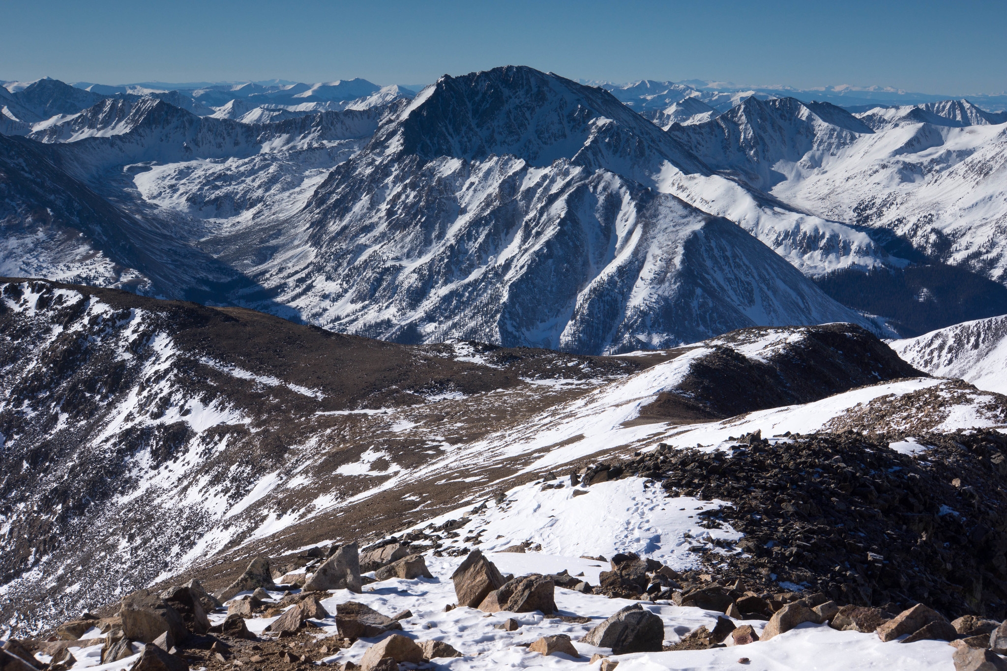
Mt. Massive

Photo via.
Elevation: 14,429 ft
Roundtrip distance from CT: 7.3 mi
Trail junction mile marker: 166.9
Mt. Massive is the first 14er southbound Colorado Trail hikers encounter on their way to Durango. At 14,429 feet, Massive is one of the highest peaks in the United States. You’ll gain roughly 3,400 feet in 3.65 miles from the signed CT junction to the summit.
READ NEXT – The Colorado Trail: Epic Big-Mountain Hiking at Its Finest.
This is a challenging trail, but you’ll be able to find water and camping on the CT near the junction, as well as along the Mt. Massive trail itself—so you can break up the challenge over two days if you want. The Mt. Massive Trail branches right off the CT (pretty high up, too, you’re already above 11,000 feet at the junction) and you’ll cross treeline about a half-mile later around 11,500 feet.
Once you summit, you have options. Turn around and head down the same way you ascended, or take the Southwest Massive trail down to Halfmoon Road, hang a left, and road walk a couple of miles to reconnect with the CT at the Mt. Massive Trailhead. You’ll miss 3.1 (largely viewless) miles of the CT if you go this route and will hike about 9.8 off-trail miles, for a net total of 6.7 extra miles.
Note: Out-of-state hikers (especially flatlanders) are often still struggling with altitude at this point in the hike and may not be ready to tackle 14ers yet. Take your plans to summit this guy and Elbert with a grain of salt.
The Mt. Massive trail junction is identified by name in Guthook, so you should have no trouble finding it.
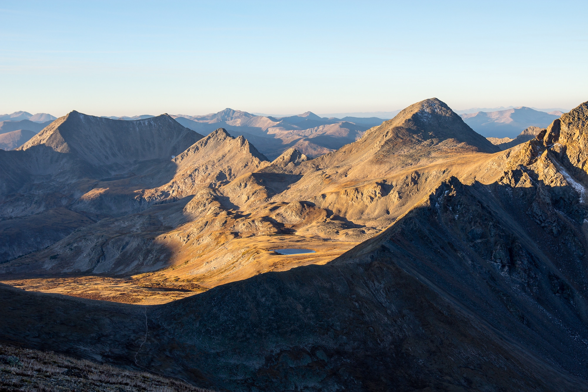
Mt. Elbert
A snowy view from the summit of Mt. Elbert. Photo via.
Elevation: 14,439 ft
Roundtrip distance from CT: 7 mi
Trail junction mile marker: 170.0 or 174.6
False summits are the name of the game with Mt. Elbert, but the reward is worth the pain. Once you gain the true summit, you’ll be standing on top of the highest peak in Colorado and the second-highest peak in the contiguous US. Elbert is almost certainly the most popular 14er among Colorado Trail thru-hikers.
I’ve based the roundtrip distance for Elbert on the 3.5-mile East Ridge Route (mile 174.6), which is the one I’m most familiar with. If you want to break this route up into two days, note that there’s not much camping and only thin aspen shade near the junction. There’s water nearby, but not at the junction, so you’ll have to carry it in from elsewhere.
There is no water at all on the East Ridge Route itself, but you’ll find lovely, shaded camping in abundance two miles up the trail near treeline (roughly 11,800 feet).
Meanwhile, the 3.3-mile Northeast Ridge Route branches off the CT at mile 170. SOBOs could ascend that trail and descend the East Route. That way you would miss 4.6 CT miles for a net total of just 2.2 off-trail miles.
Note: Out-of-state hikers (especially flatlanders) are often still struggling with altitude at this point in the hike and may not be ready to tackle 14ers yet. Take your plans to summit this guy and Massive with a grain of salt.
Both Elbert trail junctions are listed by name in Guthook, so you shouldn’t have trouble finding either one.
- 14ers.com Northeast Ridge | East Ridge
- AllTrails Northeast Ridge |East Ridge
READ NEXT – How to Tackle Your First 14er in Preparation for a Thru-Hike.
Missouri Mountain, Mt. Belford, and Mt. Oxford (Collegiate West)
View from the slopes of Mount Belford. Photo via.
Elevation: 14,075 ft (Missouri) | 14,203 (Belford) | 14,153 (Oxford)
Roundtrip distance from CT: 7 mi (Missouri) | 7 mi (Belford/Oxford)
Trail junction mile marker: Collegiate West mi 9.7
Ten miles into Collegiate West, you’ll pass very close to the Sheep Gulch trailhead on Clear Creek Road. Hang a left on the road and walk about 1.8 miles to the Missouri Gulch Trailhead. From here, you can access three fourteeners in one fell swoop: Missouri, Belford, and Oxford.
READ NEXT – Collegiate East vs. West: 8 Key Differences for CT Hikers.
It’s a seven-mile round trip from the CT at Sheep Gulch to the summit of Missouri and a seven-mile round trip to Belford and Oxford (you summit the former on the way to the latter). There’s water and camping within the first two miles on the Missouri Gulch Trail when you’re still below treeline (you’ll leave the trees around 1.75 miles in).
If you want to hike Missouri, Belford, and Oxford at the same time, retrace your steps from the Missouri summit down to 12,600 feet and then turn right to hike over Elkhead Pass. You’ll end up in a saddle between Belford and Oxford (with Belford to the west and Oxford to the east). The round-trip hike from Missouri Gulch Trailhead is about 16.4 miles, according to AllTrails.
Guthook users: look for “Segment 2 – Trail Junction” to know where to turn off the CT.
- 14ers.com Missouri | Belford/Oxford
- AllTrails
La Plata Peak (Collegiate West)

La Plata from Independence Pass. Photo via.
Elevation: 14,360 ft
Roundtrip distance from CT: 10.5 mi
Trail junction mile marker: Collegiate West mi 12.7
Just three miles after the turn-off for Missouri, Belford, and Oxford, you’ll cross Road 390A. If you walk about 1.75 miles west on that dirt road, you’ll reach the trailhead for La Plata Peak. Be aware that after roughly the first two miles, the trail becomes intermittent and poorly marked. Study the route in advance, and once you get up there, follow the sparse cairns to find your way to the summit.
It’s about 5.25 miles and 4,000 feet of elevation gain from the 390A road crossing on the CT to the summit. You can find water and camping both at the road crossing and on the 14er trail. Trees are kind of sparse on this hike to begin with, but you’ll leave them for good around 11,500 feet—around 2.5 miles into the hike including the road walk.
Guthook users: Look for “Dirt Road” at mile 12.7 to know where to turn.
Huron Peak (Collegiate West)

Photo via.
Elevation: 14,003 ft
Roundtrip distance from CT: 7.5 mi
Trail junction mile marker: 15.4
Huron Peak just barely tops 14,000 feet, but the summit views are as majestic as any 14er in the state. When I hiked the Colorado Trail, Huron was the 14er most frequently recommended to me by fellow hikers and locals. It’s not too long and not too hard. The scenery is diverse and incredibly rewarding.
The CT joins Clear Creek Road around Collegiate West mile 15.4. Southbound thru-hikers are supposed to turn right onto the road here, but if you turn left instead it’s roughly a 0.4-mile road walk to the South Winfield trailhead. Then another 3.3 to the summit from there. You’ll gain a total of about 3,400 feet along the way.
The first two miles of the hike, including the road walk, are below treeline (roughly 11,800 feet). There are a few water sources and plenty of camping along the way. You can also camp down at the bottom by the CT junction (plenty of water here) but the area can be crowded with 4x4s and car campers in summer.
Guthook users: Look for “Road-Trail Junction” at mile 15.4 to know where to turn off the CT.
Mt. Harvard / Mt. Columbia (Collegiate East)

Left to right: Harvard, Columbia, and Yale from Collegiate West. Photo via.
Elevation: 14,423 ft (Harvard) | 14,078 ft (Columbia)
Roundtrip distance from CT: 9.8 mi (Harvard) | 8.4 mi (Columbia)
Trail junction mile marker: 203.4
From the Colorado Trail, SOBOs should turn left at the signed junction with Frenchman Creek Trail to access Mt. Harvard and Mt. Columbia.
After 3.3 miles from the junction with the CT, turn right (north) at the T intersection and hike another 1.6 miles to summit Harvard. Turning left/south will take you 0.9 miles to Columbia instead.
You’ll be in the trees for roughly the first 1.3 miles of this trail, up to about 11,000 feet—everything beyond that point is exposed. You’ll gain 3,461 feet in 4.9 miles to reach the summit of Harvard, or 3,116 feet in 4.9 miles for Columbia.
There is water and reasonably flat ground for camping along the Frenchman Creek Trail prior to the T. No road walking is required to summit these 14ers.
Guthook users should look for the Frenchman Creek trail junction at mile 203.4 in the app to figure out where to turn off the CT.
Mt. Yale (Collegiate East)
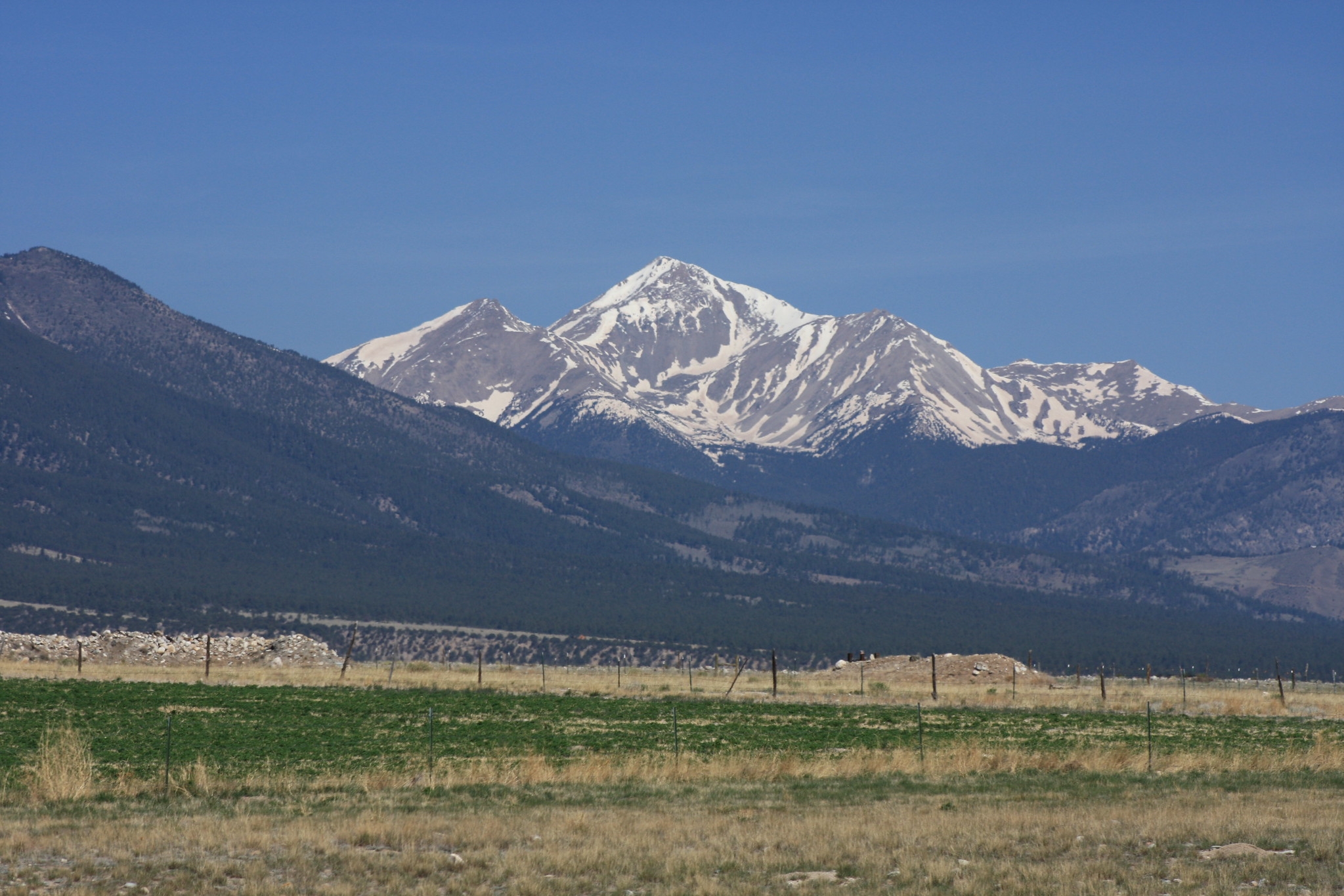
Photo via.
Elevation: 14,199 ft
Roundtrip distance from CT: 3.5 mi
Trail junction mile marker: 213.4
Mt. Yale’s East Ridge Route is considered a Class 2 trail, meaning some modest route-finding and scrambling are required. In other words, it’s not just straight-ahead walking on a clear trail the whole way to the summit, so be prepared. The good news is that Yale is one of the shortest 14er side trips off the CT, as well as one of the most scenic.
After crossing North Cottonwood Road on the CT, SOBOs will climb up to a saddle. If you turn east off the trail from this saddle, you can follow a quarter-mile side trail to the top of a small peak with lovely views of the surrounding mountains. If you turn west, you’ll follow a faint trail along a ridgeline to the top of Yale.
You’ll ascend roughly 2,400 feet in 1.8 miles to gain the summit. There’s no water along the East Ridge Route or at the junction with the CT, so plan ahead and carry plenty of water. The saddle is just below treeline (close to 12,000 feet) and would be a good place to camp before ascending Yale first thing in the morning. You’ll get out of the trees within the first quarter-mile from the saddle.
Guthook users: The junction with the East Ridge Route is not marked as such in the app. Look for “Top of Ridge” at mile 213.4 to find the Yale turn-off.
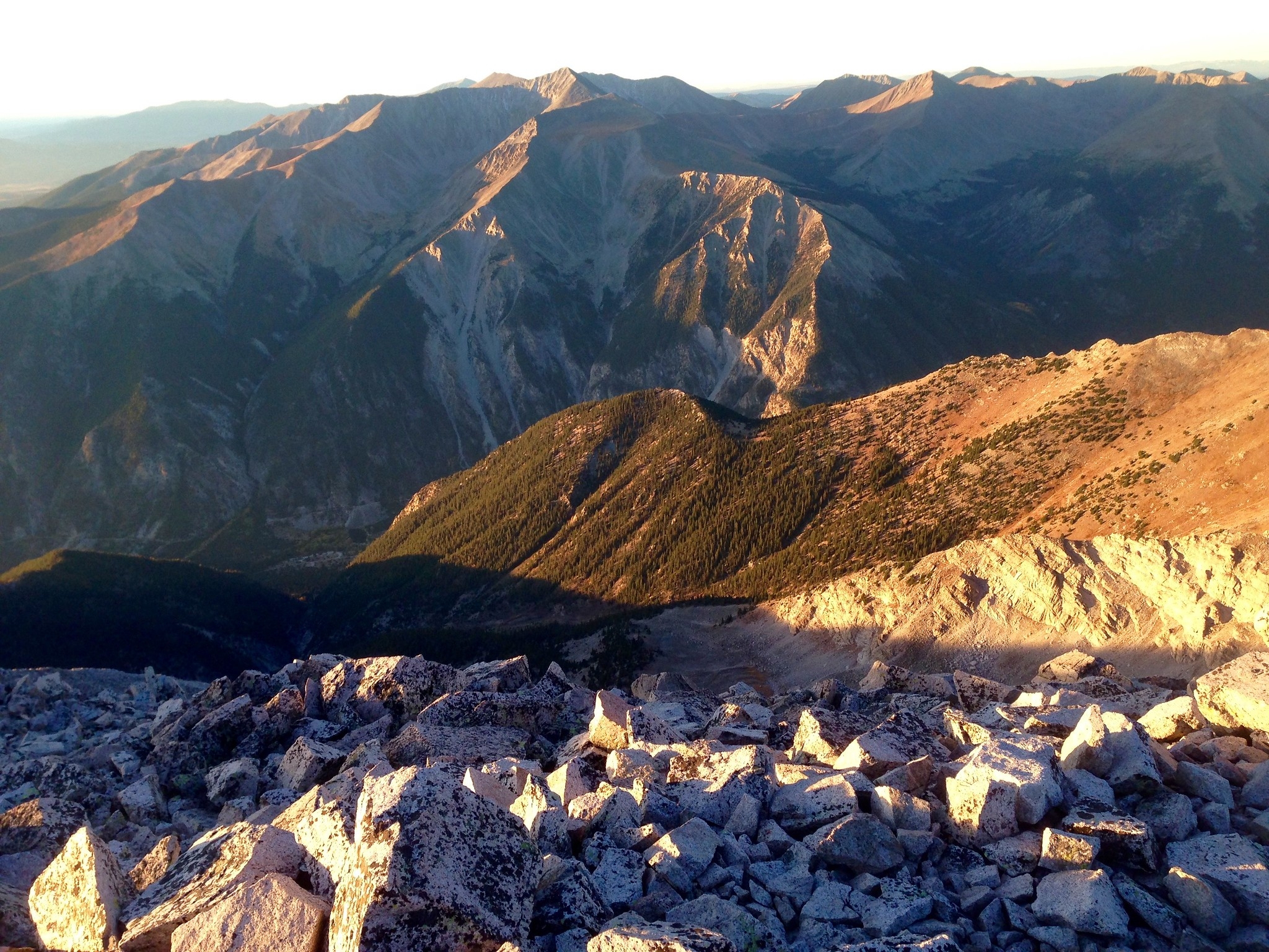
Mt. Princeton (Collegiate East)

View from the summit of Mt. Princeton. Photo via.
Elevation: 14,196 ft
Roundtrip distance from CT: 11 mi
Trail junction mile marker: 226.7
At mile 226.7, the CT joins up with CR 322 for an extensive road walk. SOBOs bear left to stay on the road or right to start hiking up to Mt. Princeton’s summit. You’ll follow the road up for 3.6 miles before splitting off to the right on the Mt. Princeton Trail, then hike another 1.9 miles to the peak. All told, you’ll ascend nearly 4,700 feet in about 5.5 miles. Treeline is approximately where the trail splits from the road near 11,800 feet.
This is one of the longer round-trip 14er hikes off the Colorado Trail, and much of the route is road walking, which can be a drag. On the other hand, you can pamper yourself at Mt. Princeton Hot Springs Resort (mile 230) after you get back down.
Guthook users: Look for the road-trail junction at 226.7 to know where to turn off the CT. The CT joins a road for about six miles at this point anyway, so it should be hard to miss.
Mt. Antero (Collegiate East)
Antero from the summit of Mt. Princeton. Photo via.
Elevation: 14,275 ft
Roundtrip distance from CT: 12.4 mi
Trail junction mile marker: 238.8
The Colorado Trail joins the Little Brown’s Creek Trail at mile 238.8 and the two paths run together for about a quarter-mile before the CT splits off again. To summit Antero, SOBOs should turn left on the Brown’s Creek Trail when the two first join up. It’s 6.4 miles and 4,600 feet of elevation gain from there to the peak.
Summiting this 14er from the Colorado Trail is a bit of a slog. You’ll be below treeline for roughly the first 3.3 miles up to 11,900 feet, then it’s all exposed from there. There’s lots of water along the way. Note that there’s a 4WD road most of the way up to the top, so the summit itself isn’t as wilderness-y as most of the 14ers on this list.
Hiking Antero is easier as a thru-hiker, because you’ll miss 1.5 miles of the Brown’s Creek Trail from the parking area. Our reported round-trip mileage is shorter than the AllTrails estimate as a result. Guthook users: look for the Little Brown’s Creek Trail junction (mile 238.8) to know where to turn.
Mt. Shavano/Tabeguache Peak (Collegiate East)

Hikers at the summit of Mt. Shavano. Photo via.
Elevation: 14,232 ft (Shavano) | 14,163 ft (Tabeguache)
Roundtrip distance from CT: 8.6 (Shavano) | 10.6 (Tabeguache)
Trail junction mile marker: 244.9
The trail joins a jeep road just before Guthook mile 245. Instead of continuing on the CT/road walk, SOBOs turn left on a side trail here to summit Shavano and Tabeguache (“tab-uh-watch”).
The first 2.5 miles up to roughly 12,300 feet are below treeline. All told, you’ll ascend 4,300 feet in 8.6 miles to reach the top of Shavano. It’s another mile from there to Tab. There’s water along the way, as well as camping and water near the trail junction.
Guthook users: Turn off the trail at the jeep trail transition waypoint at mile 244.9. DO NOT go past this point to the “Mt. Shavano Trail” waypoint half a mile south (that’s just where the 14er trail comes up to the CT from the parking area).
San Luis Peak

Photo via.
Elevation: 14,014 ft
Roundtrip distance from CT:
Trail junction mile marker: 330.4 or 340.4
The southernmost 14er on the Colorado Trail is also one of the coolest (and easiest). San Luis is widely considered the most remote 14er in the state, and the conga line of day hikers going to and from the summit is noticeably sparser than on other 14er trails.
From the Eddiesville Trailhead at mile 330.4 (aka the beginning of Segment 20), you can depart the CT for the six-mile Stewart Creek Trail to the summit. Just bear right on the dirt road leaving the parking area instead of left. The trail will leave the road shortly after. There’s plenty of water along this route, and you’ll have the benefit of tree cover for roughly the first four miles.
From the top, it’s about 1.5 miles down to the junction with the CT at mile 340. You’ll hike about 7.8 off-trail miles by going this route and will miss 10 miles of the CT.
If you’d prefer not to miss a huge chunk of the CT (full disclosure: this stretch of trail does offer some nice scenery and plenty of moose-seeing opportunities), it makes sense to hike up to the saddle at mile 340 and do the much shorter out-and-back to the summit from there.
Guthook users: Look for Eddiesville Trailhead at 330 or the unnamed saddle at 340 to know where to turn.
- 14ers.com Northeast Ridge Route | South Ridge Route
- AllTrails Northeast Ridge Route | South Ridge Route
Bring a Map
Some of the access trails described on this list are faint and difficult to follow at times. Also, some of these 14ers can be summited via less-common alternate routes from the CT or from other 14ers. That’s why, when you’re planning to summit 14ers, the detail and context afforded by a paper map are invaluable.
Map-and-compass is pretty much always the most reliable way to navigate the backcountry (provided you know how to use them). After all, once you step off the CT, you won’t have the benefit of Guthook to help you navigate. National Geographic’s Colorado Trail map bundle is both affordable and comprehensive. With it, you’ll be able to navigate the CT and any side trails you choose to take.
What 14ers are you planning to summit on your Colorado Trail thru-hike? Let us know in the comments.
More Resources

This website contains affiliate links, which means The Trek may receive a percentage of any product or service you purchase using the links in the articles or advertisements. The buyer pays the same price as they would otherwise, and your purchase helps to support The Trek's ongoing goal to serve you quality backpacking advice and information. Thanks for your support!
To learn more, please visit the About This Site page.

Comments 6
Oops – we need to add those junctions! Thanks for the heads up!
Thank you so much for writing this up! Particularly the camping and water availability. It’s something I’ve considered doing for my plans to hike the CT. Particularly Mt Massive and Elbert.
Yikes, some of these trail descriptions are pretty off – Yale’s East Ridge is a little more involved then what’s being described. I don’t get the feeling the author has actually done the hikes described, so take all of the information here with a grain of salt. I would use mine instead, as I’ve vetting almost every single one personally and usually: multiple times.
Also, ridge from Missouri to Harvard is not straightforward. There are other issues, so for anyone planning to do more than Massive, Elbert or Huron you might want to do a little more research (not just AllTrails. Or not. I have no doubt people way less prepared have pulled it off. Just make sure your guardian angel signed up to hike with you 🙂