 ">
">
Peakbagging the New England 100 Highest’s Maine Six-Pack
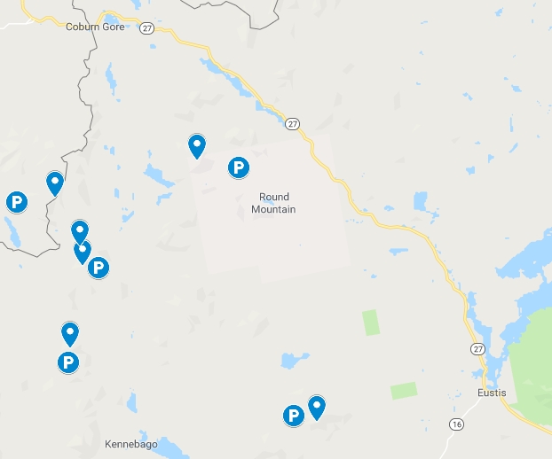
Six of the most isolated peaks on the New England Hundred Highest list are located around Rangeley, Eustis, and Carrabassett Valley, Maine. Five of the six are bushwhacks with vague herd paths. The sixth hike (Snow – Chain of Ponds) technically has a trail, but there were no signs or blazes and it was old logging roads followed by a herd path, so honestly, there isn’t much practical difference.
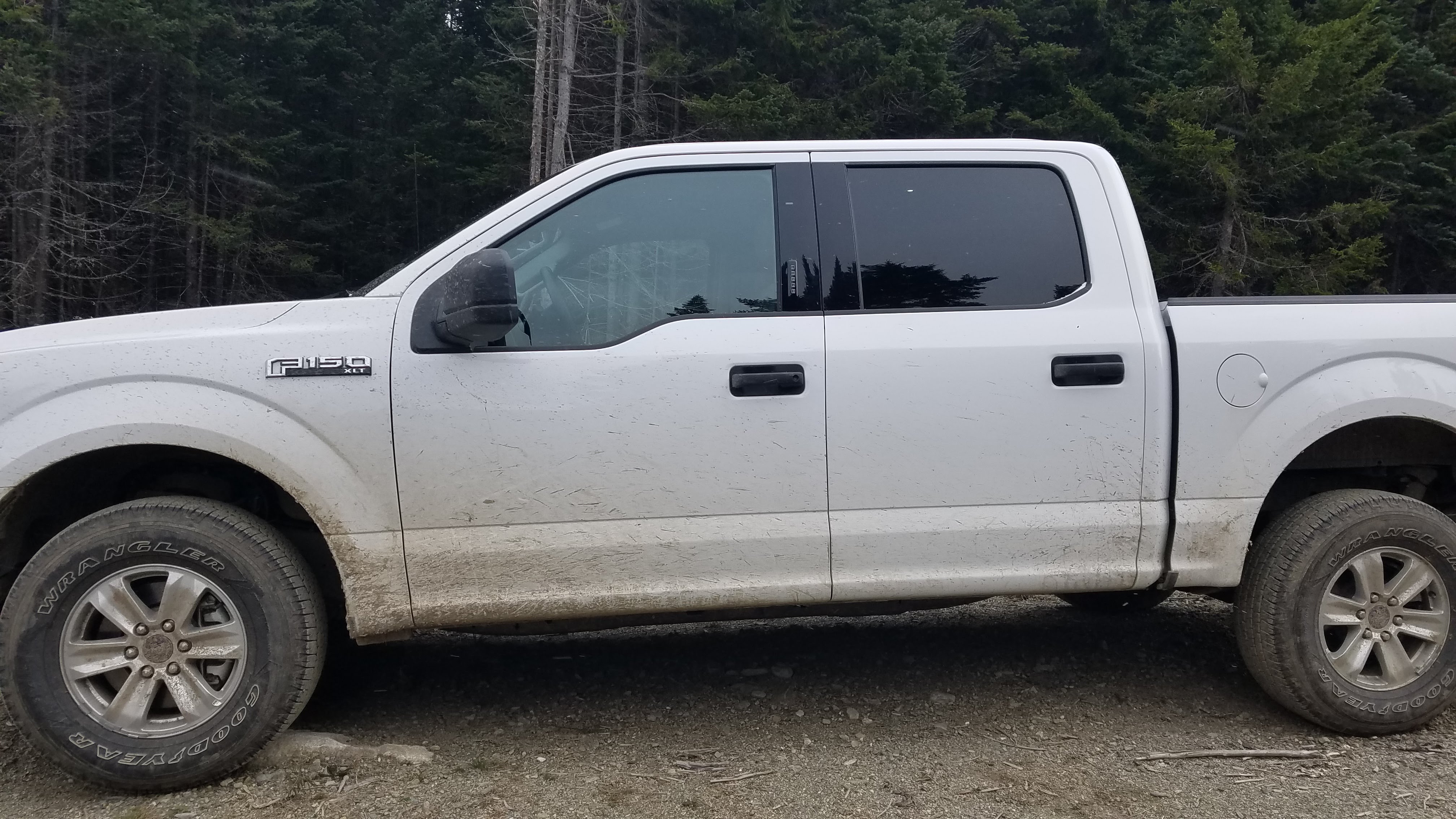
Having braved the atrocious backwoods dirt road to Elephant Mountain trailhead and read other peakbaggers’ accounts, I was certain I would need a vehicle with higher clearance than my Ford Fiesta’s four inches. I ended up renting a Ford F-150 pick-up truck from a rental agency at Portland International Jetport. I paid $135 for three days (plus parking for my car). I paid with my credit card so the truck would be covered by the credit card company’s comprehensive rental car insurance.
Unfortunately, I realized too late in my peakbagging adventures that the AMC Four Thousand Footer committee offers a paper pamphlet and paper maps for the Hundred Highest’s bushwhacks for $15 (it’s buried on their website and I missed it the first few times). So as it turned out, for three out of my five hikes, I didn’t take the optimal/most popular way. And while I love wilderness as much as any other introverted hiker, spruce thickets are very enthusiastic in their welcome and don’t like to let me leave. On my hike of Snow Cupsuptic, I collected more than 1/2 cup of evergreen needles on my person, between my pants, pockets, shirt, and underwear. And as it turns out, six-foot-high briers were commonplace on these hikes; they seem to thrive on overgrown logging roads.
For my October endurance weekend, I stayed in a bunk room at the Hostel of Maine for $44/night. Their setup is amazing and I’d highly recommend staying with them. The bunk rooms are well-designed, the bathrooms clean. Guests have access to a full-size fridge, toaster, dishes, hot plate, and microwave. They also include a very nice self-serve breakfast in the morning (including fresh-baked bread), and were very willing to set aside breakfast for me the night before, since I left early each morning.

Before I left the cover of Wi-Fi, I made sure to download Google Maps data for the surrounding area, with the knowledge that Google Maps doesn’t always know what it’s doing on old logging roads. This download was crucial, since there was no cell service anywhere in the area, and while it wasn’t perfect, it was much better than nothing. I also created multiple GPS tracks using GaiaGPS for each hike, just in case the roads I anticipated hiking from weren’t accessible.
1. Snow (Chain of Ponds)
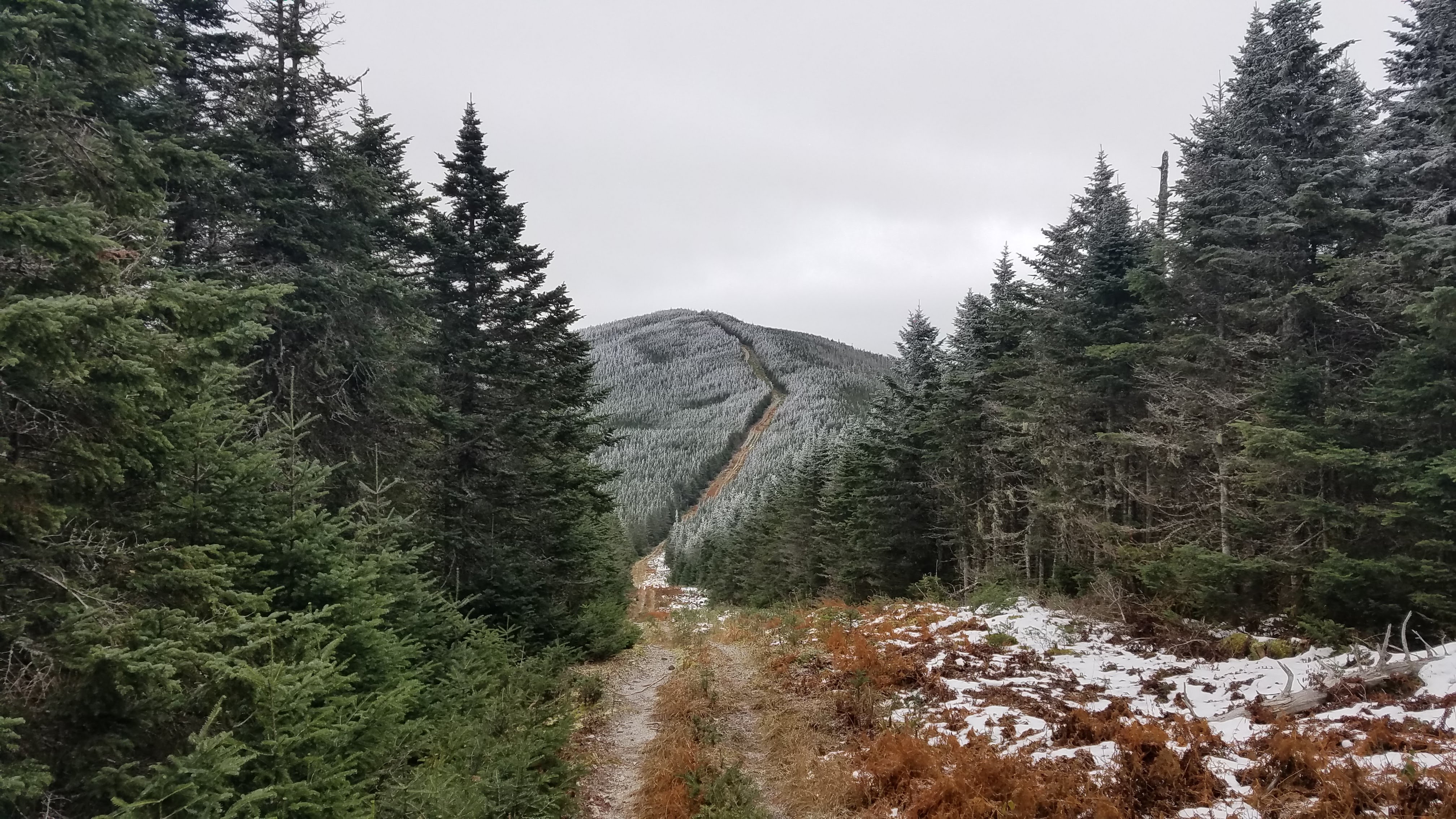
On Friday night, I did Snow (Chain of Ponds). I decided to do this one in the evening because it was the only one of the six that was officially trailed, and I knew I’d be hiking back in the dark. There weren’t any signs or blazes, so I ended up needing to use my GaiaGPS track to make my way to the peak. The hiking was mostly on old, soggy logging roads. I hiked on logging roads until there was a small herd path that split off to the right, and I followed that all the way to the summit. At the summit, there were the remains of an old fire tower.
There were spectacular views of the surrounding area from the top of the rickety old thing (and a brisk wind, too). I took a bunch of pictures as the sun was setting and then scampered back to the truck.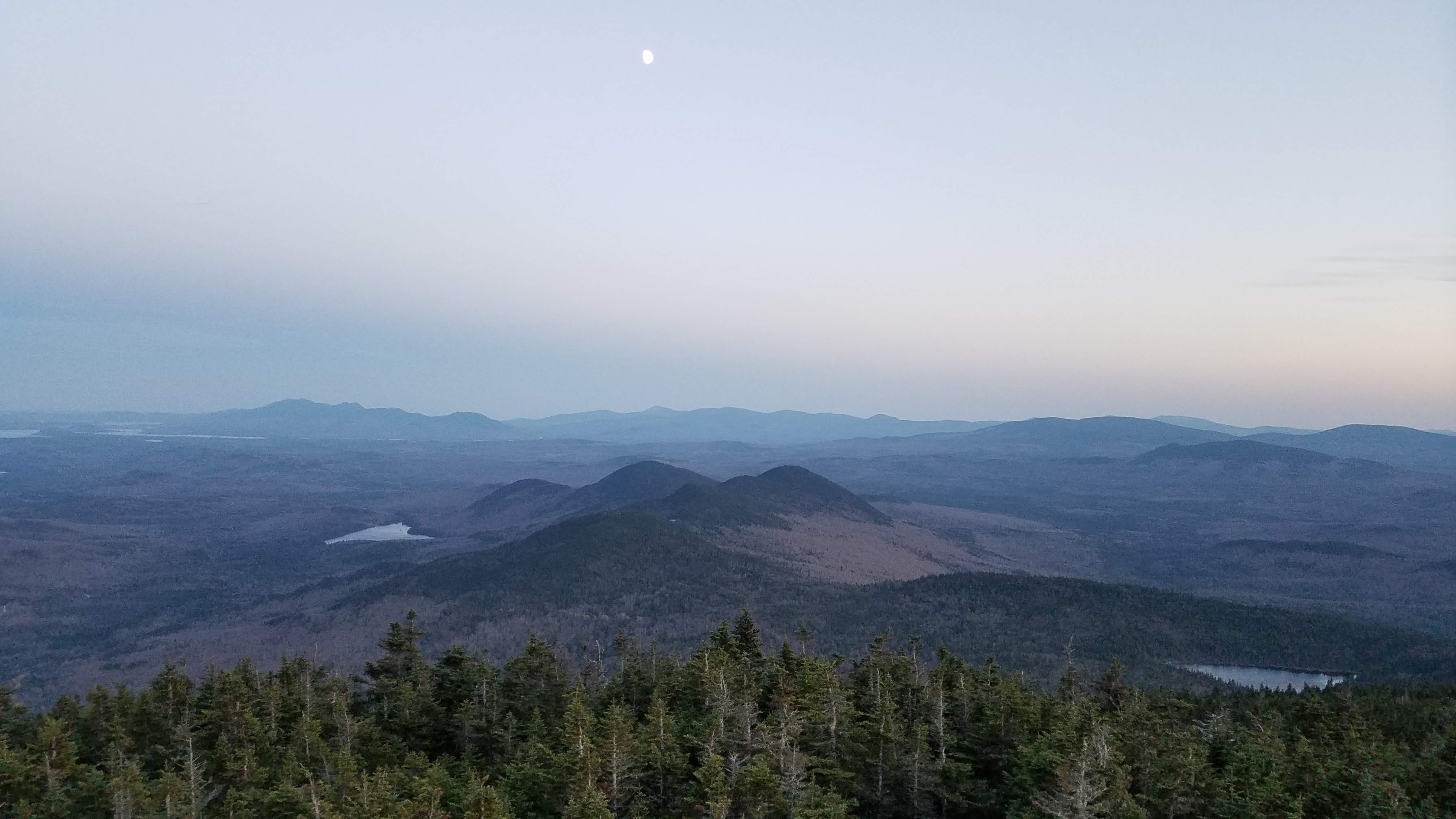

All told, the hike was seven miles and gained 2,200 feet in elevation. I was able to average 2.5 mph and finished in just under three hours.


2. East Kennebago
On Saturday morning, I was up before the sun to pack and head out for East Kennebago. I fought with Google Maps when it tried to send me down a gated and locked private road, but I did eventually get to my chosen starting point… it was a bushwhack with no herd path whatsoever. It seems that no one else hiked to the peak the way I did.

Near the summit, I found a well-worn herd path that originated from a road on the mountain’s west side, rather than its north side. I’m guessing that’s the recommended approach; it would have been 3.0 miles total and 1,000 feet of gain. Instead, I hiked 3.2 miles total in two hours with 1,500 feet of gain. The one advantage was the driving; where I hiked from was much closer to the day’s other peaks, cutting out at least an hour of driving. I did get the joy of seeing two moose at the summit sign before I headed back down to the truck.

3. and 4. Kennebago Divide/White Cap
After hiking East Kennebago, I hopped back in the truck, ate more snacks, and drove the 45 minutes to get as close to the Kennebago Divide/White Cap trailhead as possible. This was the section where I was most grateful for the pick-up truck’s ground clearance and four-wheel drive. Google led me down the smallest, swampiest path through the woods; I wouldn’t go so far as to even call it a dirt road. This was right before it got narrow and seriously muddy.

There were deep ruts filled with water and mud, and the path wasn’t wide enough for two trucks. I spent most of these four miles hyperventilating, imagining the trouble I would be in if the rental truck got stuck with no cell service and no passing cars. But it didn’t get stuck and I emerged onto a more normal dirt road. I then made it to within a few miles of the trailhead before the road was impassable, with a four-foot deep and six-foot wide wide washout. I parked the truck and had a nice relaxing road walk in the midday sun.

On this road, I met the one hiker I saw the entire weekend. We chatted, and he gave me some tips and a printout from someone’s blog, showing where each of the herd paths went. I thanked him and we went our separate ways. The herd paths were smooth sailing and I quickly summited both peaks, and then took a bushwhack shortcut back to the dirt road to hike back to the truck. All said and done, it was 8.0 miles at 2.6 mph with 2,250 feet of gain.


5. Snow (Cupsuptic)
The drive to the Snow trailhead went smoothly, though I don’t think I would have made it with my own car. Again, it seemed like I chose the wrong place to start. The hike was 1.9 miles with 1,000 feet of gain and it took me almost two hours. I got stuck in spruce thickets on the way up, but was able to avoid them on the way back down.

For this hike, I honestly don’t know how the AMC recommends folks hike this. I did find a very light herd path at the summit, but I drove past the area where people might have started from three times, and I didn’t see any kind of visible herd path or remnants from past cars parking there. I got back to the truck just as the sun was setting. I then headed back to the hostel for dinner and a well-deserved shower.
6. Boundary Peak
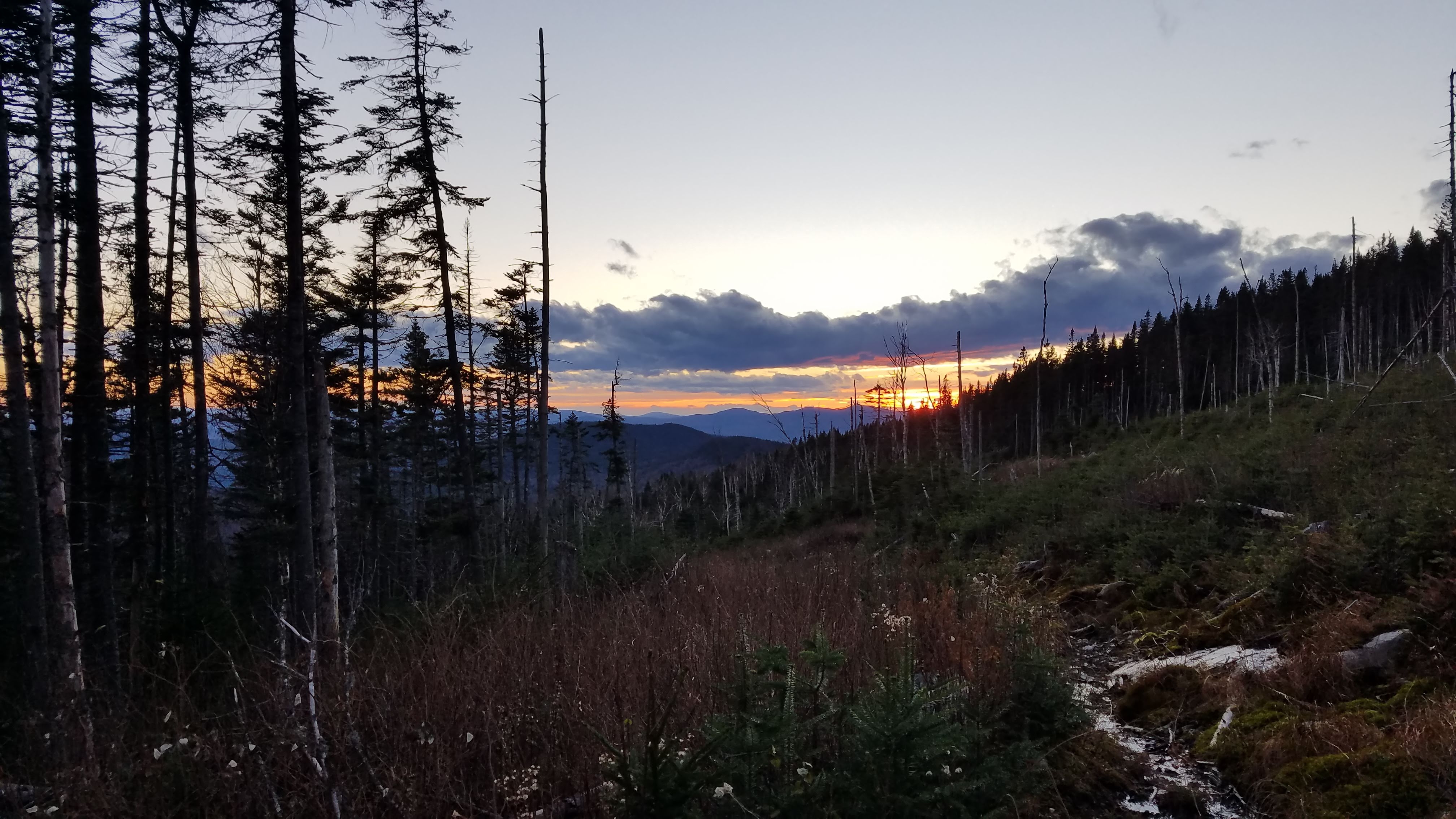
After dealing with very, very drunk wedding guests attempting to picnic on the floor of the bunkroom at 11 p.m., I was really tired when I set out from the hostel at 6 a.m. I stopped for more coffee and got to see the sun rise over the Bigelow Range.

So I was properly amped up on caffeine when I passed into Canada to go hike my one remaining Hundred Highest—Boundary Peak, which is best approached from Canada. I passed through with no problem (“No sir, that’s not a beer I just drank. That’s a blueberry soda from last night.”) and drove the 20 minutes to the park’s entrance, where I was informed by the laconic ranger that they were closed to hiking for moose hunting season and I could come back tomorrow. And the gate was locked tight across the access road, with another ten miles to drive to get to the trailhead.

So I turned around and headed back to the border. The US Border Patrol agents were not nearly so friendly as the Canadian ones, and the massive amounts of caffeine in my system didn’t help my anxiety. They pulled me aside and grilled me for half an hour about why I was driving a rental truck, had I ever been arrested, what did I do for work, and why I’d only been in Canada such a short time. They also didn’t seem to understand the New England Hundred Highest—one agent kept insisting that I couldn’t finish my hike today since it would involve hiking across the border (it’s called Boundary Peak. Like, on the boundary?).
They searched the truck and all of my personal belongings before letting me go. After that invigorating exercise, I spent a few hours arguing with Google Maps and wandering the same backwoods logging roads as Saturday’s adventures, trying to find a road that would get me close enough to the border swath to make it feasible to hike to Boundary Peak. I ended up hitting three different gated and locked logging roads before I found one road that brought me within half a mile of the border.
Using the combo of my compass, GaiaGPS, and Google Maps, I bushwhacked my way to the border swath and then hiked on the swath for a few miles to summit my final peak. I saw dozens of moose blinds on the Canadian side of the border, though I thankfully saw no hunters.

It was very cold and windy (18 degrees+35 mph winds= -3 degrees windchill, with snow flurries at the summit) and the swath wasn’t optimal walking. On my way back toward my car, I ended up hyperextending my knee when I stepped on a loose, unstable rock hidden by thick dead grass. It was uncomfortable, but the pain didn’t start until later so I was able to get back to the truck with no trouble. I was beyond thrilled to get back into the warm truck and head home, knowing I never had to do this ever again.

The New England Hundred Highest took me to places I never imagined I’d go, and I’m glad for the experience, but I’m also very glad to be back following GPS on roads that actually exist. After a few months off for my knee to recuperate, I’ve thrown myself back into hiking with my usual passion, working on the Northeast 111, which is comprised of the New England 67 4,000 footers, the Adirondack 46ers, and two additional peaks in the Catskills.


This website contains affiliate links, which means The Trek may receive a percentage of any product or service you purchase using the links in the articles or advertisements. The buyer pays the same price as they would otherwise, and your purchase helps to support The Trek's ongoing goal to serve you quality backpacking advice and information. Thanks for your support!
To learn more, please visit the About This Site page.

Comments 4
Thanks for this article. I may settle for the NE99highest. No patch needed…
Great article with loads of info. These mtns are my final 100. Hopefully one or 2 this summer. Could not locate maps you mentioned hundred highest bushwacks from Amc any clues as to where to find? Thanks
Thanks for reading my article. After a quick look through the AMC 4000 Footer website, it looks like they’ve stopped offering this resource. They recommend contacting Keith D’Alessandro for more information about the lists (http://www.amc4000footer.org/the-lists-we-recognize.html). For my hikes, I just used a combo of GaiaGPS and Google Maps. Best of luck on your 100!
Thanks for this very informative article- looking forward to attempting these this fall! Happy hiking!