 ">
">
Next Stop Sherburne Pass – Where it All Began
Incredible Scenery
The second 50 miles of this trip provided some amazing scenery: Bromley, Big Branch, Little Rock Pond, the Cascades, the Rock Garden, Clarendon Gorge, Killington and Pico.
My destination for this section of the journey was Sherburne Pass and the Inn at Long Trail. I was looking forward to picking up a resupply box I shipped there, and perhaps take a zero day to rest up before continuing on the traditional Long Trail route. The trailhead to the section my father hiked starts directly behind the Inn. The current trail is just a mile or so west of here but the old and new trail reconnect in a short distance north of the inn.

A great place to catch both sunset and sunrise. Thanks Bromley!
After my first town stop in Manchester Center, I got back on the trail with a short day, staying at the top of Bromley Mountain in the Ski Patrol Warming Hut. It was a great place to watch both the sunset and sunrise.
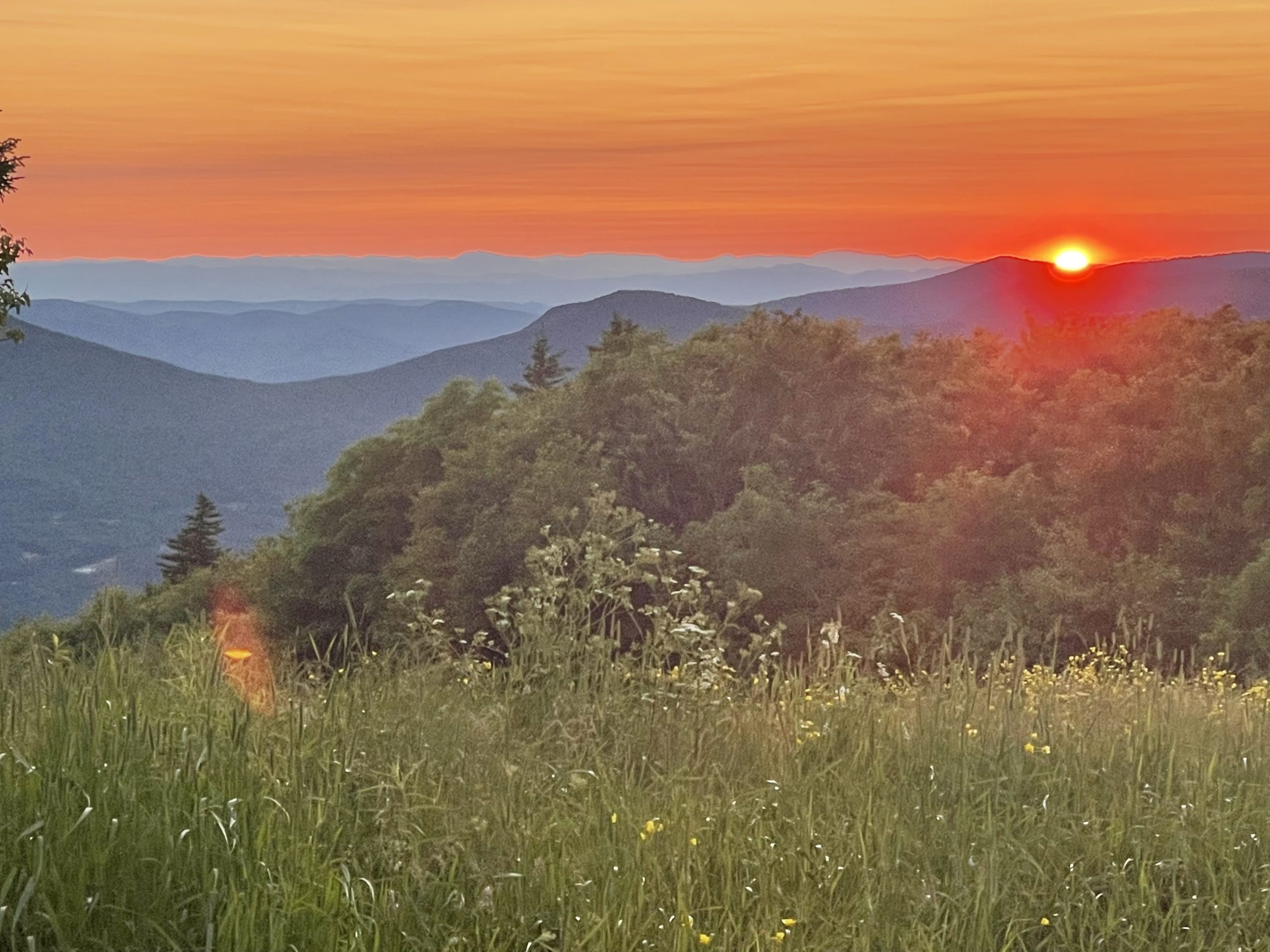
The weather cooperated for a great sunset at Bromley.
I then spent the next couple of days doing longer miles to make up for the short day to Bromley, but it was well worth it! And the scenery just kept getting better.

Baker Peak, a great lunch spot.
Threading the Needle
As any thru-hiker knows, weight matters. I’m happy with how I’ve been able to carry just what I need for this trip, and nothing more. After using some duct tape to do a minor repair on my trail runners, I realized I’ve used every single item in my kit except my rain pants. If I were to carry the rain pants the whole way to Canada without using them, I’d be okay with that. But something tells me I’ll need them somewhere in the next 175 miles.

Trail Magic!
My food amounts were also dialed in. I had plenty to eat and only had a couple of lunch items left in my food bag when I arrived at Sherburne Pass to resupply. I would’ve eaten those as well if I hadn’t encountered some wonderful Trail Magic courtesy of Spineless Cougar and Roofwalker at mile 82!

Yessss!
As a section hiker, I never felt comfortable enough to partake in Trail Magic when it was offered. I figured it should be reserved for thru-hikers. But now I am a thru-hiker, so I indulged!
Turning Poop Into Mulch
I met a hiker named Paws at Bromley and the next day we hiked together. We were both headed for the same shelter and hiked at a similar pace. He was great company. We covered several miles at a brisk pace before taking a break to filter water and grab a bite.
We ran into the Green Mountain Club Caretaker for Griffith Lake and Peru Peak Shelter. She was near the shelter privy with a pitchfork and rubber gloves, processing mulch (which used to be poop) from the privy. When she finished her work, she joined us as we took our break at the shelter. She described some of her responsibilities as caretaker, including maintaining the privy’s. It looked like hard work.
Last week I met a GMC volunteer crew at Goddard Shelter where they used garden tools to turn the “cone into a divot” in the moldering privy. They had hiked in just for that purpose, also hauling a pack with 30 pounds of wood chips for the privy. Despite the smelly nature of that chore, they seemed enthusiastic about their role in maintaining the LT and gave me great intel on spots to camp.
I took their advice and camped for a night at Little Rock Pond Shelter, a great place to swim and rest up after a 17-mile day. After pitching my tent, I walked over to the picnic table to cook dinner. A young woman was there doing the same, and we struck up a conversation. She was a former GMC Caretaker who was currently thru-hiking the AT. We were soon joined by the current GMC Caretaker at Little Rock Pond, and I listened in as they compared notes and talked shop.

Little Rock Pond. I swam under the watchful red eye of a loon the night before.
The dinner conversation that night furthered my education on poop and privy’s. High use backcountry areas usually require a composting privy which uses manual labor to convert poop into mulch. Medium use areas often employ a moldering privy, which is a more passive approach.
The caretakers talked with great pride about the end-product of “mulch” that’s created by the process. There was also talk about breaking up frozen cones in privy’s that remained open in the winter, and a few privy maintenance horror stories as well! They apologized a time or two for talking about poop while I was eating freeze-dried food for dinner!
The bottom line in all these conversations is that poop is a serious back country issue. I have a newfound respect for all the volunteers and caretakers who work hard to maintain the trail and privies!
The Mileage Tug-of-War
After a day or two in this stretch, I was still trying to catch up on some mileage from my short days into and out of Manchester. The footing on the trail improved a bit. I was making good time, but there was much to see along the way, and I felt compelled to stop and enjoy the scenery. I had to resist the urge to just keep walking even though the conditions were good, and I felt great. Sometimes it’s best to slow down and enjoy!

The “Rock Garden” near White Rocks. The place had a cool energy about it. Pterodactyl, the Little Rock Pond Caretaker, was kind enough to take a photo for me as he was passing by to check on another shelter.
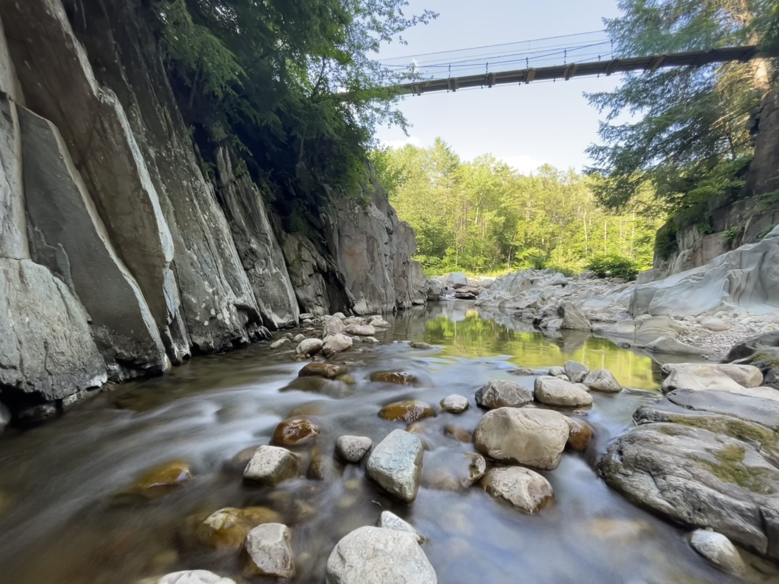
At one point I caught a glimpse of a nice waterfall down in the hollow below the trail. When I got to where the trail forded the stream, I dropped my pack and climbed down on the rocks and cascades to explore and take photos. It was worth it.

The Cascades. It required a rock scramble to get down and see several falls, pools, and slides.
When I went back up over the falls to retrieve my pack, there were three AT thru-hikers I had run into a few times. They were filtering water in the stream. I mentioned how cool the falls were, but they just picked up their packs and moved on. They seemed to be stuck in the same tug-of-war that I felt earlier. They needed to get miles in. Too bad, I thought at the time.
Water Everywhere!
Water has always been one of my favorite subjects to photograph, and this stretch had it in abundance.

Rocks and water. Big Branch was beautiful.
Clarendon Gorge was amazing! Definitely a place to stop and swim again, because… why not? I was happy to see the three AT thru-hikers stopped there as well to enjoy this special place. They swam and camped nearby, resisting the urge to cover more miles after all. I thought that was great!
Clarendon Gorge, best swimming hole so far.
I also met them at Killington the next day and we all took the difficult side trail to the top. At least one of them had climbed it before, but they insisted on doing it again with full packs. I was thinking to skip it since the weather was iffy and I needed to get to Sherburne Pass and pick up my resupply. This time it was me feeling the tug-of-war to keep moving, but they convinced me to join them!
Dramatic Killington
I’ve skied Killington and Pico many times, but climbing and hiking there was a whole different experience. It was a long steady climb to the top. I had started walking at daybreak to try to beat the weather. The plan was to hike 16 miles across the flanks of Killington, Ramshead, and Pico, and the last weather forecast from two days ago had mentioned severe thunderstorms.
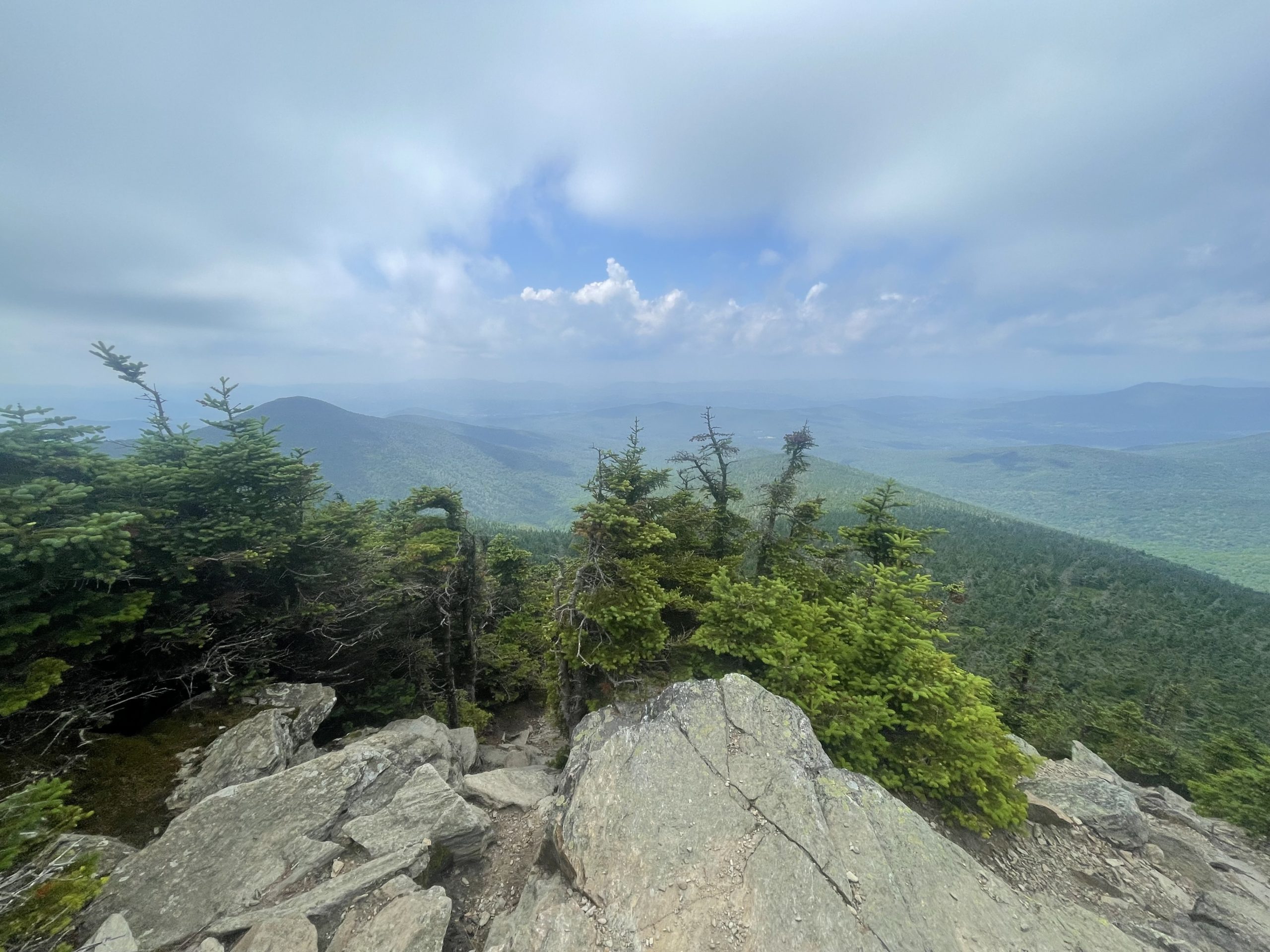
A break in the clouds on Killington Peak.
After I climbed high enough to get a cell signal I was able to monitor the weather and the forecast improved. So I took the side trail and climbed Killington peak with my full pack. At 4235 feet it was the first 4K peak on the LT and required a total of 3010’ of climbing from my start that morning. The sun came out and the view was stunning.

The raincover makes my pack look bigger and heavier than it is. Thanks Gumby for taking a pic of me!
Great Fanfare at the 100 Mile Mark
I carefully dropped back down to the LT/AT and started walking to the distant sound of thunder. Soon after, I passed 100 miles on the Long Trail to great fanfare! It was a momentous occasion, but it didn’t go exactly as planned.

Time to carefully head back down.
I had my phone out watching the GPS to record the 100-mile mark and document the occasion. Suddenly the winds picked up and the sky went dark. At mile 99.8 all hell broke loose, and I got pummeled by hail just as I hit 100 miles. A fast-moving storm cell hit the mountains. It was glorious!

After the rain and hail stopped, the sun came out and I dried off a bit.
The storm moved in so fast, I never had a chance to drop my pack and put rain gear on, so I just kept hiking until I reached the Inn at Long Trail three hours later. The descent down to Sherburne Pass was wet and tricky, but I made it one piece. First order of business – a shower and a draft Guinness. I earned it!
Tomorrow a zero day to rest up at the inn. The Inn wasn’t here in 1937 when my father hiked, it was built the following year. But the Long Trail crossed the mountain pass right here. I’ll resume my journey at the same trailhead where my father started his.

This website contains affiliate links, which means The Trek may receive a percentage of any product or service you purchase using the links in the articles or advertisements. The buyer pays the same price as they would otherwise, and your purchase helps to support The Trek's ongoing goal to serve you quality backpacking advice and information. Thanks for your support!
To learn more, please visit the About This Site page.
