 ">
">
Out of the Frying Pan and Into Maine
What’s the Maine idea? Only 250 miles of the North reMaine-ing! Figured I’d do some blog Maine-tenance. Ok, ok, I think you get it….we’ve made it into Maine! The last few weeks have brought us through the rest of New Hampshire’s White Mountains and Presidential Range, and into the last northern state. We’ve had some incredible once-in-a-lifetime experiences like summiting Mt. Washington at sunrise and boulder-scrambling through Mahoosuc Notch, and learned some important things like how to trust our boots on wet rocks and how to use our arms, elbows, and hands to get up and down the mountains. We’ve also seen the trail change from a distinguishable path to near-vertical rock slabs with white blaze marks. Whoever said this was the most challenging part of the AT was certainly correct! But it’s made for some great stories ?

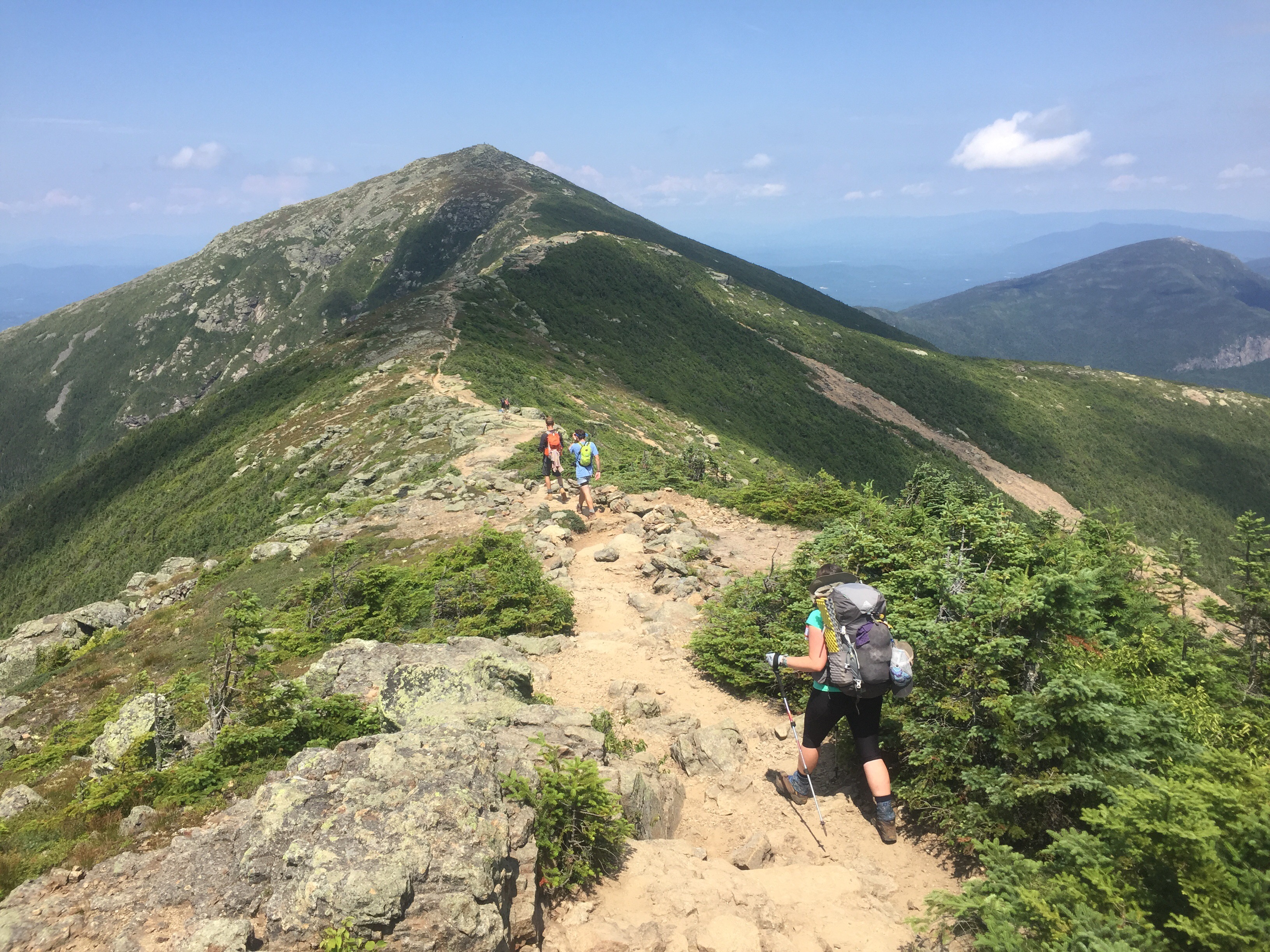
Our 84th day of the journey began with waffles and coffee at the Notch Hostel in North Woodstock, NH. We had stayed overnight to clean up and resupply before heading out to Franconia Ridge, a very well traversed 4-peak hike in the White Mtns. This stretch of the trail brings hikers up Liberty Mtn, over the Haystack and Lincoln ridge lines, and up and over Mt. Lafayette. It is known as one of the best USA hikes, and boy, did we have perfect weather for it! It was sunny and bright, and just hot enough to make the strong winds feel cool against our skin. The 360 degree view included the mountains we’d already conquered (Moosilauke, Wolf, and Kinsman) as well as the mountains laying ahead, most notably Mt. Washington, its peak buried in the clouds.

With dark clouds gathering around us we decided to keep going up and over one more mountain-Garfield- before calling it a day. Even with its steep, rocky climb to the top and it’s equally steep, rocky decline, we were able to arrive at the Garfield Shelter before the storm hit, although it was certainly a nerve-wracking experience with rumbles of thunder accompanying us the entire way. After an exhausting day, Chris decided to treat himself to a “Ramen Bomb,” which is a thru-hiker favorite combo of Ramen noodles and mashed potatoes. It’s amazing how on the trail this concoction can be the highlight of the day, but on any other occasion it might cause a few eyebrows to raise.
Day 85 started with the motivating thought of scoring leftover pancakes from the Galehead Hut, only 3 miles away. But wet and slippery rocks from the previous night’s rainstorm slowed us down a bit more than expected. Although some thru-hikers can jump from rock to rock with confidence, Chris and I were in agreement to take it slow on the downhills rather than misstep and tumble down 10-20 jagged and unforgiving feet. And even the slow and steady get rewarded! We ended up making it to the Hut in time for scraps of chocolate chip pancakes and oatmeal! Even the sun had come back out to light the entire valley and dry the rocks for our ascent up South Twin Mtn. We relaxed at the almost- 5,000 ft elevation summit, again catching some epic views of Mt. Washington before descending towards the Zealand Hut, where we hoped to get a Work-For-Stay (WFS) opportunity.

We were pleasantly surprised to see our German friend, The Rock, at the Zealand Hut when we arrived. He had split off from us a few days ago, but had taken a day at the Hut to let his knees recover. Sadly that meant no WFS opportunity for us, but the staff members, known as “the croo,” were more than happy to give us some leftover Shepherds Pie for dinner before we moved on. Thru-hikers can often score these dinner and breakfast leftovers because whatever food is left at the Huts, the staff must carry back down the mountains to dispose of. This is part of the Appalachian Mountain Club’s (AMC) dedication to the Leave No Trace principles.
After we got our fill, Chris and I found a stealth campsite about a 1/4-mile down the trail. We made plans with The Rock to meet in the morning and start the climb up towards Mt. Washington together.
We packed up our campsite on the morning of Day 86, skipping breakfast in favor of booking it to the next Hut, the official AMC Center. The trail was less rocky ridge line and more dark wooded forest, making for some pleasant hiking with The Rock. Moss hung from the trees, mist lingered in the air, and the surrounding boulders were covered with fuzzy green lichen. We passed the miles chatting about Star Wars, Game of Thrones, video games, psychology, religion, Germany, the trail, and foods we were excited to eat later…quite interesting topics!


Upon arriving at the AMC Center, a volunteer named Susan approached the 3 of us and another hiker, Blink, and offered a ride to a nearby deli to get lunch and snacks instead of paying at the over-priced food court! Trail Magic! On the way, Susan pointed out the steep and winding road that brave drivers can take up to the top of Mt. Washington as well as the Cog Railway, two options that go up and down the mountain without any hiking involved. She mentioned that on a nice day, the summit of Mt. Washington can be crowded with families and tourists, which can be disappointing for hikers that have spent hours working to reach the top. This must have sparked an idea in The Rock’s mind. When we returned to the AMC Center he told us his plan – reach the Lake of Clouds Hut by the evening and (weather-depending) get up around 4am to summit Mt. Washington in time to catch the sunrise before the tourists arrived. Even though this would mean getting little sleep, we decided we’d likely never have the opportunity again and agreed to try.

The Lake of Clouds Hut was 7 miles away…uphill through the Presidential Range. We hiked through fierce sunshine followed by relentless rain, only to have the sun come back long enough to see the next rain clouds gather around us. It was like the weather was having intense mood swings! Our climb included summiting Mt. Pierce, Eisenhower, and Monroe, while clouds moved over, past, and through us constantly.


We arrived at the Hut in time to secure some WFS spots. One of the croo members gave us the rundown: sit in this corner until all the guests finished dinner, wait to see if there would be leftovers, eat, do some sort of chores, and then find a spot on the dining room floor to sleep. It was definitely a far cry from our normal shelter or tenting routine, but free food and a dry place to stay in exchange for washing dishes sounded wonderful! We ended up sitting in the Hut corner until about 8:30pm, but it was totally worth the wait…the leftovers were delicious! Mac ‘n cheese, pulled pork with homemade bbq sauce, sautéed green beans, peach cobbler, berry pies…a bit more flavorful than a Ramen Bomb! After getting our fill, Chris and I washed dishes while The Rock arranged the food cabinets. We finished our chores around 10:30pm (way past hiker bedtime), and completely exhausted, set our alarms for our 4am wakeup.


It seemed like we were waking up as soon as we had closed our eyes, but with no clouds in the sky, the 3 of us sleepily packed up in the dark and headed out. The sky was a dark purple, and stars were still twinkling above our heads. We started our ascent with headlamps illuminating the path ahead. Although it was only 1.5 miles to the top, it was entirely a boulder field, marked by cairns (stacked rocks) instead of blaze marks. That fact, coupled with it being dark and us getting hardly any sleep, made it pretty easy to miss the turn, and we ended up hiking in the wrong direction for about 20 minutes! Oops! Fortunately we were able to course correct before it was too late.


The sky turned cotton-candy pink and blue as the sun peeked through the clouds just as we reached the summit around 5:45am! Mt. Washington sits at 6,288 ft above elevation, making it a one-of-a-kind place to watch the sun rise over the mountains. It also makes it a very unique place to study the crazy weather, so the mountaintop includes a very large Weather Research Station where the highest land wind speeds have been recorded. Fortunately the wind was quite mild that morning, so we sat there, just the 3 of us, taking in the view. We were very happy to have made the early morning journey, knowing this was an experience that we’ll likely not have again.


Alas, we eventually had to move on. We still had Mt. Madison to conquer, the last official mountain of the Presidential Range. Although we started with high ambitions of making it all 13.5 miles to the bottom, we soon realized we were in for a tough, long, rock scramble down. After such a high point in the morning, the rest of the day was frustrating as we moved so slowly. We had a little pick-me-up at the Madison Hut, which had cold leftover eggs, pancakes, and oatmeal, before continuing our crawl down the mountains. At least we got to enjoy epic views of the whole valley! Of course we wish we could have been looking more, but we spent the afternoon watching our feet, making sure not to twist an ankle or fall off a rock cliff!

Finally, with rain on the horizon, we called it a day at the 8-mile mark. Chris had spotted a stealth campsite and we decided not to push our luck. The Rock decided to continue on alone so we said our goodbyes. Always sad to split up from friends, but HYOH!
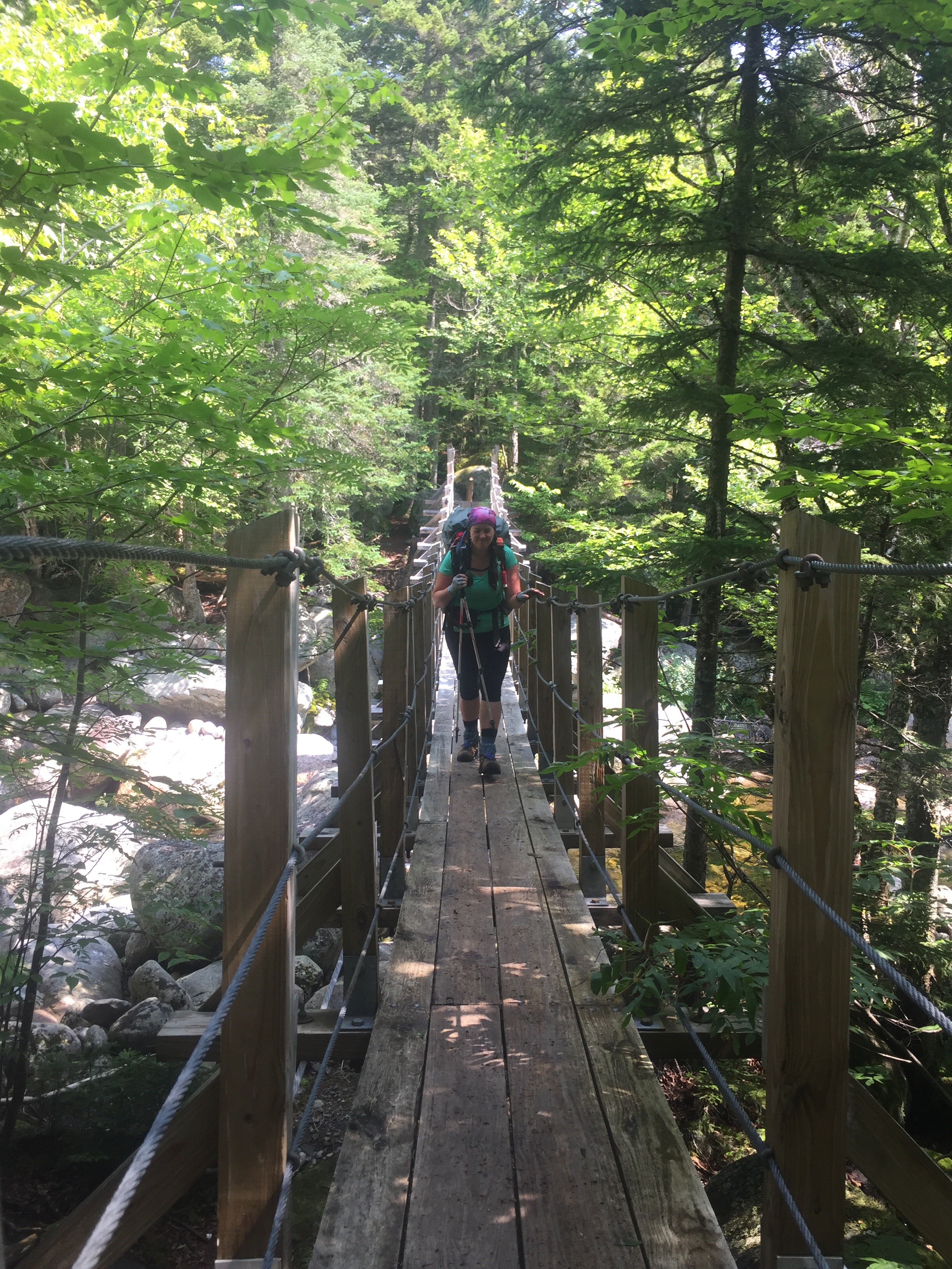
We continued our crawling descent on Day 88, celebrating briefly when we reached the valley floor. There was still another 5 miles to go, but we were spurred on by the thought of reaching Pinkham’s Notch where there were rumors of ice cream and sodas, always great motivators! We traversed over roots, rocks, and rivers, getting re-accompanied with the humidity of the valley. Since we’d been up on the windy ridges for a few days, we seemed to have forgotten how the air likes to just sit around the trees. But soon the narrow winding trail gave way to a wider path, which led us to the steps of the Pinkham Notch Visitor Center! As promised there were sodas and Ben & Jerry’s ice cream pints. We got impatient after not finding spoons right away so we ate the ice cream with forks because we’re classy thru-hikers ?
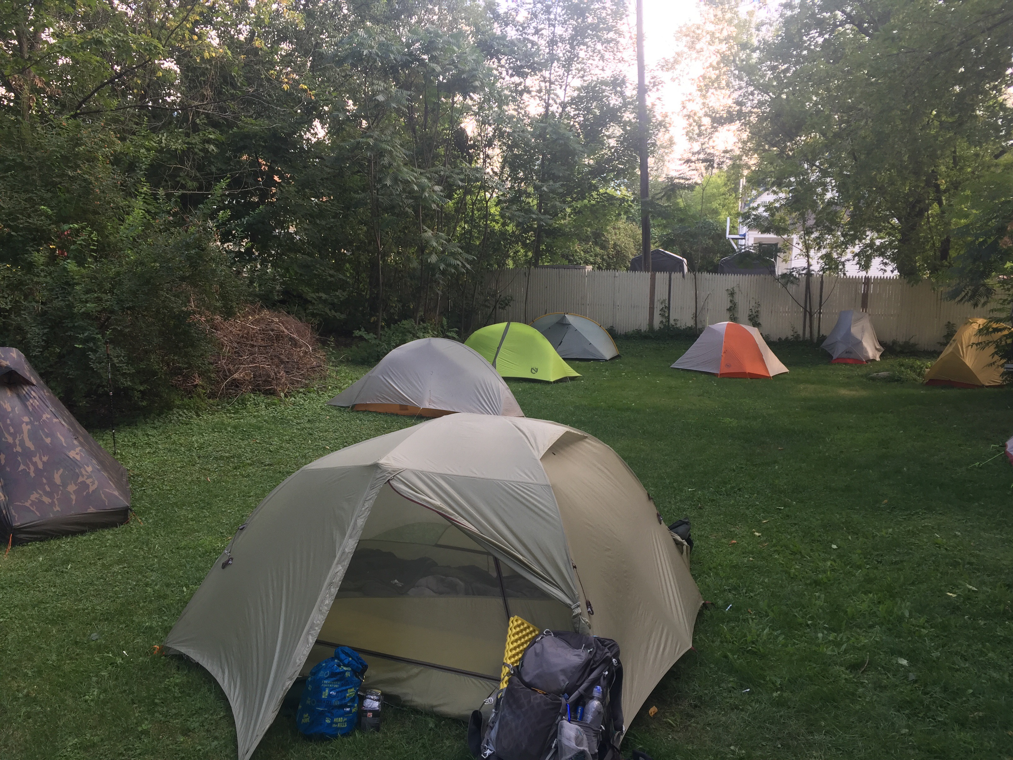
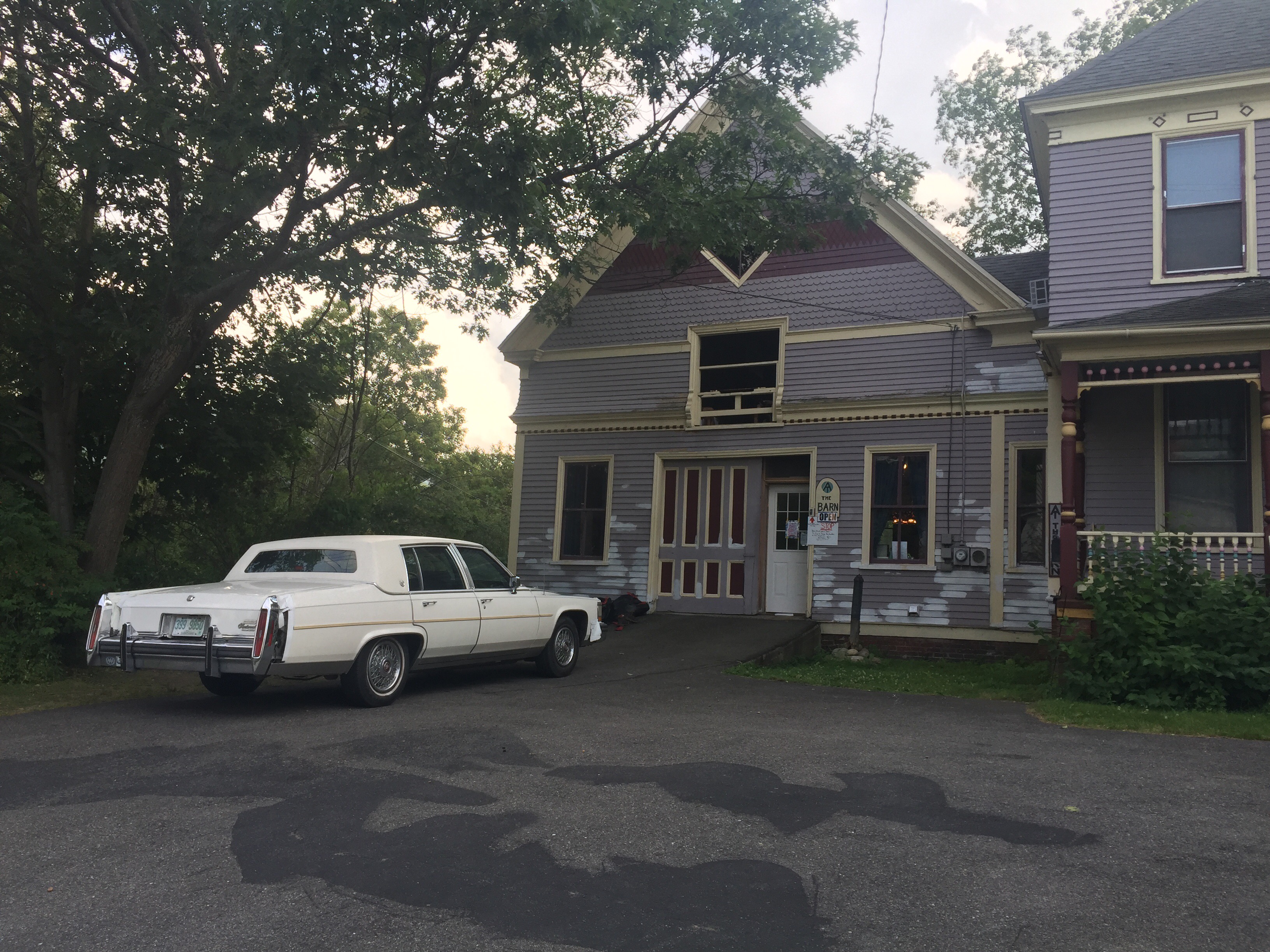
We made arrangements to stay at The Barn, a nearby hostel, although it was full of other hikers so we’d have to camp outside. With limited options, and excited for a shower and laundry, we accepted, and soon found ourselves in the back of a bouncy, white Cadillac on the way to Gorham, NH. We were greeted by a ton of familiar faces at the hostel…Rambo, Jaws, Mama Jaws, Papa Jaws, Sparky, O2, Princess Vedalia, Jager, Thumper, and Famous Amos! It was so fun to hear everyone’s different accounts of the White Mountains and Presidential Range! There were also a bunch of Southbound hikers who were able to give us intel of the terrain ahead. We ended the day surrounded by friends, ready to tackle the last bit of New Hampshire.
Days 89 and 90 were challenging, both physically and emotionally. If the terrain could talk, it might say something like, “this is the last part of New Hampshire so I’m going to make it as difficult as possible.” The weather bounced back and forth between cloudy and rainy, letting the sun peek through only once during our 2-day stretch. We hiked up and over the Wildcat Range, down to Carter Notch, up Carter Dome, over Mt. Hight, up and over South Carter, Middle Carter, North Carter, and finally up and over Mt. Moriah. The trail ranged from muddy puddles to insanely steep, slick vertical rock slabs, causing us at times to throw our trekking poles down the 20-ft boulder faces and slide down on our butts.


But amazingly we made it down unscathed to Rattle River, where the White Mountain Hostel was nestled right on the trail. After being cold and wet for 2 days, we were very much looking forward to hot showers and beds for the night. Add in being able to watch the new episodes of Game of Thrones and Rick and Morty, and our spirits were lifted once again. ?
We woke up feeling pretty sore on Day 91, but waffles, coffee, and leftover pizza helped a bit. We were also celebrating our 3 month mark on our journey! And wow, what a difference in terrain and weather. As the saying goes, “don’t quit on a bad day.” Now we can see why, as one day can be vastly different from the previous day. We were able to stretch our legs out on the gently sloping uphills and passed by mountain ponds and alpine forests. The sun was shining, making for a pleasant hiking day for the first time in a while.


We ended at the Gentian Pond Shelter, which is notorious for hosting a moose, but I guess he didn’t want to make an appearance that evening. Instead, we got to know some other hikers, both Northbound and Southbound. The shelter also was known for its amazing view of the valley, so we were able to watch the sun go down, changing the colors of the sky as it did.

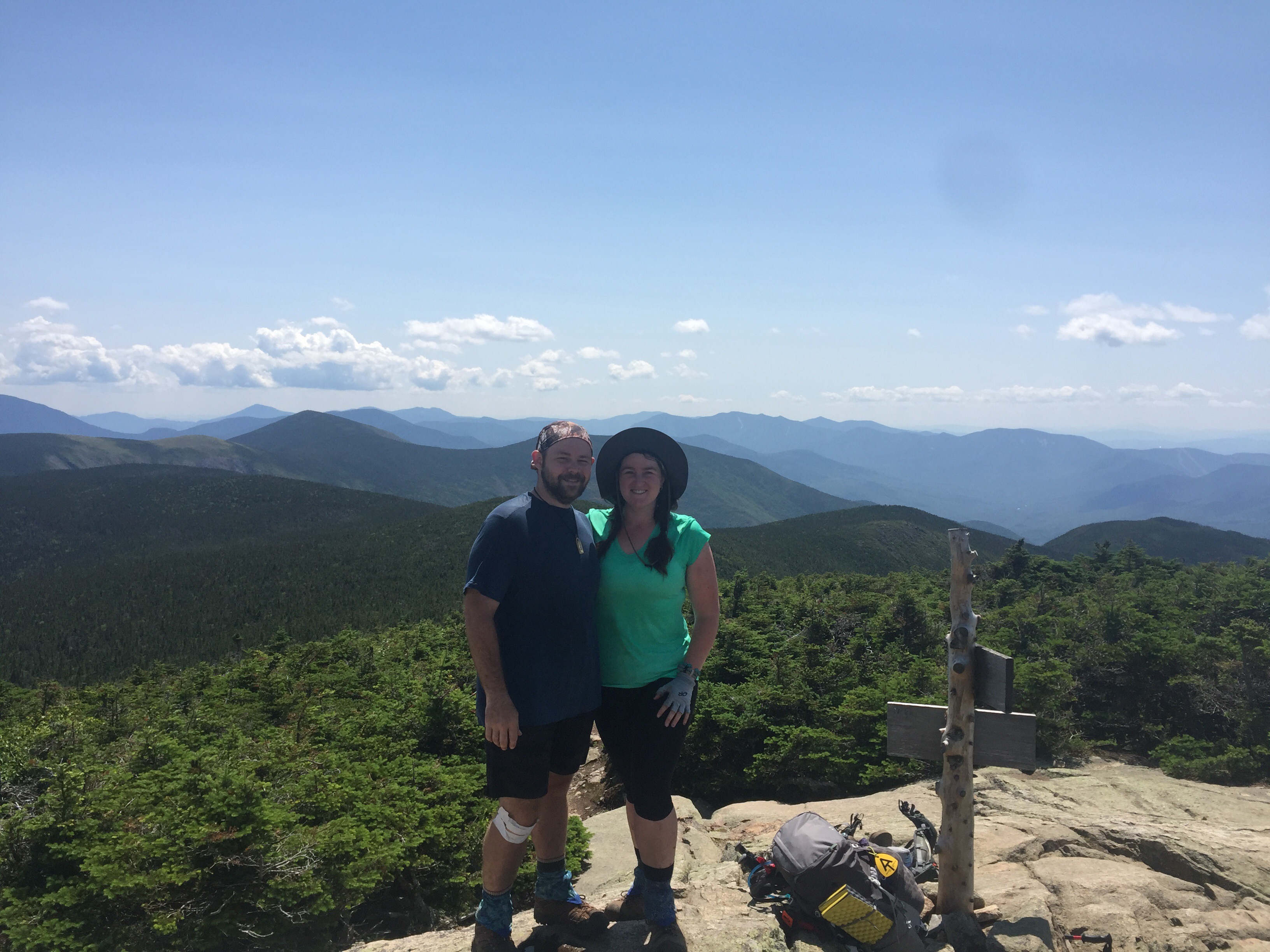
We will remember Day 92 as the day we stopped hiking. It was now mountaineering, boulder scrambling, rock climbing, toe jamming, root grappling, butt sliding, tip-toeing, cliff balancing, crab walking, and exorcist-style crawling up and down rock walls, slick with rain and lichen. But it was also the day we officially crossed into Maine, the last state on our northern leg of our journey! It is a culmination of all the difficult parts of the trail we’ve experienced so far, and we started reminiscing about the “good ole days” when we hiked on an actual trail at a 2mph pace. But the good news is, according to many Northbounders, we’ll be well conditioned for the southern portion of the trail. Can’t wait for that!


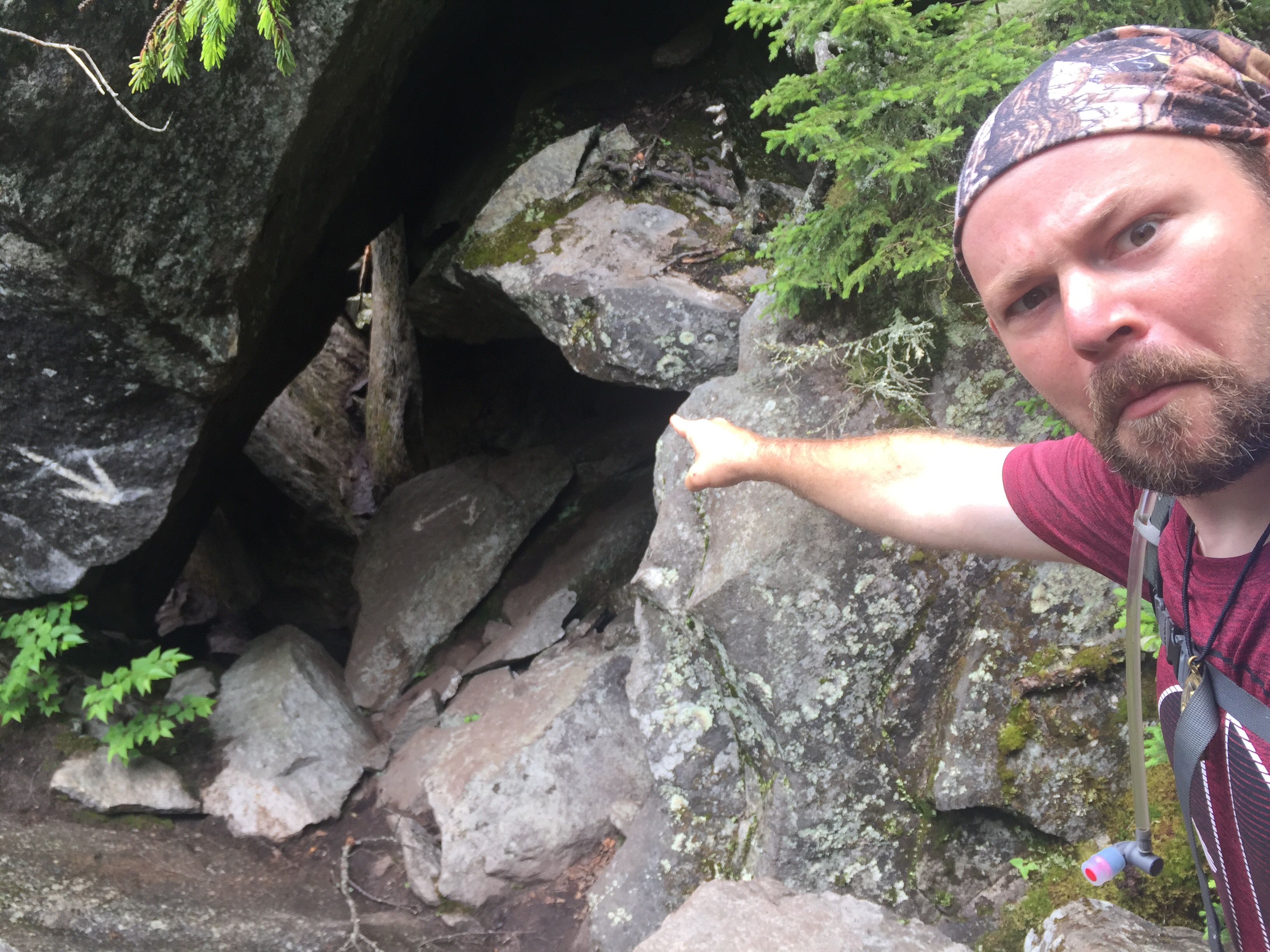
We woke to thunder, lightning, and rain on Day 93, making us consider taking a “zero day” at the shelter. Coming up was the infamous Mahoosuc Notch, which we were told explicitly not to attempt in the rain. But as we debated how much food we had left, the skies cleared, and we decided not to waste the good weather. So off we went to the mythical, mystical, much-talked about Notch, which is labeled as “the most difficult or fun mile on the AT.” When we came around the corner…holy boulders! Right off the bat we put our trekking poles away, knowing they’d just be cumbersome as we made our way through and around the mile of car-sized rocks.

And then for the next 3 hours we scrambled. We bouldered. We rock-climbed. We went up, down, around, on top of, in between, and under rocks both dry and wet. Cool air swirled around us like natures air conditioning. The cause? Mountain ice, still unmelted and untouched in spots that must never see the sun!

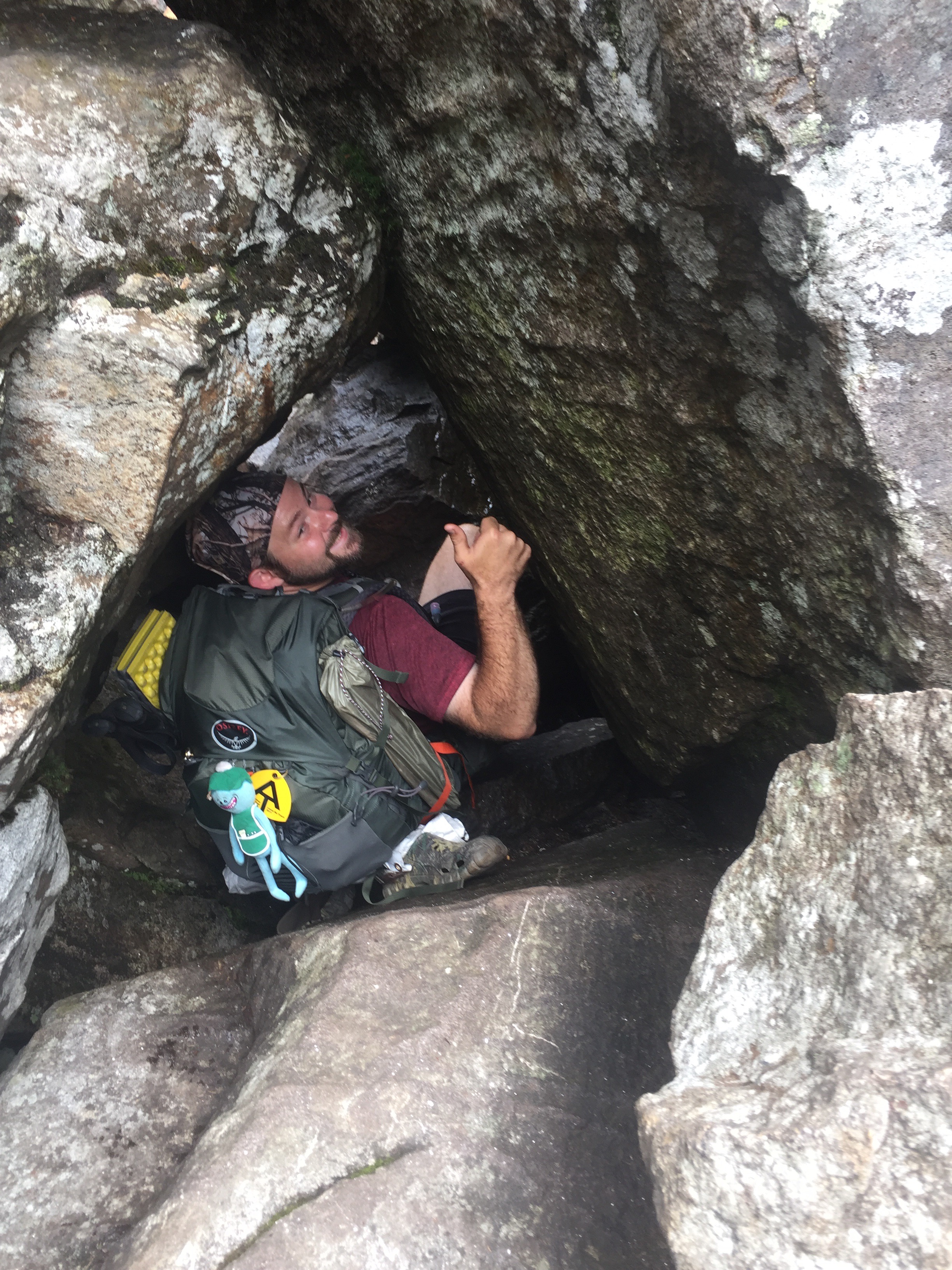
Although difficult, it was definitely fun as we used our hands, arms, elbows, knees, backs, and fronts to get through the section. At several spots we were even forced to take off our packs to crawl through little caves!

Finally after making it through the Notch without serious injury, it was a climb up the Mahoosuc Arm to the Speck Pond Shelter where we’d spend the night. It was our slowest, shortest day so far, going a mere 5 miles in 7 hours. But hey, great pictures, right?!


Day 94 started off with an intense climb up Old Speck, one of the 3 mountains in Maine above 4,000 feet in elevation. Inside of a cloud, we couldn’t see more than a few feet in front of us, let alone the views surrounding us. But that was ok, because we were headed to town for a resupply anyway! We had places to be! We were hoping to reach the trailhead by early afternoon, aiming to coincide with dayhikers returning to their cars. Well, it kind of worked.
We approached the parking lot in time to meet Sue, who was picking up her husband from the AT. They weren’t driving all the way to where we were headed, Andover, ME, but they could drive us some of the way. They dropped us off at the intersection where we headed left and they headed right. Then we stuck out our thumbs and started walking, hoping for some kind stranger to pick us up. About 30 mins later, a woman who was familiar with the area and AT hikers was gracious enough to stuff us and our packs into her car and drove us another few miles down the road. Again, we were dropped off at an intersection where we were headed left and she was headed right. Started walking with our thumbs out, hoping for the best. This time it took about 15 mins before a woman from Andover pulled over and offered to take us the rest of the way. A 3-part hitchhike…definitely memorable! ???
So here we are in Andover, ME, resupplying our food and reenergizing our bodies and spirits for the next leg of the trail. We’ll keep trekking and making the most of our journey for the next 2 weeks or so before reaching Mt. Katahdin, the northern terminus of the AT. And of course we’ll keep smiling, because Maine mountains aren’t just funny…they’re hill areas! ⛰?

This website contains affiliate links, which means The Trek may receive a percentage of any product or service you purchase using the links in the articles or advertisements. The buyer pays the same price as they would otherwise, and your purchase helps to support The Trek's ongoing goal to serve you quality backpacking advice and information. Thanks for your support!
To learn more, please visit the About This Site page.
