 ">
">
Through the Mojave Heat as Mexico Looms Ahead
I mentioned at the end of my last post that I was getting a new pack in Tehachapi. Back in Sierra City, I had noticed that my first pack had taken a beating.
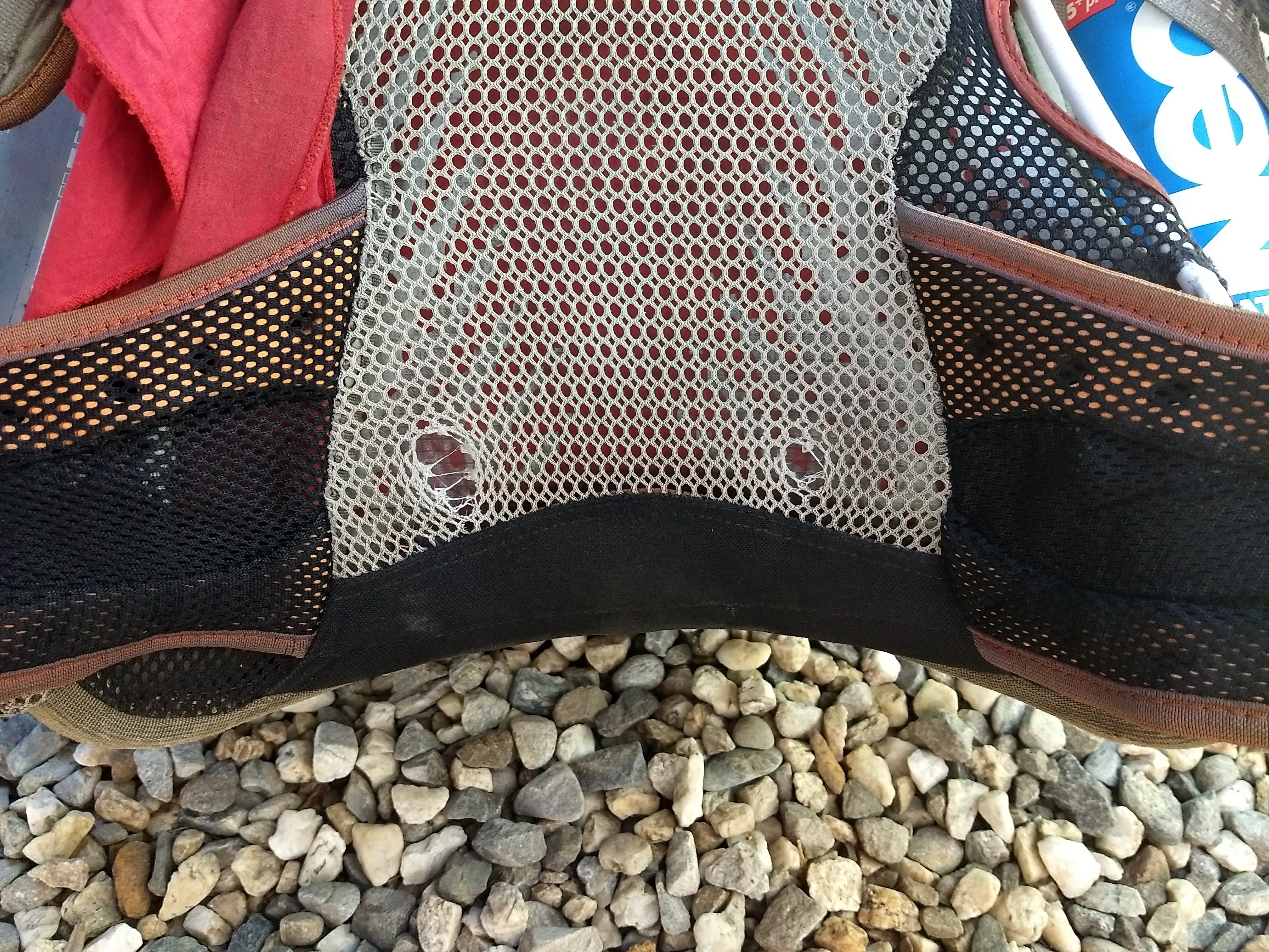
I’ve had several fantastic customer service interactions with Osprey in the past. Let’s just say I was less impressed this time. To make a long story short, after several weeks of waiting for a response to my warranty request, I was entering the Sierra worrying that my pack wouldn’t hold out much longer. When I connected to the internet again in Lone Pine, I ordered the Gossamer Gear Kumo 36. The Osprey held out fine to Tehachapi (that’s over 2,000 PCT miles, and it wasn’t new when I started), but I was definitely excited for shiny new gear.
Spoiler alert: I love the Kumo. It is a really good pack for me. I might even write about it sometime in a separate post.
Hitting the Great Wall
Our trail angel dropped us off at the DG Market (it’s like regular DG, only so much better) after providing a nice driving tour of town. Have I mentioned before how it’s a really bad idea to resupply when you’re still starving? I bought waaaaaay too much food. We were planning to just take three days to Agua Dulce, and we could grab some snacks and munchies in Green Valley on the way.
I had a hard time packing all of my food in my new bag. Not a good start.
With resupply done, it was time for town food. Leafy had suggested the Great Wall’s lunch buffet, and after my championship performance in Lone Pine I couldn’t say no. Sadly, I would not have a repeat. Only halfway through my second plate, I had well and truly hit the Great Wall. Even a trip to the bathroom wasn’t enough to rally me. I tip my hat to you, Great Wall, “The Only Buffet That Won.”
The four of us spent the next two hours comatose in a grassy patch of shade, slowly packing away our resupply. All of our budgets were stretching thin with the end of the trail approaching, and we debated staying in town versus trying to hitch back out that night. Time made our choice for us. By the time we could move again, it was late afternoon and no one felt like hiking. Rather than splitting a room, we decided to try yuckin’ it up with the locals and trying to find a place to stay.
Another Desert Angel
Angel picked us up on our way back to the center of town. She absolutely lives up to her name. She turned out to be a Couchsurfing host, and offered to host us for the night. As long as we wouldn’t mind killing a few hours at the brewery while she went to see a movie with a friend. Obviously we said yes.

A wall of beer, bumper stickers, and potato chips. Who could ask for more?
Back at Angel’s that night, we got to play with her dogs before going to bed. And to think we were concerned we might have had to sleep in the city park that night. We slept late, and only made it back to town around 11 a.m. Breakfast was a bomb sandwich from Kohnen’s, where we sat trying to work up the motivation to venture out into the heat. We were going to cross the aqueduct the next day, but had some distance to cover before getting there.
Finally, around 3 p.m., we were back to the trail and climbing in the heat of the afternoon under direct sunlight. The goal was to make about 26 miles before sleeping. And I was still feeling hung over. Damn it.
The Mojave for Real
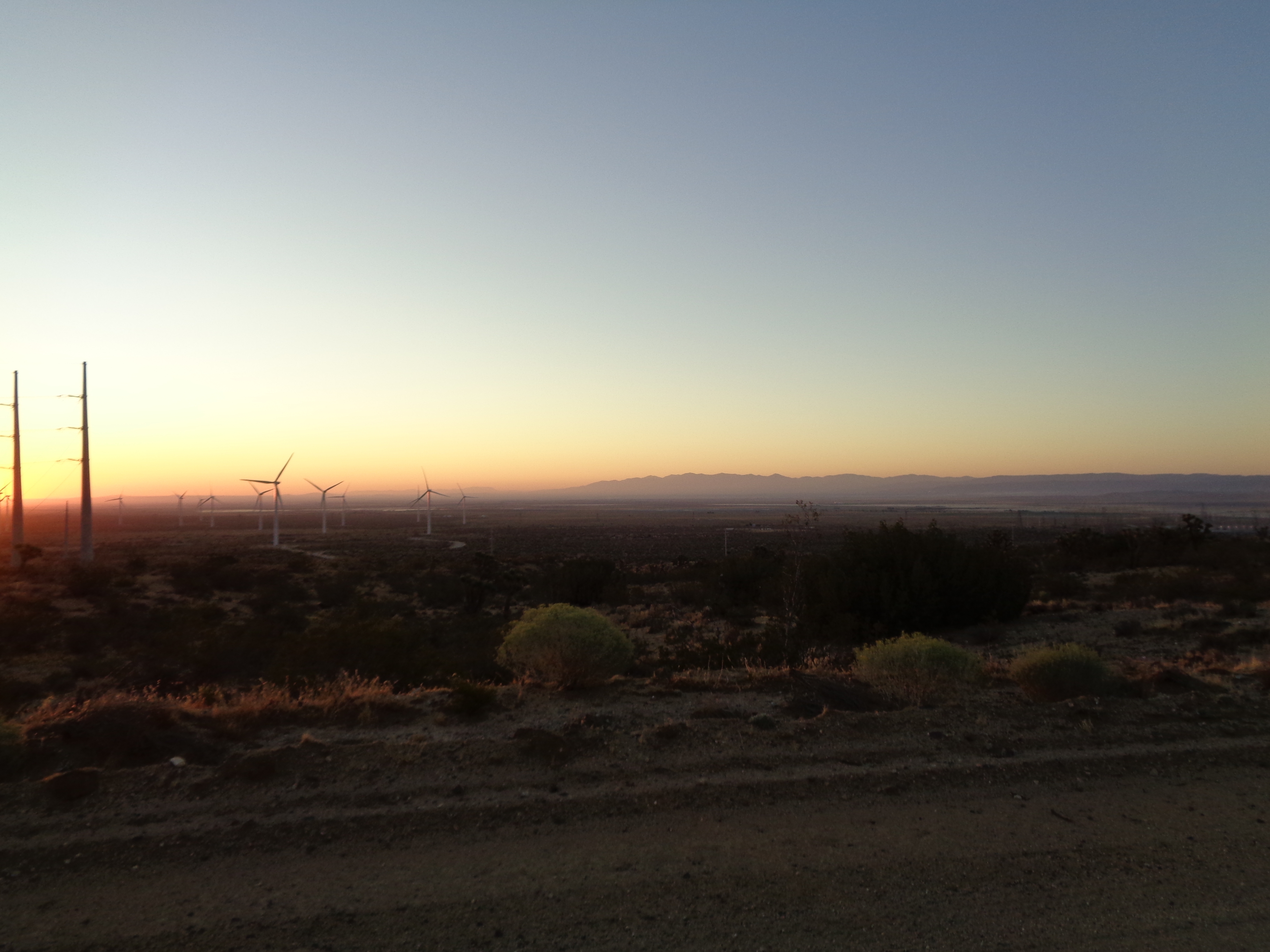
The trail is dusty. We can see for miles and miles all around, and the land is almost completely occupied by towering wind turbines and shimmering solar fields. I stopped to rest under a rare shade tree by a dry creek bed before we started climbing away from the desert floor. Finally, as the sun began to set, we left the energy fields behind and relished another stunning desert sunset.


Along the ridge as dark fell, I almost went past the little rest stop someone had erected at mile 547. Looking through the register there, I confirmed that a few hikers had gotten past us while we lounged around in Tehachapi. Per Bear scored some sweet new sunglasses. We left in the dark, and floating somewhere below us were the disembodied flashing red lights of the sprawling wind farms.
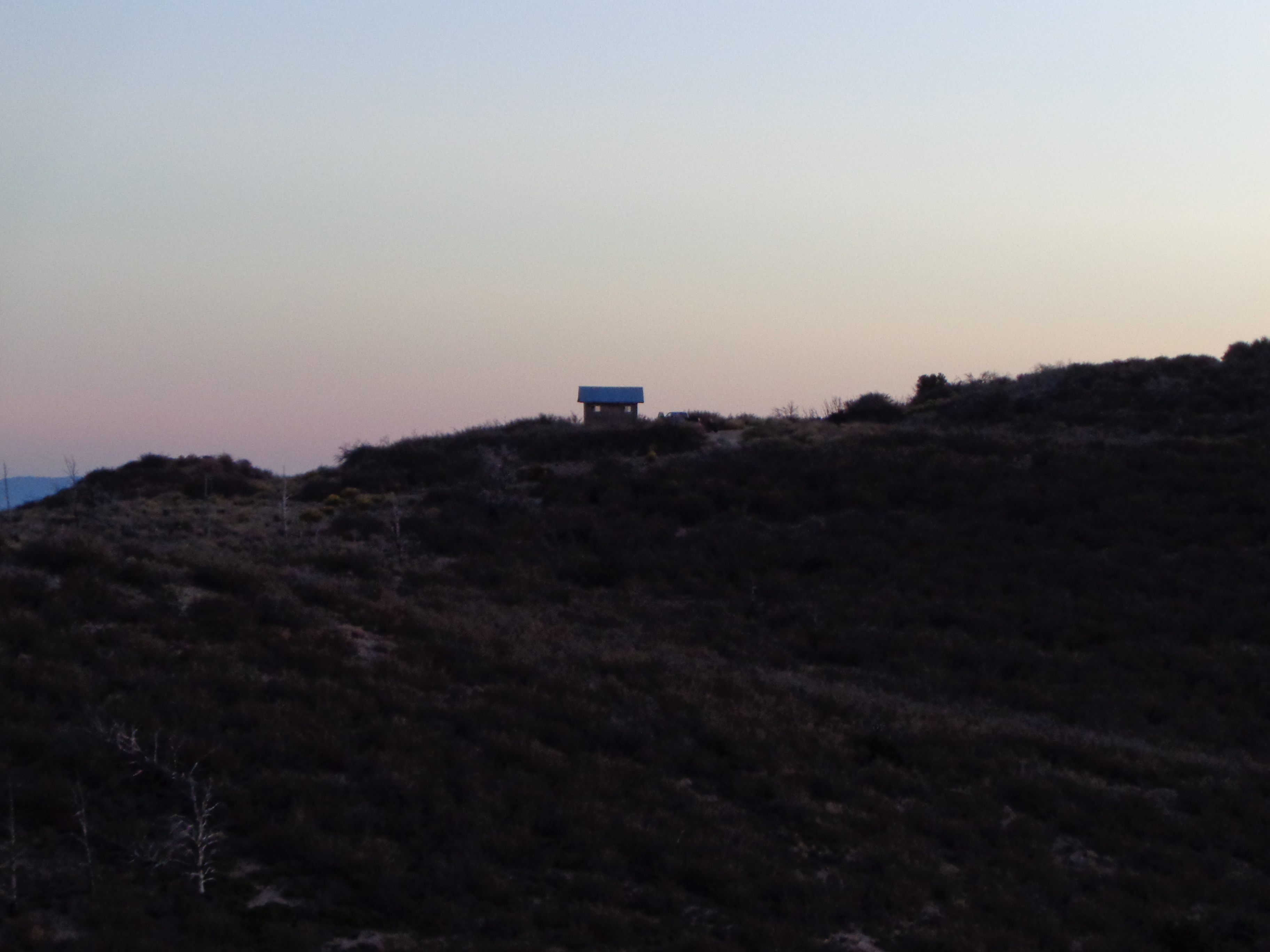
A creepy shack along the ridge near 547.
For miles approaching Tylerhorse Canyon, the trail deteriorated into a mess of washouts and rutted piles of debris. In the dark, it was a struggle to keep on trail and not roll ankles or twist knees. I grew frustrated as the miles dragged on, conscious that I would be waking up super early to cross the aqueduct. It was about 11 p.m. when I finally dropped my pack by the trickle of a creek that was our camp. I ate a wrap while setting up camp, set my alarm for 3 a.m., and crashed out.
And woke up around 3:45. Shit.
The Aqueduct
I was packed in a flash, stuffing Pop-Tarts in my mouth as I set off to cover the last few miles down to the aqueduct. Thankfully the spigot was running when we arrived, since I hadn’t had the patience to fill up from the slow stream in camp. Leafy and I began the notorious 17-mile stretch ahead of the other two, with plans to regroup and rest at Hikertown at the southern end.
Down in this wide basin, the sky stretched from horizon to horizon. The sunrise was breathtaking. As the sun further illuminated my surroundings, I began to understand just how formidable this section really is. It is completely flat. No plants grow higher than your hip. There are no structures to speak of. All of which combines to mean absolutely no shade. And we were just getting started.
If there was ever a section of trail designed for a head down, music on, just blast on through approach, this is it. There isn’t much to see, unless you’re lucky enough to witness a helicopter crew working on high-voltage lines nearby. Even the oft-photographed pipe is only visible for a short time near the southern end. Believe it or not, my legs and hips were sore from the perfectly repetitive steps taken over miles and miles of flat road.
Within the last few miles, the combination of the building heat and my dwindling water reserves started to take its toll. I missed a trail sign across a road, and instead walked .5 miles toward a highway before realizing my mistake. When I regained the trail, Leafy and I finished the last mile together.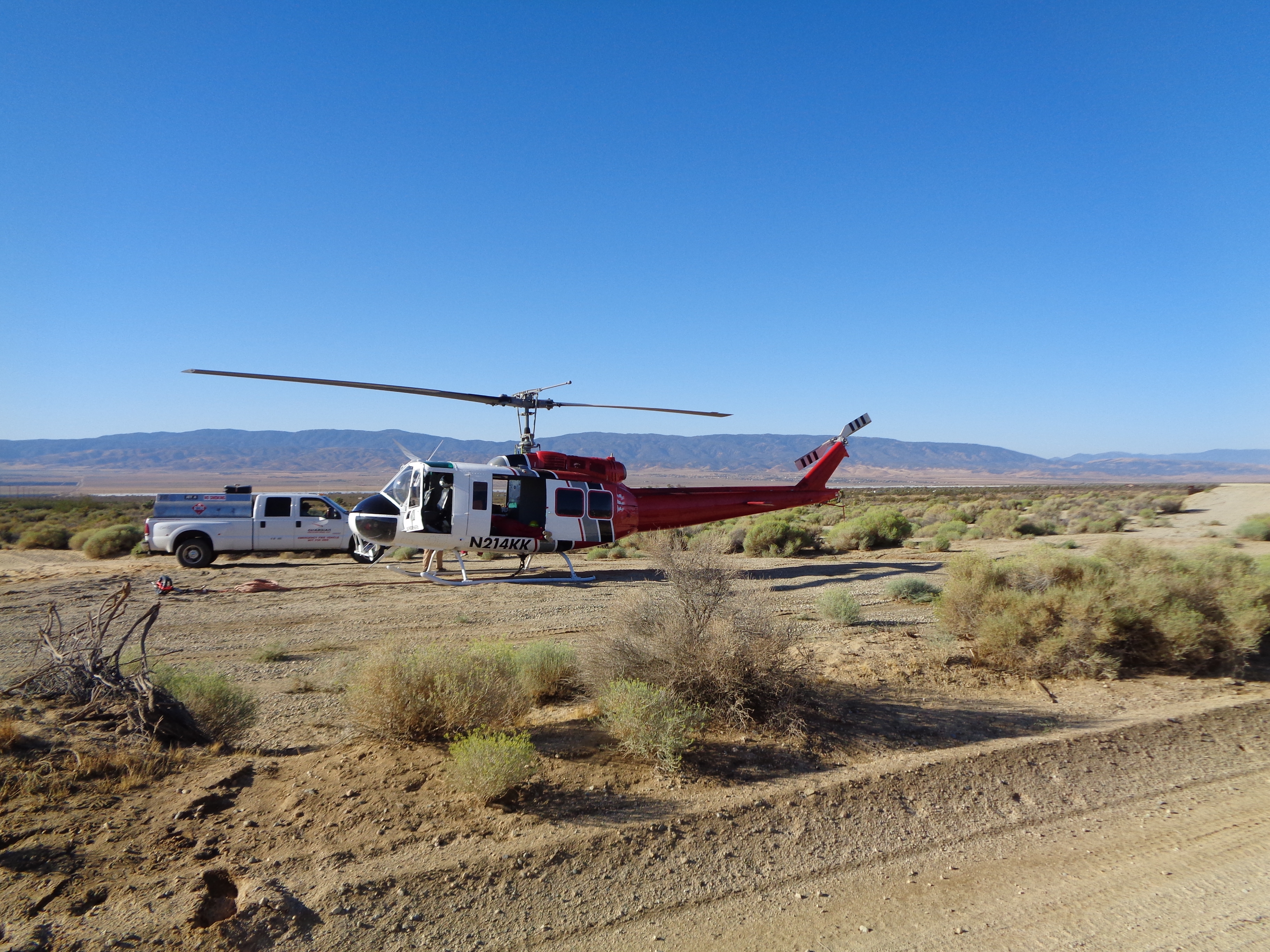


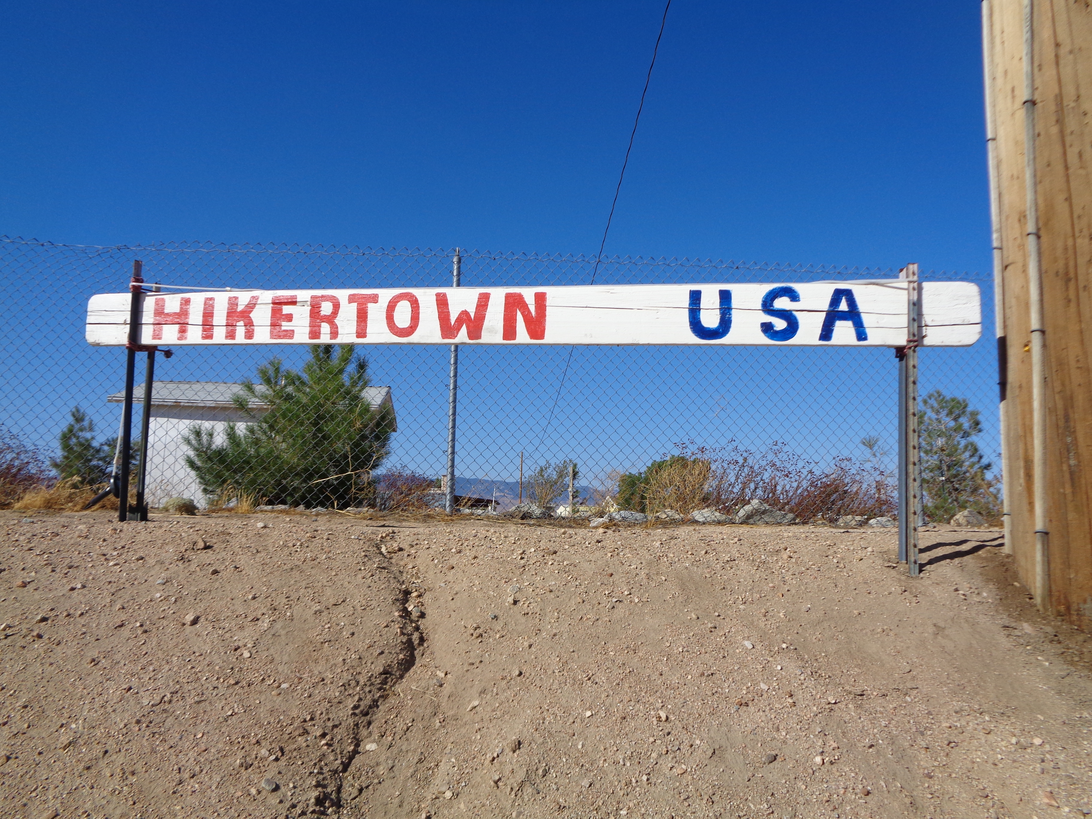
We pulled in at noon. In the 21 hours since leaving Tehachapi, we had covered 50 miles of trail while still managing to get a few winks of sleep. Arriving at Hikertown was a huge relief. I laid out my Tyvek under the shade of an umbrella and napped for a while until Kirby and Per Bear arrived. Shortly after, two more hikers showed up. Apparently Ohm Boy and Red Feather had also camped in Tylerhorse the night before, but had gone downstream a bit so we hadn’t seen them. Carefree had arrived at Hikertown before us, accounting for all of the unknown names we had seen in registers since Tehachapi.
To the Moon
The group, now seven strong, departed in waves. I waited out the heat until 3, then set off with Leafy and Ohm Boy. Around dusk, we arrived in camp with the rest of the group and debated trying to make a few more miles after dinner. Inertia got the best of me, and I resolved to stay and just get up early again to try to beat the worst of the heat the next day.


I hiked with Ohm Boy for much of the morning. The trail wound gently along a hillside dense with crooked oak trees. We all made quick work of a dozen miles before the heat came up again around 10 a.m. Which of course coincided well with the transition from oak forest to thick manzanita, and a burned area farther on. We were once again at the mercy of the punishing sun.
With one climb left before reaching the road to Green Valley, we hit the 500-mile marker. Thankfully, we had crossed a trickling spring before the climb, but even then I was quite parched when I got down to the road in the midafternoon.
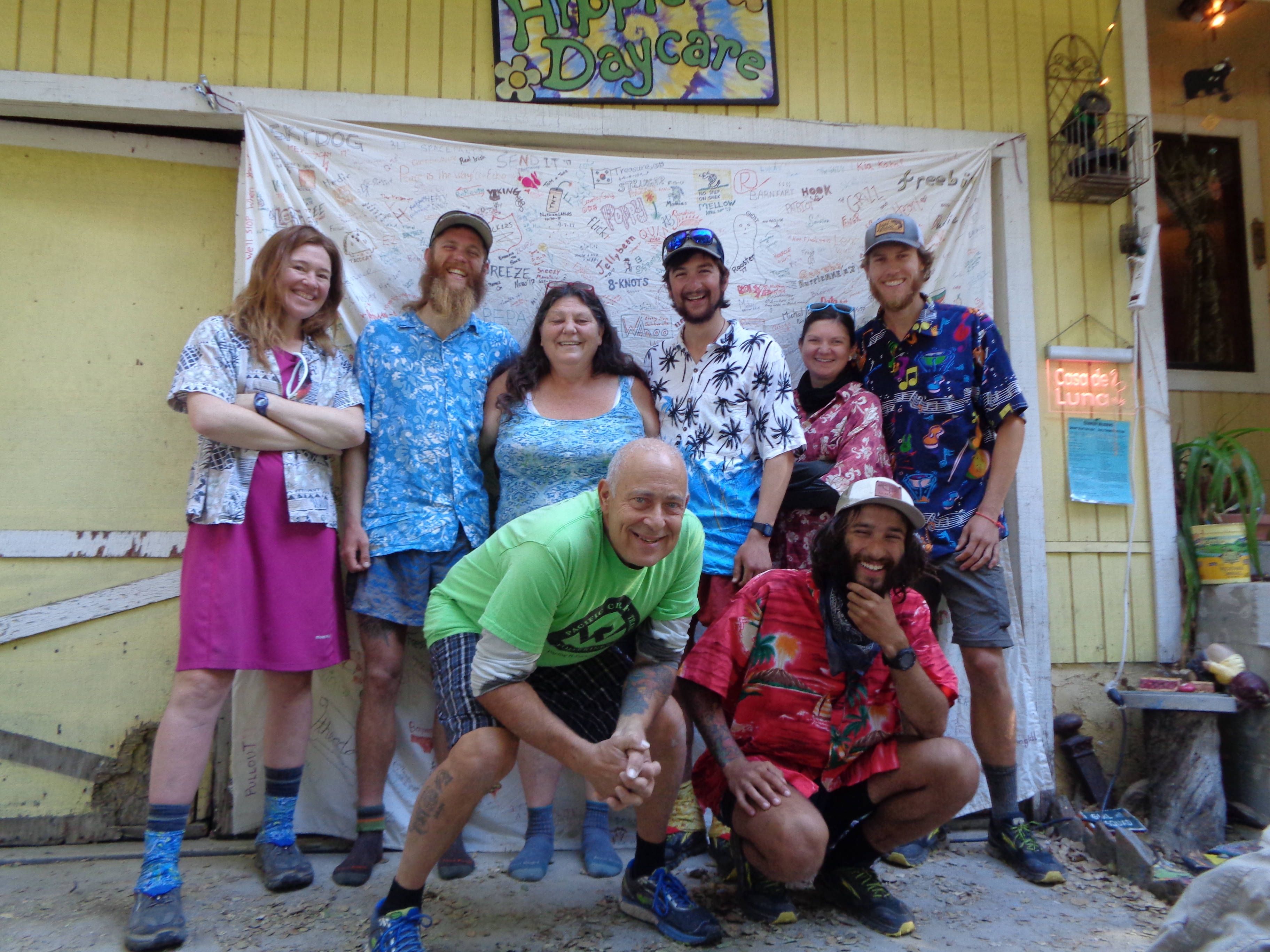
If you’ve spent even 30 minutes reading about the PCT, you’ve probably heard of Casa de Luna. Joe and Terry Anderson have been legends of fun and hospitality on the trail for 20 years now. And they certainly live up to it. After getting set up in the labyrinthine manzanita grove out back, we donned the traditional Hawaiian shirts and got down to the only business allowed at Casa de Luna: Relaxing. Kirby and Per Bear were determined to try the “24 Challenge” the next day, but we all stayed up drinking beer and listening to the Andersons’ many fantastic stories.
Joe’s cinnamon pancakes far exceed their reputation. Despite our insistence that we would all be hiking out in the morning, the pull of the vortex was only growing stronger as the appointed hour drew near. We posed for our picture in front of the Class of 2017 banner, where I finally learned the secret of why everybody looks so damn happy in those photos! (Don’t worry, I’ll never tell.) 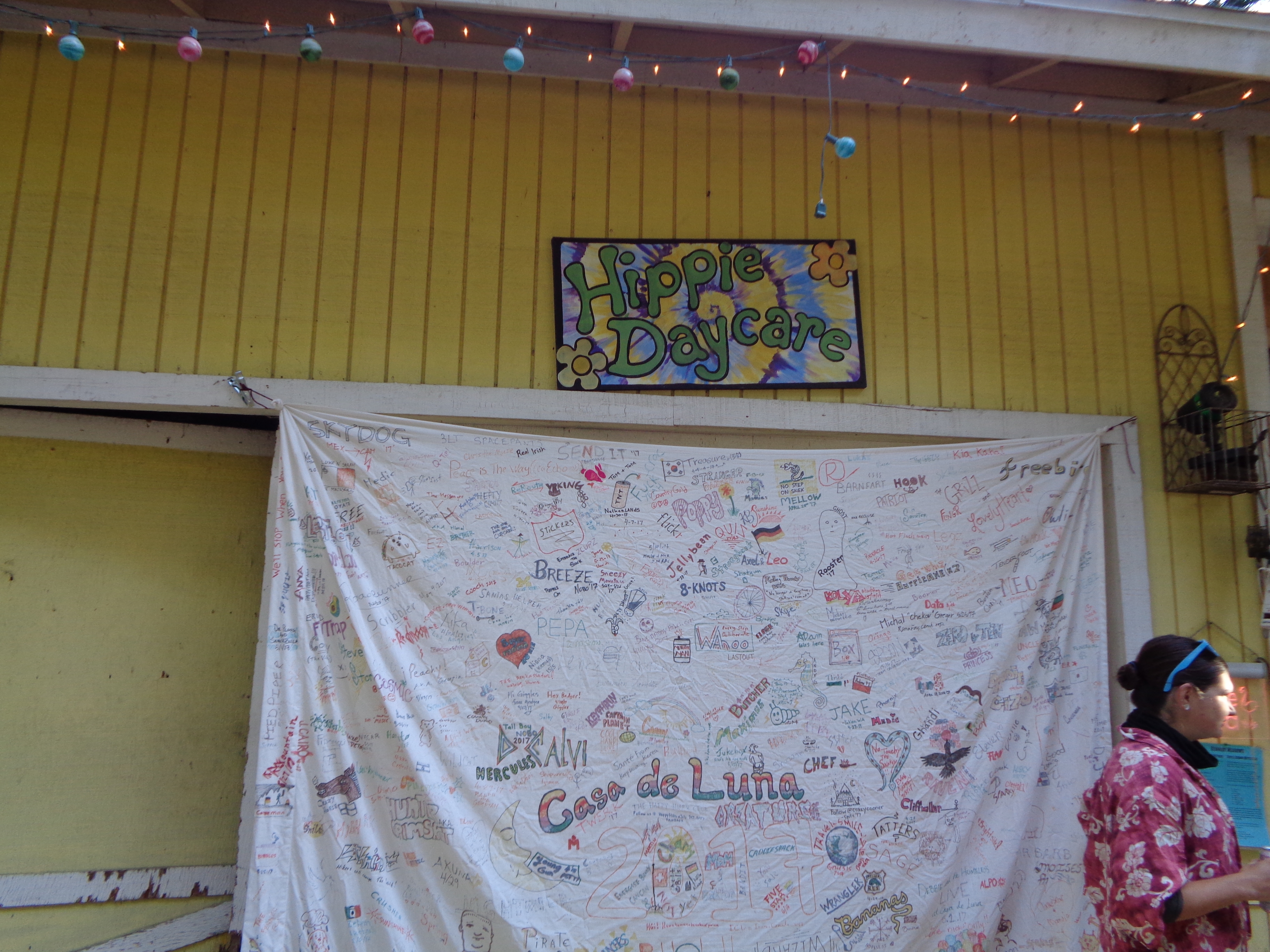
Kirby and Per had already begun the consumption part of their challenge when Joe started pulling grills out of the garage. They were committed to doing the miles, and Ohm Boy and Red Feather joined them in Terry’s van to return to the trailhead. Leafy and I officially abandoned the idea of hiking in favor of more beer and a barbecue lunch. while later, Terry returned with Ohm Boy and Red Feather. They had wisely decided that they weren’t finished with the House of the Moon either.

This is what the vortex looks like.
Enough Foolin’ Around
My time at Casa de Luna was truly magical. The unfamiliar desert had me struggling to feel at ease, but I left excited to find comfort in my new environment. Physical aches felt unimportant, and I was full of energy when we finally left a full 24 hours after arriving.
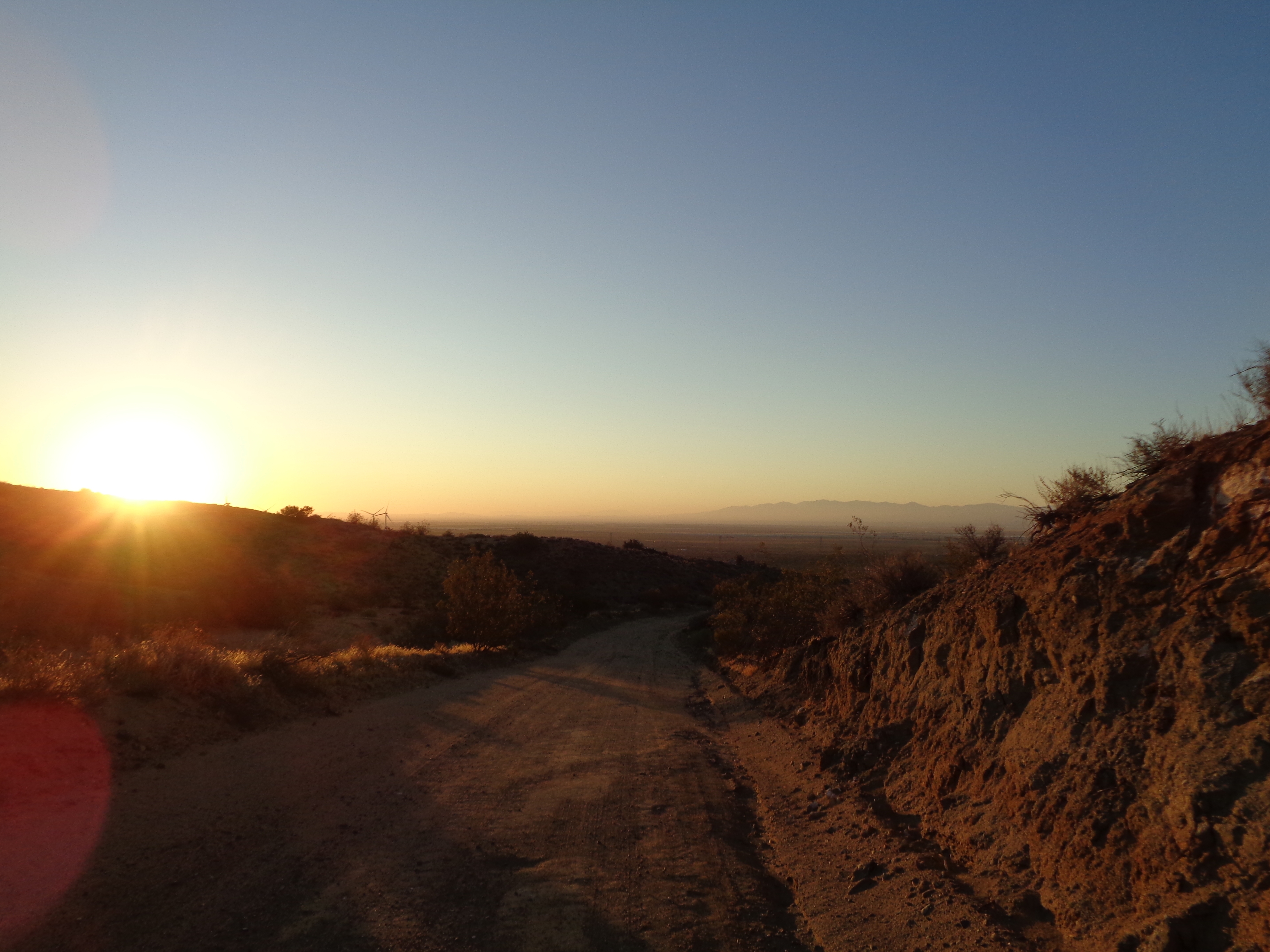
Which meant, with about 24 miles to cover to catch up to Kirby and Per Bear in Agua Dulce, more night hiking. And also, another desert sunset accompanied by the soft evening breeze as the air finally begins to cool. The trail was nice and gentle and we made good time. Still, given the late hour, we decided not to try our luck finding a place to stay in town, and instead I camped with Leafy and Ohm Boy under a power line on the edge of town.

Sunsets are good.
On the way into town the next morning, we ran into Kirby and Per Bear eating breakfast at a coffee shop. They had successfully completed (aka survived) their challenge, and looked in pretty good shape. After a resupply at the grocery store, I ran across the street to use the bathroom. I ran into Country Gold, a traveling hostel caretaker and former hiker, who I had met years ago at Uncle Johnny’s on the AT. One of the best things about being a repeat thru-hiker is running into people you met on other trails.
Vasquez Rocks Natural Area was a dramatic welcome back to trail after the road walk through town. The weathered rocks angling out of parched earth are a defining feature in my mental image of a desert. I gazed around me while traversing the park, and ended up doing a bit of unintentional bushwhacking when I wandered off trail. Worth it.


Climbing out of the Mojave, with smoke from the Anaheim fires in the sky. 
A Break from the Desert
I was really starting to get border fever at this point. Basically all that was left were Mts. Baden-Powell and San Jacinto. Just two mountains, four resupplies, and a little over 400 miles to go.
We got to experience some of the diversity in the Angeles National Forest, spending the day approaching Baden-Powell mostly under tree cover. Toward the end of the day, we paralleled the Angeles Crest Highway, and ended up camping in a trailhead parking lot. Because there were picnic tables, trash cans, and privies. Typical hiker trash.

Because it just wouldn’t be the PCT without this sign.

I started the day in my element. Climbing the side of a prominent mountain among fragrant conifers, gaining elevation as the sun rises. We lingered at Little Jimmy Spring, the most naturally occurring water I’d seen since before Tehachapi. As we broke out of the trees once more, we saw a valley covered in a dense inverted cloud layer. I ignored the morning chill for a few minutes and simply stared toward the horizon.
Back above 9,000 feet for the first time since before Kennedy Meadows, the last mile or so to the summit kind of kicked my butt. But, not to worry, the 360 views were just as breathtaking. I remarked to Ohm Boy how strange it felt knowing that we could point to a city of 3 million people, yet it was totally invisible from our vantage point. 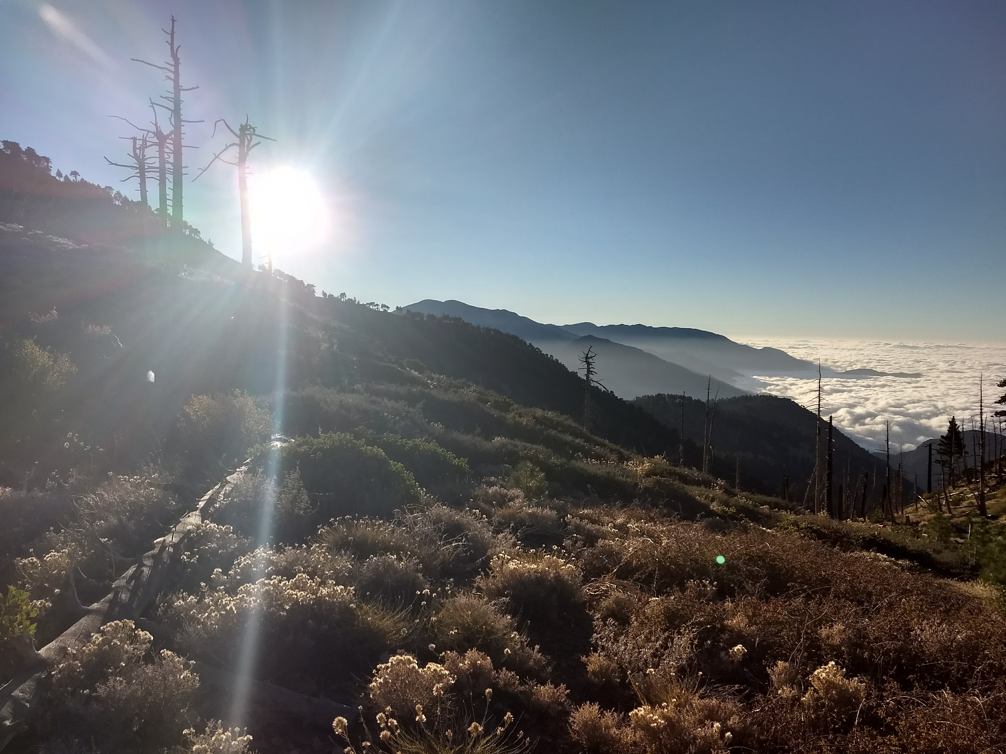

You can’t tell, but that’s LA down there. 
The switchbacks on the south side of the peak are quite steep. We descended through the cloud layer and were treated to a rare moment of cool moisture on our dusty skin. Soon, though, the clouds burned off and it was back to that SoCal sunshine. The trail remained high enough that we at least had shade the rest of the way to Wrightwood. The topic of conversation naturally shifted to food as we neared town, and my belly set to rumbling. Rest assured, I would get plenty of food and have a generally hootin’ good time in town. 

This website contains affiliate links, which means The Trek may receive a percentage of any product or service you purchase using the links in the articles or advertisements. The buyer pays the same price as they would otherwise, and your purchase helps to support The Trek's ongoing goal to serve you quality backpacking advice and information. Thanks for your support!
To learn more, please visit the About This Site page.
