 ">
">
And Then It Caught On Fire: PCT Days 95-100
Day 95. Miles: 18.7 Total: 1599.7
It’s a surprisingly difficult stretch of trail into Etna, with lots of rocky and exposed climbs and descents. I unexpectedly overtake Billie Goat, who has slowed down a bit to hike with her partner, who’s visiting for a week from Utah. We hike together for a while, then pause for a break and a swim at a lake with Smiley, Viking, and Shepherd.

When I reach the road, I’m lucky. A hiker named Doggone is thru-hiking with support from his wife Taxi Lady, and Danger and I get to the trailhead just moments before Doggone, so we are able to tag along for the ride to town with Taxi Lady.
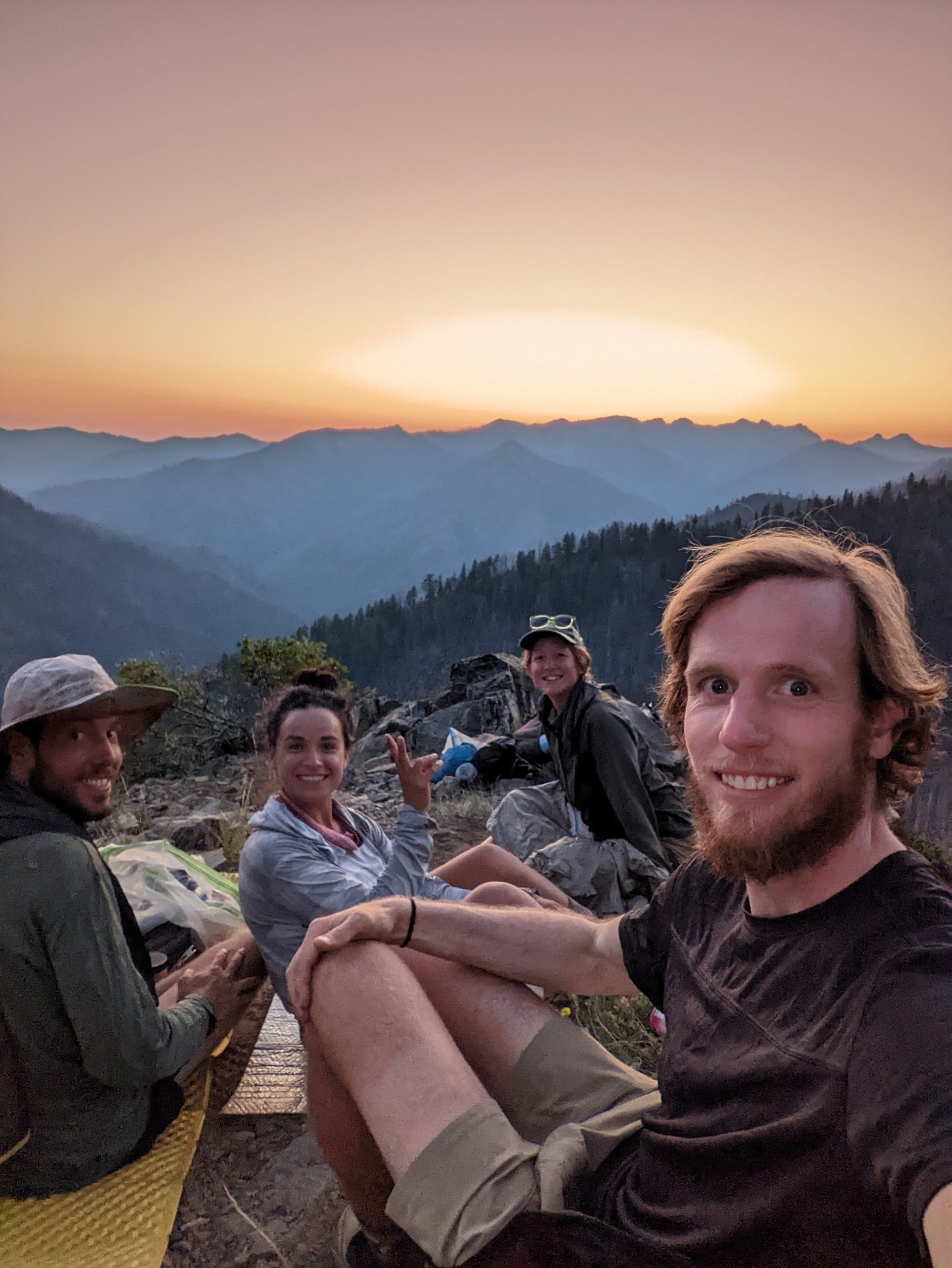
Etna is another delightful, hiker-friendly town. Camping is available at the local park, and we eat at a brewery with live music. The restaurant is woefully understaffed, but despite her enormous workload, the lone server is friendly and kind. We camp with Smiley’s friends Rolls and Royce, a married couple trail-named for their luxury items, including camp chairs and a French press for their coffee.
Day 96. Miles: 6.9 Total: 1606.6
After a restful morning in town, Smiley, Rolls, Royce and I catch a ride back to the trail a local trail celebrity named Molly. Molly is a charismatic octogenarian who drives like a Nascar professional.
By the time we’re hiking again, it’s approaching sunset. At dusk, we find a few scattered cowboy camping spots on a ridge and stop. A few curious deer wake me up throughout the night, but it’s still one of my favorite camp spots on the trail so far.
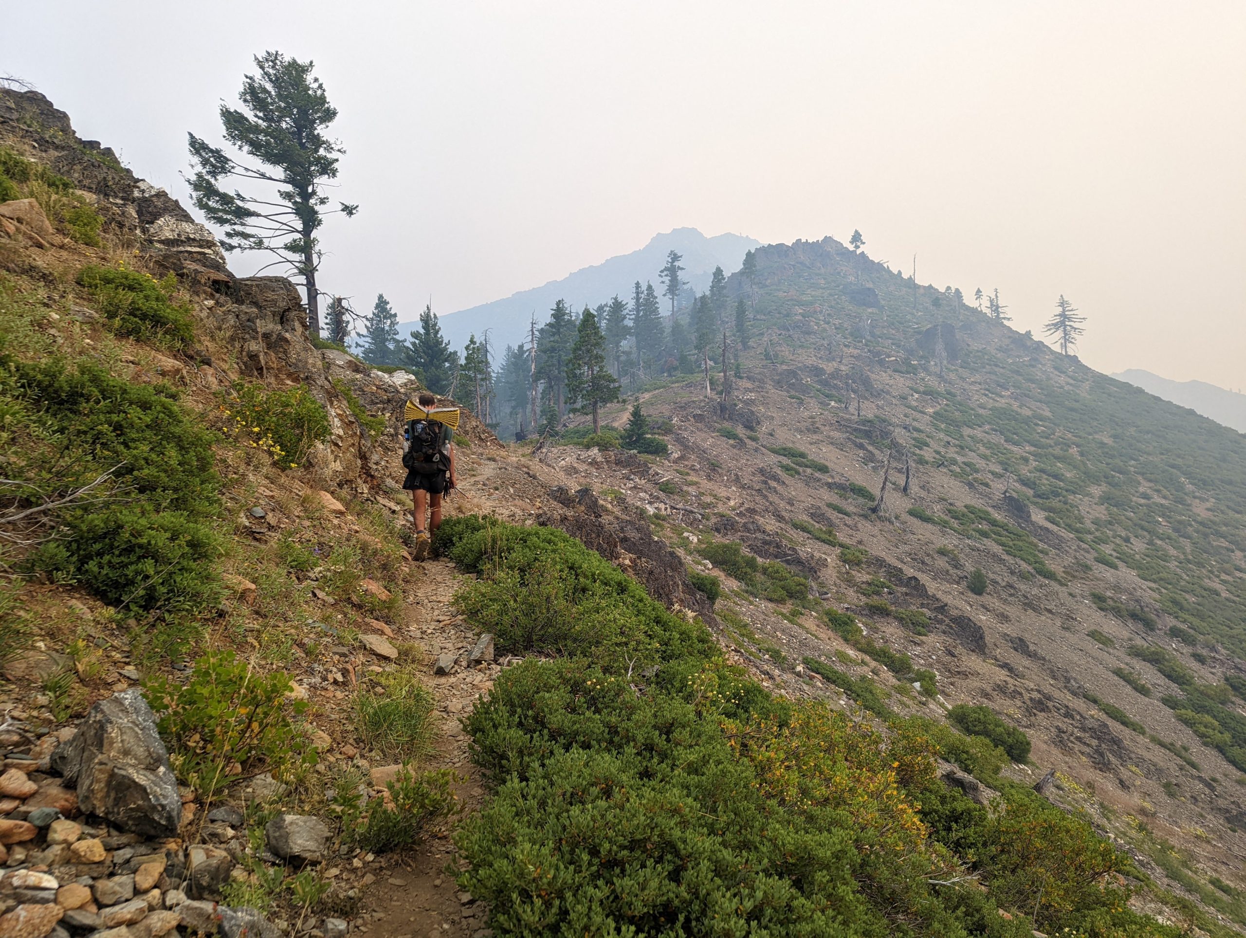
Day 97. Miles: 27.9 Total: 1634.5
I thought I was used to 28-mile days now, but today feels hard. The terrain is Sierra-like, with rocky trail and deep blue lakes. I periodically get cell service, and I use it to check on the article I wrote for Kidney Donor Athletes, which has gone live today. The story was emotional to write, and when I switch my phone out of airplane mode, I already have two direct messages on Instagram from readers with comments about the article. Their words are so kind they make me cry as I’m hiking.

I fall behind the others, and in the evening, I walk alone into the sunset along a grassy ridge. When I reach the campsite, it’s almost dark, and I’m not sure if my friends are here. Then I notice a smiley face and an arrow scratched into the dirt. I grin and almost start crying again. It’s such a tiny thing, but as a slower hiker, it’s a constant chore trying to figure out where my friends have stopped for breaks or campsites when they’re not immediately visible from the trail. The simple gesture of leaving me a sign makes me want to hug Smiley. As I continue past the spring and back into the woods, Rolls flags me down and points out a couple campsites remaining near their tent. Once again, I feel overwhelmed with gratitude. It’s been an emotional day.

Day 98. Miles: 28.1 Total: 1662.6
It’s a long, humid descent to Seiad Valley. The forest is as green as Appalachia here. Temperatures heat up quickly. I got up early because I have a package in town, so I need to be there by three p.m., but I still pause for an icy swim with Wild Card and Leaky in the creek beneath a bridge.
It’s 110° as I complete the long road walk into Seiad Valley. A few fire trucks rush past me while I’m walking. I don’t think much of it.
It’s probably 90° inside the little store when I arrive, but it feels cool and fresh compared to the heat outside. I resupply, pick up my package (a new Gossamer Gear One tent after my zippers broke on my trusty old REI Flash 2 after 200+ nights of use), and collapse in the shade with a small crowd of other hikers waiting out the day. Even beneath a tree, 110° is too hot to find relief, even when I slurp down a frozen lemonade slushie and lie still on my Z-lite. I’m sweating, just lying here.
I return to the store for a second frozen lemonade. Inside, the clerk is on the phone. I overhear part of her conversation: “…from 5 to 35 acres in 45 minutes.” When she hangs up, she turns to me and the other hikers in line. “There’s a fire east of here,” she explains. “But don’t you worry, it’s nowhere near the trail.”
Eventually, Smiley, Rolls, and Royce arrive. The heat in the parking lot has not abated despite the shade tree, so we decide to hike out, hoping for cooler temperatures in the woods.
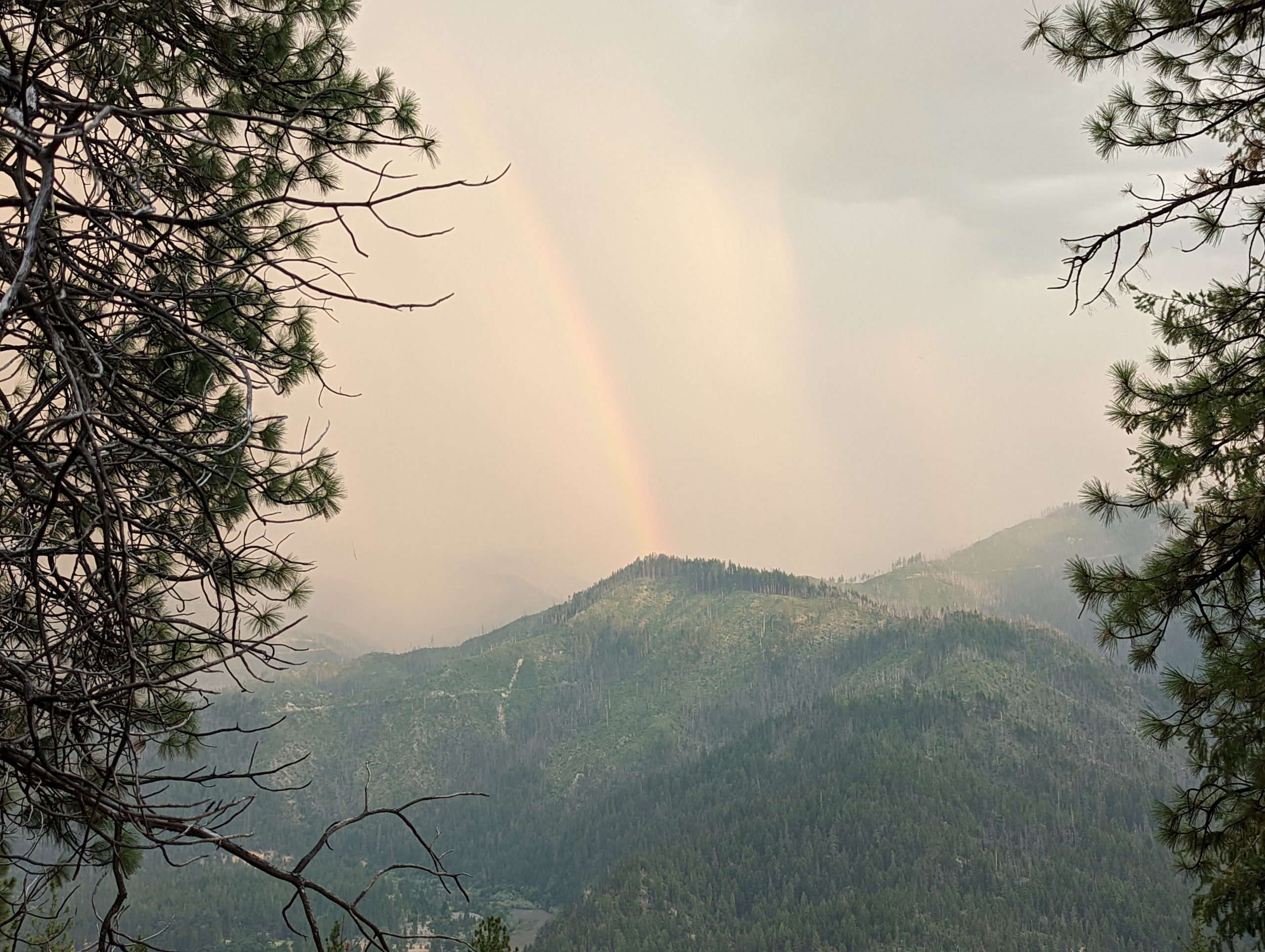
On our way up the mountain, the wind picks up. The sky has turned a smoky, yellowish color. A rainbow appears along with the storm, looking strange against the hazy backdrop. Thunder rumbles, distant at first, then nearby in huge crashes. We see lightning crack across the sky over and over. Crucially, it does not actually rain.
After about two miles, we stop and set up camp. I brush my teeth and climb into my new tent. Then I hear voices. I pop out again. A few other hikers have descended from above us on the mountain, unwilling to continue upward in the thunderstorm. They make camp with us.
I go back to my tent, but then I hear more voices, more urgent this time. “There’s a fire nearby,” says a hiker I don’t know. “It just started. We called 911, but we’re telling hikers so they can head down.” The hiker points into the distance. Sure enough, beyond the ridge, an orange glow is visible.
The other hikers begin to break camp, and I swiftly repack my new tent. When I convene with Smiley, Rolls, and Royce, they express reluctance to turn around. The fire appears to be across the river, and the wind is blowing it away from us. My GPS dot on Far Out does not point the same direction as theirs, and I feel less confident that the fire is south of the river and not just southwest across the nearby ridge. My first instinct is to go down the mountain with the other hikers, but I hesitate. I finally have a group again, and I don’t want to deal with this situation alone or with strangers. My friends want to either go back to sleep or continue north, but they won’t descend back to Seiad Valley. Another hiker I met in the Sierra, a young German woman named Dolphin, also wants to keep going, so she joins us.
Rolls has an Inreach and she’s trying to get more information from family at home. I suggest we hike north at least half a mile for now, to a switchback where we can obtain a better view of the fire. The others agree, and we start north. The temperature is twenty degrees cooler following the storm and sundown, but that means it’s still in the low 90s, and I’m soon covered in sweat. The scent of smoke is thick on the air.
From the switchback, we have a better view of the fire. It’s growing, but from this angle, I finally can see that Smiley and Royce are correct– it’s definitely on the other side of the river. This provides some comfort. (Unbeknownst to us, the McKinney fire jumps the river east of us, this same night.) Again, I suggest that we turn around. “At least, if we’re down there,” I reason, “we’ll have communication and people will know where we are.”

But there’s nothing thru-hikers hate more than backtracking. It’s true. None of us want to do this climb again. “The wind is blowing away from us, and there’s a river in between us,” they say, and I agree to keep hiking north instead. We continue up the mountain by headlamp. Eventually, we find a campsite with a good view of the fire, and we consider stopping to camp. Rolls is hearing back from her family now, but it doesn’t make sense. They report that there’s a fire 18 miles ahead of us, and we should turn around. We assume they must be seeing old information about a previous fire. We’re looking at this fire, and it’s definitely south of us.
Little did we know, there were two fires: the larger McKinney fire, positively exploding in size to our east and threatening the trail north of us, prompting the closure already online. That was the fire the woman at the store was talking about. The fire we’re looking at is a smaller lightning strike fire that only began a few hours ago.

We were just north of Seiad Valley. The fire we were looking at was the tiny icon just southwest of us. At the same time, we were being covered in smoke and ash by the much larger McKinney fire to our east.
We agree to keep going and camp at a junction. That way, in the morning, when we have more information, we can decide whether to continue northward or take the shorter side trail back down into town. The trail is steep and overgrown with dense brush, slowing our pace to a crawl.
It’s two a.m. when we go to sleep, cowboy camped on the hillside. The nearby fire is still clearly visible to the south, and now we can see the glow of the McKinney fire to the east, turning the sky a dull, ominous orange.
Day 99. Miles: 8.1 (PCT) + 7.4 (Applegate Road) Total: 1670.7
I wake just a few hours later. It’s quiet, and the air is thick with smoke. My sleeping bag is covered with a featherlight dusting of ash. More ash drifts silently down from the hazy sky. Bleary-eyed, I pack up again. We talk for a while, trying to decide what to do. The trail is closed up ahead. I hear from Rookie, who’s behind us, that roads out Seiad Valley are closed in both directions. The McKinney fire grew from 300 to 18,000 acres overnight.
Ahead, past the top of the climb, there’s a road crossing. From there, we can go back to Seiad Valley or due north on forest service roads into Oregon, rather than east toward the fire on the PCT. Smiley has a different map application on his phone, and he plots out a 30-mile route to a lake north of us where we can find a ride to Medford or Ashland. The thought of pressing forward into unknown territory away from the PCT makes me uneasy. I feel torn. I want to stay with my friends, but it feels rash to leave the PCT, where at least the authorities know to look for hikers.
When we arrive at the road, we see a forest service fire truck approach. The fireman gets out and uses his phone to show us the evacuation route. By now, we know that all hikers from Etna to Ashland are being advised to bail off trail. The route is Smiley’s plan, the forest service road north to Applegate Lake. While we’re standing there, a pickup truck full of hikers stops and the hikers unload. They’re being shuttled up the mountain from Seiad Valley store to walk the ten miles down to the lake.
“Just start hiking,” the fireman advises. “You’ll be able to get a ride from the lake.”
We start down the road, and I’m feeling better now. I’m exhausted from two long, hot days and hiking through most of the night, but hearing from the firefighter has eased the tight knot of tension in my stomach that I’ve been feeling since the lightning strike. I knew that fire would likely factor into my PCT experience, but I imagined it would be something I heard about from afar. Maybe the trail closes ahead of you, and you have to negotiate a ride or walking route around the closure. I didn’t imagine a fire (or two) starting just a few hillsides over in the middle of the night, the confusion of trying to figure out where it was and what to do.
Even though we disagreed about the best course of action, I was glad to encounter the situation with friends who stayed cool-headed and supportive of each other throughout the chaos.
When we’re just three miles from Applegate Lake and the Oregon border, a police van stops to pick us up. We are transported to the lake, where an officer collects our names and birth dates so they can confirm our safety if loved ones call. Then, they bring city buses to the lake and divide the group of sixty hikers in half based on whether we aim to go to Medford or Ashland. We choose the Medford bus and find an AirBnb in town.

We’re in Oregon. It’s not what I envisioned, but I’m thankful for the quick response of emergency services and for my hiking companions. By the end of the day, the McKinney fire is over 30,000 acres and 0% contained. It’s the largest fire in California.
Day 100. Miles: 0 Total: 1670.7
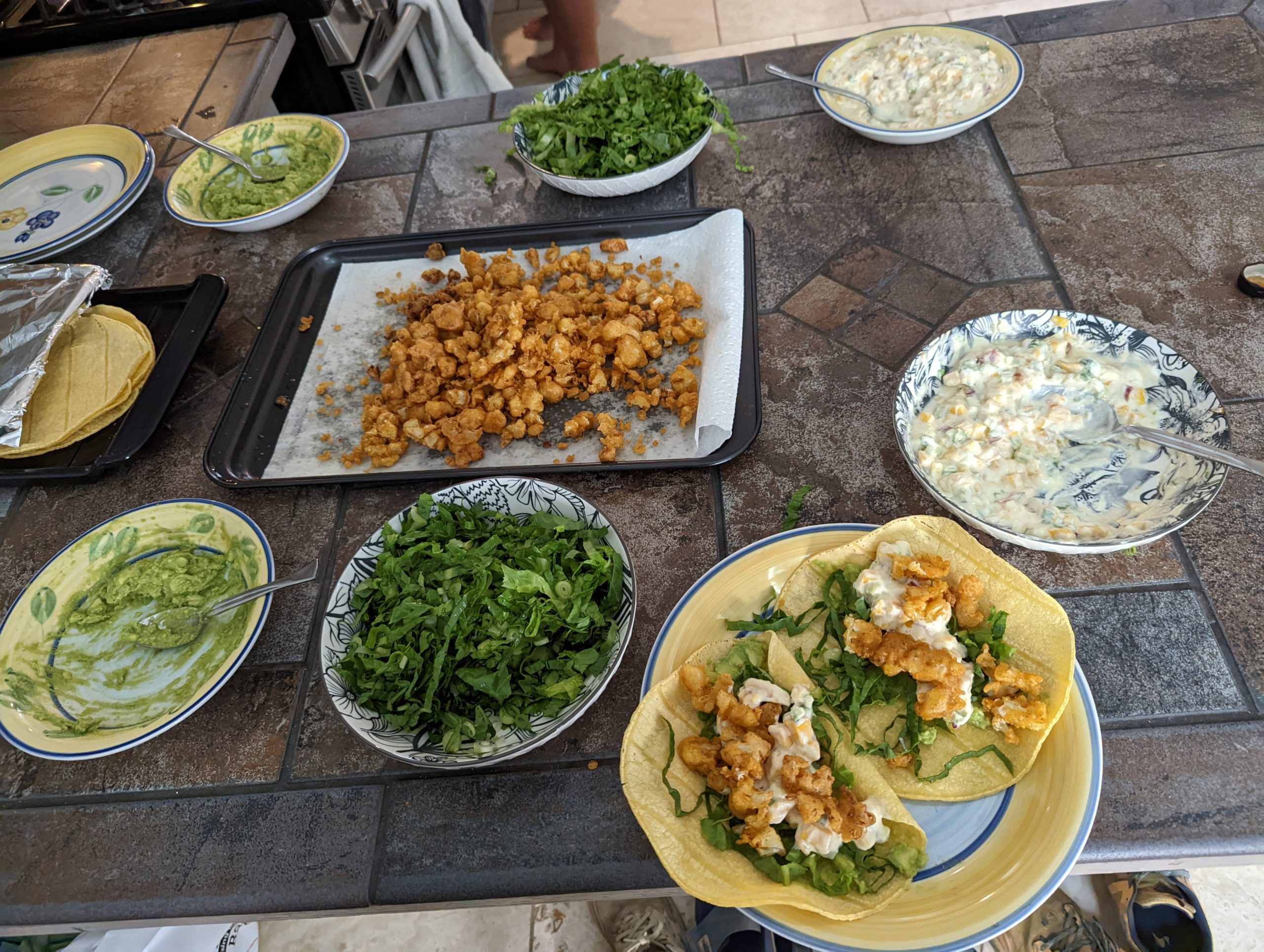
Today, we take a zero. The AirBnb in Medford is spacious and comfortable. After a grocery run, Rolls, Royce, and Smiley prepare a beautiful, healthy meal, and we drink fruity margaritas. I chop strawberries to add to cookies and cream ice cream. Wild Card and Leaky come over, and we play games around the dinner table and laugh and laugh until I have tears in my eyes.
It’s not how I imagined my 100th day on the PCT, but I’m glad to be right here, right now, with these people.

This website contains affiliate links, which means The Trek may receive a percentage of any product or service you purchase using the links in the articles or advertisements. The buyer pays the same price as they would otherwise, and your purchase helps to support The Trek's ongoing goal to serve you quality backpacking advice and information. Thanks for your support!
To learn more, please visit the About This Site page.

Comments 1
I just want to say I’ve enjoyed reading your wonderful descriptions of the experience to this point and am looking forward to hearing what came next. I’m planning on doing the trek next year and this narrative has been fun and informative to read as I imagine what it will be like both logistically and emotionally. Thanks for your story and I hope the rest of the hike is/was everything you hoped for in spite of the fire detours in Oregon.