 ">
">
Episode 14: The Shifting State
Ashland to Bend (Mile 1981)
The Oregon trail started slowly. For impatient days we were still in the trees. The meandering trail in Northern California had trained us to expect a green tunnel, and we’d heard the rumors that Oregon would bring more of the same. Long days of marching over the soft, flat ground have begun to meet lengthening nights as the approaching Fall withdraws the parentheses of day. For those first few days in Oregon, we zoned out on the trail, blindly walking through a green tunnel where other hikers provided the variety that our surroundings lacked.
Coming out of Ashland, we made it about 24 miles to Hyatt Lake campground, where Bivvy led us to the hiker campsite. Of course, Jon was there fully set up. He had his laundry hanging on a line outside his tent, with all of his gear meticulously arranged. He had already showered and eaten, and when we arrived he produced two beers from what was evidently a pocket of magic he had tapped into (it was later verified that he had walked a couple miles round trip to get to the camp store). We’ve discovered that no matter where we find Jon at the end of the day – if we do actually catch up to him – he will always hand us a beer. It’s both a thoughtful and unnerving gesture, one that sometimes contributes to our concern that he is a figment of our imagination.
Despite the fact that it took us two hours more than Jon that first day, we started out optimistically our second day. We’re not the fastest hikers, I should mention, and we tend to get distracted. I always have a hard time getting my head back into hiking after an extended break, and Ashland had been such a big difference from what we were used to; we had been solidly entertained for two days, and now we had to get our minds back to the deprivation of hiking. It is a creative pursuit, hiking 2600 miles. Without your own thoughts, you would go crazy. We spend all day turning old things over in our heads, trying to make new things. Some days we just float in a vague bog of memory. But this moving meditation gets tiring, which is why we switched over to listening to podcasts. I know it sounds pretty lame to be tuned out, listening to This American Life while we’re having the experience of a lifetime, but honestly we’ve run out of our own thoughts. Sometimes, we need Ira Glass to think for us.
Our day of introspection and radio stories ended much sooner than we expected. After only 20 miles, we saw a sign for trail magic that was irresistible. Not only was it hosted by the some previous PCT hikers that we had recently done a short section with – Jolly Lama (which is one of our favorite trail names), One Track, and Veggie Gourmet – but it seemed to be pretty elaborate trail magic. We followed a trail of plastic flowers to a clearing off a jeep road and found one of the best restaurants we’ve visited yet. The guys had set up a massive canopy tent under which they had many chairs and a full front country kitchen set up. On the back of the canopy hung a cardboard sign that said “Le Bistro”. They handed us menus with fantastic descriptions for food such as “farm-fresh, free-range organic eggs poached to perfection and nestled in a bed of spring greens.” (They were using Costco eggs, by the way). Guests were only asked to wear an outfit from their costume box and not upset the massive stuffed tiger that sat on their car. The whole thing was hilarious and, since we found Bivvy waiting for us there, we couldn’t resist camping with the group.

Bivvy spent a lot of the night worrying over his maps and by morning he had made a decision. He had to be at a book signing in a few weeks and was worried he’d never get to hike Washington. So, he caught a ride into town with One Track when he went to get more supplies, took a bus to Portland, and started from Cascade Locks. We spent the better part of the morning hanging out with Bivvy, talking and ultimately saying goodbye. We’ll miss Bivvy’s acerbic wit and voluntary curation of the movies we choose to watch in town, about which we are helpless without a guide. But the trail community is small and the sort of people who put their lives, careers, loved ones – and occasionally their first novel – on hold to hike from Mexico to Canada are the kind of people who make big decisions quickly, who show up in unexpected places at unexpected times. So we said what people on the trail always say to each other when they part ways: “We’ll see you when we see you.”
That day, we hiked another 20 miles before dark and saw almost no other hikers. As we approached the spring where we planned to camp, we figured we’d be mostly alone since people behind us would have stopped at Le Bistro and people ahead of us would have hiked further – but when we reached the campsite, we were confronted with a massive cluster of tents. There was absolutely no room. We hiked down to the spring and found more tents, then hiked up the ridge next to the camping area and discovered another handful of tents in the trees. After 20 minutes of searching, we discovered a flat spot in the trees and set up, exhausted and very confused about where all these people had come from. It didn’t dawn on us until the next day when we were packing up: SOBOs. Our bubble had collided at last with the Southbounder bubble. Before this, we were seeing a handful of SOBOs a day, but that day we were passed by dozens. It was a welcome change; lately, we haven’t seen any other hikers since we’re all going the same direction; we are basically a conveyor belt, moving along the trail at the same rate and time so that we never collide. But now our days are punctuated by the infectious, nervous excitement of Southbounders who know the majority of their adventure is still ahead of them. It’s a type of enthusiasm we haven’t encountered since the John Muir Trail hikers, and we’ve missed it.
That day, leaving our busy camp behind while the other tents were just starting to stir, we were certain we’d hike at least 30 miles. We were getting an early start, the elevation profile looked flat, and the terrain lately had been soft pine needles. We had been warned about the downed trees in the next section by NOBOs and SOBOs alike, but we assumed that, like most obstacles on the trail, it was overstated. And for the first few miles, it was. Not so much with the next twenty miles.

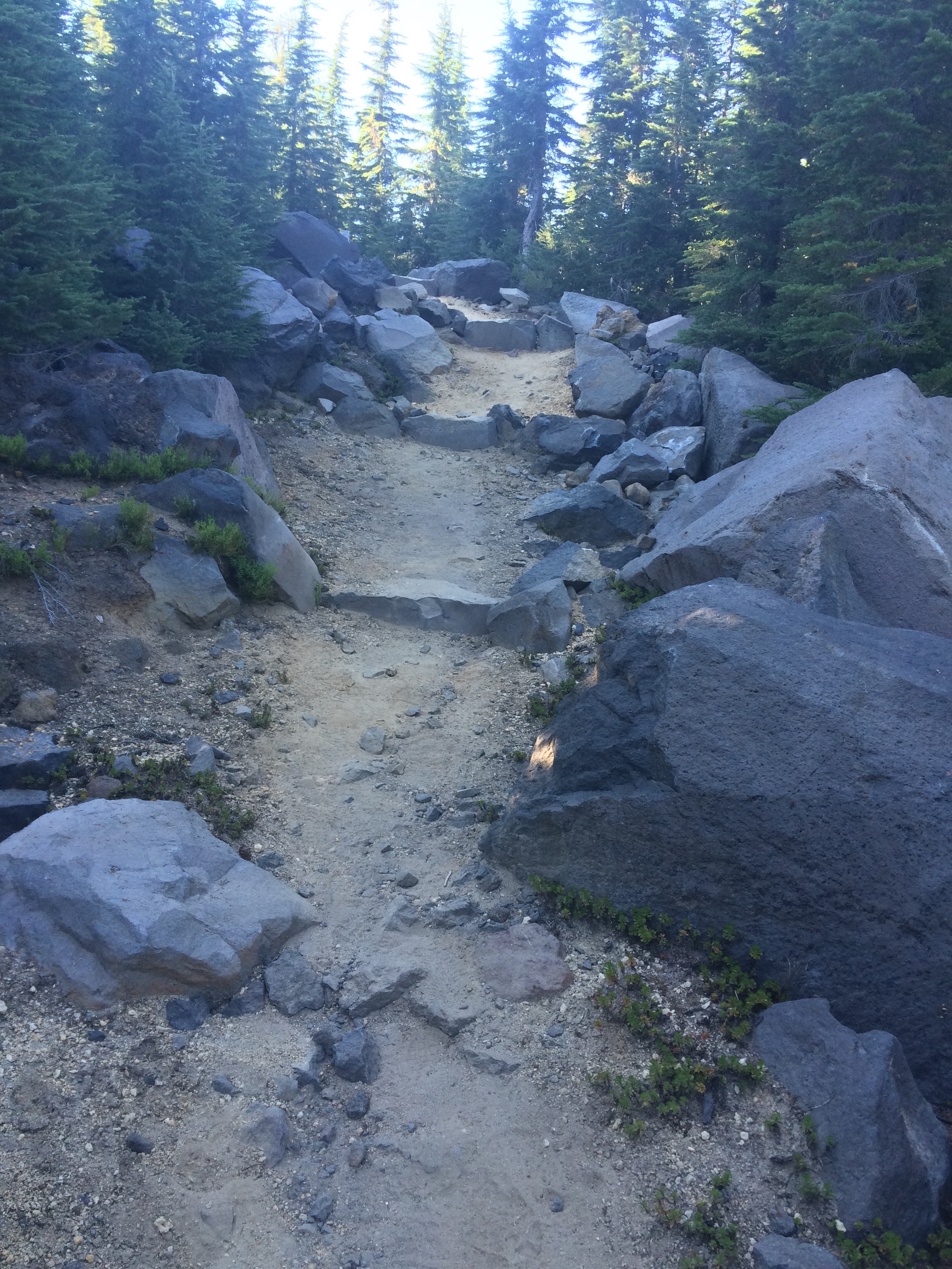
The Oregon section of the PCT is a hard one to maintain. There are lots of trees, lots of burn areas – which means lots of standing dead trees that are just waiting to fall – and lots and lots of wilderness. Many people don’t realize that in wilderness areas, motors are prohibited. That means that ATVs can’t come roaring through sensitive habitats – but it also means that chainsaws can’t be used to clear fallen trees. Instead, trail maintainers use an analogue form of tree-clearing: the crosscut. Toe Touch and I were on a trail crew that worked primarily in wilderness areas, so we’re familiar with the exhausting back and forth rhythm of the five-foot-long saw, so arcane that most people assume it’s only used to decorate the walls of restaurants that serve pancakes. In short, it takes a very long time to clear a section of trail in Oregon – and that’s why, after 24 miles and over 200 arboreal hurdles – we were too sore to move.
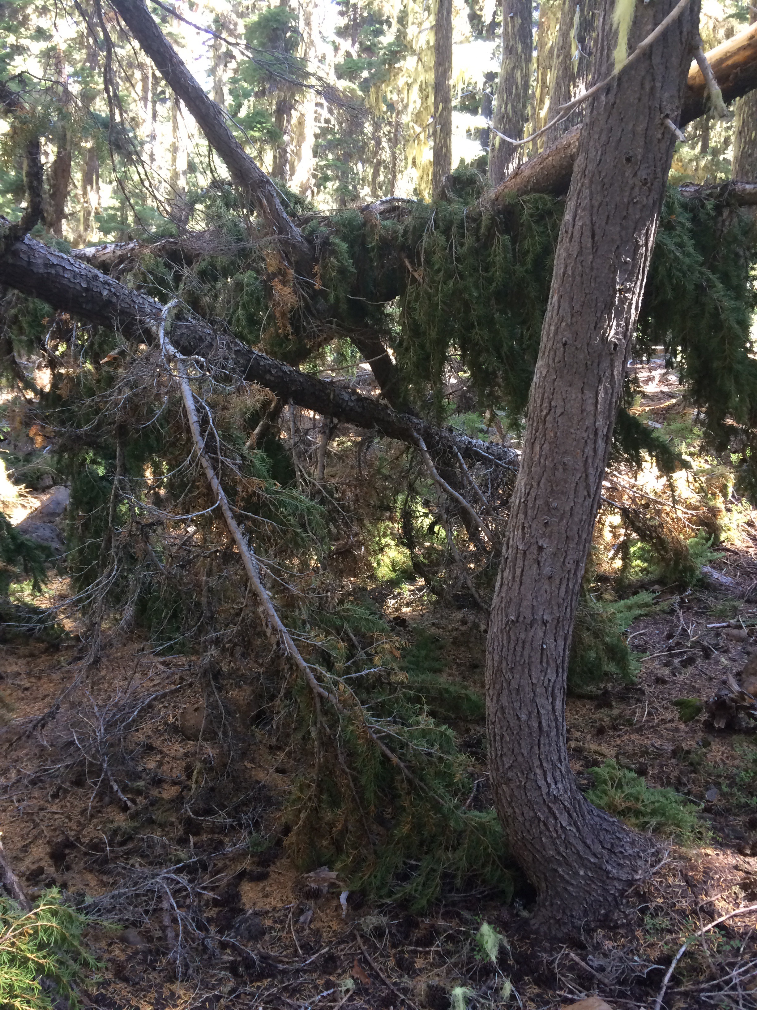
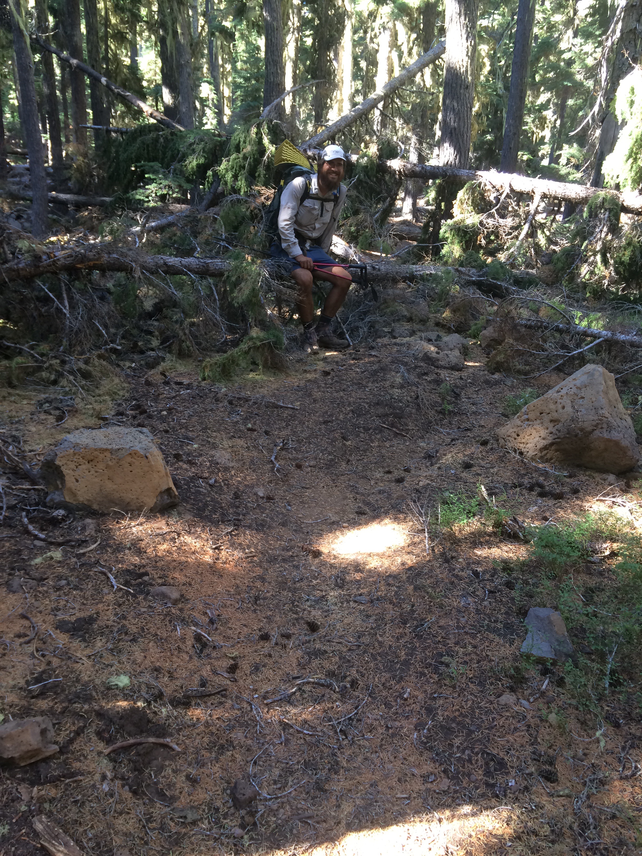
That day was a big lesson in humility. We’d started to feel like we could do anything, that we were almost entitled to a 28 or 30 mile day if we just woke up early and hiked consistently. But the constant motion of lifting, pivoting, and balancing each step had left our hips and knees screaming by the end of the day. Many of the trees that had fallen were above my waist, which meant scrambling up, straddling them, and hopping off the other side. Apparently, we’re not physically superior Gods; we’re just really good at walking for a long time.

We were tired, sore, and disappointed by the end of the day. Not only had we only come 24 miles and stressed all of our joints, but we were starting to feel like Oregon, the ‘easiest’ state, was going to be more of a struggle than expected. It was sunset when the green tunnel fell away and we found ourselves in a massive burn area. A sea of tree remnants stood in front of us; thatches of burned trees stripped of their bark stood, stark petrified wood like bones against the dusk colors. The setting sun turned the skeletal display a honey color, bathing the trees in a warmth much softer and kinder than the fire that must have bared them. The evening light always wakes up details; it has a way of giving small things an importance. Sharp against the trees’ austerity were bright purple flowers that grew, opportunistically, in the freedom of that shadeless graveyard. Small green plants had begun to show themselves as well, reaching up towards the exposed sun and bringing an innocent liveliness to the death that surrounded them.
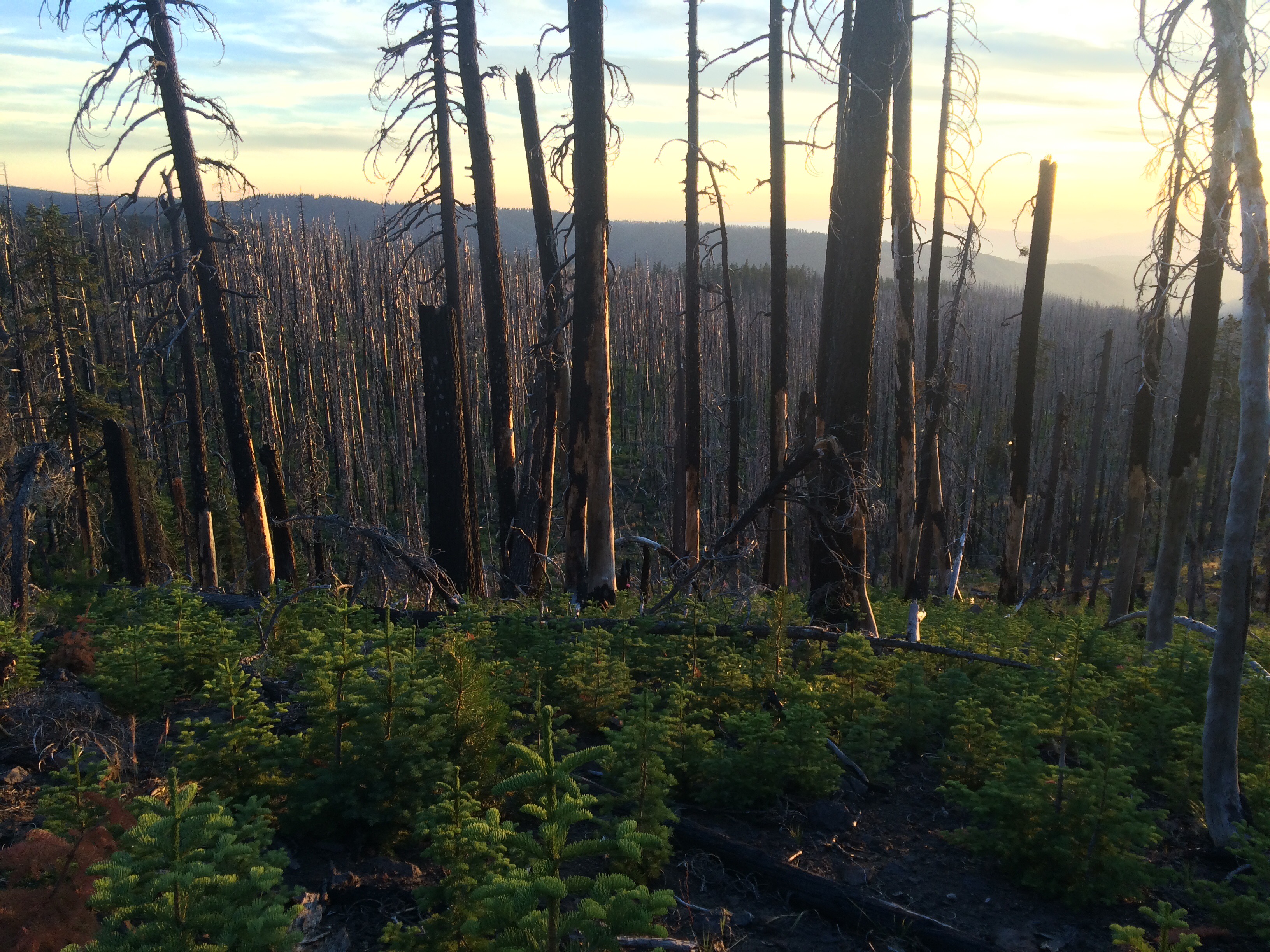
Like the birds and animals around us, we were silent while we passed through this area. The beauty here was hushed and drew us in with its quietness. We were almost straining to hear as we walked through the ghost of a forest, pale trees standing erect like soldiers.


That’s how Oregon has passed us by, with forests that seem to be filled with stories. All along the trail now we see the remnants of fresh cuts, fallen trees blocking the trail which have been sawn off by trail crews or thoughtful volunteers. Their edges face us like a map of past decades, a history of climate told through rings. Burn zones scar the mountainsides and the slow movement of water, as cumbersome glaciers or unrestrained flumes, has made an impression across the ridges, which compared to East Coast Geology are young. In short there’s a certain solemnity to the changes that have shaped this area; there is a pervasive idea that, like the first generation after a war, this forest is loud with the past.
And it is dynamic. No one can say that Oregon is boring. Despite those miles that we slogged through, dull by comparison to what we’ve seen, this state has changed more rapidly than any area we’ve walked through yet. The next day we walked into Crater Lake National Park and the park office surrounded by other hikers. We got our package, showered, and ate a lot of food at the restaurant. By now, we estimated, Centerfold was at least half a day ahead of us. But Little Spoon and I wanted to see the sun rise on Crater Lake, so we took our time. We camped a few miles from the Rim Trail, woke up at 4 AM, and hit the trail by 4:30. Just before 6, we were rushing along the edge of the rim, catching our first glimpses of the stunning blue over the edge. We found an outlook, climbed up, and watched the massive lake as it lightened. The sunrise was incredible; but just in case we had any concern that we had chosen the wrong spot, there were a couple photographers setting up tripods when we got there.


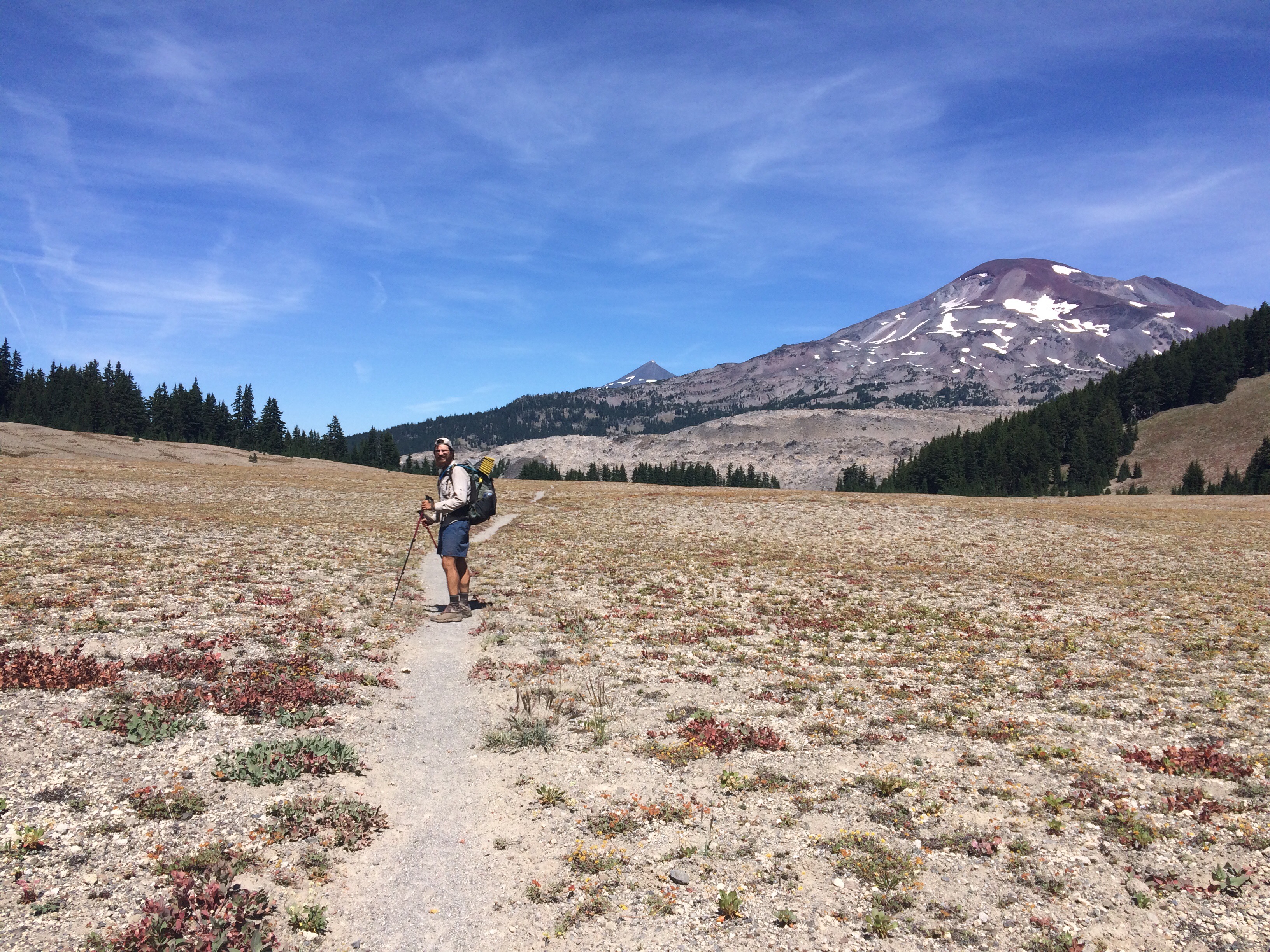
We spent the day lazily making our way around the stunning rim since we thought we would be descending back down to a dull, viewless stretch afterwards. Eventually the trail broke away from the rim and we walked through a huge, flat meadow with a head-on view of Mount Thielson, and then we descended into the trees again as if nothing had happened. But Crater Lake was only the beginning of the shocking, alien beauty hidden within Oregon’s forested corridor. That night, we camped alone by Thielson creek with the daunting mountain looming over our tent site. The next day we started late and hiked into the dark, cresting the ridge of Cowhorn mountain at sunset. As we crept along the rocky knife edge looking for camping, light angled towards us from either side. On our left the last rays of sunset were leaving the sky but on our right the nearly full moon was rising, casting its cold, eerie light in opposition to the colored dusk. The situation was beautiful and completely accidental; I found myself wishing we could hike that ridge forever, but eventually we came across some tents and both Cracker and O.G. (a triple crowned from the 1990’s whose name stands for ‘Original Gangster’) called out to us, “Chuckles and Little Spoon! I think there’s camping 50 yards up the trail!” We settled into our camp chores, their domestic familiarity feeling oddly docile after the light shows of our past two days. We had hiked something like 54 miles in two days, and our level of energy felt unstoppable.


In the morning, I could barely move. Perhaps it was a combination of our longer days or the pivoting evasion of fallen trees, but my hip flexors were screaming and Spoon’s foot wasn’t feeling great. We took the morning easy, but we couldn’t afford to drag our feet that day. We needed to get to Crescent Lake camp store to resupply, so we eventually fell into our rhythm and reached the junction with Crescent Lake before dark.
That day was a strange one, because we also passed the first area that I had done trail work in, back in 2011. Unfortunately, it was in a section where the trail was divided; most hikers seem to take the Oregon Skyline Trail, which cuts several miles off the PCT and ends directly at Crescent Lake, but the official PCT weaves past the Diamond Peaks and a lot of carefully constructed rock steps that our crew installed. I didn’t think I’d remember anything we had worked on, but I was surprised to recognize our section of trail. It felt really rewarding to be standing there on the check step I’d installed five years prior, but I had to laugh at the fact that most thru-hikers don’t actually see these steps.
We woke up at the junction of the Crescent Lake camp store to get surprisingly good coffee and traditional hiker breakfast – hot dogs and frozen pizza. We weren’t able to get our package sent there, but fortunately lots of other people did send themselves a package and, like us, sent way too much food for the easy Oregon miles. We resupplied out of the hiker box, used the laundry and showers, and hiked fifteen miles before dark caught us. Oregon had turned back into a green tunnel since Crater Lake, but that evening we were surprised to see that the trail passed one gorgeous lake after another. We forced ourselves to pass up a lot of incredible camping spots that evening.
The next day we woke up determined. We hiked all day and made 31 miles – embarrassingly, our longest day yet – and reached the opening of a burn area by Elk Lake lodge feeling full of energy still. Maybe it was due to the full moon, which rose a massive, luminescent orb above the charred outlines of trees. It was the largest full moon I can remember ever seeing, and glowed with such a strong light over such an unnatural swath of land, it felt as though we were on a different planet. O.G., who we’d been leap-frogging for days, caught us and camped there that night. At around 11 PM, we heard a hiker walking back up the trail from the lodge one mile away, talking on his phone and apparently drunk. “Jenny! Hey! I can’t find the trail, Jenny!” He wandered around us for probably 20 minutes, unaware there were tents nearby, while we laughed quietly.
The next morning we woke up, again, feeling destroyed. The 31 miles that we thought hadn’t affected us actually had taken a toll on our legs. We wondered how Centerfold does it as we packed up our stuff and made coffee. O.G. left camp reliably early and as he got on trail, he shouted back to us, “Jenny! I can’t find the trail!” The rest of the day we felt exhausted physically, but mentally and emotionally we were glowing.
We weren’t sure what trail we were on, but it no longer seemed to be the PCT. The first half of the day we wound through flower-strewn meadows ringed with huge mountain ranges. We passed the Sisters range, glittering with mica, and headed into the Obsidian Wilderness where jet black glass glistened against the earth. We stopped at a spring fed River before continuing around the bend to another planet.
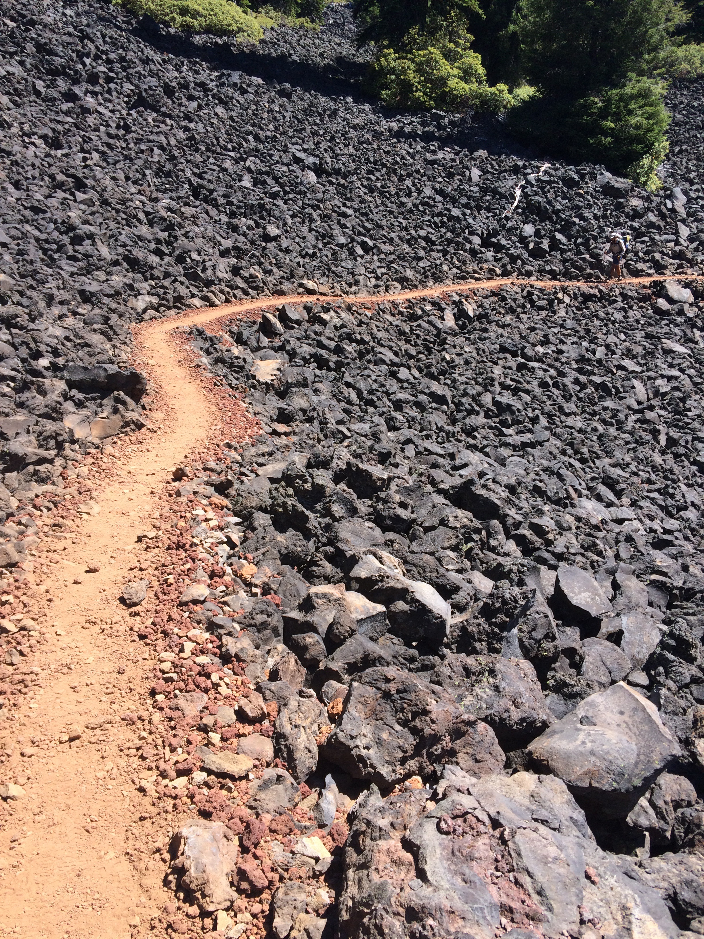
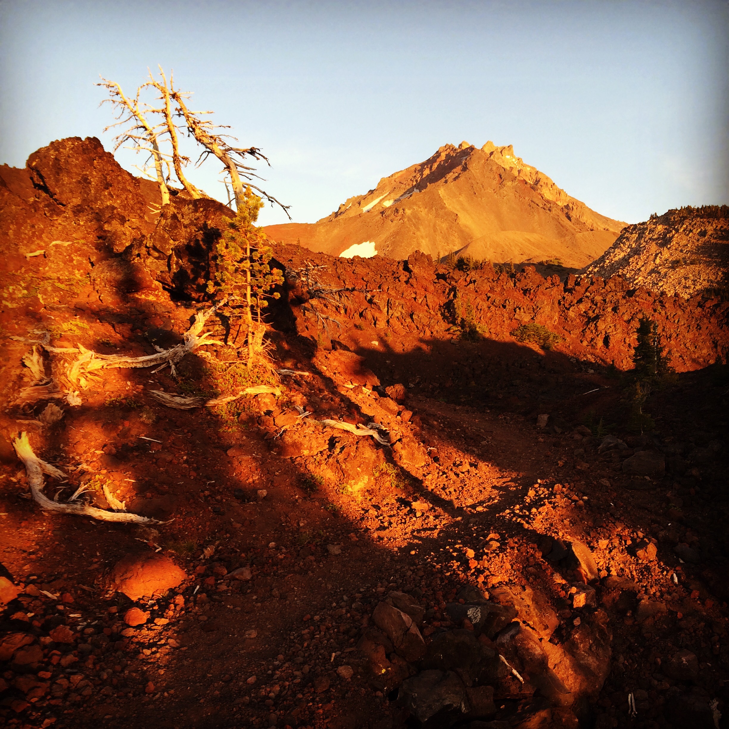
Coming out to face the lava fields, we were shocked by the color and desolation of the scene in front of us. Bright red rocks burst into life in the evening light, and eventually the setting sun painted the landscape with its complete lack of plant life, its red and yellow slag piles which led up to meet bright patches of snow in the mountains looming above us, its howling wind that cut through the rising warmth from the magma remnants under our feet. It was like walking on Mars.

We began to wonder how we would ever find camping, and then as suddenly as we had set foot on Mars, we were past it. The trail rose up the edge of a rocky bowl, seemingly heading straight for the forlorn peaks ahead, and then without warning cut abruptly to the left and took us down to the safety and obscurity of the tree line once again. That night, although we had only gone 25 miles that day and we felt exhausted, we fell asleep grateful that we could walk this trail; grateful that our feet could carry us from forest to meadow to peak to alien landscapes all in one day and that we could still fall asleep warm in our sleeping bags.

Not every day is like this, but these are the days that keep us moving forward to see what exists over the next mountain or around the next curve. These are the days that let us see around the miles we’re trying to overcome to the history of the landscape that we’re walking through. Like a camera negative imprinted on the sky, we get to see a shadow of the past in the present. Lava spilling over mountain tops and fire spiraling up the tree trunks, fierce wind and ice ripping dead trunks out of the ground, and torrents of water crashing through the underbrush. This landscape is so alive, all that prevents us from seeing it first hand is the limits of time. I know that six months is a speck in the span of our earth’s geology, but I hope it’s long enough for those changes which shaped the natural world around us to leave a small imprint on our thinking, to remind us that ultimately, great change happens slowly and not without sacrifice.

In the morning of our last day to Bend, we hiked out seven miles to Mackenzie Pass and eventually caught a hitch all the way to Bend, where we met up with Centerfold. We averaged a little over 23 miles a day from Ashland to Bend, stops included, while Centerfold averaged about 30 miles a day. I thought he’d be pretty tired but when we found him he was rested, clean, and smiling as he handed us each a beer. We owe the mysterious art of natural change our gratitude for creating places like Oregon, but there are times – like those when I’m with Little Spoon and Centerfold – when I’m grateful for those things that do not change, that are right just the way they are.

Sponsors of Chuckles and Little Spoon that you should check out:
Mary Jane’s Farm organic dehydrated meals https://www.maryjanesfarm.org/
Honey Stinger bars, waffles, and energy chews https://www.honeystinger.com/
Big Sur Bars https://bigsurbar.com/
Katabatic Gear https://katabaticgear.com/
Mom’s Stuff salve https://www.momsstuffsalve.com
Little Spoon’s Instagram (Mark Santoski) https://www.instagram.com/marksantoski/
Centerfold’s Instagram (Jon Graca) https://www.instagram.com/jograca/
Toe Touch’s Instagram (Julie McCloskey) https://www.instagram.com/jtmcc272/
Toe Touch’s Blog https://seeyajules.com/

This website contains affiliate links, which means The Trek may receive a percentage of any product or service you purchase using the links in the articles or advertisements. The buyer pays the same price as they would otherwise, and your purchase helps to support The Trek's ongoing goal to serve you quality backpacking advice and information. Thanks for your support!
To learn more, please visit the About This Site page.
