 ">
">
hard decisions
a song of fire and more fire
On Friday, July 29th, day 92 of our journey, we walked into Burney, California. We had gotten up at 3:15 am to hike the almost 18 miles into town from our camp spot. The last few days had been HOT and we wanted to get into town before noon. As temps hit triple digits, we were enjoying a cold soda and much needed food at The Blackberry Patch. We heard from a local that they had never seen it get this hot before. That night we were luxuriating in air conditioning, cranked to the max, as our hiking world began to change. Storms entered the area and lightening strikes, combined with drought and the high heat, started what would become known as the McKinney Wildfire. It would grow to the largest wildfire of 2022 (at that point) in the state of California within days, ultimately destroying over 60,000 acres of land. While still miles north of us, our path soon take us close to the fire. We got back on trail the next day, but soon learned that evacuations and trail closures were occurring where we would be hiking in mere days. Another fire ignited north of Crater Lake, in Oregon, creating yet another trail closure. The Lionshead Trail closure (from a wildfire in 2020) in northern Oregon had still not reopened. As we looked at the logistics of skipping around each section of trail, it became increasingly obvious that our best plan of action was to skip the remainder of northern California and Oregon altogether and tackle the state of Washington instead. We would plan to get back to California and Oregon if/when the fire closures opened back up. We were not alone in our decision and the area from Olallie Lake, Oregon, to Cascade Locks (at the Oregon/Washington border) suddenly saw a rapid influx of hikers. This was an amazing chance to catch up with hikers we had met along the way as well as meet some new hikers who had reached this point as part of a continuous thru-hike. Little did we know at the time, this would be one of the best logistics decisions we made on trail. It meant that our hike did not look like a traditional thru-hike, but we were able to have amazing weather for the state of Washington, not worrying about snow keeping us out of the higher passes.
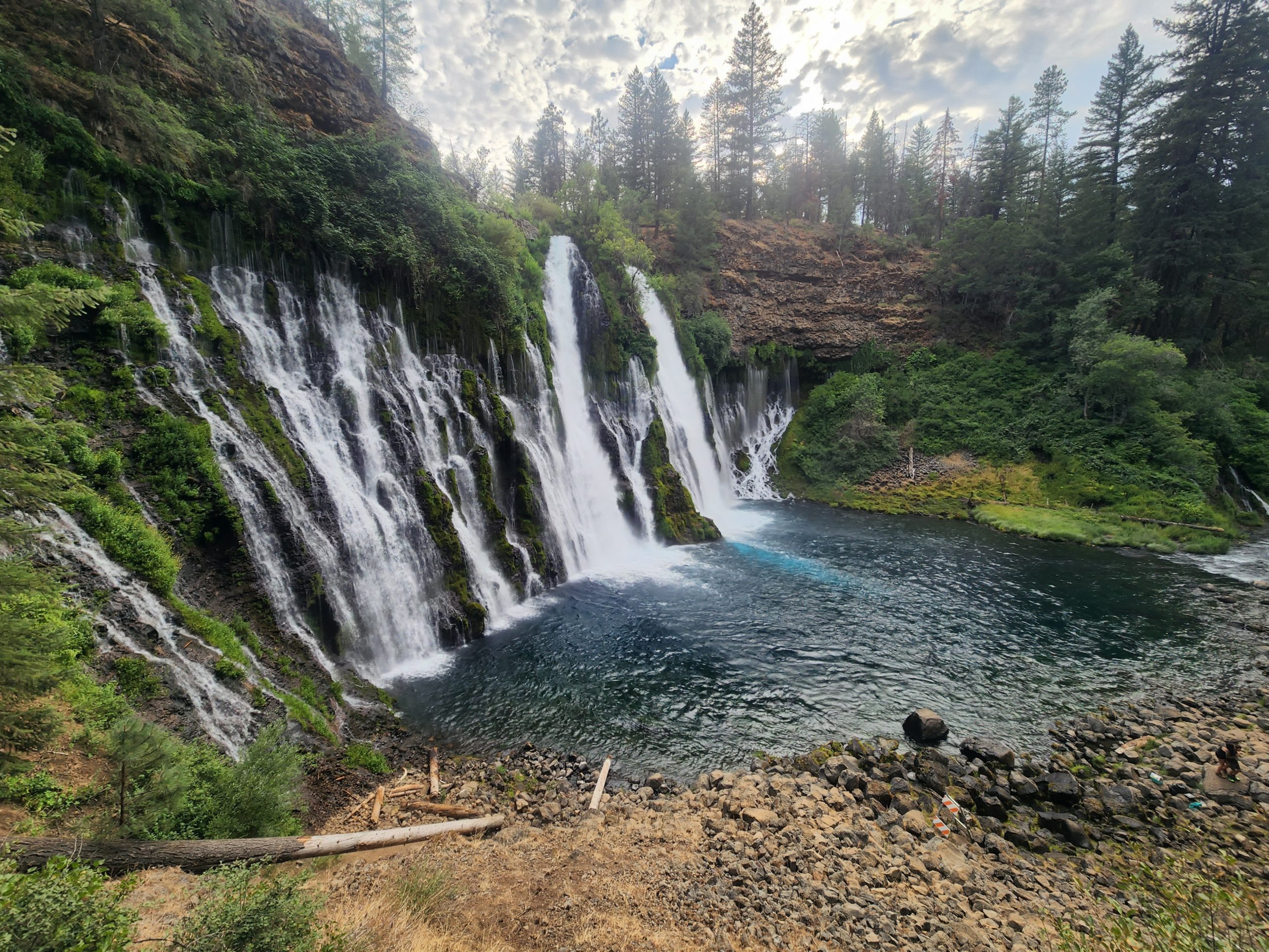
Burney Falls, our last stop in California before escaping north
a surprise in the north
We hitched, joined in a rental car, and jumped on local busses to get from Burney Falls to Timberline Lodge, near Government Camp, Oregon. Timberline Lodge sits at the base of Mt. Hood and is known as the setting of The Shining (the exterior shots from the movie). At trail mile 2098, it was 679 miles from where we had stepped off at Burney Falls. It appeared that our hike was back on track. Over the next few days we passed some of the most unique waterfalls on trail as we neared Cascade Locks and the Bridge of the Gods. This marked our entrance into Washington. I had not really thought about Washington much. I never really knew if I would make it there on the hike so I had not delved too deeply into the specifics of the section. I had only recently learned the miles would be some of the most difficult on the trail. What I would come to know, though, is that it is one of the most beautiful sections of trail as well. Sharp mountain peaks covered with forest were the norm. I believe the Goat Rocks Wilderness and Northern Cascades rival the Sierra in beauty and majesty. The snow-covered slopes of Mt. Hood, Mt. Adams, Mt St. Helens, and Mt. Rainier would dominate the vistas throughout southern and middle Washington. As we traversed further north, these peaks would be hidden behind us by the Cascades, rugged and breathtaking mountains in their own right. The small, isolated trail towns provide some of the tastiest pastries as well.
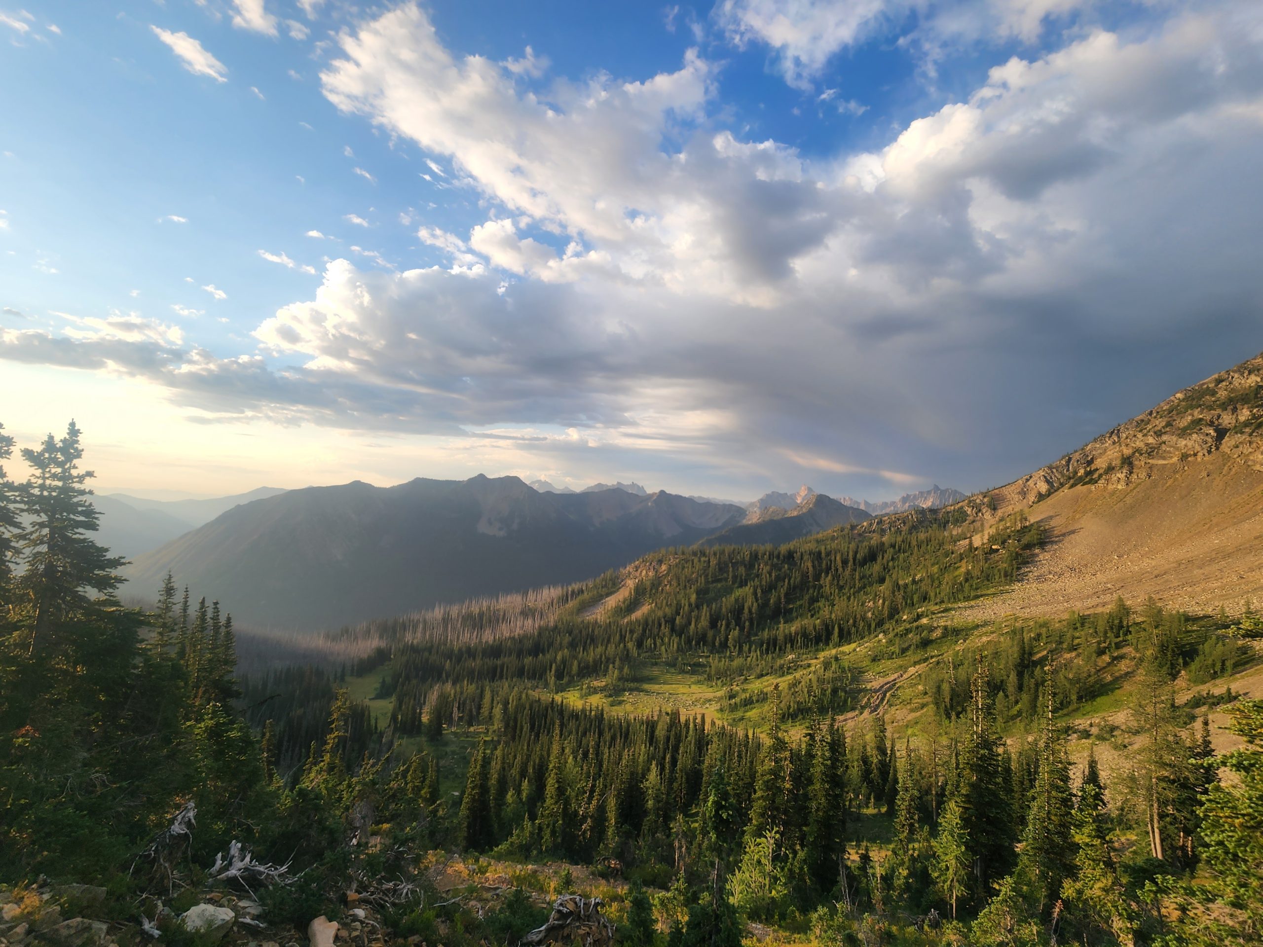
Rugged peaks and forest were now the norm

Sunrise hiking before reaching Hart’s Pass

Tunnel Falls along the Eagle Creek Trail, a PCT alternate route

Smoke laden valleys
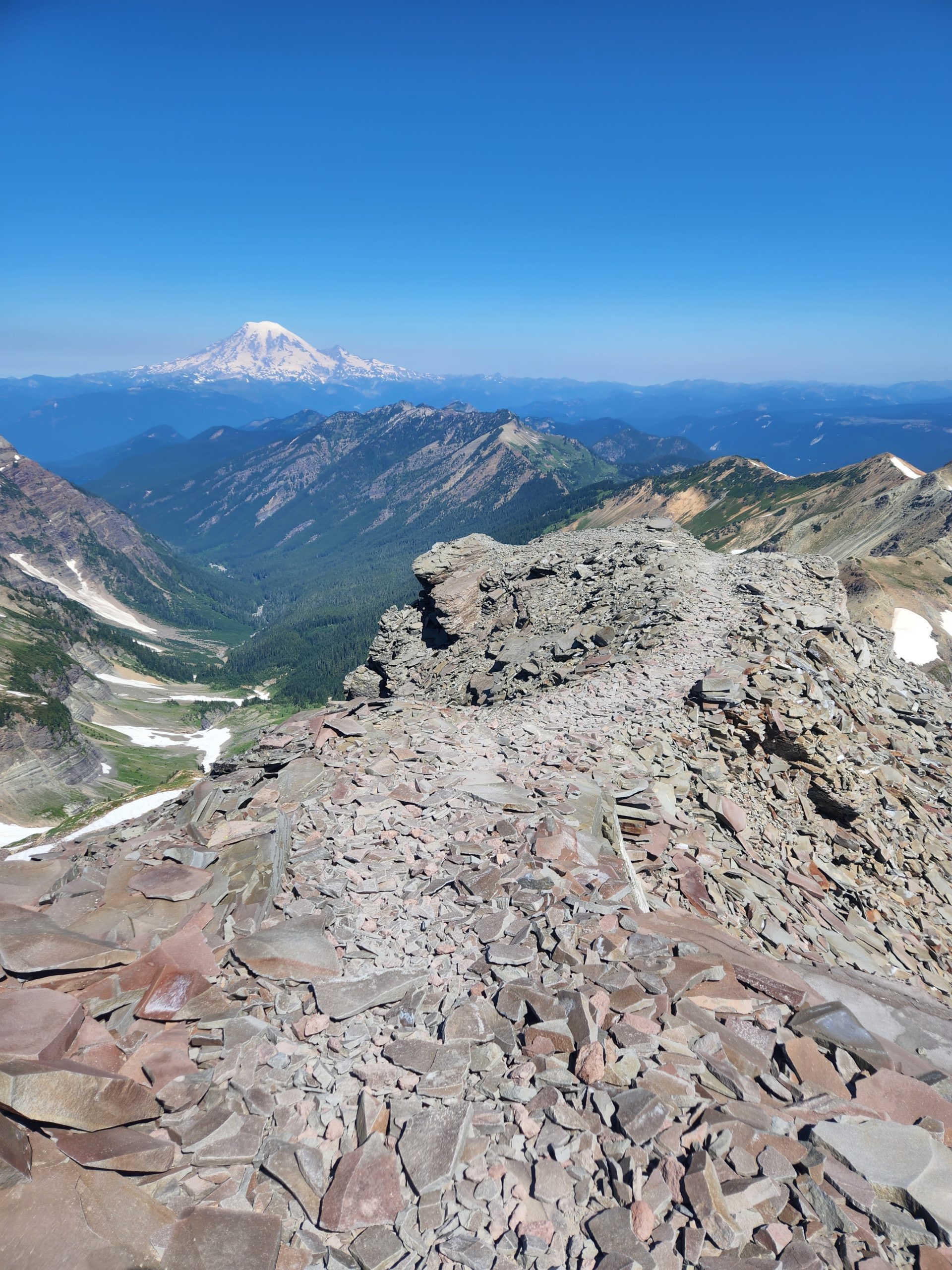
A view of Mt. Rainier from the Knife’s Edge
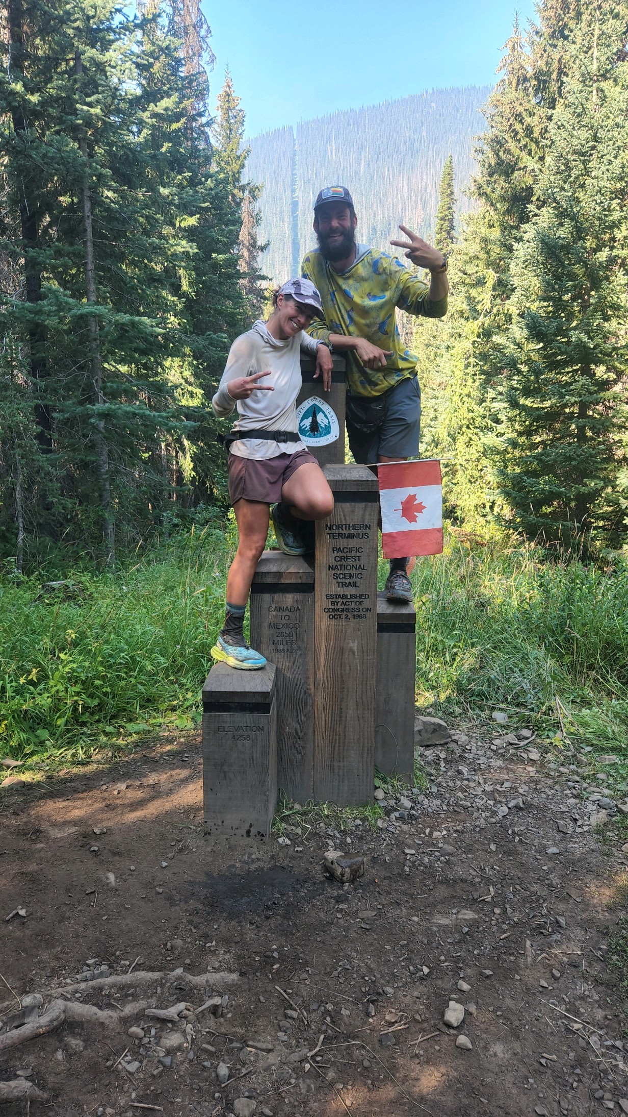
the journey ends
The Canadian border was looming ever closer and I began to take a hard look at my hiking plans. I continued to struggle physically throughout the hike. While injury did not sideline me again after Southern California, pain certainly slowed me down. It was all I could do to make it to camp each night and no amount of Aleve or new shoes/shoe inserts were making much of a difference. Each morning I would question if I could make if far enough from the tent to relieve myself without my feet totally giving out. It felt like I had completely worn away all cushion on the bottom of my feet and l was walking directly on bone. I also felt mentally and emotionally done. Not in the worn out way my body felt, but rather in a “complete” way. For me, it was never about hiking every mile of the trail. For the purists, whose goal is to completely hike the trail, this may seem a foreign concept. It also means I cannot technically call my hike a “thru-hike”. I hiked close to 1,800 of the 2,650 miles of the PCT. After those 1,800 miles, I felt like I accomplished something big. I had fought with demons, re-grounded myself and brought to close a chapter in my life. This hike marked a transitional period for me and touching the monument at the Canadian border felt like an appropriate endcap on that evolution. I may decide to get those remaining miles in at some point. After my feet have recovered and my body is ready to take on the next adventure. Or I may decide to do another, SHORTER, trail. I do not feel I have the deep desire, that some speak of, to continue long thru-hikes. Perhaps, as my trek is viewed through the foggy lens of time, I will decide another long hike is worth the bodily abuse. Perhaps this will be a single chapter in my life, not to be forgotten, but not to be repeated. Time will tell.

fire closure and just closure
We were lucky enough to make it to the border monument, the northern terminus of the PCT. Literally hours after I stepped off trail for the final time, the path to the monument was closed due to wildfires in the area. Many hikers would not have the same closure to their journey as I did and I am grateful I was able to get there. It is about more than the photo-op. It is about achieving a goal and the tangible culmination of an incredibly hard feat. For all of those who have had to find an alternate ending to their journey, my heart aches. My next steps are only planned so far in advance. I will return to the trail to support my husband as he tries to eke out the final miles in Oregon before our end-date or the weather turns. I am glad for this opportunity to remain close to the trail community for a little while longer. After that… wherever my sore feet will take me.

Wildfire, one ridge away, the night before reaching the terminus
Unfiltered and I
-4Shirts

This website contains affiliate links, which means The Trek may receive a percentage of any product or service you purchase using the links in the articles or advertisements. The buyer pays the same price as they would otherwise, and your purchase helps to support The Trek's ongoing goal to serve you quality backpacking advice and information. Thanks for your support!
To learn more, please visit the About This Site page.
